From Surf Wiki (app.surf) — the open knowledge base
Metairie, Louisiana
| Field | Value | |
|---|---|---|
| name | Metairie | |
| native_name | fr | |
| settlement_type | Census-designated place | |
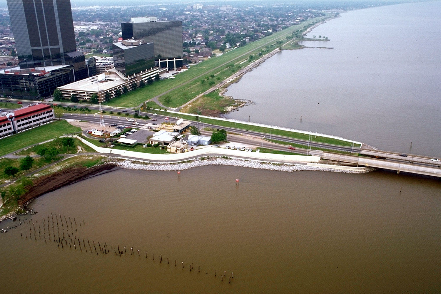
| <!-- images, nickname, motto --> | image_skyline | Metairie CBD.jpg |
| image_caption | Metairie Central Business District | |
| image_flag | Flag of Metairie, Louisiana.svg | |
| etymology | ||
| subdivision_type | Country | |
| subdivision_name | ||
| subdivision_type1 | State | |
| subdivision_name1 | Louisiana | |
| subdivision_type2 | Parish | |
| subdivision_name2 | Jefferson | |
| subdivision_name3 | ||
| pushpin_map | Louisiana#USA | |
| pushpin_label | Metairie | |
| pushpin_map_caption | Location of Metairie in Louisiana | |
| coordinates | ||
| coordinates_footnotes | ||
| established_date | ||
| unit_pref | Imperial | |
| area_footnotes | ||
| area_total_km2 | 60.35 | |
| area_total_sq_mi | 23.30 | |
| area_land_sq_mi | 23.26 | |
| area_water_sq_mi | 0.04 | |
| elevation_ft | 3 | |
| elevation_m | ||
| population_as_of | [2020](2020-united-states-census) | |
| population_total | 143507 | |
| population_density_sq_mi | 6169.96 | |
| population_density_km2 | 2382.27 | |
| population_demonym | ||
| timezone1 | CST | |
| utc_offset1 | −6 | |
| timezone1_DST | CDT | |
| utc_offset1_DST | −5 | |
| utc_offset2_DST | ||
| postal_code_type | ZIP Codes | |
| postal_code | 70001–70006, 70009–70011, 70033, 70055, 70060 | |
| area_code | 504 | |
| blank_name | GNIS feature ID | |
| blank_info | 555301 | |
| area_land_km2 | 60.24 | |
| area_water_km2 | 0.11 |
Metairie ( ) is an unincorporated community and census-designated place (CDP) in Jefferson Parish, Louisiana, United States, and is part of the New Orleans metropolitan area. With a population of 143,507 in 2020, Metairie is the largest community in Jefferson Parish, the fifth-largest CDP in the United States, and the largest outside Clark County, Nevada. It is an unincorporated area that (as of 2020) would have been Louisiana's fourth-largest city behind Shreveport if incorporated.
History
Métairie () is the French term for a small tenant farm which paid the landlord with a share of the produce, a practice also known as sharecropping (in French, métayage). In the 1760s, many of the original French farmers were tenants; after the Civil War, the majority of the community's inhabitants were sharecroppers until urbanization started in the 1910s.
In the 1720s, French settlers became the first Europeans to settle Metairie in the area known then as Tchoupitoulas and now as Metairie Ridge, a natural levee formed by an ancient branch of the Mississippi River, Bayou Metairie, which flowed through modern-day River Ridge, Metairie, Gentilly, and New Orleans East. It emptied into Mississippi Sound. The Acolapissa Native Americans used this ridge as a road; it is the oldest road in the New Orleans area. An electric streetcar was installed running along the road in the late 1910s, opening the area to greater development. Upscale housing tracts were constructed off the road in the 1920s; this area is now known as "Old Metairie".
The 1947 Fort Lauderdale hurricane, with winds of 125 mph, directly hit Metairie. Much of the community was under 6 ft of water.
Hurricane Betsy, a Category 3 storm, hit the area in 1965, causing extensive wind damage and moderate flooding. Thirty years later, the May 8, 1995 Louisiana flood, which dumped upwards of 20 in of rain on Metairie in a twelve-hour period, also flooded some parts of the region, especially areas south and west of Metairie, including Kenner, Harahan, and River Ridge.
In 1989, a Metairie district elected white supremacist David Duke to the Louisiana state legislature for a single term.
On August 29, 2005, Hurricane Katrina caused a new migration from Orleans Parish, because housing was needed to replace what had been destroyed in the flooding of the city.
Veterans Boulevard was laid out alongside a drainage canal, and became a commercial center of the region. The central business district of Metairie is located on Causeway Boulevard near Lake Pontchartrain. In the 1970s and early 1980s, an area of bars and nightclubs opened in a section of Metairie known as "Fat City". Several New Orleans radio and television stations have also established transmitter facilities in Metairie and Jefferson Parish; two of them, WGNO-TV and WNOL, now have studios and main offices in Metairie.
Geography
Metairie is located in eastern Jefferson Parish and is bordered by New Orleans to the east, Kenner to the west, Lake Pontchartrain to the north, and the Illinois Central Railroad tracks to the south. South of the railroad are River Ridge, Harahan, Elmwood, and Jefferson. The 17th Street Canal forms the border between Metairie and New Orleans to the east. It is a principal community in Greater New Orleans. According to the U.S. Census Bureau, the Metairie CDP has a total area of 60.2 sqkm, of which 60.1 sqkm is land and 0.1 sqkm, or 0.18%, is water.
Climate
The climate of Metairie has been classified as humid subtropical. Like the city of New Orleans, it has short, generally mild winters and hot, humid summers. The average precipitation is 62.5 in annually; the summer months are the wettest, while October is the driest month. Precipitation in winter usually accompanies the passing of a cold front. On average, there are 77 days of 90 °F or greater highs, 8.1 days per winter where the high does not exceed 50 °F, and 8.0 nights with freezing lows annually. It is rare for the temperature to reach 20 or, with the last occurrence of each being February 5, 1996, and June 26, 2016, respectively. |Jan record high F = 82 |Feb record high F = 85 |Mar record high F = 88 |Apr record high F = 93 |May record high F = 96 |Jun record high F = 99 |Jul record high F = 101 |Aug record high F = 103 |Sep record high F = 101 |Oct record high F = 97 |Nov record high F = 87 |Dec record high F = 84 |Jan record low F = 16 |Feb record low F = 20 |Mar record low F = 28 |Apr record low F = 37 |May record low F = 51 |Jun record low F = 54 |Jul record low F = 64 |Aug record low F = 64
Demographics
|align-fn=center 1960 1970 1980 1990 2000 2010 2020
Matairie first appeared as an unincorporated community in the 1970 U.S. census; and as a census designated place in the 1980 United States census.
| Race / Ethnicity (*NH = Non-Hispanic*) | title=P004 Hispanic or Latino, and Not Hispanic or Latino by Race – 2000: DEC Summary File 1 – Metairie CDP, Louisiana | url=https://data.census.gov/table?q=p004&g=160XX00US2250115&tid=DECENNIALSF12000.P004 | website=United States Census Bureau}} | title=P2 Hispanic or Latino, and Not Hispanic or Latino by Race – 2010: DEC Redistricting Data (PL 94-171) – Metairie CDP, Louisiana | url=https://data.census.gov/table?q=p2&g=160XX00US2250115&tid=DECENNIALPL2010.P2 | website=United States Census Bureau}} | % 2000 | % 2010 |
|---|---|---|---|---|---|---|---|---|
| White alone (NH) | 119,535 | 100,280 | 89,070 | 81.80% | ||||
| Black or African American alone (NH) | 9,860 | 14,020 | 15,827 | 6.75% | ||||
| Native American or Alaska Native alone (NH) | 336 | 294 | 247 | 0.23% | ||||
| Asian alone (NH) | 4,002 | 4,458 | 5,474 | 2.74% | ||||
| Native Hawaiian or Pacific Islander alone (NH) | 31 | 39 | 24 | 0.02% | ||||
| Other race alone (NH) | 129 | 372 | 817 | 0.09% | ||||
| Mixed race or Multiracial (NH) | 1,648 | 1,571 | 4,604 | 1.13% | ||||
| Hispanic or Latino (any race) | 10,595 | 17,447 | 27,444 | 7.25% | ||||
| **Total** | **146,136** | **138,481** | **143,507** | **100.00%** |
According to the 2019 American Community Survey, there were 130,427 people living in the census-designated place. At the 2010 United States census, there were 138,481 people living in Metairie. The 2020 census reported 143,507 people living in the CDP. As of 2019, population density was 5,607.7 people per square mile, with a median age of 40.6.
At the 2019 American Community Survey, the racial and ethnic makeup was 69% non-Hispanic white, 10% Black and African American, 4% Asian, 1% multiracial, and 16% Hispanic and Latino American. According to 2017 census estimates, the racial makeup of Metairie was 67.5% White, 16.2% Hispanic or Latino American of any race, 9.9% Black and African American, 3.9% Asian, 0.7% from other races, 0.9% from two or more races, and 0.1% Native American. By the time of the 2020 census, its racial and ethnic makeup was 62.89% non-Hispanic white, 10.98% Black or African American, 0.49% Native American, 3.73% Asian, 0.02% Pacific Islander, 18.20% two or more races, and 18.42% Hispanic or Latino American of any race.
Among the population of Metairie, 52% were female in 2019. There were 56,421 households with an average of 2.63 persons per household. An estimated 52% of households were married couples living together, 23% non-family, 18% female householder with no male present, and 7% male householder with no female present. Approximately 61,354 housing units were in the community, and 92% were occupied; 59% of housing units were owner-occupied, and 64% of housing units were single unit structures. The median value of owner-occupied housing units was $246,600, and the median household income was $60,404. Residents had a per capita income of $35,007 at the 2019 American Community Survey.
Religion
In Metairie, an estimated 54.1% of adult residents identified with some religion as of 2019. Due to Spanish and French colonial influence, Metairie and the surrounding area have an overwhelmingly Catholic populace. Approximately 34.6% identified with the Catholic Church, served by the Roman Catholic Archdiocese of New Orleans; 5.9% were Baptist, 3.1% Pentecostal, 1.4% Methodist, 0.6% Lutheran, 0.6% Latter-Day Saints, 0.5% Anglican, and 0.5% from another Christian group including the Metropolitan Community Church among others.
At this survey, approximately 0.7% were Muslims and 0.4% identified with an Eastern religion such as Hinduism, Buddhism, or Sikhism; 0.6% of the community claimed affiliation with Judaism. Metairie is home to Congregation Gates of Prayer, a Reform synagogue, and beside it is Congregation Beth Israel, the oldest Orthodox congregation in the New Orleans metro area. Beth Israel constructed its new building in Metairie in 2012, several years after its building in Lakeview, New Orleans was destroyed by Hurricane Katrina.
Economy
Metarie has the headquarters of Rawbar Inc., which operates Acme Oyster House, a restaurant chain.
Arts and culture
Public libraries

Jefferson Parish Library operates public libraries. The East Bank Regional Library, which houses the library system's headquarters, is in Metairie. Other public libraries in Metairie include the Lakeshore Library, the Old Metairie Library, and the Wagner Library.
Tallest buildings
Three Lakeway Center is 403 ft, and is the tallest building in Louisiana outside of New Orleans and Baton Rouge. The Galleria is 269 ft.
Sports

Metairie was home to the New Orleans Baby Cakes Triple-A Minor League Baseball team of the Pacific Coast League from 1993 to 2019. The minor league club played its home games at Privateer Park, home to the University of New Orleans's NCAA baseball team, from 1992 through 1996, and at Shrine on Airline from 1997 to 2019.
The training facilities of NFL franchise New Orleans Saints and the NBA franchise New Orleans Pelicans are located in Metairie. As such, many players reside in the area.
Boxing cards have been held in the Copeland Tower Suites (formerly Landmark Hotel).
Beginning in 2020, the New Orleans Gold of Major League Rugby play their homes games in Metairie at the Gold Mine on Airline.
Parks and recreation

Notable parks include Lafreniere Park and Pontiff Playground.
Education

Metairie's public schools are operated by the Jefferson Parish Public School System.
There is one zoned public high school in Metairie: East Jefferson High School. Additionally, many residents are zoned to Alfred Bonnabel High School in Kenner and Riverdale High School in Jefferson.
Previously, some residents were zoned to Grace King High School in Metairie. Grace King High School closed in 2023.
Magnet public schools
- Haynes Academy for Advanced Studies
Private schools
- Archbishop Chapelle High School
- Archbishop Rummel High School
- Crescent City Christian School
- Metairie Park Country Day School
- Ridgewood Preparatory School-closed 2023
- St. Martin's Episcopal School
Infrastructure
Transportation
Mass transit is provided by Jefferson Transit.
Major roads include Interstate 10, Veterans Memorial Boulevard and Earhart Expressway. The Lake Pontchartrain Causeway's southern terminus lies in Metairie.
References
References
- "2020 U.S. Gazetteer Files". United States Census Bureau.
- "QuickFacts: Metairie CDP, Louisiana".
- "Census of Population and Housing". [[U.S. Census Bureau]].
- "Metairie, Louisiana (LA) Detailed Profile" (notes), ''City Data'', 2019, webpage: [http://www.city-data.com/city/Metairie-Louisiana.html C-Metr].
- "Census 2020 Data for the State of Louisiana" (town list), [[US Census Bureau]], May 2003, webpage: [https://www.census.gov/library/stories/state-by-state/louisiana-population-change-between-census-decade.html C2020-LA].
- (March 30, 2020). "Blake Pontchartrain: The Royal Blue Line streetcar in Old Metairie was an extension of the Napoleon Avenue line".
- "The Blue Line Streetcar - 1916".
- Andrews, Victor. (2010-03-22). "Old Metairie: A suburb of the city celebrates the feel of a small town". The Times-Picayune.
- Norwood, Nicondra. (2016-09-19). "Remembering one of the worst hurricanes to hit the Gulf Coast". WVUE-TV.
- Remnick, David. (2005-09-26). "High Water".
- Broach, Drew. (2015-05-08). "'A rain of biblical proportions': The May 8-10, 1995, flood". The Times–Picayune.
- Maraniss, David. (February 19, 1989). "Ex-klansman Wins Election in Louisiana". Washington Post.
- (October 16, 2012). "About".
- "Geographic Identifiers: 2010 Census Summary File 1 (G001): Metairie CDP, Louisiana". U.S. Census Bureau.
- "National Weather Service".
- "Decennial Census by Decade".
- (1960). "1960 Census of Population - Number of Inhabitants - Louisiana - Table 8 - Population of All Incorporated Places and Unincorporated Places of 1,000 or More: 1940 to 1960".
- (1970). "1970 Census of Population - Louisiana - Characteristics of the Population - Table 6. Population of Places: 1970 and 1960".
- (1980). "1980 Census of Population - Louisiana - Table 14 - Summary of General Characteristics".
- (1990). "1990 Census of Population - Louisiana - Table 1. Summary of General Characteristics of Persons: 1990".
- (2000). "2000 Census of Population - Population and Housing Unit Counts - Louisiana". United States Census Bureau.
- "2010 Census of Population - Population and Housing Unit Counts - Louisiana".
- "P004 Hispanic or Latino, and Not Hispanic or Latino by Race – 2000: DEC Summary File 1 – Metairie CDP, Louisiana".
- "P2 Hispanic or Latino, and Not Hispanic or Latino by Race – 2010: DEC Redistricting Data (PL 94-171) – Metairie CDP, Louisiana".
- "P2 Hispanic or Latino, and Not Hispanic or Latino by Race – 2020: DEC Redistricting Data (PL 94-171) – Metairie CDP, Louisiana".
- "Census profile: Metairie, LA".
- "U.S. Census website". [[United States Census Bureau]].
- "Metairie, Louisiana (LA) profile: population, maps, real estate, averages, homes, statistics, relocation, travel, jobs, hospitals, schools, crime, moving, houses, news, sex offenders".
- "Explore Census Data".
- "Metairie, Louisiana Religion".
- Tapper, Josh. (2015-08-17). "10 years on, Katrina still fosters a bond for New Orleans Jews". The Times of Israel.
- "Rawbar Inc". [[U.S. Department of Transportation]].
- "[http://www.jefferson.lib.la.us/branches/jplpage.eastbankregional.html East Bank Regional and library headquarters]." [[Jefferson Parish Library]]. Retrieved on September 28, 2010.
- "Lakeshore Library".
- "Old Metairie Library".
- "Wagner Library".
- "Three Lakeway Center".
- "Three Lakeway Center". [[Emporis]].
- "The Galleria".
- "The Galleria". [[Emporis]].
- "Training Camp in Metairie". neworleanssaints.com.
- "Pelicans Practice Facility Tour".
- Duncan, Jeff. (May 30, 2013). "Some New Orleans Saints can't resist lure of life in the big city". [[The Times-Picayune]].
- (June 5, 2013). "Professional boxing set to return to Metairie's Landmark Hotel". nola.com.
- (May 3, 2018). "TKO Promotions brings professional boxing back to Metairie on June 2". crescentcitysports.com.
- "2020 CENSUS - SCHOOL DISTRICT REFERENCE MAP: Jefferson Parish, LA". [[U.S. Census Bureau]].
- "High School Districts 2023-2024 East Bank of Jefferson Parish". [[Jefferson Parish Public Schools]].
- "2020 CENSUS - CENSUS BLOCK MAP (INDEX): Metairie CDP, LA". [[U.S. Census Bureau]].
- "[http://jpschools.org/wp-content/uploads/2013/03/12-13-eb-high-dist.pdf High School Districts 2012–2013 East Bank of Jefferson Parish Louisiana]." ([https://web.archive.org/web/20130905125113/http://jpschools.org/wp-content/uploads/2013/03/12-13-eb-high-dist.pdf Archive]) [[Jefferson Parish Public School System]]. Retrieved on May 18, 2014.
- Fazio, Marie. (2023-05-29). "The last days of Grace King High School, a Jefferson Parish institution with famous alumni". [[The Times-Picayune]].
- "Maps & Schedules".
- "List of Streets in Metairie, Jefferson County, Louisiana, United States, Google Maps and Photos Streetview, United States, List of Streets, Google Street View, Geographic.org".
- "The U.S. Causeway".
This article was imported from Wikipedia and is available under the Creative Commons Attribution-ShareAlike 4.0 License. Content has been adapted to SurfDoc format. Original contributors can be found on the article history page.
Ask Mako anything about Metairie, Louisiana — get instant answers, deeper analysis, and related topics.
Research with MakoFree with your Surf account
Create a free account to save articles, ask Mako questions, and organize your research.
Sign up freeThis content may have been generated or modified by AI. CloudSurf Software LLC is not responsible for the accuracy, completeness, or reliability of AI-generated content. Always verify important information from primary sources.
Report