From Surf Wiki (app.surf) — the open knowledge base
1947 Fort Lauderdale hurricane
Category 4 Atlantic hurricane

Category 4 Atlantic hurricane
| Field | Value |
|---|---|
| name | Hurricane Four (George) |
| image | Fort Lauderdale hurricane weather analysis, Sept 17, 1947.jpg |
| caption | Surface weather analysis of the hurricane nearing landfall in South Florida on September 17 |
| formed | |
| extratropical | September 21, 1947 |
| dissipated |
| damage-suffix = ($ in USD)
- The Bahamas
- Florida
- Louisiana
- Mississippi The 1947 Fort Lauderdale hurricane (Air Weather Service designation: GeorgeMultiple sources:
A day later, the storm struck South Florida as a Category 4 hurricane, its eye becoming the first and only of a major hurricane to strike Fort Lauderdale. In Florida, advance warnings and stringent building codes were credited with minimizing structural damage and reducing loss of life to 17 people, but nevertheless widespread flooding and coastal damage resulted from heavy rainfall and high tides. Many vegetable plantings, citrus groves, and cattle were submerged or drowned as the storm exacerbated already high water levels and briefly threatened to breach the dikes surrounding Lake Okeechobee. However, the dikes held firm, and evacuations were otherwise credited with minimizing the potential death toll. On the west coast of the state, the storm caused further flooding, extensive damage south of the Tampa Bay Area, and the loss of a ship at sea.
On September 18, the hurricane entered the Gulf of Mexico and threatened the Florida Panhandle, but later its track moved farther west than expected, ultimately leading to a landfall southeast of New Orleans, Louisiana. Upon making landfall, the storm killed 34 people on the Gulf Coast of the United States and produced a storm tide as high as 15.2 ft, flooding millions of square miles and destroying thousands of homes. The storm was the first major hurricane to test Greater New Orleans since 1915, and the widespread flooding that resulted spurred flood-protection legislation and an enlarged levee system to safeguard the flood-prone area. In all, the powerful storm killed 51 people and caused $110 million (1947 US$) in damage.
Meteorological history
On September 2, 1947, an observer for Pan American Airways at Dakar, French West Africa, noted a tropical wave. Within a few days it moved offshore, dropping 85.4 mm of rain there. The wave was also discernible as a trough aloft, in the Intertropical Convergence Zone, and was seen near Cape Verde on September 5. At 12:00 UTC on September 4, the Atlantic hurricane database—HURDAT—initiated a tropical depression midway between Cap-Vert and the archipelago. Before 2014, HURDAT began it as a tropical storm and made it a hurricane within 18 hours of formation, raising its winds from 50 mph (85 km/h) to 75 mph (120 km/h); however, reanalysis found that it took more than a week to become a hurricane. For nearly six days the cyclone—at a brisk 17 mi/h—headed south of due west, crossing half the tropical Atlantic, during which observers lost track of it after the second day, due to sparse in-situ data. Late on September 10, the ship Arakaka radioed the next definite report of its position, near . At 15:00 UTC the next day, reconnaissance was first sent to sample the storm, finding it of moderate intensity. At this point the cyclone began turning north of due west. Within a day it underwent rapid intensification, its winds increasing from 60 mph (95 km/h) to 100 mph (155 km/h), and a new flight reported a pressure of 977 mb, indicating a 24-hour drop of 22 mb. Now equal to a Category 2 storm, the cyclone trekked west-northwest, a heading it kept for more than three days while being closely surveilled by aircraft. Just after, it attained winds of 115 mph (160 km/h)—major hurricane status—and for the first time aircraft noted concentric eyewalls in an Atlantic hurricane. The storm became a Category 4 hurricane on September 14. Late that day a flight found a pressure of 938 mb in the storm's eye, a record low for a mission to date in the Atlantic, implying maximum sustained winds of 141 mi/h. Due to a 7 mi eye—smaller than average for its location—reanalysis assigned winds of 145 mph (230 km/h), equal to high-end Category 4 status. Within a day the storm weakened and slowed considerably, nearing a "standstill" late on September 15 off the northernmost Bahamas, possibly due to a strong ridge.Multiple sources:
Quasi-stationary, the storm lumbered west early on September 16, while sited 250 miles (405 km) east of Palm Beach, Florida. Its trajectory then shifted south of due west, nearing the Abaco Islands. At 19:00 UTC the cyclone made its first landfall, on Great Guana Cay, with winds of 120 mph (195 km/h). A weather station on a hilltop to its south—at Hope Town, Elbow Cay—recorded 160 mi/h, its highest winds on record, feeling the storm's radius of maximum wind. Shortly afterward it logged 60 mi/h near the edge of the eye, along with a pressure of 960 mb at the same time, suggesting a central pressure of 954 mb. Both the pressure and the station's elevation justified Category 3 winds, a demotion from the storm's former Category 5 rank in HURDAT. Early on September 16 the storm, now very large—and accordingly described as a "monster" by media—turned west-southwest, brushed Grand Bahama, and began to regain force, closing in on peninsular Florida. By the time it reached the state's east coast, its twin eyewalls had formed a large eye, confirming its completion of an inner-core replacement.Multiple sources:
At 16:30 UTC on September 17, the cyclone struck South Florida near Fort Lauderdale with maximum sustained winds of 130 mph (215 km/h), equal to low-end Category 4 status. At Hillsboro Inlet Light an anemometer, 43 m above sea level, measured a gust of 155 mi/h—the strongest to be verified in a Florida hurricane before Andrew in 1992—and a brief lull, the latter during the eye passage; the former hinted at sustained winds of 131–138 mph (211–228 km/h) near standard height. A barometer there sampled a low of 27.97 inHg, and another at Cap's Place noted 945 mb, while readings farther south, nearer the center of the eye, varied from 951 to; as Fort Lauderdale saw a longer calm than Hillsboro, the lowest pressures—reckoned to be near 943 mb—occurred by the eye's edge, implying eyewall mesovortices.Multiple sources:
The storm's radius of maximum wind was 15 miles (30 km)—near the mean for its intensity and location—but its size was huge and movement slow: hurricane-force winds extended outward 120 miles (195 km) and the storm crept inland at less than 10 mph (15 km/h). Winds over 100 mph (160 km/h) swept more than 70 miles (110 km) of coast between a point "well north" of Palm Beach and northern Miami. The storm's top winds were between Lake Worth and Fort Lauderdale, lashing lesser-populated areas such as Pompano, Deerfield, Boca Raton, Delray Beach, Coconut Creek, Coral Springs, and Margate. Winds topped 50 mph (80 km/h) over most of Florida below Brevard County, a radius of 150 miles (240 km). Meteorologist Grady Norton dubbed the storm a "Great Hurricane", one of only 10 such Florida storms on record (from 1880–1948), signifying overall intensity and impact; 13 years later his understudy Gordon Dunn deemed it "Extreme".Multiple sources:
Upon landfall, the sprawling storm headed west over the marshy Everglades and the Big Cypress region; while slowly weakening, it lightly damaged rural Collier and Broward counties. Just north of Naples, which received the southern side of the eye, the storm entered the Gulf of Mexico around 03:00 UTC on September 18, bearing winds of 100 mph (155 km/h). Moving offshore, it skirted Sanibel and Captiva islands, the latter of which recorded a pressure of 969.5 mb.Multiple sources:
Once over water, the hurricane turned more northwesterly and began to restrengthen, its forward pace rising to 18 mph. Around 14:00 UTC on September 19, the hurricane traversed the Chandeleur Islands and hit St. Bernard Parish, Louisiana, as a high-end Category 2 hurricane with sustained winds of 110 mph (175 km/h). Its 25 mi eye passed over Saint Bernard, Belle Chasse, and downtown New Orleans; several barometers read 967 to, supporting a central value of 966 mb, as Belle Chasse Naval Air Station and the U.S. Weather Bureau office in New Orleans intercepted the calm center. After passing inland, the vortex hit the Louisiana state capital Baton Rouge with sustained winds of 96 mph, but degenerated rapidly thereafter: within 10 hours of landfall it lost hurricane status. Over Ark-La-Tex the tropical storm weakened further, becoming a tropical depression in North Texas late on September 20. Past the Red River its track bent northeast, and by 12:00 UTC the next day the system became extratropical, at which time it also dissipated.
Preparations
On the evening of September 15, the U.S. Weather Bureau foresaw a north turn, suggestive of landfall between Jacksonville, Florida, and Savannah, Georgia. As a precautionary measure, small watercraft between Jupiter, Florida, and Cape Hatteras, North Carolina, were advised to remain in port. Early on September 16, the forecast was revised, and hurricane warnings were issued for eastern Florida from Titusville to Fort Lauderdale, later to be expanded to Miami. These were eventually issued for the west coast of the state south of Tampa, along with storm warnings in the Florida Keys.
- P. 2 At least 5,000 people sheltered in a courthouse at Miami.
- P. 2 As the hurricane approached Northern commercial flights were grounded, and 1,500 National Guard troops were readied to be mobilized if needed by Florida Governor Millard Caldwell. 4,700 persons in Broward County moved into Red Cross shelters, while up to 15,000 people evacuated the flood-prone Lake Okeechobee region. In all, more than 40,000 people statewide moved into Red Cross shelters. Military aircraft were flown to safer locations, in some cases four or days more in advance. Hotels in the at-risk area filled quickly due to fears of a disaster like the 1928 Okeechobee hurricane; At Lake Worth alone, 1,800 people sheltered in nine official shelters during the storm. As the hurricane reached the Gulf of Mexico, forecasters thought it would hit between Apalachicola and Pensacola, Florida, but by 04:15 UTC on September 19, the Weather Bureau office in New Orleans posted hurricane warnings from St. Marks, Florida, to Morgan City, Louisiana. As the storm neared Louisiana, Emile Verret, the acting governor of Baton Rouge, closed the state capital and sent public officials home. In New Orleans, local National Guard units were mobilized.
Impact
| Impacts by region | Region | Deaths | Injuries | Locale | Deaths | Injuries | Damages | Source | Caribbean | ||||||
|---|---|---|---|---|---|---|---|---|---|---|---|---|---|---|---|
| and Bahamas | United States | Total | colspan | 51 | colspan | 935 | colspan | colspan | Multiple sources: | ||||||
| 0 | ? | Bahamas | 0 | Multiple sources: | |||||||||||
| 51 | 935 | Florida | 17 | 186 | Multiple sources: | ||||||||||
| Louisiana | 12 | 95 | |||||||||||||
| Mississippi | 22 | 654 |
The Bahamas
As the storm passed nearby, Green Turtle Cay was flooded by 2 ft of water and the local weather station abandoned.
- P. 6 Heavy seas flooded Hope Town during the storm. On the Abaco Islands the storm destroyed all crops, leading to food shortages. On Abaco Island winds hurled most of the coconuts off the palms, and seawater washed over vegetation, causing the latter to wither. No casualties occurred on the island, though settlements noted substantial damage. Strong winds badly damaged or destroyed the majority of docks and homes on the western end of Grand Bahama. At West End, then Settlement Point, a storm surge of 12 ft destroyed half the community. Out of roughly 300 families there, the storm left 111 homeless. It leveled or overturned 56 homes and badly damaged 55 more. A weather station during the storm measured winds of 125 mi/h at 07:00 UTC on September 17. Fierce winds downed a 40 ft tower and extensively damaged the island's primary fishing cannery, the Grand Bahama Packing Company; at the latter they unroofed the main building and collapsed a warehouse.
- P. 10 Damages were severer on Grand Bahama than on either Bimini or the Abaco Islands. On September 19 the United States Coast Guard dispatched the cutter Macoma to supply Grand Bahama with food and medical necessities. Aircraft also dropped food onto the island. Despite its intensity, the storm was not blamed for any deaths in the Lucayan Archipelago, and only slight injuries were reported.
Florida
Main article: Effects of the 1947 Fort Lauderdale hurricane in Florida
Statewide the storm destroyed 205 homes and severely damaged 10,543. Broadly comparable to the great 1926 and 1928 hurricanes, it killed far fewer people—only 17—than its size and intensity suggested, largely due to improvements in warnings, preparations, and building codes since the 1920s. As a result, its winds lightly damaged structures, destroying just 37 homes, mainly small, in Broward County, blowing hundreds more off their foundations, and unroofing lightweight structures in the Palm Beaches, while doing less damage to new buildings. Rainfall and surf did most damage. Gusts of 127 to in the Fort Lauderdale–Hollywood area tore off roofs and broke utility poles "like toothpicks". At Hillsboro Beach homes suffered roof and window damage but survived. At West Palm Beach, 40% of the initial $1 million in losses were to roofs. Gusts there reached 140 mi/h, snapping many trees.
The storm ravaged the Boca Raton Army Air Field, doing $4 million in losses there and hastening its closure; on base the hurricane mostly destroyed makeshift structures, including 150 barracks, supply houses, warehouses, the post stockade, the fire station, and the theater and mess buildings.Multiple sources:
At Hialeah, the 11,000-seat race track was mostly unroofed, its barns and paddocks damaged and many of its flamingos missing. Gusts of 110 mi/h flipped and wrecked aircraft at Miami International Airport, while destroying hangars. Across Miami the winds felled power lines, signage, awnings, and trees.
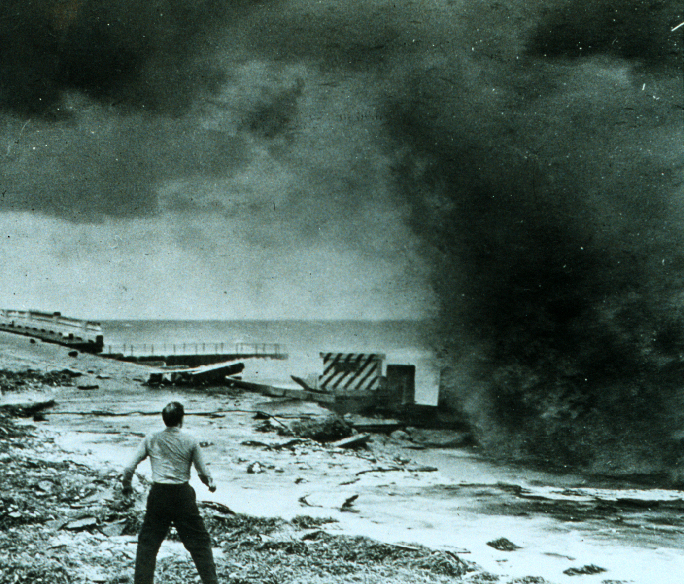
A large storm tide inundated the beaches, peaking at 11 ft at Hillsboro Inlet; similar levels occurred elsewhere from Fort Lauderdale to Palm Beach, eroding long swaths of State Highway A1A. Washouts also occurred from Sunny Isles Beach to Baker's Haulover Inlet. Near Lake Worth the ocean eliminated a 5 mi segment of roadway, and washed out a 1 mi section at Delray Beach. High tides reconfigured the coast, opening new channels and old inlets, and "whitecaps broke" 1 mi inland on Las Olas Boulevard. The waves unmoored a few freighters at Port Everglades. A 6 + 1/2 ft storm tide hit Bahia Mar Yacht Club, near the port. Large waves battered apartments, homes, and many of the 334 resorts on Miami Beach, causing severe flooding. A 3 to layer of sand covered many grounds, and nearby neighborhoods on the Venetian Islands, like Belle Isle, were flooded to a depth of several feet. At Pompano floods lingered five days after the storm, covering the municipal beach and isolating the Hillsboro Inlet bridge. The sea also left sand drifts at Dania Beach, and swept away six homes at Deerfield. Tides reached 5.8 ft at Fort Pierce.

As it crossed South Florida, the storm dropped prolific rains over a broad area, peaking at 10.12 in at St. Lucie Lock, and so worsened a rainier-than-average wet season. In Miami, floods swamped 200 mi of city streets, and in Miami Springs over half the homes. Homestead "resembled Venice". Davie, having lost 35,000 citrus trees to floodwaters in past months, incurred devastating losses to groves and vegetable beds. In Fort Lauderdale the New River overran its banks, submerging downtown streets. The storm ruined vegetable beds in Broward County, delaying cultivation. It yielded 6 to of rain over the Everglades, flooding farms and drowning cattle. On Lake Okeechobee, the cyclone rivaled the 1928 hurricane, imperiling—but not overtopping—the Herbert Hoover Dike. Tides reached 21.6 ft at Clewiston and 20.9 ft at Moore Haven. Near the north shore, tides crested at 13 ft. A 150 ft section of dike collapsed, stranding 700 cattle and flooding 1,800 acres of cropland. On Conners Highway floodwaters and debris combined to obstruct motorists; the former seeped over at 30 spots and overwhelmed a 3,000 ft stretch.

On the state's west coast, sustained winds of 105 mph buffeted Naples, which likely missed the worst conditions. "Heavy" impacts affected the Fort Myers–Punta Gorda area, and 3 ft of water covered the Sanibel Island Light grounds. Tides at Everglades City peaked at 5 + 1/2 ft, forcing denizens into attics and flooding local streets. However, winds blew offshore over Tampa Bay, resulting in below-normal tides and lesser damages. In Pinellas County winds damaged boats and ripped off roof shingles. In St. Petersburg the storm and a walk-out strike coincided, disrupting trolley service for 15 hours. In Fort Myers, hundreds of trees were prostrated and the city left powerless. During the storm, two vessels, with a total combined crew of nine people, went missing; as of September 18, contact had been established with the former and the crew declared safe, but the remaining vessel, with a crew of two, had not been accounted for. Additionally, six Cuban schooners carrying 150 crew members in all sheltered off Anclote Key late on September 17 and rode out the storm. However, another Cuban vessel, the Antonio Cerdedo, foundered and sank off Fort Myers with a loss of seven of its crew members. On September 19, a tornado generated by the storm struck Apalachicola, cutting a 3 mi path, killing two people, and injuring 100 others. The tornado damaged or destroyed 58 homes over a 100 yd area, inflicting F3-level damage on the present Fujita scale.
Gulf Coast of the United States

Wind instruments at Moisant Field were disabled after recording sustained winds of 90 mph. Due to northerly winds, water overtopped sections of the levees on Lake Pontchartrain, leaving some lakefront streets "waist deep," above the 3 ft delimiter. Local communications failed during the storm, so the New Orleans Weather Bureau office handed responsibility to its counterpart in Fort Worth, Texas, which issued public advisories instead. The storm flooded a large part of Greater New Orleans: up to 2 ft of water covered Moisant Field, forcing it to shut down, and up to 6 ft in parts of Jefferson Parish. The storm surge in Louisiana peaked at 9.8 – at Shell Beach on Lake Borgne and at 11.5 ft in Ostrica. In Orleans Parish the surge overtopped the 9 ft seawall—built by the Orleans Levee Board in the 1920s to stop a repeat of the 1915 hurricane there—and spread water over 9 mi2 of the parish, as far from Lake Pontchartrain as Gentilly Ridge. Water covered large parts of Jefferson Parish for as long as two weeks.
Subsidence settled behind the levees, forming "topographic bowls". These contained up to 6 ft of water, which was dredged and pumped back into Lake Pontchartrain. An 11 ft storm surge also hit remote areas of St. Bernard and Plaquemines parishes. Tides of up to 15.2 ft impacted the western half of the Mississippi coast, causing heavy damage in Bay St. Louis, Gulfport, and Biloxi. These recorded their highest tides on record until Hurricane Camille. Although the storm was not a major hurricane at landfall, it still did significant damage, in part owing to the hydrology of the region. 12 people were killed in Louisiana and 22 in Mississippi. In both states combined, the Red Cross reported that the storm destroyed 1,647 homes and damaged 25,000 others, mostly by water. In New Orleans, the storm produced an estimated $100 million worth of damage to the city.
Aftermath
In Florida, a federal state of emergency was declared by then-U.S. President Harry S. Truman. The hurricane, a subsequent tropical storm, and an October hurricane generated one of the worst floods in South Florida's history, spurring the creation of the Central and Southern Florida Flood Control District, along with a plan for new flood-control levees and canals. In New Orleans, the United States Congress approved the Lake Pontchartrain and Vicinity Project to assist ongoing efforts to increase the height of the existing levee along the lakeshore; to bolster the existing seawall in Orleans Parish, an 8 ft levee was erected along the lakeside in Jefferson Parish. New Orleans' Walnut Street Ferry was damaged and never replaced. If this same storm were to hit in 2006 it would probably do around $14.406 billion (2006 USD) in damages.
Notes
References
Sources
References
- (22 April 1997). "The Deadliest Atlantic Tropical Cyclones, 1492–1996".
- Landsea, Christopher W.. (June 1, 2021). "Hurricane FAQ – [[National Oceanic and Atmospheric Administration". [[Hurricane Research Division]].
- "Documentation of Atlantic Tropical Cyclones Changes in HURDAT: 1947 Storm 4 – Revised in 2014". [[Atlantic Oceanographic and Meteorological Laboratory]], [[Hurricane Research Division]].
- (September 16, 1947). "Hurricane Warnings Issued, Lauderdale to Titusville". Miami Daily News.
- (September 16, 1947). "Strong Winds Expected Here Today". [[The Daytona Beach News-Journal.
- (September 17, 1947). "Storm Nears Florida: Rich Resort Area Periled". Kingsport News.
- (September 2, 1978). "Three 1947 Storms Produced Record Rainfall". Miami Herald.
- (September 17, 1947). "Winds Rake Coast in Hurricane Path Nearing Florida". The New York Times.
- (September 26, 1947). "Boca Field Digging Its Way Out". Delray Beach News.
- (September 18, 1947). "Miami: Beach Hard-Hit". Miami Daily News.
- (September 19, 1947). "L. W. (Lake Worth) Reports Few Hardships". The Palm Beach Post.
- (September 19, 1947). "Storm Heads for Louisiana". The Palm Beach Post.
- (September 19, 1947). "Hurricane Levels Buildings". [[Windsor Star.
- (September 21, 1947). "Aid Is Sent to Bahamas". New York Times.
- (September 20, 1947). "Great Abaco Island Residents Survive Gale". [[Miami Herald]].
- (September 18, 1947). "Grand Bahamas Damaged: All Docks and Most of Houses on West End Are Razed". [[New York Times]].
- (September 18, 1947). "Damage Caused In Bahamas". [[Montreal Star]].
- (September 19, 1947). "Food Rushed to Bahamas". New York Times.
- (November 1993). "Memorable Gulf Coast hurricanes of the 20th century". National Hurricane Center.
- (September 22, 1947). "Broward County Takes Stock of Storm Damage". Fort Lauderdale Daily News.
- (September 19, 1947). "Loss Reported Many Millions In Palm Beach". The Palm Beach Post.
- (September 19, 1947). "Summary Of Damage From Storm In South Florida". Miami Daily News.
- (September 19, 1947). "Buildings Worse in '28; Trees, Shrubs This". Palm Beach Post.
- (September 18, 1947). "Wind-Lashed South Florida Digs Out of Storm's Debris". Miami Daily News.
- Sutor, Jack. (September 21, 1947). "Aerial Survey of Ocean Road Shows Damage". Palm Beach Post.
- (September 18, 1947). "New River Inlet Nearly Reopened". Fort Lauderdale Daily News.
- (September 18, 1947). "Debris Covers Pompano Beach After Big Blow". Fort Lauderdale Daily News.
- (September 18, 1947). "Dania Withstands Hurricane". Fort Lauderdale Daily News.
- (September 18, 1947). "Storm News Roundup". Fort Lauderdale Daily News.
- (September 19, 1947). "Times Writer Plunges Into Heart of Hurricane, Comes Out With Dramatic Story of 'Big Blow'". Saint Petersburg Times.
- (September 19, 1947). "Glades Come Out of Hurricane With Relatively Small Damage". The Palm Beach Post.
- (September 21, 1947). "Glades Towns In Flood Path". Palm Beach Post.
- (September 21, 1947). "Glades Highway Closed by State". Palm Beach Post.
- (September 19, 1947). "Pinellas Weathers Hurricane With Only Minor Damage". Saint Petersburg Times.
- (September 19, 1947). "Coast Guard Searches For Two Boats With Eight Men and One Woman Aboard". Saint Petersburg Times.
- (2010). "Louisiana Hurricane History: Early 20th Century (continued)". [[National Weather Service]].
- Bourne, Joel K Jr.. (October 2004). "Gone With the Water". National Geographic.
- Yamazaki, Gordon. (2001). "Environmental Atlas of the Lake Pontchartrain Basin". Lake Pontchartrain Basin Foundation.
This article was imported from Wikipedia and is available under the Creative Commons Attribution-ShareAlike 4.0 License. Content has been adapted to SurfDoc format. Original contributors can be found on the article history page.
Ask Mako anything about 1947 Fort Lauderdale hurricane — get instant answers, deeper analysis, and related topics.
Research with MakoFree with your Surf account
Create a free account to save articles, ask Mako questions, and organize your research.
Sign up freeThis content may have been generated or modified by AI. CloudSurf Software LLC is not responsible for the accuracy, completeness, or reliability of AI-generated content. Always verify important information from primary sources.
Report