From Surf Wiki (app.surf) — the open knowledge base
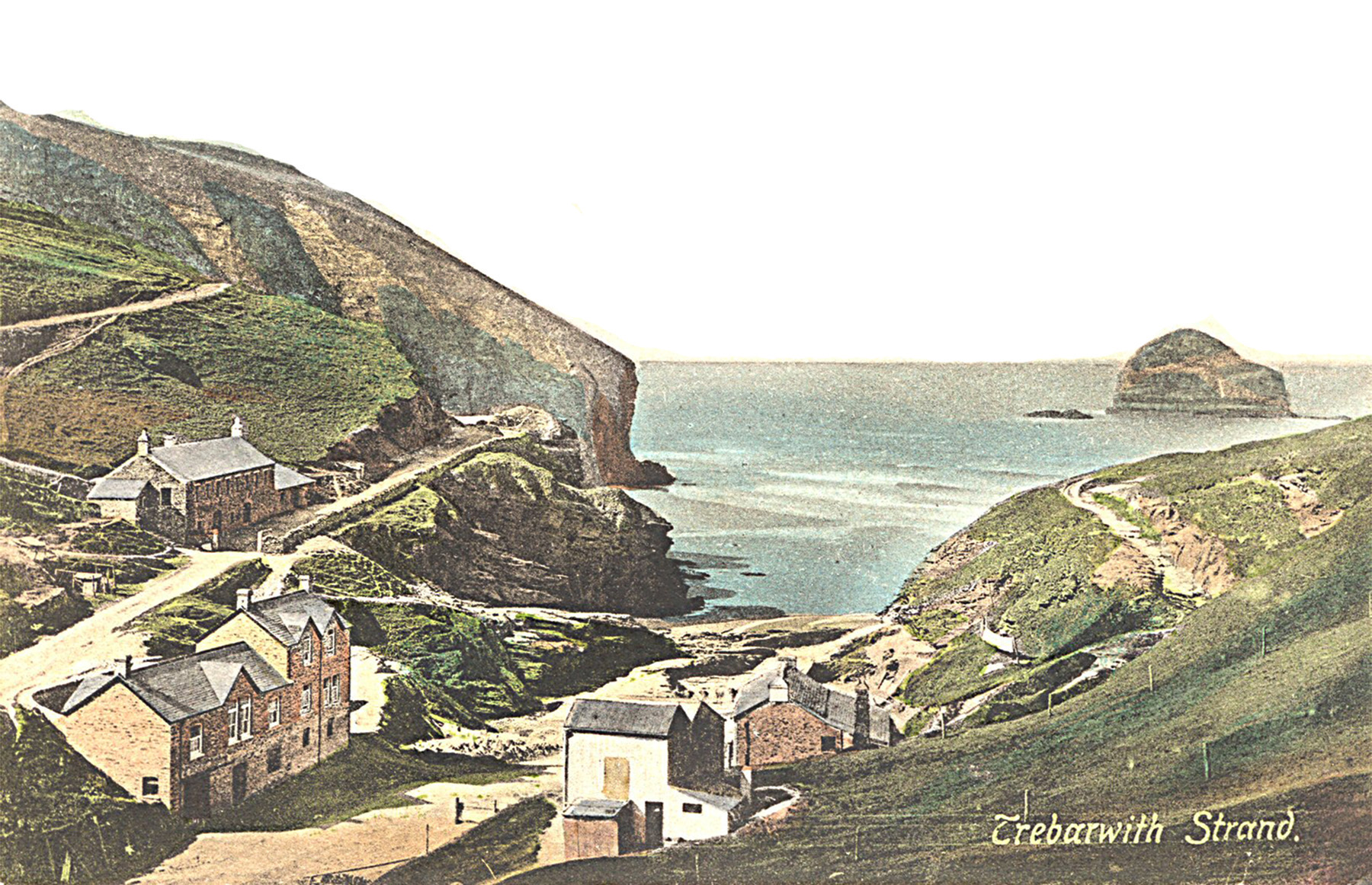
Trebarwith Strand
Section of coastline in Northern Cornwall, UK
Section of coastline in Northern Cornwall, UK
| Field | Value |
|---|---|
| static_image_name | Tintagel, above Trebarwith Strand - geograph.org.uk - 842440.jpg |
| static_image_caption | Above Trebarwith Strand looking towards Dennis Point with the Port William inn, centre left. In the distance the coastline runs out to Port Quin Bay and Rumps Point |
| country | England |
| map_type | Cornwall |
| official_name | Trebarwith Strand |
| civil_parish | Tintagel |
| unitary_england | Cornwall |
| lieutenancy_england | Cornwall |
| region | South West England |
| post_town | TINTAGEL |
| postcode_district | PL34 |
| postcode_area | PL |
History
The name Trebarwith was first associated with the village on the higher ground to the south of the valley which is the most southerly part of Tintagel parish. Land at Trebarwith is first mentioned in records of 1284 and was held from 1329 until the early 16th century by the Lercedekne family. Trebarwith Farm is a Grade II listed building. The road along the valley from Penpethy to the Strand is known as the Sanding Road and was originally built c. 1825 to allow the collection of sand. The local soil is acidic and so sand and lime were fed into it. The sand was loaded into sacks and carried up the hill by donkeys and ponies. A large pool that can be accessed at low tide is known as the horses' pool as this is where the animals cooled off on hot days.
Trebarwith Strand was central to Tintagel's slate industry. Quarrying has taken place here since the fifteenth century and around eight disused quarries scar the coast between the beach and Tintagel Castle. There are also quarries lining the Sanding Road as it climbs up from the beach. Ships brought coal to Port William at the southern end of the beach where cranes and derricks would winch slate down the cliff to be taken away for export.
At Lill Cove a small water-powered copper mine led up from the beach to the cliffs above Trebarwith, though the tunnels at the beach end have now been blocked by rock falls.
A wide "road" has been cut through the rocks at the top of the beach to allow access for the donkeys and ponies bringing sand to the settlements inland.
In the 19th century, a hotel was built close to the access point to the beach. The building is now gift shops and holiday apartments. At some point in the 1970s, the hotel stable block was converted into a pub now called the Port William.
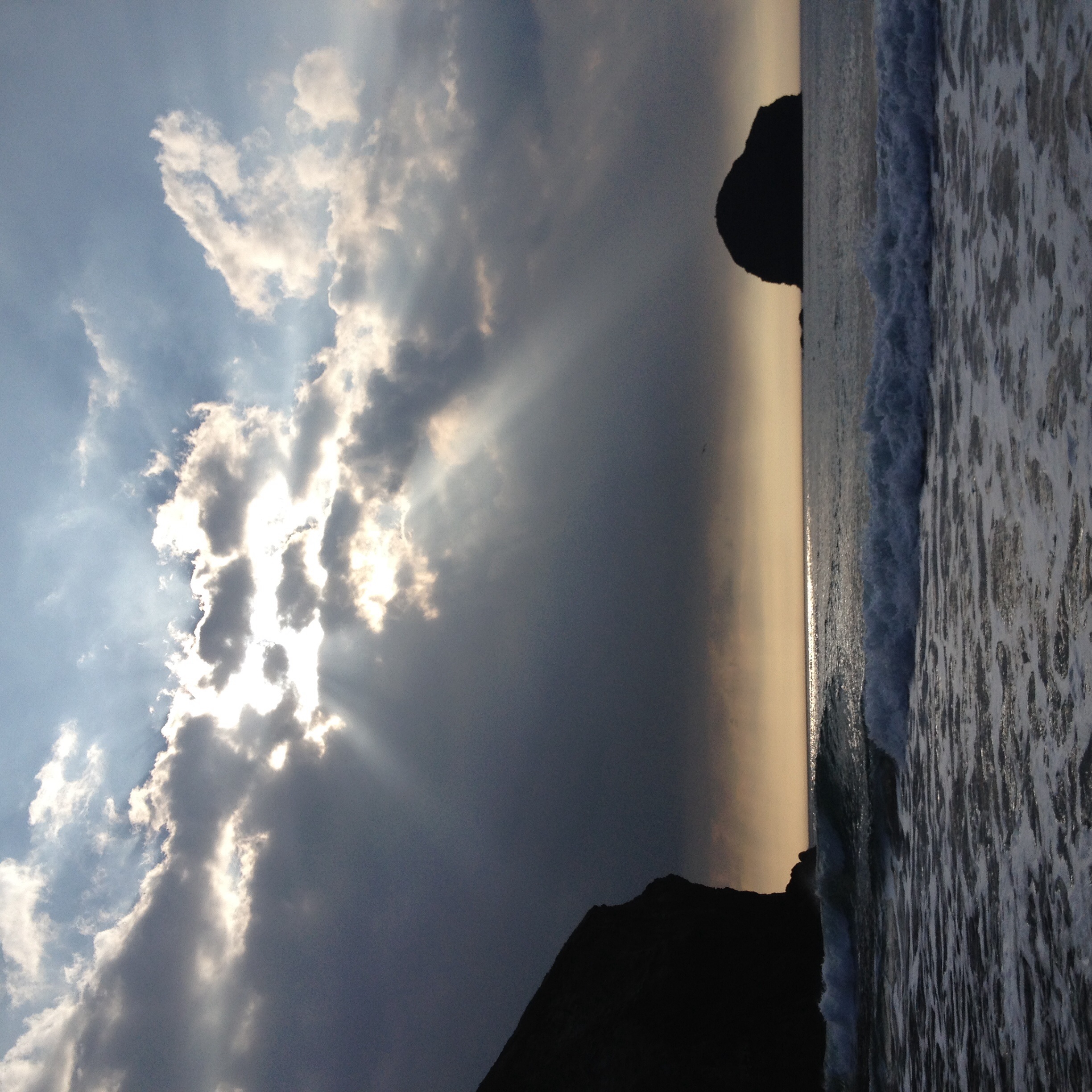
In October 1886, the barque Sarah Anderson was wrecked off Gull Rock with the loss of all on board.
In February 2015, a man was swept out to sea while scattering his sister's ashes at the beach.
Natural history

When the tide is at its lowest the sea recedes 300 yd and an expanse of sand in excess of 1/2 mi wide is uncovered. The rockpools at the base of the cliffs create perfect places for small fish and crabs to hide until the tide turns, and there is an abundance of small molluscs such as periwinkles, barnacles, limpets and mussels clinging in clusters to the rocks.
A small unnamed stream flows into the sea at Trebarwith Strand. About a mile upstream there was a corn mill powered by a water wheel. The building is now a pub called the Mill House Inn.
Surfing and bathing
Access by road and path
Vehicle access to the beach is via a dead-end lane known as the Sanding Road which runs down a narrow valley from the B3263 Tintagel to Camelford road. From Tintagel, a shortcut is available through the village of Treknow which then joins the Sanding Road.
Trebarwith Strand is accessible to walkers along the South West Coast Path from both the north and south. The footpath, running through Access Land passes boreholes and other remnants of the cliff quarry workings which were in operation until 1937.
In popular culture
The 1974 film Malachi's Cove or The Seaweed Children based on Anthony Trollope's story and directed by Henry Herbert was filmed largely at Trebarwith. The film starred Donald Pleasence as Malachi.
Trebarwith Strand stood in for Shakespeare’s coast of Illyria in the 1996 production of "Twelfth Night". Gull Rock forms the backdrop for the 1997 film “Oscar and Lucinda” and the 2000 film “Saving Grace."
References
References
- Canner, A. C. (1982) ''The Parish of Tintagel''. Camelford: A. C. Canner; p. 20
- "Trebarwith Farm".
- [https://commons.wikimedia.org/wiki/File:The_Statutes_of_the_United_Kingdom_of_Great_Britain_and_Ireland_1825_(6_George_IV).pdf The Statutes of the United Kingdom of Great Britain and Ireland 1825 (6 George IV)]
- "Circular walk to Tintagel Castle from Trebarwith Strand".
- «Coastal Slate Quarries – Tintagel to Trebarwith” (1990) Adam Sharpe, CAU archaeological survey for the National Trust. ISBN 1 871162 95 5
- (2007-10-24). "Wreck Report for 'Sarah Anderson', 1887 - PortCities Southampton". Plimsoll.org.
- (1 February 2015). "Man scattering ashes at Trebarwith Strand swept out to sea". BBC.
- (2009-01-10). "Two Men and a Dog Rescued From Cornish Cliff Face After Phoning a Pub For Assistance". Maritime & Coastguard Agency.
- Hatcher, John (1970) ''Rural Economy and Society in the Duchy of Cornwall 1300-1500''. Cambridge University Press; pp. 34-35 {{ISBN. 0-521-08550-0
- [https://www.imdb.com/title/tt0070357/ Malachi's Cove] (The Seaweed Children), IMDb
This article was imported from Wikipedia and is available under the Creative Commons Attribution-ShareAlike 4.0 License. Content has been adapted to SurfDoc format. Original contributors can be found on the article history page.
Ask Mako anything about Trebarwith Strand — get instant answers, deeper analysis, and related topics.
Research with MakoFree with your Surf account
Create a free account to save articles, ask Mako questions, and organize your research.
Sign up freeThis content may have been generated or modified by AI. CloudSurf Software LLC is not responsible for the accuracy, completeness, or reliability of AI-generated content. Always verify important information from primary sources.
Report