From Surf Wiki (app.surf) — the open knowledge base
Tibet Autonomous Region
Autonomous region of China

Autonomous region of China
| Field | Value |
|---|---|
| name | Tibet Autonomous Region |
| settlement_type | Autonomous region |
| translit_lang1 | Chinese |
| translit_lang1_type | Simplified Chinese |
| translit_lang1_info | 西藏自治区 |
| translit_lang1_type1 | Hanyu pinyin |
| translit_lang1_info1 | zh |
| translit_lang1_type2 | Abbreviation |
| translit_lang1_info2 | XZ / 藏 (zh) |
| translit_lang2 | Tibetan |
| translit_lang2_type | Tibetan script |
| translit_lang2_info | |
| translit_lang2_type1 | Tibetan pinyin |
| translit_lang2_info1 | bo |
| translit_lang2_type2 | Wylie transliteration |
| translit_lang2_info2 | bo |
| image_skyline | {{multiple image |
| border | infobox |
| total_width | 290 |
| image_style | border:1; |
| perrow | 1/2/2/2 |
| image1 | 布达拉宫.jpg |
| caption1 | Potala Palace |
| image2 | Everest North Face toward Base Camp Tibet Luca Galuzzi 2006.jpg |
| caption2 | Mount Everest |
| image3 | 雅鲁藏布大峡谷 - panoramio.jpg |
| caption3 | Yarlung Tsangpo Canyon |
| image4 | Tashilhunpo11.jpg |
| caption4 | Shigatse |
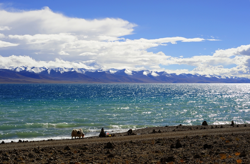
| image5 | Nam_Co,_China_(Unsplash).jpg |
| caption5 | Namtso |
| image6 | 古格断壁残垣.jpg |
| caption6 | Tsaparang |
| image7 | 格尔木 NJ2-0028与NJ2-0041牵引货列下行通过三岔河大桥 03.jpg |
| caption7 | Qinghai-Tibet Railroad |
| image_map | Tibet in China (claimed hatched) (+all claims hatched).svg |
| mapsize | 275px |
| map_caption | Location of the Tibet Autonomous Region in China (territory claimed by China but controlled by India is striped) |
| seat_type | Capital |
| and largest city | |
| seat | Lhasa |
| parts_type | Divisions |
| - Prefecture-level | |
| - County-level | |
| - Township- | |
| level | |
| parts | |
| 7 prefectures | |
| 74 counties | |
| 699 towns and subdistricts | |
| government_type | Autonomous region |
| governing_body | Tibet Autonomous Region People's Congress |
| leader_title | Party Secretary |
| leader_name | Wang Junzheng |
| leader_title1 | Congress Chairman |
| leader_name1 | Yan Jinhai |
| leader_title2 | Government Chairman |
| leader_name2 | Garma Cedain |
| leader_title3 | Regional CPPCC Chairman |
| leader_name3 | Pagbalha Geleg Namgyai |
| leader_title4 | National People's Congress Representation |
| leader_name4 | 24 deputies |
| area_footnotes | |
| area_total_km2 | 1228400 |
| area_rank | 2nd |
| elevation_max_m | 8,848 |
| elevation_max_point | Mount Everest |
| population_total | 3,648,100 |
| population_as_of | 2020 |
| population_density_km2 | auto |
| population_rank | 32nd |
| population_density_rank | 33rd |
| demographics_type1 | Demographics |
| demographics1_footnotes | tags -- |
| demographics1_title1 | Ethnic composition |
| demographics1_info1 | 86.0% Tibetan |
| 12.2% Han | |
| 0.8% others | |
| demographics1_title2 | Languages and dialects |
| demographics1_info2 | Tibetan, Mandarin Chinese |
| demographics_type2 | GDP |
| demographics2_title1 | Total |
| demographics2_info1 | CN¥ 250.5 billion (31st) |
| demographics2_title2 | Per capita |
| demographics2_info2 | CN¥ 75,237 (22nd) |
| iso_code | CN-XZ |
| blank4_name_sec2 | HDI (2022) |
| blank4_info_sec2 | 0.648 (31st) – |
| website | |
| subdivision_name | China |
| subdivision_type | Country |
and largest city
- Prefecture-level
- County-level
- Township- level 7 prefectures 74 counties 699 towns and subdistricts 12.2% Han 0.8% others
US$ 34.569 billion
US$ 10,640 ᡩᡯᠠᠩ The Tibet Autonomous Region (TAR), often shortened to Tibet, or referred to in Chinese as Xizang, is an autonomous region of the People's Republic of China. It was established in 1965 to replace the Tibet Area, a former administrative division of the Republic of China.
The current borders of the Tibet Autonomous Region were generally established in the 18th century and include about half of cultural Tibet, which was at times independent and at times either under the Mongol-led Yuan dynasty or Qing dynasty rule. The TAR spans more than 1200000 km2 and is the second-largest province-level division of China by area. Due to its harsh and rugged terrain, it has a total population of only 3.6 million people or approximately 3 PD/km2.
Names
Main article: Etymology of Tibet
Tibet Autonomous Region is often shortened to Tibet in English or as Xizang in Hanyu Pinyin which has been the Chinese transliteration of Ü-Tsang since the Manchu-led Qing dynasty. The English word Thibet dates back to 1827 and may have been derived from older terms in other languages. The official use of Xizang in Chinese records dates back to 1724 when the Kangxi Emperor of Qing dynasty wrote an edict for the Imperial Stele Inscriptions of the Pacification of Tibet in languages such as Han, Manchu, Mongolian, and Tibetan.{{cite book|author=徐学林编著|title=中国历代行政区划|location=合肥|publisher=安徽教育出版社|year=1991|isbn=7-5336-0945-X|page=275|url=https://books.google.com/books?id=HbpEAAAAYAA|archive-date=2023-12-23|archive-url=https://web.archive.org/web/20231223052959/https://books.google.com.hk/books?id=HbpEAAAAYAAJ&q=%E5%B9%B3%E5%AE%9A%E8%A5%BF%E8%97%8F%E7%A2%91&redir_esc=y
History
Main article: History of Tibet
In the 6th century, the 39'th Tibetan king, Namri Songtsen, began to annex neighboring tribes by force, he was later assassinated by a coup, and his son Songtsen Gampo succeeded him and quelled rebellions in various regions. Songtsen Gampo inherited his father's will and successively conquered and annexed other kingdoms such as "Songbo" in the Yushu area of Qinghai, Sumpa in the west, "Kangguo" (called "Dongnwu Kingdom" in the Old Book of Tang) in Qianduo (now Chamdo), "Fuguo (Chinese:附国)" in Ganzi, "Fanlu (Chinese:蕃绿)" in Litang, and Tuyuhun in Qinghai. Songtsen Gampo also led a large army to attack Zhangzhung in 642. It took him three years to conquer Zhangzhung and sent Khyungpo Pungse Sutse as the governor of Zhangzhung. Zhangzhung then became a vassal state of the Tibetan Empire.
Yarlung kings founded the Tibetan Empire in 618. By the end of the 8th century, the empire reached its greatest extent. After a civil war, the empire broke up in 842. The royal lineage fragmented and ruled over small kingdoms such as Guge and Maryul. The Mongols conquered Tibet in 1244 and later ruled it under the Yuan Dynasty but granted the region a degree of political autonomy. The Sakya lama Drogön Chögyal Phagpa became a religious teacher to Kublai Khan in the 1250s and was made the head of the Tibetan region administration .
From 1354 to 1642, Central Tibet (Ü-Tsang) was ruled by a succession of dynasties from Nêdong, Shigatse and Lhasa. In 1642, the Ganden Phodrang court of the 5th Dalai Lama was established by Güshi Khan of the Khoshut Khanate, who was enthroned as King of Tibet. The Khoshuts ruled until 1717, when they were overthrown by the Dzungar Khanate. Despite politically charged historical debate concerning the nature of Sino-Tibetan relations, some historians posit that Tibet under the Ganden Phodrang (1642–1951) was an independent state, albeit under various foreign suzerainties for much of this period, including by the Ming dynasty (1368–1644). The Dzungar forces were in turn expelled by the 1720 expedition to Tibet during the Dzungar–Qing Wars. This began a period of Manchu-led Qing rule over Tibet. |publication-place = Abingdon |access-date = 20 November 2022
From the fall of the Qing dynasty in 1912 until 1950, Tibet was de facto independent although still claimed by the successor Republic of China. The Republican regime, preoccupied with warlordism (1916–1928), civil war (1927–1949) and Japanese invasion (1937–1945), was not able to exert authority in Central Tibet. Other regions of ethno-cultural Tibet in eastern Kham and Amdo had been under de jure administration of the Chinese dynastic government since the mid-18th century; they form parts of the provinces of Qinghai, Gansu, Sichuan and Yunnan.
In 1950, following the proclamation of the People's Republic of China the year before, the People's Liberation Army (PLA) defeated the Tibetan army near the city of Chamdo. In 1951, Tibetan representatives signed the Seventeen Point Agreement with the Central People's Government affirming its sovereignty over Tibet and the annexation of Tibet by the People's Republic of China. The 14th Dalai Lama ratified the agreement in October 1951. Despite the agreement, relations between the Tibetan and Chinese governments deteriorated, and on March 10, 1959, Tibetans in Lhasa launched an uprising, which ultimately failed, but the date continues to be marked as Tibetan Uprising Day each year by Tibetan Exiles . The 14th Dalai Lama fled to India and renounced the Seventeen Point Agreement, saying he had approved it under duress. During the 1950s and 1960s, CIA-trained Tibetan agents were parachuted into Tibet to fight the PLA, but almost all of them were captured and killed. The establishment of the Tibet Autonomous Region in 1965 made Tibet a provincial-level division of China.
Geography
Main article: Geography of Tibet
The Tibet Autonomous Region is located on the Tibetan Plateau, the highest region on Earth. In northern Tibet elevations reach an average of over 4572 m. Mount Everest is located on Tibet's border with Nepal.
China's provincial-level areas of Xinjiang, Qinghai and Sichuan lie to the north, northeast and east, respectively, of the Tibet AR. There is also a short border with Yunnan Province to the southeast. The countries to the south and southwest are Nepal, Myanmar, India and Bhutan. China claims Arunachal Pradesh administered by India as part of the Tibet Autonomous Region. It also claims some areas adjoining the Chumbi Valley that are recognised as Bhutan's territory, and some areas of eastern Ladakh claimed by India. India and China agreed to respect the Line of Actual Control in a bilateral agreement signed on September 7, 1993.
Physically, the Tibet AR may be divided into two parts: the lakes region in the west and northwest and the river region, which spreads out on three sides of the former on the east, south and west. Both regions receive limited amounts of rainfall as they lie in the rain shadow of the Himalayas; however, the region names are useful in contrasting their hydrological structures, and also in contrasting their different cultural uses: nomadic in the lake region and agricultural in the river region. On the south the Tibet AR is bounded by the Himalayas, and on the north by a broad mountain system. The system at no point narrows to a single range; generally there are three or four across its breadth. As a whole the system forms the watershed between rivers flowing to the Indian Ocean — the Indus, Brahmaputra and Salween and its tributaries — and the streams flowing into the undrained salt lakes to the north.
The lake region extends from the Pangong Tso Lake in Ladakh, Lake Rakshastal, Yamdrok Lake and Lake Manasarovar near the source of the Indus River, to the sources of the Salween, the Mekong and the Yangtze. Other lakes include Dagze Co, Namtso, and Pagsum Co. The lake region is a wind-swept Alpine grassland. This region is called the Chang Tang (Byang sang) or 'Northern Plateau' by the people of Tibet. It is 1100 km broad and covers an area about equal to that of France. Due to its great distance from the ocean it is extremely arid and possesses no river outlet. The mountain ranges are spread out, rounded, disconnected, and separated by relatively flat valleys.
The Tibet AR is dotted over with large and small lakes, generally salt or alkaline, and intersected by streams. Due to the presence of discontinuous permafrost over the Chang Tang, the soil is boggy and covered with tussocks of grass, thus resembling the Siberian tundra. Salt and fresh-water lakes are intermingled. The lakes are generally without outlet, or have only a small effluent. The deposits consist of soda, potash, borax and common salt. The lake region is noted for a vast number of hot springs, which are widely distributed between the Himalayas and 34° N, but are most numerous to the west of Tengri Nor (northwest of Lhasa). So intense is the cold in this part of Tibet that these springs are sometimes represented by columns of ice, the nearly boiling water having frozen in the act of ejection.
The river region is characterized by fertile mountain valleys and includes the Yarlung Tsangpo River (the upper courses of the Brahmaputra) and its major tributary, the Nyang River, the Salween, the Yangtze, the Mekong, and the Yellow River. The Yarlung Tsangpo Canyon, formed by a horseshoe bend in the river where it flows around Namcha Barwa, is the deepest and possibly longest canyon in the world. Among the mountains there are many narrow valleys. The valleys of Lhasa, Shigatse, Gyantse and the Brahmaputra are free from permafrost, covered with good soil and groves of trees, well irrigated, and richly cultivated.
The South Tibet Valley is formed by the Yarlung Tsangpo River during its middle reaches, where it travels from west to east. The valley is approximately 1200 km long and 300 km wide. The valley descends from 4500 m above sea level to 2800 m. The mountains on either side of the valley are usually around 5000 m high. Lakes here include Lake Paiku and Lake Puma Yumco.
Politics
The Tibet Autonomous Region is a province-level entity of the People's Republic of China. Chinese law nominally guarantees some autonomy in the areas of education and language policy. Like other subdivisions of China, routine administration is carried out by a People's Government, headed by a chairman, who has been an ethnic Tibetan except for an interregnum during the Cultural Revolution. As with other Chinese provinces, the chairman carries out work under the direction of the regional secretary of the Chinese Communist Party. The standing committee of the regional Communist Party Committee serves as the top rung of political power in the region. The current chairman is Garma Cedain and the current party secretary is Wang Junzheng. The central leadership in Beijing formulates policies regarding Tibet through the Central Tibet Work Coordination Group, which is usually led by the chairman of the Chinese People's Political Consultative Conference.
Administrative divisions
Main article: List of administrative divisions of the Tibet Autonomous Region, List of township-level divisions of the Tibet Autonomous Region
The Autonomous Region is divided into seven prefecture-level divisions: six prefecture-level cities and one prefecture.
These in turn are subdivided into a total of 66 counties and 8 districts (Chengguan, Doilungdêqên, Dagzê, Samzhubzê, Karub, Bayi, Nêdong, and Seni).
| Division code | Division | Area in km2 | Population 2020 | Seat | Divisions | Districts | Counties | CL cities | 540000 | Tibet Autonomous Region | 540100 | Lhasa city | 540200 | Shigatse / Xigazê city | 540300 | Chamdo / Qamdo city | 540400 | Nyingchi city | 540500 | Shannan / Lhoka city | 540600 | Nagqu city | 542500 | Ngari Prefecture |
|---|---|---|---|---|---|---|---|---|---|---|---|---|---|---|---|---|---|---|---|---|---|---|---|---|
| 1,228,400.00 | 3,648,100 | Lhasa city | 8 | 64 | 2 | |||||||||||||||||||
| 29,538.90 | 867,891 | Chengguan District | 3 | 5 | ||||||||||||||||||||
| 182,066.26 | 798,153 | Samzhubzê District | 1 | 17 | ||||||||||||||||||||
| 108,872.30 | 760,966 | Karuo District | 1 | 10 | ||||||||||||||||||||
| 113,964.79 | 238,936 | Bayi District | 1 | 5 | 1 | |||||||||||||||||||
| 79,287.84 | 354,035 | Nêdong District | 1 | 10 | 1 | |||||||||||||||||||
| 391,816.63 | 504,838 | Seni District | 1 | 10 | ||||||||||||||||||||
| 296,822.62 | 123,281 | Gar County | 7 |

| Administrative divisions in Tibetan, Chinese, and varieties of romanizations | English | Tibetan | Tibetan Pinyin | Wylie transliteration | Chinese | Pinyin |
|---|---|---|---|---|---|---|
| Tibet Autonomous Region | Poi Ranggyongjong | bod rang skyong ljongs | 西藏自治区 | Xīzàng Zìzhìqū | ||
| Lhasa city | Lhasa Chongkyir | lha sa grong khyer | 拉萨市 | Lāsà Shì | ||
| Xigazê city | Xigazê Chongkyir | ggzhis ka rtse grong khyer | 日喀则市 | Rìkāzé Shì | ||
| Qamdo city | Qamdo Chongkyir | chab mdo grong khyer | 昌都市 | Chāngdū Shì | ||
| Nyingchi city | Nyingchi Chongkyir | nying khri grong khyer | 林芝市 | Línzhī Shì | ||
| Shannan city | Lhoka Chongkyir | lho kha grong khyer | 山南市 | Shānnán Shì | ||
| Nagqu city | Nagqu Chongkyir | nag chu grong khyer | 那曲市 | Nàqū Shì | ||
| Ngari Prefecture | Ngari Sakü | mnga' ris sa khul | 阿里地区 | Ālǐ Dìqū |
| # | Cities | 2020 Urban area | 2010 Urban area | 2020 City proper |
|---|---|---|---|---|
| 1 | Lhasa | 551,802 | 199,159 | 867,891 |
| 2 | Xigazê | 94,464 | 63,967 | 798,153 |
| 3 | Nyingchi | 60,696 | 238,936 | |
| 4 | Shannan | 54,188 | 354,035 | |
| 5 | Qamdo | 50,127 | 760,966 | |
| 6 | Nagqu | 31,436 | 504,838 | |
| (7) | Mainling | 5,915 | *see Nyingchi* | |
| (8) | Cona | 2,871 | *see Shannan* |
Demographics
|1912 |1,160,000 |1928 |372,000 |1936–37 |372,000 |1947 |1,000,000 |1954 |1,273,969 |1964 |1,251,225 |1982 |1,892,393 |1990 |2,196,010 |2000 |2,616,329 |2010 |3,002,166 |2020 |3,648,100 With an average of about two people per square kilometer, Tibet has the lowest population density among any of the Chinese province-level administrative regions, mostly due to its harsh and rugged terrain. In 2024, only 39.7 percent of Tibet's population was urban, with 60.3 being rural, amongst the lowest in China, though this is significantly up from 22.6 percent in 2011.
In 2020 the Tibetan population was three million. The ethnic Tibetans, comprising 86.0% of the population, mainly adhere to Tibetan Buddhism and Bön, although there is an ethnic Tibetan Muslim community. Other Muslim ethnic groups such as the Hui and the Salar have inhabited the region. There is also a tiny Tibetan Christian community in eastern Tibet. Smaller tribal groups such as the Monpa and Lhoba, who follow a combination of Tibetan Buddhism and spirit worship, are found mainly in the southeastern parts of the region.
Historically, the population of Tibet consisted of primarily ethnic Tibetans. According to tradition the original ancestors of the Tibetan people, as represented by the six red bands in the Tibetan flag, are: the Se, Mu, Dong, Tong, Dru and Ra. Other traditional ethnic groups with significant population or with the majority of the ethnic group reside in Tibet include Bai people, Blang, Bonan, Dongxiang, Han, Hui people, Lhoba, Lisu people, Miao, Mongols, Monguor (Tu people), Menba (Monpa), Mosuo, Nakhi, Qiang, Nu people, Pumi, Salar, and Yi people.
According to the Encyclopædia Britannica Eleventh Edition published between 1910 and 1911, the total population of the Tibetan capital of Lhasa, including the lamas in the city and vicinity, was about 30,000, and the permanent population also included Chinese families (about 2,000).
Most Han people in the Tibet Autonomous Region (12.2% of the total population) are recent migrants, because all of the Han were expelled from "Outer Tibet" (Central Tibet) following the British invasion until the establishment of the PRC. As of 2010, only 8% of Han people have household registration in TAR, others keep their household registration in place of origin.
Tibetan scholars and exiles claim that, with the 2006 completion of the Qingzang Railway connecting the Tibet Autonomous Region to Qinghai Province, there has been an "acceleration" of Han migration into the region. The Tibetan government-in-exile based in northern India asserts that the PRC is promoting the migration of Han workers and soldiers to Tibet to marginalize and assimilate the locals.
Religion
Main article: Religion in Tibet
The main religion in Tibet has been Buddhism since its introduction in the 8th century AD. Before the arrival of Buddhism, the main religion among Tibetans was an indigenous shamanic and animistic religion, Bon, which now comprises a sizeable minority and influenced the formation of Tibetan Buddhism.
According to estimates from the International Religious Freedom Report of 2012, most Tibetans (who comprise 91% of the population of the Tibet Autonomous Region) are adherents of Tibetan Buddhism, while a minority of 400,000 people are followers the native Bon or folk religions which share the image of Confucius (Tibetan: Kongtse Trulgyi Gyalpo) with Chinese folk religion, though in a different light. According to some reports, the government of China has been promoting the Bon religion, linking it with Confucianism.
Most of the Han Chinese who reside in Tibet practice their native Chinese folk religion (). There is a Guandi Temple of Lhasa (拉萨关帝庙) where the Chinese god of war Guandi is identified with the cross-ethnic Chinese, Tibetan, Mongol and Manchu deity Gesar. The temple is built according to both Chinese and Tibetan architecture. It was first erected in 1792 under the Qing dynasty and renovated around 2013 after decades of disrepair.
Built or rebuilt between 2014 and 2015 is the Guandi Temple of Qomolangma (Mount Everest), on Ganggar Mount, in Tingri County.
There are four mosques in the Tibet Autonomous Region with approximately 4,000 to 5,000 Muslim adherents, although a 2010 Chinese survey found a higher proportion of 0.4%. There is a Catholic church with 700 parishioners, which is located in the traditionally Catholic community of Yanjing in the east of the region.
The mainly state-funded American advocacy group Freedom House ranked the Tibet Autonomous Region as "not free" in their 2025 annual world report, giving the region a rating of −2 out of 40 for political rights and 2 out of 60 for civil liberties. This gives the region a total score of 0 out of 100, positioning it as one of the least free places on earth.
Human rights
Main article: Human rights in Tibet

From the 1951 Seventeen Point Agreement to 2003, life expectancy in Tibet increased from thirty-six years to sixty-seven years with infant mortality and absolute poverty declining steadily.
Before the annexation of Tibet by the People's Republic of China in 1951, Tibet was ruled by a theocracy and had a caste-like social hierarchy. Human rights in Tibet prior to its incorporation into the People's Republic of China differed considerably from those in the modern era. Due to tight control of press in mainland China, including the Tibet Autonomous Region, it is difficult to accurately determine the scope of human rights abuses.
When General Secretary Hu Yaobang visited Tibet in 1980 and 1982, he disagreed with what he viewed as heavy-handedness. Hu reduced the number of Han party cadre, and relaxed social controls.
Critics of the Chinese Communist Party (CCP) claim the CCP's official aim to eliminate "the three evils of separatism, terrorism and religious extremism" is used as a pretext for human rights abuses. A 1992 Amnesty International report stated that judicial standards in the Tibet Autonomous Region were not up to "international standards". The report accused the CCP government with keeping political prisoners and prisoners of conscience; ill-treatment of detainees, including torture, and inaction in the face of ill-treatment; the use of the death penalty; extrajudicial executions; and forced abortion and sterilization.
Towns and villages in Tibet
Comfortable Housing Program
Beginning in 2006, 280,000 Tibetans who lived in traditional villages and as nomadic herdsmen have been forcefully relocated into villages and towns. In those areas, new housing was built and existing houses were remodelled to serve a total of 2 million people. Those living in substandard housing were required to dismantle their houses and remodel them to government standards. Much of the expense was borne by the residents themselves, often through bank loans. The population transfer program, which was first implemented in Qinghai where 300,000 nomads were resettled, is called "Comfortable Housing", which is part of the "Build a New Socialist Countryside" program. Its effect on Tibetan culture has been criticized by exiles and human rights groups. Finding employment is difficult for relocated persons who have only agrarian skills. Income shortfalls are offset by government support programs. It was announced that in 2011 that 20,000 CCP cadres will be placed in the new towns.
Economy
Main article: Economy of Tibet
| 2023 | 239.3 |
|---|
In general, Autonomous regions of China have some of the highest per capita government spending on public goods and services. Providing public goods and services in these areas is part of a government effort to reduce regional inequalities, reduce the risk of separatism, and stimulate economic development. Tibet has the highest amount of funding from the central government to the local government as of at least 2019. As of at least 2019, Tibet has the largest total per capita government expenditure of any region in China, including on health care, the highest per capita government expenditure on education, and the second highest per capita government expenditure on social security and employment.
The Tibetans traditionally depended upon agriculture for survival. Since the 1980s, however, other jobs such as taxi-driving and hotel retail work have become available in the wake of the reform and opening up. By 2023, its gross domestic product (GDP) stood at nearly 239.3 billion yuan (about 33.6 billion U.S. dollars), adding that the growth rates of the region's major economic indicators, including per capita disposable income, fixed asset investment, and total retail sales of consumer goods, all ranked first in China. The added value of the service sector accounted for 54.1 percent and contributed a 57.6 percent share to economic growth. Investment in fixed assets also grew rapidly last year, with investment in infrastructure up by 34.8 percent and investment in areas related to people's livelihoods up by 31.8 percent. The region's GDP grew by an annual average of 9.5 percent from 2012 to 2023, about 3 percentage points higher than the China's national average.
By 2022, the GDP of the region surpassed 213 billion yuan (US$31.7 billion in nominal), while GDP per capita reached ( in nominal). In 2022, Tibet's GDP per capita ranked 25th highest in China, as well as higher than any South Asian country except Maldives. In 2008, Chinese news media reported that the per capita disposable incomes of urban and rural residents in Tibet averaged ( () and () respectively.
While traditional agriculture and animal husbandry continue to lead the area's economy, in 2005 the tertiary sector contributed more than half of its GDP growth, the first time it surpassed the area's primary industry.
The collection of caterpillar fungus (Cordyceps sinensis, known in Tibetan as Yartsa Gunbu) in late spring / early summer is in many areas the most important source of cash for rural households. It contributes an average of 40% to rural cash income and 8.5% to the Tibet Autonomous Region's GDP.
The re-opening of the Nathu La pass (on southern Tibet's border with India) should facilitate Sino-Indian border trade and boost Tibet's economy.
The China Western Development policy was adopted in 2000 by the central government to boost economic development in western China, including the Tibet Autonomous Region. Because the central government permits Tibet to have a preferentially low corporate income tax rate, many corporations have registered in Tibet.
Education
There are 4 universities and 3 colleges in Tibet, including Tibet University, Tibet University for Nationalities, Tibet University of Traditional Tibetan Medicine , Tibet Agricultural and Animal Husbandry College, Lhasa Teachers College, Tibet Police Officers Institute and Tibet Vocational and Technical College.
As of at least 2019, Tibet is the region of China with the most notable per capita government spending on education.
Tourism
Foreign tourists were first permitted to visit the Tibet Autonomous Region in the 1980s. While the main attraction is the Potala Palace in Lhasa, there are many other popular tourist destinations including the Jokhang Temple, Namtso Lake, and Tashilhunpo Monastery. Nonetheless, tourism in TAR is still restricted for non-Chinese passport holders (including citizens of the Republic of China from Taiwan), and foreigners must apply for a Tibet Travel Permit (TTP) to enter the region, as well as Alien's Travel Permit (ATP) if travelling elsewhere in TAR outside Lhasa and Nagqu
In 2024, more than 63.89 million domestic and foreign tourists visited Xizang.
Transportation
A 2019 white paper from The State Council Information Office of the People's Republic of China reported Tibet's road system has achieved a total of 118,800 km.
Airports
The civil airports in Tibet are Lhasa Gonggar Airport, Qamdo Bangda Airport, Nyingchi Airport, and the Gunsa Airport.
Gunsa Airport in Ngari Prefecture began operations on July 1, 2010, to become the fourth civil airport in China's Tibet Autonomous Region.
The Peace Airport for Shigatse was opened for civilian use on October 30, 2010.
Announced in 2010, Nagqu Dagring Airport was expected to become the world's highest altitude airport, at 4,436 meters above sea level. However, in 2015 it was reported that construction of the airport has been delayed due to the necessity to develop higher technological standards.
Railway
The Qinghai–Tibet Railway from Golmud to Lhasa was completed on October 12, 2005. It opened to regular trial service on July 1, 2006. Five pairs of passenger trains run between Golmud and Lhasa, with connections onward to Beijing, Chengdu, Chongqing, Guangzhou, Shanghai, Xining and Lanzhou. The line includes the Tanggula Pass, which, at 5,072 m (16,640 ft) above sea level, is the world's highest railway.
The Lhasa–Shigatse Railway branch from Lhasa to Shigatse was completed in 2014. It opened to regular service on August 15, 2014. The planned China–Nepal railway will connect Shigatse to Kathmandu, capital of Nepal, and is expected to be completed around 2027.
The construction of the Sichuan–Tibet Railway began in 2015. The line is expected to be completed around 2030.
Notes
References
Citations
Sources
References
- link. (11 September 2008). People's Government of Tibet Autonomous Region
- (11 May 2021). "Communiqué of the Seventh National Population Census (No. 3)". [[National Bureau of Statistics of China]].
- (March 2024). "National Data". [[National Bureau of Statistics of China.
- "Human Development Indices (8.0)- China".
- (2025-01-07). "Tibet profile". BBC News.
- (26 September 2024). "Top French museum apologises, agrees to restore name 'Tibet' in place of 'Xizang'". [[Tibetan Review]].
- Wong, Chun Han. (2024-01-05). "China Doesn't Want You to Say 'Tibet' Anymore". [[The Wall Street Journal]].
- Dang, Yuanyue. (2023-12-10). "Chinese state media drops 'Tibet' for 'Xizang' after release of Beijing white paper". [[South China Morning Post]].
- Goldstein, Melvyn, C.. (1994). "Change, Conflict and Continuity among a Community of Nomadic Pastoralist: A Case Study from Western Tibet, 1950–1990".
- "The Surgeon's Daughter., by Sir Walter Scott".
- "Tibet, n. meanings, etymology and more {{!}} Oxford English Dictionary".
- Stein, R. A. ''Tibetan Civilization'' (1922). English edition with minor revisions in 1972 Stanford University Press, pp. 30-31. {{ISBN. 0-8047-0806-1 (cloth); {{ISBN. 0-8047-0901-7.
- (January 2015). "《御制平定西藏碑》The Imperial Stele Inscriptions of the Pacification of Tibet in Four Languages". 西北民族论丛Northwest Ethnology Series.
- (2003). "The History of Tibet: Volume 2, The Medieval Period: c. AD 850–1895, the Development of Buddhist Paramountcy". Routledge.
- (1997). "The Historical Status of China's Tibet". China Intercontinental Press.
- {{harvp. Laird. 2006
- Grunfeld, A. Tom, The Making of Modern Tibet, M.E. Sharpe, p. 245.
- Gyatso, Tenzin, Dalai Lama XIV, interview, 25 July 1981.
- Goldstein, Melvyn C., ''A History of Modern Tibet, 1913–1951'', University of California Press, 1989, p. 812–813.
- A. Tom Grunfeld (30 July 1996). ''The Making of Modern Tibet''. M.E. Sharpe. pp. 107–. ISBN 978-0-7656-3455-9.
- (2025-03-10). "Tibet Today {{!}} Human Rights Watch".
- Goldstein, Melvyn C.. (2005). "The snow lion and the dragon: China, Tibet, and the Dalai Lama". Univ. of California Press.
- "Agreement on the Maintenance of Peace and Tranquility along the Line of Actual Control in the India-China Border Areas {{!}} UN Peacemaker". United Nations.
- "Tibet: Agricultural Regions".
- "The World's Biggest Canyon". china.org.
- (2004). "Tibetan Geography". China Intercontinental Press.
- Zheng Du, Zhang Qingsong, Wu Shaohong: ''Mountain Geoecology and Sustainable Development of the Tibetan Plateau'' (Kluwer 2000), {{ISBN. 0-7923-6688-3, p. 312;
- "Decoding Chinese Politics".
- link. [[Ministry of Civil Affairs]]
- {{zh. Shenzhen City Bureau of Statistics. [[:zh:中国统计出版社. China Statistics Print]]. link
- National Bureau of Statistics]]. (2012). [[:zh:中国统计出版社. China Statistics Print]]
- Ministry of Civil Affairs. (August 2014). [[:zh:中国统计出版社. China Statistics Print]]
- 国务院人口普查办公室、国家统计局人口和社会科技统计司编. (2022). [[:zh:中国统计出版社. China Statistics Print]]
- 国务院人口普查办公室、国家统计局人口和社会科技统计司编. (2012). [[:zh:中国统计出版社. China Statistics Print]]
- link
- link
- link
- link
- link. [[National Bureau of Statistics of China]]
- link. [[National Bureau of Statistics of China]]
- link. [[National Bureau of Statistics of China]]
- link. [[National Bureau of Statistics of China]]
- link. [[National Bureau of Statistics of China]]
- "Communiqué of the National Bureau of Statistics of People's Republic of China on Major Figures of the 2010 Population Census". [[National Bureau of Statistics of China]].
- (11 May 2021). "FACTBOX-Key takeaways from China's 2020 population census". Reuters.
- (2021-09-02). "How Much Does Beijing Control the Ethnic Makeup of Tibet?".
- Hannue, ''Dialogues Tibetan Dialogues Han''
- {{Cite EB1911
- Grunfeld, A. Tom. (1996). "The Making of Modern Tibet". East Gate Books.
- link
- Johnson, Tim. (28 March 2008). "Tibetans see 'Han invasion' as spurring violence | McClatchy". Mcclatchydc.com.
- (2003). "Population Transfer Programmes". [[Central Tibetan Administration]].
- [https://2009-2017.state.gov/documents/organization/208434.pdf Internazional Religious Freedom Report 2012] {{Webarchive. link. (28 March 2017 by the US government. p. 20: «''Most ethnic Tibetans practice Tibetan Buddhism, although a sizeable minority practices Bon, an indigenous religion, and very small minorities practice Islam, Catholicism, or Protestantism. Some scholars estimate that there are as many as 400,000 Bon followers across the Tibetan Plateau. Scholars also estimate that there are up to 5,000 ethnic Tibetan Muslims and 700 ethnic Tibetan Catholics in the TAR.''»)
- Min Junqing. ''The Present Situation and Characteristics of Contemporary Islam in China''. JISMOR, 8. [https://doors.doshisha.ac.jp/duar/repository/ir/18185/r002000080004.pdf 2010 Islam by province, page 29] {{Webarchive. link. (27 April 2017 . Data from: Yang Zongde, ''Study on Current Muslim Population in China'', Jinan Muslim, 2, 2010.)
- link. (December 2007)
- Shenyu Lin. ''[http://himalaya.socanth.cam.ac.uk/collections/journals/ret/pdf/ret_12_07.pdf The Tibetan Image of Confucius] {{Webarchive. link. (13 September 2017 ''. Revue d'Etudes Tibétaines.)
- China-Tibet Online: [http://eng.tibet.cn/2010zj/xw/201411/t20141105_2088487.html Confucius ruled as a "divine king" in Tibet]{{dead link. (December 2017)
- link. (4 March 2016 .)
- China-Tibet Online: [http://eng.tibet.cn/2010wh/xw/201303/t20130313_1869432.html Tibet's largest Guandi Temple gets repaired]{{dead link. (December 2017)
- link. (7 November 2017 .)
- link. (4 March 2016 .)
- "Tibet: Freedom in the World 2025 Country Report".
- Lin, Chun. (2006). "The transformation of Chinese socialism". [[Duke University Press]].
- Samten G. Karmay, {{usurped
- Fjeld, Heidi. (2003). "Commoners and Nobles:Hereditary Divisions in Tibet". Nordic Institute of Asian Studies.
- Regions and territories: Tibet bbc http://news.bbc.co.uk/2/hi/asia-pacific/country_profiles/4152353.stm [https://www.bbc.co.uk/news/world-asia-pacific-16689779]
- US State Department, Bureau of Democracy, Human Rights, and Labor, ''[https://web.archive.org/web/20090226175344/http://www.state.gov/g/drl/rls/hrrpt/2008/eap/119037.htm#tibet 2008 Human Rights Report: China (includes Tibet, Hong Kong, and Macau)]'', February 25, 2009
- Lampton, David M.. (2024). "Living U.S.-China Relations: From Cold War to Cold War". [[Rowman & Littlefield]].
- Simon Denyer, [https://www.theguardian.com/world/2015/dec/08/china-party-dissent-xinjiang-tibet China cracks down on aggrieved party cadres in Xinjiang and Tibet] {{Webarchive. link. (2016-12-29 , The Guardian, 8 December 2015.)
- Amnesty International, [http://www.tibetjustice.org/materials/un/un8annex2.1.html Amnesty International: "China – Amnesty International's concerns in Tibet"] {{Webarchive. link. (2009-09-12 , Secretary-General's Report: Situation in Tibet, E/CN.4/1992/37)
- "Amnesty International Documents". Hrweb.org.
- (March 1991). "China's Birth Control Policy in the Tibet Autonomous Region". [[Asian Survey]].
- (13 June 2000). "Human Rights Violations in Tibet". Human Rights Watch.
- "Database of NGO Reports presented to the UN Committee on the Rights of the Child.". Archive.
- (2 November 2012). "China must urgently address rights violations in Tibet – UN senior official". UN News.
- (10 April 2008). "European Parliament resolution of 10 April 2008 on Tibet". Publications Office of the EU.
- (2013-06-27). "They Say We Should Be Grateful". Human Rights Watch.
- Jacobs, Andrew. (27 June 2013). "Rights Report Faults Mass Relocation of Tibetans". The New York Times.
- (31 January 2020). "Home – Regional – Annual by Province". China NBS.
- "2021年西藏GDP达2080.17亿元 同比增长6.7%_中国经济网——国家经济门户".
- "National Data". [[National Bureau of Statistics of China]]. 1 March 2022. Retrieved 23 March 2022.
- Tibet's GDP up 9.5 percent in 2023, https://www.macaubusiness.com/tibets-gdp-up-9-5-percent-in-2023/, January 24, 2024.
- (January 23, 2024 }}{{Dead link). "Xizang's GDP up 9.5 percent in 2023".
- (October 8, 2022). "Tibet's annual GDP growth reaches 9.5% over 10 years.".
- International Monetary Fund. "World Economic Outlook Database, April 2023". [[International Monetary Fund]].
- "Tibetans report income rises". news.nen.com.cn.
- (31 January 2006). "Xinhua – Per capita GDP tops $1,000 in Tibet".
- (31 January 2006). "Tibet posts fixed assets investment rise".
- Winkler D. 2008 Yartsa gunbu (Cordyceps sinenis) and the fungal commodification of rural Tibet. Economic Botany 62.3. See also Hannue, ''Dialogues Tibetan Dialogues Han''
- Maseeh Rahman in New Delhi. (19 June 2006). "China and India to trade across Himalayas". The Guardian.
- "全国高等学校名单 – 中华人民共和国教育部政府门户网站".
- Lin, Shuanglin. (2022). "China's Public Finance: Reforms, Challenges, and Options". [[Cambridge University Press]].
- "Archived copy".
- "FAQs on Tibet Travel Permit, Document".
- https://www.xizang.gov.cn/zwgk/zfsj/ndtjgb/202504/t20250410_472331.html 2024年西藏自治区国民经济和社会发展统计公报, 全年接待国内外游客6389.10万人次 Statistical Communiqué on National Economic and Social Development of Xizang Autonomous Region in 2024, (Xizang) received 63.891 million domestic and international tourists throughout the year.
- "Full Text: Tibet Since 1951: Liberation, Development and Prosperity".
- (12 May 2009). "Gongkhar Airport in Tibet enters digital communication age".
- (1 July 2010). "Tibet's fourth civil airport opens".
- (26 July 2010). "Tibet to have fifth civil airport operational before year end 2010".
- (12 January 2010). "World's highest-altitude airport planned on Tibet".
- (24 April 2015). "China to stop building extremely high plateau airports". [[China Daily]].
- (24 August 2018). "Nepal, China agree on rail study". The Kathmandu Post.
This article was imported from Wikipedia and is available under the Creative Commons Attribution-ShareAlike 4.0 License. Content has been adapted to SurfDoc format. Original contributors can be found on the article history page.
Ask Mako anything about Tibet Autonomous Region — get instant answers, deeper analysis, and related topics.
Research with MakoFree with your Surf account
Create a free account to save articles, ask Mako questions, and organize your research.
Sign up freeThis content may have been generated or modified by AI. CloudSurf Software LLC is not responsible for the accuracy, completeness, or reliability of AI-generated content. Always verify important information from primary sources.
Report