From Surf Wiki (app.surf) — the open knowledge base
Theewaterskloof Dam
| Field | Value |
|---|---|
| name | Theewaterskloof Dam |
| image | Theewaterskloofdam.jpg |
| image_caption | View of Theewaterskloof reservoir from hills to the east |
| location_map | Western Cape |
| location_map_caption | Location in the Western Cape |
| location_map_alt | Map of the Western Cape showing the location of Theewaterskloof Dam |
| dam_crosses | Sonderend River |
| res_name | Theewaterskloof Dam Reservoir |
| location | Western Cape, South Africa |
| owner | Department of Water and Sanitation |
| dam_length | 646 m |
| dam_height | 35 m |
| dam_type | F |
| purpose | Irrigation and domestic |
| opening | 1980 |
| res_capacity_total | 480406 Ml |
| res_catchment | 500 km2 |
| res_surface | 5059 ha |
| coordinates |
Theewaterskloof Dam is an earth-fill type dam located on the Sonderend River near Villiersdorp, Western Cape, South Africa. Administratively it is located within Theewaterskloof Local Municipality. It was established in 1978 and is the largest dam in the Western Cape Water Supply System with a capacity of 480 million cubic metres, about 41% of the water storage capacity available to Cape Town, which has a population of over 4 million people. The dam mainly serves for municipal and industrial use as well as for irrigation purposes. The hazard potential of the dam has been ranked high (3).
Dam characteristics
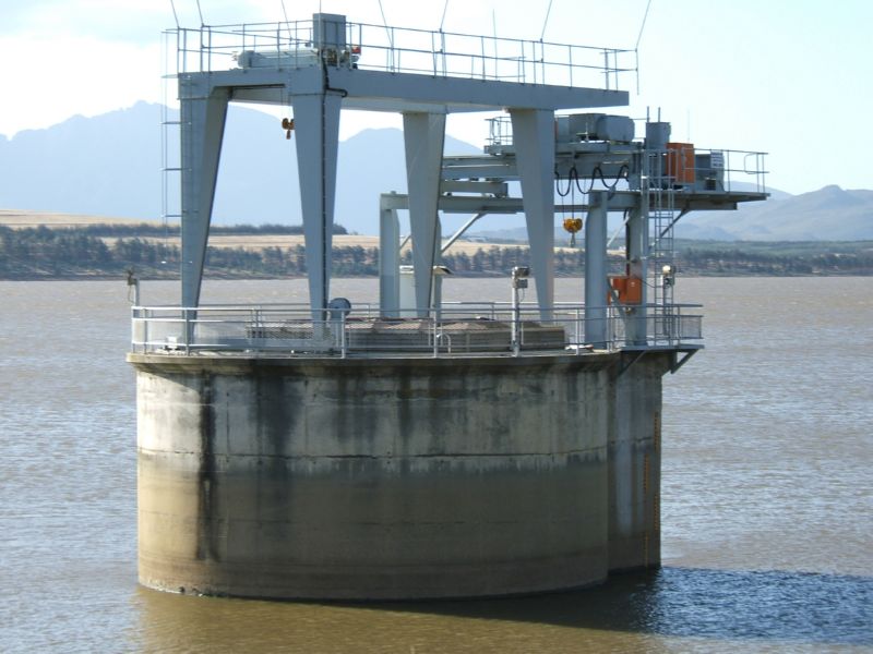
Theewaterskloof Dam's earth-fill wall is 646 m long and 35 m high. An inlet tower and conduit through the wall allow for releases of water into the Sonderend River. The spillway can handle a maximum flood of 394 m3/s. The Charmaine intake tower draws water from the reservoir into the Franschhoek Tunnel, which conveys it under the Franschhoek Mountains into the Berg River catchment and ultimately into Cape Town's water supply. In winter the tunnel can operate in reverse, conveying surplus water from the Berg River into Theewaterskloof. An additional intake tower supplies water to the Vyeboom Irrigation Board for irrigation of areas around the dam.
Water restrictions
Main article: Cape Town water crisis
.jpg)
Below-average rainfall since 2015 have seen the Theewaterskloof water level drop to critical levels. Water restrictions were imposed by the City of Cape Town in 2016 to meet a target of 600 million litres of water per day, with residents limited to 100 litres of water per day and a ban on car washing, watering gardens and topping up swimming pools with municipal water.
By the end of the 2017 dry season, Theewaterskloof had declined to a level of 12.9%, with the last 10% mostly unreachable. A storm in June 2017 brought heavy rain, increasing the level to 15%, but overall rainfall in 2017 remained very low. Media footage of the declining dam level sparked the importance of conserving water. Water restrictions in Cape Town were increased from Level 4 to Level 4b on 1 July 2017, limiting consumption to 87 litres of water per person per day. Rainfall in 2017 remained well below average, and by early 2018 the dam was again approaching critically low level, resulting in water consumption being limited to only 50 litres per person per day, and plans for a possible "Day Zero" in April 2018 when Cape Town's municipal water supply was predicted to be shut off.
As a result of good rains in the winters of 2019 and 2020, the Theewaterskloof water level reached 100% in October 2020.
Rainfall and capacity
Theewaterskloof dam has a capacity of 480406 Ml of water, and when full the reservoir covers an area of 5059 ha. The catchment area of 500 km2 is served by streams emanating in the Hottentots Holland mountain range. This area has a long-term average of 69 days with precipitation per year. Historically records show we are in a dry period 1mm of rain per square meter equates to 500 000 000 litres falling on this area. Hence it requires a full metre of rainfall with 100% runoff to fill the dam from totally empty, which is unlikely to happen in any single year. It takes a few days for all the runoff to reach the dam. Evaporation and how saturated the ground is affects the amount of water reaching the dam. An average amount of between 9% and 15% is used to offset the values against evaporation and soil absorption. A deeper dam has less evaporation due to less surface area per volume. Theewaterskloof dam.png|Location of the dam Theewaterskloof Dam catchment map.svg|Catchment area of the dam
References
References
- [http://www.dwaf.gov.za/iwqs/gis_apps/dam/dams/index.htm List of South African Dams] from the [[Department of Water Affairs]]
- (November 2019). "List of Registered Dams". Dam Safety Office, Department of Water and Sanitation.
- van Vuuren, Lani. (May 2011). "Blood, sweat and tears at Riviersonderend". Water Research Commission.
- "Residential water restrictions explained".
- "Western Cape dam levels up only 1.5% after storms".
- (2018-02-03). "Cape Town faces Day Zero: what happens when the city turns off the taps?". The Guardian.
- Bhengu, Lwandile. (4 October 2020). "Western Cape's largest dam overflows for the first time in six years". Sowetan.
- institutt, NRK og Meteorologisk. "Weather statistics for Theewaterskloofdam". yr.no.
- (September 2023). "Rainfall History}}{{Dead link".
- "Western Cape rainfall".
- (2015). "Synergy". Synergy.
This article was imported from Wikipedia and is available under the Creative Commons Attribution-ShareAlike 4.0 License. Content has been adapted to SurfDoc format. Original contributors can be found on the article history page.
Ask Mako anything about Theewaterskloof Dam — get instant answers, deeper analysis, and related topics.
Research with MakoFree with your Surf account
Create a free account to save articles, ask Mako questions, and organize your research.
Sign up freeThis content may have been generated or modified by AI. CloudSurf Software LLC is not responsible for the accuracy, completeness, or reliability of AI-generated content. Always verify important information from primary sources.
Report
Social events
The Theewaterskloof Dam is also the home of the annual Synergy Live music festival, one of the biggest outdoor music festivals in South Africa, which typically takes place on the last weekend of November or the first weekend of December.