From Surf Wiki (app.surf) — the open knowledge base
Tehuantepecer
Violent mountain-gap wind traveling through Chivela Pass
Violent mountain-gap wind traveling through Chivela Pass
Tehuantepecer, or Tehuano wind, is a violent mountain-gap wind that travels through the Chivela Pass in southern Mexico, across the Isthmus of Tehuantepec. It is most common between October and February, with a summer minimum in July. It originates from eastern Mexico and the Bay of Campeche as a post-frontal northerly wind, accelerated southward by cold air damming, that crosses the isthmus and blows through the gap between the Mexican and Guatemalan mountains. The term dates back to at least 1929. This wind can reach gale, storm, even hurricane force. The leading edge of its outflow (or cold front) may form rope cloud over the Gulf of Tehuantepec. These winds can be observed on satellite pictures such as scatterometer wind measurements, they influence waves which then propagate as swell and are sometimes observed 1600 km away (such as in the Galapagos Islands). These strong winds bring cooler sub-surface waters to the surface of the tropical eastern Pacific Ocean and may last from a few hours to 6 days.
Climatology
The synoptic condition is associated with the formation of high-pressure systems in Sierra Madre in the wake of an advancing cold front. Tehuantepecers primarily occur during the cold season months for the region in the wake of cold fronts, between October and February, with a summer minimum in July caused by the westward extension of the Azores-Bermuda high pressure system. Wind magnitude is greater during El Niño years than during La Niña years, due to the more frequent cold frontal incursions during El Niño winters. Tehuantepec winds reach 20 kn to 45 kn, and on rare occasions 100 kn. The wind's direction is from the north to north-northeast. It leads to a localized acceleration of the trade winds in the region, and can enhance thunderstorm activity when it interacts with the Intertropical Convergence Zone. The effects can last from a few hours to six days.
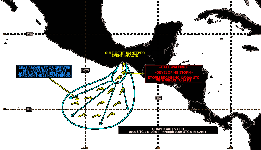
As seen by weather satellites
Its leading edge shows up as a rope cloud within the visible and infrared channels of weather satellite images, and since it lies at the leading edge of a density (temperature and dew point) discontinuity, its leading edge by definition it is a cold front, though it has also been described as a squall line, with embedded rain squalls sometimes seen. Within polar orbiting imagery, a corridor of strong low-level winds show up this feature within scatterometer data retrievals, with its leading edge at the south to southwest edge of the wind surge.
Ocean impact
Tehuantepecers can be felt up to 160 km out to sea in the tropical eastern Pacific Ocean. Sustained winds at sea have been recorded as high as 49.9 m/s, with gusts as high as 60.2 m/s, with a wind event in February 1974 which sandblasted the ship which took the observation. These winds cause waves which then propagate as swell and are sometimes observed 1600 km away (e.g., in the Galapagos Islands). Its effects can appear similar to a tropical cyclone, though the sky is usually clear. The surface wind can also change local ocean currents during an event. These strong winds upwell sub-surface waters, cooling the tropical eastern Pacific Ocean by as much as 14 °F (9 °C), and may last 4–7 days.
References
Other reading
- Steenburgh, W.J., D.M. Schultz, B.A. Colle, 1998: The Structure and Evolution of Gap Outflow over the Gulf of Tehuantepec, Mexico. Monthly Weather Review, Vol. 126, pp. 2673–2691
- Bourassa MA, Zamudio L, O’Brien JJ, Noninertial flow in NSCAT observations of Tehuantepec winds, Journal of Geophysical Research-Oceans, 104 (C5): 11311-11319 MAY 15 1999
- Chelton DB, Freilich MH, Esbensen SK, Satellite observations of the wind jets off the Pacific coast of Central America. Part I: Case studies and statistical characteristics, Monthly Weather Review, 128 (7): 1993-2018 Part 1 JUL 2000
References
- Hurd, Willis E.. (May 1929). "Northers of the Gulf of Tehuantepec". [[American Meteorological Society]].
- (August 2003). "Isthmus of Tehuantepec wind climatology and ENSO signal". Journal of Climate.
- Fett, Bob. (2002-12-09). "World Wind Regimes - Central America Gap Wind Tutorial". [[United States Naval Research Laboratory]] Monterey, Marine Meteorology Division.
- American Meteorological Society. (2012-01-26). "Tehuantepecer". Glossary of Meteorology.
- (January 1997). "The 1993 Superstorm Cold Surge: Frontal Structure, Gap Flow, and Tropical Impact". Monthly Weather Review.
- Arnerich, Paul A.. "Tehuantepecer Winds of the West Coast of Mexico". [[National Oceanic and Atmospheric Administration]].
- Hurd, Willis E.. (November 1939). "Tehuantepecer of November 24, 1939". American Meteorological Society.
This article was imported from Wikipedia and is available under the Creative Commons Attribution-ShareAlike 4.0 License. Content has been adapted to SurfDoc format. Original contributors can be found on the article history page.
Ask Mako anything about Tehuantepecer — get instant answers, deeper analysis, and related topics.
Research with MakoFree with your Surf account
Create a free account to save articles, ask Mako questions, and organize your research.
Sign up freeThis content may have been generated or modified by AI. CloudSurf Software LLC is not responsible for the accuracy, completeness, or reliability of AI-generated content. Always verify important information from primary sources.
Report