From Surf Wiki (app.surf) — the open knowledge base
Sperry Glacier
Glacier in the U.S. state of Montana
Glacier in the U.S. state of Montana
| Field | Value |
|---|---|
| name | Sperry Glacier |
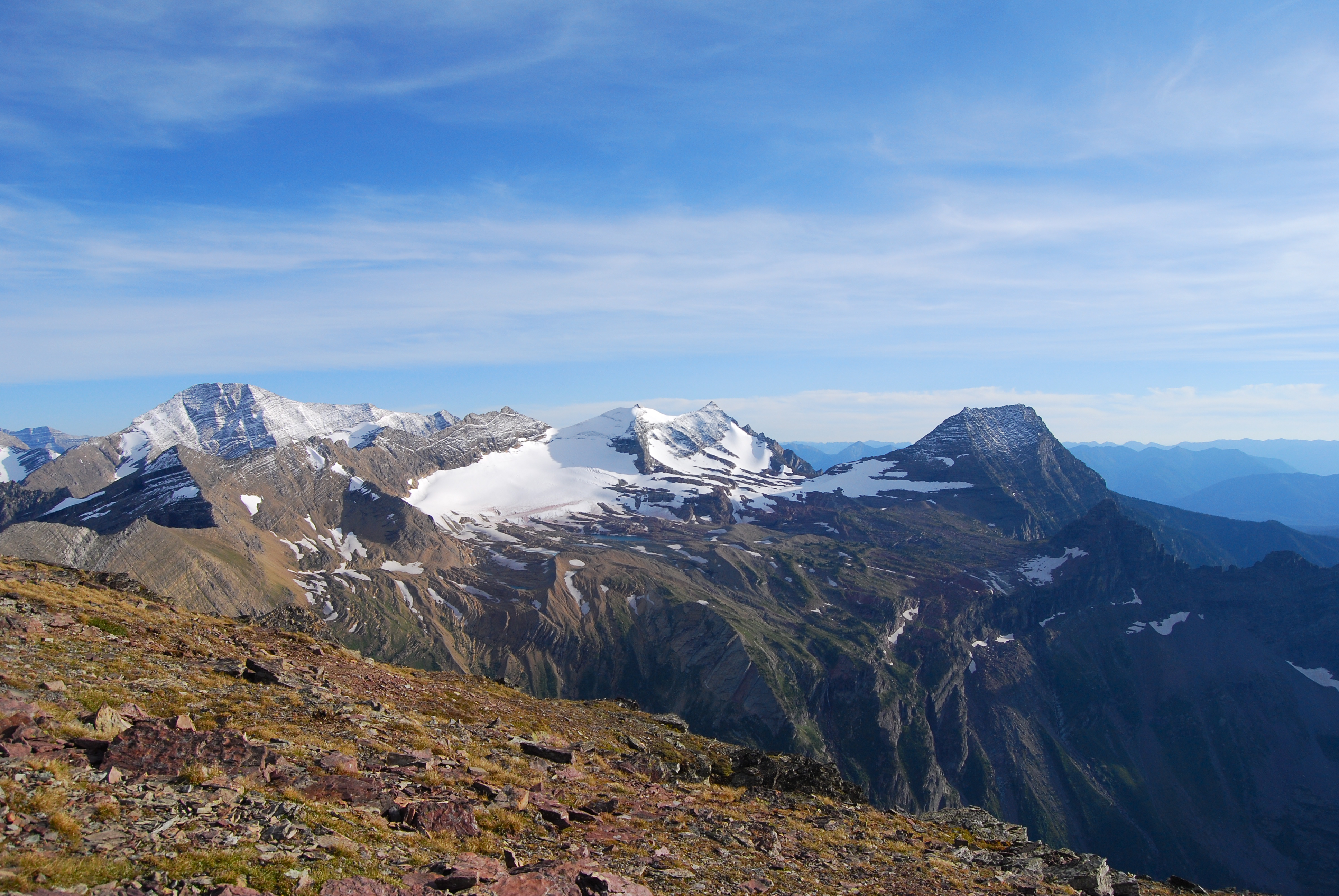
| photo | Close up of Sperry Glacier.JPG |
| photo_caption | Sperry Glacier beneath snowy Gunsight Mountain - September 8, 2008 |
| type | Mountain glacier |
| location | Glacier National Park, Flathead County, Montana, United States |
| coords | |
| area | 216 acre in 2005 |
| terminus | Talus |
| status | Retreating |
Sperry Glacier is a glacier on the north slopes of Gunsight Mountain west of the Continental Divide in Glacier National Park in the U.S. state of Montana. Although many geologic features of Glacier National Park were formed during the much longer period of glaciation ending over 10,000 years ago, Sperry Glacier — like all the glaciers in the park today — is a product of the recent Little Ice Age, the period of cooler average temperatures starting in about the 13th century and concluding in the mid-19th century.
Once one of the largest glaciers in the park, the surface area of Sperry Glacier has retreated 75 percent since the mid-19th century. 2005 measurements of the surface area of the glacier resulted in an estimated area of 216 acre, whereas the glacier is estimated to have covered an area of 930 acre at the end of the Little Ice Age in the mid-19th century. The glacier lost almost 35 percent of its surface area between 1966 and 2005. Like all other glaciers in the park, Sperry has significantly retreated, though it leaves many minor glacial features, including large moraines and streams and lakes colored a milky aqua from glacial flour. Unlike the more famous Grinnell Glacier, Sperry Glacier is high above the lakes it feeds, so no icebergs form.
Visiting the Glacier
Hikers often spend the night at Sperry Chalet or its neighboring campground before undertaking the hike to Sperry Glacier. Although it is only 7 mi round-trip from Sperry Chalet to Sperry Glacier, the trail is quite steep, rising 1600 ft in just 2.5 mi. Invisible from the rocky slopes below, a series of glacial cirques with streams, waterfalls and lakes reflecting snow fields and mountain peaks leads to a steep and narrow stone staircase cut into the stone ridge of Comeau Pass. The view from the top of the steps is panoramic, encompassing Mount Brown, Edwards Mountain, and Little Matterhorn.
Reaching the glacier itself involves crossing a wide rock scrabble, snow fields, and the technically challenging glacial moraine. Following the rock cairns and other trail markers will ensure the best footing and easiest routes. Ranger-led hikes are available, starting at the chalet.
For the more adventurous hiker, the glacier and the surrounding area known as Floral Park can be reached via a long day hike starting from Logan Pass. The route takes the hiker along the entire western edge of Hidden Lake before climbing upward along Bearhat Mountain and crossing the westernmost tip of the Dragon's Tail. From there, the route descends into Floral Park, and after a careful traverse across the bottom of the glacier, the hiker can exit the area via Comeau Pass and can descend down to the Going-to-the-Sun Road near Lake McDonald. The route is in the vicinity of 20 mi and is quite strenuous.
References
References
- {{cite gnis
- (2010). "Retreat of Glaciers in Glacier National Park". United States Geological Survey.
- "Sperry Glacier, USGS Lake McDonald East (MT) Topo Map". TopoQuest.
- "Discovery and Exploration". National Park Service.
- Edwards, J. Gordon. (1995). "A Climber's Guide to Glacier National Park". Falcon Press Publishing Co..
This article was imported from Wikipedia and is available under the Creative Commons Attribution-ShareAlike 4.0 License. Content has been adapted to SurfDoc format. Original contributors can be found on the article history page.
Ask Mako anything about Sperry Glacier — get instant answers, deeper analysis, and related topics.
Research with MakoFree with your Surf account
Create a free account to save articles, ask Mako questions, and organize your research.
Sign up freeThis content may have been generated or modified by AI. CloudSurf Software LLC is not responsible for the accuracy, completeness, or reliability of AI-generated content. Always verify important information from primary sources.
Report