From Surf Wiki (app.surf) — the open knowledge base
Shekerley Mountains
Mountains in Antigua and Barbuda
Mountains in Antigua and Barbuda
| Field | Value |
|---|---|
| name | Shekerley Mountains |
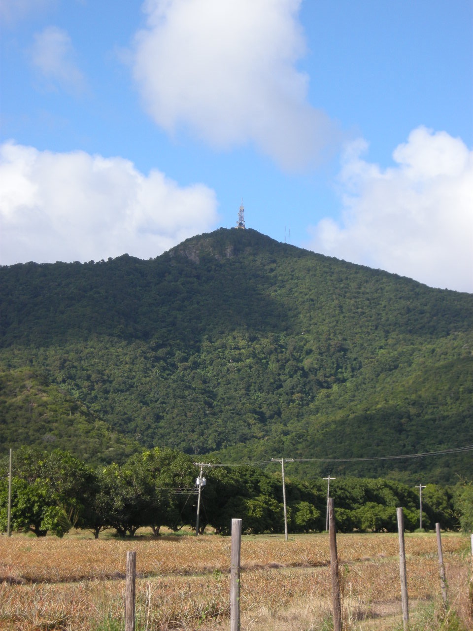
| photo | File:Der dunkle Dreimaster in der Mitte gehört Silvio Berlusconi.JPG |
| photo_size | 280px |
| photo_caption | The eastern Shekerley Mountains and Falmouth Harbour |
| region | Caribbean |
| highest | Boggy Peak |
| elevation_m | 402 |
| coordinates | |
| map | Antigua and Barbuda |
| map_caption | Location of the Shekerley Mountains |
| location | Flag of Antigua and Barbuda.svg Antigua and Barbuda |
The Shekerley Mountains are a low mountain range in southwestern Antigua. The range contains all of the highest peaks in Antigua and Barbuda. There are several peaks that are higher than 100 metres (about 300 feet), including Boggy Peak, the tallest. The mountains are the centre of a cultural region known as Round South, and they extend across three parishes– Saint John, Saint Mary, and Saint Paul. The mountains are sparsely populated, with about one-thousand people living in the chain's various communities, most notably in John Hughes. The mountains contain many valleys, including Christian Valley and Dark Valley. Historically, many of the island's sugar estates were located in the mountains, although few slaves escaped to the region due to legends of a "boggy man", this being the origin of the name "Boggy Peak". While the origin of the name Shekerley is unknown, it is probably based on a proper name in common with much of the island's other geographic names. It used to be referred to the a possessive form "Shekerley's Mountains" on many maps from the island's early colonisation.
The mountains are located in the volcanic region of Antigua. The range stretches for 15 km along the south coast of the island, from Johnsons Point in the west, to Falmouth Harbour in the east. The chain is a proposed conservation site, with some minor areas including the Wallings Forest being an Important Bird Area and national park. The Shekerley Mountains cooincide with the Antiguan portion of the Leeward Islands moist forests, and this is the only part of the country with a tropical monsoon climate.
Geography
The range stretches for 15 km along the south coast of the island, from near Johnsons Point in the west, to Falmouth Harbour and Falmouth, near English Harbour in the east.
Prominent hills
All of the highest points on Antigua island are in the Shekerley Mountains range.
The most prominent hills of the Shekerley Mountains include: :* Boggy Peak, the highest and formerly named Mount Obama :* Monks Hill :* Signal Hill :* Sage Hill :* Green Castle Hill
Human activity
The Shekerley Mountains are the centre of the Round South cultural region. Communities in and near the mountains speak South Antiguan. The primary human settlements in the area are John Hughes and Ffryes. The valleys of the mountains used to support more settlements, including the now-abandoned Bermudian Valley town, Hamiltons and Roses Village. The sugar estates that dotted the chain also had populations of about a few dozen each.
The mountains are nearly encircled by Antigua's road network, including Valley Road, the primary throughfare in Saint Mary, Old Road, and Fig Tree Drive, which cuts directly through the eastern portion of the chain through John Hughes. Ecotourism and agriculture continue to be the area's dominant industries.
Demographically, the villages in the area have lower immigration than the national average and are mostly made up of African desendants. Most people in the region are Protestant Christians. These villages sometimes received immigrants in the 19th and 20th centuries at the economic peak of the region. The mountains also were encircled by the old rail network. While the area once had light industry and many farms, the area is now one of the most deprived in the country and many people commute into Bolans and into the Central Plain.
References
References
- PeakVisor. "Antigua and Barbuda Mountains".
- (2008-11-07). "Antigua plans to rename highest peak after Barack Obama". The Guardian.
- Farquhar, Bernadette. (1975). "A Grammar of Antiguan Creole". Cornell University.
- "2001 census".
- Bennett, Steve. (16 August 2020). "Antigua Hiking – Another Way to Get Away From It All Beyond The Beach".
- Baker Map (1749)
- "Antigua and Barbuda {{!}} The UWI Seismic Research Centre".
- "Protected Planet {{!}} Shekerley Mountains Management Area".
- "Leeward Islands moist forests". World Wildlife Federation.
- Anonymous. (2011-02-17). "Antigua and the Antiguans: A Full Account of the Colony and Its Inhabitants". Cambridge University Press.
- Commons, Great Britain Parliament House of. (1858). "Accounts and Papers of the House of Commons". Ordered to be printed.
- "Wallings Nature Reserve – Equator Initiative".
- "2021 State of the Environment Report".
- Editor. (2024-10-28). "Memories of Nation Building".
- "2021 State of the Environment Report".
- Antigua Rail Map
- "2007 CPA Report".
- "LCI report".
This article was imported from Wikipedia and is available under the Creative Commons Attribution-ShareAlike 4.0 License. Content has been adapted to SurfDoc format. Original contributors can be found on the article history page.
Ask Mako anything about Shekerley Mountains — get instant answers, deeper analysis, and related topics.
Research with MakoFree with your Surf account
Create a free account to save articles, ask Mako questions, and organize your research.
Sign up freeThis content may have been generated or modified by AI. CloudSurf Software LLC is not responsible for the accuracy, completeness, or reliability of AI-generated content. Always verify important information from primary sources.
Report