From Surf Wiki (app.surf) — the open knowledge base
San Rafael, Iloilo
Municipality in Iloilo, Philippines

Municipality in Iloilo, Philippines
| Field | Value | |
|---|---|---|
| name | ||
| image_skyline | San Rafael, Iloilo 20240224 094837.jpg | |
| image_caption | Mountain road in San Rafael | |
| image_flag | Flag_of_San_Rafael,_Iloilo.png | |
| flag_size | 120x80px | |
| image_seal | San Rafael (Iloilo) Municipal Seal.png | |
| seal_size | 80px | |
| image_map | ||
| map_caption | ||
| mapframe | yes | |
| pushpin_map | Philippines | |
| pushpin_label_position | left | |
| pushpin_map_caption | Location within the | |
| coordinates | ||
| settlement_type | ||
| subdivision_type | Country | |
| subdivision_name | Philippines | |
| subdivision_type1 | Region | |
| subdivision_name1 | ||
| subdivision_type2 | Province | |
| subdivision_name2 | ||
| official_name | ||
| etymology | ||
| named_for | ||
| subdivision_type3 | District | |
| subdivision_name3 | ||
| established_title | Founded | |
| established_date | 1969 | |
| parts_type | Barangays | |
| parts_style | para | |
| p1 | (see Barangays) | |
| leader_title | Mayor | |
| leader_name | Roel T. Belleza, Jr. (Lakas) | |
| leader_title1 | Vice Mayor | |
| leader_name1 | Roberto T. Belleza, Jr. (Lakas) | |
| leader_title2 | Representative | |
| leader_name2 | Binky April M. Tupas (Lakas) | |
| leader_title3 | Municipal Council | |
| leader_name3 | {{PH Town Council | |
| 1 | ||
| 2 | Joevel M. Baclagon | |
| 3 | Myrfre C. Palabrica | |
| 4 | Domingo C. Pamonag, Jr. | |
| 5 | Jeanet B. Escolida | |
| 6 | Nerio B. Pantilanan | |
| 7 | Mariano M. Aleman, Jr. | |
| 8 | Lalaine B. Baldeviso | |
| 9 | Racel Renz P. Bamo | |
| leader_title4 | Electorate | |
| leader_name4 | voters (electorate_point_in_time}} | ) |
| government_type | ||
| government_footnotes | ||
| elevation_m | ||
| elevation_max_m | 523 | |
| elevation_min_m | 58 | |
| elevation_footnotes | ||
| area_footnotes | ||
| area_total_km2 | ||
| population_footnotes | ||
| population_total | ||
| population_as_of | ||
| population_density_km2 | auto | |
| population_blank1_title | Households | |
| population_blank1 | ||
| timezone | PST | |
| utc_offset | +8 | |
| postal_code_type | ZIP code | |
| postal_code | ||
| postal2_code_type | ||
| postal2_code | ||
| area_code_type | ||
| area_code | ||
| website | ||
| demographics_type1 | Economy | |
| demographics1_title1 | ||
| demographics1_info1 | ||
| demographics1_title2 | Poverty incidence | |
| demographics1_info2 | % () | |
| demographics1_title3 | Revenue | |
| demographics1_info3 | ||
| demographics1_title4 | Revenue rank | |
| demographics1_title5 | Assets | |
| demographics1_info5 | ||
| demographics1_title6 | Assets rank | |
| demographics1_title7 | IRA | |
| demographics1_title8 | IRA rank | |
| demographics1_title9 | Expenditure | |
| demographics1_info9 | ||
| demographics1_title10 | Liabilities | |
| demographics1_info10 | ||
| demographics_type2 | Service provider | |
| demographics2_title1 | Electricity | |
| demographics2_info1 | ||
| demographics2_title2 | Water | |
| demographics2_title3 | Telecommunications | |
| demographics2_title4 | Cable TV | |
| blank_name_sec1 | ||
| blank_info_sec1 | ||
| blank1_name_sec1 | Native languages | |
| blank1_info_sec1 | ||
| blank2_name_sec1 | Crime index | |
| blank1_name_sec2 | Major religions | |
| blank2_name_sec2 | Feast date | |
| blank3_name_sec2 | Catholic diocese | |
| blank4_name_sec2 | Patron saint |
San Rafael, officially the Municipality of San Rafael (, ), is a municipality in the province of Iloilo, Philippines. According to the , it has a population of people.
History
In 1969, all or part of 16 barrios (barangays) of Barotac Viejo were separated from that town and consolidated into the new municipality. However, in 1971 Republic Act No. 6267 decreed that 5 barrios be restored to Barotac Viejo, with the barrio of Omio becoming part of Lemery.
Fire
In February 2012, a fire damaged 18 stalls in the public market. As San Rafael has no fire station, fire trucks had to be called in from nearby towns.
Typhoon Haiyan
Typhoon Haiyan passed over Panay Island on November 8, 2013, affecting San Rafael along with several other coastal cities. The provincial board declared the state of Iloilo to be in a state of emergency, after acting governor Raul C. Tupas toured the fifth district. Local convenience stores were heavily damaged during the storm, although at least one reopened soon after. Several houses were damaged during the typhoon. They were destroyed by strong wind and falling trees. After a few days, relief soon arrived. Several new houses were built by a religious organization.
Geography
San Rafael is located 74 km from the provincial capital, Iloilo City. It is bordered by Dumarao to the north, Lemery to the east, Barotac Viejo to the south, and Passi City to the west.
San Dionisio, one of the nine barangays, has the most land area (1,772.5532 hectares), while Aripdip has the least (486.4018 hectares). Poblacion, San Florentino, and San Andres are the next three largest barangays, with 1,476.3524 hectares, 993.5601 hectares, and 974.0931 hectares, respectively.
Climate
Nine (9) barangays, namely Aripdip, Bagacay, Calaigang, Ilongbukid, Poblacion, Poscolon, San Andres, San Dionisio, and San Florentino, make up the municipality of San Rafael. San Dionisio, one of the nine barangays, has the most land area (1,772.5532 hectares), while Aripdip has the least (486.4018 hectares). Poblacion, San Florentino, and San Andres are the next three largest barangays, with 1,476.3524 hectares, 993.5601 hectares, and 974.0931 hectares, respectively.
Barangays
San Rafael is politically subdivided into 9 barangays. Each barangay consists of puroks and some have sitios.
- Aripdip
- Bagacay
- Calaigang
- Ilongbukid
- Poscolon
- San Andres
- San Dionisio
- San Florentino
- Poblacion
Demographics
In the 2024 census, the population of San Rafael was 18,293 people, with a density of {{sigfig|18293/67.05|2}} PD/km2.
Economy
Government
In 2013, Beboy Belleza was re-elected as mayor by an almost 2-1 margin.
Education
San Rafael has elementary schools in almost all barangays. There is a primary school in Bagacay. San Rafael Central School is located in Poblacion. Children spend 2 years in kindergarten and 6 years in elementary.
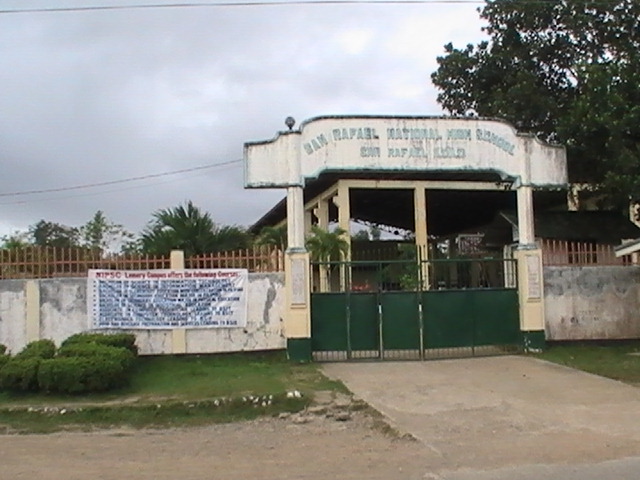
San Rafael has two high schools: San Rafael National High School was established in 1983, while Ilongbukid National High School was created in 2000. Students spend 4 years in high school. There are 4 grading periods each school year. The 4th grading period is the most important because it determines if the student will advance a grade the next school year.
Secondary school starts with 1st Year and ends with 4th Year. The subjects for Grade 1 students are English, Mathematics, Pilipino, and Sibika at Cultura (History and Culture). English language is used as the language of instruction for English, Mathematics, and Science. Grade 2 students take English, Mathematics, Science, Sibika at Kutura, Agriculture. Grade 3-6 students take additional courses, such as Music, Art, P.E., and Hekasi (it contains 5 subjects but is graded as one subject).
References
References
- {{DILG detail
- "Act creating Municipality of San Rafael".
- "Act Restoring barrios to Barotac Viejo".
- [http://www.abs-cbnnews.com/nation/regions/02/19/12/iloilo-public-market-razed Iloilo public market razed]
- {{usurped
- [http://www.interaksyon.com/article/74478/provincial-board-declares-iloilo-under-state-of-calamity Provincial board declares Iloilo under state of calamity] {{webarchive. link. (2013-12-08)
- [https://www.bbc.co.uk/news/world-asia-25056976 Typhoon Haiyan: Images from Panay Island]
- [http://election-results.rappler.com/2013/region-6/iloilo/san-rafael 2013 Election Results for San Rafael, Iloilo]
- "List of primary schools in San Rafael".
- "An Act Converting San Rafael Barangay HS into San Rafael NHS".
- "Act creating Ilongbukid NHS".
This article was imported from Wikipedia and is available under the Creative Commons Attribution-ShareAlike 4.0 License. Content has been adapted to SurfDoc format. Original contributors can be found on the article history page.
Ask Mako anything about San Rafael, Iloilo — get instant answers, deeper analysis, and related topics.
Research with MakoFree with your Surf account
Create a free account to save articles, ask Mako questions, and organize your research.
Sign up freeThis content may have been generated or modified by AI. CloudSurf Software LLC is not responsible for the accuracy, completeness, or reliability of AI-generated content. Always verify important information from primary sources.
Report