From Surf Wiki (app.surf) — the open knowledge base
San Mateo County, California
County in California, United States
County in California, United States
| Field | Value | |
|---|---|---|
| name | San Mateo County | |
| settlement_type | County | |
| image_skyline | {{multiple image | |
| total_width | 280 | |
| border | infobox | |
| perrow | 1/2/2/1 | |
| caption_align | center | |
| image1 | Pacifica, California - aerial view (cropped).jpg | |
| caption1 | Pacifica on the Californian Coast | |
| image2 | San Mateo County History Museum (cropped).jpg | |
| caption2 | Redwood City | |
| image3 | Ritz Carlton HMB in the age of COVID (49812323307) (cropped).jpg | |
| caption3 | Half Moon Bay | |
| image4 | Ano Nuevo State Park.JPG | |
| caption4 | Año Nuevo | |
| image5 | Carolands Chateau (cropped2).jpg | |
| caption5 | Hillsborough | |
| image6 | La Honda Road - panoramio (cropped).jpg | |
| caption6 | La Honda-San Gregorio | |
| motto | *All of California in One County* | |
| image_seal | Seal of San Mateo County, California.svg | |
| seal_size | 90px | |
| image_map | ||
| map_caption | Interactive map of San Mateo County | |
| image_map1 | Map of California highlighting San Mateo County.svg | |
| mapsize1 | 200px | |
| map_caption1 | Location in California | |
| coordinates | ||
| subdivision_type | Country | |
| subdivision_name | United States | |
| subdivision_type1 | State | |
| subdivision_name1 | California | |
| subdivision_type2 | Region | |
| established_title | Incorporated | |
| established_date | April 19, 1856 | |
| named_for | Saint Matthew (English translation) | |
| seat_type | County seat | |
| and largest city by area | ||
| seat | Redwood City | |
| seat1_type | Largest city by population | |
| seat1 | San Mateo | |
| unit_pref | US | |
| area_total_sq_mi | 744 | |
| area_land_sq_mi | 448 | |
| area_water_sq_mi | 293 | |
| elevation_max_footnotes | ||
| elevation_max_ft | 2603 | |
| elevation_min_ft | ||
| government_type | Council–CEO | |
| governing_body | Board of Supervisors | |
| leader_title1 | President | |
| leader_name1 | David Canepa | |
| leader_title2 | Vice President | |
| leader_name2 | Noelia Corzo | |
| leader_title3 | Board of Supervisors | |
| leader_name3 | {{Collapsible list | |
| title | Supervisors | |
| frame_style | border:none; padding:0; | |
| list_style | text-align:left; | |
| 1 | Jackie Speier | |
| 2 | Noelia Corzo | |
| 3 | Ray Mueller | |
| 4 | Lisa Gauthier | |
| 5 | David Canepa | |
| leader_title4 | County executive officer | |
| leader_name4 | Mike Callagy | |
| <!-- Population -----------> | population_as_of | [April 1, 2020](2020-united-states-census) |
| population_footnotes | ||
| population_total | 764442 | |
| population_density_sq_mi | 1704 | |
| <!-- GDP -----------> | demographics_type2 | GDP |
| demographics2_footnotes | ||
| demographics2_title1 | Total | |
| demographics2_info1 | $202.488 billion (2023) | |
| <!-- Time zones -----------> | timezone | Pacific Time Zone |
| utc_offset | -8 | |
| timezone_DST | Pacific Daylight Time | |
| utc_offset_DST | -7 | |
| postal_code_type | ||
| area_code_type | Area codes | |
| area_code | 415/628, 650 | |
| blank_name_sec1 | FIPS code | |
| blank_info_sec1 | 06-081 | |
| blank1_name_sec1 | GNIS feature ID | |
| blank1_info_sec1 | ||
| website | ||
| blank_name_sec2 | Congressional districts | |
| blank_info_sec2 | 15th, 16th |
and largest city by area
San Mateo County, officially the County of San Mateo, is a county located in the U.S. state of California. As of the 2020 United States census, the population was 764,442. Redwood City is the county seat, the third-most populated city in the county after Daly City and San Mateo.
San Mateo County is included in the San Francisco–Oakland–Berkeley, CA MSA (metropolitan statistical area), Silicon Valley, and is part of the San Francisco Bay Area, the nine counties bordering San Francisco Bay. As of 2020, it has a median household income of $128,091, the fourth-highest household income of any county in the nation behind Loudoun County, Virginia, Falls Church, Virginia, and Santa Clara County, California.
The county covers most of the San Francisco Peninsula. The county is predominantly suburban and is home to many corporate campuses.
History
San Mateo County was formed in 1856 upon the division of San Francisco County, one of the state's 18 original counties established at California statehood in 1850. Until 1856, San Francisco's city limits extended west to Divisadero Street and Castro Street, and south to 20th Street. In 1856, the California state government divided the county. A straight line was then drawn across the tip of the San Francisco Peninsula just north of San Bruno Mountain. Everything south of the line became the new San Mateo County while everything north of the line became the new consolidated City and County of San Francisco.{{cite book |author= San Mateo County was officially organized on April 18, 1857, under a bill introduced by Senator T.G. Phelps. The 1857 bill defined the southern boundary of San Mateo County as following the south branch of San Francisquito Creek to its source in the Santa Cruz Mountains and thence due west to the Pacific Ocean, and named Redwood City as the county seat. San Mateo County then annexed part of northern Santa Cruz County in March 1868, including Pescadero and Pigeon Point.
Although the formation bill named Redwood City the county seat, a May 1856 election marked by "unblushing frauds perpetuated on an unorganized and wholly unprotected community by thugs and ballot stuffers from San Francisco" named Belmont the county seat. The election results were declared illegal and the county government was moved to Redwood City, with land being donated from the original Pulgas Grant for the county government on February 27, 1858. Redwood City's status as county seat was upheld in two successive elections in May 1861 and December 9, 1873, defeating San Mateo and Belmont. Another election in May 1874 named San Mateo the county seat, but the state supreme court overturned that election on February 24, 1875, and the county seat has remained at Redwood City ever since.
San Mateo County bears the Spanish name for Saint Matthew. As a place name, San Mateo appears as early as 1776 in the diaries of Anza and Font. Several local geographic features were also designated San Mateo on early maps including variously: a settlement, an arroyo, a headland jutting into the Pacific (Point Montara), and a large land holding (Rancho San Mateo). Until about 1850, the name appeared as San Matheo.
Japanese Americans in San Mateo
The Japanese first arrived in San Mateo County and were part of a group guided by Ambassador Tomomi Iwakura in 1872. A number of male Japanese students came to San Mateo to learn English and many other helpful skills to bring back to Japan. These students were also some of the first Japanese to join American students in the Belmont School for Boys. These students had to work for their housing and food before classes and in the evenings. Many of the first Japanese immigrants were able to find jobs as gardeners and landscapers in San Mateo. Most of them had a good educational background from their homelands, but their lack of knowledge of the English language made it difficult for them to find other jobs in the beginning.
Geography
According to the U.S. Census Bureau, the county has a total area of 741 sqmi, of which 448 sqmi is land and 293 sqmi (40%) is water. It is the third-smallest county in California by land area. A number of bayside watercourses drain the eastern part of the county including San Bruno Creek and Colma Creek. Streams draining the western county include Frenchmans Creek, Pilarcitos Creek, Naples Creek, Arroyo de en Medio, and Denniston Creek. These streams originate along the northern spur of the Santa Cruz Mountains that run through the county. The northern and eastern parts of the county are very heavy densely populated with largely urban and suburban areas, with many of its cities as edge-cities for the Bay Area, while the deep south and the west-central parts of the county are less densely populated with more rural environment and coastal beaches areas.
Features
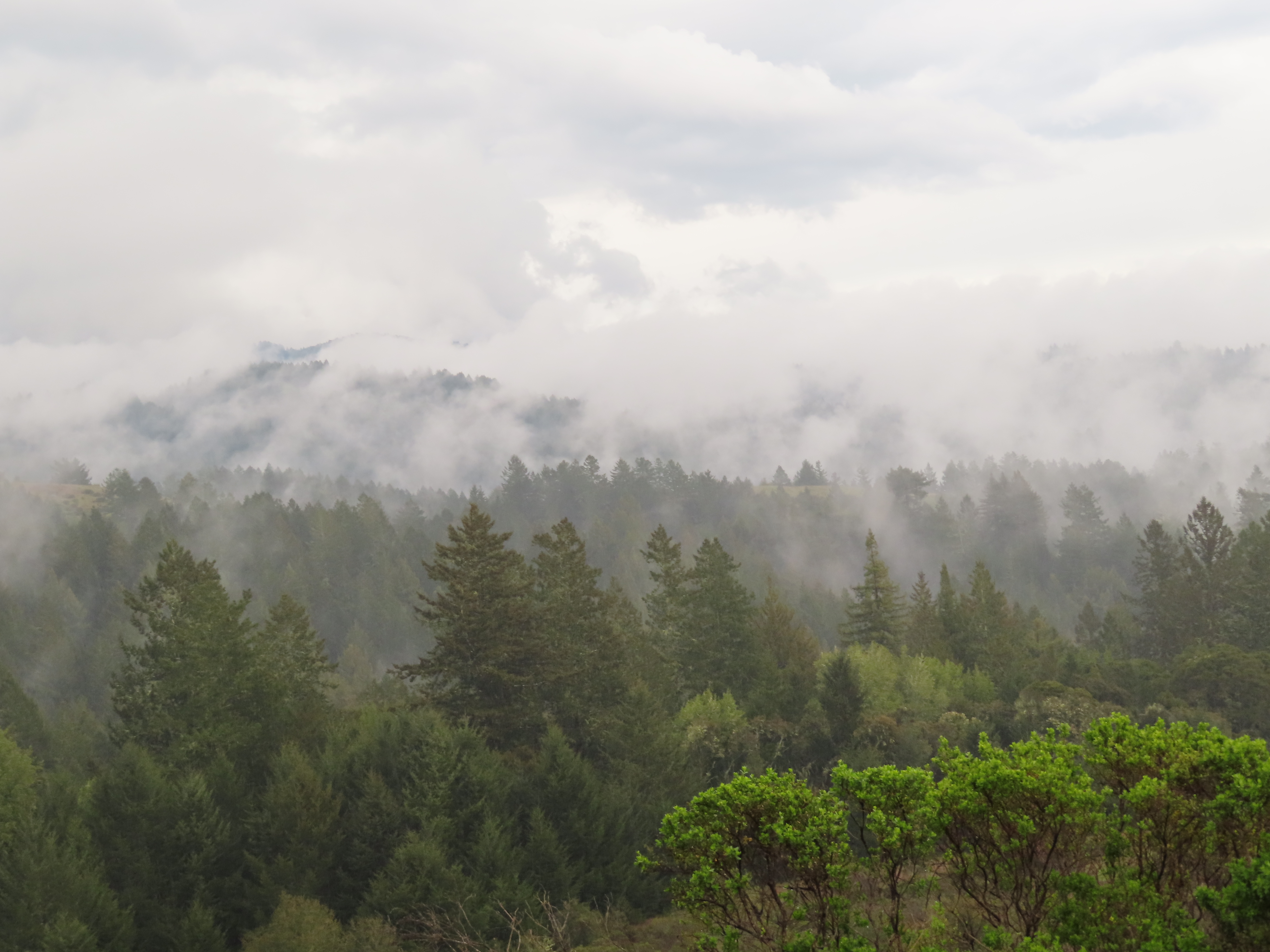
San Mateo County straddles the San Francisco Peninsula, with the Santa Cruz Mountains running its entire length. The county encompasses a variety of habitats, including estuarine, marine, oak woodland, redwood forest, coastal scrub and oak savannah. There are numerous species of wildlife present, especially along the San Francisco Bay estuarine shoreline, San Bruno Mountain, Fitzgerald Marine Reserve and the forests on the Montara Mountain block. Several creeks discharge to the San Francisco Bay, including San Mateo Creek and Laurel Creek, and several coastal streams discharge to the Pacific Ocean, such as Frenchmans Creek and San Vicente Creek.
Año Nuevo State Marine Conservation Area and Greyhound Rock State Marine Conservation Area are two adjoining marine protected areas off the coast of San Mateo County. Like underwater parks, these marine protected areas help conserve ocean wildlife and marine ecosystems.
Flora and fauna
The county is home to several endangered species including the San Francisco garter snake and the San Bruno elfin butterfly, both of which are endemic to San Mateo County. The endangered Ridgway's Rail is also found on the shores of San Francisco Bay, in the cities of Belmont and San Mateo. The endangered wildflower Hickman's potentilla is found near the Pacific Ocean on the lower slopes of Montara Mountain. The endangered wildflowers White-rayed pentachaeta, Pentachaeta bellidiflora, San Mateo Woolly Sunflower, Eriophyllum latilobum, Marin Dwarf Flax, Hesperolinon congestum and the San Mateo Thornmint, Acanthomintha duttonii, are found in the vicinity of the Crystal Springs Reservoir.
In May 2014, a California condor was spotted near Pescadero, a coastal community south of San Francisco—it was the first California condor spotted in San Mateo County since 1904. The three-year-old female flew more than 100 mi north from Pinnacles National Park, in San Benito County, on May 30, and landed on a private, forested property near Pescadero, on the San Mateo County Coast, where it was photographed by a motion-activated wildlife camera.
Pumas (Puma concolor), also known as cougars or mountain lions, roam the county.
Tule elk (Cervus canadensis nannodes) were native to San Mateo County and among the "favored foods" of the Ohlone people based on ethnohistoric and archeological evidence there. The discovery of two elk specimens made news in 1962, one a royal elk (royal elk bulls have six tines per antler) from a peat bog excavated in Pacifica's historic Laguna Alta, and now in the Museum of Vertebrate Zoology collection. These may date from the time of Spanish settlement. Laguna Alta lay just south of the Interstate 280 and Skyline Boulevard intersection, east of Mussel Rock. The California Academy of Sciences also has an elk skull fragment collected one mile inland from the mouth of Purisima Creek in 1951. Additional coastal elk remains dating from the Middle and Late Periods in Northern California were found in at least five more late Holocene archeological sites in San Mateo County: SMA-115 (Montara State Beach site), SMA-118 (Bean Hollow State Beach site), SMA-244 (Butano Ridge site), SMA-97 (Año Nuevo Creek site) and SMA-218 (Año Nuevo State Reserve site). On the eastern side of the San Francisco Peninsula, elk remains were also unearthed at multiple archaeological sites along San Francisquito Creek.
National protected areas
- Don Edwards San Francisco Bay National Wildlife Refuge (part)
- Golden Gate National Recreation Area (part)
Marine protected area
- Montara State Marine Reserve & Pillar Point State Marine Conservation Area
County parks
|shape-color1=#282 |shape-outline1=#fff |mark-size1=20 |mark-coord1 = |mark-title1 =Coyote Point Park
|mark-coord2 = |shape-color2=#f22 |shape2=n-square |mark-title2 =Sawyer Camp Trail
|mark-coord3 = |shape-color3=#f22 |shape3=n-square |mark-title3 =Devil's Slide Trail
|mark-coord4 = |mark-title4 =Edgewood County Park
|mark-coord5 = |mark-size5=10 |mark-title5 =Fitzgerald Marine Reserve
|mark-coord6 = |mark-title6 =Flood Park
|mark-coord7 = |mark-title7 =Friendship Park
|mark-coord8 = |mark-title8 =Huddart Park
|mark-coord9 = |mark-title9 =Junipero Serra Park
|mark-coord10= |mark-title10=Memorial Park
|mark-coord11= |mark-size11=15 |mark-title11=Mirada Surf
|mark-coord12= |mark-size12=10 |mark-title12=Moss Beach
|mark-coord13= |mark-title13=Pescadero Creek
|mark-coord14= |mark-title14=Pillar Point
|mark-coord15= |mark-size15=15 |mark-title15=Quarry Park
|mark-coord16= |mark-title16=Sam McDonald
|mark-coord17= |mark-title17=San Bruno Mountain
|mark-coord18= |mark-title18=San Pedro Valley
|mark-coord19= |shape-color19=#22f |shape19=n-cross |mark-size19=15 |mark-title19=Sanchez Adobe
|mark-coord20= |mark-title20=Tunitas Creek Beach
|mark-coord21= |shape-color21=#22f |shape21=n-cross |mark-size21=15 |mark-title21=Woodside Store
|mark-coord22= |mark-title22=Wunderlich
|fullscreen-option=1
- }} The County of San Mateo Parks Department operates 22 parks, trails, and historic sites spread throughout the county; the first, Memorial Park, was dedicated on July 4, 1924. The County Superintendent of Schools, Roy Cloud, had visited a one-room schoolhouse in Harrison Canyon as part of his duties; at the time, it was thickly forested with old-growth redwoods and he was alarmed when he learned they were scheduled to be logged. He petitioned the County Board of Supervisors to purchase the land instead. The Recreation Commission was not created until 1932, and the park was improved as part of the Works Progress Administration efforts starting in 1935.
| No. | Name | Image | Est. | Size | City | Ref. | 1 | Coyote Point{{flatlist | 2 | Crystal Springs{{flatlist | 3 | Devil's Slide | 4 | Edgewood | 5 | Fitzgerald | 6 | Flood | 7 | Friendship | 8 | Huddart | 9 | Junipero Serra | 10 | Memorial | 11 | Mirada Surf | 12 | Moss Beach | 13 | Pescadero Creek | 14 | Pillar Point | 15 | Quarry | 16 | Sam McDonald | 17 | San Bruno Mountain | 18 | San Pedro Valley | 19 | Sanchez Adobe | 20 | Tunitas Creek Beach | 21 | Woodside Store | 22 | Wunderlich | ||||
|---|---|---|---|---|---|---|---|---|---|---|---|---|---|---|---|---|---|---|---|---|---|---|---|---|---|---|---|---|---|---|---|---|---|---|---|---|---|---|---|---|---|---|---|---|---|---|---|---|---|---|---|---|---|---|
| [[File:Zeppelin-ride-020100925-130 (5028699547).jpg | 100px]] | 1963 | 149 + | San Mateo/Burlingame | url=https://parks.smcgov.org/coyote-point-recreation-area | title=Coyote Point Recreation Area | publisher=Parks Department, County of San Mateo | access-date=December 27, 2019}} | ||||||||||||||||||||||||||||||||||||||||||||||
| [[File:Lake San Andreas - Sawyer Camp Trail (15916868610).jpg | 100px]] | 17.5 mi | Burlingame | |||||||||||||||||||||||||||||||||||||||||||||||||||
| [[File:Devil's Slide Trail, which used to be an unstable part of California Highway 1 until they built bypass tunnels and turned it into a nature reserve. (26033922316).jpg | 100px]] | 1.3 mi | Pacifica/Montara | |||||||||||||||||||||||||||||||||||||||||||||||||||
| [[File:Monday Night Birding (14177890134).jpg | 100px]] | 1980 | 467 acre | Redwood City | ||||||||||||||||||||||||||||||||||||||||||||||||||
| [[File:JV Fitzgerald Marine Reserve 04 (11013086134).jpg | 100px]] | 1969 | Moss Beach | |||||||||||||||||||||||||||||||||||||||||||||||||||
| 21 acre | Menlo Park | |||||||||||||||||||||||||||||||||||||||||||||||||||||
| Redwood City | ||||||||||||||||||||||||||||||||||||||||||||||||||||||
| [[File:Huddart park to Crystal Spring trail (2).jpg | 100px]] | 1948 | 974 acre | Woodside | ||||||||||||||||||||||||||||||||||||||||||||||||||
| [[File:Junipero Serra County Park 01 (7387783278).jpg | 100px]] | 1960 | 103 acre | San Bruno | ||||||||||||||||||||||||||||||||||||||||||||||||||
| [[File:Huckleberry Flat picnic area (3172631077).jpg | 100px]] | 1924 | 673 acre | Loma Mar | ||||||||||||||||||||||||||||||||||||||||||||||||||
| 15 + | El Granada | |||||||||||||||||||||||||||||||||||||||||||||||||||||
| 2014 | 467 acre | Moss Beach | ||||||||||||||||||||||||||||||||||||||||||||||||||||
| [[File:Entering the Park (5365626915).jpg | 100px]] | 1968 | 8020 acre | Loma Mar | ||||||||||||||||||||||||||||||||||||||||||||||||||
| [[File:Great Blue Heron at Pillar Point Bluffs.jpg | 100px]] | 2011 | 220 acre | Moss Beach | ||||||||||||||||||||||||||||||||||||||||||||||||||
| 517 acre | El Granada | |||||||||||||||||||||||||||||||||||||||||||||||||||||
| [[File:Sam McDonald County Park (16121518351).jpg | 100px]] | 1970 | 850 acre | Loma Mar | ||||||||||||||||||||||||||||||||||||||||||||||||||
| [[File:Aerial view of San Bruno Mountain.jpg | 100px]] | 1978 | 2416 acre | Brisbane | ||||||||||||||||||||||||||||||||||||||||||||||||||
| [[File:San Pedro Valley Park, Pacifica.jpg | 100px]] | 1970s | 1052 acre | Pacifica | ||||||||||||||||||||||||||||||||||||||||||||||||||
| [[File:Sánchez Adobe exterior 2.JPG | 100px]] | 1953 | 5 acre | Pacifica | ||||||||||||||||||||||||||||||||||||||||||||||||||
| [[File:Tuitas Beach and Ocean Shore Railroad.jpg | 100px]] | Half Moon Bay | ||||||||||||||||||||||||||||||||||||||||||||||||||||
| [[File:Woodside store.jpg | 100px]] | 1940 | — | Woodside | ||||||||||||||||||||||||||||||||||||||||||||||||||
| [[File:Meadow Trail Wunderlich Park.jpg | 100px]] | 1974 | 942 acre | Woodside |
;Notes
Prior to the rebuilding of the San Mateo Bridge that began in 1996, the county had also operated Werder Pier for fishermen; it had been the western segment of the original 1929 vertical-lift bridge.
In addition to the county-operated parks, San Mateo County voters created the Midpeninsula Regional Open Space District in 1972, administered by the Peninsula Open Space Trust, which owns several protected spaces within San Mateo County (as well as within Santa Clara and Santa Cruz counties). San Mateo County protected spaces administered by POST include:
- Coal Creek Open Space Preserve
- El Corte de Madera Creek
- La Honda Creek Open Space Preserve
- Long Ridge Open Space Preserve (partially within Santa Clara County)
- Los Trancos Open Space Preserve (partially within Santa Clara County)
- Pulgas Ridge Open Space Preserve
- Purisima Creek Redwoods Open Space Preserve
- Ravenswood Open Space Preserve
- Russian Ridge Open Space Preserve
- Skyline Ridge Open Space Preserve
- Teague Hill Open Space Preserve
- Thornewood Open Space Preserve
- Windy Hill Open Space Preserve
State parks
- Año Nuevo State Park
- Butano State Park
- Castle Rock State Park
- Heritage Grove
- Portola Redwoods State Park
- Quarry Park
- Burleigh H. Murray Ranch
- Pigeon Point Light Station Historic State Park
- Point Montara Light Station State Park
- San Bruno Mountain State Park
State beaches
- Año Nuevo State Reserve
- Bean Hollow State Beach
- Big Basin State Beach
- Gray Whale Cove State Beach
- Half Moon Bay State Beach
- Montara State Beach
- Pacifica State Beach
- Pebble Beach
- Pescadero State Beach
- Pomponio State Beach
- San Gregorio State Beach
- Thornton State Beach
Demographics
| align-fn = center 1790–1960 1900–1990 1990–2000 2010 2020
2020 census
| Race / Ethnicity (*NH = Non-Hispanic*) | Pop 1980 | Pop 1990 | title=P004: Hispanic or Latino, and Not Hispanic or Latino by Race – 2000: DEC Summary File 1 – San Mateo County, California | url=https://data.census.gov/table?g=050XX00US06081&tid=DECENNIALSF12000.P004 | website=United States Census Bureau | access-date= }} | title=P2: Hispanic or Latino, and Not Hispanic or Latino by Race – 2010: DEC Redistricting Data (PL 94-171) – San Mateo County, California | url=https://data.census.gov/cedsci/table?q=p2&g=050XX00US06081&tid=DECENNIALPL2010.P2 | website=United States Census Bureau | access-date= }} | Pop 2020 | % 1980 | % 1990 | % 2000 | % 2010 | % 2020 |
|---|---|---|---|---|---|---|---|---|---|---|---|---|---|---|---|---|
| White alone (NH) | 415,984 | 392,131 | 352,355 | 303,609 | 275,902 | 70.83% | 60.36% | 49.83% | 42.26% | 36.09% | ||||||
| Black or African American alone (NH) | 34,730 | 34,000 | 23,778 | 18,763 | 14,701 | 5.91% | 5.23% | 3.36% | 2.61% | 1.92% | ||||||
| Native American or Alaska Native alone (NH) | 2,481 | 2,349 | 1,546 | 1,125 | 1,021 | 0.42% | 0.36% | 0.22% | 0.16% | 0.13% | ||||||
| Asian alone (NH) | 56,305 | 105,559 | 140,313 | 175,934 | 227,783 | 9.59% | 16.25% | 19.84% | 24.49% | 29.80% | ||||||
| Native Hawaiian or Pacific Islander alone (NH) | x | x | 9,112 | 9,884 | 8,840 | x | x | 1.29% | 1.38% | 1.16% | ||||||
| Other race alone (NH) | 4,490 | 957 | 2,217 | 2,709 | 5,840 | 0.76% | 0.15% | 0.31% | 0.38% | 0.76% | ||||||
| Mixed race or Multiracial (NH) | x | x | 23,132 | 23,925 | 38,969 | x | x | 3.27% | 3.33% | 5.10% | ||||||
| Hispanic or Latino (any race) | 73,339 | 114,627 | 154,708 | 182,502 | 191,386 | 12.49% | 17.65% | 21.88% | 25.40% | 25.04% | ||||||
| **Total** | **587,329** | **649,623** | **707,161** | **718,451** | **764,442 ** | **100.00%** | **100.00%** | **100.00%** | **100.00%** | **100.00%** |
As of the 2020 census, the county had a population of 764,442 and a median age of 39.9 years. 20.2% of residents were under the age of 18 and 16.5% were 65 years of age or older; for every 100 females there were 97.6 males, and for every 100 females age 18 and over there were 95.6 males age 18 and over.
The racial makeup of the county was 39.3% White, 2.1% Black or African American, 0.9% American Indian and Alaska Native, 30.1% Asian, 1.2% Native Hawaiian and Pacific Islander, 14.1% from some other race, and 12.3% from two or more races. Hispanic or Latino residents of any race comprised 25.0% of the population.
98.3% of residents lived in urban areas, while 1.7% lived in rural areas.
There were 269,417 households in the county, of which 32.9% had children under the age of 18 living with them and 24.1% had a female householder with no spouse or partner present. About 22.1% of all households were made up of individuals and 9.5% had someone living alone who was 65 years of age or older.
There were 283,693 housing units, of which 5.0% were vacant. Among occupied housing units, 56.5% were owner-occupied and 43.5% were renter-occupied. The homeowner vacancy rate was 0.6% and the rental vacancy rate was 4.9%.
2012
As of 2012, San Mateo County had one of the largest Tongan communities outside of Tonga, with an estimated 13,000 Tongan Americans.

2010
The 2010 United States census reported that San Mateo County had a population of 718,451. The racial makeup of San Mateo County was 383,535 (53.4%) White, 20,436 (2.8%) African American, 3,306 (0.5%) Native American, 178,118 (24.8%) Asian (9.8% Filipino, 9.0% Chinese, 1.9% Indian, 1.2% Japanese, 0.8% Korean, 0.5% Vietnamese, 0.3% Burmese, 0.1% Pakistani), 10,317 (1.4%) Pacific Islander (0.6% Tongan, 0.3% Samoan, 0.2% Fijian, 0.1% Native Hawaiian), 84,529 (11.8%) from other races, and 38,210 (5.3%) from two or more races. Hispanic or Latino of any race were 182,502 persons (25.4%); 15.7% of San Mateo County is Mexican, 2.7% Salvadoran, 1.2% Guatemalan, 1.2% Nicaraguan, 0.7% Peruvian, 0.6% Puerto Rican, 0.2% Colombian, and 0.2% Cuban.
| Demographic profile | 2010 |
|---|---|
| Total Population | 718,451 - 100.0% |
| One Race | 680,241 - 94.7% |
| Not Hispanic or Latino | 535,949 - 74.6% |
| White alone | 303,609 - 42.3% |
| Black or African American alone | 18,763 - 2.6% |
| American Indian and Alaska Native alone | 1,125 - 0.2% |
| Asian alone | 175,934 - 24.5% |
| Native Hawaiian and Other Pacific Islander alone | 9,884 - 1.4% |
| Some other race alone | 2,709 - 0.4% |
| Two or more races alone | 23,925 - 3.3% |
| Hispanic or Latino (of any race) | 182,502 - 25.4% |
| Population reported at [2010 United States census](2010-united-states-census) |
|---|
| **The County** |
| ** San Mateo County** |
| **Incorporated |
| cities and towns** |
| **Atherton** |
| **Belmont** |
| **Brisbane** |
| **Burlingame** |
| **Colma** |
| **Daly City** |
| **East Palo Alto** |
| **Foster City** |
| **Half Moon Bay** |
| **Hillsborough** |
| **Menlo Park** |
| **Millbrae** |
| **Pacifica** |
| **Portola Valley** |
| **Redwood City** |
| **San Bruno** |
| **San Carlos** |
| **San Mateo** |
| **South San Francisco** |
| **Woodside** |
| **Census-designated |
| places** |
| **Broadmoor** |
| **El Granada** |
| **Emerald Lake Hills** |
| **Highlands-Baywood Park** |
| **Ladera** |
| **La Honda** |
| **Loma Mar** |
| **Montara** |
| **Moss Beach** |
| **North Fair Oaks** |
| **Pescadero** |
| **West Menlo Park** |
| **Other |
| unincorporated areas** |
| All others not CDPs (combined) |
2000

As of the census of 2009, there were 714,936 people, 258,648 households, and 174,582 families residing in the county. The population density was 2,753 /mi2. There were 284,471 housing units at an average density of 789 /mi2. 7.4% were of Italian, 7.1% Irish, 7.0% German and 5.3% English ancestry according to Census 2000. 46.9% spoke English, 28.4% Spanish, 6.2% Tagalog, 4.0% Chinese or Mandarin and 1.1% Cantonese, and other language 4.2%, as their first language from estimate census 2009.
There were 258,648 households, out of which 30% had children under the age of 18, 48.6% were married couples living together, 14.7% had a female householder with no husband present, and 41.7% were non-families. 31.5% of all households were made up of individuals, and 6.2% had someone living alone who was 65 years of age or older. The average household size was 3.79 and the average family size was 4.44.
In the county, the population was spread out, with 28.6% under the age of 18, 15.9% from 18 to 24, 25.8% from 25 to 44, 21% from 45 to 64, and 9.7% who were 65 years of age or older. The median age was 31 years. For every 100 females there were 97.8 males. For every 100 females age 18 and over, there were 95.1 males.
The median income for a household in the county was $69,306, and the median income for a family was $77,737. Males had a median income of $48,342 versus $45,383 for females. The per capita income for the county was $36,045. About 6.42% of families and 9.51% of the population were below the poverty line, including 10.01% of those under age 18 and 8.52% of those age 65 or over.
Government
San Mateo County has a five-member Board of Supervisors, representing five geographic districts. The Board of Supervisors were formerly elected at-large (by voters across the entire county) until November 2012. On November 6, 2012, Measure B passed to amend the San Mateo County Charter so that each member of the Board of Supervisors would be elected by voters in his or her district.
- District 1 is represented by Jackie Speier.
- District 2 is represented by Noelia Corzo.
- District 3 is represented by Ray Mueller.
- District 4 is represented by Warren Slocum.
- District 5 is represented by David Canepa. The other county elected officials are:
| Elected Office | Name |
|---|---|
| Assessor–County Clerk–Recorder | Mark Church |
| Controller | Juan Raizoga |
| Coroner | Robert Foucrault |
| District Attorney | Stephen M. Wagstaffe |
| Sheriff | *Vacant* |
| Treasurer–Tax Collector | Sandie Arnott |
San Mateo County is split between California's 15th and 16th congressional districts, represented by and , respectively.
In the California State Assembly, San Mateo County is split between three legislative districts:{{Cite web |access-date = September 28, 2014 |archive-url = https://web.archive.org/web/20151023054757/http://wedrawthelines.ca.gov/downloads/meeting_handouts_072011/handouts_20110729_q2_ad_finaldraft_splits.zip |archive-date = October 23, 2015 |url-status = dead
- ,
- , and
- .
In the California State Senate, San Mateo is split between the 11th and 13th districts, represented by and , respectively.{{Cite web |access-date = September 28, 2014 |archive-url = https://web.archive.org/web/20151023054153/http://wedrawthelines.ca.gov/downloads/meeting_handouts_072011/handouts_20110729_q2_sd_finaldraft_splits.zip |archive-date = October 23, 2015 |url-status = dead
Politics
Presidential election results and voter registration
| Population and registered voters | Total population | Registered votersPercentage of registered voters with respect to total population. Percentages of party members with respect to registered voters follow. | Democratic | Republican | Democratic–Republican spread | American Independent | Green | Libertarian | Peace and Freedom | Americans Elect | Other | No party preference |
|---|---|---|---|---|---|---|---|---|---|---|---|---|
| 711,622 | ||||||||||||
| 360,786 | 50.7% | |||||||||||
| 185,134 | 51.3% | |||||||||||
| 69,925 | 19.4% | |||||||||||
| **+115,209** | **+31.9%** | |||||||||||
| 7,693 | 2.1% | |||||||||||
| 2,521 | 0.7% | |||||||||||
| 1,852 | 0.5% | |||||||||||
| 735 | 0.2% | |||||||||||
| 14 | 0.0% | |||||||||||
| 754 | 0.2% | |||||||||||
| 92,158 | 25.5% |
Cities by population and voter registration
| City | Population | Registered voters | |||||
|---|---|---|---|---|---|---|---|
| Democratic | Republican | D–R spread | Other | No party preference | |||
| Atherton | 7,137 | 69.4% | 34.7% | 31.1% | **+3.6%** | 3.9% | 30.3% |
| Belmont | 26,941 | 58.7% | 48.5% | 16.0% | **+32.5%** | 3.9% | 31.6% |
| Brisbane | 4,671 | 59.8% | 52.1% | 10.4% | **+41.7%** | 5.1% | 32.4% |
| Burlingame | 30,889 | 57.5% | 47.5% | 17.2% | **+30.3%** | 4.0% | 31.3% |
| Colma | 1,489 | 47.1% | 55.5% | 11.0% | **+44.5%** | 3.7% | 29.8% |
| Daly City | 106,280 | 43.9% | 51.8% | 9.6% | **+42.2%** | 3.3% | 35.3% |
| East Palo Alto | 29,314 | 35.9% | 57.4% | 6.1% | **+51.3%** | 4.4% | 32.1% |
| Foster City | 33,901 | 48.9% | 44.3% | 16.6% | **+27.7%** | 2.9% | 36.2% |
| Half Moon Bay | 12,932 | 58.4% | 47.7% | 18.3% | **+29.4%** | 5.6% | 28.4% |
| Hillsborough | 11,387 | 68.5% | 33.8% | 30.0% | **+3.8%** | 3.9% | 32.3% |
| Menlo Park | 34,698 | 55.7% | 51.6% | 15.5% | **+36.1%** | 3.5% | 29.4% |
| Millbrae | 22,394 | 57.4% | 44.6% | 15.9% | **+28.7%** | 3.8% | 35.7% |
| Pacifica | 38,546 | 64.9% | 53.6% | 13.1% | **+40.5%** | 4.7% | 28.6% |
| Portola Valley | 4,568 | 74.7% | 46.3% | 22.4% | **+23.9%** | 3.8% | 27.5% |
| Redwood City | 85,925 | 48.7% | 50.7% | 14.9% | **+35.8%** | 5.9% | 30.5% |
| San Bruno | 42,807 | 53.3% | 52.0% | 13.4% | **+38.6%** | 3.9% | 30.7% |
| San Carlos | 30,185 | 65.3% | 48.7% | 18.6% | **+30.1%** | 3.8% | 28.9% |
| San Mateo | 104,430 | 52.6% | 50.1% | 15.5% | **+34.6%** | 3.9% | 30.5% |
| South San Francisco | 67,789 | 48.6% | 53.5% | 10.9% | **+42.6%** | 3.5% | 32.1% |
| Woodside | 5,458 | 75.2% | 40.4% | 26.6% | **+13.8%** | 4.5% | 28.5% |
Overview
The California Secretary of State, as of February 2019, reports that San Mateo County has 404,958 registered voters. Of those voters, 202,341 (50%) are registered Democratic, 60,045 (14.3%) are registered Republican, 15,834 (3.9%) are registered with other political parties, and 126,738 (31.3%) declined to state a political party preference. Every city, town, and unincorporated area of San Mateo County has more registered Democrats than Republicans.
On November 4, 2008, San Mateo County voted 61.8% against Proposition 8, which amended the California Constitution to ban same-sex marriages.{{cite web |access-date = June 14, 2009 |archive-url = https://web.archive.org/web/20090612235853/http://www.sos.ca.gov/elections/sov/2008_general/57_65_ballot_measures.pdf |archive-date = June 12, 2009 |url-status = dead
Crime
The following table includes the number of incidents reported and the rate per 1,000 persons for each type of offense.
| Population and crime rates | Population | Violent crime | Homicide | Forcible rape | Robbery | Aggravated assault | Property crime | Burglary | Larceny-theft | Motor vehicle theft | Arson |
|---|---|---|---|---|---|---|---|---|---|---|---|
| 711,622 | |||||||||||
| 2,072 | 2.91 | ||||||||||
| 16 | 0.02 | ||||||||||
| 128 | 0.18 | ||||||||||
| 734 | 1.03 | ||||||||||
| 1,194 | 1.68 | ||||||||||
| 8,677 | 12.19 | ||||||||||
| 3,072 | 4.32 | ||||||||||
| 10,712 | 15.05 | ||||||||||
| 1,988 | 2.79 | ||||||||||
| 125 | 0.18 |
Cities by population and crime rates
| City | Population | Violent crimes | Violent crime rate | |||
|---|---|---|---|---|---|---|
| per 1,000 persons | Property crimes | Property crime rate | ||||
| per 1,000 persons | Overall | |||||
| Atherton | 7,060 | 6 | 0.85 | 124 | 17.56 | |
| Belmont | 26,389 | 24 | 0.91 | 408 | 15.46 | |
| Brisbane | 4,374 | 6 | 1.37 | 142 | 32.46 | |
| Broadmoor | 4,264 | 13 | 3.05 | 62 | 14.54 | |
| Burlingame | 29,427 | 61 | 2.07 | 707 | 24.03 | |
| Colma | 1,832 | 7 | 3.82 | 287 | 156.66 | |
| Daly City | 103,311 | 216 | 2.09 | 1,803 | 17.45 | |
| East Palo Alto | 28,766 | 333 | 11.58 | 587 | 20.41 | |
| Foster City | 31,230 | 18 | 0.58 | 345 | 11.05 | |
| Hillsborough | 11,060 | 1 | 0.09 | 86 | 7.78 | |
| Menlo Park | 32,713 | 53 | 1.62 | 625 | 19.11 | |
| Pacifica | 38,041 | 42 | 1.10 | 578 | 15.19 | |
| Redwood City | 78,466 | 208 | 2.65 | 1,800 | 22.94 | |
| San Bruno | 42,002 | 85 | 2.02 | 961 | 22.88 | |
| San Mateo | 99,303 | 261 | 2.63 | 1,876 | 18.89 | |
| South San Francisco | 65,006 | 111 | 1.71 | 1,321 | 20.32 | |
| 603,244 | 1,445 | 2.40 | 11,712 | 19.42 |
Economy
A July 2013 Wall Street Journal article identified the Facebook initial public offering (IPO) as the cause of a change in the U.S.' national economic statistics, as San Mateo County—the home of the company—became the top wage-earning county in the country after the fourth quarter of 2012. The article revealed that the Bureau of Labor Statistics reported that the average weekly wage in the county was $3,240, which is 107% higher than the previous year: "That's the equivalent of $168,000 a year, and more than 50% higher than the next highest county, New York County (better known as Manhattan), which came in at $2,107 a week, or roughly $110,000 a year."
As of the fourth quarter of 2021, the median value of homes in San Mateo County was $1,247,070, an increase of 11% from the prior year. It ranked fourth in the U.S. for counties with highest median home value, behind Nantucket, Manhattan, and Santa Clara.
Additionally, San Mateo County hosts the headquarters of Visa Inc, Sony Interactive Entertainment, Electronic Arts, YouTube, Genentech, GoPro, and Gilead Sciences, as well as a hub of venture capital firms in Menlo Park and several other technology-related companies.
In 2016, Peninsula Clean Energy began providing electricity to 20 percent of residential customers, all municipalities, and all small- to mid-size businesses in the county, as a Community Choice Aggregation program, an alternative to Pacific Gas and Electric.
Education
The people of San Mateo County may use the services of San Mateo County Libraries along with the Peninsula Library System and its dozens of branches, bookmobile and Library-a-Go-Go machine at the Millbrae BART/Caltrain station.
The county is divided into several public school districts and is also served by the local Catholic diocese and many other private parochial and secular schools. The San Mateo County Board of Education oversees early education, special education, and the court and community schools program in the county, as well as serves as an appeal board for the adjudication of expulsion appeals, interdistrict attendance appeals, and charter schools.
Some students in San Mateo County's public schools attend outdoor education in La Honda. San Mateo Outdoor Education is a residential school that teaches major concepts of ecology via exploration of forest, pond, garden, tidepool, wetland, and sandy shore habitats.{{cite web |access-date = June 14, 2010 |archive-url = https://web.archive.org/web/20100316152309/http://www.smcoe.k12.ca.us/outdoored/SMOLibrary/SMOLib004/SMOLib004Parents.html |archive-date = March 16, 2010 |url-status = dead
K-12 school districts
They include:
; Unified
- Cabrillo Unified School District
- La Honda-Pescadero Unified School District
- South San Francisco Unified School District
; Secondary
- Jefferson Union High School District
- San Mateo Union High School District
- Sequoia Union High School District
; Elementary
- Bayshore Elementary School District
- Belmont-Redwood Shores Elementary School District
- Brisbane Elementary School District
- Burlingame Elementary School District
- Hillsborough City Elementary School District
- Jefferson Elementary School District
- Las Lomitas Elementary School District
- Menlo Park City Elementary School District
- Millbrae Elementary School District
- Pacifica School District
- Portola Valley Elementary School District
- Ravenswood City Elementary School District
- Redwood City Elementary School District
- San Bruno Park Elementary School District
- San Carlos Elementary School District
- San Mateo-Foster City Elementary School District
- Woodside Elementary School District
Private schools
Offering secondary (6–12) education:
- Crystal Springs Uplands School (K–12)
- Junípero Serra High School (9–12, M)
- Menlo School (6–12)
- Mercy High School (9–12, F)
- Notre Dame High School (9–12, F)
- The Nueva School (K–12)
- Pacific Bay Christian School (K–12)
- Sacred Heart (K–12)
- Silicon Valley International (K–12)
- Stanbridge Academy (K–12)
- Woodside Priory School (6–12)
Higher education
.jpg)
There are three community colleges in San Mateo County, all of which belong to the San Mateo County Community College District:
- Cañada College (Redwood City)
- College of San Mateo (San Mateo)
- Skyline College (San Bruno)
Transportation
Major highways
- [[File:I-280 (CA).svg|25px]] Interstate 280
- [[File:I-380 (CA).svg|25px]] Interstate 380
- [[File:US 101 (1961 cutout).svg|25px]] U.S. Route 101 (Bayshore Freeway)
- [[File:California 1.svg|20px]] State Route 1
- [[File:California 9.svg|20px]] State Route 9
- [[File:California 35.svg|20px]] State Route 35 (Skyline Boulevard)
- [[File:California 82.svg|20px]] State Route 82 (El Camino Real)
- [[File:California 84.svg|20px]] State Route 84 (Woodside Road/Bayfront Expressway/Dumbarton Bridge)
- [[File:California 92.svg|20px]] State Route 92 (San Mateo Bridge)
- [[File:California 109.svg|20px]] State Route 109
- [[File:California 114.svg|20px]] State Route 114 (Willow Road)
Public transportation
Rail
Caltrain, the commuter rail system, connects ten cities in the county with San Francisco (to the north) and San Jose / Gilroy (to the south), running between the Highway 101 and El Camino Real corridors for most of the way. There are 13 stations in San Mateo County, of which 12 have daily service; the ten cities with stations stretch from Brisbane on the north to Menlo Park on the south. ;Caltrain stations in San Mateo County, from north to south:
- Bayshore
- South San Francisco
- San Bruno
- Millbrae
- Broadway (weekends)
- Burlingame
- San Mateo
- Hayward Park
- Hillsdale
- Belmont
- San Carlos
- Redwood City
- Menlo Park
Bay Area Rapid Transit (BART) trains serve San Francisco International Airport (SFO) and the northern portion of the county, paralleling El Camino Real / Mission Boulevard at six stations between Daly City and Millbrae, including the station at SFO. ;BART stations in San Mateo County, from north to south:
- Daly City
- Colma
- South San Francisco
- San Bruno
- San Francisco International Airport
- Millbrae
The only direct connection between Caltrain and BART is at Millbrae station.
Bus
SamTrans (San Mateo County Transit District) provides local bus service within San Mateo County with some routes connecting to the Palo Alto Transit Center in Santa Clara County and Salesforce Transit Center in San Francisco. Approximately of all SamTrans bus routes travel along El Camino Real, and route ECR, the primary bus route on El Camino, carries approximately 25% of SamTrans ridership.
Each Caltrain and BART station has connections to SamTrans routes. In addition, Daly City station is served by SF Muni bus routes. There are many free shuttles that operate from Caltrain, BART, and Ferry stations along fixed routes to local employers during weekday commuting hours (6–10 am and 3–7 pm).
Overnight rail service is substituted by All Nighter bus service, split between SamTrans routes 397 (replacing Caltrain between San Francisco and Palo Alto via SFO) and ECR Owl (replacing BART between Daly City and SFO).
Airports
San Francisco International Airport is geographically located in San Mateo County, east of Highway 101 near San Bruno and Millbrae, but it is owned and operated by the City and County of San Francisco.
San Mateo County owns two general aviation airports: Half Moon Bay Airport and San Carlos Airport.{{cite web | access-date = June 14, 2010 }}
Marine transport

The only deepwater port in South San Francisco Bay is the Port of Redwood City, situated along Redwood Creek, originally created as a lumber embarcadero in 1850. The San Mateo Harbor Harbor District manages the Pillar Point Harbor (on the Pacific coast side) and Oyster Point Marina (on San Francisco Bay).
The San Francisco Bay Ferry operates routes connecting the South San Francisco Ferry Terminal in Oyster Point to the Oakland Ferry Terminal in Jack London Square (Oakland) and the Alameda Ferry Terminal in Alameda. A free shuttle is provided to connect ferry passengers to the South San Francisco Caltrain station, via several business parks on Oyster Point.
Notable structures
There are a number of well-known structures within San Mateo County:
- Carolands Mansion, Hillsborough
- Cow Palace, Daly City
- Uplands Mansion, Hillsborough
- Crystal Springs Reservoir, unincorporated central part of county
- CuriOdyssey, San Mateo
- Filoli Mansion, Woodside
- The Flintstone House, Hillsborough
- Notre Dame de Namur University, Belmont, which incorporates Ralston Hall
- Pigeon Point Lighthouse, Pescadero
- Point Montara Lighthouse, Montara
- Pulgas Water Temple, Woodside
- Sanchez Adobe, Pacifica
- San Mateo County History Museum, Redwood City
- San Francisco International Airport
- Stanford Linear Accelerator Center, Menlo Park
Communities
Cities
- Belmont
- Brisbane
- Burlingame
- Daly City
- East Palo Alto
- Foster City
- Half Moon Bay
- Menlo Park
- Millbrae
- Pacifica
- Redwood City (county seat)
- San Bruno
- San Carlos
- San Mateo
- South San Francisco
Towns
- Atherton
- Colma
- Hillsborough
- Portola Valley
- Woodside
Census-designated places
- Baywood Park
- Broadmoor
- El Granada
- Emerald Lake Hills
- Highlands
- Ladera
- La Honda
- Loma Mar
- Montara
- Moss Beach
- North Fair Oaks
- Pescadero
- West Menlo Park
Unincorporated communities
- Burlingame Hills
- Devonshire
- Kings Mountain
- Los Trancos Woods
- Menlo Oaks
- Palomar Park
- Princeton-by-the-Sea
- San Gregorio
- Sky Londa
Population ranking
The population ranking of the following table is based on the 2020 United States census of San Mateo County.
† county seat
| Rank | Location | Municipal type | Population (2020 Census) |
|---|---|---|---|
| 1 | **San Mateo** | Charter city | 105,661 |
| 2 | **Daly City** | General-law city | 104,901 |
| 3 | **†** **Redwood City** | Charter city | 84,292 |
| 4 | **South San Francisco** | General-law city | 66,105 |
| 5 | **San Bruno** | General-law city | 43,908 |
| 6 | **Pacifica** | General-law city | 38,640 |
| 7 | **Foster City** | General-law city | 33,805 |
| 8 | **Menlo Park** | General-law city | 33,780 |
| 9 | **Burlingame** | General-law city | 31,386 |
| 10 | **San Carlos** | General-law city | 30,722 |
| 11 | **East Palo Alto** | General-law city | 30,034 |
| 12 | **Belmont** | General-law city | 28,335 |
| 13 | **Millbrae** | General-law city | 23,216 |
| 14 | **North Fair Oaks** | Census-designated place | 14,027 |
| 15 | **Half Moon Bay** | General-law city | 11,795 |
| 16 | **Hillsborough** | General-law city | 11,387 |
| 17 | **Atherton** | General-law city | 7,188 |
| 18 | **El Granada** | Census-designated place | 5,481 |
| 19 | **Woodside** | General-law city | 5,309 |
| 20 | **Brisbane** | General-law city | 4,851 |
| 21 | **Portola Valley** | General-law city | 4,456 |
| 22 | **Broadmoor** | Census-designated place | 4,411 |
| 23 | **Emerald Lake Hills** | Census-designated place | 4,406 |
| 24 | **West Menlo Park** | Census-designated place | 3,930 |
| 25 | **Moss Beach** | Census-designated place | 3,214 |
| 26 | **Montara** | Census-designated place | 2,833 |
| 27 | **Highlands** | Census-designated place | 2,359 |
| 28 | **Baywood Park** | Census-designated place | 1,693 |
| 29 | **Ladera** | Census-designated place | 1,557 |
| 30 | **Colma** | General-law city | 1,507 |
| 31 | **La Honda** | Census-designated place | 979 |
| 32 | **Pescadero** | Census-designated place | 595 |
| 33 | **Loma Mar** | Census-designated place | 134 |
Notes
References
References
- {{Cite GNIS. 277305. San Mateo County
- "Long Ridge". Peakbagger.com.
- "District 5 | County of San Mateo, CA".
- "District 2 | County of San Mateo, CA".
- "Board of Supervisors | County of San Mateo, CA".
- "State & County QuickFacts". United States Census Bureau.
- "Gross Domestic Product: All Industries in San Mateo County, CA".
- "San Mateo County, California".
- "Find a County". National Association of Counties.
- (1916). "History of San Mateo County: from the earliest times with a description of its resources and advantages; and the biographies of its representative men". Burlingame Publishing Company.
- (1856). "California Maps". CA Genealogy.
- Alexander & Hamm (1916), p. 24.
- Gudde, Erwin G.. (2004). "California Place Names". University Of California Press.
- (2003). "Building A Community: The story of Japanese Americans in San Mateo County". AACP, Inc.
- (2003). "Building A Community: The story of Japanese Americans in San Mateo County". AACP, Inc.
- (2003). "Building a Community: The Story of Japanese Americans in San Mateo County". AACP, Inc.
- (August 22, 2012). "2010 Census Gazetteer Files". United States Census Bureau.
- P. Rogers. (June 14, 2014). "First California condor spotted in San Mateo County since 1904". [[Vallejo Times Herald]].
- (June 30, 2014). "California Condor Recovery Program (monthly status report)". National Park Service.
- (September 15, 2019). "Mountain lion dies after being hit by car on Highway 280 in San Mateo County". ABC7 San Francisco.
- (1971). "Contributions to the Archaeology of San Mateo County. I: Introduction, Prior Archaeological Work in the San Francisco Bay Region". San Francisco State College Treganza Anthropology Museum Papers.
- Norton Pearl. (May 1, 1962). "Royal Elk Fossil Found in San Mateo County, May 1962". San Mateo County Historical Association.
- "Mammal Collection, Museum of Vertebrate Zoology at Berkeley".
- Dale R. McCullough. (May 1, 1965). "Deposit on the San Francisco Peninsula". Journal of Mammalogy.
- (2007). "Creek & Watershed Map of Daly City and Vicinity". Oakland Museum.
- "Cervus elaphus nannodes".
- Mark Gerald Hylkema. (1991). "Prehistoric native American adaptations along the central California coast of San Mateo and Santa Cruz counties". San Jose State University.
- Barbara Bocek. (1988). "Sites and Site Clusters: Middle Period Archaeology of the San Francisquito Drainage". Society of California Archaeology Proceedings.
- Barbara Bocek. (1992). "Subsistence, Settlement and Tribelet Territories on the Eastern San Francisco Peninsula". Society of California Archaeology Proceedings.
- (2001). "San Mateo County Parks: A remarkable story of extraordinary places and the people who built them". San Mateo County Parks and Recreation Foundation.
- "San Mateo County Parks". Parks Department, County of San Mateo.
- "Coyote Point Recreation Area". Parks Department, County of San Mateo.
- "Coyote Point Marina". Parks Department, County of San Mateo.
- "Crystal Springs Regional Trail". Parks Department, County of San Mateo.
- "Devil's Slide Trail". Parks Department, County of San Mateo.
- "Edgewood Park & Natural Preserve". Parks Department, County of San Mateo.
- "Fitzgerald Marine Reserve". Parks Department, County of San Mateo.
- "Flood Park". Parks Department, County of San Mateo.
- "Friendship Park". Parks Department, County of San Mateo.
- "Huddart Park". Parks Department, County of San Mateo.
- "Junipero Serra Park". Parks Department, County of San Mateo.
- "Memorial Park". Parks Department, County of San Mateo.
- "Pescadero Creek Park". Parks Department, County of San Mateo.
- "Pillar Point Bluff". Parks Department, County of San Mateo.
- "Quarry Park". Parks Department, County of San Mateo.
- "Sam McDonald Park". Parks Department, County of San Mateo.
- "San Bruno Mountain State & County Park". Parks Department, County of San Mateo.
- "San Pedro Valley Park". Parks Department, County of San Mateo.
- "Sanchez Adobe". Parks Department, County of San Mateo.
- "Tunitas Creek Beach". Parks Department, County of San Mateo.
- "Woodside Store". Parks Department, County of San Mateo.
- "Wunderlich Park". Parks Department, County of San Mateo.
- "Welcome to the Midpeninsula Regional Open Space District". Peninsula Opens Space Trust.
- "Annual Estimates of the Resident Population for Counties: April 1, 2020 to July 1, 2024". United States Census Bureau.
- "Decennial Census by Decade". [[US Census Bureau]].
- "Historical Census Browser". University of Virginia Library.
- (March 27, 1995). "Population of Counties by Decennial Census: 1900 to 1990". United States Census Bureau.
- (April 2, 2001). "Census 2000 PHC-T-4. Ranking Tables for Counties: 1990 and 2000". United States Census Bureau.
- "California: 1980, General Social and Economic Characteristics, Part 1 - Table 59: Persons by Race, Hispanic Origin, and Sex".
- "California: 1990, Part 1 - Table 5: Race and Hispanic Origin".
- "P004: Hispanic or Latino, and Not Hispanic or Latino by Race – 2000: DEC Summary File 1 – San Mateo County, California".
- "P2: Hispanic or Latino, and Not Hispanic or Latino by Race – 2010: DEC Redistricting Data (PL 94-171) – San Mateo County, California".
- "P2: Hispanic or Latino, and Not Hispanic or Latino by Race – 2020: DEC Redistricting Data (PL 94-171) – San Mateo County, California".
- included in the Asian category in the 1980 Census
- included in the Asian category in the 1990 Census
- not an option in the 1980 Census
- not an option in the 1990 Census
- (2021). "2020 Decennial Census Demographic Profile (DP1)".
- (2021). "2020 Decennial Census Redistricting Data (Public Law 94-171)".
- (2023). "2020 Decennial Census Demographic and Housing Characteristics (DHC)".
- (March 20, 2012). "Tongans mourn passing of king". [[San Mateo Daily Journal]].
- {{USCensus2010CA
- "San Mateo County".
- "U.S. Census website". [[United States Census Bureau]].
- (November 6, 2012). "Election Results November 6, 2012 Presidential General Election". Registration & Elections Division.
- (August 2012). "Measure B". Registration & Elections Division.
- {{Cite GovTrack. CA. 15
- "Dave Leip's Atlas of U.S. Presidential Elections".
- U.S. Census Bureau. American Community Survey, 2011 American Community Survey 5-Year Estimates, Table B02001. [https://www.census.gov U.S. Census website]. Retrieved October 26, 2013.
- California Secretary of State. [http://www.sos.ca.gov/elections/ror/ror-pages/ror-odd-year-2013/political-sub.pdf February 10, 2013 - Report of Registration] {{webarchive. link. (July 27, 2013 . Retrieved October 31, 2013.)
- "Report of Registration as of February 10, 2019 Registration by Political Subdivision by County".
- Office of the Attorney General, Department of Justice, State of California. [http://stats.doj.ca.gov/cjsc_stats/prof09/00/11.pdf Table 11: Crimes – 2009] {{webarchive. link. (December 2, 2013 . Retrieved November 14, 2013.)
- Only larceny-theft cases involving property over $400 in value are reported as property crimes.
- United States Department of Justice, Federal Bureau of Investigation. [https://www.fbi.gov/about-us/cjis/ucr/crime-in-the-u.s/2012/crime-in-the-u.s.-2012/tables/8tabledatadecpdf/table-8-state-cuts/table_8_offenses_known_to_law_enforcement_by_california_by_city_2012.xls Crime in the United States, 2012, Table 8 (California)]. Retrieved November 14, 2013.
- (July 2, 2013). "How Facebook's IPO Created the Best-Paid County In America". The Wall Street Journal.
- (January 4, 2019). "County Median Home Price".
- (October 2, 2016). "San Mateo County ditches PG&E, starts buying cheaper, greener energy".
- "2020 census - school district reference map: San Mateo County, CA". [[U.S. Census Bureau]].
- (December 2022). "El Camino Real Bus Speed and Reliability Study". San Mateo County Transit District.
- "Shuttles: Serving Commuters and Residents of San Mateo County for Over 20 Years".
- "All Nighter Routes".
- "OPF - Oyster Point Ferry Shuttle (SSF Ferry Terminal/Caltrain)".
- "Discovering our Maritime History at the San Mateo County Historical Museum".
- "2020 U.S. Census website". [[United States Census Bureau]].
This article was imported from Wikipedia and is available under the Creative Commons Attribution-ShareAlike 4.0 License. Content has been adapted to SurfDoc format. Original contributors can be found on the article history page.
Ask Mako anything about San Mateo County, California — get instant answers, deeper analysis, and related topics.
Research with MakoFree with your Surf account
Create a free account to save articles, ask Mako questions, and organize your research.
Sign up freeThis content may have been generated or modified by AI. CloudSurf Software LLC is not responsible for the accuracy, completeness, or reliability of AI-generated content. Always verify important information from primary sources.
Report