From Surf Wiki (app.surf) — the open knowledge base
Sai Ying Pun
Area of Western District, Hong Kong

Area of Western District, Hong Kong
| Field | Value |
|---|---|
| name | Sai Ying Pun |
| native_name | 西營盤 |
| native_name_lang | yue |
| settlement_type | Neighbourhood |
| image_skyline | Western District View 201308.jpg |
| image_caption | Sai Ying Pun (on the left hand side of the image) |
| pushpin_map | |
| pushpin_label_position | |
| pushpin_label | |
| coordinates | |
| subdivision_type1 | Special Administrative Region |
| subdivision_name1 | |
| subdivision_type2 | Area |
| subdivision_name2 | Hong Kong Island |
| subdivision_type3 | District |
| subdivision_name3 | Western District |
| established_title | |
| seat_type | |
| seat1_type | |
| parts_type | |
| parts_style | |
| parts | |
| p2 | |
| government_footnotes | tags -- |
| leader_name | |
| leader_name1 | |
| total_type | |
| unit_pref | metric |
| website |
Sai Ying Pun is an area in Sai Wan, on Hong Kong Island, in Hong Kong. It is administratively part of the Central and Western District.
Etymology
In Cantonese, Sai () means "west" and Ying Pun () means "camp", especially a military camp. It was where the early British military stayed.
Location
Sai Ying Pun is built on the steeply sloping lower slopes of Victoria Peak and also on the western reclamation. The areas of Shek Tong Tsui and Kennedy Town are located to the west, Sheung Wan and Tai Ping Shan are to the east, and the Mid-Levels is higher up the hill to the south. Victoria Harbour is to the north.
While the boundaries are not de jure drawn, they are nevertheless de facto defined by Whitty Street in the west and Tung Wah Hospital in the east. The HKU MTR station exit B1 straddles the boundary between Shek Tong Tsui and Sai Ying Pun. Good Luck Mansion and The Kadoorie Biological Sciences Building are in Shek Tong Tsui, while Saint Anthony's Church, Pao Siu Loong Building, and the Main Building are in Sai Ying Pun.
The eastern boundary is blurry. Lok Sin Tong Leung Kau Kui College is in Sai Ying Pun while Tung Wah Hospital is in Sheung Wan. The section of Queens Road West from Medal Court to Hollywood Road marks part of the boundary. Elsewhere, the location of the border is unknown. On a map, Sai Ying Pun can be distinguished from Sheung Wan because it is left of the street grid of the Tai Ping Shan neighborhood.
Geology
Sai Ying Pun is built on top of Hong Kong granite. The granite was formed in the Upper Jurassic Period and is from the last phase of intrusions in the Hong Kong area. The granite is found over most of the north and centre of Hong Kong Island, and also Kowloon. The flat parts of Sai Ying Pun near the harbour are reclaimed land, built from landfill.
History
On January 26, 1841 (the 21st year of Emperor Daoguang's reign), the British army landed in Sai Ying Pun, which is now Possession Street (水坑口街), and Sai Ying Pun was not as prosperous as it is today. In May of that year, according to the population census published in the Hong Kong Gazette, there were approximately 7,450 people in Sai Ying Pun.
Sai Ying Pun, which developed in the 1850s, is a microcosm of Hong Kong history. Due to its location by the sea and steep mountains, the Hong Kong government chose Sai Ying Pun as the British military camp for the Bengal Volunteers from India, which had 800 Indian soldiers. The camp was located on the hillside of present-day Water Street.
In 1842, Canton Press (廣州周報) reported on the construction plan of Hong Kong: "About four miles from west to east along the northern bay, to the east is the peninsula where the Jardine Matheson Company's buildings are located, to the west is the military camp where the Bengal Volunteers are stationed, and a road connects the two east and west outposts." The Bengal Volunteers military camp referred to here is Sai Ying Pun (lit. the Western Military camp).
Queen's Road was the first road built in the area. It meandered around the camp structures and extended along the north coast of Hong Kong Island.
Sai Ying Pun was settled as Chinese immigrants moved into Hong Kong and built to the west of Tai Ping Shan. Europeans were assigned areas above High Street where Chinese were excluded from living.
In the early 1880s, sewerage was installed into the area, with the main flow coming down Centre Street. Streets were also macadamised or concreted at this time.
Around 1882, Battery Road was renamed Bonham Road.
From 1884 to 1887, many brothels were declared by the Government to be unlicensed and closed down. These were mainly in First, Second and Third Street, but also in Sheung Fung Lane, Ui On Lane and Centre Street.
In 1894, an epidemic of bubonic plague struck and afflicted Sai Ying Pun residents. It was not initially as bad as in neighbouring Tai Ping Shan, which was abandoned and demolished to improve hygiene. However, Sheung Fung Lane residents were almost wiped out. Government reports called this area the number IX health district and went into great detail about the buildings where the disease occurred. In 1896, there were 115 cases, in 1898, 153 cases, in 1899, 263 cases, in 1900 98 cases, in 1904 there were 149 cases with 144 dying, and 55 cases in 1905. The great majority of infections in this district resulted in death.
In 1902, number 10 and 12 Second Street partially collapsed killing four people and injuring six. An additional storey had been added to number 10 at the beginning of 1901. It fell on number 12 and caused it to collapse as well. The extension had been designed by architects Denison and Ram. Also in 1902, a cookhouse at 56 First Street collapsed, one person was killed.
In 1899, there were 1017 houses and a population estimate of 24,800. Most houses in Des Voeux Road and First Street were three stories, and in Second and Third Street they were two stories. In 1904 population was 24,900 and average occupancy per floor of each house was 8.9. In 1905, the population was 25083.
In 1903, most houses were made from soft blue bricks, they had basements, and retaining walls at the front and back due to the steep slope.
In the early 1900s, there was a Berlin Foundling House in High Street, a Sailors Home, and a Lunatic Asylum.
Main streets

- Bonham Road
- Centre Street
- Connaught Road West
- Des Voeux Road West
- Eastern Street
- First Street
- High Street
- Pok Fu Lam Road
- Queen's Road West
- Second Street
- Third Street
- Western Street
- Whitty Street
Minor lanes
There are many small lanes in Sai Ying Pun, mostly open only to pedestrians. They had more importance in historical times when they were used to access many houses. Now they are mainly cross connects and back alleys. Some lanes are private, and some may have disappeared. The interest nowadays is in their names, as very few places now have addresses in them.
- Algar Lane
- Cheung On Lane
- Chung Ching Street
- David Lane
- Fuk Luk Lane
- Fuk On Lane
- Fuk Sau Lane
- Fuk Shing Lane
- Fuk Ching lane
- Heung Hing Lane
- Ki Ling Lane
- Kung Shu Lane
- Kwok Hing Lane
- Lau U Lane
- Leung I Fong
- On Wai Lane
- Praya West – renamed to Connaught Road when reclamation moved the shoreline of the harbour.
- Rienacker Street
- Sai Yuen Lane
- Sheung Fung Lane
- Sheung Hing Lane and Alley
- Tak Sing Lane
- Torsien Street
- Tuck Wa Lane
- Ui On Lane
- Un Fuk Lane
- Un Shing Lane
- Wai On Lane
- Water Street
- Yu Lok Lane – contains the oldest existing houses in the suburb
Public facilities
- Western District Community Centre (built 1922 as Tsan Yuk Hospital)
- King George V Memorial Park, Hong Kong
- Prince Philip Dental Hospital
- Sun Yat Sen Memorial Park
- Sai Ying Pun Community Complex
- Sai Ying Pun Market
- Second Street Public Bathhouse (built 1925)
- Western Magistracy (built 1953)
Education

;Primary schools
- Kau Yan School
- Bonham Road Government Primary School
- St Clare's Primary School
- Li Sing Primary School (李陞小學)
Kennedy Town is in Primary One Admission (POA) School Net 11. Within the school net are multiple aided schools (operated independently but funded with government money) and Bonham Road and Li Sing government primary schools.
Li Sing Primary originated from the attached primary school of Northcote College of Education. Li Sing Primary is named after Li Sing, one of the co-founders of Tung Wah Group of Hospitals, and the father of Li Po-chun (李寶椿), who decided to fund the school because it carried his father's name. Li Po-chun gave $250,000 Hong Kong dollars towards the school's construction. Leigh & Orange built the school, which opened in February 1955. The Governor of Hong Kong formally opening the facility. on 18 October 1955. This was the first such adult education centre in Hong Kong. It is on the Sai Ying Pun Heritage Trail (西營盤歷史文化徑).
;Secondary schools
- King's College
- Lok Sin Tong Leung Kau Kui College
- St. Louis School, Hong Kong
- St. Paul's College, Hong Kong
- St. Stephen's Church College
- St. Stephen's Girls' College
;University
- University of Hong Kong
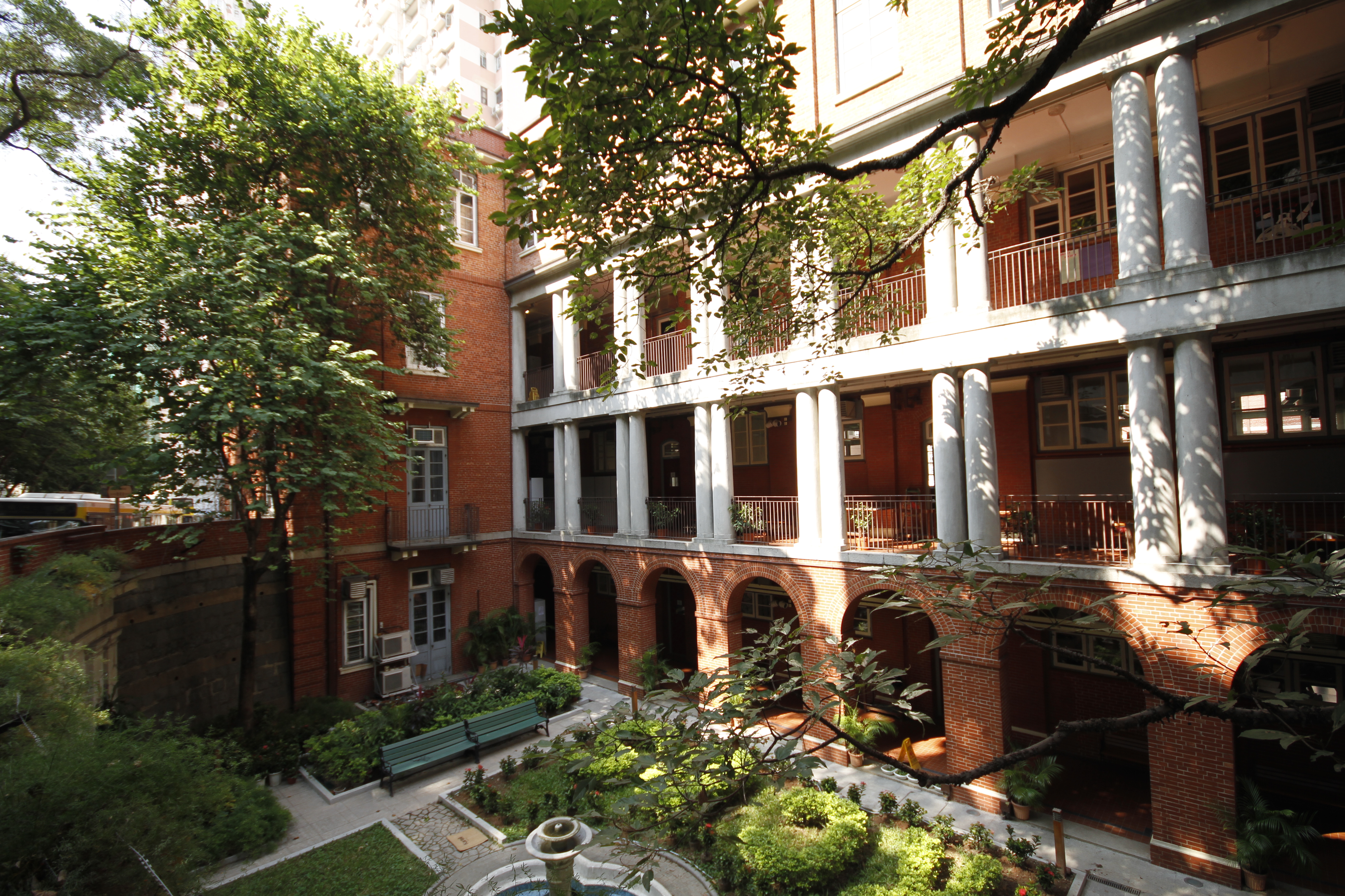
Historical buildings
Source:
Grade 1
- Façade of Old Mental Hospital (Sai Ying Pun Community Complex)
- Old Tsan Yuk Maternity Hospital – Main Building
- Tsung Tsin Mission of Hong Kong Kau Yan Church
- King's College
Grade 2
- No. 207 Des Voeux Road West – a four-storey shop house
- Old Lunatic Asylum Chinese Block – Main Building & Staff Quarters
- Old Tsan Yuk Maternity Hospital – Annex Block
- St. Louis School, Hong Kong – East Wing
Grade 3
- Tsung Tsin Mission of Hong Kong Kau Yan Church
- No. 19 Hing Hon Road
- Old Upper Levels Police Station
- Nos. 9 and 10 Yu Lok Lane
Transportation
Sai Ying Pun station, which is one of the MTR stations and part of Hong Kong Island line, started servicing the area on 29 March 2015. Trams run along Des Voeux Road West, taking passengers to the east or west of Hong Kong Island.
Many bus routes run along Des Voeux Road and Queen's Road West, with some routes routed through the lower parts of Water Street and Pok Fu Lam Road. Most streets are too steep or narrow for buses, however green minibuses and some red minibus routes travel through the upper streets.
Taxis frequent First, Second and Third Streets.
A series of escalators can take pedestrians up Centre Street, from Second Street to Bonham Road via the Sai Ying Pun Market.
The Western Harbour Crossing tunnel goes from Sai Ying Pun under Victoria Harbour to West Kowloon, and is a popular route for cars, trucks and buses.
References
- Geological Map of Hong Kong 1979
- Hong Kong Government Reports Online from Hong Kong University
References
- "《中國叢報》中1841年香港島人口統計".
- "分區簡史及地方名字由來-區內地方名字的由來".
- Lau, Alfred Y.K.. (1995). "An Outline of the Urban Development of Sai Ying Pun in the Nineteenth Century". Journal of the Hong Kong Branch of the Royal Asiatic Society.
- "POA School Net 11". [[Education Bureau]].
- (2014-12-06). "The Tenth Station
/ Li Sing Primary School". Cache Hong Kong. - (1953-05-31). "Weather Caprices Cause Coronation Day Anxieties: Around Hong Kong". [[South China Sunday Post–Herald]].
- Sweeting, Anthony. (2004-07-01). "Education in Hong Kong, 1941 to 2001: Visions and Revisions". [[Hong Kong University Press]].
- (1953-05-28). "New Primary School: Being Planned For The Western District". [[South China Morning Post]].
- Sweeting, Anthony. (2004-07-01). "Education in Hong Kong, 1941 to 2001: Visions and Revisions". [[Hong Kong University Press]].
- (1956-05-24). "Adult Recreation and Reading Centres: Governor Visits Schools At Pokfulam And Aberdeen". [[South China Morning Post]].
- "2014-2015年度". Li Sing Primary School.
- "SYP School Trail". Cache Hong Kong.
- "Leisure and Cultural Services Department - Antiquities and Monuments Office".
This article was imported from Wikipedia and is available under the Creative Commons Attribution-ShareAlike 4.0 License. Content has been adapted to SurfDoc format. Original contributors can be found on the article history page.
Ask Mako anything about Sai Ying Pun — get instant answers, deeper analysis, and related topics.
Research with MakoFree with your Surf account
Create a free account to save articles, ask Mako questions, and organize your research.
Sign up freeThis content may have been generated or modified by AI. CloudSurf Software LLC is not responsible for the accuracy, completeness, or reliability of AI-generated content. Always verify important information from primary sources.
Report