From Surf Wiki (app.surf) — the open knowledge base
Qira County
| Field | Value |
|---|---|
| name | Qira County |
| native_name | ug-Arab |
| other_name | |
| settlement_type | County |
| image_map | Location of Chira within Xinjiang (China).png |
| map_caption | Location of the county in Hotan Prefecture (yellow) and Xinjiang |
| pushpin_map | China Xinjiang Southern#Xinjiang#China |
| pushpin_label | Qira |
| pushpin_map_caption | Location of the seat in Xinjiang |
| parts | 2 towns, 6 townships |
| parts_type | Township-level divisions |
| subdivision_type | Country |
| subdivision_name | China |
| subdivision_type1 | Autonomous region |
| subdivision_name1 | Xinjiang |
| subdivision_type2 | Prefecture |
| subdivision_name2 | Hotan |
| seat_type | County seat |
| seat | Qira Town |
| area_total_km2 | 31688.01 |
| area_footnotes | |
| population_total | 157,792 |
| population_as_of | 2020 |
| population_footnotes | |
| population_density_km2 | auto |
| population_density_urban_km2 | auto |
| demographics_type2 | Ethnic groups |
| demographics2_title1 | Major ethnic groups |
| demographics2_info1 | Uyghur |
| coordinates | |
| elevation_footnotes | |
| elevation_m | 1500-7282 |
| elevation_ft | 4900-23981 |
| timezone | China Standard |
| utc_offset | +8 |
| postal_code_type | Postal code |
| postal_code | 848300 |
| website |
|ibox-order=ug, zh Qira County (Uyghur: چىرا ناھىيىسى), alternatively Chira or Cele (from Mandarin Chinese), is a county in Hotan Prefecture, Xinjiang Uyghur Autonomous Region, China. Almost all the residents of the county are Uyghurs and live around oases situated between the desolate Taklamakan Desert and Kunlun Mountains. The county is bordered to the north by Aksu Prefecture, to the east by Yutian / Keriya County, to the northwest by Lop County, to the southwest by Hotan County including the China-India disputed Aksai Chin area and to the south by Rutog County, Ngari Prefecture in Tibet.
History
The sixth century Dandan Oilik oasis town archaeological site where Buddhist shrines and texts were discovered is located in the desert of northern Qira (Chira) County.
Qira town (Chira), the town that is the current county seat of Qira County, has been forced to change locations on three occasions due to encroachment by the sands of the Taklamakan Desert.
In his 1900-01 expedition in the region, Aurel Stein travelled across the northern section of today's Qira County, a section of the Taklamakan Desert between today's Lop County and the Keriya River. There were several wells along the course he took.
Qira County was divided from Yutian / Keriya County in 1928/9.
In the thirty years between the 1950s and 1980s, a significant area of farmland near the county seat was taken into the desert by blown sand.
Since the founding of Xinjiang Autonomous Region in 1955, Qira County has been part of Hotan Prefecture.
In the 1980s, 446 households living in the county seat were forced to relocate due to the effects of desertification which had brought the Taklamakan Desert within 1.5 km km of their homes, sometimes burying homes in sand overnight.
In 1983, the Qira research station of the Chinese Academy of Sciences was founded to combat drift sand. A transitional zone was established with help from the scientists at the station, and the sands were pushed back over 5 km.
In 2005, a small 1,500 year-old Buddhist temple was discovered 7 km from Damiku (Damagou).
On October 20, 2014, Damiku (Damagou) was changed from a township to a town.
On January 7, 2016, areas near Nur, Bostan and Ulughsay townships in Qira County were made part of the newly created Kunyu.
On February 28, 2017, it was announced by the county government that those who reported others for stitching the 'star and crescent moon' insignia on their clothing or personal items or having the words 'East Turkestan' on their mobile phone case, purse or other jewelry, would be eligible for cash payments.
In March 2017, Salamet Memetimin, the Communist Party secretary for Chaka township's Bekchan village and ethnic Uyghur, was relieved of her duties for taking her nikah marriage vows at her home. According to the Hotan Daily, 97 officials were charged with disciplinary violations at this time.
In 2018, local government authorities in the county expected to have almost 12,000 detainees in vocational camps and detention centres and some projects related to the centres outstripped budgetary limits.
According to the Chinese Government, by the end of 2018, construction of Jinnan New Village ({{linktext|津南|新村}}) in Qira Town (Cele) was completed. To increase aid delivery to Xinjiang, places in Xinjiang are paired with other areas of China which can provide aid. Tianjin and Hotan are paired in this program. Through assistance from the Tianjin government, a standard football field and training center was constructed at the No. 1 Primary School in the county.
Geography
The northern part of Qira County is made up of sand dunes and ends in a straight line drawn in the Taklamakan Desert that forms part of the boundary between Hotan Prefecture and Aksu Prefecture. The area is between 1500 m and 1800 m above sea level.
Oasis areas occupy 2.9% of the total area of the county. The oasis areas along China National Highway 315 include the Qira County county seat area, Gulahma and Damiku. Qaka, Ulughsay, Nur, Bostan and Kunyu's small exclaves in Qira County are located close to the Kunlun Mountains.
The southern part of Qira County is mountainous with an average elevation of 3200 m above sea level. The upper reaches of the White Jade River (Yurung Kash), which provide water for Hotan (Khotan), are found in the Kunlun Mountains of southern Qira County. Mountain passes in the area include Mandar Kol Dawan, Shalgon Dawan, Kuchkash Bulak Dawan, and Art Dawan. One of the prominent mountains in the county is Muztag (K5, Wu-lu-ko Ho Shan, Mo-shih Shan, Mu-shih Shan, Muztagh Jilga; 慕士山, 木斯山) which is 7282 m above sea level. The meltwater from this mountain creates the Qira River (Cele River, Ts'e-lo Ho; 策勒河) which flows through Qaka into the Qira county seat.
In the mid-20th century, camping grounds in the sparsely populated southern mountainous area of the county included Chotma, Yangi kan, Zaiuk, Yaskako Tagh, Mandar Chap, and Chumik.
Climate
|Jan record high C = 20.0 |Jan record low C = -21.8 |Feb record high C = 23.7 |Feb record low C = -20.7 |Mar record high C = 32.3 |Mar record low C = -9.3 |Apr record high C = 36.9 |Apr record low C = -0.7 |May record high C = 38.0 |May record low C = 2.6 |Jun record high C = 40.5 |Jun record low C = 8.0 |Jul record high C = 42.0 |Jul record low C = 11.5 |Aug record high C = 40.9 |Aug record low C = 7.4 |Sep record high C = 36.8 |Sep record low C = 1.9 |Oct record high C = 32.1 |Oct record low C = -4.7 |Nov record high C = 25.1 |Nov record low C = -13.7 |Dec record high C = 19.6 |Dec record low C = -20.5
Administrative divisions
Qira County includes two towns and six townships:
| Name | Simplified Chinese | Hanyu Pinyin | Uyghur (UEY) | Uyghur Latin (ULY) | Administrative division code | Notes |
|---|---|---|---|---|---|---|
| **Towns** | ||||||
| Qira Town | 策勒镇 | zh | چىرا بازىرى | ug | 653225100 | |
| Gulahma Town | 固拉合玛镇 | zh | گۇلاخما بازىرى | ug | 653225102 | formerly Gulahma Township (固拉合玛乡) |
| **Townships** | ||||||
| Qira Township | 策勒乡 | zh | چىرا يېزىسى | ug | 653225200 | |
| Damiku Township | ||||||
| (Dumuka) | 达玛沟乡 | zh | دامىكۇ يېزىسى | ug | 653225202 | |
| Qaka Township | 恰哈乡 | zh | چاقا يېزىسى | ug | 653225203 | |
| Ulughsay Township | 乌鲁克萨依乡 | zh | ئۇلۇغساي يېزىسى | ug | 653225204 | |
| Nur Township | 奴尔乡 | zh | نۇرى يېزىسى | ug | 653225205 | |
| Bostan Township | 博斯坦乡 | zh | بوستان يېزىسى | ug | 653225206 |
Economy
Agricultural products of the county include wheat, corn, cotton, petroleum products, melons, pomegranates, walnuts, peaches, and apricots. Livestock raised in the county include horses, cows and sheep. Industry in the country includes electronics, construction, cotton ginning and food processing (fruits).
Demographics
|2000|132139 |2010|147050 |2015|166735 |}}
As of 2015, 163,705 of the 166,735 residents of the county were Uyghur, 2,921 were Han Chinese and 109 were from other ethnic groups.
As of the 2010s, the population of Qira County was more than 98% Uyghur.
As of 1999, 98.45% of the population of Qira (Cele) County was Uyghur and 1.51% of the population was Han Chinese.
Transportation
- China National Highway 315 runs through the Qira County county seat, Gulahma and Damiku.
- Qira Railway Station is served by Hotan–Ruoqiang railway.
Notable persons
- Ismail Amat, former Chairman (Governor) of Xinjiang
Gallery
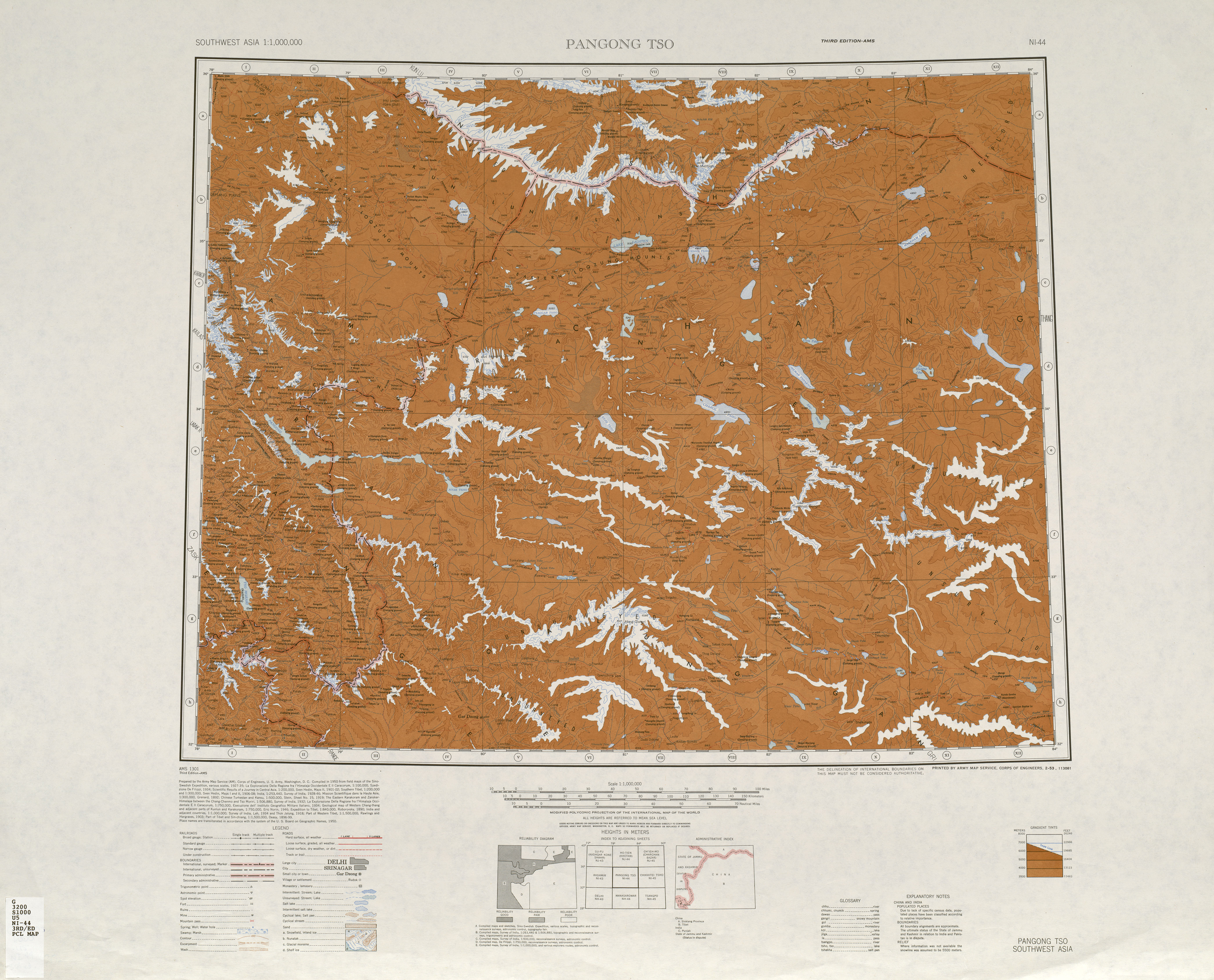
File:Johnson-journey-ilchi1865-mapa.jpg|Map including Chira (1865) File:Plate 23. Sect. II- Chinese Turkistan, Kashmir & Jamu of maps of Constables 1893 hand atlas.jpg|Map of the region including Chira (1893) File:China West 1906-08 Sven Hedin.jpg|Map of the expeditions of Sven Hedin (1906-8) including Qira (labeled as Chira) (RGS, early 20th century) File:Txu-oclc-6654394-ni-44-3rd-ed.jpg|Map including the southern part of Qira County and the county's border with Tibet (AMS, 1950) File:Txu-oclc-6654394-nj-44-3rd-ed.jpg|Map including Qira (labeled as TS'E-LO (CHIRA BAZAR)) and surrounding region (USATC, 1971) File:NJ-44-14 Chia-ha China.jpg|Map including Qira (labeled as TS'E-LE) (DMA, 1974) File:Operational Navigation Chart G-7, 6th edition.jpg|From the Operational Navigation Chart; map including Qira (labeled as QIRA (TS'E-LE)) (DMA, 1980) File:Txu-pclmaps-oclc-22834566 g-7a.jpg|Map including Qira (labeled as QIRA (TS'E-LE)) (DMA, 1984) File:CHANTOS TAKING MELONS TO MARKET IN THE OASIS OF CHIRA.jpg|Traders in early 20th century Qira (Chira) File:Mural excavated at Dandan-Uiliq CD-4.jpg|Buddhist Mural from Dandan Oilik
Notes
References
References
- [http://www.citypopulation.de/en/china/xinjiang/admin/ Xinjiang: Prefectures, Cities, Districts and Counties]
- link. (6 January 2011). zh-hans. 和田地区辖县。位于昆仑山北麓、塔克拉玛干沙漠南缘。面积3.6万平方千米,人口12.6万,有维吾尔、汉、回、藏、壮等民族。其中维吾尔族占98.4%,辖1镇7乡。
- (2016). "Complete Atlas Of The World". [[Penguin Random House]].
- The official spelling is "Qira" according to ''Zhōngguó dìmínglù'' {{lang. zh-hans. 中国地名录 (Beijing, ''[[SinoMaps Press]]'' 1997); {{ISBN. 7-5031-1718-4; p. 308.
- (2018). "Snow Cover Mapping and Ice Avalanche Monitoring from the Satellite Data of the Sentinels". [[International Society for Photogrammetry and Remote Sensing.
- (1971). "NJ 44 Ho-tien". [[U.S. Army Topographic Command]].
- (September 2009). 上海辞书出版社. [[Shanghai Lexicographical Publishing House]].. zh-hans. 1929年由于阗县(今于田县)析置。{...}农产有小麦、玉米、小麦、棉花、油料作物及甜瓜、石榴、核桃、桃、杏等。畜产以马、牛、羊为主。工业有电力、建材、轧花、食品加工(果脯)等。
- (2001). "Sustainable Land Use in Deserts".
- link. zh-hans. 民国17年(公元1928年)2月23日,中华民国政府批准将策勒县佐升格为策勒县治,同年,和阗行政长官制改为和田行政长官公署,策勒县隶属新疆省和阗行政长官公署管辖。中华人民共和国成立初,策勒县隶属新疆省和阗行政公署;1955年10月1日,新疆维吾尔自治区成立,策勒县隶属新疆维吾尔自治区和田地区。
- (27 May 2013). "Holding back the sands of time".
- (2012-12-06). "Sustainable Land Use in Deserts". Springer.
- Cheng Yingqi. (16 August 2013). "Scientists make land arable again". [[China Daily]].
- (2 November 2005). "World's smallest temple discovered in China".
- link. (24 February 2016)
- link. (24 February 2016)
- (4 April 2017). "Xinjiang Police Search Uyghur Homes For 'Illegal Items'".
- (9 August 2017). "'No Sign' of Kazakh Imam Scheduled For Release From Prison in July".
- Lily Kuo. (11 January 2019). "'If you enter a camp, you never come out': inside China's war on Islam".
- link. [[National Bureau of Statistics of the People's Republic of China]]. (2019). zh-hans. 653225100210 220 津南新村村委会
- (8 July 2019). "Tianjin helping Xinjiang's football development in China".
- {{GEOnet2. 32FA8826E5343774E0440003BA962ED3. Muztag (Approved - N), [[National Geospatial-Intelligence Agency. United States National Geospatial-Intelligence Agency]]
- {{GEOnet2. 32FA8826E53A3774E0440003BA962ED3. K5 (Variant - V), [[National Geospatial-Intelligence Agency. United States National Geospatial-Intelligence Agency]]
- {{GEOnet2. 32FA8826E5393774E0440003BA962ED3. Mu-shih Shan (Variant - V), [[National Geospatial-Intelligence Agency. United States National Geospatial-Intelligence Agency]]
- {{GEOnet2. AD4CEC26540D4485866711038E92B7DD. 慕士山 (Non-Roman Script - NS), [[National Geospatial-Intelligence Agency. United States National Geospatial-Intelligence Agency]]
- link. (1958). 地圖出版社. 统一书号 (National Standard Book Number of China)]] 12014·449
- link. (20 July 2019). zh-hans. 卧龙谷位于新疆和田策勒县恰哈乡玉如克塔什村,在它的怀抱里,策勒河带着这里人的喜怒哀乐悠悠地流向远方。
- (1950). "NI 44 Pangong Tso". [[Army Map Service]].
- link. [[China Meteorological Administration]]
- link. zh-hans. 策勒县位于新疆最南端,南枕昆仑山、北临塔克拉玛干大沙漠,县域总面积3.16万平方公里。全县地势总体南高北低,山区平均海拔3200米,平原区海拔1500—1800米。{...}县境内可供人类生存的绿洲面积仅占2.9%,且被沙漠和戈壁分割包围成大小不等的72块,历史上策勒县城因风沙侵袭三次被迫搬迁。策勒县总人口16.8万人,维吾尔族占总人口的98%以上。全县辖6乡2镇1街道,
- link. XZQH.org. (2 December 2014). zh-hans. 2000年第五次人口普查,策勒县常住总人口132139人,{...}2003年,全县总面积31688.01平方千米,{...}2010年第六次人口普查,策勒县常住总人口147050人,其中:策勒镇14562人,策勒乡31123人,固拉哈玛乡26621人,达玛沟乡19250人,恰哈乡15010人,乌鲁克萨依乡4587人,奴尔乡11581人,博斯坦乡6626人,色日克街道15684人,兵团一牧场2006人。 2014年10月20日,自治区政府(新政函[2014]177号)同意撤销固拉合玛乡,设立固拉合玛镇。调整后,全县辖2个镇、6个乡:策勒镇、固拉哈玛镇、策勒乡、达玛沟乡、恰哈乡、乌鲁克萨依乡、奴尔乡、博斯坦乡。
- link. [[National Bureau of Statistics of the People's Republic of China]]. (2018). zh-hans. 统计用区划代码 名称 653225100000 策勒镇 653225101000 固拉合玛镇 653225200000 策勒乡 653225202000 达玛沟乡 653225203000 恰哈乡 653225204000 乌鲁克萨依乡 653225205000 奴尔乡 653225206000 博斯坦乡 653225500000 兵团一牧场
- Ellsworth Huntington. (1907). "The Pulse of Asia A Journey in Central Asia Illustrating the Geographic Basis of History". [[Houghton Mifflin Company]].
- {{GEOnet2. 4079295DAB222317E0440003BA962ED3. دامىكۇ (Variant Non-Roman Script - VS), [[National Geospatial-Intelligence Agency. United States National Geospatial-Intelligence Agency]]
- {{GEOnet2. 4079295DA9E22317E0440003BA962ED3. چاقا (Variant Non-Roman Script - VS), [[National Geospatial-Intelligence Agency. United States National Geospatial-Intelligence Agency]]
- link. {{lang. ug. شىنجاڭ ئۇيغۇر ئاپتونوم رايونى {{lang. zh-hans. 新疆维吾尔自治区统计局 Statistic Bureau of Xinjiang Uygur Autonomous Region
- (2004). "Governing China's Multiethnic Frontiers". [[University of Washington Press]].
This article was imported from Wikipedia and is available under the Creative Commons Attribution-ShareAlike 4.0 License. Content has been adapted to SurfDoc format. Original contributors can be found on the article history page.
Ask Mako anything about Qira County — get instant answers, deeper analysis, and related topics.
Research with MakoFree with your Surf account
Create a free account to save articles, ask Mako questions, and organize your research.
Sign up freeThis content may have been generated or modified by AI. CloudSurf Software LLC is not responsible for the accuracy, completeness, or reliability of AI-generated content. Always verify important information from primary sources.
Report