From Surf Wiki (app.surf) — the open knowledge base
Port of Manila

| Field | Value |
|---|---|
| name | Port of Manila |
| *Pantalan ng Maynila* | |
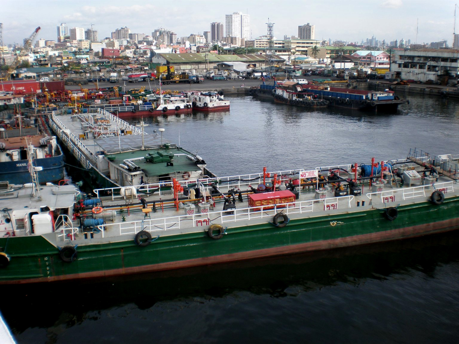
| image_caption | Manila South Harbor |
| country | Philippines |
| location | Port Area and Tondo, Manila |
| coordinates | |
| locode | PHMNL |
| opened | 12th century |
| operated | Philippine Ports Authority |
| owner | Government of Manila |
| type | Natural/Artificial |
| sizeland | 137.5 ha |
| berths | 22 |
| piers | 12 |
| arrivals | 20,828(2012) |
| cargotonnage | 75,058,855(2012) |
| containervolume | 4,523,339 TEU(2016) |
| passengertraffic | 72,438,609(2017) |
| website |
Pantalan ng Maynila Manila South Harbor view from MH sunset (Port Area, Manila; 07-20-2024).jpg
The Port of Manila () refers to the collective facilities and terminals that process maritime trade function in harbors in Metro Manila. Located in the Port Area and Tondo districts of Manila, facing Manila Bay, it is the largest and the premier international shipping gateway to the country. The Philippine Ports Authority, a government-owned corporation, manages the Port of Manila and most of the public ports in the country. It is composed of 3 major facilities, namely Manila North Harbor, Manila South Harbor, and the Manila International Container Terminal.
History
Trade in Manila Bay dates at least ninth to twelfth centuries when Manila traded with neighboring countries including China and Japan, with ties to India through the areas that are now Malaysia and Indonesia. During the Spanish Colonial Era of the Philippines Manila handled trade with China and other East Asian countries, with Mexico, with Arab countries, and directly with Spain from the 16th to mid-19th century when the port was opened to all trade. This was the galleon trade that connected the Philippines to Spain via Mexico, another Spanish territory. From the end of the galleon trade, through the American Colonial Era of the Philippines and Philippine independence, until today, the Port of Manila has been the main port of the Philippines for both domestic and international trade.
The port is part of the Maritime Silk Road that runs from the Chinese coast to the south via Singapore towards the southern tip of India, to Mombasa, then through the Suez Canal to the Mediterranean with its connections to Central and Eastern Europe.
Location
The entrance to Manila Bay is 19 km wide and expands to a width of 48 km. Mariveles, in the province of Bataan, is an anchorage just inside the northern entrance, and Sangley Point is the former location of Cavite Naval Base. On either side of the bay are volcanic peaks topped with tropical foliage. 40 km to the north is the Bataan Peninsula and to the south is the province of Cavite.
Facilities
Manila North Harbor
.jpg)
Manila North Harbor (seaport code:MNN), occupies a 53 ha area in Tondo, Manila and is operated by the Manila North Harbour Port Inc., a subsidiary of International Container Terminal Services Inc. It has 7 piers (numbered with even numbers: 2, 4, 6, 8, 10, 12 and 14). North Harbor is accessible through Mel Lopez Boulevard (Radial Road 10).
The North Port Passenger Terminal, opened in 2013, can accommodate 2–3 million passengers sailing on inter-island ferries to cities throughout the archipelago. It is the main hub of 2GO ferry company, the largest inter-island ferry company in the Philippines.
| Year | Cargo Tonnage | Container Volume | Passengers |
|---|---|---|---|
| **2010** | 17,207,751 | 16,146,329 | 821,983 |
| **2011** | 17,806,136 | 18,442,473 | 728,662 |
| **2012** | 19,402,011 | 19,174,424 | 766,942 |
Manila South Harbor

Manila South Harbor (seaport code:MNS), is an 80 ha port facility located in Port Area, Manila operated by Asian Terminals Incorporated, with 5 piers numbered with odd-numbers 3, 5, 9, 13 and 15. It is accessible through Bonifacio Drive/Radial Road 1 and has a passenger terminal located between Pier 13 and 15 named Eva Macapagal Super Terminal. It was formerly the main hub of 2GO ferry company. In April 2014, a new Liebherr quay crane was installed to increase the efficiency of the harbor.
| Year | Cargo Tonnage | Container Volume | Passengers |
|---|---|---|---|
| **2010** | 40,816,716 | 12,958,525 | 1,004,780 |
| **2011** | 44,067,826 | 12,612,780 | 816,839 |
| **2012** | 40,317,702 | 11,130,626 | 161,500 |
Manila International Container Terminal

.jpg)
Manila International Container Terminal (seaport code:MNL) is operated by International Container Terminal Services Inc. It is one of Asia's major seaports and one of the Philippines' most active ports. It is located between the Manila North Harbor and the Manila South Harbor and can be accessed by road through MICT South Access Road.
In 2019, Manila International Container Terminal ranked 29th in the list of world's busiest container ports with Twenty-foot equivalent units (TEUs) of 5,315. Inaugurated on July 7, 2012, Berth 6 became fully operational and increased the Port's annual capacity by 450,000 TEUs.
| Year | Number of Vessel | Cargo Tonnage | Container Volume |
|---|---|---|---|
| **2010** | 1,942 | 32,225,795 | 18,266,554 |
| **2011** | 1,941 | 34,377,129 | 18,689,936 |
| **2012** | 1,862 | 34,345,059 | 19,966,465 |
Future plans
It has been suggested by Japan International Cooperation Agency (JICA) and National Economic and Development Authority (NEDA) on the 2014 study Metro Manila Dream Plan to place a cap for the expansion of Manila seaports, shifting cargo-handling operations to the ports of Subic Bay and Batangas, and to eventually redevelop the port area into high value-added diversified waterfront area. However, the government has yet to implement the suggestion.
With Berth 6 in operation, ICTSI is scheduled to finish Phase 1 development of Yard 7 by yearend and increase MICT's import capacity by 18 percent.
South of Metro Manila, ICTSI's Laguna Gateway Inland Container Terminal (LGICT) has finished its Phase 1 development. The inland container depot (ICD), which serves as an extension of the MICT, adds 250,000 TEUs to MICT's annual capacity. It will be connected to Manila through the revival of the Manila-Calamba cargo intermodal system, which ceased operations in 2000 due to lower demand.
Transportation and infrastructure connections
Buses
As of April 2025, there are no public transport buses plying reasonably near these areas. However some jeepneys coming from/along Intramuros, Manila City Hall, Carriedo, Doroteo Jose area can be observed instead. Also, Indian-style limited-space tricycles which could accommodate a maximum of five passengers could be also ridden from around Ermita-Malate area particularly from United Nations Avenue corner Taft Avenue, and along Mabini Street starting from around Quirino Avenue. Such are usually utilised by a portion of the commuting employees of government offices (Philippine Coast Guard, Department of Public Works and Highways, Philippine Ports Authority, Bureau of Customs) and private companies ( Manila Hotel, Asian Terminals, Inc., banks, food service establishments, customs brokerage & logistics firms ) around the area,
Access to/from the NLEX
The NLEX Harbor Link, an expressway that connects with the main line North Luzon Expressway (NLEX) at the Harbor Link Interchange in Valenzuela up to Radial Road 10 (R-10) in Navotas, serves as an alternative road to the Manila North Harbor especially for the cargo trucks entering the port coming from Northern and Central Luzon, without a truck ban, and also eases traffic congestion at Andres Bonifacio Avenue and 5th Avenue.
Future projects
Pier 4 LRT station
Main article: Pier 4 station
The Pier 4 station is the future western terminus of Manila Light Rail Transit System Line 2 (LRT-2). It will be constructed near the North Port Passenger Terminal located at Pier 4 of Manila North Harbor along Mel Lopez Boulevard. The west extension of LRT-2 will also serve as a rail transport connection to the Port of Manila.
North-South Harbor Bridge
Main article: North-South Harbor Bridge
The Department of Public Works and Highways (DPWH) is also proposing to construct a bridge crossing the Pasig River between North Harbor and South Harbor.
NLEX-CAVITEX Port Expressway Link / Harbor Link Port Access Mobility Facility
A proposed expressway in NLEX–CAVITEX Port Expressway Link or Harbor Link Port Access Mobility Facility is being planned to connect the existing Navotas Interchange of NLEX Harbor Link to Manila–Cavite Expressway (CAVITEX) or Anda Circle, respectively. It will run above the existing alignment of Mel Lopez Boulevard.
References
References
- "UNLOCODE (PH) – PHILIPPINES".
- "Port Statistics".
- "The CIA World Factbook – Philippines". [[Central Intelligence Agency]].
- [http://www.bartleby.com/65/ph/PhilipRep.html Philippines, The. The Columbia Encyclopedia, Sixth Edition. 2001–07] {{webarchive. link. (July 28, 2008)
- [https://www.wsj.com/articles/china-bypasses-philippines-in-its-proposed-maritime-silk-road-1415636066 China Bypasses Philippines in Its Proposed ‘Maritime Silk Road’]
- [https://manilastandard.net/opinion/columns/307953/belt-and-road-benefits-the-philippines.html Belt and Road benefits the Philippines]
- [http://www.photius.com/seaports/ ''Seaport Codes and Information'']
- Almonte, Liza. (October 10, 2013). "After passenger terminal Manila North Harbour turns to work on container facility". PortCalls Asia.
- Amojelar, Darwin G.. (October 9, 2013). "Manila North Harbor operator spending another P5 billion to expand terminal". InterAksyon.
- "SUMMARY SHIPPING, CARGO & PASSENGER STATISTICS BY PORT CLASSIFICATION".
- "Archived copy".
- "Archived copy".
- (April 29, 2014). "ATI deploys new quay crane to Manila South Harbor". The Manila Times.
- "Archived copy".
- "Archived copy".
- "Archived copy".
- "One Hundred Container Ports 2020".
- (June 28, 2012). "President Aquino inaugurates Berth 6 of ICTSI Manila flagship". The Shipping Tribune.
- "Archived copy".
- "Archived copy".
- "Archived copy".
- (September 2014). "Main Points of the Roadmap". [[Japan International Cooperation Agency]].
- "MICT to complete first port expansion phase by end of 2015 - IHS Maritime 360".
- (October 7, 2014). "ICTSI setting aside $300M for Laguna depot, MICT". BusinessMirror.
- (August 14, 2014). "ICTSI to revive Manila-Calamba cargo train". Malaya Business Insight.
- Mercurio, Richmond. (March 2, 2020). "NLEX keen on Port Expressway Link project". The Philippine Star.
- Mercurio, Richmond. (February 14, 2020). "Construction to start soon on Harbor Link extension". The Philippine Star.
- "NLEX-Cavitex Port Expressway Link".
This article was imported from Wikipedia and is available under the Creative Commons Attribution-ShareAlike 4.0 License. Content has been adapted to SurfDoc format. Original contributors can be found on the article history page.
Ask Mako anything about Port of Manila — get instant answers, deeper analysis, and related topics.
Research with MakoFree with your Surf account
Create a free account to save articles, ask Mako questions, and organize your research.
Sign up freeThis content may have been generated or modified by AI. CloudSurf Software LLC is not responsible for the accuracy, completeness, or reliability of AI-generated content. Always verify important information from primary sources.
Report