From Surf Wiki (app.surf) — the open knowledge base
Peletier Plateau
Plateau in Antarctica
Plateau in Antarctica
| Field | Value |
|---|---|
| country_type | Continent |
| country | Antarctica |
| parent | Queen Elizabeth Range |
| coordinates | |
| map | Antarctica |
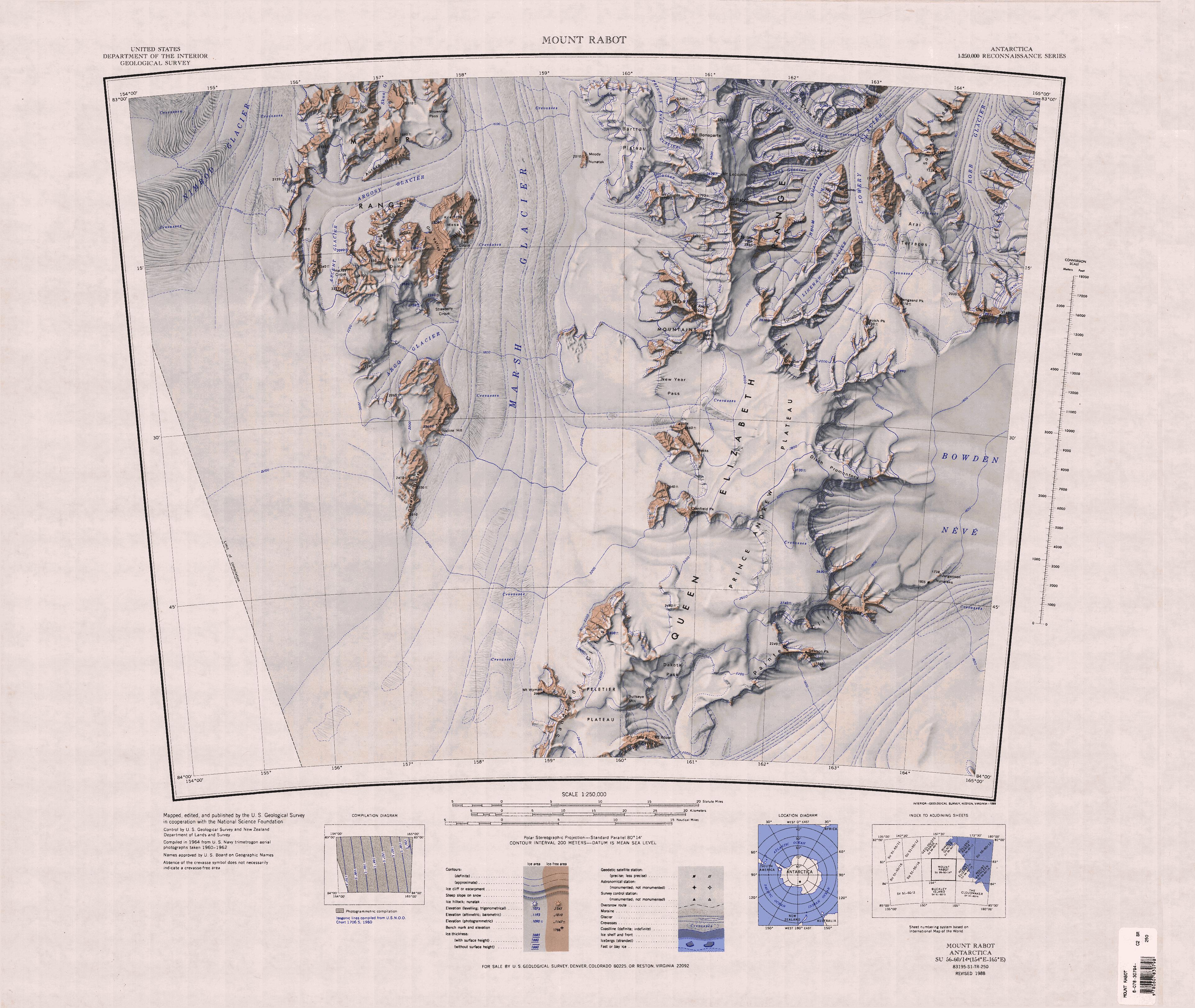
The Peletier Plateau () is an ice-covered plateau, about 20 nmi long and 5 nmi wide, forming the southern part of Queen Elizabeth Range.
Exploration and name
The Peletier Plateau was named by the United States Advisory Committee on Antarctic Names (US-ACAN) for Rear Admiral Eugene Peletier, CEC, United States Navy, Bureau of Yards and Docks, who was of assistance to Rear Admiral George J. Dufek in the preparation of United States Navy Operation Deep Freeze II, 1956–57.
Location

The Peletier Plateau is in the southwest of the Queen Elizabeth Range between the head of Marsh Glacier to the west and Law Glacier to the southeast. Mount Allsup is at its southern tip, at the southwest end of the Canopy Cliffs, which face the Law Glacier. Mount Ropar is at the northeast end of the Canopy Cliffs. The Sandford Cliffs extend along the west side of the plateau, facing the Marsh Glacier. Mount Wyman stands west of them, extending into the glacier. Bullseye Mountain and Dakota Pass are to the northeast of the plateau, leading to Prince Andrew Plateau.
Features
Mount Allsup
Canopy Cliffs
Mount Ropar
Sandford Cliffs
Mount Wyman
Bullseye Mountain
Dakota Pass
References
Sources
- {{citation|url=https://pubs.usgs.gov/fedgov/70039167/report.pdf |accessdate=2023-12-03 |edition=2 |editor-last=Alberts |title=Geographic Names of the Antarctic |editor-first=Fred G.
- {{citation |url=https://commons.wikimedia.org/wiki/File:C84195s1_Ant.Map_Buckley_Island.jpg |accessdate=2024-01-03
- {{citation |url=https://commons.wikimedia.org/wiki/File:C83165s1_Ant.Map_Mount_Rabot.jpg |accessdate=2024-01-03
This article was imported from Wikipedia and is available under the Creative Commons Attribution-ShareAlike 4.0 License. Content has been adapted to SurfDoc format. Original contributors can be found on the article history page.
Ask Mako anything about Peletier Plateau — get instant answers, deeper analysis, and related topics.
Research with MakoFree with your Surf account
Create a free account to save articles, ask Mako questions, and organize your research.
Sign up freeThis content may have been generated or modified by AI. CloudSurf Software LLC is not responsible for the accuracy, completeness, or reliability of AI-generated content. Always verify important information from primary sources.
Report