From Surf Wiki (app.surf) — the open knowledge base
Pan-Philippine Highway
Highway in the Philippines traversing most of the country
.jpg)
Highway in the Philippines traversing most of the country
| Field | Value |
|---|---|
| country | PHL |
| type | AH |
| route | 26 |
| alternate_name | |
| map | Maharlika Highway map.png |
| map_notes | Map of the Philippines showing the route of Pan-Philippine Highway |
| image_width | 250px |
| image_notes | The segment of the highway in Daraga, Albay with AH26 sign (right) while overlooking Mayon Volcano (background) |
| maint | the Department of Public Works and Highways (DPWH) |
| length_km | 3379.73 |
| length_ref | |
| length_notes | Excludes sea route |
| Includes 96.98 km Tacloban–Ormoc spur and 292.39 km Davao–Cagayan de Oro spur | |
| established | 1960s |
| allocation | |
| terminus_a | Laoag, Philippines |
| direction_a | North |
| terminus_b | Zamboanga City, Philippines |
| direction_b | South |
| regions | |
| provinces |
National Road, Daraga Cagsawa, AH26 sign (Daraga, Albay; 04-19-2023).jpg Includes 96.98 km Tacloban–Ormoc spur and 292.39 km Davao–Cagayan de Oro spur
The Pan-Philippine Highway, also known as the Maharlika Highway (; ), is a network of roads, expressways, bridges, and ferry services that connect the islands of Luzon, Samar, Leyte, and Mindanao in the Philippines, serving as the country's principal transport backbone. Measuring 3379.73 km long excluding sea routes not counted by highway milestones, it is the longest road in the Philippines that forms the country's north–south backbone component of National Route 1 (N1) of the Philippine highway network. The entire highway is designated as Asian Highway 26 (AH26) of the Asian Highway Network.
The northern terminus of the highway is in front of the Ilocos Norte Provincial Capitol in Laoag and the southern terminus is near the Zamboanga City Hall in Zamboanga City.
History
The Pan-Philippine Highway System was an infrastructure program of President Diosdado Macapagal as a first priority project for the improvement and expansion of Philippine highway and land transport networks. It was stated in his final State of the Nation Address in 1965 that the project requires the concreting of 3,003 km from 1965 to 1969, which continued into the administration of President Ferdinand Marcos. This included the construction of 11,333 bridges, comprising the entire system. It is a mixture of old existing roads and new roads that would be eventually added to become part of the highway. Government planners believed that the motorway and other connected roads would stimulate agricultural production by reducing transport costs, encourage social and economic development outside existing major urban centers such as Manila, and expand industrial production for domestic and overseas markets. Construction, which continued in the following decades, was supported by loans and grants from foreign aid institutions, including the World Bank. In 1979, the highway was renamed to Maharlika Highway.
The highway was rehabilitated and improved in 1997, during the administration of President Fidel V. Ramos, with assistance from the Japanese government, and dubbed the "Philippine-Japan Friendship Highway". Japan's assistance is applied only up to Carmen, Davao del Norte at the south, thus covering only about 2100 km or about 62% of the highway's entire length. In 1998, the Department of Tourism designated 35 sections of the highway as "Scenic Highways", with developed amenities for travelers and tourists.
Asian Highway Network
The Pan-Philippine Highway is designated as AH26 in the Asian Highway Network, a cooperative project which seeks to improve highway systems and standards across the continent. Ratified by the Philippines in 2007, it is currently the only highway in the system that is isolated from every other highway; island-based sections of the Asian Highway Network in Japan (AH1), Sri Lanka (AH43) and Indonesia (AH2) are all linked to the mainland sections by ferries to South Korea (AH1), India (Dhanushkodi), and Singapore, respectively. Despite its isolation, it can be linked internationally via ferry routes such as Laoag–China and Zamboanga–Malaysia.
Route description
AH26 officially runs along the following thoroughfares:
- [[File:N1 (Philippines).svg|30px]] N1: Laoag – Guiguinto
- Manila North Road/Maharlika Highway: Laoag – Burgos – Aparri
- Bangag-Magapit Road: Aparri – Lal-lo
- Cagayan Valley Road: Lal-lo – Tuguegarao
- Maharlika Highway: San Pablo – Cabagan – Ilagan – Cauayan – Santiago – Solano – Bayombong – Santa Fe – San Jose City – Cabanatuan – Gapan – San Miguel – Baliwag – Pulilan – Guiguinto
- [[File:E1 (Philippines).svg|30px]] E1: Guiguinto – Quezon City
- North Luzon Expressway: Santa Rita Interchange – Balintawak Interchange
- [[File:N1 (Philippines).svg|30px]] N1: Quezon City – Makati
- EDSA (Eastern Route): Balintawak Interchange – Magallanes Interchange
- [[File:E2 (Philippines).svg|30px]] E2: Makati – Calamba
- South Luzon Expressway: Magallanes Interchange – Calamba Exit
- [[File:N1 (Philippines).svg|30px]] N1: Calamba – Matnog
- Maharlika Highway: Calamba – Santo Tomas – San Pablo – Tiaong – Candelaria – Sariaya – Tayabas
- Lucena Diversion Road: Tayabas – Lucena – Pagbilao
- Maharlika Highway: Pagbilao – Atimonan – Gumaca – Lopez – Calauag – Labo – Daet – Sipocot – Milaor – Naga City – Pili – Nabua – Polangui – Daraga – Sorsogon City – Irosin – Matnog
- Gap (San Bernardino Strait)
- [[File:Ferry Sign.svg|30px]] Matnog–Allen ferry line: Luzon – Visayas
- [[File:N1 (Philippines).svg|30px]] N1: Allen – Calbayog – Catbalogan – Tacloban – Palo – Mahaplag – Liloan
- Allen Old Road: Allen --
- Gap (Bohol Sea)
- [[File:Ferry Sign.svg|30px]] Liloan–Lipata ferry line: Visayas – Mindanao
- [[File:N1 (Philippines).svg|30px]] N1: Surigao City – Zamboanga City
- Maharlika Highway: Surigao City – Kitcharao
- Surigao-Butuan National Highway: Kitcharao – Butuan
- Davao-Agusan National Highway: Butuan – Bayugan – Tagum – Davao City
- J.P. Laurel Avenue: Davao City
- C.M. Recto Avenue: Davao City (one-way street)
- Davao–Cotabato Road: Davao City – Digos
- Digos-Makar Road: Digos – Malungon – General Santos
- Marbel-Makar Road: General Santos – Polomolok – Koronadal
- Cotabato-Marbel Road: Koronadal – Banga – Surallah – Norala
- Isulan-Surallah Road: Isulan
- Marbel-Allah Valley-Cotabato Road: Isulan – Cotabato City
- Cotabato-Lanao Road: Cotabato City – Matanog
- Cotabato–Malabang–Lanao del Norte Road: Sultan Dumalondong – Picong
- Malabang–Dobleston–Tukuran Road: Sultan Naga Dimaporo
- Tucuran Junction–Karomatan Junction Road: Tukuran
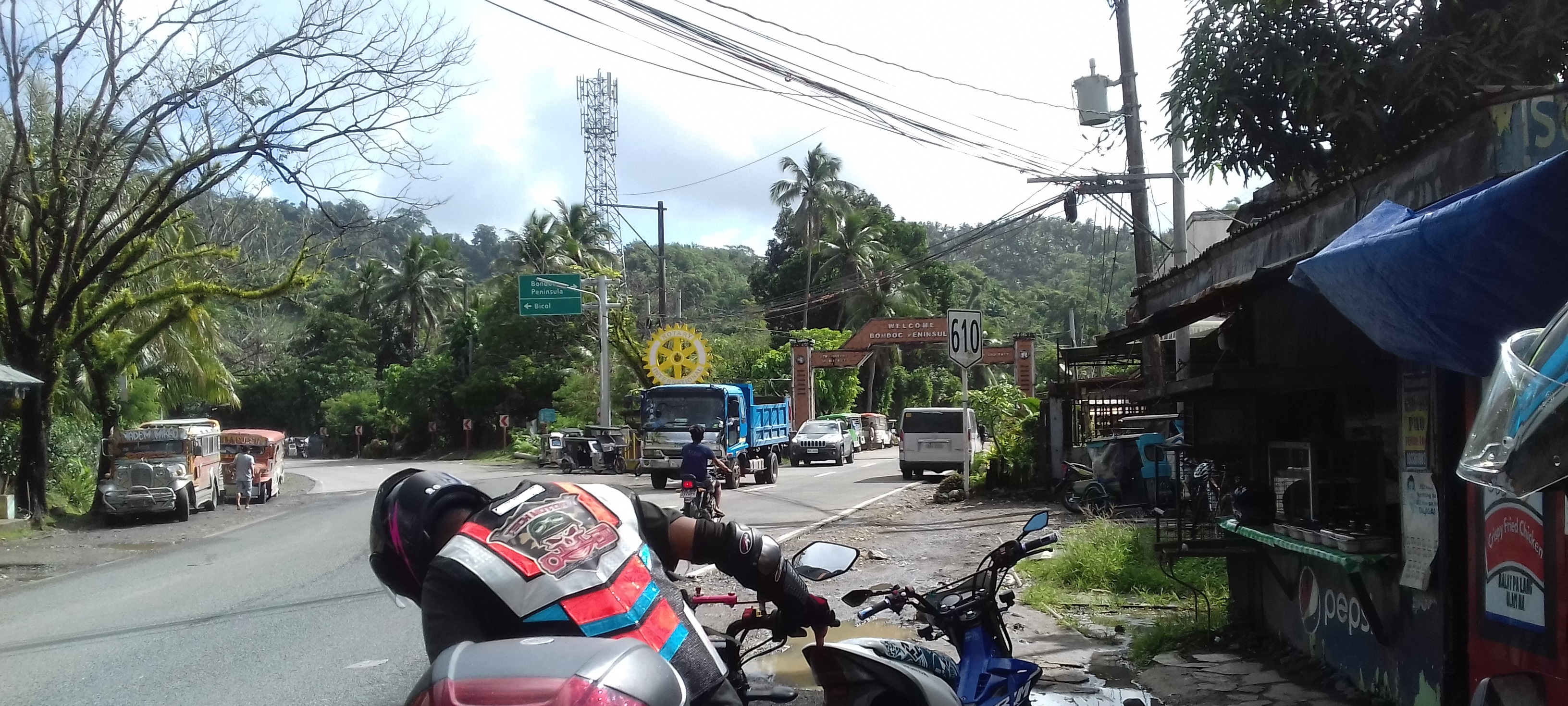
- Maharlika Highway: Tukuran – Pagadian– Ipil – Tungawan – Zamboanga City
Auxiliary Routes
Alternatively, AH26 runs along the following thoroughfares: ;Luzon (West Metro Manila)
- [[File:N1 (Philippines).svg|30px]] N1: Quezon City – Caloocan
- EDSA (Western Route): Balintawak Interchange – Monumento
- [[File:N120 (Philippines).svg|30px]] N120: Caloocan – Pasay
- Samson Road: Caloocan
- Gen. San Miguel Street: Caloocan
- C-4 Road: Caloocan – Malabon – Navotas
- R-10: Navotas
- Mel Lopez Boulevard: Manila
- Bonifacio Drive: Manila
- Roxas Boulevard: Manila – Pasay
- [[File:N1 (Philippines).svg|30px]] N1: Pasay – Makati
- EDSA (Western Route): Roxas Boulevard – Magallanes Interchange
;Luzon (South Skyway)
- [[File:E2 (Philippines).svg|30px]] E2: Makati – Muntinlupa
- Skyway: Makati – Muntinlupa
;Visayas
- [[File:N70 (Philippines).svg|30px]] N70: Palo – Ormoc
- Gap (Camotes Sea)
- [[File:Ferry Sign.svg|30px]] Ormoc–Cebu ferry line
;Mindanao
- [[File:N10 (Philippines).svg|30px]] N10: Davao City – Cagayan de Oro
- Bukidnon–Davao Road: Davao City – Quezon – Maramag
- Sayre Highway: Maramag – Malaybalay – Cagayan de Oro
- [[File:N9 (Philippines).svg|30px]] N9: Cagayan de Oro
- [[File:N946 (Philippines).svg|30px]] N946: Cagayan de Oro
Intersections
;Ilocos Norte
- in Bacarra
;Cagayan
- in Abulug
- in Abulug
- at Magapit Interchange, Lal-lo
- in Tuguegarao
- in Tuguegarao
- in Tuguegarao
- in Tuguegarao
;Isabela
- in Cabagan
- in Cauayan
- in Santiago
- in Cordon
;Nueva Vizcaya
- in Bagabag
- in Aritao
;Nueva Ecija
- in San Jose
- in Santo Domingo
- in Cabanatuan
- in Santa Rosa
- in Gapan
;Bulacan


- in San Rafael
- in Pulilan
- in Plaridel
- in Santa Rita, Guiguinto. Route number change from N1 to E1.
- in Balagtas
- in Balagtas
- in Meycauayan
_NLEX_Segment_08.jpg)
;Metro Manila
- in Valenzuela
- at Harbor Link Interchange, Valenzuela
- in Unang Sigaw, Quezon City
- at Balintawak Interchange, Quezon City. Route number change from E1 to N1.
- in Unang Sigaw, Quezon City
- in Muñoz, Quezon City
- in Diliman, Quezon City
- in Diliman, Quezon City
- in Diliman, Quezon City
- in Cubao, Quezon City
- near Camp Aguinaldo, Quezon City
- at Ortigas Interchange in Quezon City and Mandaluyong
- in Mandaluyong
- in Makati
- in Makati
- in Makati
- at Magallanes Interchange, Makati. Route number change from N1 to E2.
- in Taguig
- in Taguig
- in Parañaque and Muntinlupa
- in Alabang, Muntinlupa
- in Muntinlupa
;Cavite
- in Carmona
;Laguna (Biñan–Calamba)
- in Biñan
- in Santa Rosa
- in Calamba. Route number change from E2 to N1.
;Batangas
- in Santo Tomas
- in Santo Tomas
;Laguna (Alaminos–San Pablo)
- in Alaminos (western & eastern termini)
- in San Pablo (two southern termini)
;Quezon
- in Tiaong (northern terminus)
- in Tiaong
- in Tiaong (southern terminus)
- in Candelaria (western & eastern termini)
- in Sariaya
- in Isabang, Tayabas
- in Isabang, Lucena
- in Gulang-Gulang, Lucena
- in Talipan, Pagbilao
- in Silangang Malicboy, Pagbilao
- in Gumaca
- in Lopez
- in Lopez
;Camarines Norte
- in Santa Elena
- in Labo
- in Daet (northern & southern termini)
;Camarines Sur
- in Sipocot
- in Pamplona
- in Pili
- in Pili
- in Pili
- in Baao
- in Nabua
- in Bato
;Albay
- in Polangui (two northern termini)
- in Ligao
- in Ligao
- in Daraga
;Sorsogon
- in Pilar
- in Castilla
- in Sorsogon City (western terminus)
- in Sorsogon City
- in Sorsogon City (eastern terminus)
- in Bulan
;Northern Samar
- in Allen
;Samar
- in Calbayog
- in Calbayog
- in Gandara (northern & southern termini)
- in Catbalogan
- in Paranas
- in Basey
- in Santa Rita
;Samar–Leyte boundary
- San Juanico Bridge
;Leyte
- in Tacloban
- in Tacloban
- in Palo
- in Palo
- in Abuyog
- in Mahaplag
;Southern Leyte
- in Sogod
- in Liloan
- in Liloan
;Surigao del Norte
- in Surigao City
- in Placer
;Agusan del Norte
- in Butuan
;Agusan del Sur
- in Prosperidad
- in Prosperidad
- in San Francisco
- in Trento
;Davao de Oro
- in Montevista
- in Nabunturan
;Davao del Norte
- in Tagum (northern terminus)
- in Tagum
- in Tagum (southern terminus)
- in Carmen
- in Panabo

;Davao del Sur
- in Panacan, Davao City (eastern terminus)
- in Buhangin, Davao City
- in Buhangin, Davao City
- in Agdao, Davao City (eastern terminus)
- in Agdao, Davao City
- in Agdao & Buhangin, Davao City
- in Poblacion, Davao City
- in Poblacion, Davao City
- in Poblacion, Davao City
- in Talomo, Davao City
- in Talomo, Davao City (western terminus)
- in Talomo, Davao City (western terminus)
- in Talomo, Davao City
- in Bago Aplaya, Davao City
- in Digos (northern terminus)
- in Digos
- in Digos
- in Hagonoy (southern terminus)
- in Sulop
;South Cotabato
- in General Santos (eastern terminus)
- in General Santos
- in General Santos
- in General Santos
;Sultan Kudarat
- in Tacurong
- in Surallah
- in Isulan
- in Esperanza
;Maguindanao del Sur
- in Datu Saudi Ampatuan
;Maguindanao del Norte
- in Sultan Kudarat
- in Datu Odin Sinsuat
- in Datu Odin Sinsuat
- in Sultan Mastura
- in Parang
- in Parang
;Lanao del Sur
- in Malabang
;Zamboanga del Sur
- in Tukuran
;Zamboanga Sibugay
- in Ipil
;Zamboanga City
- . Southern terminus of AH26.
Auxiliary routes
;Metro Manila (western route) – part of and
- in Balintawak, Quezon City. Northern terminus of AH26 auxiliary route in Metro Manila.
- in Caloocan. Route number change from N1 to N120.
- in Navotas
- in Navotas
- in Tondo, Manila
- in Tondo and San Nicolas, Manila
- in Ermita and Intramuros, Manila
- in Ermita, Manila
- in Ermita, Manila
- in Malate, Manila
- in Pasay
- in Pasay. Route number change from N120 to N1.
- in Pasay
- in Pasay
- at Magallanes Interchange, Makati. Southern terminus of AH26 auxiliary route in Metro Manila.
;Visayas (western route) – part of
- in Palo. Northern terminus of AH26 auxiliary route in Visayas.
- in Capoocan
- in Ormoc
- in Ormoc
- in Ormoc
;Mindanao – part of and
- in Davao City. Southern terminus of AH26 auxiliary route in Mindanao.
- in Arakan
- in Maramag
- in Maramag (southern terminus of southern section)
- in Valencia
- in Valencia (northern terminus of southern section)
- in Malaybalay (northern & southern terminus of northern section)
- in Cagayan de Oro
- in Cagayan de Oro
- in Cagayan de Oro
- in Cagayan de Oro
- in Cagayan de Oro
- in Cagayan de Oro
Notes
Alternative names
Pan-Philippine Highway also has alternative names, especially locally within the poblacion of respective town and cities.
References
References
- Cabral, Maria Catalina. "Asian Highway 26 (AH26)". Department of Public Works and Highways.
- (March 22, 2009). "Department Order No. 15, series of 2009: Installation of Route Markers & Directional Signs along the Asian Highway - Route AH26 (Daang Maharlika)".
- Macapagal, Diosdado. (January 25, 1965). "Fourth State of the Nation Address".
- (1941). "Southern Luzon Western Sheet". US Geodetic Survey.
- (1944). "1944 Army Map Service Road Map of Northern Luzon, Philippines". Army Maps Service, Corps of Engineers.
- (1944). "1944 Army Map Service Road Map of the Central and Southern Philippines". Army Maps Service, Corps of Engineers.
- (September 13, 1979). "Changing the Name of the Pan-Philippine Highway into the Maharlika Highway".
- (2007). "Philippine-Japan Friendship Highway Rehabilitation Project (I) (II)".
- (2009). "Philippine-Japan Friendship Highway (Mindanao Section) Rehabilitation Project, Phase I and II".
- (November 17, 2014). "What does AH26 road sign mean?". Rappler.com.
- "ROAD AND BRIDGE INFORMATION APPLICATION".
- (June 20, 1953). "Philippine Highway Act of 1953".
This article was imported from Wikipedia and is available under the Creative Commons Attribution-ShareAlike 4.0 License. Content has been adapted to SurfDoc format. Original contributors can be found on the article history page.
Ask Mako anything about Pan-Philippine Highway — get instant answers, deeper analysis, and related topics.
Research with MakoFree with your Surf account
Create a free account to save articles, ask Mako questions, and organize your research.
Sign up freeThis content may have been generated or modified by AI. CloudSurf Software LLC is not responsible for the accuracy, completeness, or reliability of AI-generated content. Always verify important information from primary sources.
Report