From Surf Wiki (app.surf) — the open knowledge base
Okanogan County, Washington
County in Washington, United States
County in Washington, United States
| Field | Value |
|---|---|
| county | Okanogan County |
| state | Washington |
| ex image | Okanogan County Courthouse 01.jpg |
| ex image size | 300px |
| ex image cap | Okanogan County Courthouse in Okanogan |
| seal | Okanogan County wa seal.jpg |
| coordinates | |
| founded year | 1888 |
| founded date | February 2 |
| named for | Fort Okanogan |
| seat wl | Okanogan |
| largest city wl | Omak |
| area_total_sq_mi | 5312.7 |
| area_land_sq_mi | 5266.2 |
| area_water_sq_mi | 46.5 |
| area percentage | 0.9% |
| population_total | 42104 |
| population_as_of | 2020 |
| population_est | 44942 |
| pop_est_as_of | 2024 |
| density_sq_mi | 8.3 |
| time zone | Pacific |
| district | 4th |
| website |
Okanogan County () is a county located in the U.S. state of Washington along the Canada–U.S. border. As of the 2020 census, the population was 42,104. The county seat is Okanogan, while the most populous city is Omak. It is the largest county by area in the state.
About a fifth of the county's residents live in the Greater Omak Area. The county forms a portion of the Okanogan Country. The first county seat was Ruby, which has now been a ghost town for more than 100 years.
Okanogan County was formed out of Stevens County in February 1888. The name derives from the Okanagan language place name ukʷnaqín. The name Okanogan (Okanagan) also refers to a part of southern British Columbia.
History
Before Europeans arrived, the Okanogan County region was home to numerous indigenous peoples that would eventually become part of three Indian reservations referred to as the Northern Okanogans or Sinkaietk, Tokoratums, Kartars and Konkonelps. They spoke in seven types of Interior Salish languages related to the Puget Sound tribes. The Okanogans experienced a favorable climate, camping in the winter, hunting bears in the spring, catching fish in the summer and hunting deer in fall. The camps consisted of teepee-like longhouses built with hides and bark. Women gathered nuts and berries. A popular destination for this was the Kettle Falls, where the Columbia River dropped some 20 ft.
Due to its remoteness, the Okanogan County area was one of the last in Washington settled by Europeans. It was an early thoroughfare used by prospectors to gain access to other communities, such as British Columbia. By the 21st century, the region specialized in agriculture, forestry and tourism. Electric producer Grand Coulee Dam was constructed between 1933 and 1942, originally with two power plants, around the Okanogan and Grant counties at the former's southern border.
In July 2014, the Carlton Complex wildfire burned over 250000 acre in Okanogan County. It destroyed over 300 homes including 100 in and around Pateros
Geography
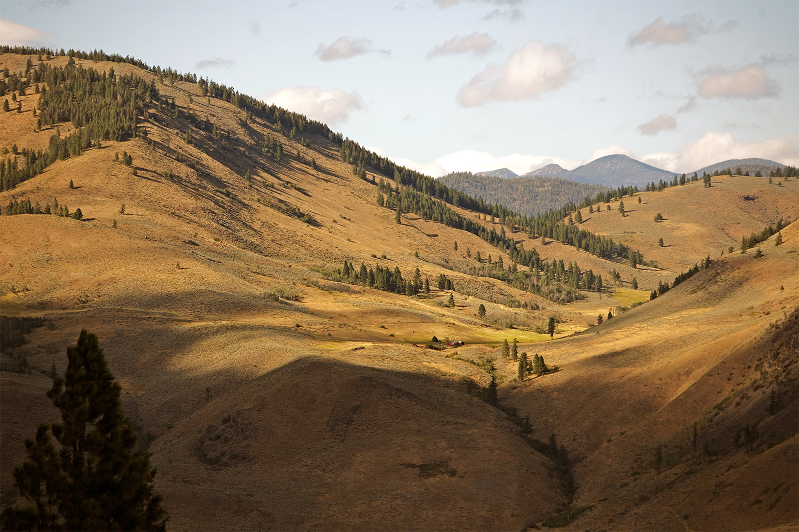
According to the United States Census Bureau, the county has a total area of 5312.7 sqmi, of which 5266.2 sqmi is land and 46.5 sqmi (0.9%) is water. It is the largest county in the state by area, and it is larger than three states in land area.
Geographic features
- Cascade Mountains
- Columbia River
- Okanogan River
- North Gardner Mountain, the highest point in Okanogan County
- Beaner Lake
Major highways
- [[File:US 97.svg|20px]] U.S. Route 97
- [[File:WA-20.svg|20px]] State Route 20
- [[File:WA-153.svg|20px]] State Route 153
Adjacent counties
- Fraser Valley Regional District, British Columbia – northwest
- Okanagan-Similkameen Regional District, British Columbia – north
- Kootenay Boundary Regional District, British Columbia – northeast
- Ferry County – east
- Lincoln County – southeast
- Grant County – south
- Douglas County – south
- Chelan County – southwest
- Skagit County – west
- Whatcom County – west
National protected areas
- Pacific Northwest National Scenic Trail (part)
- Nez Perce National Historical Park (part)
- Okanogan–Wenatchee National Forest
- Pasayten Wilderness
Demographics
|align-fn=center 1790–1960 1900–1990 1990–2000 2010–2020
2020 census
As of the 2020 census, there were 42,104 people, 16,942 households, and 10,768 families residing in the county. The population density was 8.0 PD/sqmi. There were 21,720 housing units at an average density of 4.12 PD/sqmi; 22.0% were vacant.
Of the residents, 21.7% were under the age of 18, 5.3% were under 5 years of age, and 24.1% were 65 years of age or older; the median age was 44.8 years. For every 100 females there were 105.7 males, and for every 100 females age 18 and over there were 105.5 males. 19.4% of residents lived in urban areas and 80.6% lived in rural areas.
| Race / Ethnicity (*NH = Non-Hispanic*) | title=P004: Hispanic or Latino, and Not Hispanic or Latino by Race – 2000: DEC Summary File 1 – Okanogan County, Washington | url=https://data.census.gov/table/DECENNIALSF12000.P004?q=P004:+HISPANIC+OR+LATINO,+AND+NOT+HISPANIC+OR+LATINO+BY+RACE+[73]&g=050XX00US53047 | publisher=United States Census Bureau | access-date=January 31, 2026 | df=mdy }} | title=P2 Hispanic or Latino, and Not Hispanic or Latino by Race – 2010: DEC Redistricting Data (PL 94-171) - Okanogan County, Washington | url=https://data.census.gov/table/DECENNIALPL2010.P2?q=p2&g=050XX00US53047 | website=United States Census Bureau | access-date=January 31, 2026 | df=mdy }} | % 2000 | % 2010 |
|---|---|---|---|---|---|---|---|---|---|---|---|---|
| White alone (NH) | 28,362 | 28,092 | 26,522 | 71.69% | ||||||||
| Black or African American alone (NH) | 79 | 131 | 159 | 0.20% | ||||||||
| Native American or Alaska Native alone (NH) | 4,355 | 4,391 | 4,588 | 11.01% | ||||||||
| Asian alone (NH) | 172 | 223 | 268 | 0.43% | ||||||||
| Pacific Islander alone (NH) | 21 | 27 | 40 | 0.05% | ||||||||
| Other race alone (NH) | 63 | 42 | 271 | 0.16% | ||||||||
| Mixed race or Multiracial (NH) | 824 | 987 | 2,059 | 2.08% | ||||||||
| Hispanic or Latino (any race) | 5,688 | 7,227 | 8,197 | 14.38% | ||||||||
| **Total** | **39,564** | **41,120** | **42,104** | **100.00%** |
The racial makeup of the county was 65.6% White, 0.4% Black or African American, 11.6% American Indian and Alaska Native, 0.7% Asian, 0.1% Pacific Islander, 11.8% from some other race, and 9.8% from two or more races. Hispanic or Latino residents of any race comprised 19.5% of the population.
There were 16,942 households in the county, of which 27.1% had children under the age of 18 living with them and 25.3% had a female householder with no spouse or partner present. About 30.3% of all households were made up of individuals and 15.8% had someone living alone who was 65 years of age or older.
Among occupied housing units, 69.6% were owner-occupied and 30.4% were renter-occupied. The homeowner vacancy rate was 1.9% and the rental vacancy rate was 6.1%.
2010 census
As of the 2010 census, there were 41,120 people, 16,519 households, and 10,914 families living in the county. The population density was 7.8 PD/sqmi. There were 22,245 housing units at an average density of 4.2 /sqmi. The racial makeup of the county was 73.9% white, 11.4% American Indian, 0.6% Asian, 0.4% black or African American, 0.1% Pacific islander, 10.1% from other races, and 3.5% from two or more races. Those of Hispanic or Latino origin made up 17.6% of the population. In terms of ancestry, 21.4% were German, 12.4% were Irish, 12.2% were English, and 3.6% were American.
Of the 16,519 households, 29.4% had children under the age of 18 living with them, 49.7% were married couples living together, 10.7% had a female householder with no husband present, 33.9% were non-families, and 28.0% of all households were made up of individuals. The average household size was 2.45 and the average family size was 2.96. The median age was 42.9 years.
The median income for a household in the county was $38,551 and the median income for a family was $48,418. Males had a median income of $37,960 versus $29,032 for females. The per capita income for the county was $20,093. About 14.7% of families and 19.5% of the population were below the poverty line, including 27.3% of those under age 18 and 9.2% of those age 65 or over.
2000 census
As of the 2000 census, there were 39,564 people, 15,027 households, and 10,579 families living in the county. The population density was 8 /mi2. There were 19,085 housing units at an average density of 4 /mi2. The racial makeup of the county was 75.32% White, 0.28% Black or African American, 11.47% Native American, 0.44% Asian, 0.07% Pacific Islander, 9.58% from other races, and 2.84% from two or more races. 14.38% of the population were Hispanic or Latino of any race. 14.0% were of German, 9.5% English, 9.2% United States or American and 6.8% Irish ancestry.
There were 15,027 households, out of which 33.20% had children under the age of 18 living with them, 54.40% were married couples living together, 11.00% had a female householder with no husband present, and 29.60% were non-families. 24.50% of all households were made up of individuals, and 9.70% had someone living alone who was 65 years of age or older. The average household size was 2.58 and the average family size was 3.04.
In the county, the population was spread out, with 27.70% under the age of 18, 7.30% from 18 to 24, 25.50% from 25 to 44, 25.50% from 45 to 64, and 14.00% who were 65 years of age or older. The median age was 38 years. For every 100 females there were 99.20 males. For every 100 females age 18 and over, there were 98.00 males.
The median income for a household in the county was $29,726, and the median income for a family was $35,012. Males had a median income of $29,495 versus $22,005 for females. The per capita income for the county was $14,900. About 16.00% of families and 21.30% of the population were below the poverty line, including 28.20% of those under age 18 and 10.40% of those age 65 or over.
Communities

Cities
- Brewster
- Okanogan (county seat)
- Omak
- Oroville
- Pateros
- Tonasket
Towns
- Conconully
- Coulee Dam (partial)
- Elmer City
- Nespelem
- Riverside
- Twisp
- Winthrop
Census-designated places
- Disautel
- Loomis
- Malott
- Methow
- Nespelem Community
- North Omak
Unincorporated communities
- Aeneas
- Azwell
- Carlton
- Ellisford (aka Ellisforde)
- Havillah
- Mazama
- Monse
- Nighthawk
- Olema
- Rocky Butte
- Synarep
- Wauconda
Ghost towns
- Bodie
- Bolster
- Chesaw
- Molson
- Ruby
Politics
Okanogan County was once a national bellwether county in U.S. presidential elections, voting for the nationwide winner in each presidential election from 1904 to 1992. In fact, it became the longest-running national bellwether after Crook County, Oregon, voted for George H. W. Bush in 1992. However, it has become a Republican-leaning county since 1996, when it voted for Bob Dole, with the longest national bellwether status passing on to New Castle County, Delaware.
References
Skagit County Grant County
References
- "Washington Placenames Pronunciation".
- "State & County QuickFacts". United States Census Bureau.
- "Find a County". National Association of Counties.
- Wilma, David. (January 21, 2006). "Okanogan County — Thumbnail History". [[HistoryLink.org]].
- "Washington State Archives – Central Regional Branch: Guide to Holdings: Okanogan County".
- Bright, William. (2004). "Native American placenames of the United States". University of Oklahoma Press.
- "Thumbnail History". [[HistoryLink]].
- (July 26, 2014). "Fire's updated toll: 300 homes, 'horrifying' devastation". Seattle Times.
- Geranios, Nicholas K.. (July 19, 2014). "Damage from Washington Wildfires 'Hard to Believe'". Boston.com.
- "2024 County Gazetteer Files – Washington". [[United States Census Bureau]].
- Rhode Island has 1,545 sq. mi, and Delaware has 2,489 sq. mi. Connecticut has 5,543 sq. mi. total, but only 4,842 sq. mi. of '''land''' area, and thus is considered smaller than Okanogan County in this regard.
- "County Population Totals and Components of Change: 2020-2024". United States Census Bureau.
- "U.S. Decennial Census". United States Census Bureau.
- "Historical Census Browser". University of Virginia Library.
- "Population of Counties by Decennial Census: 1900 to 1990". United States Census Bureau.
- "Census 2000 PHC-T-4. Ranking Tables for Counties: 1990 and 2000". United States Census Bureau.
- (2023). "2020 Decennial Census Demographic and Housing Characteristics (DHC)". United States Census Bureau.
- "P004: Hispanic or Latino, and Not Hispanic or Latino by Race – 2000: DEC Summary File 1 – Okanogan County, Washington". [[United States Census Bureau]].
- "P2 Hispanic or Latino, and Not Hispanic or Latino by Race – 2010: DEC Redistricting Data (PL 94-171) - Okanogan County, Washington".
- "P2 Hispanic or Latino, and Not Hispanic or Latino by Race – 2020: DEC Redistricting Data (PL 94-171) - Okanogan County, Washington".
- (2021). "2020 Decennial Census Redistricting Data (Public Law 94-171)". United States Census Bureau.
- (2021). "2020 Decennial Census Demographic Profile (DP1)". United States Census Bureau.
- "DP-1 Profile of General Population and Housing Characteristics: 2010 Demographic Profile Data". United States Census Bureau.
- "Population, Housing Units, Area, and Density: 2010 – County". United States Census Bureau.
- "DP02 SELECTED SOCIAL CHARACTERISTICS IN THE UNITED STATES – 2006–2010 American Community Survey 5-Year Estimates". United States Census Bureau.
- "DP03 SELECTED ECONOMIC CHARACTERISTICS – 2006–2010 American Community Survey 5-Year Estimates". United States Census Bureau.
- Connelly, Joel. (December 6, 2020). "Loss of a presidential bellwether: For decades, Okanogan County telegraphed Washington's allegiance in federal elections. Not anymore.".
- Leip, David. "Dave Leip's Atlas of U.S. Presidential Elections".
- The leading "other" candidate, [[Progressive Party (United States, 1912). Progressive]] [[Theodore Roosevelt]], received 1,088 votes, while Socialist candidate [[Eugene V. Debs. Eugene Debs]] received 827 votes, [[Prohibition Party. Prohibition]] candidate [[Eugene W. Chafin. Eugene Chafin]] received 38 votes, and [[Socialist Labor Party of America. Socialist Labor]] candidate [[Arthur Reimer]] received 21 votes.
- Reed, Sam. (November 4, 2008). "President/Vice President - County Results". [[Secretary of State of Washington]].
- Reed, Sam. (November 6, 2012). "President/Vice President - County Results". [[Secretary of State of Washington]].
This article was imported from Wikipedia and is available under the Creative Commons Attribution-ShareAlike 4.0 License. Content has been adapted to SurfDoc format. Original contributors can be found on the article history page.
Ask Mako anything about Okanogan County, Washington — get instant answers, deeper analysis, and related topics.
Research with MakoFree with your Surf account
Create a free account to save articles, ask Mako questions, and organize your research.
Sign up freeThis content may have been generated or modified by AI. CloudSurf Software LLC is not responsible for the accuracy, completeness, or reliability of AI-generated content. Always verify important information from primary sources.
Report