From Surf Wiki (app.surf) — the open knowledge base
North Sea
Marginal sea of the Atlantic Ocean
Marginal sea of the Atlantic Ocean
| Field | Value |
|---|---|
| name | North Sea |
| image | NASA NorthSea1 2.jpg |
| alt | A satellite image of North-Western Europe showing the expanse of the North Sea |
| location | Western Europe and Northern Europe |
| coords | |
| type | Sea |
| inflow | Baltic Sea, Elbe, Weser, Ems, Rhine/Waal, Meuse, Scheldt, Spey, Don, Dee, Tay, Forth, Tyne, Wear, Tees, Humber, Thames |
| basin_countries | United Kingdom (specifically England and Scotland), Norway, Denmark, Germany (specifically Lower Saxony and Schleswig-Holstein), the Netherlands, Belgium, Luxembourg, France, Switzerland, Italy, Liechtenstein, Austria, Czech Republic |
| length | 960 km |
| width | 580 km |
| area | 570000 km2 |
| depth | 95 m |
| max-depth | 700 m |
| volume | 54000 km3 |
| salinity | 3.4 to 3.5% |
| temperature_high | 18 C |
| temperature_low | 6 C |
| reference | [Seatemperature.org](https://www.seatemperature.org/north-sea) and [Royal Belgian Institute of Natural Sciences](http://www.mumm.ac.be/EN/NorthSea/facts.php) |
| max-depth = 700 m
NOTE Lead paragraphs do not use references as per Manual of Style. See Wikipedia:Lead section#Citations Please do not put missing-citation tags here unless the fact is not given in the article proper. References are in the main part of the article proper.
-- The North Sea lies between Great Britain, Denmark, Norway, Germany, the Netherlands, Belgium, and France. A sea on the European continental shelf, it connects to the Atlantic Ocean through the English Channel in the south and the Norwegian Sea in the north. It is more than 970 km long and 580 km wide, covering 570000 km2.
It hosts key north European shipping lanes and is a major fishery. The coast is a popular destination for recreation and tourism in bordering countries, and a rich source of energy resources, including wind and wave power.
The North Sea has featured prominently in geopolitical and military affairs, particularly in Northern Europe, from the Middle Ages to the modern era. It was also important globally through the power northern Europeans projected worldwide during much of the Middle Ages and into the modern era. The North Sea was the centre of the Vikings' rise. The Hanseatic League, the Dutch Republic, and Britain all sought to gain command of the North Sea and access to the world's markets and resources. As Germany's only outlet to the ocean, the North Sea was strategically important through both world wars.
The coast has diverse geology and geography. In the north, deep fjords and sheer cliffs mark much of its Norwegian and Scottish coastlines respectively, whereas in the south, the coast consists mainly of sandy beaches, estuaries of long rivers and wide mudflats. Due to the dense population, heavy industrialisation, and intense use of the sea and the area surrounding it, various environmental issues affect the sea's ecosystems. Adverse environmental issuescommonly including overfishing, industrial and agricultural runoff, dredging, and dumping, among others have led to several efforts to prevent degradation and to safeguard long-term economic benefits.
Geography
Main article: Geography of the North Sea
|image-width=250 The North Sea is bounded by the Orkney Islands and east coast of Great Britain to the west{{cite encyclopedia and the northern and central European mainland to the east and south, including Norway, Denmark, Germany, the Netherlands, Belgium, and France.{{cite book |access-date=17 February 2020 |archive-date=17 April 2023 |archive-url=https://web.archive.org/web/20230417083622/https://books.google.com/books?id=GEpMAAAAMAAJ&pg=PA499 |url-status=live
The North Sea is more than 970 km long and 580 km wide, with an area of 750000 km2 and a volume of 54000 km3. Around the edges of the North Sea are sizeable islands and archipelagos, including Shetland, Orkney, and the Frisian Islands. The North Sea receives freshwater from a number of European continental watersheds, as well as the British Isles. A large part of the European drainage basin empties into the North Sea, including water from the Baltic Sea. The largest and most important rivers flowing into the North Sea are the Elbe and the Rhine – Meuse.{{cite book |access-date=2 October 2020 |archive-date=17 April 2023 |archive-url=https://web.archive.org/web/20230417083657/https://books.google.com/books?id=E7xLaYVGEF4C&q=%22North+Sea%22+watershed&pg=PA262 |url-status=live |access-date = 24 November 2008 |archive-url = https://web.archive.org/web/20081217143715/http://www.emecs.or.jp/guidebook/eng/pdf/05north.pdf |archive-date = 17 December 2008
Major features
For the most part, the sea lies on the European continental shelf with a mean depth of 90 m.{{cite book |access-date=26 December 2008 |archive-date=17 April 2023 |archive-url=https://web.archive.org/web/20230417083622/https://books.google.com/books?id=L7V-JtHroGkC&pg=PA100 |url-status=live
The Dogger Bank, a vast moraine, or accumulation of unconsolidated glacial debris, rises to a mere 15 to below the surface.{{cite book |url-access=registration |access-date = 20 July 2007 |archive-date = 11 July 2012 |archive-url = https://archive.today/20120711211708/http://mapserver.maptech.com/homepage/index.cfm?lat=54.74456315454079&lon=2.3527509224287115&scale=1500000&zoom=50&type=0&icon=0&width=498&height=498&searchscope=dom&CFID=1719760&CFTOKEN=33728793&scriptfile=http://mapserver.maptech.com/homepage/index.cfm&latlontype=DMS |access-date=17 February 2020 |archive-date=17 April 2023 |archive-url=https://web.archive.org/web/20230417083623/https://books.google.com/books?id=EMMBAAAAYAAJ&pg=PA420 |url-status=live |access-date=17 February 2020 |archive-date=17 April 2023 |archive-url=https://web.archive.org/web/20230417083623/https://books.google.com/books?id=cxsPAAAAYAAJ&pg=PA445 |url-status=live
Other areas which are less deep are Cleaver Bank, Fisher Bank and Noordhinder Bank.
Extent
The International Hydrographic Organization defines the limits of the North Sea as follows:
*On the Southwest*. A line joining the *Phare de Walde* (Walde Lighthouse, in France, 50°59'37"N, 1°54'53"E) and Leathercoat Point (England, 51°10'01.4"N 1°24'07.8"). northeast of Dover. *On the Northwest.* From Dunnet Head (58°40'20"N, 3°22'30"W) in Scotland to Tor Ness (58°47'N) in the Island of Hoy, thence through this island to the Kame of Hoy (58°55'N) on to Breck Ness on Mainland (58°58'N) through this island to Costa Head (3°14'W) and Inga Ness (59'17'N) in Westray through Westray, to Bow Head, across to Mull Head (North point of Papa Westray) and on to Seal Skerry (North point of North Ronaldsay) and thence to Horse Island (South point of the Shetland Islands). *On the North.* From the North point (Fethaland Point) of the Mainland of the Shetland Islands, across to Graveland Ness (60°39'N) in the Island of Yell, through Yell to Gloup Ness (1°04'W) and across to Spoo Ness (60°45'N) in Unst island, through Unst to Herma Ness (60°51'N), on to the SW point of the Rumblings and to Muckle Flugga () all these being included in the North Sea area; thence up the meridian of 0°53' West to the [parallel of 61°00' North](61st-parallel-north) and eastward along this parallel to the coast of Norway, the whole of Viking Bank is thus included in the North Sea. *On the East.* The Western limit of the Skagerrak A line joining [Hanstholm () and the Naze (Lindesnes, )].
Hydrology
Temperature and salinity
The average temperature is 17 °C in the summer and 6 °C in the winter. The average temperatures have been trending higher since 1988, which has been attributed to climate change.{{cite web |access-date = 1 December 2008 |archive-date = 3 January 2009 |archive-url = https://web.archive.org/web/20090103150607/http://www.terradaily.com/reports/Global_Warming_Triggers_North_Sea_Temperature_Rise_999.html |url-status = live
The salinity averages between 34 and of water. The salinity has the highest variability where there is fresh water inflow, such as at the Rhine and Elbe estuaries, the Baltic Sea exit and along the coast of Norway.{{cite book |chapter-url=https://books.google.com/books?id=2NC3JmKI7mYC&pg=PA120 |access-date=3 December 2008 |archive-date=17 April 2023 |archive-url=https://web.archive.org/web/20230417083623/https://books.google.com/books?id=2NC3JmKI7mYC&pg=PA120 |url-status=live
Water circulation and tides
The main pattern to the flow of water in the North Sea is an anti-clockwise rotation along the edges.{{cite web |archive-url = https://web.archive.org/web/20061231073713/http://www.metoffice.gov.uk/education/secondary/students/flood.html |archive-date = 31 December 2006 |access-date = 2 November 2008}}
The North Sea is an arm of the Atlantic Ocean receiving the majority of ocean current from the northwest opening, and a lesser portion of warm current from the smaller opening at the English Channel. These tidal currents leave along the Norwegian coast.{{cite web |access-date = 9 January 2009 |archive-url = https://web.archive.org/web/20081209094254/http://www.safetyatsea.se/index.php?art=2041&group=400 |archive-date = 9 December 2008 |chapter-url=https://books.google.com/books?id=sGSMw7gCOLYC&pg=PA67 |access-date=3 December 2008 |archive-date=17 April 2023 |archive-url=https://web.archive.org/web/20230417083634/https://books.google.com/books?id=sGSMw7gCOLYC&pg=PA67 |url-status=live
The North Sea located on the continental shelf has different waves from those in deep ocean water. The wave speeds are diminished and the wave amplitudes are increased. In the North Sea there are two amphidromic systems and a third incomplete amphidromic system.{{cite book |access-date=4 December 2008 |archive-date=17 April 2023 |archive-url=https://web.archive.org/web/20230417083656/https://books.google.com/books?id=c3MOQKCru6sC&pg=PA328 |url-status=live |access-date=4 December 2008 |archive-date=17 April 2023 |archive-url=https://web.archive.org/web/20230417083702/https://books.google.com/books?id=STBKHpqMt6MC&pg=PA157 |url-status=live
The Kelvin tide of the Atlantic Ocean is a semidiurnal wave that travels northward. Some of the energy from this wave travels through the English Channel into the North Sea. The wave continues to travel northward in the Atlantic Ocean, and once past the northern tip of Great Britain, the Kelvin wave turns east and south and once again enters the North Sea.{{cite book |access-date=1 July 2020 |archive-date=17 April 2023 |archive-url=https://web.archive.org/web/20230417083624/https://books.google.com/books?id=Ysa4ymmEotYC&pg=PA93 |url-status=live
| Tidal range (m) | ||||||||
|---|---|---|---|---|---|---|---|---|
| (from calendars) | Maximum tidal range (m) | Tide-gauge | Geographical and historical features | |||||
| 0.79–1.82 | 2.39 | Lerwick | Shetland Islands | |||||
| 2.01–3.76 | 4.69 | Aberdeen | Mouth of River Dee in Scotland | |||||
| 2.38–4.61 | 5.65 | North Shields | Mouth of Tyne estuary | |||||
| 2.31–6.04 | 8.20 | Kingston upon Hull | Northern side of Humber estuary | |||||
| 1.75–4.33 | 7.14 | Grimsby | Southern side of Humber estuary farther seaward | |||||
| 1.98–6.84 | 6.90 | SkegnessTide tables for Skegness: [Tideschart](https://www.tideschart.com/United-Kingdom/England/Lincolnshire/Skegness/) und | ||||||
| 1.92–6.47 | 7.26 | King's LynnTide tables for King's Lynn: [Tideschart](https://www.tideschart.com/United-Kingdom/England/Norfolk/Kings-Lynn/) und | ||||||
| 2.54–7.23 | Hunstanton | Eastern edge of the Wash | ||||||
| 2.34–3.70 | 4.47 | Harwich | East Anglian coast north of Thames Estuary | |||||
| 4.05–6.62 | 7.99 | London Bridge | Inner end of Thames Estuary | |||||
| 2.38–6.85 | 6.92 | Dunkirk | Dune coast east of the Strait of Dover | |||||
| 2.02–5.53 | 5.59 | Zeebrugge | Dune coast west of Rhine–Meuse–Scheldt delta | |||||
| 3.24–4.96 | 6.09 | Antwerp | Inner end of the southernmost estuary of Rhine–Meuse–Scheldt delta | |||||
| 1.48–1.90 | 2.35 | Rotterdam | Borderline of estuary delta and sedimentation delta of the Rhine | |||||
| 1.10–2.03 | 2.52 | Katwijk | Mouth of the Uitwateringskanaal of the Oude Rijn into the sea | |||||
| 1.15–1.72 | 2.15 | Den Helder | Northeastern end of Holland dune coast west of IJsselmeer | |||||
| 1.67–2.20 | 2.65 | Harlingen | East of IJsselmeer, outlet of IJssel river, the eastern branch of the Rhine | |||||
| 1.80–2.69 | 3.54 | Borkum | Island in front of Ems river estuary | |||||
| 2.96–3.71 | Emden | East side of Ems river estuary | ||||||
| 2.60–3.76 | 4.90 | Wilhelmshaven | Jade Bight | |||||
| 2.66–4.01 | 4.74 | Bremerhaven | Seaward end of Weser estuary | |||||
| 3.59–4.62 | Bremen-Oslebshausen | Bremer Industriehäfen, inner Weser estuary | ||||||
| 3.3–4.0 | Bremen Weser barrage | Artificial tide limit of river Weser, 4 km upstream of the city centre | ||||||
| 2.6–4.0 | Bremerhaven 1879 | Before start of Weser Correction (Weser straightening works) | ||||||
| 0–0.3 | Bremen city centre 1879 | Before start of Weser Correction (Weser straightening works) | ||||||
| 1.45 | url=https://web.archive.org/web/20140327220829/http://www.wsv.de/wsa-hb/ | date=27 March 2014 }}) | Große Weserbrücke, 5 years after completion of Weser Correction works | |||||
| 2.54–3.48 | 4.63 | Cuxhaven | Seaward end of Elbe estuary | |||||
| 3.4–3.9 | 4.63 | Hamburg St. Pauli | St. Pauli Piers, inner part of Elbe estuary | |||||
| 1.39–2.03 | 2.74 | Westerland | Sylt island, off the Nordfriesland coast | |||||
| 2.8–3.4 | Dagebüll | Coast of Wadden Sea in Nordfriesland | ||||||
| 1.1–2.1 | 2.17 | url=http://www.dmi.dk/en/hav/maalinger/tidal-tables/ | title=Tidal tables | work=dmi.dk | access-date=17 March 2014 | archive-url=https://web.archive.org/web/20140316211710/http://www.dmi.dk/en/hav/maalinger/tidal-tables/ | archive-date=16 March 2014}} | Northern end of Wadden Sea in Denmark |
| 0.5–1.1 | Hvide Sande | Danish dune coast, entrance of Ringkøbing Fjord lagoon | ||||||
| 0.3–0.5 | Thyborøn | Danish dune coast, entrance of *Nissum Bredning* lagoon, part of Limfjord | ||||||
| 0.2–04 | Hirtshals | Skagerrak. Hanstholm and Skagen have the same values. | ||||||
| 0.14–0.30 | 0.26 | Tregde | Skagerrak, southern end of Norway, east of an amphidromic point | |||||
| 0.25–0.60 | 0.65 | Stavanger | North of that amphidromic point, tidal rhythm irregular | |||||
| 0.64–1.20 | 1.61 | Bergen | Tidal rhythm regular |
Coasts
Main article: Coastline of the North Sea
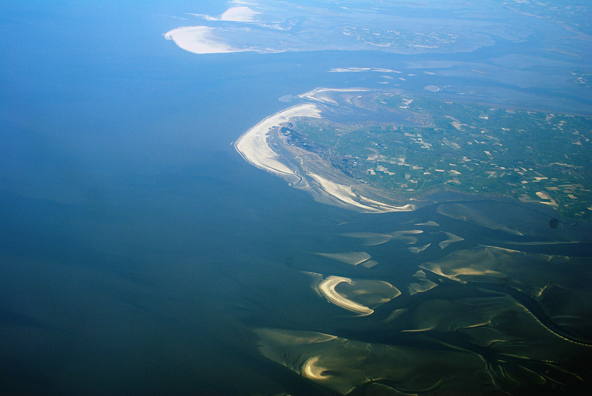
The eastern and western coasts of the North Sea are jagged, formed by glaciers during the ice ages. The coastlines along the southernmost part are covered with the remains of deposited glacial sediment. The Norwegian mountains plunge into the sea creating deep fjords and archipelagos. South of Stavanger, the coast softens, the islands become fewer. The eastern Scottish coast is similar, though less severe than Norway. From north east of England, the cliffs become lower and are composed of less resistant moraine, which erodes more easily, so that the coasts have more rounded contours. In the Netherlands, Belgium and in East Anglia the littoral is low and marshy. The east coast and south-east of the North Sea (Wadden Sea) have coastlines that are mainly sandy and straight owing to longshore drift, particularly along Belgium and Denmark.{{Cite book |access-date = 4 December 2007 |archive-url = https://web.archive.org/web/20070710023601/http://www.ospar.org/eng/doc/pdfs/R2C2.pdf |archive-date = 10 July 2007
Coastal management
The southern coastal areas were originally flood plains and swampy land. In areas especially vulnerable to storm surges, people settled behind elevated levees and on natural areas of high ground such as spits and geestland. As early as 500 BC, people were constructing artificial dwelling hills higher than the prevailing flood levels. It was only around the beginning of the High Middle Ages, in 1200 AD, that inhabitants began to connect single ring dikes into a dike line along the entire coast, thereby turning amphibious regions between the land and the sea into permanent solid ground.{{cite book |orig-date=2002 |access-date=4 December 2008 |archive-date=17 April 2023 |archive-url=https://web.archive.org/web/20230417083652/https://books.google.com/books?id=NACgnCN_jaEC&pg=PA308 |url-status=live
The modern form of the dikes supplemented by overflow and lateral diversion channels, began to appear in the 17th and 18th centuries, built in the Netherlands.{{cite web |access-date = 24 July 2007 |archive-date = 26 June 2007 |archive-url = https://web.archive.org/web/20070626085020/http://www.eh-resources.org/floods.html |url-status = live |access-date = 24 July 2007 |archive-url = https://web.archive.org/web/20070525134637/http://www.allwondersoftheworld.com/seven-modern-wonders/north-sea-protection-works.html |archive-date = 25 May 2007}} Currently, 27% of the Netherlands is below sea level protected by dikes, dunes, and beach flats.{{cite web |access-date = 19 July 2007 |archive-url = https://web.archive.org/web/20090201074700/http://geography.about.com/od/specificplacesofinterest/a/dykes.htm |archive-date = 1 February 2009
Coastal management today consists of several levels.{{cite web |archive-url = https://archive.today/20130102043157/http://www.basf.com/group/corporate/en/content/news-and-media-relations/science-around-us/imperiled-dikes/index |archive-date = 2 January 2013 |access-date = 16 January 2009 |access-date = 16 January 2009 |archive-url = https://web.archive.org/web/20090205005638/http://icce2008.hamburg.baw.de/downloads/intern/Paper/BookOfAbstracts/0863_Peters.pdf |archive-date = 5 February 2009 |access-date = 2 November 2008 |archive-url = https://web.archive.org/web/20081212154705/http://www.snh.org.uk/publications/on-line/heritagemanagement/erosion/appendix_1.2.shtml |archive-date = 12 December 2008
Storm tides
Main article: Storm tides of the North Sea
Storm surges threaten, in particular, the coasts of the Netherlands, Belgium, Germany, and Denmark and low-lying areas of eastern England particularly around The Wash and Fens. Storm surges are caused by changes in barometric pressure combined with strong wind created wave action.{{cite book |chapter-url=https://books.google.com/books?id=0I6BNSgx3_cC&pg=RA1-PA150 |access-date=15 December 2008 |archive-date=17 April 2023 |archive-url=https://web.archive.org/web/20230417083625/https://books.google.com/books?id=0I6BNSgx3_cC&pg=RA1-PA150 |url-status=live
The first recorded storm tide flood was the Julianenflut, on 17 February 1164. In its wake, the Jadebusen, (a bay on the coast of Germany), began to form. A storm tide in 1228 is recorded to have killed more than 100,000 people.{{cite web |access-date = 4 December 2008 |archive-url = https://web.archive.org/web/20081217143715/http://www.emetsoc.org/annual_meetings/documents/Morin_SilverMedalLecture_2008.pdf |archive-date = 17 December 2008 |access-date =4 December 2008 |archive-date =12 May 2011 |archive-url =https://web.archive.org/web/20110512012345/http://translate.google.ca/translate?hl=en&sl=de&u=http://www.g-o.de/dossier-detail-395-8.html&sa=X&oi=translate&resnum=5&ct=result&prev=/search%3Fq%3D1362%2BGroote%2BManndr%25C3%25A4nke%26hl%3Den%26client%3Dfirefox-a%26rls%3Dorg.mozilla:en-GB:official%26sa%3DG |url-status =live In the 20th century, the North Sea flood of 1953 flooded several nations' coasts and cost more than 2,000 lives.{{Cite book |archive-url = https://web.archive.org/web/20021126105045/http://www.naturegrid.org.uk/rivers/gt%20stour%20case%20study-pages/fld-cstl.html |archive-date = 26 November 2002 |access-date = 24 July 2007 315 citizens of Hamburg died in the North Sea flood of 1962.{{cite book |access-date=2 October 2020 |archive-date=17 April 2023 |archive-url=https://web.archive.org/web/20230417083632/https://books.google.com/books?id=m5IOAAAAQAAJ&q=North+Frisian+Flood+of+1981&pg=PA131 |url-status=live
Tsunamis
Though rare, the North Sea has been the site of a number of historically documented tsunamis. The Storegga Slides were a series of underwater landslides, in which a piece of the Norwegian continental shelf slid into the Norwegian Sea. The immense landslips occurred between 8150 BCE and 6000 BCE, and caused a tsunami up to 20 m high that swept through the North Sea, having the greatest effect on Scotland and the Faeroe Islands.{{cite news |access-date = 24 July 2007 |archive-date = 1 November 2007 |archive-url = https://web.archive.org/web/20071101180658/http://www.spiegel.de/international/0,1518,441819,00.html |url-status = live The Dover Straits earthquake of 1580 is among the first recorded earthquakes in the North Sea measuring between 5.6 and 5.9 on the Richter scale. This event caused extensive damage in Calais both through its tremors and possibly triggered a tsunami, though this has never been confirmed. The theory is a vast underwater landslide in the English Channel was triggered by the earthquake, which in turn caused a tsunami. The tsunami triggered by the 1755 Lisbon earthquake reached Holland, although the waves had lost their destructive power. The largest earthquake ever recorded in the United Kingdom was the 1931 Dogger Bank earthquake, which measured 6.1 on the Richter magnitude scale and caused a small tsunami that flooded parts of the British coast.{{Cite book |access-date = 2 November 2008 |archive-url = https://web.archive.org/web/20140425180447/http://www.naturalsciences.be/active/sciencenews/archive2005/tsunami |archive-date = 25 April 2014
In 1995, the 25.6 m tall Draupner wave occurred in the North Sea, becoming the first rogue wave to be observed using scientific instruments.
Geology
Main article: Geology of the North Sea, Geology of southern North Sea
Shallow epicontinental seas like the current North Sea have since long existed on the European continental shelf. The rifting that formed the northern part of the Atlantic Ocean during the Jurassic and Cretaceous periods, from about , caused tectonic uplift in the British Isles.{{cite journal Since then, a shallow sea has almost continuously existed between the uplands of the Fennoscandian Shield and the British Isles. This precursor of the current North Sea has grown and shrunk with the rise and fall of the eustatic sea level during geologic time. Sometimes it was connected with other shallow seas, such as the sea above the Paris Basin to the south-west, the Paratethys Sea to the south-east, or the Tethys Ocean to the south.{{cite web |access-date = 19 November 2008 |archive-date = 22 June 2015 |archive-url = https://web.archive.org/web/20150622010928/http://www.earthdynamics.org/torsvik/torsvik-papers/2002/2002-Torsvik-etal-BATLAS.pdf |url-status = live
During the Late Cretaceous, about , all of modern mainland Europe except for Scandinavia was a scattering of islands. By the Early Oligocene, , the emergence of Western and Central Europe had almost completely separated the North Sea from the Tethys Ocean, which gradually shrank to become the Mediterranean as Southern Europe and South West Asia became dry land.{{cite book |access-date = 1 July 2020 |archive-date = 17 April 2023 |archive-url = https://web.archive.org/web/20230417083625/https://books.google.com/books?id=ZSuuvlMuQaEC&pg=PA66 |url-status = live |access-date = 17 February 2020 |archive-date = 17 April 2023 |archive-url = https://web.archive.org/web/20230417083626/https://books.google.com/books?id=WX2iJQmKTvcC&pg=PA18 |url-status = live
In 2006 a bone fragment was found while drilling for oil in the North Sea. Analysis indicated that it was a Plateosaurus from 199 to 216 million years ago. This was the deepest dinosaur fossil ever found and the first find for Norway.
File:Doggerland.svg|Map showing hypothetical extent of Doggerland (), which provided a land bridge between Great Britain and continental Europe File:North Sea -.jpg|North Sea from De Koog, Texel island File:Mediterranean Rupelian.jpg|The North Sea between and , as Central Europe became dry land
Nature
Fish and shellfish
Copepods and other zooplankton are plentiful in the North Sea. These tiny organisms are crucial elements of the food chain supporting many species of fish. Over 230 species of fish live in the North Sea. Cod, haddock, whiting, saithe, plaice, sole, mackerel, herring, pouting, sprat, and sandeel are all very common and are fished commercially.{{cite web |access-date = 23 June 2013 |archive-date = 25 January 2012 |archive-url = https://web.archive.org/web/20120125104206/http://qsr2010.ospar.org/en/ch12_02.html |url-status = live
Crustaceans are also commonly found throughout the sea. Norway lobster, deep-water prawns, and brown shrimp are all commercially fished, but other species of lobster, shrimp, oyster, mussels and clams all live in the North Sea. Recently non-indigenous species have become established including the Pacific oyster and Atlantic jackknife clam.
Birds
The coasts of the North Sea are home to nature reserves including the Ythan Estuary, Fowlsheugh Nature Preserve, and Farne Islands in the UK and the Wadden Sea National Parks in Denmark, Germany and the Netherlands.{{cite web | access-date = 12 January 2009 | archive-url = https://web.archive.org/web/20090205005633/http://www.marbef.org/outreach/downloads/North%20sea%20pullout.pdf | archive-date = 5 February 2009

Marine mammals
The North Sea is also home to marine mammals. Common seals, grey seals, and harbour porpoises can be found along the coasts, at marine installations, and on islands. The very northern North Sea islands such as the Shetland Islands are occasionally home to a larger variety of pinnipeds including bearded, harp, hooded and ringed seals, and even walrus. North Sea cetaceans include various porpoise, dolphin and whale species.
Flora
Plant species in the North Sea include species of wrack, among them bladder wrack, knotted wrack, and serrated wrack. Algae, macroalgal, and kelp, such as oarweed and laminaria hyperboria, and species of maerl are found as well. Eelgrass, formerly common in the entirety of the Wadden Sea, was nearly wiped out in the 20th century by a disease.{{cite journal Similarly, sea grass used to coat huge tracts of ocean floor, but have been damaged by trawling and dredging have diminished its habitat and prevented its return. Invasive Japanese seaweed has spread along the shores of the sea, clogging harbours and inlets and has become a nuisance.{{cite book |access-date=1 July 2020 |archive-date=17 April 2023 |archive-url=https://web.archive.org/web/20230417083626/https://books.google.com/books?id=gHrXsKJ89rEC&pg=PA432 |url-status=live
Biodiversity and conservation
Due to the heavy human populations and high level of industrialization along its shores, the wildlife of the North Sea has suffered from pollution, overhunting, and overfishing. Flamingos and pelicans were once found along the southern shores of the North Sea, but became extinct over the second millennium.{{cite web |access-date = 24 November 2008 |archive-url = https://wayback.archive-it.org/all/20081217143715/http://www.fmap.ca/ramweb/media/biodiversity_loss/downloads/Examples_regional_extinctions.doc |archive-date = 17 December 2008 Grey whales also resided in the North Sea but were driven to extinction in the Atlantic in the 17th century{{cite web |access-date = 3 December 2008 |archive-url = https://web.archive.org/web/20090104224507/http://www.petermaas.nl/extinct/speciesinfo/atlanticgreywhale.htm |archive-date = 4 January 2009 |access-date = 3 December 2008 |archive-date = 17 April 2023 |archive-url = https://web.archive.org/web/20230417083626/https://www.theguardian.com/environment/2002/mar/21/fish.food |url-status = live |access-date = 3 December 2008 |archive-url = https://web.archive.org/web/20081217143716/http://www.cemagref.fr/english/seven/News/07/25ans/ETsturgeon.pdf |archive-date = 17 December 2008
Other factors like the introduction of non-indigenous species, industrial and agricultural pollution, trawling and dredging, human-induced eutrophication, construction on coastal breeding and feeding grounds, sand and gravel extraction, offshore construction, and heavy shipping traffic have also contributed to the decline. For example, a resident orca pod was lost in the 1960s, presumably due to the peak in PCB pollution in this time period.{{cite news |access-date=17 February 2019 |archive-date=20 February 2019 |archive-url=https://web.archive.org/web/20190220003210/https://www.theguardian.com/environment/2016/jan/14/uks-last-resident-killer-whales-doomed-to-extinction |url-status=live
The OSPAR commission manages the OSPAR convention to counteract the harmful effects of human activity on wildlife in the North Sea, preserve endangered species, and provide environmental protection. |access-date=30 November 2008 |archive-url=https://web.archive.org/web/20090108222855/http://europa.eu/scadplus/leg/en/lvb/l28061.htm |archive-date=8 January 2009 All North Sea border states are signatories of the MARPOL 73/78 Accords, which preserve the marine environment by preventing pollution from ships.{{cite journal | access-date = 12 January 2009 | archive-date = 10 May 2011 | archive-url = https://web.archive.org/web/20110510104253/http://eur-lex.europa.eu/LexUriServ/LexUriServ.do?uri=OJ:L:2000:332:0081:0089:EN:PDF | url-status = live |chapter-url = http://www.snh.org.uk/pdfs/strategy/CMNP/Case%20Study/Wadden%20Sea%20Region%20Final.pdf |access-date = 1 December 2008 |archive-url = https://web.archive.org/web/20081217143713/http://www.snh.org.uk/pdfs/strategy/CMNP/Case%20Study/Wadden%20Sea%20Region%20Final.pdf |archive-date = 17 December 2008
Names
The North Sea has had various names throughout history. One of the earliest recorded names was Septentrionalis Oceanus, or "Northern Ocean", which was cited by Pliny.{{cite book |chapter-url=https://books.google.com/books?id=DMPjAyyz1W4C&pg=PA119 |access-date=8 December 2008 |archive-date=17 April 2023 |archive-url=https://web.archive.org/web/20230417084127/https://books.google.com/books?id=DMPjAyyz1W4C&pg=PA119 |url-status=live |access-date=1 July 2020 |archive-date=17 April 2023 |archive-url=https://web.archive.org/web/20230417084127/https://books.google.com/books?id=npQ6Hd3G4kgC&pg=PA401 |url-status=live
File:Prima Europe tabula.jpg|A 1482 recreation of a map from Ptolemy's Geography showing the "Oceanus Germanicus" File:Solar eclipse 1715May03 Halley map.png|Edmond Halley's solar eclipse 1715 map showing The German Sea File:Geological map Britain William Smith 1815.jpg|William Smith's 1815 geological map of England and Wales showing The German Ocean
History
Main article: History of the North Sea
Early history
The North Sea has provided waterway access for commerce and conquest. Many areas have access to the North Sea because of its long coastline and the European rivers that empty it. There is little documentary evidence concerning the North Sea before the Roman conquest of Britain in 43 CE, however, archaeological evidence reveals the diffusion of cultures and technologies from across or along the North Sea to Great Britain and Scandinavia and reliance by some prehistoric cultures on fishing, whaling, and seaborne trade on the North Sea. The Romans established organised ports in Britain, which increased shipping and began sustained trade and many Scandinavian tribes participated in raids and wars against the Romans and Roman coinage and manufacturing were important trade goods. When the Romans abandoned Britain in 410, the Germanic Angles, Frisians, Saxons, and Jutes began the next great migration across the North Sea during the Migration Period. They made successive invasions of the island from what is now the Netherlands, Denmark, and Germany.{{cite book |access-date=1 July 2020 |archive-date=17 April 2023 |archive-url=https://web.archive.org/web/20230417084206/https://books.google.com/books?id=MThYNoTutLkC&pg=PA49 |url-status=live
The Viking Age began in 793 with the attack on Lindisfarne; for the next quarter-millennium, the Vikings ruled the North Sea. In their superior longships, they raided, traded, and established colonies and outposts along the coasts of the sea. From the Middle Ages through the 15th century, the northern European coastal ports exported domestic goods, dyes, linen, salt, metal goods and wine. The Scandinavian and Baltic areas shipped grain, fish, naval necessities, and timber. In turn, the North Sea countries imported high-grade cloths, spices, and fruits from the Mediterranean region. Commerce during this era was mainly conducted by maritime trade due to underdeveloped roadways.{{cite journal
In the 13th century the Hanseatic League, though centred on the Baltic Sea, started to control most of the trade through important members and outposts on the North Sea.{{cite book |access-date = 1 July 2020 |archive-date = 17 April 2023 |archive-url = https://web.archive.org/web/20230417084139/https://books.google.com/books?id=OzIRDbARyWIC&pg=PA128 |url-status = live |access-date = 1 July 2020 |archive-date = 17 April 2023 |archive-url = https://web.archive.org/web/20230417084129/https://books.google.com/books?id=8qvY8pxVxcwC&pg=PA305 |url-status = live |access-date=1 July 2020 |archive-date=17 April 2023 |archive-url=https://web.archive.org/web/20230417084139/https://books.google.com/books?id=2AAoAAAAYAAJ&pg=RA1-PA539 |url-status=live
Age of sail
The 17th century Dutch Golden Age saw Dutch maritime power at its zenith.{{cite book |access-date=1 July 2020 |archive-date=17 April 2023 |archive-url=https://web.archive.org/web/20230417084129/https://books.google.com/books?id=haiG4P79gysC&pg=PA7 |url-status=live |url-access=registration Important overseas colonies, a vast merchant marine, a large fishing fleet, powerful navy, and sophisticated financial markets made the Dutch the ascendant power in the North Sea, to be challenged by an ambitious England. This rivalry led to the first three Anglo-Dutch Wars between 1652 and 1673, which ended with Dutch victories. After the Glorious Revolution in 1688, the Dutch prince William ascended to the English throne. With unified leadership, commercial, military, and political power began to shift from Amsterdam to London.{{cite book |access-date=1 July 2020 |archive-date=17 April 2023 |archive-url=https://web.archive.org/web/20230417084129/https://books.google.com/books?id=5wlngm9J29kC&pg=PA134 |url-status=live The British did not face a challenge to their dominance of the North Sea until the 20th century.{{cite book |access-date=1 July 2020 |archive-date=17 April 2023 |archive-url=https://web.archive.org/web/20230417084141/https://books.google.com/books?id=TKXn0IQBKCcC&pg=PA183 |url-status=live
Modern era
Tensions in the North Sea were again heightened in 1904 by the Dogger Bank incident. During the Russo-Japanese War, several ships of the Russian Baltic Fleet, which was on its way to the Far East, mistook British fishing boats for Japanese ships and fired on them, and then upon each other, near the Dogger Bank, nearly causing Britain to enter the war on the side of Japan.
During the First World War, Great Britain's Grand Fleet and Germany's Kaiserliche Marine faced each other in the North Sea,{{cite book |access-date=1 July 2020 |archive-date=17 April 2023 |archive-url=https://web.archive.org/web/20230417084134/https://books.google.com/books?id=6hwb6ovvYCcC |url-status=live |orig-date=2005 |access-date=1 July 2020 |archive-date=17 April 2023 |archive-url=https://web.archive.org/web/20230417084141/https://books.google.com/books?id=B1cMtKQP3P8C&pg=RA2-PA836 |url-status=live |access-date=1 July 2020 |archive-date=17 April 2023 |archive-url=https://web.archive.org/web/20230417084132/https://books.google.com/books?id=4IcGeprPmDkC |url-status=live |access-date=1 July 2020 |archive-date=17 April 2023 |archive-url=https://web.archive.org/web/20230417084135/https://books.google.com/books?id=Ka-1eQRnXMUC |url-status=live World War I also brought the first extensive use of submarine warfare, and a number of submarine actions occurred in the North Sea.{{cite book |orig-date=2005 |access-date=2 October 2020 |archive-date=17 April 2023 |archive-url=https://web.archive.org/web/20230417084131/https://books.google.com/books?id=B1cMtKQP3P8C&q=World+War+I:+Encyclopedia |url-status=live
The Second World War also saw action in the North Sea, though it was restricted more to aircraft reconnaissance and action by fighter/bomber aircraft, submarines and smaller vessels such as minesweepers and torpedo boats.
After the war, hundreds of thousands of tons of chemical weapons were disposed of by being dumped in the North Sea.{{cite book |access-date=1 July 2020 |archive-date=17 April 2023 |archive-url=https://web.archive.org/web/20230417084132/https://books.google.com/books?id=TGJ5qp7QrgMC&pg=PA49 |url-status=live
After the war, the North Sea lost much of its military significance because it is bordered only by NATO member-states. However, it gained significant economic importance in the 1960s as the states around the North Sea began full-scale exploitation of its oil and gas resources.It was, incidentally, the home of several Pirate Radio stations from 1960 to 1990. {{cite book |orig-date=1976 |access-date=1 July 2020 |archive-date=17 April 2023 |archive-url=https://web.archive.org/web/20230417084137/https://books.google.com/books?id=9I8OAAAAQAAJ&pg=RA2-PA195 |url-status=live |access-date =11 November 2007 |archive-date =22 October 2007 |archive-url =https://web.archive.org/web/20071022043115/http://www.forthports.co.uk/ports/ |url-status =live
Economy
Political status
Countries that border the North Sea all claim the 12 nmi of territorial waters, within which they have exclusive fishing rights.{{Cite book | access-date = 12 January 2009 | archive-date = 5 February 2009 | archive-url = https://web.archive.org/web/20090205005632/http://www.fig.net/pub/figpub/pub36/chapters/chapter_5.pdf | url-status = live |access-date = 2 November 2008 |archive-date = 14 July 2013 |archive-url = https://web.archive.org/web/20130714182421/http://ec.europa.eu/fisheries/cfp/ |url-status = live
After the discovery of mineral resources in the North Sea during the early 1960s, the Convention on the Continental Shelf established country rights largely divided along the median line. The median line is defined as the line "every point of which is equidistant from the nearest points of the baselines from which the breadth of the territorial sea of each State is measured". The ocean floor border between Germany, the Netherlands, and Denmark was only reapportioned in 1969 after protracted negotiations and a judgment of the International Court of Justice.{{Cite book |access-date=24 July 2007 |archive-date=1 December 2008 |archive-url=https://web.archive.org/web/20081201013509/http://www.icj-cij.org/docket/index.php?p1=3&p2=3&k=cc&case=52&code=cs2&p3=4 |url-status=live
Oil and gas
As early as 1859, oil was discovered in onshore areas around the North Sea and natural gas as early as 1910. Onshore resources, for example the K12-B field in the Netherlands continue to be exploited today.
Offshore test drilling began in 1966 and then, in 1969, Phillips Petroleum Company discovered the Ekofisk oil field{{cite book |chapter-url=https://books.google.com/books?id=TW6yMgPdgbQC&pg=PP1 |access-date=8 December 2008 |archive-date=17 April 2023 |archive-url=https://web.archive.org/web/20230417084132/https://books.google.com/books?id=TW6yMgPdgbQC&pg=PP1 |url-status=live |chapter-url=https://books.google.com/books?id=jZIOAAAAQAAJ&pg=PA73 |access-date=1 July 2020 |archive-date=17 April 2023 |archive-url=https://web.archive.org/web/20230417084136/https://books.google.com/books?id=jZIOAAAAQAAJ&pg=PA73 |url-status=live |access-date = 15 January 2009 |archive-url = https://web.archive.org/web/20061007012331/http://www.total.no/en/About+TOTAL+NORGE/History/Fina/index.aspx |archive-date = 7 October 2006
The exploitation of the North Sea oil reserves began just before the 1973 oil crisis, and the climb of international oil prices made the large investments needed for extraction much more attractive.{{cite book |chapter-url=https://books.google.com/books?id=MfjDlUe8Kc0C&pg=PA102 The start in 1973 of the oil reserves by the UK allowed them to stop the declining position in international trade in 1974, and a huge increase after the discovery and exploitation of the huge oil field by Phillips group in 1977 as the Brae field.
Although the production costs are relatively high, the quality of the oil, the political stability of the region, and the proximity of important markets in western Europe have made the North Sea an important oil-producing region. The largest single humanitarian catastrophe in the North Sea oil industry was the destruction of the offshore oil platform Piper Alpha in 1988 in which 167 people lost their lives.
Besides the Ekofisk oil field, the Statfjord oil field is also notable as it was the cause of the first pipeline to span the Norwegian trench. The largest natural gas field in the North Sea, Troll gas field, lies in the Norwegian trench, dropping over 300 m, requiring the construction of the enormous Troll A platform to access it.
The price of Brent Crude, one of the first types of oil extracted from the North Sea is used today as a standard price for comparison for crude oil from the rest of the world. The North Sea contains western Europe's largest oil and natural gas reserves and is one of the world's key non-OPEC producing regions.{{cite web | access-date = 23 January 2008 | archive-date = 9 March 2009 | archive-url = https://web.archive.org/web/20090309153553/http://www.auburn.edu/~johnspm/gloss/absolute_advantage | url-status = live
In the UK sector of the North Sea, the oil industry invested £14.4 billion in 2013 and was on track to spend £13 billion in 2014. Industry body Oil & Gas UK put the decline down to rising costs, lower production, high tax rates, and less exploration.
In January 2018, The North Sea region contained 184 offshore rigs, which made it the region with the highest number of offshore rigs in the world at the time.
The British North Sea's oil and gas production, peaking in 2000, had declined by 2024, while offshore wind projects like Dogger Bank grew to support renewable energy goals, with windfall taxes funding the transition.
Fishing
Main article: Fishing in the North Sea

The North Sea is Europe's main fishery accounting for over 5% of international commercial fish caught. Fishing in the North Sea is concentrated in the southern part of the coastal waters. The main method of fishing is trawling.{{cite book |access-date=12 January 2009 |archive-date=17 April 2023 |archive-url=https://web.archive.org/web/20230417084702/https://books.google.com/books?id=mtucgF2qOrIC&pg=RA1-PA252 |url-status=live In 1995, the total volume of fish and shellfish caught in the North Sea was approximately 3.5 million tonnes.{{cite web |access-date = 29 November 2008 |archive-url = https://web.archive.org/web/20081202121543/http://www.mumm.ac.be/EN/NorthSea/fishing.php |archive-date = 2 December 2008 |access-date =9 December 2007 |archive-date =9 November 2008 |archive-url =https://web.archive.org/web/20081109062620/http://www.ens-newswire.com/ens/nov2008/2008-11-05-03.asp
In recent decades, overfishing has left many fisheries unproductive, disturbing marine food chain dynamics and costing jobs in the fishing industry. Herring, cod and plaice fisheries may soon face the same plight as mackerel fishing, which ceased in the 1970s due to overfishing.{{cite web |access-date = 2 November 2008 |archive-url = https://web.archive.org/web/20070704031349/http://archive.greenpeace.org/comms/cbio/crisis1.html |archive-date = 4 July 2007 The objective of the European Union Common Fisheries Policy is to minimize the environmental impact associated with resource use by reducing fish discards, increasing the productivity of fisheries, stabilising markets of fisheries and fish processing, and supplying fish at reasonable prices for the consumer.{{Cite book |access-date =19 July 2007 |archive-date =22 March 2008 |archive-url =https://web.archive.org/web/20080322120042/http://www.europarl.europa.eu/facts_2004/4_3_1_en.htm |url-status =live
Whaling
Whaling was an important economic activity from the 9th until the 13th century for Flemish whalers. The medieval Flemish, Basque and Norwegian whalers who were replaced in the 16th century by Dutch, English, Danes, and Germans, took massive numbers of whales and dolphins and nearly depleted the right whales. This activity likely led to the extinction of the Atlantic population of the once common grey whale. By 1902 the whaling had ended. After being absent for 300 years a single grey whale returned in 2010, it probably was the first of many more to find its way through the now ice-free Northwest Passage.
Mineral resources
In addition to oil, gas, and fish, the states along the North Sea also take millions of cubic metres per year of sand and gravel from the ocean floor. These are used for beach nourishment, land reclamation and construction. Rolled pieces of amber may be picked up on the east coast of England.{{cite book |access-date=12 January 2009 |archive-date=17 April 2023 |archive-url=https://web.archive.org/web/20230417084711/https://books.google.com/books?id=g6NVVpqhixIC&pg=PA153 |url-status=live
Renewable energy
Due to the strong prevailing winds, and shallow water, countries on the North Sea, particularly Germany and Denmark, have used the shore for wind power since the 1990s.{{cite book |access-date=12 January 2009 |archive-date=17 April 2023 |archive-url=https://web.archive.org/web/20230417084723/https://books.google.com/books?id=q9r6aYDLwkgC&pg=PA206 |url-status=live
The expansion of offshore wind farms has met with some resistance. Concerns have included shipping collisions{{cite web |access-date = 8 December 2008 |archive-date = 17 December 2008 |archive-url = https://web.archive.org/web/20081217143715/http://www.bmu.bund.de/files/pdfs/allgemein/application/pdf/new_research.pdf |access-date = 16 January 2009 |archive-url = https://web.archive.org/web/20090205005628/http://www.berr.gov.uk/files/file20258.pdf |archive-date = 5 February 2009 There are also concerns about reliability, and the rising costs of constructing and maintaining offshore wind farms.{{cite news |access-date =16 January 2009 |archive-date =1 December 2008 |archive-url =https://web.archive.org/web/20081201140506/http://news.bbc.co.uk/2/hi/business/7391056.stm |url-status =live
Energy production from tidal power is still in a pre-commercial stage. The European Marine Energy Centre has installed a wave testing system at Billia Croo on the Orkney mainland and a tidal power testing station on the nearby island of Eday. Since 2003, a prototype Wave Dragon energy converter has been in operation at Nissum Bredning fjord of northern Denmark.
Tourism

The beaches and coastal waters of the North Sea are destinations for tourists. The English, Belgian, Dutch, German and Danish coasts{{cite book |access-date=27 December 2008 |archive-date=17 April 2023 |archive-url=https://web.archive.org/web/20230417084645/https://books.google.com/books?id=21ikixG655wC&pg=PA139 |url-status=live |access-date=27 December 2008 |archive-date=17 April 2023 |archive-url=https://web.archive.org/web/20230417084645/https://books.google.com/books?id=mxq97WB2aVQC&pg=PA170 |url-status=live
The North Sea Trail is a long-distance trail linking seven countries around the North Sea.{{cite web |access-date = 2 January 2009 |archive-url = https://web.archive.org/web/20160101042324/http://www.northseatrail.org/ |archive-date = 1 January 2016 Windsurfing and sailing{{cite book |access-date=27 December 2008 |archive-date=17 April 2023 |archive-url=https://web.archive.org/web/20230417084645/https://books.google.com/books?id=vNnCnURw2O4C&pg=PA112 |url-status=live |url-access= registration |access-date=27 December 2008 recreational fishing and birdwatching are among other activities.
The climatic conditions on the North Sea coast have been claimed to be healthy. As early as the 19th century, travellers visited the North Sea coast for curative and restorative vacations. The sea air, temperature, wind, water, and sunshine are counted among the beneficial conditions that are said to activate the body's defences, improve circulation, strengthen the immune system, and have healing effects on the skin and the respiratory system.{{Cite book |access-date =2 November 2008 |archive-date =1 December 2008 |archive-url =https://web.archive.org/web/20081201021723/http://www.germany-tourism.de/ENG/destination_germany/master_tlkur-id1252.htm?cc_lang= |url-status =live
The Wadden Sea in Denmark, Germany and the Netherlands is an UNESCO World Heritage Site.
Marine traffic
The North Sea is important for marine transport and its shipping lanes are among the busiest in the world. Major ports are located along its coasts: Rotterdam, the busiest port in Europe and the fourth busiest port in the world by tonnage , Antwerp (was 16th) and Hamburg (was 27th), Bremen/Bremerhaven and Felixstowe, both in the top 30 busiest container seaports, as well as the Port of Bruges-Zeebrugge, Europe's leading ro-ro port.{{cite web |access-date = 28 December 2008 |archive-url = https://web.archive.org/web/20090725000609/http://www.marinetalk.com/articles-marine-companies/com/Port-Authority-Bruges-Zeebrugge-POR069.html |archive-date = 25 July 2009 |url-status = usurped
Fishing boats, service boats for offshore industries, sport and pleasure craft, and merchant ships to and from North Sea ports and Baltic ports must share routes on the North Sea. The Dover Strait alone sees more than 400 commercial vessels a day. Because of this volume, navigation in the North Sea can be difficult in high traffic zones, so ports have established elaborate vessel traffic services to monitor and direct ships into and out of port.{{cite book |access-date=12 January 2009 |archive-date=17 April 2023 |archive-url=https://web.archive.org/web/20230417084646/https://books.google.com/books?id=sGSMw7gCOLYC&pg=PA167 |url-status=live
The North Sea coasts are home to numerous canals and canal systems to facilitate traffic between and among rivers, artificial harbours, and the sea. The Kiel Canal, connecting the North Sea with the Baltic Sea, is the most heavily used artificial seaway in the world reporting an average of 89 ships per day not including sporting boats and other small watercraft in 2009. It saves an average of 250 nmi, instead of the voyage around the Jutland peninsula. The North Sea Canal connects Amsterdam with the North Sea.
Critical Maritime Infrastructure
The North Sea contains a dense concentration of critical maritime infrastructure (CMI). Including offshore and subsea assets that support energy supply, digital communications, and maritime transportation. In terms of research and policy, "critical" generally refers to infrastructure whose disruption could have significant societal and economic effects and therefor attracts heightened attention in risk management and protection planning Which maritime assets are treated as "critical" can vary across sectors and jurisdictions, as designation is partly are policy and administrative choice.
The discovery of the North Sea's physical characteristics has facilitated extensive offshore development. Compared with deep water oceans, the North Sea is relatively shallow, which supports large-scale offshore oil and gas activity. Recently there has also been the expansion of offshore wind and associated cable networks adding to the vastness of critical maritime infrastructure in the North Sea. Alongside fixed offshore installations, the North Sea seabed hosts networks of pipelines, electricity cables, and fiber-optic communications cables within in a maritime area with high levels of port activity and shipping traffic. One regional assessment estimates that the Nort Sea hosts around 71,000 km of active subsea cables (about 5% of the global network), in addition to extensive pipelines and other offshore systems.
Infrastructure
Critical maritime infrastructure in the North Sea includes offshore and subsea assets linked with energy production, transmission, and communications. These infrastructures are often interdependent as offshore production relies on export connections to shore, while maintenance and emergency response depend on ports, specialized vessels, and onshore support basses.
The infrastructure landscape has been described as changing alongside decarbonization and investment policies. Oil and gas activity continues in parts of the North Sea, while late-life operations and decommissioning increase the need for monitoring and seabed management over a longer period of time. At the same time, offshore windfarms have expanded, increasing the number of installations at sea and the complexity of subsea power connections. Additional decarbonization-related developments include producing hydrogen offshore and using depleted oil and gas fields to store CO2 underground. These activities can require new or upgraded infrastructure such as offshore facilities, pipelines, and monitoring systems, which could increase reliance on these assets.
Offshore oil and gas installations
Offshore oil and gas infrastructure are complex installation that is essential for economic production in the North Sea. These installations include fixed and floating platforms as well as processing facilities, drilling units and associated subsea systems. Some installations function as hubs that gather hydrocarbons from multiple fields via subsea connection before exports to shore, supported by logistic chains.
Subsea Pipelines
Subsea pipelines transport oil and gas from offshore fields to onshore terminals and processing plants, and can also connect offshore hubs and nearby fields. Pipeline systems typically include trunk lines and infield flowlines as well as supporting equipment such as valves and monitoring and control systems. Existing pipeline corridors may also be discussed in connection with infrastructure, including potential reuse or adaptation for new purposes.
Offshore wind farms
Offshore wind developments typically include turbine arrays, offshore substation, and export cables that transmit electricity to shore. As projects scale up, associated electrical infrastructure can become more complex, including multiple export connections, onshore reinforcements, and links that support cross-border electricity integration. Construction and maintenance depend on specialised vessels and ports. Operating wind farms requires continuous monitoring, scheduled servicing and repair capacity to manage downtime.
Vulnerabilities and protection
CMI protection is complicated by the distribution of assets across large sea areas and the location of many components on or beneath the seabed. Reviews of CMI protection discuss a wide spectrum of risks such as accidents and technical failures, criminal activity and deliberate interference. It is important to note that planning often spans multiple policy fields such as marine safety, maritime security, and cybersecurity. Persistent monitoring is difficult due to limited visibility below the surface and the scale and technical challenges of surveillance in the maritime domain.
Accidental damage is commonly discussed in relation to dense maritime use and seabed activity. Mapping of cables and pipelines can support safe navigation and reduce risk from anchoring and fishing, but subsea infrastructure mapping may be incomplete or imprecise and can be distributed across multiple databases with limited standardization. Environmental and operational conditions can affect integrity and repair capacity; climate-related factors such as increasing storm intensity are discussed as part of the wider risk environment for offshore assets.
Deliberate disruption is frequently discussed with references to subsea cables and pipelines. It is noted that underwater supply lines are difficult to protect effectively on the sea floor and identifies submarines data and power cables as particularly vulnerable. The same analysis shows that cable damage can be carried out "hidden in common marine traffic" and describes scenarios where relatively common maritime equipment can damage cables if their location is known.
Cybersecurity is also treated as part of CMI protection since offshore installations and electricity networks increasingly rely on digital control and monitoring systems. It is noted that vulnerabilities associated with the digitalisation of maritime energy infrastructure have been reported hacking incidents affecting European wind farms and industrial control environments. More general critical infrastructure protection is framed as risk management in terms of identifying threats and vulnerabilities while evaluating likelihood and consequences, particularly for networked infrastructures where disruption can have cascading effects.
Protection and resilience measures include surveillance and maritime domain awareness as well as redundancy and resilience panning, and improved repair and recovery capacity. Subsea monitoring is technically channeling and resources-intensive needing vast monitoring capabilities as well as coordination between public authorities and private operators. It is also important to integrate diverse policy fields and strengthening public-private coordination, alongside investment in repair capacity and protective measures for maritime space.
International law and jurisdiction are also relevant to CMI protection, as many assets are located beyond territorial waters. It is noted that unauthorised mapping of infrastructure in another states territorial waters is not compatible with innocent passage. While in EEZ, the law of the sea does not provide coastal states with clear authority to prevent foreign vessels from collecting intelligence on maritime infrastructure, creating legal constraints for some preventative measures.
Citations
General and cited references
References
- Helland-Hansen, Bjørn. (1909). "IV. The Basin of the Norwegian Sea.". Geofysisk Institutt.
- (2008). "About the North Sea: Key facts". Safety at Sea project: Norwegian Coastal Administration.
- (14 June 1974). "Limits in the seas: North Sea continental shelf boundaries". United States Government.
- Alan Fyfe. (Autumn 1983). "The Devil's Hole in the North Sea". The Edinburgh Geologist.
- (1953). "Limits of Oceans and Seas, 3rd edition". International Hydrographic Organization.
- The Walde Lighthouse is {{convert. 6. km. 0. 50. 59. 06. N. 1. 55. 00. E. 51. 10. 00. N. 1. 24. 00. E
- (9 September 2009). "North Sea cod 'could disappear' even if fishing outlawed".
- Tide table for Lerwick: [http://www.tide-forecast.com/locations/Lerwick-Shetland-Islands-Scotland/tides/latest tide-forecast] {{Webarchive. link. (26 April 2014)
- Tide table for Aberdeen: [http://www.tide-forecast.com/locations/Aberdeen-Scotland/tides/latest tide-forecast] {{Webarchive. link. (5 August 2014)
- Tide table for North Shields: [http://www.tide-forecast.com/locations/North-Shields-England/tides/latest tide-forecast] {{Webarchive. link. (26 April 2014)
- Tide tables for Kingston upon Hull: [https://www.tideschart.com/United-Kingdom/England/City-of-Kingston-upon-Hull/Hull-(Albert-Dock)/ Tides Chart] {{Webarchive. link. (15 April 2019 and [http://www.tide-forecast.com/locations/Hull-England/tides/latest Tide-Forecast] {{Webarchive). link. (7 March 2014)
- Tide table for Grimsby: [http://www.tide-forecast.com/locations/Grimsby/tides/latest Tide-Forecast] {{Webarchive. link. (7 March 2014)
- Tide tables for Hunstanton: [https://www.tideschart.com/United-Kingdom/England/Norfolk/Hunstanton/ Tideschart] {{Webarchive. link. (12 June 2020)
- "Tide Times and Tide Chart for Harwich". tide-forecast.com.
- "Tide Times and Tide Chart for London". tide-forecast.com.
- Tide tables for Dunkerque: [https://www.tideschart.com/France/Hauts--de--France/Departement-du-Nord/Dunkerque/ Tides Chart] {{Webarchive. link. (15 April 2019 and [http://www.tide-forecast.com/locations/Dunkerque-France/tides/latest tide forecast] {{Webarchive). link. (6 March 2014)
- Tide tables for Zeebrugge: [https://www.tideschart.com/Belgium/Flanders/Provincie-West--Vlaanderen/Zeebrugge/ Tides Chart] {{Webarchive. link. (15 April 2019 and [http://www.tide-forecast.com/locations/Zeebrugge-Belgium/tides/latest tide forecast] {{Webarchive). link. (6 March 2014)
- "Tide Times and Tide Chart for Antwerpen". tide-forecast.com.
- "Tide Times and Tide Chart for Rotterdam". tide-forecast.com.
- Ahnert. F.(2009): Einführung in die Geomorphologie. 4. Auflage. 393 S.
- "Katwijk aan Zee Tide Times & Tide Charts". surf-forecast.com.
- "Tide Times and Tide Chart for Den Helder". tide-forecast.com.
- "Tide Times and Tide Chart for Harlingen". tide-forecast.com.
- "Tide Times and Tide Chart for Borkum". tide-forecast.com.
- "Windfinder.com – Wind, waves, weather & tide forecast Emden".
- "Tide Times and Tide Chart for Wilhelmshaven". tide-forecast.com.
- "Tide Times and Tide Chart for Bremerhaven". tide-forecast.com.
- Guido Gerding. "Gezeitenkalender für Bremen, Oslebshausen, Germany (Tidenkalender) – und viele weitere Orte". gezeiten-kalender.de.
- "Gezeitenvorausberechnung". bsh.de.
- calculated from [[Ludwig Franzius]]: ''Die Korrektion der Unterweser'' (1898). suppl. B IV.: weekly average tide ranges 1879
- telephonical advice by Mrs. Piechotta, head of department of hydrology, Nautic Administration for Bremen ([http://www.wsv.de/wsa-hb/ WSA Bremen] {{Webarchive. link. (27 March 2014 ))
- "Tide Times and Tide Chart for Cuxhaven". tide-forecast.com.
- "Tide Times and Tide Chart for Hamburg". tide-forecast.com.
- "Gezeitenvorausberechnung". bsh.de.
- "Tide Times and Tide Chart for Westerland". tide-forecast.com.
- "Gezeitenvorausberechnung". bsh.de.
- "Tidal tables". dmi.dk.
- "Tide Times and Tide Chart for Esbjerg, Denmark". tide-forecast.com.
- [http://vannstand.no/index.php/nb/english-section/tide-table Vannstand – Norwegian official maritime Information → English version] {{webarchive. link. (29 April 2015)
- "Development of the East Riding Coastline". East Riding of Yorkshire Council.
- "Holderness Coast United Kingdom". EUROSION Case Study.
- Bondevik, Stein. (5 August 2003). "Record-breaking Height for 8000-Year-Old Tsunami in the North Atlantic". Eos, Transactions, American Geophysical Union.
- (27 September 2010). "The last word: Terrors of the sea".
- See Ziegler (1990) or Glennie (1998) for the development of the paleogeography around the North Sea area from the Jurassic onwards
- (June 2008). "The northern sector of the last British Ice Sheet: Maximum extent and demise". [[Earth-Science Reviews]].
- Lindsey, Kyle. (25 April 2006). "Dinosaur of the Deep". Paleontology Blog.
- (2009). "Modelling the direct impact of bottom trawling on the North Sea fish community to derive estimates of fishing mortality for non-target fish species". ICES Journal of Marine Science.
- "Walrus". Ecomare.
- (2 April 2005). "Whales and dolphins in the North Sea 'on the increase'". Newcastle University Press Release.
- (2008). "Effects of Trawling and Dredging on Seafloor Habitat". [[United States National Academy of Sciences.
- "Morimarusa – Ancient Greek (LSJ)".
- [[Hartmann Schedel]] 1493 map ([[:File:Schedelsche Weltchronik d 287.jpg. q.v.]]): Baltic Sea called "Mare Germanicum", North Sea called "Oceanus Germanicus"
- (2009). "'North Sea or German Ocean'? The Anglo-German Cartographic Freemasonry, 1842–1914". Imago Mundi.
- Looijenga, Tineke. (2003). "Texts & Contexts of the Oldest Runic Inscriptions". BRILL.
- Cuyvers, Luc. (1986). "The Strait of Dover". BRILL.
- Frank, Hans. (15 October 2007). "German S-Boats in Action in the Second World War: In the Second World War". Naval Institute Press.
- "Atlantic, WW2, U-boats, convoys, OA, OB, SL, HX, HG, Halifax, RCN ...". Naval-History.net.
- "Text of the UN treaty".
- Glennie, K. W.. (1998). "Petroleum Geology of the North Sea: Basic Concepts and Recent Advances". Blackwell Publishing.
- (6 July 1988). "On This Day 6 July 1988: Piper Alpha oil rig ablaze". BBC.
- "Statpipe Rich Gas". Gassco.
- "North Sea Brent Crude". Investopedia ULC.
- (12 August 2014). "Shell to cut 250 onshore jobs at its Scotland North Sea operations". Yahoo Finance.
- "Number offshore rigs worldwide by region 2018".
- (3 January 2024). "The fall of UK North Sea oil and rise of offshore wind". Reuters.
- Clover, Charles. (2004). "The End of the Line: How overfishing is changing the world and what we eat". Ebury Press.
- "Cetaceans and Belgian whalers, A brief historical review". Belgian whalers.
- (2000). "The North Atlantic grey whale (Escherichtius [sic] robustus): An historical outline based on Icelandic, Danish-Icelandic, English and Swedish sources dating from ca 1000 AD to 1792.". Occasional papers 1. Universities of St Andrews and Stirling, Scotland. 50 p..
- (2011). "Gray whale (Eschrichtius robustus) in the Mediterranean Sea: anomalous event or early sign of climate-driven distribution change?". Marine Biodiversity Records.
- Phua, C.. "Ecological Effects of Sand Extraction in the North Sea". [[University of Porto]].
- [http://www.ewea.org/fileadmin/files/library/publications/statistics/EWEA_OffshoreStats_July2013.pdf The European offshore wind industry -key trends and statistics 1st half 2013 ] {{Webarchive. link. (30 April 2016 EWEA 2013)
- Moss, Joanne "Critical perspectives: North Sea offshore wind farms.: Oral histories, aesthetics and selected legal frameworks relating to the North Sea." (2021) https://uu.diva-portal.org/smash/get/diva2:1611092/FULLTEXT01.pdf {{Webarchive. link. (24 October 2023 Retrieved 2 October 2023)
- [http://www.businessgreen.com/business-green/news/2235062/study-finds-offshore-wind-farms Study finds offshore wind farms can co-exist with marine environment] {{Webarchive. link. (16 September 2009 . Businessgreen.com (26 January 2009). Retrieved on 5 November 2011.)
- [http://www.offshore-sea.org.uk/consultations/Offshore_Energy_SEA/OES_Non_Technical_Summary.pdf Future Leasing for Offshore Wind Farms and Licensing for Offshore Oil & Gas and Gas Storage] {{webarchive. link. (22 May 2009 . UK Offshore Energy Strategic Environmental Assessment. January 2009 (PDF). Retrieved on 5 November 2011.)
- Kaiser, Simone. (20 August 2007). "Wuthering Heights: The Dangers of Wind Power".
- (22 December 2008). "Centrica seeks consent for 500MW North Sea wind farm". New Energy Focus.
- Gow, David. (4 September 2008). "Greenpeace's grid plan: North Sea grid could bring wind power to 70m homes". The Guardian.
- Wynn, Gerard. (15 January 2009). "Analysis – New EU power grids in frame due to gas dispute". Reuters.
- (March 2017). "North Sea Infrastructure". [[TenneT]].
- "Billia Croo Test Site". [[EMEC]].
- "Fall of Warness Test Site". [[EMEC]].
- (2005). "Prototype testing in Denmark". [[Wave Dragon]].
- (24 October 2019). "St. Andrews, Scotland: See the place where golf was born and Will and Kate fell in love". USA Today.
- (2008). "World Port Rankings". [[American Association of Port Authorities]].
- (2007). "The Dover Strait". [[Maritime and Coastguard Agency]].
- "Kiel Canal". Kiel Canal official website.
- "23390-Country Info Booklets Hebridean Spirit The Baltic East". Hebridean Island Cruises.
- (2023). "Critical maritime infrastructure protection: What's the trouble?". Marine Policy.
- Neal, A. W.. (2025). "NATO Science for Peace and Security Series C: Environmental Security". Springer.
- Schaller, Christian. (2024). "Russia's Mapping of Critical Infrastructure in the North and Baltic Seas – International Law as an Impediment to Countering the Threat of Strategic Sabotage?". Nordic Journal of International Law.
- (2011). "Methodologies and applications for critical infrastructure protection: State-of-the-art". Energy Policy.
This article was imported from Wikipedia and is available under the Creative Commons Attribution-ShareAlike 4.0 License. Content has been adapted to SurfDoc format. Original contributors can be found on the article history page.
Ask Mako anything about North Sea — get instant answers, deeper analysis, and related topics.
Research with MakoFree with your Surf account
Create a free account to save articles, ask Mako questions, and organize your research.
Sign up freeThis content may have been generated or modified by AI. CloudSurf Software LLC is not responsible for the accuracy, completeness, or reliability of AI-generated content. Always verify important information from primary sources.
Report