From Surf Wiki (app.surf) — the open knowledge base
Nevada Wilderness Areas
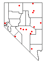
In 1989 the U.S. Government enacted the Nevada Wilderness Bill, expanding the one existing Wilderness Area (Jarbidge) and creating thirteen new areas. The estimated total of 733400 acre was over eleven times the area that had previously been under wilderness protection.
The following Wilderness Areas were expanded or designated in the Humboldt National Forest:
- The Jarbidge Wilderness Area, previously 64667 acre, was expanded to 113167 acre. This area protects wilderness in the higher elevations of the Jarbidge Mountains in far northern Elko County.
- The Currant Mountain Wilderness Area was created, protecting approximately 36000 acre in the upper elevations of the White Pine Range in eastern White Pine County.
- The East Humboldt Wilderness Area was created, protecting approximately 36900 acre in the upper elevations of the East Humboldt Range in central Elko County.
- The Quinn Canyon Wilderness Area was created, protecting approximately 27000 acre in the upper elevations of the Quinn Canyon Range in northeastern Nye County.
- The Ruby Mountains Wilderness Area was created, protecting approximately 90000 acre in the upper elevations of the Ruby Mountains in southern Elko County.
- The Grant Range Wilderness Area was created, protecting approximately 50000 acre in the upper elevations of the Grant Range in northeastern Nye County.
- The Mount Moriah Wilderness Area was created, protecting approximately 82000 acre in the upper elevations of the north section of the Snake Range in eastern White Pine County.
- The Santa Rosa-Paradise Peak Wilderness Area was created, protecting approximately 31000 acre in the upper elevations of the southern section of the Santa Rosa Range in northern Humboldt County.
The following Wilderness Areas were designated in the Toiyabe National Forest:
- The Alta Toquima Wilderness Area was created, protecting approximately 38000 acre in the upper elevations of the Toquima Range in northwestern Nye County.
- The Arc Dome Wilderness Area was created, protecting approximately 115000 acre in the upper elevations of the Toiyabe Range in northwestern Nye County.
- The Mount Rose Wilderness Area was created, protecting approximately 28000 acre in the upper elevations of the Carson Range in southern Washoe County.
- The Mount Charleston Wilderness Area was created, protecting approximately 43000 acre in the upper elevations of the Spring Mountains in western Clark County.
- The Table Mountain Wilderness Area was created, protecting approximately 98000 acre of the Monitor Range in north-central Nye County.
Finally, the Boundary Peak Wilderness was created in the Inyo National Forest, protecting approximately 10000 acre in the northern section of the White Mountains in western Esmeralda County. Additional areas are under consideration for designation as Wilderness Areas - for more information link to the Nevada Wilderness site listed below.
center|thumb|350px|Ruby Mountains Wilderness, Nevada
There are 16 official wilderness areas in Lincoln County that are part of the National Wilderness Preservation System. All are managed by the Bureau of Land Management. Several extend into neighboring counties (as indicated below).
- Big Rocks Wilderness
- Clover Mountains Wilderness
- Delamar Mountains Wilderness
- Far South Egans Wilderness (partly in Nye County, NV)
- Fortification Range Wilderness
- Meadow Valley Range Wilderness (partly in Clark County, NV)
- Mormon Mountains Wilderness (partly in Clark County, NV)
- Mount Grafton Wilderness (mostly in White Pine County, NV)
- Mount Irish Wilderness
- Parsnip Peak Wilderness
- South Egan Range Wilderness (partly in White Pine County, NV; Nye County, NV)
- South Pahroc Range Wilderness
- Tunnel Spring Wilderness
- Weepah Spring Wilderness (partly in Nye County, NV)
- White Rock Range Wilderness
- Worthington Mountains Wilderness
White Pine County is home to a number of designated wilderness areas. They were created on December 20, 2006, by the "White Pine County Conservation, Recreation, and Development Act of 2006." About half are integral parts of Humboldt National Forest. The rest are managed by the Bureau of Land Management. One is shared between the two agencies. Some extend into neighboring counties, as indicated.
- Bald Mountain Wilderness (Humboldt NF)
- Becky Peak Wilderness (BLM)
- Bristlecone Wilderness (BLM)
- Goshute Canyon Wilderness (BLM)
- Government Peak Wilderness (BLM)
- High Schells Wilderness (Humboldt NF)
- Highland Ridge Wilderness (BLM)
- Mount Grafton Wilderness (BLM) partly in Lincoln County, NV
- Mount Moriah Wilderness (Humboldt NF / BLM)
- Red Mountain Wilderness (Humboldt NF) partly in Nye County, NV
- Shellback Wilderness (Humboldt NF)
- South Egan Range Wilderness (BLM) partly in Lincoln County, NV; Nye County, NV
- White Pine Range Wilderness (Humboldt NF)
References
References
- [http://www.wilderness.net/index.cfm?fuse=NWPS&sec=fastFacts Fast facts about America's wilderness] - Wilderness.net
This article was imported from Wikipedia and is available under the Creative Commons Attribution-ShareAlike 4.0 License. Content has been adapted to SurfDoc format. Original contributors can be found on the article history page.
Ask Mako anything about Nevada Wilderness Areas — get instant answers, deeper analysis, and related topics.
Research with MakoFree with your Surf account
Create a free account to save articles, ask Mako questions, and organize your research.
Sign up freeThis content may have been generated or modified by AI. CloudSurf Software LLC is not responsible for the accuracy, completeness, or reliability of AI-generated content. Always verify important information from primary sources.
Report