From Surf Wiki (app.surf) — the open knowledge base
Mourne Mountains
Mountain range in Northern Ireland
Mountain range in Northern Ireland
| Field | Value | |
|---|---|---|
| name | Mourne Mountains | |
| other_name | *Beanna Boirche* | |
| photo | Murlough Beach.jpg | |
| photo_size | 300 | |
| photo_caption | View of the Mournes from Murlough Nature Reserve | |
| country_type | Sovereign state | |
| country | United Kingdom | |
| region_type | Constituent country | |
| region | Northern Ireland | |
| district_type | County | |
| district | County Down | |
| range_coordinates | ||
| highest | Slieve Donard | |
| elevation_m | 850 | |
| length_km | length_orientation = | |
| width_km | width_orientation = | |
| geology | Granite | |
| map | UK Northern Ireland#Island of Ireland |
The Mourne Mountains ( ; ), also called the Mournes or the Mountains of Mourne, are a predominantly granite mountain range in County Down in the south-east of Northern Ireland. They include the highest mountain in all of Ulster, Slieve Donard at 850 m. The Mournes are designated an Area of Outstanding Natural Beauty and it has been proposed to make the area Northern Ireland's first national park. The area is partly owned by the National Trust and sees over 50,000 visitors every year. The Mourne Wall crosses fifteen of the summits and was built to enclose the catchment basin of the Silent Valley and Ben Crom reservoirs. The wall, and the area inside it, are owned by Northern Ireland Water.
Name
The name 'Mourne' is derived from the name of a Gaelic clan or sept called the Múghdhorna. The older name of this mountainous territory was Bairrche, which is likely a collective noun derived from the Irish barr, meaning 'top, peak'. This survives in the Irish name for the mountains, na Beanna Boirche, literally "the peaks of the peak district". It was historically anglicized as 'Bennyborfy'. The name Bairche or Boirche was also personified as the mythical shepherd of the mountains.
Many of the mountains have names beginning "Slieve", from the Irish sliabh, meaning "mountain".
Mountains

On clear days, the Mourne Mountains can be seen from the Isle of Man and Dublin.
| Rank | Name | Irish name | Elevation | Prominence |
|---|---|---|---|---|
| 1 | Slieve Donard | |||
| Highest in Ulster | *Sliabh Dónairt* ("Domhanghart's mountain") | 850 m | 822 m | |
| 2 | Slieve Commedagh | *Sliabh Coimhéideach* ("guarding/watching mountain") | 767 m | 180 m |
| 3 | Slieve Binnian | *Sliabh Binneáin* ("mountain of the little peaks") | 746 m | 282 m |
| 4 | Slieve Bearnagh | *Sliabh Bearnach* ("gapped mountain") | 739 m | 304 m |
| 5 | Slieve Lamagan | *Sliabh Lámhagáin* ("crawling/creeping mountain") | 704 m | 197 m |
| 6 | Slieve Meelbeg | *Sliabh Míol Beag* ("small mountain of the beasts") | 702 m | 193 m |
| 7 | Slieve Meelmore | *Sliabh Míol Mór* ("great mountain of the beasts") | 680 m | 109 m |
| 8 | Slieve Bearnagh North Tor | — | 680 m | 10 m |
| 9 | Slieve Binnian North Top | — | 678 m | 53 m |
| 10 | Slieve Muck | *Sliabh Muc* ("pig mountain") | 670 m | 155 m |
| 11 | Chimney Rock Mtn/Slieve Neir | *Sliabh an Aoire* ("shepherd mountain") | 656 m | 131 m |
| 12 | Cove Mountain | — | 655 m | 100 m |
| 13 | Slieve Corragh | *Sliabh Corrach* ("rugged/pointed mountain") | 640 m | 15 m |
| 14 | Eagle Mountain | *Sliabh an Iolair* ("eagle mountain") | 638 m | 263 m |
| 15 | Shanlieve | *Seanshliabh* ("old mountain") | 626 m | 31 m |
| 16 | Slieve Loughshannagh | *Sliabh Loch Seannach* ("fox lake mountain") | 617 m | 104 m |
| 17 | Slieve Beg | *Sliabh Beag* ("little mountain") | 596 m | 41 m |
| 18 | Doan | *Dún Maol Chobha* ("Maol Cobha's fort") | 593 m | 119 m |
| 19 | Slievenaglogh (Northern) | *Sliabh na gCloch* ("mountain of the stones") | 586 m | 41 m |
| 20 | Carn Mountain | *Sliabh an Chairn* ("mountain of the cairn") | 585 m | 50 m |
| 21 | Finlieve | *Finnshliabh* ("white mountain") | 579 m | 20 m |
| 22 | Slievemoughanmore | — | 560 m | 154 m |
| 23 | Crossone | |||
| (lesser summit of Slieve Donard) | *Cros Eoghain* ("Owen's cross") | 540 m | 12 m | |
| 24 | Pigeon Rock Mtn/Drumlee | *Droim Lao* ("ridge of the calf") | 534 m | 139 m |
| 25 | Ott Mountain | *Ucht* ("mountain-breast") | 527 m | 32 m |
| 26 | Ben Crom | *Binn Chrom* ("stooped/curved peak") | 526 m | 81 m |
| 27 | Rocky Mountain (Eastern) | *Sliabh na gCloch* ("mountain of the stones") | 524 m | 60 m |
| 28 | Spences Mountain | |||
| (lesser summit of Slieve Neir) | — | 515 m | Unknown | |
| 29 | Cock Mountain/Slievahilly | *Sliabh an Choiligh* ("cock mountain") | 504 m | 130 m |
| 30 | Butter Mountain | *Sliabh an Ime* ("butter mountain") | 500 m | 95 m |
| Rank | Name | Irish name | Translation | Height |
|---|---|---|---|---|
| 31 | Slievemartin | Sliabh Mártain | Martin's mountain | 485 m |
| 32 | Spaltha | Unknown | Unknown | 479 m |
| 33 | Thomas Mountain | Unknown | Unknown | 475 m |
| 34 | Tievedockaragh | Taobh Docrach | difficult hillside | 473 m |
| 35 | Spelga | Speilgeach | place of pointed rocks | 472 m |
| 36 | Slievemeen | Sliabh Mín | smooth mountain | 471 m |
| 37 | Pierces Castle | Unknown | Unknown | 465 m |
| 38 | Crenville | Unknown | Unknown | 460 m |
| 39 | Millstone Mountain | Unknown | Unknown | 459 m |
| 40 | Wee Binnian | Broinn Bhinneáin | breast of (Slieve) Binnian | 459 m |
| 41 | Slievenagarragh | Unknown | Unknown | 450 m |
| 42 | Slievenamaddy | Sliabh na Madaidh | dog mountain | 450 m |
| 43 | Altaggart Mountain | Unknown | Unknown | 445 m |
| 44 | Slievenaglogh (Southern) | Sliabh na gCloch | mountain of the stones | 445 m |
| 45 | Slievenamiskan | Sliabh Meascáin | butter lump mountain | 444 m |
| 46 | Slievenabrock | Sliabh na mBroc | badger mountain | 438 m |
| 47 | Hares Gap | Unknown | Unknown | 435 m |
| 48 | Hares Castle | Unknown | Unknown | 430 m |
| 49 | Wee Slievemoughan | Unknown | Unknown | 428 m |
| 50 | Slievedermot | Sliabh Diarmuid | Dermot's mountain | 425 m |
| 51 | Slievemeel | Sliabh Maol | bald mountain | 420 m |
| 52 | Leganabruchan | Unknown | Unknown | 410 m |
| 53 | Craigdoo | Creag Dubh | black rock | 408 m |
| 54 | Rocky Mountain (Western) | Unknown | Unknown | 405 m |
| 55 | Slieve Ban | Sliabh Bán | white mountain | 395 m |
| 56 | Windy Gap | Unknown | Unknown | 395 m |
| 57 | Lukes Mountain | Unknown | Unknown | 391 m |
| 58 | Slievebane | Unknown | Unknown | 390 m |
| 59 | Tornamrock | Torr na mBroc | Torr of the Badgers | 390 m |
| 60 | Slievenamuck | Unknown | Unknown | 390 m |
| 61 | Gruggandoo | Unknown | Unknown | 380 m |
| 62 | Black Stairs | Unknown | Unknown | 370 m |
| 63 | Deers Meadow | Unknown | Unknown | 370 m |
| 64 | Carnadranna | Unknown | Unknown | 365 m |
| 65 | Slieve Roe | Sliabh Ruadh | red mountain | 364 m |
| 66 | Slieve Roosley | Unknown | Unknown | 362 m |
| 67 | Hen Mountain/Slievenakirk | Sliabh na Circe | hen mountain | 360 m |
| 68 | Trainors Rocks | Unknown | Unknown | 360 m |
| 69 | Lugagour | Unknown | Unknown | 360 m |
| 70 | Leckan More | Unknown | Unknown | 355 m |
| 71 | Percy Bysshe | Unknown | Unknown | 355 m |
| 72 | Crannoge | Unknown | Unknown | 350 m |
| 73 | The Fallow | Unknown | Unknown | 350 m |
| 74 | Crotlieve | Crotshliabh | hump-mountain | 347 m |
| 75 | Knockshee | Cnoc Sidhe | fairy hill | 346 m |
| 76 | Long Seefin | Suidhe Finn | Finn's seat | 345 m |
| 77 | Glen Fofanny | Unknown | Unknown | 340 m |
| 78 | Slievenagore | Unknown | Unknown | 335 m |
| 79 | Moolieve | Unknown | Unknown | 332 m |
| 80 | Mullagharve | Unknown | Unknown | 330 m |
| 81 | Slievenaman | Unknown | Unknown | 323 m |
| 82 | Ardglash | Unknown | Unknown | 320 m |
| 83 | Wee Roosley | Unknown | Unknown | 320 m |
| 84 | Slievemageogh | Unknown | Unknown | 316 m |
| 85 | Slievemiskan | Unknown | Unknown | 310 m |
| 86 | Carmeen | Unknown | Unknown | 310 m |
| 87 | Grugganskeagh | Unknown | Unknown | 310 m |
| 88 | Knockchree | Unknown | Unknown | 305 m |
Other features
The below sub-headings detail other features and visitor attractions found in the Mourne Mountains.
The Mourne Wall

The Mourne Wall is a dry stone wall measuring 31.4 km in length that crosses fifteen summits and was constructed to define and protect the 36 km2 catchment area purchased by Belfast Water Commissioners in the late 19th century. This followed a number of Acts of Parliament allowing the sale, and the establishment of a water supply from the Mournes to the growing industrial city of Belfast. Construction of the Mourne Wall was started in 1904 and was completed in 1922.
The Mourne Wall has been a listed building since 1996, and 600 repairs were completed in 2018 by Geda Construction.
Forests
_-_geograph.org.uk_-_830551.jpg)
Tollymore Forest Park is at Bryansford, near the town of Newcastle in the Mourne and Slieve Croob Area of Outstanding Natural Beauty. It covers an area of 630 ha at the foot of the Mourne Mountains and has views of the surrounding mountains and the sea at nearby Newcastle. The Shimna River flows through the park where it is crossed by 16 bridges, the earliest dating to 1726. The river is a spawning ground for salmon and trout and is an Area of Special Scientific Interest for its geology, flora and fauna. The forest has four walking trails signposted by different coloured arrows, the longest being the 8 mi "long haul trail". The Forest Park has been managed by the Forest Service since they purchased it from the Roden Estate in 1941.
Donard Forest is near Newcastle, County Down. It borders Donard Park at the foot of the Mourne Mountains. The Glen River flows through the forest, crossed by three stone bridges.
Rostrevor Forest is near the village of Rostrevor, County Down, between the Mourne Mountains and Carlingford Lough, in the Mourne Area of Outstanding Natural Beauty. The first trees, primarily sitka spruce, douglas fir and pine, were planted in 1931.
Reservoirs

All water reservoirs are owned and maintained by Northern Ireland Water (NIW).
Silent Valley Reservoir is a reservoir in the Mourne Mountains near Kilkeel, County Down. It supplies most of the water for County Down, surrounding counties and most of Belfast via the Aquarius pipeline. The reservoir was built between 1923 and 1933 by a workforce of over one thousand men, nine of whom died during construction. The catchment area is 9,000-acres (3,600 ha / 36 km2).
Ben Crom Reservoir is upstream of Silent Valley in the Kilkeel River valley, and supplies the same areas. It was constructed between 1953 and 1957.
Spelga Reservoir is in the townland of Spelga (Irish: Speilgeach), close to Hilltown, in the North West of the Mourne Mountains. It was formed by construction of Spelga Dam and sits at over 1,200 ft (370 m) above sea level. The dam was constructed between 1953 and 1957, and has a volume of 2,700,000 cubic metres and a catchment area of 1,340-acres (542 ha / 5.423 km2).
Fofanny Dam Reservoir is approximately 2 km north-east of Spelga Dam and is much smaller.
Flora and fauna
Aside from grasses, the most common plants found in the Mournes are heathers and gorse. Of the former, three species are found: cross-leaved heath, bell heather, and common heather. Of the latter, two species are found: common gorse and western gorse. Other plants which grow in the area are: common cottongrass, roseroot, harebell, marsh St John's-wort, wild thyme, wood sorrel and heath spotted orchid.
Sheep graze high into the mountains, and the range is also home to birds, including the raven, peregrine falcon, wren, buzzard, meadow pipit, grey wagtail, stonechat and snipe. The golden eagle, a former inhabitant, has not been seen in the Mournes since 1836.
Recreation
"Discover Northern Ireland", a website operated by Tourism NI, promotes the Mourne Mountains as a popular destination for hiking and taking in views of the surrounding landscape, including local forests and the coastline. The Mournes offer a range of activities for visitors, including hiking, forest and beach walks, cycling and rock climbing, with nearly three-quarters of visitors choosing the Mournes as a place to go walking and hiking.
The Mournes are a popular destination for Duke of Edinburgh's Award expeditions. However, there are also a number of walking challenges which take place in the Mournes. The Mourne Wall challenge, which is also referred to as the 7-peak challenge because it takes into account 7 of the 10 highest Mourne mountains, is advertised by WalkNI. The Mourne six peak challenge is advertised by DiscoverNI and takes hikers up Slieve Donard, Commedagh, Bearnagh, Slieve Binnian, Slieve Meelmore and Slieve Meelbeg across three days of hiking.
Information and statistics on tourism to the Mournes were gathered by TourismNI in 2014. In a survey of leisure visitors, 79% were found to come from Northern Ireland, 15% from elsewhere in the British Isles or Republic of Ireland, and 5–6% were international visitors. Two-thirds of all visitors made a single-day trip rather staying overnight, and party sizes averaged between 3 and 4 people.
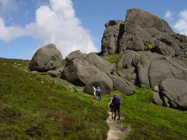
There are many granite cliffs, in the form of outcrops and tors, scattered throughout the range, making the Mournes one of Northern Ireland's major rock-climbing areas since the first recorded ascents in the 1930s. The rockforms are generally quite rounded, thus often requiring cams for protection, but with good friction. The 1998 guidebook lists 26 separate crags, with a total of about 900 routes of all grades.
Conservation
Following a fundraising drive in 1993, the National Trust purchased nearly 1300 acre of land in the Mournes, which included a part of Slieve Donard (at 850 m) and nearby Slieve Commedagh (at 767 m), the second-highest mountain in the area.
It has been proposed that the Mourne Mountains be made Northern Ireland's first national park. The plan has been subject to controversy because of the area's status as private property, with over 1,000 farmers based in the proposed park, and also because of fears over the impact on local communities, bureaucracy and house prices.
Gorse burning


There is a tradition in the Mournes of controlled burning of gorse to clear land for sheep to graze. However, many fires are unmanaged and some become out-of-control wildfires. In the 1950s, Emyr Estyn Evans had written that some shepherds in the Mournes tended to burn gorse and heather recklessly. He said that such over-burning "results in widespread destruction" and, along with other mismanagement, had "greatly impoverished the mountain environment". In the 21st century there have been hundreds of heather and gorse wildfires in the Mournes each year, the vast majority started deliberately, with "farmers and vandals" often blamed. It is claimed many of the wildfires are caused by sheep farmers and landowners carrying out unapproved burning to clear gorse/heather and thus maximize the subsidy payments they receive for the amount of grazing-land they have. Some are also caused by careless visitors.
Under the law, farmers must follow rules when burning gorse and heather: the burning may only be carried out from 1 September until 14 April; they must notify the fire service and have permission to do so; it must be carried out under supervision; and it must be properly controlled with fire breaks.
In April 2021, more than a hundred firefighters tackled a major gorse wildfire in the eastern Mournes, which blazed for three days and devastated habitat in the area. The over-clearing of gorse, heather and trees also heightens the risk of landslides.
Historically, gorse had many uses in the rural economy and hill farmers often cleared gorse by hand.
Wind farm proposal
In 2015, German-owned company ABO Wind applied to build a wind farm at Gruggandoo in the western Mourne Mountains. Its first two applications were turned down, and its revised application is to build eight turbines standing 142 m high, along with a network of access tracks, substations and a control building. The turbines would be among the tallest structures in Ireland. The company claims they could power 37% of homes in the district. There is opposition, as the wind farm would be in an Area of Outstanding Natural Beauty and would impact wildlife and habitats. Local protest group, Mourne AONB Against Windfarms, warn it would open the door for further wind farms to be built in the Mournes and other protected areas. Planning officers for Newry, Mourne and Down District Council deem the wind farm "unacceptable" and recommended the council reject it. In 2020, councillors instead voted to ask for a public inquiry.
Popular culture
The mountains are immortalised in a song written by Percy French in 1896, "The Mountains of Mourne". The song has been recorded by many artists, including Don McLean, and was quoted in Irish group Thin Lizzy's 1979 song "Roisin Dubh (Black Rose): A Rock Legend".
"The Mountains of Mourne" are also mentioned in John Lennon's song "The Luck of the Irish" on the album Some Time in New York City.
The scenery of the Mourne Mountains have also provided the backdrop for a number of productions, most famously HBO's Game of Thrones.
Many local painters have depicted the mountains, including the same Percy French, who immortalized them in song.
The Mourne Mountains also influenced C. S. Lewis to create the mythical world featured in his The Chronicles of Narnia series.
Helicopter crash
On 23 October 2010 an AgustaWestland AW109 (tail number: N2NR) was operating a VFR flight from Enniskillen Airport to Caernarfon Airport, Wales. While en route the helicopter crashed into the western side of Shanlieve, killing all three passengers and crew on board. The cause of the accident was determined to be pilot error in heavy fog.
Notes
References
References
- Pitfield, Mankelow, Cooper, Cameron, Lusty, Shaw, Linley. (2012). "County Down and Belfast: mineral resource map of Northern Ireland.".
- (2015). "Ireland's Range High Points". High Point Ireland.
- (2019). "Mourne Area of Outstanding Natural Beauty". NAAONB.
- Mourne National Park Working Party. (September 2007). "Mourne National Park Working Party Report to Minister".
- (2019). "The Mournes". National Trust.
- "Visit Mourne Mountains".
- Joyce, Patrick. (1869). "The origin and history of Irish names of places".
- "Placenames Database of Ireland". [[Placenames Database of Ireland]].
- Paul Tempan. (May 2019). "Irish Hill and Mountain Names". MountainViews.ie.
- McKay, Patrick. (1999). "A Dictionary of Ulster Place-Names". The Institute of Irish Studies.
- [https://experience.arcgis.com/experience/9b31e0501b744154b4584b1dce1f859b/page/Place-Name-Info/?data_id=dataSource_1-PlaceNames_Gazeteer_No_Global_IDs_3734%3A24072 Place Names NI: Mourne Mountains]
- O'Laverty, James. (1878). "The Barony of Iveagh". An Historical Account of the Diocese of Down and Conor, Ancient and Modern.
- (October 2019). "Slieve definition of slieve by The Free Dictionary". The Free Dictionary.
- (2010). "Mourne Mountains from the Isle of Man". Andy Stephenson.
- "View of Mourne Mountains over Dublin". gettyimages.
- (September 2018). "Irish Highest 100: The highest 100 Irish mountains with a prominence of +100m". Mountainviews.ie.
- Paul Tempan. (February 2012). "Irish Hill and Mountain Names". MountainViews.ie.
- (2014). "MountainViews.ie, a hillwalking resource for Ireland". Mountaineering Ireland (Irish Mountaineering Council).
- Simon Stewart. (2018). "MountainViews Sources and Credits". MountainViews.ie.
- Mountainviews, (September 2013), "A Guide to Ireland's Mountain Summits: The Vandeleur-Lynams & the Arderins", Collins Books, Cork, {{ISBN. 978-1-84889-164-7
- Svetlana Shele. (18 August 2017). "On Terminology: Elevation vs. Altitue vs. Prominence".
- [http://www.placenamesni.org/resultdetails.php?entry=15008 Place Names NI: Finlieve]
- [http://www.placenamesni.org/resultdetails.php?entry=15008 Place Names NI: Crossone]
- [http://www.placenamesni.org/resultdetails.php?entry=14656 Place Names NI: Slievenamaddy]
- [http://www.placenamesni.org/resultdetails.php?entry=14646 Place Names NI: Slievenabrock]
- [http://www.placenamesni.org/resultdetails.php?entry=15074 Place Names NI: Slievedermot]
- [http://www.placenamesni.org/resultdetails.php?entry=14663 Place Names NI: Craigdoo]
- [http://www.placenamesni.org/resultdetails.php?entry=15140 Place Names NI: Slieve Ban]
- [http://www.placenamesni.org/resultdetails.php?entry=14891 Place Names NI: Slieve Roe]
- [http://www.placenamesni.org/resultdetails.php?entry=14745 Place Names NI: Hen Mountain]
- [http://www.placenamesni.org/resultdetails.php?entry=15141 Place Names NI: Knockshee]
- [http://www.placenamesni.org/resultdetails.php?entry=14872 Place Names NI: Long Seefin]
- (18 August 2019). "Mourne Mountain Mythical Measurements (blog post by Kieron Gribbon)".
- The Mourne Mountains. (2010). "The Mourne Wall".
- Belfast Plumbing Services. (1 August 2016). "History of Belfast Water Supply".
- (31 May 2019). "The Mourne Wall – NI Water's very own Wonderwall!". NI Water.
- "Mourne Mountains".
- (2014). "Destination Mournes". TourismNI.
- (February 2011). "Mournes Expedition Area Information". The Duke of Edinburgh.
- (2019). "Mourne Wall Challenge". Outdoor Recreation Northern Ireland.
- (2019). "Mourne six peak challenge". DiscoverNI.
- (2014). "Destination Mournes". TourismNI.
- (2014). "Destination Mournes". TourismNI.
- (2014). "Destination Mournes". TourismNI.
- "Irish Climbing Online Wiki – Co. Down".
- (1998). "Mournes: MCI Guide". Mountaineering Ireland.
- (2015). "The Mountains of Mourne". The Mourne Mountains.
- (25 September 2002). "Minister paves the way for national park in the Mournes". Northern Ireland Planning Service.
- Peterkin, Tom. (29 August 2007). "Mourne Mountains national park status row". The Daily Telegraph.
- Cassidy, Martin. (23 February 2007). "Community split over national park". BBC News.
- (2018). "Response to Northern Ireland Environment Agency consultation on reducing wildfires in the countryside". [[Mountaineering Ireland]].
- (1951). "Mourne Country: Landscape and Life in South Down". Dundalgan Press.
- (30 June 2021). "Mourne Mountains: NIFRS records more than 1,000 wildfires since 2016". [[BBC News]].
- (27 April 2021). "The Irish Times view on mountain fires: an ecological disaster". [[The Irish Times]].
- (28 March 2025). "Malicious fire lighting must stop". [[Department of Agriculture, Environment and Rural Affairs]].
- (25 April 2021). "Slieve Donard: Over 100 firefighters continue to tackle Mournes 'major incident'". BBC News.
- McClements, Freya. (26 April 2021). "Northern Irish fire service believes Mourne Mountain blaze started deliberately". Irish Times.
- (13 May 2017). "The link between gorse fires, farming and a disregard for nature". [[The Irish Times]].
- (5 May 2011). "Gorse fires in Northern Ireland damage environment". [[BBC News]].
- (26 October 2020). "Council to consider Mourne wind turbines taller than London Eye". Belfast Telegraph.
- [https://www.belfasttelegraph.co.uk/news/northern-ireland/nichola-mallon-asked-to-agree-to-inquiry-into-mournes-wind-farm-project-39671470.html "Nichola Mallon asked to agree to inquiry into Mournes wind farm project"]. ''Belfast Telegraph'', 27 October 2020.
- "The Luck of the Irish Lyrics and Guitar Chords". Irish Folk Songs.
- "Game of Thrones Filming & Production".
- (30 May 2007). "Lot :167, The Mountains of Mourne By William Percy French".
- "Percy French Paintings".
- Guardian Staff. (4 December 2005). "Northern Ireland: If you didn't find Narnia in your own wardrobe ...". The Observer.
- Inge, Sopphie. (22 November 2016). "Winter snow blankets Mourne landscape that inspired Narnia as magical CS Lewis square opens in Belfast". belfasttelegraph.
- "Agusta A109A II, N2NR, 23 October 2010".
This article was imported from Wikipedia and is available under the Creative Commons Attribution-ShareAlike 4.0 License. Content has been adapted to SurfDoc format. Original contributors can be found on the article history page.
Ask Mako anything about Mourne Mountains — get instant answers, deeper analysis, and related topics.
Research with MakoFree with your Surf account
Create a free account to save articles, ask Mako questions, and organize your research.
Sign up freeThis content may have been generated or modified by AI. CloudSurf Software LLC is not responsible for the accuracy, completeness, or reliability of AI-generated content. Always verify important information from primary sources.
Report