From Surf Wiki (app.surf) — the open knowledge base
Lop County
| Field | Value |
|---|---|
| name | Lop County |
| native_name | ug-Arab |
| other_name | |
| settlement_type | County |
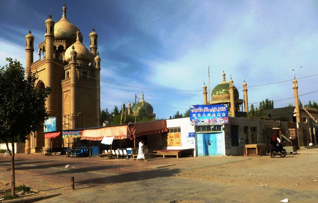
| image_skyline | File:Rawak BLP467 PHOTO1187 2 261.jpg |
| image_caption | Rawak Stupa in the Taklamakan Desert |
| image_map | Location of Lop within Xinjiang (China).png |
| map_caption | Location of Lop County (red) within Hotan Prefecture (yellow) and Xinjiang |
| pushpin_map | China Xinjiang Southern#Xinjiang#China |
| pushpin_label | Lop |
| pushpin_map_caption | Location of the seat in Xinjiang |
| subdivision_type | Country |
| subdivision_name | China |
| subdivision_type1 | Autonomous region |
| subdivision_name1 | Xinjiang |
| subdivision_type2 | Prefecture |
| subdivision_name2 | Hotan |
| seat_type | County seat |
| seat | Lop Town |
| area_total_km2 | 14287 |
| area_footnotes | |
| population_total | 286,900 |
| population_as_of | 2020 |
| population_footnotes | |
| population_density_km2 | auto |
| population_density_urban_km2 | auto |
| demographics_type2 | Ethnic groups |
| demographics2_title1 | Major ethnic groups |
| demographics2_info1 | Uyghur |
| coordinates | |
| timezone | China Standard |
| utc_offset | +8 |
| postal_code_type | Postal code |
| postal_code | 848200 |
| website |
|ibox-order=ug, zh
Lop County (, Uyghur: لوپ ناھىيىسى), also Luopu (from Mandarin Chinese), is a county in Hotan Prefecture, in the southwest of the Xinjiang Uyghur Autonomous Region, China. Almost all the residents of the county are Uyghur and live around oases situated between the desolate Taklamakan Desert and Kunlun Mountains. The county is bordered to the north by Aksu and Awat County in Aksu Prefecture, to the east by Qira/Chira County, to the northwest by Karakax County, to the west by Hotan (Khotan) and to the south and west by Hotan County.
History
Local inhabitants at Sampul cemetery (Shanpula; سامپۇل / ) around 14 km where art such as the Sampul tapestry has been found, buried their dead from roughly 217 BCE to 283 CE. The analysis of mtDNA haplogroup distribution showed that the Sampula inhabitants had a large mixture of East Asian, West-Asian and European characteristics. According to Chengzhi et al. (2007), analysis of maternal mitochondrial DNA of the human remains has revealed genetic affinities at the maternal side to Ossetians and Iranians, an Eastern-Mediterranean paternal lineage.
Archaeologist Aurel Stein visited Rawak Stupa during his First Central Asian expedition in April 1901.
Lop County was established in August 1902.
In May 1956, Abdimit, a Sufi shaykh from Khotan, attempted to incite insurrection in the county which was put down by armed troops and police forces.
The Sampul tapestry was discovered in Sampul in the mid-1980s.
Between August 1986 and May 1987, an outbreak of viral hepatitis occurred in Dol (Duolu) township resulting in 9,371 cases of acute hepatitis and 47 deaths.
In 2004, an official who declined to be identified from the Lop county religious affairs committee told Radio Free Asia that fasting was not allowed during Ramadan, and that high school students in his town would be given candy before they left school at 4:30 p.m.. The official confirmed reports that Chinese authorities were continuing a program of heavy religious control and censorship.
On July 11, 2006, the townships of Jiya and Yurungqash (Yulongkashi), then part of Lop County, were transferred to Hotan City.
According to the World Uyghur Congress and Radio Free Asia, in the lead-up to the 2008 Beijing Olympics, authorities in Lop county forced women to remove head coverings in a stated effort to promote "women for the new era".
On October 21, 2014, Sampul township was re-designated as a town.
At 9 PM on May 11 and 8:15 AM on May 12, 2015, two suicide bombings at a security checkpoint station in the county resulted in six deaths and four injured.
On November 20, 2016, Hanggiya (Hanggui) was changed from a township into a town.
Marriages between Uyghurs and Han Chinese persons are encouraged with subsidies by the government. In October 2017, the marriage of a Han Chinese man from Henan Province to a Uyghur woman from the county was celebrated on the county's social media page.
Hetian Haolin Hair Accessories, a company first registered at the Lop County Beijing Industrial Park (洛浦县北京工业园区) in 2018, employed 5,000 new workers in its first year of business, making 159 international shipments. The Lop County Beijing Industrial Park has been associated with re-education camp photographs.
According to The Guardian, as of early 2019, there were eight internment camps, officially labelled "vocational training centres", in the county.
To increase aid delivery to Xinjiang, places in Xinjiang are paired with other areas of China which can provide aid. Tianjin and Hotan are paired in this program. In July 2019, football equipment and training materials with pictures and videos to local youth players and football coaches were provided for primary school students in the county.
On September 14, 2020, the U.S. Department of Homeland Security blocked imports of products from four entities in Xinjiang including all products made with labor from the Lop County No. 4 Vocational Skills Education and Training Center and hair products made in the Lop County Hair Product Industrial Park.
Geography
The northern part of Lop County is made up of sand dunes and ends in a straight line drawn in the Taklamakan Desert that forms part of the boundary between Hotan Prefecture and Aksu Prefecture. The Hotan River forms the boundary with Karakax County. The National Closed Sandified Land Protected Area is located in Northern Hanggiya Township.
The towns and townships are clustered around the oases around the highways in the southern part of the county.
The southern tip of the county reaches the Kunlun Mountains. At 5466 m above sea level, the highest point in the county is Tekiliktag (Tiekelekeshan, T'ieh-k'o-li-k'o Shan; تەكىلىكتاغ / 铁克勒克山).
File:NJ-44-10 Khotan, China.jpg|Map of the region including Lop (Lo-p'u) (DMA, 1983) File:Txu-oclc-6654394-nj-44-3rd-ed.jpg|Map including Lop (labeled as LO-P'U (LOP BAZAR)) and surrounding region (USATC, 1971) File:Operational Navigation Chart G-7, 6th edition.jpg|Map including Lop (labeled as LOP (LO-P'U)) and surrounding region (DMA, 1980) File:Txu-pclmaps-oclc-22834566 g-7a.jpg|Map including Lop (labeled as Lop (Lo-p'u)) (DMA, 1984)
Climate
|Jan record high C = 21.4 |Jan record low C = -23.9 |Feb record high C = 22.9 |Feb record low C = -23.3 |Mar record high C = 31.1 |Mar record low C = -8.4 |Apr record high C = 36.0 |Apr record low C = -0.2 |May record high C = 37.2 |May record low C = 2.8 |Jun record high C = 40.5 |Jun record low C = 7.9 |Jul record high C = 40.5 |Jul record low C = 10.2 |Aug record high C = 39.3 |Aug record low C = 7.2 |Sep record high C = 35.8 |Sep record low C = 2.6 |Oct record high C = 31.0 |Oct record low C = -4.7 |Nov record high C = 25.0 |Nov record low C = -11.5 |Dec record high C = 18.6 |Dec record low C = -20.1
Administrative divisions
The county includes 1 subdistrict, 4 towns, 5 townships, and 1 other area:
| Name | Simplified Chinese | Hanyu Pinyin | Uyghur (UEY) | Uyghur Latin (ULY) | Administrative division code | Notes | |
|---|---|---|---|---|---|---|---|
| **Subdistrict** | |||||||
| Chengqu Subdistrict | 城区街道 | zh | شەھەر رايونى كوچا باشقارمىسى | ug | 653224001 | ||
| **Towns** | |||||||
| Lop Town | 洛浦镇 | zh | لوپ بازىرى | ug | 653224100 | ||
| Sampul Town | 山普鲁镇 | zh | سامپۇل بازىرى | ug | 653224101 | formerly Sampul Township (山普鲁乡) | |
| Hanggiya Town | 杭桂镇 | zh | ھاڭگىيا بازىرى | ug | 653224102 | formerly Hanggiya Township (杭桂乡) | |
| Charbagh Town | 恰尔巴格镇 | zh | چارباغ بازىرى | ug | 653224103 | formerly Charbagh Township (چارباغ يېزىسى / 恰尔巴格乡) | |
| **Townships** | |||||||
| Buya Township | 布亚乡 | zh | بۇيا يېزىسى | ug | 653224201 | ||
| 32FA882778C03774E0440003BA962ED3 | Dol (Approved - N)}}, United States National Geospatial-Intelligence Agency | 多鲁乡 | zh | دول يېزىسى | ug | 653224205 | |
| 4079295DAB322317E0440003BA962ED3 | Nawa (Approved - N)}}, United States National Geospatial-Intelligence Agency | 纳瓦乡 | zh | ناۋا يېزىسى | ug | 653224206 | |
| Beshtoghraq Township | 拜什托格拉克乡 | zh | بەشتوغراق يېزىسى | ug | 653224207 | ||
| 32FA8864E7803774E0440003BA962ED3 | Aqqik (Approved - N)}}, United States National Geospatial-Intelligence Agency | 阿其克乡 | zh | ئاچچىق يېزىسى | ug | 653224208 |
Other:
- Lop County Beijing Industrial Park (洛浦县北京工业园区)
Economy
The county is known for its silk and carpets. The county's economy is primarily agricultural, producing cotton, wheat, corn and silkworm cocoons. Industries in the county include tractor repair, concrete, carpets, and silk reeling.
, there was about 44,300 acres (293,944 mu) of cultivated land in Lop.
Demographics
|2000|235716 |2010|232916 |}} According to the 2002 census, it had a population of 240,000.
At the end of 2008, 98% of the population of Lop County was Uyghur and 1.9% of the population was Han Chinese.
As of 2015, 282,513 of the 287,590 residents of the county were Uyghur, 4,895 were Han Chinese and 182 were from other ethnic groups.
As of the 2010s, the population of the county, reported as 280,000 by The Guardian, was almost entirely Uyghur.
As of 1999, 98.6% of the population of Lop (Luopu) County was Uyghur and 1.36% of the population was Han Chinese.
In 1952, the population of Lop was 123,608.
Transportation
- China National Highway 217 through the Taklamakan Desert to northern Xinjiang
- China National Highway 315 between Hotan and Qira County
- G3012 Turpan–Hotan Expressway
Notes
References
References
- [http://www.citypopulation.de/en/china/xinjiang/admin/ Xinjiang: Prefectures, Cities, Districts and Counties]
- {{GEOnet2. DB99C42FE8333C34E040D6A415F71A66. Lop (Approved - N), [[National Geospatial-Intelligence Agency. United States National Geospatial-Intelligence Agency]]
- (2016). "Complete Atlas Of The World". [[Penguin Random House]].
- Che Muqi. (1989). "The Silk Road, Past and Present". [[Foreign Languages Press]].
- Jianghua Zhang. (28 January 2019). "Epidemiological investigation of sudden cardiac death in multiethnic Xinjiang Uyghur autonomous region in Northwest China". [[BMC Public Health]].
- (1952). "Lop". Morningside Heights, New York, Columbia University Press, by arrangement with J.B. Lippincott Co..
- "洛浦县政府网 Luopu County Government Network".
- {{GEOnet2. 56E36B72279348D0B2D1BC88E4B7AD3F. Luopu (Approved - N), [[National Geospatial-Intelligence Agency. United States National Geospatial-Intelligence Agency]]
- link. zh. 西以玉龙喀什河为界与和田县、和田市隔河相望,北伸延入塔克拉玛干大沙漠与阿克苏市、阿瓦提县为邻{...}总面积14287平方公里。{...}境内山丘属昆仑支脉,南部最高山为铁克勒克山,海拔5466米。
- Christopoulos, Lucas (August 2012), "Hellenes and Romans in Ancient China (240 BC – 1398 AD)," in Victor H. Mair (ed), ''Sino-Platonic Papers'', No. 230, Chinese Academy of Social Sciences, University of Pennsylvania Department of East Asian Languages and Civilizations, pp 15-16, ISSN 2157-9687.
- Christopoulos, Lucas (August 2012), "Hellenes and Romans in Ancient China (240 BC – 1398 AD)," in Victor H. Mair (ed), ''Sino-Platonic Papers'', No. 230, Chinese Academy of Social Sciences, University of Pennsylvania Department of East Asian Languages and Civilizations, p. 27, ISSN 2157-9687.
- Trading Genes along the Silk Road: mtDNA Sequences and the Origin of Central Asian Populations; David Comas1, 2, *, Francesc Calafell1, 3, *, Eva Mateu1, Anna Pérez-Lezaun1, 4, Elena Bosch1, Rosa Martínez-Arias1, Jordi Clarimon1, Fiorenzo Facchini5, Giovanni Fiori5, Donata Luiselli5, Davide Pettener5 and Jaume Bertranpetit1, The American Journal of Human Genetics, Volume 63, Issue 6, 1824–1838, 1 December 1998 {{doi. 10.1086/302133
- (2007). "Mitochondrial DNA analysis of ancient Sampula population in Xinjiang". Progress in Natural Science.
- Christopoulos, Lucas (August 2012), "Hellenes and Romans in Ancient China (240 BC – 1398 AD)," in Victor H. Mair (ed), ''Sino-Platonic Papers'', No. 230, Chinese Academy of Social Sciences, University of Pennsylvania Department of East Asian Languages and Civilizations, p. 27 & footnote #46, ISSN 2157-9687.
- Livius.org. "[https://www.livius.org/articles/person/roxane/ Roxane]." ''Articles on Ancient History''. Page last modified 17 August 2015. Retrieved on 8 September 2016.
- Strachan, Edward and Roy Bolton (2008), ''Russia and Europe in the Nineteenth Century'', London: Sphinx Fine Art, p. 87, {{ISBN. 978-1-907200-02-1.
- For another publication calling her "Sogdian", see Christopoulos, Lucas (August 2012), "Hellenes and Romans in Ancient China (240 BC – 1398 AD)," in Victor H. Mair (ed), ''Sino-Platonic Papers'', No. 230, Chinese Academy of Social Sciences, University of Pennsylvania Department of East Asian Languages and Civilizations, p. 4, ISSN 2157-9687.
- Holt, Frank L. (1989), ''Alexander the Great and Bactria: the Formation of a Greek Frontier in Central Asia'', Leiden, New York, Copenhagen, Cologne: E. J. Brill, pp 67–8, {{ISBN. 90-04-08612-9.
- Ahmed, S. Z. (2004), ''Chaghatai: the Fabulous Cities and People of the Silk Road'', West Conshokoken: Infinity Publishing, p. 61.
- Magill, Frank N. et al. (1998), ''The Ancient World: Dictionary of World Biography, Volume 1'', Pasadena, Chicago, London,: Fitzroy Dearborn Publishers, Salem Press, p. 1010, {{ISBN. 0-89356-313-7.
- Stein, M. Aurel. (1907). "Ancient Khotan: Detailed report of archaeological explorations in Eastern Turkestan". Clarendon Press.
- Michael Dillon. (2004). "Xinjiang: China's Muslim Far Northwest". [[RoutledgeCurzon]].
- MAJ J.Scott LaRonde. (22 May 2008). "Protracted Counterinsurgency: Chinese COIN Strategy in Xinjiang".
- Wang Mingyi. (22 March 1988). "Science & Technology China". [[Foreign Broadcast Information Service]].
- (15 February 2006). "THE INTERNET IN CHINA: ATOOL FOR FREEDOM OR SUPPRESSION?". [[United States House Committee on Foreign Affairs.
- link. XZQH.org. (2 December 2014). zh-hans. 2006年7月11日,洛浦县吉亚乡、玉龙喀什镇与和田县吐沙拉乡正式划归和田市管辖。
- (25 November 2008). "Authorities Increase Repression in Xinjiang in Lead-up to and During Olympics".
- "Xitay hökümiti hazir xotende ayallarni yüzini échiwétishqa mejburlimaqta".
- Roseanne Gerin, [[Shohret Hoshur]]. (13 May 2015). "Six Dead, Four Injured in Two Successive Suicide Attacks in China's Xinjiang".
- Joshua Lipes, Eset Sulaiman. (28 May 2015). "Chinese Police Shoot Two Uyghurs Dead in Xinjiang Bomb Attack".
- link. (5 December 2016). zh-hans. 2016年11月20日,自治区人民政府同意撤销洛浦县杭桂乡建制,设立杭桂镇,其行政区域界线、政府驻地及隶属关系不变。
- Dake Kang. (1 December 2018). "China's Uighurs told to share beds, meals with party members".
- Juozapas Bagdonas. (16 November 2019). "Tracking Down the Fruits of Xinjiang's Forced Labor Industry".
- (8 July 2019). "Tianjin helping Xinjiang's football development in China".
- (14 September 2020). "DHS Cracks Down on Goods Produced by China's State-Sponsored Forced Labor".
- "Citing Forced Labor Concerns, US Issues Ban on Xinjiang Cotton". The Diplomat.
- {{GEOnet2. 32FA88268BC83774E0440003BA962ED3. Tekiliktag (Approved - N), [[National Geospatial-Intelligence Agency. United States National Geospatial-Intelligence Agency]]
- {{GEOnet2. 4079295DA8E22317E0440003BA962ED3. تەكىلىكتاغ (Variant Non-Roman Script - VS), [[National Geospatial-Intelligence Agency. United States National Geospatial-Intelligence Agency]]
- link. [[China Meteorological Administration]]
- link. XZQH.org. (2 December 2014). zh-hans. 光绪二十八年(1902年8月),析和阗东境玉河以东十五庄,于阗西境乙根兰杆以西二十三庄置洛浦县(《新疆图志·建置一》),仍属和阗直隶州,下设三普拉、阿提良、塔瓦克等三明(大庄)。{...}2000年第五次人口普查,洛浦县常住总人口235716人,{...}2003年,全县总面积14314平方千米,{...}2006年,将洛浦县吉亚乡、玉龙喀什镇划归和田市管辖。2008年末,洛浦县总人口62097户235785人,其中维吾尔族占98%,汉族占1.9%。{...}2010年第六次人口普查,洛浦县常住总人口232916人,其中:城区街道19649人,洛浦镇18127人,布牙乡30257人,山普拉乡29509人,恰尔巴格乡41710人,杭桂乡40496人,多鲁乡32399人,纳瓦乡12961人,拜什托拉格乡6119人,阿其克管理区1486人,良种场203人。 2010年5月25日,自治区政府(新政函[2010]98号)同意设立阿其克乡(前身为阿其克管理区)。2014年10月21日,自治区政府(新政函[2014]192号)同意撤销山普鲁乡,设立山普鲁镇。调整后,全县辖2个镇、7个乡:洛浦镇、山普鲁镇、布亚乡、恰尔巴格乡、杭桂乡、多鲁乡、纳瓦乡、拜什托格拉克乡、阿其克乡。
- link. (13 December 2019). zh-hans. 清光绪二十八年(1902年8月),设置洛浦县。{...}2010年5月25日,自治区政府(新政函[2010]98号)同意设立阿其克乡(前身为阿其克管理区)。2014年10月21日,自治区政府(新政函[2014]192号)同意撤销山普鲁乡,设立山普鲁镇。调整后,全县辖2个镇、7个乡:洛浦镇、山普鲁镇、布亚乡、恰尔巴格乡、杭桂乡、多鲁乡、纳瓦乡、拜什托格拉克乡、阿其克乡。
- link. [[National Bureau of Statistics of the People's Republic of China]]. (2018). zh-hans. 统计用区划代码 名称 653224001000 城区街道办事处 653224100000 洛浦镇 653224101000 山普鲁镇 653224102000 杭桂镇 653224201000 布亚乡 653224203000 恰尔巴格乡 653224205000 多鲁乡 653224206000 纳瓦乡 653224207000 拜什托格拉克乡 653224208000 阿其克乡 653224401000 良种场 653224402000 洛浦县北京农业科技示范园区 653224403000 洛浦县北京工业园区
- {{GEOnet2. 32FA8856C24F3774E0440003BA962ED3. Sampul (Approved - N), [[National Geospatial-Intelligence Agency. United States National Geospatial-Intelligence Agency]]
- (17 September 2020). "Full Text: Employment and Labor Rights in Xinjiang".
- {{GEOnet2. 32FA882778C03774E0440003BA962ED3. Dol (Approved - N), [[National Geospatial-Intelligence Agency. United States National Geospatial-Intelligence Agency]]
- (2003). Xie Yuzhong. [[:zh:新疆人民出版社. 新疆人民出版社]]. zh-hans. 杭桂 Hanggiya {...}
{{lang. zh-hans. 多鲁 Dol {...}
{{lang. zh-hans. 山普鲁 Sampul {...} - {{GEOnet2. 4079295DAB322317E0440003BA962ED3. دول (Variant Non-Roman Script - VS), [[National Geospatial-Intelligence Agency. United States National Geospatial-Intelligence Agency]]
- {{GEOnet2. 4079295DAB322317E0440003BA962ED3. Nawa (Approved - N), [[National Geospatial-Intelligence Agency. United States National Geospatial-Intelligence Agency]]
- {{GEOnet2. 4079295DAB322317E0440003BA962ED3. ناۋا (Variant Non-Roman Script - VS), [[National Geospatial-Intelligence Agency. United States National Geospatial-Intelligence Agency]]
- {{GEOnet2. 32FA8864E7803774E0440003BA962ED3. Aqqik (Approved - N), [[National Geospatial-Intelligence Agency. United States National Geospatial-Intelligence Agency]]
- {{GEOnet2. 4079295DA3222317E0440003BA962ED3. ئاچچىق (Variant Non-Roman Script - VS), [[National Geospatial-Intelligence Agency. United States National Geospatial-Intelligence Agency]]
- (September 2009). 上海辞书出版社. [[Shanghai Lexicographical Publishing House]].. zh-hans. 昆仑山北麓、玉龙喀什河沿岸。{...}面积1.43万平方千米。{...}1902年(清光绪二十八年)设县。经济以农业为主,产棉花、小麦、玉米和蚕茧。工业有农机修造、水泥、地毯、缫丝等。以产丝绸、地毯著名。
- Herold J. Wiens. (November 1966). "Cultivation Development and Expansion in China's Colonial Realm in Central Asia". [[The Journal of Asian Studies]].
- link. Xinjiang Uyghur Autonomous Region Bureau of Statistics
- Lily Kuo. (11 January 2019). "'If you enter a camp, you never come out': inside China's war on Islam".
- (2004). "Governing China's Multiethnic Frontiers". [[University of Washington Press]].
- (1952). "The Columbia Lippincott Gazetteer of the World". [[Columbia University Press]].
This article was imported from Wikipedia and is available under the Creative Commons Attribution-ShareAlike 4.0 License. Content has been adapted to SurfDoc format. Original contributors can be found on the article history page.
Ask Mako anything about Lop County — get instant answers, deeper analysis, and related topics.
Research with MakoFree with your Surf account
Create a free account to save articles, ask Mako questions, and organize your research.
Sign up freeThis content may have been generated or modified by AI. CloudSurf Software LLC is not responsible for the accuracy, completeness, or reliability of AI-generated content. Always verify important information from primary sources.
Report