From Surf Wiki (app.surf) — the open knowledge base
List of United States congressional districts
None
None
--
Congressional districts in the United States are electoral divisions for the purpose of electing members of the United States House of Representatives. The number of voting seats within the House of Representatives is currently set at 435, with each one representing an average of 761,169 people following the 2020 United States census. The number of voting seats has applied since 1913, excluding a temporary increase to 437 after the admissions of Alaska and Hawaii. The total number of state members is capped by the Reapportionment Act of 1929. In addition, each of the five inhabited U.S. territories and the federal district of Washington, D.C., sends a non-voting delegate to the House of Representatives.
The Bureau of the Census conducts a constitutionally mandated decennial census whose figures are used to determine the number of congressional districts to which each state is entitled, in a process called "apportionment". The 2022 elections were the first to be based on the congressional districts which were defined based on the 2020 United States census.
Each state is responsible for the redistricting of districts within their state, while several states have one "at-large" division (Alaska, Delaware, North Dakota, South Dakota, Vermont, and Wyoming). Redistricting must take place if the number of members changes following a re-apportionment, or may take place at any other time if demographics represented in a district have changed substantially. Setting the boundaries of states' congressional districts is the responsibility of state governments, who often gerrymander districts for various reasons. Districts may sometimes retain the same boundaries, while changing their district numbers.
Each congressional district is expected to be equal in population to all other congressional districts in a state. The boundaries and numbers shown for the congressional districts are established by their respective state's constitution or court orders in the apportionment and redistricting cycle.
Delimitation
Many other nations assign independent bodies to oversee and mandate the delimitation of boundaries; however, in some nations the legislature manages this process. In the United States, legislatures play a commanding role in the redistricting (as delimitation is referred to in the United States) of congressional districts. The redrawing of boundaries occurs after the decennial census; single-member constituencies are responsible for the election of the legislators that govern this process. In 25 states the state legislature is responsible for creating the redistricting plan, but six states (Alaska, Delaware, North Dakota, South Dakota, Vermont and Wyoming) do not require redistricting for the House of Representatives and instead elect a single representative for the entire state. Each state has its own constitution and laws surrounding the redistricting process, and most of the modern criteria applied federally have come about through rulings by the U.S. Supreme Court.
Prior to 1962, there was limited federal and state government regulation on redistricting, and these were rarely enforced. However, after the Baker v. Carr (1962) decision redistricting became justiciable and courts became an active participant in the redistricting process of congressional districts as the decision allowed voters to challenge redistricting plans. Since Shaw v. Reno (1993) and Abrams v. Johnson (1997), the courts have invalidated numerous congressional redistricting plans upon the basis of traditional districting principles. These decisions have been surrounded in controversy as the Supreme Court has not identified these 'traditional' criteria explicitly, resulting in the major political parties attempting to abuse the lack of legislation and definition to advantage their respective parties. According to the database of redistricting laws in all fifty states and previous court decisions, the de facto principles are: compactness, contiguity, equal population, and preserving county and city boundaries.
Extremes
Population
- Average population: 761,169 people based on 2020 U.S. census. It was 708,377 in 2010.
- State with the most people in the average district: Delaware (989,948). In 2010, Montana: 994,416.
- State with the fewest people in the average district: Montana (542,113). In 2010, Rhode Island: 527,624.
- District with the most people: (989,948). In 2010, : 994,416.
- District with the fewest people: (545,085). In 2010, also : 526,283.
Area
- District with the greatest area: , same as in 2010.
- District with the greatest area that comprises less than an entire state: . In 2010: .
- District with the smallest area: . In 2010: .
Oldest district
- , same geographical borders since 1789.
Cook Partisan Voting Index
- District with the highest Cook PVI score for the Democratic Party:
- District with the highest Cook PVI score for the Republican Party:
List of districts by area and population
The following is a complete list of the 435 current congressional districts for the House of Representatives, and over 200 obsolete districts, and the six current and one obsolete non-voting delegations. The list includes the 435 voting districts of the 119th United States Congress, effective from 2025 to 2027.
| Rank | ||||
|---|---|---|---|---|
| District | Land area | |||
| (mi2) | Land area | |||
| (km2) | Population | |||
| 1 | Alaska at-large | 571,241.61 | 1,479,508.97 | 740,133 |
| 2 | Montana 2 | 105,382.55 | 272,939.56 | 558,158 |
| 3 | Wyoming at-large | 97,088.55 | 251,458.19 | 587,618 |
| 4 | South Dakota at-large | 75,807.94 | 196,341.67 | 924,669 |
| 5 | Oregon 2 | 72,158.83 | 186,890.52 | 704,768 |
| 6 | Nebraska 3 | 69,613.74 | 180,298.76 | 649,934 |
| 7 | North Dakota at-large | 68,994.26 | 178,694.32 | 796,568 |
| 8 | Nevada 2 | 65,065.49 | 168,518.85 | 802,677 |
| 9 | Texas 23 | 58,788.47 | 152,261.44 | 806,011 |
| 10 | Arizona 2 | 58,353.74 | 151,135.50 | 853,923 |
| 11 | New Mexico 3 | 52,316.48 | 135,499.06 | 708,684 |
| 12 | New Mexico 2 | 51,426.16 | 133,193.13 | 710,491 |
| 13 | Colorado 3 | 49,950.41 | 129,370.97 | 742,698 |
| 14 | Kansas 1 | 49,634.61 | 128,553.04 | 731,386 |
| 15 | Idaho 2 | 43,245.56 | 112,005.50 | 967,957 |
| 16 | Nevada 4 | 41,790.41 | 108,236.67 | 833,125 |
| 17 | Montana 1 | 40,167.69 | 104,033.84 | 579,075 |
| 18 | Idaho 1 | 39,399.80 | 102,045.01 | 1,033,662 |
| 19 | Utah 2 | 39,218.27 | 101,574.85 | 880,783 |
| 20 | Texas 13 | 35,104.57 | 90,920.42 | 799,858 |
| 21 | Oklahoma 3 | 32,613.10 | 84,467.53 | 797,016 |
| 22 | Colorado 4 | 32,138.01 | 83,237.06 | 789,599 |
| 23 | Minnesota 8 | 31,239.65 | 80,910.32 | 727,411 |
| 24 | Minnesota 7 | 31,039.41 | 80,391.69 | 722,392 |
| 25 | Texas 19 | 30,169.59 | 78,138.89 | 787,118 |
| 26 | Utah 3 | 28,715.22 | 74,372.07 | 830,117 |
| 27 | Maine 2 | 27,548.04 | 71,349.09 | 697,280 |
| 28 | Michigan 1 | 26,920.07 | 69,722.66 | 787,617 |
| 29 | California 1 | 26,393.41 | 68,358.62 | 759,259 |
| 30 | Arizona 9 | 23,229.33 | 60,163.69 | 915,903 |
| 31 | Wisconsin 7 | 23,110.54 | 59,856.02 | 754,076 |
| 32 | Arkansas 4 | 22,676.60 | 58,732.14 | 744,382 |
| 33 | California 3 | 21,666.74 | 56,116.60 | 807,351 |
| 34 | Oklahoma 2 | 21,630.58 | 56,022.95 | 815,354 |
| 35 | Iowa 4 | 21,433.05 | 55,511.35 | 801,546 |
| 36 | Missouri 6 | 20,254.59 | 52,459.15 | 788,896 |
| 37 | Arkansas 1 | 19,849.09 | 51,408.90 | 754,656 |
| 38 | Texas 11 | 19,205.73 | 49,742.61 | 802,030 |
| 39 | Washington 5 | 18,711.90 | 48,463.59 | 801,690 |
| 40 | Missouri 8 | 18,315.28 | 47,436.36 | 776,269 |
| 41 | Mississippi 2 | 17,996.03 | 46,609.52 | 694,703 |
| 42 | California 23 | 17,966.66 | 46,533.43 | 758,179 |
| 43 | Washington 4 | 17,885.49 | 46,323.19 | 794,949 |
| 44 | New Mexico 1 | 17,570.09 | 45,506.33 | 711,081 |
| 45 | Illinois 15 | 16,752.80 | 43,389.55 | 739,197 |
| 46 | New York 21 | 16,288.85 | 42,187.94 | 767,674 |
| 47 | Arizona 7 | 15,417.65 | 39,931.54 | 813,289 |
| 48 | Kansas 2 | 15,298.46 | 39,622.83 | 739,248 |
| 49 | Louisiana 4 | 14,603.32 | 37,822.42 | 767,466 |
| 50 | Kansas 4 | 14,563.96 | 37,720.49 | 745,885 |
| 51 | Missouri 4 | 14,355.14 | 37,179.63 | 784,156 |
| 52 | West Virginia 1 | 14,340.14 | 37,140.79 | 861,893 |
| 53 | Illinois 12 | 14,015.96 | 36,301.17 | 745,901 |
| 54 | Arizona 6 | 13,691.88 | 35,461.79 | 833,838 |
| 55 | California 2 | 13,038.54 | 33,769.65 | 752,654 |
| 56 | Pennsylvania 15 | 12,982.18 | 33,623.68 | 758,111 |
| 57 | Iowa 2 | 12,902.70 | 33,417.83 | 797,329 |
| 58 | Minnesota 1 | 12,238.15 | 31,696.67 | 718,116 |
| 59 | California 25 | 11,955.87 | 30,965.57 | 792,416 |
| 60 | Kentucky 5 | 11,748.97 | 30,429.69 | 736,508 |
| 61 | Mississippi 3 | 11,722.42 | 30,360.94 | 734,735 |
| 62 | Oregon 4 | 11,613.07 | 30,077.72 | 712,690 |
| 63 | Kentucky 1 | 11,499.40 | 29,783.31 | 759,138 |
| 64 | Colorado 2 | 11,445.07 | 29,642.60 | 728,333 |
| 65 | Texas 28 | 11,357.29 | 29,415.25 | 825,116 |
| 66 | Wisconsin 3 | 11,227.74 | 29,079.72 | 740,873 |
| 67 | Georgia 8 | 10,928.22 | 28,303.96 | 787,897 |
| 68 | Iowa 1 | 10,844.57 | 28,087.31 | 804,704 |
| 69 | Iowa 3 | 10,673.35 | 27,643.86 | 837,909 |
| 70 | Louisiana 5 | 10,456.54 | 27,082.31 | 763,961 |
| 71 | Texas 17 | 10,437.15 | 27,032.09 | 798,340 |
| 72 | Texas 27 | 10,428.06 | 27,008.56 | 793,985 |
| 73 | Alabama 7 | 10,274.64 | 26,611.19 | 718,912 |
| 74 | Utah 1 | 10,271.32 | 26,602.61 | 871,848 |
| 75 | Virginia 9 | 10,070.55 | 26,082.60 | 782,270 |
| 76 | Georgia 2 | 9,953.18 | 25,778.63 | 757,227 |
| 77 | Mississippi 1 | 9,942.04 | 25,749.77 | 753,783 |
| 78 | Florida 2 | 9,853.83 | 25,521.31 | 819,004 |
| 79 | Washington 8 | 9,827.75 | 25,453.76 | 794,910 |
| 80 | California 5 | 9,807.72 | 25,401.89 | 772,810 |
| 81 | Oklahoma 4 | 9,733.71 | 25,210.18 | 819,271 |
| 82 | Michigan 2 | 9,704.77 | 25,135.24 | 788,872 |
| 83 | West Virginia 2 | 9,701.10 | 25,125.73 | 908,086 |
| 84 | California 20 | 9,672.81 | 25,052.46 | 816,324 |
| 85 | Georgia 12 | 9,632.95 | 24,949.22 | 786,415 |
| 86 | Alabama 2 | 9,465.03 | 24,514.32 | 703,362 |
| 87 | Texas 1 | 9,464.63 | 24,513.29 | 795,955 |
| 88 | Virginia 5 | 9,464.11 | 24,511.93 | 805,334 |
| 89 | Tennessee 8 | 9,226.41 | 23,896.29 | 774,995 |
| 90 | Vermont at-large | 9,217.26 | 23,872.59 | 648,493 |
| 91 | Texas 25 | 8,994.96 | 23,296.84 | 826,421 |
| 92 | Illinois 16 | 8,914.43 | 23,088.27 | 752,764 |
| 93 | Alabama 4 | 8,630.11 | 22,351.89 | 735,310 |
| 94 | North Carolina 1 | 8,342.08 | 21,605.90 | 753,478 |
| 95 | New York 19 | 8,225.38 | 21,303.64 | 776,282 |
| 96 | Indiana 8 | 8,096.08 | 20,968.75 | 758,402 |
| 97 | Texas 10 | 7,667.75 | 19,859.38 | 832,921 |
| 98 | Louisiana 3 | 7,625.36 | 19,749.60 | 777,847 |
| 99 | Missouri 3 | 7,584.79 | 19,644.52 | 799,877 |
| 100 | Ohio 2 | 7,383.46 | 19,123.06 | 790,454 |
| 101 | Georgia 1 | 7,360.10 | 19,062.57 | 806,580 |
| 102 | Florida 3 | 7,321.91 | 18,963.66 | 845,635 |
| 103 | Washington 3 | 7,309.49 | 18,931.50 | 802,855 |
| 104 | Kentucky 2 | 7,291.99 | 18,886.16 | 775,395 |
| 105 | Mississippi 4 | 7,264.08 | 18,813.89 | 759,824 |
| 106 | Alabama 1 | 7,240.75 | 18,753.46 | 760,389 |
| 107 | Colorado 7 | 7,161.21 | 18,547.45 | 728,241 |
| 108 | New York 24 | 7,088.57 | 18,359.31 | 772,889 |
| 109 | Washington 6 | 6,956.61 | 18,017.54 | 799,758 |
| 110 | South Carolina 6 | 6,926.08 | 17,938.45 | 762,934 |
| 111 | North Carolina 3 | 6,850.07 | 17,741.59 | 775,182 |
| 112 | New Hampshire 2 | 6,810.15 | 17,638.22 | 700,189 |
| 113 | Alabama 3 | 6,690.22 | 17,327.58 | 737,665 |
| 114 | Wisconsin 8 | 6,680.87 | 17,303.37 | 747,225 |
| 115 | Tennessee 4 | 6,473.25 | 16,765.63 | 826,508 |
| 116 | New York 23 | 6,458.25 | 16,726.78 | 773,707 |
| 117 | Florida 18 | 6,449.60 | 16,704.38 | 875,428 |
| 118 | Pennsylvania 13 | 6,362.38 | 16,478.49 | 769,505 |
| 119 | Texas 21 | 6,297.31 | 16,309.95 | 846,025 |
| 120 | California 13 | 6,292.60 | 16,297.75 | 790,923 |
| 121 | Virginia 6 | 6,264.60 | 16,225.23 | 797,837 |
| 122 | North Carolina 11 | 6,242.65 | 16,168.40 | 770,851 |
| 123 | Texas 15 | 6,230.46 | 16,136.81 | 812,527 |
| 124 | Hawaii 2 | 6,219.49 | 16,108.40 | 727,086 |
| 125 | Indiana 4 | 6,096.60 | 15,790.13 | 789,018 |
| 126 | Pennsylvania 9 | 6,073.27 | 15,729.69 | 770,915 |
| 127 | Indiana 9 | 6,037.01 | 15,635.78 | 764,291 |
| 128 | Nebraska 1 | 5,982.30 | 15,494.09 | 672,915 |
| 129 | Texas 36 | 5,944.78 | 15,396.91 | 816,162 |
| 130 | Tennessee 6 | 5,919.07 | 15,330.32 | 803,181 |
| 131 | Tennessee 7 | 5,891.32 | 15,258.45 | 816,216 |
| 132 | Texas 6 | 5,858.52 | 15,173.49 | 848,575 |
| 133 | Missouri 7 | 5,775.52 | 14,958.52 | 803,037 |
| 134 | South Carolina 3 | 5,633.91 | 14,591.76 | 766,747 |
| 135 | Texas 31 | 5,612.90 | 14,537.36 | 901,458 |
| 136 | Oregon 5 | 5,591.62 | 14,482.23 | 717,312 |
| 137 | Ohio 12 | 5,580.81 | 14,454.22 | 812,727 |
| 138 | Ohio 5 | 5,528.22 | 14,318.02 | 796,997 |
| 139 | South Carolina 7 | 5,407.67 | 14,005.81 | 794,163 |
| 140 | Arkansas 2 | 5,301.54 | 13,730.93 | 773,214 |
| 141 | Michigan 5 | 5,233.18 | 13,553.87 | 775,260 |
| 142 | Georgia 10 | 5,204.81 | 13,480.39 | 835,755 |
| 143 | Texas 4 | 5,201.82 | 13,472.66 | 874,662 |
| 144 | South Carolina 5 | 5,160.49 | 13,365.62 | 782,718 |
| 145 | Wisconsin 6 | 5,030.60 | 13,029.20 | 743,039 |
| 146 | California 24 | 4,886.14 | 12,655.03 | 756,496 |
| 147 | Ohio 4 | 4,879.90 | 12,638.89 | 810,105 |
| 148 | Louisiana 6 | 4,869.79 | 12,612.70 | 753,643 |
| 149 | Kentucky 4 | 4,844.51 | 12,547.21 | 776,082 |
| 150 | North Carolina 7 | 4,841.79 | 12,540.17 | 805,748 |
| 151 | Ohio 6 | 4,779.15 | 12,377.95 | 775,304 |
| 152 | Pennsylvania 14 | 4,774.73 | 12,366.50 | 752,379 |
| 153 | Michigan 9 | 4,638.21 | 12,012.91 | 782,471 |
| 154 | California 18 | 4,572.91 | 11,843.79 | 766,286 |
| 155 | Illinois 17 | 4,481.92 | 11,608.12 | 743,507 |
| 156 | Alabama 6 | 4,448.50 | 11,521.57 | 728,184 |
| 157 | Washington 2 | 4,404.09 | 11,406.54 | 789,531 |
| 158 | Utah 4 | 4,390.89 | 11,372.35 | 920,865 |
| 159 | Indiana 3 | 4,390.44 | 11,371.18 | 774,688 |
| 160 | Tennessee 1 | 4,354.28 | 11,277.53 | 797,902 |
| 161 | Indiana 2 | 4,349.54 | 11,265.25 | 751,821 |
| 162 | California 22 | 4,313.07 | 11,170.80 | 770,684 |
| 163 | Wisconsin 2 | 4,300.90 | 11,139.29 | 763,361 |
| 164 | North Carolina 5 | 4,201.04 | 10,880.63 | 755,224 |
| 165 | Georgia 3 | 4,166.22 | 10,790.46 | 799,818 |
| 166 | Arkansas 3 | 4,164.71 | 10,786.55 | 816,102 |
| 167 | Texas 34 | 4,121.86 | 10,675.56 | 796,178 |
| 168 | Tennessee 3 | 3,956.32 | 10,246.81 | 809,872 |
| 169 | Illinois 2 | 3,916.79 | 10,144.45 | 732,352 |
| 170 | Alabama 5 | 3,901.77 | 10,105.55 | 773,877 |
| 171 | Maryland 1 | 3,866.41 | 10,013.95 | 791,864 |
| 172 | Pennsylvania 16 | 3,840.90 | 9,947.90 | 758,988 |
| 173 | Kentucky 6 | 3,792.81 | 9,823.32 | 777,299 |
| 174 | California 4 | 3,780.05 | 9,790.27 | 760,875 |
| 175 | North Carolina 8 | 3,725.02 | 9,647.75 | 788,892 |
| 176 | North Carolina 13 | 3,715.91 | 9,624.17 | 835,054 |
| 177 | Louisiana 1 | 3,652.62 | 9,460.24 | 798,569 |
| 178 | California 48 | 3,614.69 | 9,362.01 | 768,439 |
| 179 | Texas 5 | 3,597.13 | 9,316.51 | 856,312 |
| 180 | Oklahoma 5 | 3,540.68 | 9,170.31 | 836,356 |
| 181 | Virginia 4 | 3,427.39 | 8,876.91 | 810,465 |
| 182 | Florida 6 | 3,410.11 | 8,832.15 | 834,806 |
| 183 | Georgia 9 | 3,405.52 | 8,820.25 | 828,902 |
| 184 | Oregon 1 | 3,351.98 | 8,681.58 | 716,626 |
| 185 | Maine 1 | 3,297.05 | 8,539.31 | 707,732 |
| 186 | Indiana 6 | 3,282.32 | 8,501.18 | 777,157 |
| 187 | North Carolina 9 | 3,254.05 | 8,427.95 | 790,294 |
| 188 | Florida 1 | 3,197.64 | 8,281.85 | 817,541 |
| 189 | Texas 22 | 3,156.50 | 8,175.31 | 894,683 |
| 190 | South Carolina 2 | 3,113.05 | 8,062.76 | 764,414 |
| 191 | Virginia 1 | 3,039.12 | 7,871.28 | 823,798 |
| 192 | Georgia 14 | 2,942.34 | 7,620.62 | 795,580 |
| 193 | Texas 8 | 2,848.23 | 7,376.88 | 946,825 |
| 194 | California 19 | 2,816.56 | 7,294.86 | 741,135 |
| 195 | Pennsylvania 8 | 2,769.36 | 7,172.61 | 773,187 |
| 196 | Michigan 7 | 2,766.00 | 7,163.91 | 792,585 |
| 197 | Virginia 7 | 2,723.77 | 7,054.54 | 825,445 |
| 198 | South Carolina 1 | 2,589.15 | 6,705.86 | 797,468 |
| 199 | Ohio 9 | 2,588.55 | 6,704.30 | 776,236 |
| 200 | Tennessee 2 | 2,576.12 | 6,672.13 | 813,928 |
| 201 | Minnesota 6 | 2,484.44 | 6,434.68 | 755,084 |
| 202 | Texas 14 | 2,450.81 | 6,347.56 | 787,873 |
| 203 | Ohio 14 | 2,432.65 | 6,300.55 | 785,649 |
| 204 | New York 22 | 2,421.90 | 6,272.69 | 765,288 |
| 205 | Maryland 6 | 2,395.10 | 6,203.29 | 821,685 |
| 206 | Michigan 4 | 2,386.19 | 6,180.21 | 785,367 |
| 207 | Florida 26 | 2,300.65 | 5,958.66 | 851,047 |
| 208 | Illinois 13 | 2,264.31 | 5,864.53 | 741,808 |
| 209 | Kansas 3 | 2,261.58 | 5,857.46 | 754,087 |
| 210 | Massachusetts 1 | 2,233.36 | 5,784.38 | 779,993 |
| 211 | Michigan 8 | 2,230.81 | 5,777.78 | 769,318 |
| 212 | Indiana 5 | 2,194.78 | 5,684.44 | 791,265 |
| 213 | North Carolina 14 | 2,192.36 | 5,678.18 | 792,862 |
| 214 | Florida 28 | 2,184.62 | 5,658.15 | 791,591 |
| 215 | Florida 20 | 2,151.66 | 5,572.78 | 818,131 |
| 216 | Virginia 2 | 2,150.83 | 5,570.62 | 788,048 |
| 217 | New Hampshire 1 | 2,143.64 | 5,551.99 | 708,843 |
| 218 | Wisconsin 5 | 2,143.50 | 5,551.64 | 750,363 |
| 219 | Tennessee 5 | 2,059.04 | 5,332.90 | 835,216 |
| 220 | Connecticut 2 | 2,021.15 | 5,234.75 | 731,305 |
| 221 | Louisiana 2 | 2,005.26 | 5,193.59 | 736,254 |
| 222 | Nevada 3 | 2,004.83 | 5,192.50 | 839,433 |
| 223 | New Jersey 2 | 1,994.30 | 5,165.22 | 794,193 |
| 224 | Illinois 14 | 1,974.93 | 5,115.05 | 766,577 |
| 225 | Texas 26 | 1,965.74 | 5,091.24 | 884,703 |
| 226 | Delaware at-large | 1,948.54 | 5,046.69 | 1,051,917 |
| 227 | Ohio 15 | 1,925.67 | 4,987.47 | 823,011 |
| 228 | Oregon 6 | 1,895.03 | 4,908.11 | 720,968 |
| 229 | North Carolina 10 | 1,871.94 | 4,848.30 | 787,565 |
| 230 | New York 18 | 1,862.87 | 4,824.80 | 791,202 |
| 231 | Ohio 8 | 1,792.67 | 4,642.98 | 791,238 |
| 232 | Missouri 2 | 1,790.83 | 4,638.24 | 773,921 |
| 233 | Massachusetts 2 | 1,783.82 | 4,620.06 | 801,772 |
| 234 | Florida 4 | 1,782.00 | 4,615.36 | 842,213 |
| 235 | Minnesota 2 | 1,727.80 | 4,474.97 | 746,020 |
| 236 | California 26 | 1,714.89 | 4,441.53 | 751,974 |
| 237 | Virginia 10 | 1,690.49 | 4,378.36 | 821,178 |
| 238 | North Carolina 6 | 1,652.02 | 4,278.70 | 794,243 |
| 239 | Florida 12 | 1,650.67 | 4,275.21 | 871,072 |
| 240 | Florida 9 | 1,650.42 | 4,274.56 | 909,540 |
| 241 | Florida 8 | 1,640.02 | 4,247.63 | 831,434 |
| 242 | Florida 11 | 1,600.09 | 4,144.21 | 893,440 |
| 243 | Arizona 1 | 1,597.51 | 4,137.52 | 819,479 |
| 244 | Wisconsin 1 | 1,533.90 | 3,972.78 | 739,693 |
| 245 | Maryland 5 | 1,516.81 | 3,928.53 | 805,367 |
| 246 | California 27 | 1,516.11 | 3,926.71 | 748,971 |
| 247 | Florida 21 | 1,506.29 | 3,901.27 | 859,087 |
| 248 | Pennsylvania 11 | 1,501.23 | 3,888.18 | 781,923 |
| 249 | Georgia 11 | 1,475.93 | 3,822.63 | 811,695 |
| 250 | Colorado 5 | 1,471.80 | 3,811.94 | 745,409 |
| 251 | Florida 17 | 1,453.66 | 3,764.95 | 877,095 |
| 252 | Texas 3 | 1,435.72 | 3,718.50 | 920,628 |
| 253 | Oregon 3 | 1,386.21 | 3,590.26 | 700,007 |
| 254 | New York 20 | 1,366.03 | 3,538.01 | 790,733 |
| 255 | New Jersey 7 | 1,347.62 | 3,490.31 | 789,429 |
| 256 | California 9 | 1,346.85 | 3,488.34 | 784,710 |
| 257 | California 41 | 1,327.17 | 3,437.35 | 824,187 |
| 258 | Ohio 7 | 1,320.78 | 3,420.81 | 789,433 |
| 259 | Massachusetts 9 | 1,255.16 | 3,250.84 | 797,381 |
| 260 | Pennsylvania 10 | 1,254.75 | 3,249.79 | 792,599 |
| 261 | Connecticut 5 | 1,246.13 | 3,227.45 | 728,034 |
| 262 | South Carolina 4 | 1,233.75 | 3,195.40 | 810,387 |
| 263 | Nebraska 2 | 1,218.96 | 3,157.10 | 682,617 |
| 264 | Pennsylvania 7 | 1,167.73 | 3,024.40 | 788,445 |
| 265 | Florida 16 | 1,154.48 | 2,990.09 | 882,786 |
| 266 | Indiana 1 | 1,102.37 | 2,855.12 | 760,512 |
| 267 | Georgia 7 | 1,101.44 | 2,852.73 | 815,698 |
| 268 | New Jersey 3 | 1,080.77 | 2,799.19 | 795,627 |
| 269 | Oklahoma 1 | 1,078.63 | 2,793.65 | 827,396 |
| 270 | North Carolina 4 | 1,052.90 | 2,726.99 | 804,357 |
| 271 | Colorado 8 | 1,010.07 | 2,616.08 | 757,119 |
| 272 | Nevada 1 | 999.63 | 2,589.03 | 792,232 |
| 273 | Ohio 10 | 990.48 | 2,565.33 | 791,001 |
| 274 | Michigan 6 | 978.11 | 2,533.30 | 768,949 |
| 275 | Texas 12 | 964.72 | 2,498.62 | 852,259 |
| 276 | Pennsylvania 6 | 925.01 | 2,395.76 | 796,009 |
| 277 | Illinois 11 | 918.71 | 2,379.45 | 766,584 |
| 278 | Pennsylvania 17 | 893.14 | 2,313.23 | 753,416 |
| 279 | California 21 | 891.31 | 2,308.48 | 775,200 |
| 280 | Florida 7 | 834.48 | 2,161.28 | 813,213 |
| 281 | New York 17 | 824.68 | 2,135.92 | 783,152 |
| 282 | Maryland 2 | 811.19 | 2,100.96 | 783,097 |
| 283 | Michigan 3 | 804.84 | 2,084.53 | 791,175 |
| 284 | California 28 | 787.85 | 2,040.52 | 750,492 |
| 285 | Tennessee 9 | 768.53 | 1,990.48 | 749,932 |
| 286 | Rhode Island 2 | 766.01 | 1,983.96 | 556,563 |
| 287 | Massachusetts 3 | 750.36 | 1,943.43 | 792,213 |
| 288 | Pennsylvania 4 | 725.88 | 1,880.03 | 786,204 |
| 289 | Washington 10 | 707.98 | 1,833.65 | 776,532 |
| 290 | New York 25 | 707.68 | 1,832.89 | 768,525 |
| 291 | Pennsylvania 1 | 699.56 | 1,811.85 | 768,164 |
| 292 | California 7 | 680.45 | 1,762.37 | 764,481 |
| 293 | Florida 19 | 679.40 | 1,759.64 | 826,915 |
| 294 | Massachusetts 4 | 672.20 | 1,740.99 | 802,402 |
| 295 | New York 1 | 663.47 | 1,718.38 | 782,097 |
| 296 | Connecticut 1 | 656.44 | 1,700.16 | 734,950 |
| 297 | Florida 15 | 654.30 | 1,694.62 | 835,404 |
| 298 | New Jersey 4 | 651.25 | 1,686.73 | 795,125 |
| 299 | New Jersey 5 | 649.45 | 1,682.06 | 794,119 |
| 300 | Texas 2 | 628.51 | 1,627.83 | 882,070 |
| 301 | Ohio 13 | 621.80 | 1,610.47 | 785,020 |
| 302 | Illinois 1 | 611.55 | 1,583.92 | 735,259 |
| 303 | Ohio 1 | 601.39 | 1,557.59 | 809,863 |
| 304 | Florida 5 | 592.02 | 1,533.33 | 852,413 |
| 305 | California 14 | 580.46 | 1,503.39 | 728,854 |
| 306 | Arizona 8 | 575.29 | 1,489.99 | 815,902 |
| 307 | California 10 | 537.41 | 1,391.89 | 773,816 |
| 308 | Georgia 13 | 534.20 | 1,383.58 | 820,432 |
| 309 | Massachusetts 6 | 532.67 | 1,379.62 | 796,651 |
| 310 | California 16 | 529.07 | 1,370.28 | 751,938 |
| 311 | Texas 35 | 520.74 | 1,348.70 | 873,155 |
| 312 | Georgia 6 | 517.34 | 1,339.90 | 803,570 |
| 313 | Illinois 10 | 510.14 | 1,321.25 | 749,775 |
| 314 | Maryland 3 | 500.61 | 1,296.56 | 782,840 |
| 315 | California 49 | 495.94 | 1,284.48 | 748,243 |
| 316 | California 8 | 481.18 | 1,246.25 | 748,589 |
| 317 | Connecticut 3 | 473.93 | 1,227.48 | 741,529 |
| 318 | Minnesota 3 | 468.11 | 1,212.39 | 710,658 |
| 319 | Connecticut 4 | 444.85 | 1,152.16 | 739,251 |
| 320 | New Jersey 12 | 438.34 | 1,135.30 | 808,427 |
| 321 | Pennsylvania 12 | 425.68 | 1,102.51 | 754,530 |
| 322 | Missouri 5 | 422.31 | 1,093.78 | 776,496 |
| 323 | North Carolina 2 | 408.99 | 1,059.28 | 790,747 |
| 324 | Arizona 5 | 405.28 | 1,049.67 | 902,036 |
| 325 | New Jersey 11 | 394.49 | 1,021.72 | 800,060 |
| 326 | California 40 | 391.18 | 1,013.15 | 744,076 |
| 327 | New Jersey 1 | 368.05 | 953.23 | 784,146 |
| 328 | Texas 30 | 355.20 | 919.97 | 788,414 |
| 329 | Washington 1 | 332.09 | 860.12 | 810,553 |
| 330 | Texas 16 | 315.48 | 817.10 | 784,072 |
| 331 | Michigan 11 | 315.15 | 816.24 | 787,210 |
| 332 | Kentucky 3 | 307.75 | 797.07 | 763,950 |
| 333 | Texas 38 | 307.68 | 796.89 | 810,804 |
| 334 | Colorado 6 | 306.67 | 794.28 | 730,108 |
| 335 | Minnesota 4 | 303.19 | 785.26 | 708,464 |
| 336 | California 32 | 296.24 | 767.25 | 763,344 |
| 337 | Massachusetts 8 | 293.39 | 759.88 | 784,982 |
| 338 | Illinois 8 | 285.45 | 739.32 | 752,591 |
| 339 | California 39 | 284.12 | 735.86 | 780,819 |
| 340 | Indiana 7 | 276.01 | 714.86 | 757,121 |
| 341 | Maryland 8 | 273.44 | 708.20 | 773,463 |
| 342 | North Carolina 12 | 273.35 | 707.96 | 801,527 |
| 343 | Texas 24 | 270.75 | 701.24 | 772,892 |
| 344 | Georgia 4 | 269.42 | 697.81 | 759,754 |
| 345 | Florida 14 | 269.11 | 696.99 | 826,751 |
| 346 | Rhode Island 1 | 267.88 | 693.81 | 555,745 |
| 347 | New York 26 | 261.43 | 677.11 | 760,693 |
| 348 | Florida 10 | 256.79 | 665.07 | 802,532 |
| 349 | California 50 | 256.53 | 664.41 | 759,815 |
| 350 | Virginia 3 | 252.37 | 653.64 | 775,248 |
| 351 | California 6 | 251.52 | 651.43 | 761,692 |
| 352 | Virginia 11 | 250.95 | 649.96 | 792,747 |
| 353 | Florida 22 | 250.75 | 649.43 | 804,159 |
| 354 | Missouri 1 | 247.95 | 642.19 | 742,814 |
| 355 | New York 2 | 238.59 | 617.94 | 777,625 |
| 356 | Texas 18 | 230.76 | 597.66 | 825,192 |
| 357 | Pennsylvania 5 | 229.20 | 593.63 | 768,273 |
| 358 | Florida 13 | 227.70 | 589.75 | 762,930 |
| 359 | Michigan 10 | 227.27 | 588.62 | 775,317 |
| 360 | Illinois 6 | 225.22 | 583.31 | 764,465 |
| 361 | Georgia 5 | 225.10 | 583.01 | 771,555 |
| 362 | Texas 37 | 223.50 | 578.85 | 775,784 |
| 363 | Massachusetts 5 | 219.31 | 568.01 | 790,877 |
| 364 | Texas 33 | 218.79 | 566.66 | 790,618 |
| 365 | Ohio 3 | 217.80 | 564.10 | 787,191 |
| 366 | Texas 9 | 217.55 | 563.45 | 822,791 |
| 367 | Maryland 4 | 217.17 | 562.46 | 763,420 |
| 368 | Ohio 11 | 215.59 | 558.38 | 759,075 |
| 369 | Michigan 13 | 215.30 | 557.63 | 784,609 |
| 370 | California 42 | 212.29 | 549.84 | 722,218 |
| 371 | California 31 | 207.67 | 537.87 | 724,696 |
| 372 | Arizona 3 | 205.87 | 533.20 | 834,750 |
| 373 | Texas 29 | 205.63 | 532.58 | 755,796 |
| 374 | Hawaii 1 | 203.10 | 526.03 | 719,060 |
| 375 | Florida 25 | 198.76 | 514.78 | 807,029 |
| 376 | New York 3 | 192.83 | 499.44 | 775,796 |
| 377 | New Jersey 6 | 191.78 | 496.70 | 786,792 |
| 378 | Michigan 12 | 191.05 | 494.82 | 751,709 |
| 379 | California 51 | 189.93 | 491.91 | 766,304 |
| 380 | California 33 | 189.19 | 490.00 | 783,103 |
| 381 | Washington 9 | 182.64 | 473.03 | 775,676 |
| 382 | Texas 20 | 179.50 | 464.90 | 766,778 |
| 383 | California 17 | 179.32 | 464.45 | 762,984 |
| 384 | California 30 | 179.30 | 464.38 | 741,397 |
| 385 | Arizona 4 | 178.85 | 463.21 | 793,264 |
| 386 | California 35 | 177.22 | 459.01 | 764,929 |
| 387 | California 47 | 173.09 | 448.29 | 756,257 |
| 388 | Illinois 9 | 167.73 | 434.43 | 740,435 |
| 389 | Florida 23 | 165.04 | 427.46 | 802,266 |
| 390 | Illinois 5 | 155.10 | 401.72 | 773,710 |
| 391 | Colorado 1 | 153.90 | 398.60 | 735,987 |
| 392 | Illinois 3 | 153.85 | 398.46 | 732,771 |
| 393 | California 38 | 149.33 | 386.77 | 722,610 |
| 394 | Texas 32 | 149.12 | 386.22 | 765,626 |
| 395 | Virginia 8 | 147.21 | 381.28 | 788,825 |
| 396 | Wisconsin 4 | 139.97 | 362.53 | 722,345 |
| 397 | Washington 7 | 137.41 | 355.88 | 811,726 |
| 398 | California 52 | 135.29 | 350.39 | 756,396 |
| 399 | Minnesota 5 | 130.81 | 338.81 | 705,006 |
| 400 | Texas 7 | 130.71 | 338.55 | 770,214 |
| 401 | Maryland 7 | 130.22 | 337.28 | 741,484 |
| 402 | California 29 | 128.97 | 334.03 | 724,033 |
| 403 | New York 16 | 124.04 | 321.27 | 773,517 |
| 404 | Florida 27 | 119.23 | 308.81 | 788,713 |
| 405 | California 15 | 116.24 | 301.07 | 723,474 |
| 406 | New York 4 | 114.05 | 295.40 | 777,491 |
| 407 | New Jersey 9 | 110.74 | 286.82 | 772,342 |
| 408 | California 45 | 103.62 | 268.38 | 741,928 |
| 409 | Florida 24 | 99.61 | 257.98 | 830,040 |
| 410 | California 36 | 97.11 | 251.52 | 754,490 |
| 411 | Illinois 4 | 95.76 | 248.01 | 712,078 |
| 412 | California 12 | 92.66 | 239.98 | 756,336 |
| 413 | California 44 | 91.14 | 236.04 | 742,823 |
| 414 | New Jersey 10 | 77.54 | 200.83 | 800,200 |
| 415 | California 46 | 74.78 | 193.68 | 763,396 |
| 416 | California 43 | 72.18 | 186.94 | 719,690 |
| 417 | Illinois 7 | 68.43 | 177.22 | 760,384 |
| 418 | New York 11 | 64.23 | 166.35 | 759,734 |
| 419 | Pennsylvania 2 | 64.02 | 165.81 | 738,540 |
| 420 | Massachusetts 7 | 60.69 | 157.19 | 789,900 |
| 421 | Pennsylvania 3 | 53.06 | 137.44 | 767,563 |
| 422 | California 37 | 52.77 | 136.66 | 744,775 |
| 423 | New Jersey 8 | 50.63 | 131.12 | 780,391 |
| 424 | California 34 | 49.68 | 128.66 | 754,617 |
| 425 | New York 5 | 47.10 | 121.99 | 766,680 |
| 426 | California 11 | 41.37 | 107.15 | 729,775 |
| 427 | New York 14 | 29.33 | 75.97 | 737,491 |
| 428 | New York 8 | 26.68 | 69.10 | 739,447 |
| 429 | New York 6 | 25.80 | 66.83 | 726,418 |
| 430 | New York 7 | 21.95 | 56.84 | 777,946 |
| 431 | New York 15 | 18.60 | 48.17 | 754,448 |
| 432 | New York 10 | 15.33 | 39.71 | 757,254 |
| 433 | New York 9 | 15.21 | 39.38 | 711,601 |
| 434 | New York 13 | 11.01 | 28.51 | 747,542 |
| 435 | New York 12 | 9.57 | 24.78 | 752,016 |
Alabama

Main article: Alabama's congressional districts
- : 1818–1819 (obsolete since statehood)
- : 1819–1823, 1841–1843, 1873–1877, 1913–1917, 1963–1965 (obsolete)
- : 1823–1841, 1843–1963, 1965–present
- : 1823–1841, 1843–1963, 1965–present
- : 1823–1841, 1843–1963, 1965–present
- : 1833–1841, 1843–1963, 1965–present
- : 1833–1841, 1843–1963, 1965–present
- : 1843–1963, 1965–present
- : 1843–1863, 1877–1963, 1965–present
- : 1877–1963, 1965–1973 (obsolete since the 1970 census)
- : 1893–1963 (obsolete since the 1960 census)
- : 1917–1933 (obsolete since the 1930 census)
Alaska
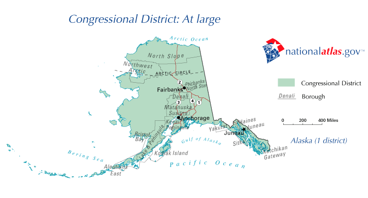
- : 1906–1959 (obsolete since statehood)
- : 1959–present
American Samoa
See Non-voting delegations, below.
Arizona

Main article: Arizona's congressional districts
- : 1863–1912 (obsolete since statehood)
- : 1912–1949 (obsolete)
- : 1949–present
- : 1949–present
- : 1963–present
- : 1973–present
- : 1983–present
- : 1993–present
- : 2003–present
- : 2003–present
- : 2013–present
Arkansas

Main article: Arkansas's congressional districts
- : 1819–1836 (obsolete since statehood)
- : 1836–1853, 1873–1875, 1883–1885 (obsolete)
- : 1853–present
- : 1853–present
- : 1863–present
- : 1875–present
- : 1885–1963 (obsolete since the 1960 census)
- : 1893–1963 (obsolete since the 1960 census)
- : 1903–1953 (obsolete since the 1950 census)
California
.svg)
Main article: California's congressional districts
- : 1849–1865, 1883–1885 (obsolete)
- : 1865–present
- : 1865–present
- : 1865–present
- : 1873–present
- : 1885–present
- : 1885–present
- : 1893–present
- : 1903–present
- : 1913–present
- : 1913–present
- : 1913–present
- : 1933–present
- : 1933–present
- : 1933–present
- : 1933–present
- : 1933–present
- : 1933–present
- : 1933–present
- : 1933–present
- : 1933–present
- : 1943–present
- : 1943–present
- : 1943–present
- : 1953–present
- : 1953–present
- : 1953–present
- : 1953–present
- : 1953–present
- : 1953–present
- : 1953–present
- : 1963–present
- : 1963–present
- : 1963–present
- : 1963–present
- : 1963–present
- : 1963–present
- : 1963–present
- : 1963–present
- : 1973–present
- : 1973–present
- : 1973–present
- : 1973–present
- : 1973–present
- : 1983–present
- : 1983–present
- : 1993–present
- : 1993–present
- : 1993–present
- : 1993–present
- : 1993–present
- : 1993–present
- : 1993–present
- : 2003–2023 (obsolete due to the 2020 census)
Colorado

Main article: Colorado's congressional districts
- : 1861–1876 (obsolete since statehood)
- : 1876–1893, 1903–1915 (obsolete)
- : 1893–present
- : 1893–present
- : 1915–present
- : 1915–present
- : 1973–present
- : 1983–present
- : 2003–present
- : 2023–present
Connecticut

Main article: Connecticut's congressional districts
- : 1789–1837, 1903–1913, 1933–1965 (obsolete)
- : 1837–present
- : 1837–present
- : 1837–present
- : 1837–present
- : 1837–1843, 1913–present
- : 1837–1843, 1965–2003 (obsolete since the 2000 census)
Delaware
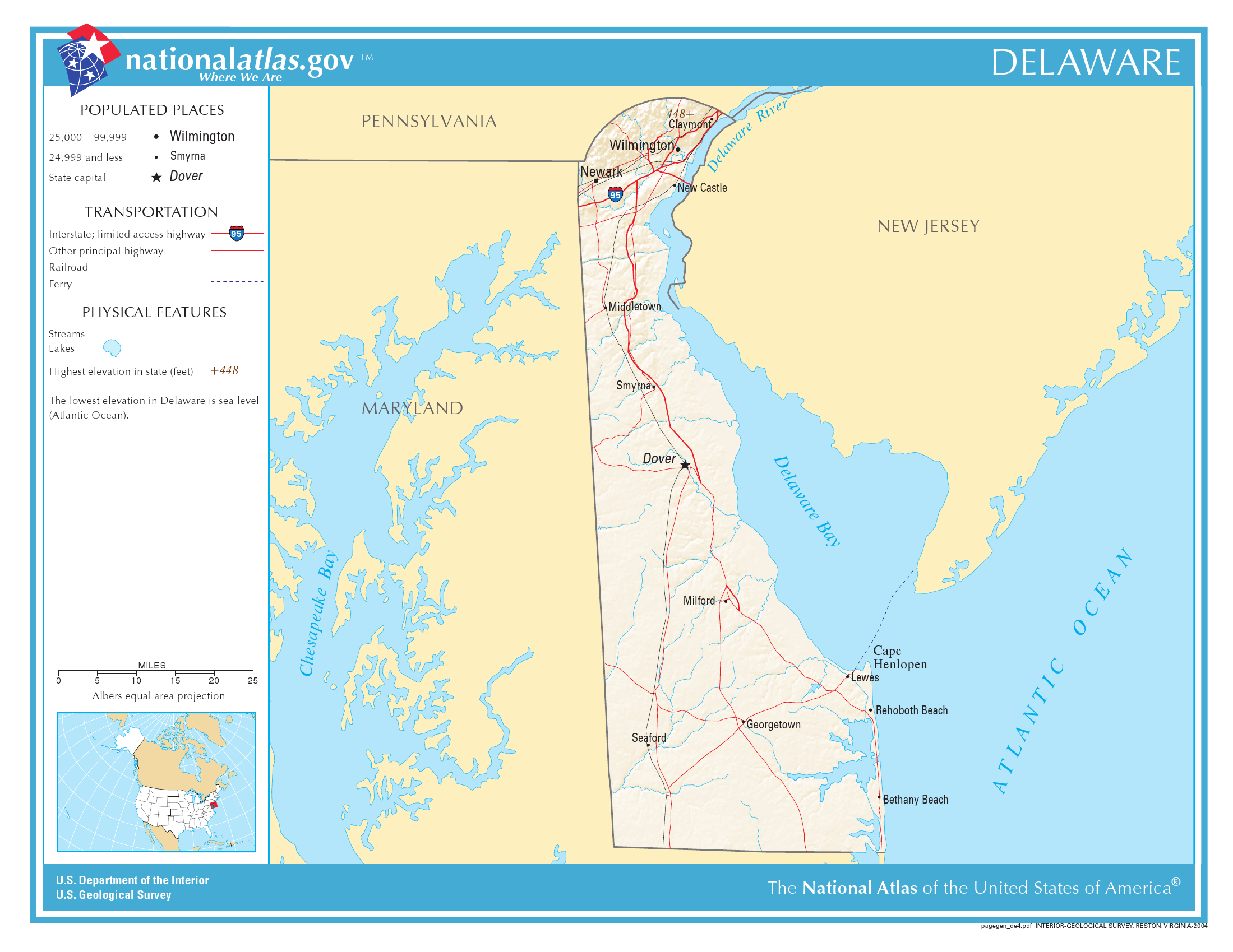
Main article: Delaware's congressional districts
- : 1789–present
The oldest district in the country, it has never changed its shape or size. From 1813 to 1823, Delaware had two representatives — both chosen at-large on a general ticket from the same statewide district.
District of Columbia
See Non-voting delegations, below.
Florida

Main article: Florida's congressional districts
- : 1822–1845 (obsolete since statehood)
- : 1845–1875, 1913–1915, 1933–1937, 1943–1945 (obsolete)
- : 1875–present
- : 1875–present
- : 1903–present
- : 1915–present
- : 1937–present
- : 1945–present
- : 1953–present
- : 1953–present
- : 1963–present
- : 1963–present
- : 1963–present
- : 1963–present
- : 1973–present
- : 1973–present
- : 1973–present
- : 1983–present
- : 1983–present
- : 1983–present
- : 1983–present
- : 1993–present
- : 1993–present
- : 1993–present
- : 1993–present
- : 2003–present
- : 2003–present
- : 2013–present
- : 2013–present
- : 2023–present
Georgia

Main article: Georgia's congressional districts
- : 1793–1827, 1829–1845, 1883–1885 (obsolete)
- : 1789–1793, 1827–1829, 1845–present
- : 1789–1793, 1827–1829, 1845–present
- : 1789–1793, 1827–1829, 1845–present
- : 1827–1829, 1845–present
- : 1827–1829, 1845–present
- : 1827–1829, 1845–present
- : 1827–1829, 1845–present
- : 1845–1863, 1873–present
- : 1873–present
- : 1885–present
- : 1893–1933, 1993–present
- : 1913–1933, 2003–present
- : 2003–present
- : 2013–present
Guam
See Non-voting delegations, below.
Hawaii

Main article: Hawaii's congressional districts
- : 1900–1959 (obsolete since statehood)
- : 1959–1971 (obsolete)
- : 1971–present
- : 1971–present
Idaho

Main article: Idaho's congressional districts
- : 1864–1890 (obsolete since statehood)
- : 1890–1919 (obsolete)
- : 1919–present
- : 1919–present
Illinois
Main article: Illinois's congressional districts
- : 1812–1818 (obsolete since statehood)
- : 1818–1833, 1863–1873, 1893–1895, 1913–1949 (obsolete)
- : 1833–present
- : 1833–present
- : 1833–present
- : 1843–present
- : 1843–present
- : 1843–present
- : 1843–present
- : 1853–present
- : 1853–present
- : 1863–present
- : 1863–present
- : 1863–present
- : 1863–present
- : 1873–present
- : 1873–present
- : 1873–present
- : 1873–present
- : 1873–2023 (obsolete due to the 2020 census)
- : 1873–2013 (obsolete since the 2010 census)
- : 1883–2003 (obsolete since the 2000 census)
- : 1895–1993 (obsolete since the 1990 census)
- : 1895–1993 (obsolete since the 1990 census)
- : 1903–1983 (obsolete since the 1980 census)
- : 1903–1983 (obsolete since the 1980 census)
- : 1903–1963 (obsolete since the 1960 census)
- : 1949–1953 (obsolete since the 1950 census)
Indiana
.png)
Main article: Indiana's congressional districts
- : 1805–1816 (obsolete since statehood)
- : 1816–1823, 1873–1875 (obsolete)
- : 1823–present
- : 1823–present
- : 1823–present
- : 1833–present
- : 1833–present
- : 1833–present
- : 1833–present
- : 1843–present
- : 1843–present
- : 1843–2003 (obsolete since the 2000 census)
- : 1853–1983 (obsolete since the 1980 census)
- : 1875–1943 (obsolete since the 1940 census)
- : 1875–1933 (obsolete since the 1930 census)
Iowa

Main article: Iowa's congressional districts
- : 1838–1846 (obsolete since statehood)
- : 1846–1847 (obsolete)
- : 1847–present
- : 1847–present
- : 1863–present
- : 1863–present
- : 1863–2013 (obsolete since the 2010 census)
- : 1863–1993 (obsolete since the 1990 census)
- : 1873–1973 (obsolete since the 1970 census)
- : 1873–1963 (obsolete since the 1960 census)
- : 1873–1943 (obsolete since the 1940 census)
- : 1883–1933 (obsolete since the 1930 census)
- : 1883–1933 (obsolete since the 1930 census)
Kansas
Main article: Kansas's congressional districts
- : 1854–1861 (obsolete since statehood)
- : 1861–1875, 1883–1885, 1893–1907 (obsolete)
- : 1875–present
- : 1875–present
- : 1875–present
- : 1885–present
- : 1885–1993 (obsolete since the 1990 census)
- : 1885–1963 (obsolete since the 1960 census)
- : 1885–1943 (obsolete since the 1940 census)
- : 1907–1933 (obsolete since the 1930 census)
Kentucky

Main article: Kentucky's congressional districts
- : 1933–1935 (obsolete)
- : 1792–1933, 1935–present
- : 1792–1933, 1935–present
- : 1803–1933, 1935–present
- : 1803–1933, 1935–present
- : 1803–1933, 1935–present
- : 1803–1933, 1935–present
- : 1813–1933, 1935–1993 (obsolete since the 1990 census)
- : 1813–1933, 1935–1963 (obsolete since the 1960 census)
- : 1813–1933, 1935–1953 (obsolete since the 1950 census)
- : 1813–1863, 1873–1933 (obsolete since the 1930 census)
- : 1823–1843, 1883–1933 (obsolete since the 1930 census)
- : 1823–1843 (obsolete since the 1840 census)
- : 1833–1843 (obsolete since the 1840 census)
Louisiana

Main article: Louisiana's congressional districts
- : 1806–1812 (obsolete since statehood)
- : 1812–1823, 1873–1875 (obsolete)
- : 1823–present
- : 1823–present
- : 1823–present
- : 1843–present
- : 1863–present
- : 1875–present
- : 1903–2013 (obsolete since the 2010 census)
- : 1913–1993 (obsolete since the 1990 census)
Maine
.png)
Until 1820, Maine was part of Massachusetts. After the 1810 census, Massachusetts was allocated 20 districts. Seven Massachusetts districts (then numbered through ) were credited to Maine soon after it became a state in 1820. See District of Maine.
Main article: Maine's congressional districts
- : 1820–1821, 1883–1885 (obsolete)
- : 1821–1883, 1885–present
- : 1821–1883, 1885–present
- : 1821–1883, 1885–1963 (obsolete since the 1960 census)
- : 1821–1883, 1885–1933 (obsolete since the 1930 census)
- : 1821–1883 (obsolete since the 1880 census)
- : 1821–1863 (obsolete since the 1860 census)
- : 1821–1853 (obsolete since the 1850 census)
- : 1833–1843 (obsolete since the 1840 census)
Maryland

Main article: Maryland's congressional districts
- : 1963–1967 (obsolete)
- : 1789–present
- : 1789–present
- : 1789–present
- : 1789–present
- : 1789–present
- : 1789–1863, 1873–present
- : 1793–1843, 1953–present
- : 1793–1835, 1967–present
Massachusetts

Main article: Massachusetts's congressional districts
- : 1793–1795 (obsolete)
- : 1789–present
- : 1789–present
- : 1789–present
- : 1789–present
- : 1789–1793, 1795–present
- : 1789–1793, 1795–present
- : 1789–1793, 1795–present
- : 1789–1793, 1795–present
- : 1795–present
- : 1795–2013 (obsolete since the 2010 census)
- : 1795–1843, 1853–1863, 1873–1993 (obsolete since the 1990 census)
- : 1795–1843, 1883–1983 (obsolete since the 1980 census)
- : 1795–1833, 1893–1963 (obsolete since the 1960 census)
- : 1795–1820 (moved to Maine), 1903–1963 (obsolete since the 1960 census)
- : 1803–1820 (moved to Maine), 1913–1943 (obsolete since the 1940 census)
- : 1803–1820 (moved to Maine), 1913–1933 (obsolete since the 1930 census)
- : 1803–1820 (obsolete since 1820 move to MaineMaine used to be part of Massachusetts. After the 1810 census, Massachusetts was allocated 20 districts. Seven districts (numbers 14 through 20) were credited to Maine soon after it became a state in 1820.)
- : 1813–1820 (obsolete since 1820 move to Maine)
- : 1813–1820 (obsolete since 1820 move to Maine)
- : 1813–1820 (obsolete since 1820 move to Maine)
Michigan

Main article: Michigan's congressional districts
- : 1819–1837 (obsolete since statehood)
- : 1837–1843, 1913–1915, 1963–1965 (obsolete)
- : 1843–present
- : 1843–present
- : 1843–present
- : 1853–present
- : 1863–present
- : 1863–present
- : 1873–present
- : 1873–present
- : 1873–present
- : 1883–present
- : 1883–present
- : 1893–present
- : 1915–present
- : 1933–2023 (obsolete since the 2020 census)
- : 1933–2013 (obsolete since the 2010 census)
- : 1933–2003 (obsolete since the 2000 census)
- : 1933–1993 (obsolete since the 1990 census)
- : 1953–1993 (obsolete since the 1990 census)
- : 1965–1983 (obsolete since the 1980 census)
Minnesota

Main article: Minnesota's congressional districts
- : 1849–1858 (obsolete since statehood)
- : 1858–1863, 1913–1915, 1933–1935 (obsolete)
- : 1863–1933, 1935–present
- : 1863–1933, 1935–present
- : 1873–1933, 1935–present
- : 1883–1933, 1935–present
- : 1883–1933, 1935–present
- : 1893–1933, 1935–present
- : 1893–1933, 1935–present
- : 1903–1933, 1935–present
- : 1903–1933, 1935–1963 (obsolete since the 1960 census)
- : 1915–1933 (obsolete since the 1930 census)
Mississippi

Main article: Mississippi's congressional districts
- : 1801–1817 (obsolete since statehood)
- : 1817–1847, 1853–1855 (obsolete)
- : 1847–present
- : 1847–present
- : 1847–present
- : 1847–present
- : 1855–2003 (obsolete since the 2000 census)
- : 1873–1963 (obsolete since the 1960 census)
- : 1883–1953 (obsolete since the 1950 census)
- : 1903–1933 (obsolete since the 1930 census)
Missouri

Main article: Missouri's congressional districts
- : 1812–1821 (obsolete since statehood)
- : 1821–1847, 1933–1935 (obsolete)
- : 1847–1933, 1935–present
- : 1847–1933, 1935–present
- : 1847–1933, 1935–present
- : 1847–1933, 1935–present
- : 1847–1933, 1935–present
- : 1853–1933, 1935–present
- : 1853–1933, 1935–present
- : 1863–1933, 1935–present
- : 1863–1933, 1935–2013 (obsolete since the 2010 census)
- : 1873–1933, 1935–1983 (obsolete since the 1980 census)
- : 1873–1933, 1935–1963 (obsolete since the 1960 census)
- : 1873–1933, 1935–1953 (obsolete since the 1950 census)
- : 1873–1933, 1935–1953 (obsolete since the 1950 census)
- : 1883–1933 (obsolete since the 1930 census)
- : 1893–1933 (obsolete since the 1930 census)
- : 1903–1933 (obsolete since the 1930 census)
Montana

Main article: Montana's congressional districts
- : 1865–1889 (obsolete since statehood)
- : 1889–1919, 1993–2023 (obsolete)
- : 1919–1993, 2023–present
- : 1919–1993, 2023–present
Nebraska
Main article: Nebraska's congressional districts
- : 1855–1867 (obsolete since statehood)
- : 1867–1883 (obsolete)
- : 1883–present
- : 1883–present
- : 1883–present
- : 1893–1963 (obsolete since the 1960 census)
- : 1893–1943 (obsolete since the 1940 census)
- : 1893–1933 (obsolete since the 1930 census)
Nevada

Main article: Nevada's congressional districts
- : 1861–1864 (obsolete since statehood)
- : 1864–1983 (obsolete)
- : 1983–present
- : 1983–present
- : 2003–present
- : 2013–present
New Hampshire

Main article: New Hampshire's congressional districts
- : 1789–1847 (obsolete)
- : 1847–present
- : 1847–present
- : 1847–1883 (obsolete since the 1880 census)
- : 1847–1853 (obsolete since the 1850 census)
New Jersey

Main article: New Jersey's congressional districts
- : 1789–1799, 1801–1813, 1815–1843 (obsolete)
- : 1799–1801, 1813–1815, 1843–present
- : 1799–1801, 1813–1815, 1843–present
- : 1799–1801, 1813–1815, 1843–present
- : 1799–1801, 1843–present
- : 1799–1801, 1843–present
- : 1873–present
- : 1873–present
- : 1893–present
- : 1903–present
- : 1903–present
- : 1913–present
- : 1913–present
- : 1933–2013 (obsolete since the 2010 census)
- : 1933–1993 (obsolete since the 1990 census)
- : 1963–1983 (obsolete since the 1980 census)
New Mexico

Main article: New Mexico's congressional districts
- : 1851–1912 (obsolete since statehood)
- : 1912–1969 (obsolete)
- : 1969–present
- : 1969–present
- : 1983–present
New York

Main article: New York's congressional districts
- : 1873–1875, 1883–1885, 1933–1945 (obsolete)
- : 1789–present
- : 1789–present
- : 1789–present
- : 1789–present
- : 1789–present
- : 1789–present
- : 1793–present
- : 1793–present
- : 1793–present
- : 1793–present
- : 1803–present
- : 1803–present
- : 1803–present
- : 1803–present
- : 1803–present
- : 1803–1809, 1813–present
- : 1803–1809, 1813–present
- : 1813–present
- : 1813–present
- : 1813–present
- : 1813–present
- : 1821–present
- : 1823–present
- : 1823–present
- : 1823–present
- : 1823–present
- : 1823–2023 (obsolete since the 2020 census)
- : 1823–2013 (obsolete since the 2010 census)
- : 1823–2013 (obsolete since the 2010 census)
- : 1823–2003 (obsolete since the 2000 census)
- : 1833–2003 (obsolete since the 2000 census)
- : 1833–1863, 1873–1993 (obsolete since the 1990 census)
- : 1833–1863, 1875–1993 (obsolete since the 1990 census)
- : 1843–1853, 1885–1993 (obsolete since the 1990 census)
- : 1903–1983 (obsolete since the 1980 census)
- : 1903–1983 (obsolete since the 1980 census)
- : 1903–1983 (obsolete since the 1980 census)
- : 1913–1983 (obsolete since the 1980 census)
- : 1913–1983 (obsolete since the 1980 census)
- : 1913–1973 (obsolete since the 1970 census)
- : 1913–1973 (obsolete since the 1970 census)
- : 1913–1963 (obsolete since the 1960 census)
- : 1913–1963 (obsolete since the 1960 census)
- : 1945–1953 (obsolete since the 1950 census)
- : 1945–1953 (obsolete since the 1950 census)
North Carolina
.svg)
Main article: North Carolina's congressional districts
- : 1883–1885 (obsolete)
- : 1789–present
- : 1789–present
- : 1789–present
- : 1789–present
- : 1789–present
- : 1793–present
- : 1793–present
- : 1793–1863, 1873–present
- : 1793–1853, 1885–present
- : 1793–1843, 1903–present
- : 1803–1843, 1933–present
- : 1803–1843, 1943–1963, 1993–present
- : 1813–1843, 2003–present
- : 2023–present
North Dakota

Main article: North Dakota's congressional districts
- : 1861–1889 (obsolete since statehood)
- : 1889–1913, 1933–1963, 1973–present
- : 1913–1933, 1963–1973 (obsolete since the 1970 census)
- : 1913–1933, 1963–1973 (obsolete since the 1970 census)
- : 1913–1933 (obsolete since the 1930 census)
Northern Mariana Islands
: See Non-voting delegations, below.
Ohio
Main article: Ohio's congressional districts
- : 1799–1803 (obsolete since statehood)
- : 1803–1813, 1913–1915, 1933–1953, 1963–1967 (obsolete)
- : 1813–present
- : 1813–present
- : 1813–present
- : 1813–present
- : 1813–present
- : 1813–present
- : 1823–present
- : 1823–present
- : 1823–present
- : 1823–present
- : 1823–present
- : 1823–present
- : 1823–present
- : 1823–present
- : 1833–present
- : 1833–2023 (obsolete since the 2020 census)
- : 1833–2013 (obsolete since the 2010 census)
- : 1833–2013 (obsolete since the 2010 census)
- : 1833–2003 (obsolete since the 2000 census)
- : 1843–1863, 1873–1993 (obsolete since the 1990 census)
- : 1843–1863, 1883–1993 (obsolete since the 1990 census)
- : 1915–1983 (obsolete since the 1980 census)
- : 1953–1983 (obsolete since the 1980 census)
- : 1967–1973 (obsolete since the 1970 census)
Oklahoma

Main article: Oklahoma's congressional districts
- : 1890–1907 (obsolete since statehood)
- : 1913–1915, 1933–1943 (obsolete)
- : 1907–present
- : 1907–present
- : 1907–present
- : 1907–present
- : 1907–present
- : 1915–2003 (obsolete since the 2000 census)
- : 1915–1953 (obsolete since the 1950 census)
- : 1915–1953 (obsolete since the 1950 census)
Oregon

Main article: Oregon's congressional districts
- : 1849–1859 (obsolete since statehood)
- : 1859–1893 (obsolete)
- : 1893–present
- : 1893–present
- : 1913–present
- : 1943–present
- : 1983–present
- : 2023–present
Pennsylvania

Main article: Pennsylvania's congressional districts
- : 1789–1791, 1793–1795, 1873–1875, 1883–1889, 1893–1903, 1913–1923, 1943–1945 (obsolete)
- : 1791–1793, 1795–present
- : 1791–1793, 1795–present
- : 1791–1793, 1795–present
- : 1791–1793, 1795–present
- : 1791–1793, 1795–present
- : 1791–1793, 1795–present
- : 1791–1793, 1795–present
- : 1791–1793, 1795–present
- : 1795–present
- : 1795–present
- : 1795–present
- : 1795–1803, 1813–present
- : 1813–present
- : 1813–present
- : 1813–present
- : 1823–present
- : 1823–present
- : 1823–2023 (obsolete since the 2020 census)
- : 1833–2013 (obsolete since the 2010 census)
- : 1833–2003 (obsolete since the 2000 census)
- : 1833–2003 (obsolete since the 2000 census)
- : 1833–1993 (obsolete since the 1990 census)
- : 1833–1993 (obsolete since the 1990 census)
- : 1833–1983 (obsolete since the 1980 census)
- : 1833–1843, 1853–1863, 1875–1983 (obsolete since the 1980 census)
- : 1875–1973 (obsolete since the 1970 census)
- : 1875–1973 (obsolete since the 1970 census)
- : 1889–1963 (obsolete since the 1960 census)
- : 1903–1963 (obsolete since the 1960 census)
- : 1903–1963 (obsolete since the 1960 census)
- : 1903–1953 (obsolete since the 1950 census)
- : 1903–1953 (obsolete since the 1950 census)
- : 1923–1953 (obsolete since the 1950 census)
- : 1923–1943 (obsolete since the 1940 census)
- : 1923–1933 (obsolete since the 1930 census)
- : 1923–1933 (obsolete since the 1930 census)
Puerto Rico
:See Non-voting delegations, below.
Rhode Island
Main article: Rhode Island's congressional districts
- : 1790–1843 (obsolete)
- : 1843–present
- : 1843–present
- : 1913–1933 (obsolete since the 1930 census)
South Carolina

Main article: South Carolina's congressional districts
- : 1873–1875 (obsolete)
- : 1789–present
- : 1789–present
- : 1789–present
- : 1789–present
- : 1789–1863, 1875–present
- : 1793–1863, 1883–present
- : 1803–1853, 1883–1933, 2013–present
- : 1803–1843 (obsolete since the 1840 census)
- : 1813–1843 (obsolete since the 1840 census)
South Dakota

Main article: South Dakota's congressional districts
- 1861–1889 (obsolete since statehood)
- : 1889–1913, 1983–present
- : 1913–1983 (obsolete since the 1980 census)
- : 1913–1983 (obsolete since the 1980 census)
- : 1913–1933 (obsolete since the 1930 census)
Tennessee
.png)
Main article: Tennessee's congressional districts
- : 1794–1796 (obsolete since statehood)
- : 1796–1805, 1873–1875 (obsolete)
- : 1805–present
- : 1805–present
- : 1805–present
- : 1813–present
- : 1813–present
- : 1813–present
- : 1823–present
- : 1823–present
- : 1823–1863, 1873–1973, 1983–present
- : 1833–1863, 1875–1933, 1943–1953 (obsolete since the 1950 census)
- : 1833–1853 (obsolete since the 1850 census)
- : 1833–1843 (obsolete since the 1840 census)
- : 1833–1843 (obsolete since the 1840 census)
Texas
.svg)
Main article: Texas's congressional districts
- : 1873–1875, 1913–1919, 1933–1935, 1953–1959, 1963–1967 (obsolete)
- : 1845–present
- : 1845–present
- : 1863–present
- : 1863–present
- : 1875–present
- : 1875–present
- : 1883–present
- : 1883–present
- : 1883–present
- : 1883–present
- : 1883–present
- : 1893–present
- : 1893–present
- : 1903–present
- : 1903–present
- : 1903–present
- : 1919–present
- : 1919–present
- : 1935–present
- : 1935–present
- : 1935–present
- : 1959–present
- : 1967–present
- : 1973–present
- : 1983–present
- : 1983–present
- : 1983–present
- : 1993–present
- : 1993–present
- : 1993–present
- : 2003–present
- : 2003–present
- : 2013–present
- : 2013–present
- : 2013–present
- : 2013–present
- : 2023–present
- : 2023–present
U.S. Virgin Islands
:See Non-voting delegations, below.
Utah

Main article: Utah's congressional districts
- : 1851–1896 (obsolete since statehood)
- : 1896–1913 (obsolete)
- : 1913–present
- : 1913–present
- : 1983–present
- : 2013–present
Vermont

Main article: Vermont's congressional districts
- : 1813–1821, 1823–1825, 1933–present
- : 1791–1813, 1821–1823, 1825–1933 (obsolete since the 1930 census)
- : 1791–1813, 1821–1823, 1825–1933 (obsolete since the 1930 census)
- : 1803–1813, 1821–1823, 1825–1883 (obsolete since the 1880 census)
- : 1803–1813, 1821–1823, 1825–1853 (obsolete since the 1850 census)
- : 1821–1823, 1825–1843 (obsolete since the 1840 census)
- : 1821–1823 (obsolete since the 1820 census)
Virginia

Main article: Virginia's congressional districts
- : 1883–1885, 1933–1935 (obsolete)
- : 1789–1933, 1935–present
- : 1789–1933, 1935–present
- : 1789–1933, 1935–present
- : 1789–1933, 1935–present
- : 1789–1933, 1935–present
- : 1789–1933, 1935–present
- : 1789–1933, 1935–present
- : 1789–1933, 1935–present
- : 1789–1863, 1873–1933, 1935–present
- : 1789–1863, 1885–1933, 1953–present
- : 1793–1863, 1993–present
- : 1793–1863 (obsolete since the 1863 move to West Virginia)
- : 1793–1863 (obsolete since the 1863 move to West Virginia)
- : 1793–1853 (obsolete since the 1850 census)
- : 1793–1853 (obsolete since the 1850 census)
- : 1793–1843 (obsolete since the 1840 census)
- : 1793–1843 (obsolete since the 1840 census)
- : 1793–1843 (obsolete since the 1840 census)
- : 1793–1843 (obsolete since the 1840 census)
- : 1803–1843 (obsolete since the 1840 census)
- : 1803–1843 (obsolete since the 1840 census)
- : 1803–1833 (obsolete since the 1830 census)
- : 1813–1823 (obsolete since the 1820 census)
Washington

Main article: Washington's congressional districts
- : 1854–1889 (obsolete since statehood)
- : 1889–1909, 1913–1915, 1953–1959 (obsolete)
- : 1909–present
- : 1909–present
- : 1909–present
- : 1915–present
- : 1915–present
- : 1933–present
- : 1959–present
- : 1983–present
- : 1993–present
- : 2013–present
West Virginia
.png)
Main article: West Virginia's congressional districts
- : 1913–1917 (obsolete)
- : 1863–present
- : 1863–present
- : 1863–2023 (obsolete since the 2020 census)
- : 1883–1993 (obsolete since the 1990 census)
- : 1903–1973 (obsolete since the 1970 census)
- : 1917–1963 (obsolete since the 1960 census)
Wisconsin

Main article: Wisconsin's congressional districts
- : 1848–present
- : 1848–present
- : 1849–present
- : 1863–present
- : 1863–present
- : 1863–present
- : 1873–present
- : 1873–present
- : 1883–2003 (obsolete since the 2000 census)
- : 1893–1973 (obsolete since the 1970 census)
- : 1903–1933 (obsolete since the 1930 census)
Wyoming
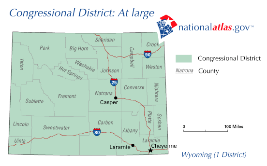
- : 1869–1890 (obsolete since statehood)
- : 1890–present
Non-voting delegations
- , 1978–present
- Cherokee Nation, 1835 and 2019–present (yet to be seated) (Cherokee delegate)
- Choctaw Nation, 1830 (never seated)
- , 1871–1875 and 1971–present
- , 1970–present
- , 2009–present
- , 1907–1946 (obsolete since independence)
- , 1901–present
- , 1970–present
Notes
References
Sources
References
- (April 26, 2021). "2020 Census Apportionment Results Delivered to the President". US Census Bureau.
- [[Public Law 62-5]] of 1911, though Congress has the authority to change that number.
- Thompson, Don. (October 12, 2022). "Census, term limit change means big turnover for lawmakers".
- "Redistricting Criteria".
- "About Congressional Districts".
- Gelman, A., King, G. (1994). Enhancing democracy through legislative redistricting. The American Political Science Review, 88, 541–559.
- Whitaker, L. (2015). Congressional Redistricting and the Voting Rights Act: A Legal Overview [Ebook] (1st ed., pp. 3–12). Congressional Research Service.
- "Redistricting and the Supreme Court: The Most Significant Cases", 2020
- (2012-01-01). "Redistricting Principles for the Twenty-First Century". Case Western Reserve Law Review.
- Bowen, D. (2014). Boundaries, redistricting criteria and representation in the U.S. House of Representatives. American Politics Research, 42(5), 856–895.
- "About Congressional Apportionment".
- "Rhode Island's 1st congressional district". United States Census Bureau.
- Files downloaded from the U.S. Census Bureau's [https://www.census.gov/cgi-bin/geo/shapefiles/index.php?year=2024&layergroup=Congressional+Districts+%28119%29 TIGER/Line Shapefiles for congressional districts]. Areas derived from the "ALAND" field in the shapefiles, given in square meters.
- Center for New Media & Promotion (CNMP), US Census Bureau. "My Congressional District".
This article was imported from Wikipedia and is available under the Creative Commons Attribution-ShareAlike 4.0 License. Content has been adapted to SurfDoc format. Original contributors can be found on the article history page.
Ask Mako anything about List of United States congressional districts — get instant answers, deeper analysis, and related topics.
Research with MakoFree with your Surf account
Create a free account to save articles, ask Mako questions, and organize your research.
Sign up freeThis content may have been generated or modified by AI. CloudSurf Software LLC is not responsible for the accuracy, completeness, or reliability of AI-generated content. Always verify important information from primary sources.
Report