From Surf Wiki (app.surf) — the open knowledge base
Jammu and Kashmir (princely state)
Princely state in South Asia (1846–1952)

Princely state in South Asia (1846–1952)
| Field | Value |
|---|---|
| capital | |
| conventional_long_name | Jammu and Kashmir |
| common_name | Jammu and Kashmir |
| image_flag | File:Flag of the Maharaja of Jammu and Kashmir (1846-1936).svg |
| image_flag2 | File:Flag of Jammu and Kashmir (1936-1953).svg |
| flag_type | |
| image_coat | Kashmir Princely State CoA.png |
| status | Princely state |
| religion | Islam (majority), Hinduism, Buddhism, Jainism, Sikhism |
| government_type | Monarchy |
| empire | British Empire (till 1947) India (after 1947) |
| common_languages | |
| title_leader | Maharaja |
| leader1 | Gulab Singh (first) |
| year_leader1 | 1846–1857 |
| leader2 | Hari Singh (last) |
| year_leader2 | 1925–1952 |
| title_deputy | Dewan |
| deputy1 | Daljit Singh (first) |
| year_deputy1 | 1917–1921 |
| deputy2 | Sheikh Abdullah (last) |
| year_deputy2 | 1948–1952 |
| year_start | 1846 |
| event_start | End of the First Anglo-Sikh War and formation of the state |
| event1 | End of British Crown Suzerainty |
| date_event1 | 15 Aug 1947 |
| event2 | Beginning of the First Kashmir War |
| date_event2 | 22 Oct 1947 |
| event3 | Accession to the Indian Union |
| date_event3 | 26–27 Oct 1947 |
| event4 | End of First Kashmir War (cession of Azad Kashmir and Gilgit-Baltistan) |
| date_event4 | 1 January 1949 |
| year_end | 1952 |
| date_end | 17 November |
| border_p1 | no |
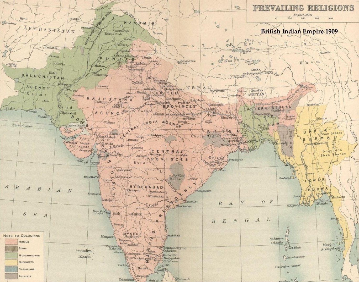
| image_map | Jammu and Kashmir in 1946 map of India by National Geographic.jpg |
| image_map_caption | Jammu and Kashmir in 1946 |
| today | Disputed; see Kashmir conflict |
the administration of the princely state of Kashmir and Jammu
Jammu and Kashmir, also known as Kashmir and Jammu, was a princely state in a subsidiary alliance with the British East India Company from 1846 to 1858, and under the paramountcy (or tutelage) of the British Crown from 1858 until British withdrawal and the partition of British India in 1947. Following the subsequent First Kashmir War between India and Pakistan, it became a disputed territory, now administered by three countries: China, India, and Pakistan. The princely state was created after the First Anglo-Sikh War, when the East India Company, which had annexed the Kashmir Valley, from the Sikhs as war indemnity, then sold it to the Raja of Jammu, Gulab Singh, for 75 lakh rupees.
At the time of the partition of India and the political integration of India, Hari Singh, the ruler of the state, delayed making a decision about the future of his state. However, an uprising in the western districts by the Gilgit Scouts against Hari Singh supported by informal militias from the neighbouring Northwest Frontier Province, and the Pakistani army personnel, forced his hand. On 26 October 1947, Hari Singh acceded 1st Edition Cold War in the High Himalayas The USA, China and South Asia in the 1950s By S. Mahmud Ali Copyright 1999( When tribal Pathan militias from Pakistan's North-West Frontiers joined Sudhan Pathan rebels fighting for freedom, Hari Singh fled to Jammu and reportedly signed a letter of accession to India.) Page 19 https://www.google.com/search?q=Sudhan+Pathan+rebels+fighting+for+freedom&client=ms-android-samsung-gj-rev1&sca_esv=593805704&tbm=bks&p to India in return for the Indian military being airlifted to Kashmir to counter the invasion by tribal militias from Pakistan, which were assisted by the Pakistani government and military leadership. The western and northern districts now known as Azad Kashmir and Gilgit-Baltistan passed to the control of Pakistan with the support of Gilgit Scouts, while the remaining territory stayed under Indian control, later becoming the Indian administered state of Jammu and Kashmir. India and Pakistan defined a cease-fire line dividing the administration of the territory with the intercession of the United Nations which was supposed to be temporary but still persists.
Administration
According to the census reports of 1911, 1921 and 1931, the administration was organised as follows:
- Jammu province: Districts of Jammu, Jasrota (Kathua), Udhampur, Reasi and Mirpur.
- Kashmir province: Districts of Kashmir South (Anantnag), Kashmir North (Baramulla) and Muzaffarabad.
- Frontier districts: Wazarats of Ladakh and Gilgit.
- Internal jagirs: Poonch, Bhaderwah and Chenani. In the 1941 census, further details of the frontier districts were given:
- Ladakh wazarat: Tehsils of Leh, Skardu and Kargil.
- Gilgit wazarat: Tehsils of Gilgit and Astore
- '*Frontier *illaqas''''': (under the Gilgit Agency) Punial, Ishkoman, Yasin, Kuh-Ghizer, Hunza, Nagar, Chilas.
Prime ministers (Jammu & Kashmir)
| # | Name | Took office | Left office | |||||||||
|---|---|---|---|---|---|---|---|---|---|---|---|---|
| 1 | Raja Sir Daljit Singh | 1917 | 1921 | |||||||||
| 2 | Raja Sir Hari Singh | 1925 | 1927 | |||||||||
| 3 | Sir Albion Banerjee | January 1927 | March 1929 | |||||||||
| 4 | G. E. C. Wakefield | 1929 | 1931 | |||||||||
| 5 | last=Copland | first=Ian | title=Islam and Political Mobilization in Kashmir, 1931–34 | journal=Pacific Affairs | volume=54 | number=2 | date=1981 | pages=228–259 | doi=10.2307/2757363 | jstor=2757363}} | 1931 | 1932 |
| 6 | Elliot James Dowell Colvin | 1932 | 1936 | |||||||||
| 7 | Sir Barjor J. Dalal | 1936 | 1936 | |||||||||
| 8 | Sir N. Gopalaswami Ayyangar | 1937 | July 1943 | |||||||||
| 9 | Kailash Narain Haksar | July 1943 | February 1944 | |||||||||
| 10 | Sir B. N. Rau | February 1944 | 28 June 1945 | |||||||||
| 11 | Ram Chandra Kak | 28 June 1945 | 11 August 1947 | |||||||||
| 12 | Janak Singh | 11 August 1947 | 15 October 1947 | |||||||||
| 13 | Mehr Chand Mahajan | 15 October 1947 | 5 March 1948 | |||||||||
| 14 | Sheikh Abdullah | 5 March 1948 | 9 August 1953 |
Demographics
Population
|1873|1534972 |1891|2543952 |1901|2905578 |1911|3158126 |1921|3320518 |1931|3646243 |1941|4021616
| Census Year | Jammu Province | Kashmir Province | Frontier Regions | Jammu & Kashmir Princely State | Pop. | % | Pop. | % | Pop. | % | Pop. | % | 1873 | 1,534,972 | 1891 | 2,543,952 | 1901 | 2,905,578 | 1911 | 3,158,126 | 1921 | 3,320,518 | 1931 | 3,646,243 | 1941 | 4,021,616 |
|---|---|---|---|---|---|---|---|---|---|---|---|---|---|---|---|---|---|---|---|---|---|---|---|---|---|---|
| 938,641 | 491,846 | 104,485 | ||||||||||||||||||||||||
| 1,439,543 | 949,041 | 155,368 | ||||||||||||||||||||||||
| 1,521,307 | 1,157,394 | 226,877 | ||||||||||||||||||||||||
| 1,597,865 | 1,295,201 | 265,060 | ||||||||||||||||||||||||
| 1,640,259 | 1,407,086 | 273,173 | ||||||||||||||||||||||||
| 1,788,441 | 1,569,218 | 288,584 | ||||||||||||||||||||||||
| 1,981,433 | 1,728,705 | 311,478 |
Religion
| Religious | |||||||||||||||||||||||||||||||||||||||||||
|---|---|---|---|---|---|---|---|---|---|---|---|---|---|---|---|---|---|---|---|---|---|---|---|---|---|---|---|---|---|---|---|---|---|---|---|---|---|---|---|---|---|---|---|
| group | 1891 | 1901 | 1911 | 1921 | 1931 | 1941 | Pop. | % | Pop. | % | Pop. | % | Pop. | % | Pop. | % | Pop. | % | Islam [[File:Star and Crescent.svg | 15px]] | Hinduism [[File:Om.svg | 15px]] | Buddhism [[File:Dharma_Wheel_(2).svg | 15px]] | Tribal | Sikhism [[File:Khanda.svg | 15px]] | Jainism [[File:Jain_Prateek_Chihna.svg | 15px]] | Christianity [[File:Christian cross.svg | 15px]] | Zoroastrianism [[File:Faravahar.svg | 15px]] | Judaism [[File:Star_of_David.svg | 15px]] | Others | Total population | 2,543,952 | 2,905,578 | 3,158,126 | 3,320,518 | 3,646,243 | 4,021,616 |
| 1,793,710 | 2,154,695 | 2,398,320 | 2,548,514 | 2,817,636 | 3,101,247 | ||||||||||||||||||||||||||||||||||||||
| 691,800 | 689,073 | 690,390 | 692,641 | 736,222 | 809,165 | ||||||||||||||||||||||||||||||||||||||
| 29,608 | 35,047 | 36,512 | 37,685 | 38,724 | 40,696 | ||||||||||||||||||||||||||||||||||||||
| 16,615 | 134 | 51 | |||||||||||||||||||||||||||||||||||||||||
| 11,399 | 25,828 | 31,553 | 39,507 | 50,662 | 65,903 | ||||||||||||||||||||||||||||||||||||||
| 593 | 442 | 345 | 529 | 597 | 910 | ||||||||||||||||||||||||||||||||||||||
| 218 | 422 | 975 | 1,634 | 2,263 | 3,509 | ||||||||||||||||||||||||||||||||||||||
| 9 | 11 | 31 | 7 | 5 | 29 | ||||||||||||||||||||||||||||||||||||||
| 10 | |||||||||||||||||||||||||||||||||||||||||||
| 0 | 60 | 0 | 1 | 0 | 95 | ||||||||||||||||||||||||||||||||||||||
| Note: The Princely State of Jammu and Kashmir includes the contemporary administrative divisions of Jammu, Kashmir, Ladakh, Azad Kashmir, and Gilgit-Baltistan. |
Jammu Province
Including Jammu District, Kathua District, Udhampur District, Reasi District, Mirpur District, Chenani Jagir, and Poonch Jagir.
| Religious | |||||||||||||||||||||||||||||||||||||||||||
|---|---|---|---|---|---|---|---|---|---|---|---|---|---|---|---|---|---|---|---|---|---|---|---|---|---|---|---|---|---|---|---|---|---|---|---|---|---|---|---|---|---|---|---|
| group | 1891 | 1901 | 1911 | 1921 | 1931 | 1941 | Pop. | % | Pop. | % | Pop. | % | Pop. | % | Pop. | % | Pop. | % | Islam [[File:Star and Crescent.svg | 15px]] | Hinduism [[File:Om.svg | 15px]] | Sikhism [[File:Khanda.svg | 15px]] | Buddhism [[File:Dharma_Wheel_(2).svg | 15px]] | Jainism [[File:Jain_Prateek_Chihna.svg | 15px]] | Christianity [[File:Christian cross.svg | 15px]] | Zoroastrianism [[File:Faravahar.svg | 15px]] | Tribal | Judaism [[File:Star_of_David.svg | 15px]] | Others | Total population | 1,439,543 | 1,521,307 | 1,597,865 | 1,640,259 | 1,788,441 | 1,981,433 |
| 797,459 | 876,599 | 953,293 | 989,644 | 1,091,021 | 1,215,676 | ||||||||||||||||||||||||||||||||||||||
| 631,225 | 626,177 | 626,439 | 626,806 | 665,246 | 722,835 | ||||||||||||||||||||||||||||||||||||||
| 5,926 | 13,113 | 16,659 | 21,627 | 29,282 | 38,566 | ||||||||||||||||||||||||||||||||||||||
| 4,293 | 4,831 | 452 | 442 | 507 | 522 | ||||||||||||||||||||||||||||||||||||||
| 593 | 439 | 345 | 528 | 591 | 901 | ||||||||||||||||||||||||||||||||||||||
| 46 | 145 | 672 | 1,207 | 1,753 | 2,788 | ||||||||||||||||||||||||||||||||||||||
| 1 | 0 | 5 | 5 | 0 | 23 | ||||||||||||||||||||||||||||||||||||||
| 0 | 41 | 29 | |||||||||||||||||||||||||||||||||||||||||
| 0 | |||||||||||||||||||||||||||||||||||||||||||
| 0 | 3 | 0 | 0 | 0 | 93 |
Kashmir Province
Including Baramulla District (Kashmir North District), Anantnag District (Kashmir South District), and Muzaffarabad District.
| Religious | |||||||||||||||||||||||||||||||||||||||||||
|---|---|---|---|---|---|---|---|---|---|---|---|---|---|---|---|---|---|---|---|---|---|---|---|---|---|---|---|---|---|---|---|---|---|---|---|---|---|---|---|---|---|---|---|
| group | 1891 | 1901 | 1911 | 1921 | 1931 | 1941 | Pop. | % | Pop. | % | Pop. | % | Pop. | % | Pop. | % | Pop. | % | Islam [[File:Star and Crescent.svg | 15px]] | Hinduism [[File:Om.svg | 15px]] | Sikhism [[File:Khanda.svg | 15px]] | Christianity [[File:Christian cross.svg | 15px]] | Zoroastrianism [[File:Faravahar.svg | 15px]] | Jainism [[File:Jain_Prateek_Chihna.svg | 15px]] | Buddhism [[File:Dharma_Wheel_(2).svg | 15px]] | Tribal | Judaism [[File:Star_of_David.svg | 15px]] | Others | Total population | 949,041 | 1,157,394 | 1,295,201 | 1,407,086 | 1,569,218 | 1,728,705 |
| 883,099 | 1,083,766 | 1,217,768 | 1,324,403 | 1,478,287 | 1,615,478 | ||||||||||||||||||||||||||||||||||||||
| 60,316 | 60,682 | 62,414 | 64,594 | 69,296 | 85,580 | ||||||||||||||||||||||||||||||||||||||
| 5,473 | 12,637 | 14,772 | 17,742 | 21,190 | 27,034 | ||||||||||||||||||||||||||||||||||||||
| 145 | 244 | 218 | 341 | 339 | 555 | ||||||||||||||||||||||||||||||||||||||
| 8 | 11 | 26 | 2 | 5 | 6 | ||||||||||||||||||||||||||||||||||||||
| 0 | 2 | 0 | 1 | 3 | 9 | ||||||||||||||||||||||||||||||||||||||
| 0 | 0 | 3 | 2 | 5 | 10 | ||||||||||||||||||||||||||||||||||||||
| 0 | 93 | 20 | |||||||||||||||||||||||||||||||||||||||||
| 10 | |||||||||||||||||||||||||||||||||||||||||||
| 0 | 52 | 0 | 1 | 0 | 2 |
Frontier Regions
Including Ladakh District, Astore District, Gilgit Leased Area, and Gilgit Agency.
| Religious | |||||||||||||||||||||||||||||||||||||||||||
|---|---|---|---|---|---|---|---|---|---|---|---|---|---|---|---|---|---|---|---|---|---|---|---|---|---|---|---|---|---|---|---|---|---|---|---|---|---|---|---|---|---|---|---|
| group | 1891 | 1901 | 1911 | 1921 | 1931 | 1941 | Pop. | % | Pop. | % | Pop. | % | Pop. | % | Pop. | % | Pop. | % | Islam [[File:Star and Crescent.svg | 15px]] | Buddhism [[File:Dharma_Wheel_(2).svg | 15px]] | Tribal | Hinduism [[File:Om.svg | 15px]] | Christianity [[File:Christian cross.svg | 15px]] | Sikhism [[File:Khanda.svg | 15px]] | Jainism [[File:Jain_Prateek_Chihna.svg | 15px]] | Zoroastrianism [[File:Faravahar.svg | 15px]] | Judaism [[File:Star_of_David.svg | 15px]] | Others | Total population | 155,368 | 226,877 | 265,060 | 273,173 | 288,584 | 311,478 |
| 113,152 | 194,330 | 227,259 | 234,467 | 248,328 | 270,093 | ||||||||||||||||||||||||||||||||||||||
| 25,315 | 30,216 | 36,057 | 37,241 | 38,212 | 40,164 | ||||||||||||||||||||||||||||||||||||||
| 16,615 | 0 | 2 | |||||||||||||||||||||||||||||||||||||||||
| 259 | 2,214 | 1,537 | 1,241 | 1,680 | 750 | ||||||||||||||||||||||||||||||||||||||
| 27 | 33 | 85 | 86 | 171 | 166 | ||||||||||||||||||||||||||||||||||||||
| 0 | 78 | 122 | 138 | 190 | 303 | ||||||||||||||||||||||||||||||||||||||
| 0 | 1 | 0 | 0 | 3 | 0 | ||||||||||||||||||||||||||||||||||||||
| 0 | 0 | 0 | 0 | 0 | 0 | ||||||||||||||||||||||||||||||||||||||
| 0 | |||||||||||||||||||||||||||||||||||||||||||
| 0 | 5 | 0 | 0 | 0 | 0 |
References
Notes
Bibliography
References
- (1908). "Kashmir and Jammu". Secretary of State for India in Council: Oxford at the Clarendon Press.
- Sneddon, Christopher. (2021). "Independent Kashmir: An incomplete aspiration". Manchester University Press.
- (2005). "Fearful Symmetry: India-Pakistan Crises in the Shadow of Nuclear Weapons". University of Washington Press, and Oxford University Press.
- "Kashmir: region, Indian subcontinent".
- (2006). "Encyclopedia Americana". Scholastic Library Publishing.
- (2003). "Encyclopedia of the United Nations and International Agreements: G to M". Taylor & Francis.
- (7 July 2010). "Q&A: Kashmir dispute - BBC News". BBC News.
- Fair, C. Christine. (2014-04-25). "Fighting to the End: The Pakistan Army's Way of War". Oxford University Press.
- Schofield, Victoria. (May 6, 2003). "Kashmir in Conflict". I. B.Tauris & Co Ltd..
- Bose, Sumantra. (2003). "Kashmir: Roots of Conflict, Paths to Peace". Harvard University Press.
- (1998-07-20). "History, People, Conflict, Map, & Facts".
- "Ceasefire violations in Jammu and Kashmir - A line on fire".
- Karim, Maj Gen Afsir. (2013). "Kashmir The Troubled Frontiers". Lancer Publishers LLC.
- Copland, Ian. (1981). "Islam and Political Mobilization in Kashmir, 1931–34". Pacific Affairs.
- (1891). "Census of India, 1891. Volume XXVIII, The Kashmir state : the report on the census and imperial and supplementary tables".
- (1901). "Census of India 1901. Vol. 23A, Kashmir. Pt. 2, Tables.".
- (1911). "Census of India 1911. Vol. 20, Kashmir. Pt. 2, Tables.".
- (1921). "Census of India 1921. Vol. 22, Kashmir. Pt. 2, Tables.".
- (1931). "Census of India 1931. Vol. 24, Jammu & Kashmir State. Pt. 2, Imperial & state tables.".
- (1941). "Census of India, 1941. Vol. 22, Jammu & Kashmir".
This article was imported from Wikipedia and is available under the Creative Commons Attribution-ShareAlike 4.0 License. Content has been adapted to SurfDoc format. Original contributors can be found on the article history page.
Ask Mako anything about Jammu and Kashmir (princely state) — get instant answers, deeper analysis, and related topics.
Research with MakoFree with your Surf account
Create a free account to save articles, ask Mako questions, and organize your research.
Sign up freeThis content may have been generated or modified by AI. CloudSurf Software LLC is not responsible for the accuracy, completeness, or reliability of AI-generated content. Always verify important information from primary sources.
Report