From Surf Wiki (app.surf) — the open knowledge base
Itabaca Channel
The Itabaca Channel separates the islands of Baltra and Santa Cruz in the Galápagos archipelago in Ecuador. The Itabaca Channel is crossed by water taxis which ferry passengers from Baltra (South Seymour), in the North, where there is an airport (Seymour Airport), to Santa Cruz in the South, and vice versa. The channel also provides an anchorage for small tour vessels, and an unloading point for cargo ships bringing goods from the mainland of Ecuador to Santa Cruz; these goods are then transported by trucks overland to the town of Puerto Ayora. The channel is around 350 meters at its narrowest point.
Name
Canal Itabaca, originally Ilabaca, was most likely named after the Chilean naval officer Julio Ernesto Ilabaca León (b. 1891), who was on board the Chilean naval corvette General Baquedano when it came to Galapagos in 1910 to conduct a hydrographical survey of the islands. Baltra Island on the northern side of the channel was named during the same voyage.
Wildlife
Wildlife commonly seen in the Itabaca channel include blue-footed boobies, lava herons, lava gulls, brown pelicans and the occasional tiger shark.
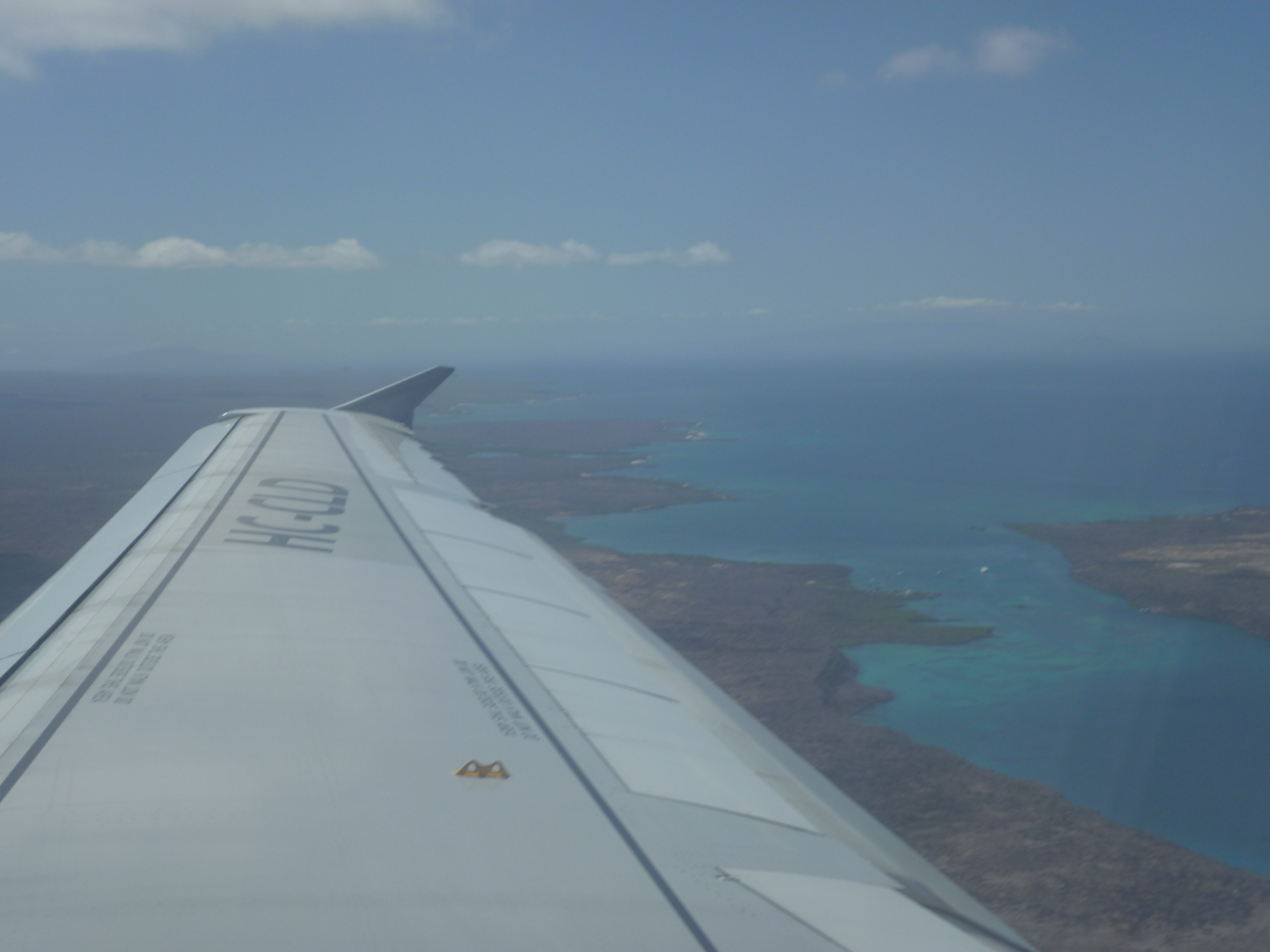
Additional images
Alvaro Sevilla Design Isla Santa Cruz Galapagos foto tomada desde el avión.jpg|Flying out of Baltra, on the right with the Island of Santa Cruz on the left and in the middle is the Itabaca Channel Boats off the Santa Cruz Island Galapagos in the Itabaca Channel photo by Alvaro Sevilla Design.JPG|Boats off the Santa Cruz Island Galapagos in the Itabaca Channel Galápagos sea lions 01.jpg|Galápagos sea lions on a buoy in the Itabaca Channel In the distance is Baltra close to the viewer is the Island of Santa Cruz in the middle is the Itabaca Channelphoto by Alvaro Sevilla Design.JPG
References
References
- (December 2024). "Two Chilean Ships And Their Contributions To The Cartography of Galapagos". Galapagos Research.
This article was imported from Wikipedia and is available under the Creative Commons Attribution-ShareAlike 4.0 License. Content has been adapted to SurfDoc format. Original contributors can be found on the article history page.
Ask Mako anything about Itabaca Channel — get instant answers, deeper analysis, and related topics.
Research with MakoFree with your Surf account
Create a free account to save articles, ask Mako questions, and organize your research.
Sign up freeThis content may have been generated or modified by AI. CloudSurf Software LLC is not responsible for the accuracy, completeness, or reliability of AI-generated content. Always verify important information from primary sources.
Report