From Surf Wiki (app.surf) — the open knowledge base
Iroquois Plateau
| Field | Value |
|---|---|
| name | Mount Dover |
| map | Antarctica |
| range_coordinates | |
| range | Neptune Range, Pensacola Mountains, Antarctica |
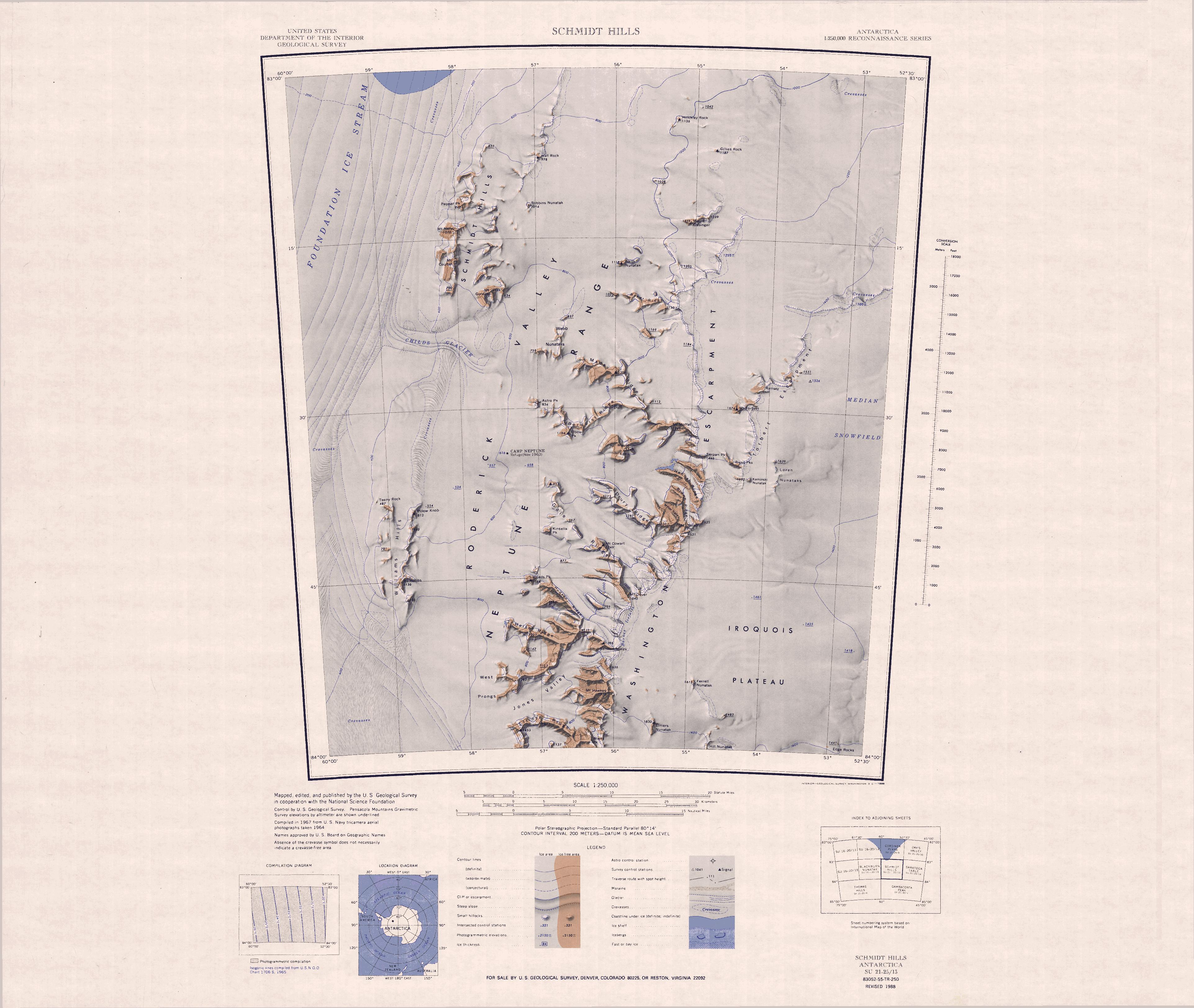
The Iroquois Plateau () is a large, mainly ice-covered plateau situated east of the southern part of the Washington Escarpment in the Pensacola Mountains, Antarctica.
Mapping and name
The Iroquois Plateau was mapped by the United States Geological Survey (USGS) from surveys and United States Navy air photographs in 1956–66. It was named by the United States Advisory Committee on Antarctic Names after the Bell UH-1 Iroquois helicopter which has greatly facilitated field operations in Antarctica.
Location
The Iroquois Plateau is in the Neptune Range. It is east of the Washington Escarpment and south of the Median Snowfield. Scattered nunataks on the plateau include Elmers Nunatak, Ferrell Nunatak, Hill Nunatak and the Edge Rocks.
Features
Elmers Nunatak
Ferrell Nunatak
Hill Nunatak
Edge Rocks
References
Sources
- {{citation|url=https://pubs.usgs.gov/fedgov/70039167/report.pdf |accessdate=2023-12-03 |edition=2 |editor-last=Alberts |title=Geographic Names of the Antarctic |editor-first=Fred G.
- {{citation |url=https://commons.wikimedia.org/wiki/File:C83052s5_Schmidt_Hills.jpg |accessdate=2024-03-18
This article was imported from Wikipedia and is available under the Creative Commons Attribution-ShareAlike 4.0 License. Content has been adapted to SurfDoc format. Original contributors can be found on the article history page.
Ask Mako anything about Iroquois Plateau — get instant answers, deeper analysis, and related topics.
Research with MakoFree with your Surf account
Create a free account to save articles, ask Mako questions, and organize your research.
Sign up freeThis content may have been generated or modified by AI. CloudSurf Software LLC is not responsible for the accuracy, completeness, or reliability of AI-generated content. Always verify important information from primary sources.
Report