From Surf Wiki (app.surf) — the open knowledge base
Interstate 405 (California)
Interstate Highway in California
Interstate Highway in California
| Field | Value | |||||
|---|---|---|---|---|---|---|
| state | CA | |||||
| type | I | |||||
| route | 405 | |||||
| alternate_name | San Diego Freeway | |||||
| section | 615 | |||||
| map | ||||||
| map_custom | yes | |||||
| map_notes | I-405 highlighted in red | |||||
| length_mi | 72.15 | |||||
| length_ref | ||||||
| established | 1964 | |||||
| direction_a | South | |||||
| terminus_a | in Irvine | |||||
| junction | {{plainlist | |||||
| *{{Jct | state | CA | SR | 133}} in Irvine | ||
| *{{Jct | state | CA | SR | 55}} in Costa Mesa | ||
| *{{Jct | state | CA | SR | 73}} in Costa Mesa | ||
| *{{Jct | state | CA | I | 605 | SR | 22}} in Seal Beach |
| *{{jct | state | CA | I | 710}} in Long Beach | ||
| *{{jct | state | CA | I | 110}} in Carson | ||
| *{{Jct | state | CA | I | 105}} near LAX | ||
| *{{jct | state | CA | I | 10}} in West Los Angeles | ||
| *{{jct | state | CA | US | 101}} in Sherman Oaks | ||
| *{{Jct | state | CA | SR | 118}} in Mission Hills | ||
| direction_b | North | |||||
| terminus_b | in Sylmar | |||||
| counties | Orange, Los Angeles | |||||
| spur_type | I | |||||
| spur_of | 5 | |||||
| previous_type | US | |||||
| previous_route | 399 | |||||
| next_type | US | |||||
| next_route | 466 |
- in Irvine
- in Costa Mesa
- in Costa Mesa
- in Seal Beach
- in Long Beach
- in Carson
- near LAX
- in West Los Angeles
- in Sherman Oaks
- in Mission Hills
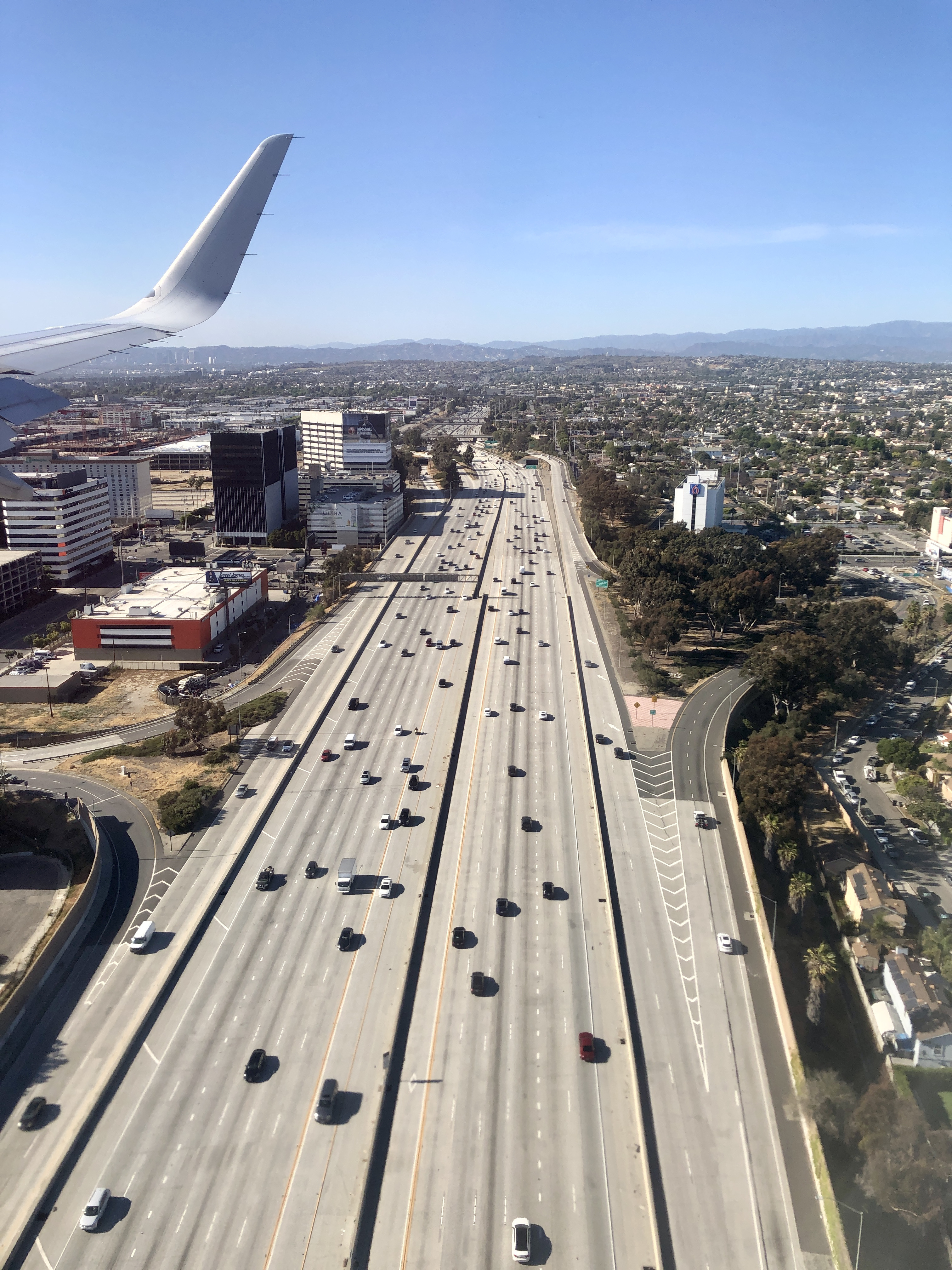
Interstate 405 (I-405, locally referred to as the 405) is a major north–south auxiliary Interstate Highway in Southern California. The entire route is known as the northern segment of the San Diego Freeway. I-405 is a bypass auxiliary route of I-5, running along the southern and western parts of the Greater Los Angeles urban area from Irvine in the south to Sylmar in the north.
I-405, heavily traveled by both commuters and freight haulers along its entire length, is the busiest and most congested freeway in the United States. The freeway's annual average daily traffic between exits 21 and 22 in Seal Beach reached 374,000 in 2008, making it the highest count in the nation. It has played a crucial role in the development of dozens of cities and suburbs along its route through Los Angeles and Orange counties. It also serves Los Angeles International Airport, Long Beach Airport, and Orange County's John Wayne Airport.
Route description
The entirety of I-405 is defined in section 615 of the California Streets and Highways Code as Route 405, and that the highway is from "Route 5 near El Toro to Route 5 near San Fernando". This definition corresponds with the Federal Highway Administration (FHWA)'s route logs of I-405.
I-405 is part of the California Freeway and Expressway System and is part of the National Highway System, a network of highways that are considered essential to the country's economy, defense, and mobility by the Federal Highway Administration. The entire freeway is known as the San Diego Freeway, and parts of it are less commonly known as the Sepulveda Freeway (after Sepulveda Boulevard). In 2024, the California State Legislature passed Assembly Bill 2698, adding subdivision (b) to section 615 of the California Streets and Highways Code that designates the segment from Bolsa Chica Road to Bolsa Avenue near the Little Saigon district in Orange County as the Little Saigon Freeway, in recognition of it being the oldest and largest Little Saigon enclave in the country.
Orange County
I-405 begins at the El Toro Y interchange in southeastern Irvine in Orange County, splitting from its parent I-5 and inheriting that route's San Diego Freeway title; I-5 continues north as the Santa Ana Freeway. The freeway passes immediately south of the Irvine Spectrum Center mall before intersecting with State Route 133 (SR 133). It then continues through Irvine, passing north of the University of California, Irvine, and then along the northern boundary of John Wayne Airport. After passing the airport, the freeway enters Costa Mesa and has an interchange with SR 55. It passes South Coast Plaza before a partial interchange with SR 73, which serves as a partially-tolled bypass of I-405 between Costa Mesa and Laguna Niguel.
The freeway then travels through Fountain Valley and along the edges of Westminster and Huntington Beach before entering Seal Beach, where it begins to run concurrently with SR 22. It continues along the northern edge of Seal Beach, passing between Naval Weapons Station Seal Beach and Joint Forces Training Base - Los Alamitos, before SR 22 splits from I-405 and continues west while the freeway turns north. I-405 then intersects the southern end of I-605 before crossing the San Gabriel River and entering Los Angeles County.
Los Angeles County
I-405 enters Los Angeles County in the city of Long Beach. It passes to the north of California State University, Long Beach, and then along the south of Long Beach Airport. The freeway then intersects with I-710 before entering Carson (and crossing through a small sliver of the city of Los Angeles before reentering Carson). It passes near California State University, Dominguez Hills, and Dignity Health Sports Park, home of Major League Soccer club LA Galaxy. A weigh station for both directions is located in Carson between the Avalon Boulevard and Main Street exits.
The freeway then intersects with I-110 as it briefly reenters the city of Los Angeles by passing through the Harbor Gateway, a strip of land connecting San Pedro to the rest of the city. I-405 then continues to roughly parallel the contour of the coastline as it passes through the South Bay communities of Torrance, Lawndale, Redondo Beach, Hawthorne, and El Segundo. The freeway then encounters I-105 on the southeastern corner of Los Angeles International Airport. It passes to the east of the airport, serving it with exits at the Imperial Highway and Century Boulevard.
I-405 next passes through Inglewood, coming near SoFi Stadium, home to the Los Angeles Rams and Los Angeles Chargers of the National Football League. It then passes through Westchester and Culver City where it meets SR 90, the Marina Freeway. It serves the Los Angeles neighborhoods of Mar Vista and West Los Angeles while passing a few miles east of Santa Monica, intersecting with I-10 in the process. The freeway continues into Westwood, passing just to the west of University of California, Los Angeles. It then passes the Getty Center as it ascends Sepulveda Pass through the Santa Monica Mountains.
After cresting the mountains, I-405 descends into the San Fernando Valley, intersecting US Route 101 (US 101) in the Sherman Oaks neighborhood of Los Angeles. The freeway then continues due north through the western part of the valley, passing east of Van Nuys Airport and California State University, Northridge. It intersects SR 118 in the Mission Hills area before ending in a merge with I-5 in Sylmar.
HOV and HOT lanes
Express lanes Following the completion of the Sepulveda Pass Improvements Project in 2014, I-405 had the longest high-occupancy vehicle (HOV) lanes in California, stretching about 70 mi of the highway.
Construction on the I-405 Improvement Project then started in March 2018, which included converting the existing HOV lanes to high-occupancy toll (HOT) lanes. The first segment of HOT lanes between SR 73 in Costa Mesa and I-605 in Seal Beach opened on December 1, 2023. The conversion included closing the lanes in November to test the tolling equipment. In addition, two lanes were added in each direction, one toll lane and one general purpose lane, making the upgrade from five to seven lanes in each direction.
, the HOT lanes are a 24/7 service. Solo drivers are tolled using a congestion pricing system based on the real-time levels of traffic. For two-person carpools, they are charged the posted toll during weekday peak hours between 6:00 am and 10:00 am and between 2:00 pm and 7:00 pm and weekend peak hours between 1:00 pm and 7:00 pm; no toll would charged during off-peak hours until years after their opening. Carpools with three or more people and motorcycles are not charged. All tolls are collected using an open road tolling system, and therefore there are no toll booths to receive cash. Each vehicle using the HOT lanes is required to carry a FasTrak Flex transponder with its switch set to indicate the number of the vehicle's occupants (1, 2, or 3+). Solo drivers may also use the FasTrak standard tag without the switch. Drivers without any FasTrak tag will be assessed a toll violation regardless of whether they qualified for free.
Traffic congestion

The freeway is one of the busiest freeways in the nation and is the busiest freeway in California. The freeway's congestion problems have led to jokes that the road was numbered 405 because traffic moves at "four or five" miles per hour (4 or), or because drivers had spent "four or five" hours to travel anywhere. Indeed, average speeds as low as 5 mph are routinely recorded during morning and afternoon commutes, and its interchanges with the Ventura Freeway (US 101) and with the Santa Monica Freeway (I-10) each consistently rank among the five most congested freeway interchanges in the US. As a result of these congestion problems, delays passing through the entirety of Greater Los Angeles using this bypass route instead of merely using the primary route I-5 through Downtown Los Angeles may be present.
I-405 is the only major north–south freeway in the densely populated areas between West Los Angeles and Downtown Los Angeles, crossing the Santa Monica Mountains and connecting the San Fernando Valley and the Los Angeles Basin. It is also a major connection for traffic en route to either the Port of Los Angeles, the Port of Long Beach, Los Angeles International Airport, or SoFi Stadium. By 2040, this corridor is estimated to increase by 35 percent and travel times reduced by 75 percent. The freeway's West Los Angeles section is the subject of annual gridlock photos and videos taken during the Thanksgiving holiday weekend, most often from an aerial view.
Another parallel freeway was proposed to connect the valley and basin (the Laurel Canyon Freeway or La Cienega Freeway) but has faced upper-class and NIMBY homeowner opposition. Despite four years of construction disruptions and billions of dollars of public money, Los Angeles Times commentary claims traffic with the lane expansions is actually just as bad or worse.
Unlike some of the other major travel corridors in the region (such as I-5 which parallels the LOSSAN Corridor), I-405 has no rail-based public transit which parallels it along the west side of Orange and Los Angeles counties. There is a proposal for a Sepulveda Transit Corridor which would parallel I-405 through Sepulveda Pass, one of the major bottlenecks on the route, which would ease congestion by providing an alternative to driving.
History

I-405 was approved as a chargeable Interstate (in other words, an Interstate financed with federal funds) in 1955. The Division of Highways originally requested I-9 for the corridor, while the Santa Ana Freeway would be I-11; I-3 was later requested in April 1958 before the Division of Highways agreed to use I-405. Construction began in 1957 with the first section, mostly north of Los Angeles International Airport, which was completed in 1961 and initially signed as SR 7. The 5.7 mi section through Sepulveda Pass was dedicated on December 21, 1962, and cost $20 million to construct. It was designed with a maximum grade of 5.5 percent and required the relocation of Sepulveda Boulevard and the Mulholland Highway, which was moved 1.1 mi to the south along a new 579 ft bridge over the freeway. Additional sections west of Alameda Street were completed in 1962 and 1963, creating 41.8 mi of continuous freeway.
The highway was renumbered to I-405 during the 1964 state highway renumbering. The Orange County portion of the San Diego Freeway took 13 years to construct, with the first section opening in 1958. The final section of I-405, 8 mi leading to I-5 in Irvine, was dedicated on December 6, 1968, and opened to traffic in January 1969.
"Carmageddon"
A section of I-405 was closed over the weekend of Friday, July 15, 2011, as part of the Sepulveda Pass Improvements Project. Before the closing, local radio DJs and television newscasts referred to it as "Carmageddon" and "Carpocalypse", parodying the notion of Armageddon and the Apocalypse, since it was anticipated that the closure would severely impact traffic. In reality, traffic was lighter than normal across a wide area. The California Department of Transportation (Caltrans) reported that fewer vehicles used the roads than usual, and those who did travel by road arrived more quickly than on a normal weekend. The Los Angeles Times on Sunday, July 17, 2011, featured comments and images of people enjoying the moment next to the I-405 freeway with the free-flowing traffic.
In response to JetBlue's offer of special flights between Hollywood Burbank Airport in Burbank and Long Beach Airport, a distance of only 29 mi, for $4.00, a group of cyclists did the same journey in one and a half hours, compared to two and a half hours by plane (including a drive to the airport from West Hollywood 90 minutes in advance of the flight and travel time to the end destination). There was also some debate about whether the Los Angeles area could benefit from car-free weekends regularly.
The Los Angeles County Metropolitan Transportation Authority then had full closure of a 10 mi stretch of I-405 on the weekend of September 29–30, 2012, while construction crews worked to demolish a portion of the Mulholland Bridge.
Researchers at the University of California, Los Angeles, used the closure of I-405 to study particulate matter air pollution. The researchers took air samples before, during, and after the closure. The researchers found an 83-percent reduction in ultrafine particles, 55-percent reduction in fine particle matter, and 62-percent less black carbon.
Sepulveda Pass Improvements Project
The $1-billion Sepulveda Pass Improvements Project added a high-occupancy vehicle (HOV) lane and associated changes to freeway entrances, exits, and underpasses along a 10 mi stretch through Sepulveda Pass between I-10 and US 101/Ventura Boulevard. The project was completed as a design–build in contrast to the traditional design–bid–build used typically in infrastructure improvement. This section of I-405 was closed for a weekend in mid-July 2011 to demolish the Mulholland Drive Bridge, and a 10 mi section was closed for the last weekend of September 2012.
Jamzilla was the name for the I-405 closure on Presidents' Day weekend 2014. There were lane closures and complete closures on I-405 starting February 14 at 10:00 pm until February 18 at 6:00 am to pave and restripe the northbound lanes.
On May 23, 2014, the 10 mi HOV lane was opened to traffic.
Future
Manchester and Century Boulevard interchanges
Proposed changes between the Manchester and Century Boulevard interchanges in the city of Inglewood are to provide a new southbound onramp and a new northbound offramp for Arbor Vitae Street, to reconstruct and widened the Arbor Vitae Street over-bridge and replace the Century Boulevard overcrossing structure. This work would reduce congestion on the approach to Los Angeles International Airport. Caltrans has not yet issued a start date for this work.
Sepulveda Pass express lanes
The HOVs lane that were constructed as part of the Sepulveda Pass Improvements Project are proposed to be upgraded to express lanes by 2028.
Exit list
References
References
- Starks, Edward. (January 27, 2022). "Table 2: Auxiliary Routes of the Dwight D. Eisenhower National System of Interstate and Defense Highways". [[Federal Highway Administration]].
- (November 16, 2015). "Roadshow: Why 'The 405' is called 'The 405'".
- "U.S. Highways With the Most Traffic". Time For Kids.
- (2013-08-20). "I-405 In LA Named Busiest Interstate In Any U.S. City".
- "Section 615". California Office of Legislative Counsel.
- (January 2025). "Table 1: Auxiliary Routes of the Dwight D. Eisenhower National System Of Interstate and Defense Highways". [[Federal Highway Administration]].
- {{CAFESystem
- {{FHWA NHS map
- {{FHWA NHS
- {{CA Named Freeways
- (September 25, 2024). "AB-2698 Route 405: Little Saigon Freeway".
- Groves, Martha. (May 22, 2014). "New Carpool Lane on Northbound 405 Finally Opens". Los Angeles Times.
- "405 Express Lanes". Orange County Transportation Authority.
- (October 23, 2023). "New 405 Freeway lanes opening set for Dec. 1".
- "How to drive the Express Lanes". Orange County Transportation Authority.
- (January 29, 2018). "5 Things You Should Know About The I-405 Improvement Project {{!}} Iteris, Inc.".
- Grad, Shelby. (November 27, 2019). "How 405 Freeway gridlock became the iconic image of an L.A. Thanksgiving". Los Angeles Times.
- (March 20, 1998). "Crossroads of Confusion". Los Angeles Times.
- Hall, Carla. (December 2, 2014). "Four ways the 405 freeway project has not made your life better". Los Angeles Times.
- (May 1957). "Interstate Highway System Adjusted and Approved by Commissioner of Public Roads". California State Department of Public Works, Division of Highways.
- McCoy, George T.. (April 1, 1958). "Correspondence Concerning Route Numbering of the Interstate Urban Network". American Association of State Highway Officials.
- (September 23, 1962). "Big New Highway Open In Sepulveda Canyon". [[The Van Nuys News]].
- Racine, Ned. (January 11, 2011). "How the Mulholland Drive bridge was constructed". Los Angeles County Metropolitan Transportation Authority.
- Gnerre, Sam. (December 6, 2021). "South Bay history: Piecing together the construction of the 405 Freeway through the South Bay". [[Daily Breeze]].
- Sanders, Bob. (January 12, 1969). "13-Year Job Completed on San Diego Freeway". Press-Telegram.
- Hebert, Ray. (December 9, 1968). "San Diego Freeway Now Reality". Los Angeles Times.
- (July 16, 2011). "Interstate 405: The 'Carmageddon', History, Myth and Trivia".
- Gish, Judy. (June 2011). "I-405 Summer Weekend Closure Planned". California Department of Transportation District 7.
- Gostar, Reza. (June 9, 2011). "Carpocalypse: The Weekend the 405 Freeway Will Stand Still – Brentwood, California Patch". Brentwood.patch.com.
- (July 21, 2011). "Metrolink sets weekend ridership recording during 405 closure". The Source.
- (July 17, 2011). "L.A. Downshifts and Takes It Easy". [[Los Angeles Times]].
- (July 13, 2011). "JetBlue — 405 Freeway Closure? We're So Over It!". JetBlue.
- "Great Circle Mapper". Gcmap.com.
- (July 17, 2011). "LA avoids feared 'Carmageddon' traffic jam". The Independent.
- (July 19, 2011). "In 'Carmageddon,' some see road map for the future". Los Angeles Times.
- Morgan, Jared. (July 19, 2012). "Carmageddon 2012 Announced, Full 405 Closure in September".
- (Spring 2014). "Carmageddon or Carmaheaven? Air Quality Results of a Freeway Closure". Access.
- "Sepulveda Pass Improvement Project". Los Angeles County Metropolitan Transportation Authority.
- Groves, Martha. (February 14, 2014). "Jamzilla lane closures on the 405 Freeway begin tonight". Los Angeles Times.
- (May 23, 2014). "Carpool lane on North 405 Freeway opens". KABC-TV.
- District 7. "Interstate 405: On- and Off-Ramp Improvements at Arbor Vitae Street". California Department of Transportation.
- "I-405 Sepulveda Pass ExpressLanes Project". Los Angeles County Metropolitan Transportation Authority.
- {{Caltrans trucklist}}
- (October 2006). "California Log of Bridges on State Highways: District 7".
- California Department of Transportation, [http://traffic-counts.dot.ca.gov/ All Traffic Volumes on CSHS], 2005 and 2006
- (March 17, 2020). "Interstate 405 Freeway Interchanges". [[California Department of Transportation]].
- . (November 24, 2013). ["405 Freeway NB Montana Avenue Offramp Dies At 57"](http://losangeles.cbslocal.com/2013/11/24/405-freeway-nb-montana-avenue-offramp-dies-at-57/). *[[KCBS-TV]]*.
- https://www.pbssocal.org/shows/lost-la/how-sepulveda-canyon-became-the-405
- "Sepulveda Pass".
This article was imported from Wikipedia and is available under the Creative Commons Attribution-ShareAlike 4.0 License. Content has been adapted to SurfDoc format. Original contributors can be found on the article history page.
Ask Mako anything about Interstate 405 (California) — get instant answers, deeper analysis, and related topics.
Research with MakoFree with your Surf account
Create a free account to save articles, ask Mako questions, and organize your research.
Sign up freeThis content may have been generated or modified by AI. CloudSurf Software LLC is not responsible for the accuracy, completeness, or reliability of AI-generated content. Always verify important information from primary sources.
Report