From Surf Wiki (app.surf) — the open knowledge base
Gloucestershire
County of England

County of England
| Field | Value | ||
|---|---|---|---|
| official_name | Gloucestershire | ||
| locator_map | [[File:Gloucestershire UK locator map 2010.svg | 200px | Gloucestershire within England]] |
| image_main | {{multiple images | ||
| border | infobox | ||
| perrow | 2 1 | ||
| total_width | 270px | ||
| image1 | Tyndale Monument.jpg | ||
| image2 | Gloucester Cathedral - geograph.org.uk - 3219332 (cropped).jpg | ||
| image3 | Edge of the Cotswolds with Malvern Hills - October 2024.jpg | ||
| image_caption | Clockwise from top left: Tyndale Monument, North Nibley; Gloucester Cathedral; and the Cotswolds near Winchcombe | ||
| coordinates | |||
| region | South West | ||
| established_date | Ancient | ||
| lord_lieutenant_office | Lord Lieutenant of Gloucestershire | ||
| lord_lieutenant_name | Edward Gillespie | ||
| high_sheriff_office | High Sheriff of Gloucestershire | ||
| high_sheriff_name | Julie Kent | ||
| ethnicity | 87.2% White British (2021) | ||
| county_council | Gloucestershire County Council | ||
| unitary_council1 | South Gloucestershire Council | ||
| admin_hq | Gloucester | ||
| iso_code | GB-GLS | ||
| gss_code | E10000013 | ||
| nuts_code | UKK13 | ||
| districts_map | [[File:Gloucestershire numbered districts.svg | 200px]] | |
| districts_key | Unitary County council area | ||
| districts_list | #Tewkesbury | ||
| MPs | List of MPs | ||
| police | Gloucestershire Constabulary | ||
| website |
the English county
- Forest of Dean
- Gloucester
- Cheltenham
- Stroud
- Cotswold
- South Gloucestershire Gloucestershire ( , ; abbreviated Glos.) is a ceremonial county in South West England. It is bordered by Herefordshire to the north-west, Worcestershire to the north, Warwickshire to the north-east, Oxfordshire to the east, Wiltshire to the south, Bristol and Somerset to the south-west, and the Welsh county of Monmouthshire to the west. The largest settlement is the city of Gloucester.
The county is predominantly rural, with an area of 3150 km2, and a population of in . Gloucester is located in the north-centre of the county, and the spa town of Cheltenham is immediately to the east. Other towns include Tewkesbury in the north, Cirencester in the east, Stroud in the centre, and Yate in the south. The far south of the county, including Filton and Kingswood, is densely populated and forms part of the Bristol built-up area. For local government purposes Gloucestershire comprises a non-metropolitan county, with six districts, and the unitary authority area of South Gloucestershire. South Gloucestershire Council is a member of the West of England Combined Authority.
Gloucestershire is bisected by the river River Severn, which enters the county near Tewkesbury and forms a wide valley down its centre before broadening into a large tidal estuary. The east of the county contains the majority of the Cotswolds, and the uplands in the west are part of the Forest of Dean and the Wye Valley. All three areas have been designated national landscapes.
Gloucestershire was likely established in the tenth century and expanded to approximately its current borders in the eleventh. The county was relatively settled during the late Middle Ages, and contained several wealthy monasteries such as Tewkesbury, Gloucester, Hailes, and Cirencester; the Forest of Dean was also a major iron-producing region in this period. The city of Bristol became an independent county in 1373, by which point it was the third-largest city in England. Gloucestershire was not heavily industrialised during the Industrial Revolution, but the Port of Gloucester was expanded with new docks and the small Forest of Dean coalfield was exploited.
History
Main article: History of Gloucestershire
Gloucestershire originally included Bristol, then a small town. Members of local rural communities moved to the port city (which was to become Bristol), and Bristol's population grew rapidly during the Industrial Revolution. Bristol became a county in its own right, separate from Gloucestershire and Somerset, in 1373. It later became part of the administrative County of Avon from 1974 to 1996. Some northern parts of the county, including Long Marston and Welford-on-Avon, were transferred to Warwickshire in 1931.

Upon the abolition of Avon in 1996, the region north of Bristol became a unitary authority area of South Gloucestershire and is now part of the ceremonial county of Gloucestershire. In March 2008, the ceremonial county of Gloucestershire adopted a flag through a contest judged by the High Sheriff of Gloucestershire, Jonathan Carr.
In July 2007, Gloucestershire was subject to some of the worst flooding in recorded British history, with tens of thousands of residents affected. The RAF conducted the largest peacetime domestic operation in its history to rescue over 120 residents from flood-affected areas. The damage was estimated at over £2 billion.
Geography and environment
Gloucestershire has three main landscape areas: a large part of the Cotswolds, the Royal Forest of Dean, and the Severn Vale. The Cotswolds take up a large portion of the east and south of the county, the Forest of Dean taking up the west, with the Severn and its valley running between these features. The Daffodil Way in the Leadon Valley, on the border of Gloucestershire and Herefordshire surrounding the village of Dymock, is known for its many spring flowers, orchards, and woodland, which attracts many walkers. In the west, the Wye Valley borders Wales.
Demography
Ethnicity
For the overwhelming majority of Gloucestershire’s history, the population of the ceremonial county was ethnically homogeneous, with the population being of White British ethnicity. In the 2021 census, the ceremonial county of Gloucestershire had a usual resident population of 935,500. The ceremonial county of Gloucestershire is divided between one non-metropolitan county: Gloucestershire County Council, which, in the 2021 census, had a usual resident population of 645,100, and one unitary authority: South Gloucestershire Council, which, in the 2021 census, had a usual resident population of 290,400. In the 2021 census, the ethnic composition of the ceremonial county of Gloucestershire comprised: 92.5% White; 3.2% Asian; 1.3% Black; 2.3% Mixed; and 0.8% Other.
- White (92.5%): English; Welsh; Scottish; Northern Irish or British (87.2%); Irish (0.6%); Gypsy or Irish Traveller (0.2%); Roma (0.1%); and Other White (4.5%).
- Asian (3.2%): Indian (1.4%); Pakistani (0.3%); Bangladeshi (0.2%); Chinese (0.5%); and Other Asian (0.7%).
- Black (1.3%): African (0.7%); Caribbean (0.4%); and Other Black (0.2%).
- Mixed (2.3%): White and Asian (0.6%); White and Black African (0.3%); White and Black Caribbean (0.8%); and Other Mixed or Multiple ethnic groups (0.5%).
- Other (0.8%): Arab (0.2%) and Any other ethnic group (0.6%).
Note: Sub-group totals may not sum exactly to the group total due to rounding. Data for the ceremonial county are aggregated from its constituent unitary authorities.
| Ethnic Group | 2001 Census | 2011 Census | 2021 Census |
|---|---|---|---|
| White | 97.3% | 95.3% | 92.5% |
| Asian | 1.2% | 2.2% | 3.2% |
| Black | 0.5% | 0.9% | 1.3% |
| Mixed | 0.8% | 1.4% | 2.3% |
| Other | 0.2% | 0.2% | 0.8% |
Note: The 2001 census figures for 'Asian' and 'Other' have been adjusted to reflect the 2011 reclassification of the Chinese ethnic group from 'Other' to 'Asian' to allow comparison across census years.
Religion
In the 2021 census, the religious composition of the ceremonial county of Gloucestershire comprised: 47.6% Christianity; 42.8% No religion; 1.5% Islam; 0.7% Hinduism; 0.4% Buddhism; 0.2% Sikhism; 0.1% Judaism; 0.5% Other religion; and 6.1% Not stated.
| Religion | 2001 Census | 2011 Census | 2021 Census |
|---|---|---|---|
| Christianity | 75.3% | 62.3% | 47.6% |
| No religion | 15.7% | 27.9% | 42.8% |
| Islam | 0.5% | 0.9% | 1.5% |
| Hinduism | 0.3% | 0.5% | 0.7% |
| Buddhism | 0.2% | 0.3% | 0.4% |
| Sikhism | 0.1% | 0.1% | 0.2% |
| Judaism | 0.1% | 0.1% | 0.1% |
| Other religion | 0.3% | 0.4% | 0.5% |
| Not stated | 7.5% | 7.5% | 6.1% |
Governance
The 2025 Gloucestershire County Council election was held on 1 May 2025. The council had been under no overall control prior to the election, being run by a Conservative minority administration. Following the election, the council remained under no overall control, with the Liberal Democrats becoming the largest party and Reform UK becoming the second largest party. At the subsequent annual council meeting on 21 May 2025, Liberal Democrat councillor Lisa Spivey was appointed leader of a Liberal Democrat minority administration. The County Council shares responsibility with six district councils: Tewkesbury, Forest of Dean, City of Gloucester, Cheltenham, Stroud, and Cotswold.
The southernmost part of the county, South Gloucestershire, is governed by South Gloucestershire Council, which is a unitary authority council independent of the county council, but the unitary authority is still part of the ceremonial county. Previously, the area of South Gloucestershire was part of the county of Avon. Although Avon was abolished in 1996, some services in South Gloucestershire are still provided in conjunction with other former parts of Avon county, such as the Avon Fire and Rescue Service. Since 2017, South Gloucestershire has been part of the West of England Combined Authority, which led by the mayor of the West of England.
The 2023 South Gloucestershire Council election was held on 4 May 2023. The council had been under Conservative majority control prior to the election. Following the election, the council is under no overall control, with the Conservatives remaining the largest party and the Liberal Democrats remaining the second largest party. At the subsequent annual council meeting on 24 May 2023, the Liberal Democrat councillor Claire Young was appointed leader of a Liberal Democrat–Labour coalition administration. In the 2024 United Kingdom general election, Claire Young was elected Member of Parliament for Thornbury and Yate, resulting in Liberal Democrat councillor Maggie Tyrrell being appointed the new leader of the coalition administration.
There are six parliamentary constituencies in Gloucestershire, all of which are Conservative-controlled as of the 2019 general election. Due to the 2023 Periodic Review of Westminster constituencies, Gloucestershire will be combined with Wiltshire for parliamentary boundary purposes, allowing cross-county electoral divisions.
Economy
This is a chart of trend of regional gross value added of Gloucestershire at current basic prices published (pp. 240–253) by Office for National Statistics with figures in millions of Pounds Sterling.
| Year | Regional Gross Value Added | Agriculture | Industry | Services | ||||
|---|---|---|---|---|---|---|---|---|
| 1995 | ||||||||
| 2000 | ||||||||
| 2003 |
The following is a chart of Gloucestershire's gross value added total in millions of Pounds Sterling from 1997 to 2009 based upon the Office for National Statistics figures
| Year | GVA (£ million) | |
|---|---|---|
| 1997 | ||
| 1998 | ||
| 1999 | ||
| 2000 | ||
| 2001 | ||
| 2002 | ||
| 2003 | ||
| 2004 | ||
| 2005 | ||
| 2006 | ||
| 2007 | ||
| 2008 | ||
| 2009 |
The 2009 estimation of £11,452 million GVA can be compared to the South West regional average of £7,927 million.
Education
Secondary schools
Gloucestershire has mainly comprehensive schools with seven selective grammar schools; two are in Stroud, Stroud High School for girls and Marling School for boys, one in Cheltenham, Pate's Grammar, and four in Gloucester, Sir Thomas Rich's for boys (aged 11–18) and girls (aged 16–18, in the sixth form), and Denmark Road High School and Ribston Hall for girls and The Crypt which is mixed. There are 42 state secondary schools, not including sixth form colleges, and 12 independent schools, including Cheltenham Ladies' College, Cheltenham College, and Dean Close School. All but about two schools in each district have a sixth form, but the Forest of Dean only has two schools with sixth forms. All schools in South Gloucestershire have sixth forms.
Higher and further education

Gloucestershire has two universities, the University of Gloucestershire and the Royal Agricultural University, and four higher and further education colleges, Gloucestershire College, Cirencester College, South Gloucestershire and Stroud College, and the Royal Forest of Dean College. Each has campuses at multiple locations throughout the county.
The University of the West of England also has three locations in Gloucestershire; an associate faculty (Hartpury College) specialising in animal behaviour and welfare, agricultural and sports-related courses in Hartpury, Gloucestershire; a regional centre at the Gloucester Docks, Alexandra Warehouse, specialising in Adult and Mental Health Nursing; and Frenchay Campus in South Gloucestershire.
Towns and cities
Main article: List of places in Gloucestershire
Gloucestershire has one city and 33 towns:
Cities
- Gloucester
Towns
The towns in Gloucestershire are:
- Berkeley
- Bradley Stoke
- Cheltenham
- Chipping Campden
- Chipping Sodbury
- Cinderford
- Cirencester
- Coleford
- Dursley
- Emersons Green
- Fairford
- Filton
- Kingswood
- Lechlade
- Lydney
- Minchinhampton
- Mitcheldean
- Moreton-in-Marsh
- Nailsworth
- Newent
- Northleach
- Painswick
- Patchway
- Quedgeley
- Stonehouse
- Stow-on-the-Wold
- Stroud
- Tetbury
- Tewkesbury
- Thornbury
- Winchcombe
- Wotton-under-Edge
- Yate
Suburban town of Stroud:
- Cainscross Town in Monmouthshire with suburbs in Gloucestershire:
- Chepstow
Green belt
Main article: Avon Green Belt, Gloucester and Cheltenham Green Belt
The county has two green belt areas, the first covers the southern area in the South Gloucestershire district, to protect outlying villages and towns between Thornbury and Chipping Sodbury from the urban sprawl of the Bristol conurbation. The second belt lies around Gloucester, Cheltenham, and Bishop's Cleeve, to afford those areas and villages in between a protection from urban sprawl and further convergence. Both belts intersect with the boundaries of the Cotswolds AONB.
Transport
Railways
Gloucestershire once had a much larger railway network than it does now with over 100 stations in the county, the vast majority of which were closed during the Beeching cuts. Nowadays, only 15 remain within the county, mostly concentrated on the CrossCountry NE-SW route and around the North Fringe of Bristol. Some stations have been reopened in recent years; Cam and Dursley railway station opened in 1994, with Ashchurch for Tewkesbury opening three years later in 1997. Local campaign groups are also seeking to reopen several disused stations, including Charfield railway station in South Gloucestershire.
Antiquities
There are a number of Roman remains scattered across the county, including the Eastgate Viewing Chamber in Gloucester and Chedworth Roman Villa.
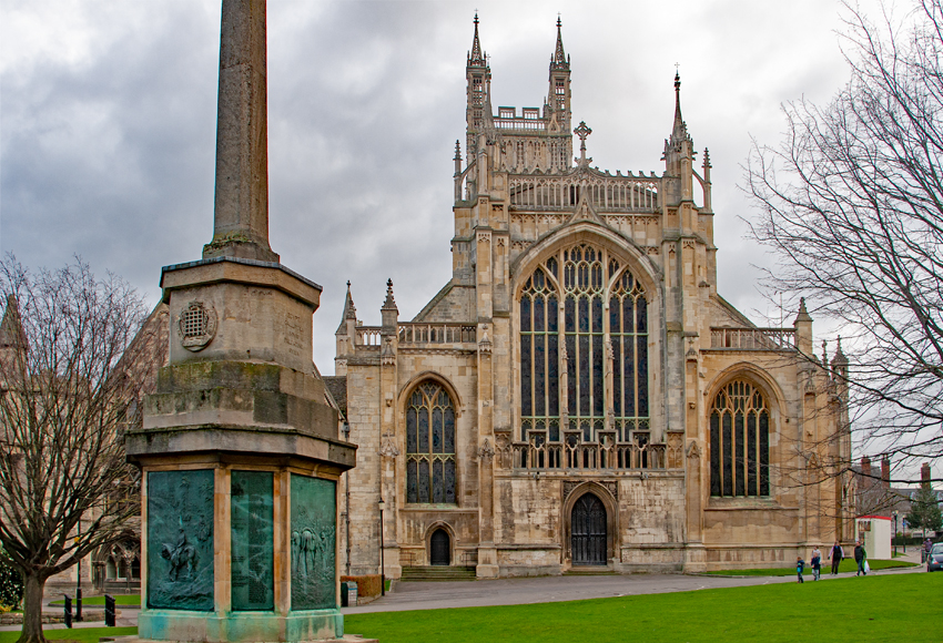
There are a variety of religious buildings across the county, notably the cathedral of Gloucester, the abbey church of Tewkesbury (which is over 500 years old and has the tallest Norman tower in England), and the church of Cirencester. Of the abbey of Hailes near Winchcombe, founded by Richard, Earl of Cornwall, in 1246, little more than the foundations are left, but these have been excavated and fragments have been brought to light.

Most of the old market towns have parish churches. At Deerhurst near Tewkesbury and Bishop's Cleeve near Cheltenham, there are churches of special interest on account of the pre-Norman work they retain. There is also a Perpendicular church in Lechlade, and that at Fairford was built (), according to tradition, to contain a series of stained-glass windows which are said to have been brought from the Netherlands. These are, however, adjudged to be of English workmanship.
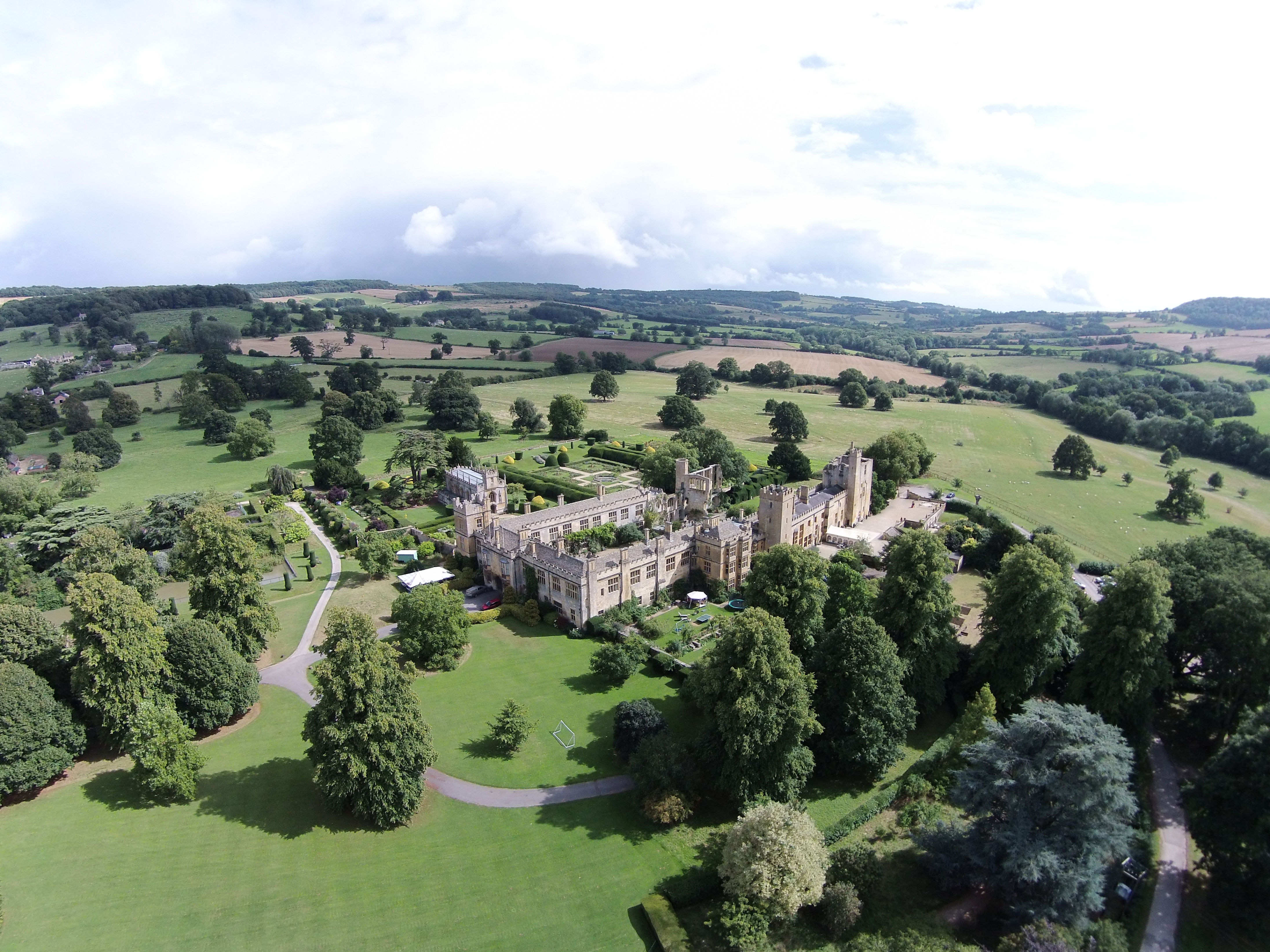
Other notable buildings include Calcot Barn in Calcot, a relic of Kingswood Abbey. Thornbury Castle is a Tudor country house, the pretensions of which evoked the jealousy of Cardinal Wolsey against its builder, Edward Stafford, duke of Buckingham, who was beheaded in 1521. Near Cheltenham is the 15th-century mansion of Southam de la Bere, of timber and stone. Memorials of the de la Bere family appear in the church at Cleeve. The mansion contains a tiled floor from Hailes Abbey. At Great Badminton is the mansion and vast domain of the Beauforts (formerly of the Botelers and others), on the south-eastern boundary of the county. Berkeley Castle at over 800 years old and the ruins of Witcombe Roman Villa at Great Witcombe are also notable heritage features.
There are several royal residences in Gloucestershire, including Highgrove House, Gatcombe Park, and (formerly) Nether Lypiatt Manor.
An annual "cheese-rolling" event takes place at Cooper's Hill, near Brockworth, and the Cotswold Games occurred within the county.
Places of interest
Places of interest in Gloucestershire include:
- Badminton House, residence of the Dukes of Beaufort [[File:HH icon.svg|Historic house]]
- Berkeley Castle, an example of a feudal stronghold. [[File:CL icon.svg]]
- Beverston Castle [[File:CL icon.svg]]
- Chavenage House [[File:HH icon.svg|Historic house]]
- Cheltenham Minster [[File:AP Icon.svg|16px]]
- Clearwell Caves
- Dean Forest Railway [[File:HR icon.svg|Heritage railway]]
- Dyrham Park [[File:HH icon.svg|Historic house]] [[File:NTE icon.svg|National Trust]]
- Edward Jenner's House [[File:HH icon.svg|Historic house]] [[File:Museum icon (red).svg|Museum]]
- Gloucester Cathedral [[File:AP Icon.svg|16px]]
- Gloucestershire Warwickshire Railway [[File:HR icon.svg|Heritage railway]]
- Hailes Abbey [[File:AP Icon.svg|16px]] [[File:EH icon.svg]]
- Newark Park [[File:HH icon.svg|Historic house]] [[File:NTE icon.svg|National Trust]]
- Owlpen Manor [[File:HH icon.svg|Historic house]]
- Rodborough and Minchinhampton Commons [[File:UKAL icon.svg|Accessible open space]]
- Snowshill Manor [[File:HH icon.svg|Historic house]] [[File:NTE icon.svg|National Trust]]
- Sudeley Castle, burial place of Queen Catherine Parr, 6th wife and consort of King Henry VIII. [[File:CL icon.svg]]
- Stanway House [[File:HH icon.svg|Historic house]]
- River Thames [[File:UKAL icon.svg|Accessible open space]]
- Rodmarton Manor [[File:HH icon.svg|Historic house]]
- Severn Bore [[File:UKAL icon.svg|Accessible open space]]
- St. John the Baptist Church, Cirencester [[File:AP Icon.svg|16px]]
- Tewkesbury Abbey [[File:AP Icon.svg|16px]]
- Tewkesbury Medieval Festival
- Tyndale Monument [[File:UKAL icon.svg|Accessible open space]]
- Wildfowl and Wetland Trust, Slimbridge
- Westbury Court Garden
- Westonbirt Arboretum
- Woodchester Mansion [[File:HH icon.svg|Historic house]]
Areas of countryside in Gloucestershire include:
- Forest of Dean [[File:UKAL icon.svg|Accessible open space]]
- Wye Valley [[File:UKAL icon.svg|Accessible open space]]
Scenic Railway Line:
- Gloucester to Newport Line
Media
Gloucestershire's only daily newspaper is the Western Daily Press, while The Citizen, which covers Gloucester, Stroud and the Forest of Dean, and the Gloucestershire Echo, which covers Cheltenham, Tewkesbury and the Cotswolds, were published daily but since October 2017 have been weekly publications. All three, along with free weeklies 'The Forester', 'Stroud Life', 'The Gloucester News', and 'The Cheltenham and Tewkesbury News', are published by Local World. The Stroud News & Journal is a weekly paid-for newspaper based in Stroud. It is published in a tabloid format by Newsquest. Newsquest also produces the weekly Wilts and Gloucestershire Standard newspaper, which covers the southern and eastern parts of the county as well as the weekly Gloucestershire Gazette, which covers the south of the county and much of South Gloucestershire.
Gloucester News Centre is an independent news website with news and information for Gloucestershire.
Radio stations in Gloucestershire include BBC Radio Gloucestershire, BBC Radio Bristol (for South Gloucestershire), Heart West, Sunshine Radio and Greatest Hits Radio Gloucestershire. There are also several community radio stations including Gloucester FM, Radio Winchcombe, Forest of Dean Radio, North Cotswold Community Radio, and Severn FM.
Local TV for the county is provided by BBC West and ITV West Country from Bristol, although in the northern extremes of Gloucestershire, BBC Midlands and ITV Central (West) from Birmingham covers this area. Some eastern parts of the county (Cirencester and parts of the Cotswolds) receive BBC South and ITV Meridian from Oxford.
In popular culture
There are two well-known accounts of childhood in rural Gloucestershire in the early 20th century, Laurie Lee's Cider With Rosie and Winifred Foley's A Child in the Forest. Part of Mrs. Craik's novel John Halifax, Gentleman is set in Enderley, a thinly disguised Amberley, where she lived at the time of writing. Most of the book is set in Nortonbury, easily recognisable as Tewkesbury.
The county has also been the setting for a number of high-profile movies and TV series, including Die Another Day, the Harry Potter films and the BBC TV series Butterflies.
"A Girl's Best Friend", the pilot for the proposed Doctor Who spin-off K-9 and Company, was filmed in Gloucestershire. The setting is the fictional town of Moreton Harwood. The fictional town of Leadworth in Doctor Who is in Gloucestershire. It is the home of companions Amy Pond, Rory Williams and River Song in their childhoods and young adulthoods. Additionally, the 2020 episode "Fugitive of the Judoon" was set and filmed at Gloucester Cathedral.
A fictional Brimpsfield was the village, home of Peter and Abby Grant, in the 1970s BBC TV series Survivors, with a railway connection to London.
Witcombe Festival is an annual music festival held in Brockworth. As well as music, the three-day festival has its roots deep in cider. The festival consists of four stages and has been headlined by Dizzee Rascal, Plan B, Sigma, Ella Eyre, Example, Wiley, Heather Small, Lethal Bizzle and Tinchy Stryder.
The Romano/Celtic temple ruins in Lydney Park contributed to J.R.R. Tolkien's description of The Shire in his Middle-earth Legendarium.
Animals
The famous Gloucestershire Old Spots pig is named for Gloucestershire and is historically associated with the county. Sheep roam widely in the Forest of Dean. The Forest of Dean and the Wye Valley also have wild boar.
Gloucester cattle, a rare breed, can still be found in and around Gloucestershire. They can be recognised by the white stripe that runs down the centre of their backs to the tip of their tails. The cattle are famous for producing milk for both Single Gloucester and Double Gloucester cheeses.
References
References
- "The High Sheriff of Gloucestershire".
- "Abbreviations".
- "Forest of Dean: Introduction". Victoria County History.
- Liddy, Christian Drummond. (2005). "War, Politics and Finance in Late Medieval English Towns: Bristol, York and the Crown, 1350–1400". Boydell & Brewer.
- (16 November 1971). "Local Government Bill (Hansard, 16 November 1971)". opsi.gov.uk.
- Robbins, Bill. (1997). "South Gloucestershire: The Transition to Unitary Authority Status". Journal of Integrated Care.
- (10 July 2013). "Gloucestershire Flag".
- (23 July 2007). "Flood crisis grows as rivers rise". BBC News.
- "KS006 - Ethnic group". Office for National Statistics.
- "KS201EW - Ethnic group". Office for National Statistics.
- "TS021 - Ethnic group". Office for National Statistics.
- "KS007 - Religion". Office for National Statistics.
- "KS209EW - Religion". Office for National Statistics.
- "TS030 - Religion". Office for National Statistics.
- "About us".
- (17 April 2020). "General election results from 1918 to 2019".
- (9 June 2021). "Gloucestershire electoral boundary changes 'a dog's dinner'". BBC News.
- Components may not sum to totals due to rounding
- includes hunting and forestry
- includes energy and construction
- includes financial intermediation services indirectly measured
- "{title}".
- "Getting to and from UWE Bristol campuses". University of the West of England.
- "Gloucester, Cheltenham and Tewkesbury Joint Core Strategy 2011 – 2031". Gloucester City, Cheltenham Borough and Tewkesbury Borough.
- (February 2020). "The long lost railways stations of Gloucestershire".
- (23 November 2021). "Details of new railway station near Bristol and when it will open".
- "History". Tewkesbury Abbey.
- "Hailes Abbey". English Heritage.
- "Fairford, St Mary's Church". Britain Express.
- "C. Michael Hogan and Amy Gregory, ''History and Architecture of Calcot Manor'', Lumina Technologies, prepared for Calcot Manor, July 5, 2006".
- "Simon Thurgood Images: Out and About in Gloucestershire".
- "Cotswold Olimpicks". Cotswold Olimpicks.
- "Newsquest Gloucestershire". Newsquest.
- "Gloucester News Centre". Gloucester News Centre.
- "Listen to 7 radio stations in Gloucester online". Radio net.
- "Local news area". BBC.
- (22 June 2003). "Minchinhampton – Introduction | A History of the County of Gloucester: Volume 11 (pp. 184–190)". British History Online.
- "Literary Tewkesbury". Tewksbury History.
- [http://www.gloucestershireonscreen.co.uk 'Gloucestershire TV and Movie Locations'] at [[Gloucestershire on Screen]] {{Webarchive. link. (22 August 2010)
- "Doctor Who Locations Guide: K9 and Company". Doctorwholocations.net.
- "K-9 and Company". Doctor Who Reference Guide.
- Moffat, Steven. (3 April 2010). "The Eleventh Hour".
- Moffat, Steven. (3 April 2010). "The Eleventh Hour".
- (21 January 2020). "Doctor Who in Gloucester: This is probably the strangest thing you'll ever see in a cafe". Gloucestershire Live.
- "The Fourth Horseman". Survivors Series.
- (30 May 2019). "Fix up look sharp! Dizzee Rascal tops incredible line-up for Witcombe Cider Festival 2019". Gloucestershire Live.
- (24 September 2014). "Gloucestershire films – JRR Tolkien and Lydney Park's links with Lord of the Rings". BBC.
- "Gloucestershire Old Spots". Rbst.org.uk.
- Vidal, John. (5 April 2013). "Hundreds of wild boars face cull in Forest of Dean". The Guardian.
- (2011). "Gloucester". Rare Breeds Survival Trust.
- "Gloucester Cattle Society". gloucestercattle.org.uk.
- (11 April 2021). "Gloucester cattle breed at increased risk of extinction". BBC News.
This article was imported from Wikipedia and is available under the Creative Commons Attribution-ShareAlike 4.0 License. Content has been adapted to SurfDoc format. Original contributors can be found on the article history page.
Ask Mako anything about Gloucestershire — get instant answers, deeper analysis, and related topics.
Research with MakoFree with your Surf account
Create a free account to save articles, ask Mako questions, and organize your research.
Sign up freeThis content may have been generated or modified by AI. CloudSurf Software LLC is not responsible for the accuracy, completeness, or reliability of AI-generated content. Always verify important information from primary sources.
Report