From Surf Wiki (app.surf) — the open knowledge base
Fresno, California
City in California, United States
City in California, United States
| Field | Value |
|---|---|
| name | Fresno |
| settlement_type | City |
| image_skyline | {{multiple image |
| border | infobox |
| perrow | 1/2/2/1 |
| total_width | 290 |
| caption_align | center |
| image1 | Downtown Fresno Skyline 2021.jpg |
| caption1 | Fresno skyline with the Sierra Nevada |
| image2 | Fresno Bee Building Dec 2012 (cropped).jpg |
| caption2 | Fresno Bee Building |
| image3 | Fulton mall-fresno (cropped).jpg |
| caption3 | Fulton Mall |
| image4 | Fresno-WarnorsTheatre (cropped).jpg |
| caption4 | Warnors Theatre |
| image5 | Fresno station 2434 35 (cropped2).JPG |
| caption5 | Santa Fe Depot |
| image_flag | Flag of Fresno, California.svg |
| flag_size | 105px |
| image_seal | Seal of Fresno, California.png |
| seal_size | 90px |
| mapframe | yes |
| mapframe-zoom | 9 |
| mapframe-point | none |
| pushpin_map | California#USA |
| pushpin_relief | yes |
| pushpin_map_caption | Location within California##Location within the United States |
| coordinates | |
| subdivision_type | Country |
| subdivision_name | United States |
| subdivision_type1 | State |
| subdivision_name1 | California |
| subdivision_type2 | Region |
| subdivision_name2 | San Joaquin Valley |
| subdivision_type3 | County |
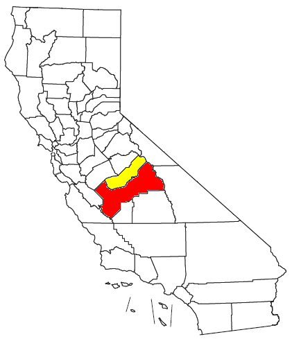
| subdivision_name3 | Fresno |
| established_title | Railway station |
| established_date | May 1872 |
| established_title2 | Incorporated |
| established_date2 | October 21, 1885{{cite web |
| url | http://www.calafco.org/docs/Cities_by_incorp_date.doc |
| title | California Cities by Incorporation Date |
| format | Word |
| publisher | California Association of Local Agency Formation Commissions |
| access-date | April 6, 2013 |
| url-status | dead |
| archive-url | https://web.archive.org/web/20141103002921/http://www.calafco.org/docs/Cities_by_incorp_date.doc |
| archive-date | November 3, 2014 |
| named_for | Spanish for "ash tree" |
| government_type | Strong Mayor |
| leader_title | Mayor |
| leader_name | Jerry Dyer (R){{cite web |
| url | https://www.fresno.gov/mayor/ |
| title | Mayor's Office |
| access-date | September 11, 2025 |
| publisher | City of Fresno |
| leader_title1 | Council President |
| leader_name1 | Mike Karbassi |
| leader_title2 | Council Vice President |
| leader_name2 | Miguel Arias |
| leader_title3 | City council{{cite web |
| title | Fresno City Council |
| url | https://www.fresno.gov/citycouncil/ |
| website | City of Fresno |
| access-date | September 11, 2025 |
| leader_name3 | {{collapsible list |
| bullets | yes |
| title | Members |
| 1 | D1: Annalisa Perea |
| 2 | D2: Mike Karbassi |
| 3 | D3: Miguel Arias |
| 4 | D4: Tyler Maxwell |
| 5 | D5: Brandon Vang |
| 6 | D6: Nick Richardson |
| 7 | D7: Nelson Esparza |
| leader_title4 | City manager |
| leader_name4 | Georgeanne White{{cite web |
| title | City Manager |
| url | https://www.fresno.gov/citymanager/ |
| website | City of Fresno |
| access-date | September 11, 2025 |
| total_type | City |
| unit_pref | Imperial |
| area_footnotes | {{Cite web |
| title | 2019 U.S. Gazetteer Files |
| url | https://www2.census.gov/geo/docs/maps-data/data/gazetteer/2019_Gazetteer/2019_gaz_place_06.txt |
| publisher | United States Census Bureau |
| access-date | July 1, 2020 |
| area_total_km2 | 300.43 |
| area_total_sq_mi | 116.00 |
| area_land_km2 | 297.30 |
| area_land_sq_mi | 114.79 |
| area_water_km2 | 3.13 |
| area_water_sq_mi | 1.21 |
| area_water_percent | 1.04 |
| elevation_footnotes | |
| elevation_ft | 308 |
| population_total | 542107 |
| population_as_of | [2020](2020-united-states-census) |
| population_footnotes | {{cite web |
| title | QuickFacts: Fresno city, California |
| url | https://www.census.gov/quickfacts/fact/table/fresnocitycalifornia/POP010220 |
| publisher | United States Census Bureau |
| access-date | August 25, 2021 |
| population_rank | 89th in North America |
| 34th in the United States | |
| 5th in California | |
| population_density_sq_mi | 4722.60 |
| population_density_km2 | 1823.43 |
| population_urban | 717,589 (US: 61st) |
| population_density_urban_km2 | 1,741.3 |
| population_density_urban_sq_mi | 4,510.0 |
| population_metro_footnotes | {{cite web |
| title | 2020 Population and Housing State Data |
| url | https://www.census.gov/library/visualizations/interactive/2020-population-and-housing-state-data.html |
| publisher | United States Census Bureau |
| access-date | August 22, 2021 |
| population_metro | 1164909 (49th) |
| population_demonym | Fresnan |
| demographics_type2 | GDP (Nominal, 2023) |
| demographics2_footnotes | |
| demographics2_title1 | Metro |
| demographics2_info1 | $60.151 billion |
| timezone | Pacific |
| utc_offset | −08:00 |
| timezone_DST | PDT |
| utc_offset_DST | −07:00 |
| postal_code_type | ZIP Codes{{cite web |
| url | https://tools.usps.com/go/ZipLookupAction!input.action |
| title | ZIP Code(tm) Lookup |
| publisher | United States Postal Service |
| access-date | November 23, 2014 |
| archive-url | https://web.archive.org/web/20141116111202/https://tools.usps.com/go/ZipLookupAction!input.action |
| archive-date | November 16, 2014 |
| url-status | live |
| postal_code | 93650, 93701–93712, 93714–93718, 93720–93730, 93737, 93740, 93741, 93744, 93745, 93747, 93750, 93755, 93760, 93761, 93764, 93765, 93771–93779, 93786, 93790–93794, 93844, 93888 |
| area_code_type | Area code |
| area_code | 559 |
| blank_name | FIPS code |
| blank_info | |
| blank1_name | GNIS feature IDs |
| blank1_info | , |
| website |
| mapframe-zoom = 9 | mapframe-point = none | access-date = April 6, 2013 | url-status = dead | archive-url = https://web.archive.org/web/20141103002921/http://www.calafco.org/docs/Cities_by_incorp_date.doc | archive-date = November 3, 2014 | access-date = September 11, 2025 | access-date = September 11, 2025 | access-date = September 11, 2025 | access-date = July 1, 2020 | access-date = August 25, 2021 34th in the United States 5th in California | access-date = August 22, 2021 | access-date = November 23, 2014 | archive-url = https://web.archive.org/web/20141116111202/https://tools.usps.com/go/ZipLookupAction!input.action | archive-date = November 16, 2014 | url-status = live
Fresno (; ) is a city in the San Joaquin Valley of California, United States. It is the county seat of Fresno County and the largest city in the greater Central Valley region, as well as the most populated city in Central California. It covers about 114.7 sqmi and had a population of 542,107 as of the 2020 census, making it the fifth-most populous city in California, the most populous inland city in California, and the 34th-most populous city in the nation.
Named for the abundant ash trees lining the San Joaquin River, Fresno was founded in 1872 as a railway station of the Central Pacific Railroad before it was incorporated in 1885. It has since become an economic hub of Fresno County and the San Joaquin Valley, with much of the surrounding areas in the Metropolitan Fresno region predominantly tied to large-scale agricultural production. Fresno is near the geographic center of California, approximately 220 mi north of Los Angeles, 170 mi south of the state capital, Sacramento, and 185 mi southeast of San Francisco. Yosemite National Park is about 60 mi to the north, Kings Canyon National Park 60 mi to the east, and Sequoia National Park 75 mi to the southeast.
Fresno is also the third-largest majority-Hispanic city in the United States with 50.5% of its population being Hispanic in 2020.
History
The original inhabitants of the San Joaquin Valley region were the Yokuts people and Miwok people, who engaged in trading with other Californian tribes of Native Americans including coastal peoples such as the Chumash of the Central California coast, with whom they are thought to have traded plant and animal products.
The first European to enter the San Joaquin Valley was Pedro Fages in 1772. The county of Fresno was formed in 1856 after the California Gold Rush and was named for the abundant ash trees (Spanish: fresno) lining the San Joaquin River.
The San Joaquin River flooded on December 24, 1867, inundating Millerton. Some residents rebuilt, others moved. Flooding also destroyed the town of Scottsburg on the nearby Kings River that winter. Rebuilt on higher ground, Scottsburg was renamed Centerville.
In 1867, Anthony Easterby purchased land bounded by the present Chestnut, Belmont, Clovis and California avenues, that today is called the Sunnyside district. Unable to grow wheat for lack of water, he hired sheep man Moses Church in 1870 to create an irrigation system. Building new canals and purchasing existing ditches, Church then formed the Fresno Canal and Irrigation Company, a predecessor of the Fresno Irrigation District.
In 1872, the Central Pacific Railroad established a station near Easterby's—by now a hugely productive wheat farm—for its new Southern Pacific line. Soon there was a store near the station and the store grew into the town of Fresno Station, later called Fresno. At that time, Mariposa street was the main artery, a rough dusty or muddy depression. Many Millerton residents, drawn by the convenience of the railroad and worried about flooding, moved to the new community. Fresno became an incorporated city in 1885. In 1903, the faltering San Joaquin Power Company was renamed the San Joaquin Light and Power Corporation and included the Fresno City Water Company and the Fresno City Railway. By 1931 the railway, now known as the Fresno Traction Company, operated 47 streetcars over 49 miles of track.
Two years after the station was established, county residents voted to move the county seat from Millerton to Fresno. When the Friant Dam was completed in 1944, the site of Millerton became inundated by the waters of Millerton Lake. In extreme droughts, when the reservoir shrinks, ruins of the original county seat can still be observed.
In the nineteenth century, with so much wooden construction and in the absence of sophisticated firefighting resources, fires often ravaged American frontier towns. The greatest of Fresno's early-day fires, in 1882, destroyed an entire block of the city. Another devastating blaze struck in 1883.
In 1919, Fresno's first and oldest synagogue, Temple Beth Israel, was founded.
As a result of its remoteness from the great universities of the San Francisco Bay Area and Greater Los Angeles, Fresno became a statewide leader in educational innovation. In 1910, Fresno High School was the first California high school to take advantage of the Upward Extension Act of 1907 to offer lower-division college-level coursework to local high school graduates who wanted to attend college but were reluctant to move hundreds of miles away to do so. The high school's Collegiate Department evolved into Fresno City College, the oldest community college in California and the second oldest in the United States. In the 1920s and 1930s, Fresno State Teachers College was at the forefront of the evolution of the state teachers colleges into state colleges offering a broad liberal arts education. The state colleges later became the California State University and Fresno State became California State University, Fresno.
Fresno entered the ranks of the 100 most populous cities in the United States in 1960 with a population of 134,000. Thirty years later, in the 1990 census, it moved up to 47th place with 354,000, and in the census of 2000, it achieved 37th place with 428,000.
_(14597374327)_(cropped).jpg)
The Fresno Municipal Sanitary Landfill was the first modern landfill in the United States, and incorporated several important innovations to waste disposal, including trenching, compacting, and the daily covering of trash with dirt. It was opened in 1937 and closed in 1987. It is a National Historic Landmark as well as a Superfund site.
Before World War II, Fresno had many ethnic neighborhoods, including Little Armenia, German Town, Little Italy, and Chinatown. In 1940, the Census Bureau reported Fresno's population as 94.0% white, 3.3% black and 2.7% Asian. Chinatown was primarily a Japanese neighborhood and today few Japanese-American businesses remain. During 1942, Pinedale, in what is now North Fresno, was the site of the Pinedale Assembly Center, an interim facility for the relocation of Fresno area Japanese Americans to internment camps. The Fresno Fairgrounds were also utilized as an assembly center.
Row crops and orchards gave way to urban development particularly in the period after World War II; this transition was particularly vividly demonstrated in locations such as the Blackstone Avenue corridor.
Fresno's geographical remoteness also made it an early pioneer in the field now known as fintech, long before the term was invented. In September 1958, Bank of America launched a new product called BankAmericard in Fresno. The city was specifically selected in part for its remoteness, to limit damage to the bank's image in case the project failed. After a troubled gestation during which its creator resigned, BankAmericard went on to become the world's first successful credit card. This financial instrument was usable across a large number of merchants and also allowed cardholders to revolve a balance (earlier financial products could do one or the other but not both). In 1970, BankAmericard was spun off into a separate company, and in 1976, that company became Visa Inc.
In the 1960s, Fresno suffered numerous demolitions of historic buildings, including the old Fresno County Courthouse and the original buildings of Edison High School. This was the result of car-centric urban planning focused on making more room for cars and parking lots, a commonplace approach in the United States at that time.
The dance style commonly known as popping evolved in Fresno in the 1970s.
In 1995, the Federal Bureau of Investigation's Operation Rezone sting resulted in several prominent Fresno and Clovis politicians being charged in connection with taking bribes in return for rezoning farmland for housing developments. Before the sting brought a halt to it, housing developers could buy farmland cheaply, pay off council members to have it rezoned, and make a large profit building and selling inexpensive housing. Sixteen people were eventually convicted as a result of the sting.
In the early 2000s, Fresno's two major venues were built, Chukchansi Park (2002) and Save Mart Center (2003). The 2017 Fresno shootings resulted in the death of 4 people.
Geography
.jpg)
Fresno has a total area of 116 sqmi with 98.96% land covering 114.79 sqmi, and 1.04% water, 1.21 sqmi.
Fresno's location, very near the geographical center of California, places the city a comfortable distance from many of the major recreation areas and urban centers in the state. Just 60 mi south of Yosemite National Park, it is the nearest major city to the park. Likewise, Sierra National Forest is 40 mi, Kings Canyon National Park is 60 mi and Sequoia National Park is 75 mi. The city is located near several Sierra Nevada lakes including Bass Lake, Shaver Lake, and Huntington Lake. Fresno is also only two and a half hours from Monterey, Carmel, Big Sur and the central coast.
Because Fresno sits at the junction of Highways 41 and 99 (SR 41 is Yosemite National Park's southern access road, and SR 99 bypasses Interstate 5 to serve the urban centers of the San Joaquin Valley), the city is a major gateway for Yosemite visitors coming from Los Angeles. The city also serves as an entrance into Sierra National Forest via Highway 168, and Sequoia and Kings Canyon National Parks via Highway 180.
_(cropped).jpg)
Fresno has three large public parks, two in the city limits and one in county land to the southwest. Woodward Park, which features the Shinzen Japanese Gardens, boasts numerous picnic areas and several miles of trails. It is in North Fresno and is adjacent to the San Joaquin River Parkway. Roeding Park, near Downtown Fresno, is home to the Fresno Chaffee Zoo, and Rotary Storyland and Playland. Kearney Park is the largest of the Fresno region's park system and is home to historic Kearney Mansion and plays host to the annual Civil War Revisited, the largest reenactment of the Civil War in the west coast of the U.S.{{cite news |access-date = March 6, 2007 |archive-url = https://web.archive.org/web/20070310221842/http://abclocal.go.com/kfsn/story?section=local&id=3522714 |archive-date = March 10, 2007 |url-status = dead |access-date = March 6, 2007 |archive-url = https://web.archive.org/web/20130610010101/http://www.civilwarrevisited.com/index.html|url-status = usurped |archive-date = June 10, 2013}}
In its 2023 ParkScore ranking, The Trust for Public Land, a national land conservation organization, reported that Fresno had one of the worst park systems among the 100 most populous U.S. cities, with only 5% of city land being used for parks and recreation. The survey measures median park size, park acres as percent of city area, residents' access to parks, spending on parks per resident, and playgrounds per 10,000 residents.
Neighborhoods
Downtown

The Central Pacific Railroad built a small wooden depot in 1872. In 1889, the Southern Pacific Railroad, which had acquired Central Pacific, constructed a new depot on the original depot site. The brick Queen Anne style depot was a jewel for the city and is one of Fresno's oldest standing buildings. In 1971, 99 years after it first opened for business on its current site, the Depot closed its rail operations due to the decline in business.
Between the 1880s and World War II, Downtown Fresno flourished, filled with electric streetcars, and contained a number of "lavish" and "opulent" buildings. Among them, the original Fresno County Courthouse (demolished), the Fresno Carnegie Public Library (demolished), the Old Fresno Water Tower, the Bank of Italy Building, the Pacific Southwest Building, the San Joaquin Light and Power Building (currently known as the Grand 1401), and the Hughes Hotel (burned down), to name a few.
Fulton Street in Downtown Fresno was Fresno's main financial and commercial district before being converted into one of the nation's first pedestrian malls in 1964. Renamed the Fulton Mall, the area contains the densest collection of historic buildings in Fresno. While the Fulton Mall corridor has suffered a sharp decline from its heyday, the Mall includes some of the finest public art pieces in the country, including a casting of Pierre-Auguste Renoir's bronze "The Washer Woman", reportedly the only one of the six castings that one can walk up to and touch. In October 2017, the City of Fresno finished and opened Fulton Mall to traffic, becoming Fulton Street. This change was celebrated with a large public parade featuring current mayor Lee Brand and former mayor Ashley Swearengin. The public art pieces will be restored and placed near their current locations and will feature wide sidewalks (up to 28' on the east side of the street) to continue with the pedestrian-friendly environment of the district.
Tower District
The historic Tower Theatre, which is included on the National Register of Historic Places, is the center of the Tower District. The theater was built in 1939 at the corner of Olive and Wishon Avenues. The Tower District neighborhood is just north of downtown Fresno proper, and one-half mile south of Fresno City College. Although the neighborhood was known as a residential area, the early commercial establishments of the Tower District began with small shops and services that flocked to the area shortly after World War II. The character of small local businesses largely remains today. To some extent, the businesses of the Tower District were developed due to the proximity of the original Fresno Normal School (later renamed California State University at Fresno). In 1916, the college moved to what is now the site of Fresno City College one-half mile north of the Tower District.
After decades of neglect and suburban flight, the neighborhood revival followed the re-opening of the Tower Theatre in the late 1970s, which at that time showed second- and third-run movies, along with classic films. Roger Rocka's Dinner Theater & Good Company Players also opened nearby in 1978, at Olive and Wishon Avenues. Fresno native Audra McDonald performed in the leading roles of Evita and The Wiz at the theater while she was a high school student. McDonald subsequently became a leading performer on Broadway in New York City and a Tony award-winning actress. Also in the Tower District is Good Company Players' 2nd Space Theatre.
The Tower District is a hub for community events such as Jamaica My Weekend, Mardi Gras in February, Gay Pride Parade, car shows, A Taste of The Tower, Halloween in the Tower, the Farmers' market opened on the northwest corner of Olive and Van Ness and LitHop, an annual literary festival, featuring mostly local writers.
The neighborhood features restaurants, live theater and nightclubs, as well as several independent shops and bookstores on or near Olive Avenue. Since renewal, the Tower District has become an attractive area for restaurant and other local businesses. The Tower District is known as the center of Fresno's LGBT and hipster communities.
The area is also known for its early twentieth century homes, many of which have been restored in recent decades. The area includes many California Bungalow and American Craftsman style homes, Spanish Colonial Revival Style architecture, Mediterranean Revival Style architecture, Mission Revival Style architecture, and many Storybook houses designed by Fresno architects, Hilliard, Taylor & Wheeler. The residential architecture of the Tower District contrasts with the newer areas of tract homes urban sprawl in north and east areas of Fresno.
Woodward Park


In the northeastern part of Fresno, Woodward Park was founded by the late Ralph Woodward, a long-time Fresno resident. He bequeathed a major portion of his estate in 1968 to provide a regional park and bird sanctuary in Northeast Fresno. The park lies on the southern bank of the San Joaquin River between Highway 41 and Friant Road. The initial 235 acre, combined with additional acres acquired later by the city, brings the park to a sizable 300 acre. Now packed with amenities, Woodward Park is the only Regional Park of its size in the Central Valley. The park has a multi-use amphitheatre that seats up to 2,500 people, an authentic Japanese Garden, fenced dog park, bike park, two playgrounds, two-mile (3 km) equestrian trail, exercise par course, three children's playgrounds, a lake, three small ponds, seven picnic areas, and five miles (8 km) of multipurpose trails that are part of the San Joaquin River Parkway's Lewis S. Eaton Trail. When complete, the Lewis S. Eaton trail system will cover 22 mi between Highway 99 and Friant Dam. The park's amphitheatre was renovated in 2010, and has hosted performances by acts such as Deftones, Tech N9ne, and Sevendust as well as numerous others. Woodward Park hosts the annual California Interscholastic Federation State Championship cross country meet. It is the home of the Woodward Shakespeare Festival which began performances in the park in 2005.
Fig Garden
Located in the western portion of Fresno, Old Fig Garden is an unincorporated community that, over time, has been completely encircled by the city of Fresno. Fig Garden was created in 1947, as the then-known Fig Garden Men's club achieved nonprofit corporate status, allowing itself to have much more governance.
In 1979, the name was changed to Fig Garden Home Owners Association. Fig Garden is unique to the rest of Fresno, as it features largely no sidewalks and is lined with various large trees. The homes are well-maintained and landscaped due to strict regulations from the homeowners association. Due to a tax Fig Garden residents voted for, there is nearly round-the-clock sheriff service within the district. The district hosts the Fig Garden Christmas Tree Lane, which is a nationally recognized event. There is also an upscale swim and racquet club located in northwestern Fig garden, which has multiple amenities including a heated lap pool, massage therapy, daycare, etc. Towards the northern boundary there is a shopping center called Fig Garden Village which hosts a plethora of upscale shopping opportunities.
Climate

Fresno has a semi-arid climate (Köppen climate classification BSh, bordering BSk), with cool, mild winters and long, hot, dry summers.{{cite web |access-date = March 6, 2007 |archive-url = https://web.archive.org/web/20061020004237/http://www.rssweather.com/climate/California/Fresno/ |archive-date = October 20, 2006 |url-status = live | access-date = May 13, 2010 | archive-url = https://web.archive.org/web/20120324094347/http://www.hko.gov.hk/wxinfo/climat/world/eng/n_america/us/fresno_e.htm | archive-date = March 24, 2012 | url-status = live |access-date=March 6, 2007 |url-status=dead |archive-url=https://web.archive.org/web/20060912142341/http://www.coha.dri.edu/web/state_analysis/California/KingsCanyonNP_metsfcwind_fresno.html |archive-date=September 12, 2006}} Fresno meteorology was selected in a national U.S. Environmental Protection Agency study for analysis of equilibrium temperature for use of ten-year meteorological data to represent a warm, dry western United States locale.
_-_Fresno_Area,_CA(ThreadEx).svg)
The official record high temperature for Fresno is 115 °F, set on July 8, 1905, while the official record low is 17 °F, set on January 6, 1913. The average windows for temperatures of 100 °F+ are June 2 through September 15; for temperatures of 90 °F+, April 25 through October 10; and for freezing temperatures, December 14 through January 24, although no freeze occurred during the 1983–84 or 2020–21 winter seasons. Annual rainfall has ranged from 23.57 in in the "rain year" from July 1982 to June 1983 down to 4.43 in from July 1933 to June 1934. The most rainfall in one month was 9.54 in in November 1885 and the most rainfall in 24 hours was 3.55 in on November 18, 1885. Measurable precipitation falls on an average of 46.5 days annually. Snow is a rarity; the heaviest snowfall at the airport was 2.2 in on January 21–22, 1962.
Demographics
2010–2024
Fresno is the larger principal city of the Fresno-Madera CSA, a Combined Statistical Area that includes the Fresno (Fresno County) and Madera (Madera County) metropolitan areas, which had a combined population of 922,516 at the 2000 census.
Fresno is home to numerous ethnic minority communities, such as the Armenian and Hmong communities. In 1920, Armenians comprised 9% of the population of the city of Fresno, with 4,000 Armenian residents at the time. Old Armenian Town was the old Armenian neighborhood in the center of Fresno. The Hmong community of Fresno, along with that of Minneapolis–Saint Paul, is one of the largest two urban U.S. ethnic Hmong communities, with just over 24,000 people, or about 5% of the city's population, being of Hmong descent.
A 2023 study and poverty mapping showed the city's core as having the most highly concentrated poverty in the state of California. The divide separating the wealthy, predominantly white neighborhoods and impoverished, predominantly minority neighborhoods is mainly due to wealthier inhabitants moving to the fringes of the northern part of the city, leaving the core to suffer from abandonment and disinvestment.
| Historical racial composition | 2010 | 1990 | 1970 | 1940 |
|---|---|---|---|---|
| White | 49.6% | 59.2% | 86.7% | 94.0% |
| —Non-Hispanic | 30.0% | 49.4% | 72.6% | n/a |
| Hispanic or Latino (of any race) | 46.9% | 29.9% | 16.1% | n/a |
| Black or African American | 8.3% | 8.3% | 9.6% | 3.3% |
| Asian | 12.6% | 12.5% | 2.0% | 2.7% |
| Race / Ethnicity (*NH = Non-Hispanic*) | title=P004: Hispanic or Latino, and Not Hispanic or Latino by Race – 2000: DEC Summary File 1 – Fresno city, California | url=https://data.census.gov/table?g=160XX00US0627000&tid=DECENNIALSF12000.P004 | publisher=United States Census Bureau | access-date=January 26, 2024}} | title=P2: Hispanic or Latino, and Not Hispanic or Latino by Race – 2010: DEC Redistricting Data (PL 94-171) – Fresno city, California | url=https://data.census.gov/table?q=p2&g=160XX00US0627000&tid=DECENNIALPL2010.P2 | publisher=United States Census Bureau | access-date=January 26, 2024}} | % 2000 | % 2010 |
|---|---|---|---|---|---|---|---|---|---|---|
| White alone (NH) | 159,473 | 148,598 | 129,705 | 37.29% | ||||||
| Black or African American alone (NH) | 34,357 | 37,885 | 37,611 | 8.03% | ||||||
| Native American or Alaska Native alone (NH) | 3,259 | 3,127 | 3,501 | 0.76% | ||||||
| Asian alone (NH) | 47,136 | 60,939 | 77,243 | 11.02% | ||||||
| Pacific Islander alone (NH) | 427 | 663 | 766 | 0.10% | ||||||
| Other race alone (NH) | 728 | 984 | 2,918 | 0.17% | ||||||
| Mixed race or Multiracial (NH) | 11,752 | 10,414 | 16,592 | 2.75% | ||||||
| Hispanic or Latino (any race) | 170,520 | 232,055 | 273,771 | 39.87% | ||||||
| **Total** | **427,520** | **494,665** | **542,107** | **100.00%** |
2020

The 2020 United States census reported that Fresno had a population of 542,107. The population density was 4,706.8 PD/sqmi. The racial makeup of Fresno was 33.2% White, 7.6% African American, 2.4% Native American, 14.7% Asian, 0.2% Pacific Islander, 26.8% from other races, and 15.2% from two or more races. Hispanic or Latino of any race were 50.5% of the population.
The census reported that 98.1% of the population lived in households, 1.0% lived in non-institutionalized group quarters, and 0.9% were institutionalized.
There were 175,944 households, out of which 39.7% included children under the age of 18, 40.6% were married-couple households, 9.0% were cohabiting couple households, 30.8% had a female householder with no partner present, and 19.5% had a male householder with no partner present. 22.8% of households were one person, and 9.2% were one person aged 65 or older. The average household size was 3.02.
.jpg)
The age distribution was 27.7% under the age of 18, 10.5% aged 18 to 24, 28.6% aged 25 to 44, 20.7% aged 45 to 64, and 12.4% who were 65years of age or older. The median age was 32.2years. For every 100 females, there were 97.0 males.
There were 184,226 housing units at an average density of 1,599.5 /mi2, of which 175,944 (95.5%) were occupied. Of these, 48.3% were owner-occupied, and 51.7% were occupied by renters.
In 2023, the US Census Bureau estimated that the median household income was $66,804, and the per capita income was $31,012. About 16.3% of families and 20.9% of the population were below the poverty line.
2010
The 2010 United States census reported that Fresno had a population of 494,665. The population density was 4,404.5 PD/sqmi. The racial makeup of Fresno was 245,306 (49.6%) White, 40,960 (8.3%) African American, 8,525 (1.7%) Native American, 62,528 (12.6%) Asian (3.6% Hmong, 1.7% Indian, 1.2% Filipino, 1.2% Laotian, 1.0% Thai, 0.8% Cambodian, 0.7% Chinese, 0.5% Japanese, 0.4% Vietnamese, 0.2% Korean), 849 (0.2%) Pacific Islander, 111,984 (22.6%) from other races, and 24,513 (5.0%) from two or more races. Hispanic or Latino of any race were 232,055 persons (46.9%). Among the Hispanic population, 42.7% of the total population are Mexican, 0.4% Salvadoran, and 0.4% Puerto Rican. Non-Hispanic Whites were 30.0% of the population in 2010, down from 72.6% in 1970.
.png)
The Census reported that 485,798 people (98.2% of the population) lived in households, 4,315 (0.9%) lived in non-institutionalized group quarters, and 4,552 (0.9%) were institutionalized.
There were 158,349 households, of which 68,511 (43.3%) had children under the age of 18 living in them, 69,284 (43.8%) were opposite-sex married couples living together, 30,547 (19.3%) had a female householder with no husband present, 11,698 (7.4%) had a male householder with no wife present. There were 12,843 (8.1%) unmarried opposite-sex partnerships, and 1,388 (0.9%) same-sex married couples or partnerships. 35,064 households (22.1%) were made up of individuals, and 12,344 (7.8%) had someone living alone who was 65 years of age or older. The average household size was 3.07. There were 111,529 families (70.4% of all households); the average family size was 3.62.
The age distribution of the population shows 148,823 people (30.1%) under the age of 18, 62,601 people (12.7%) aged 18 to 24, 135,076 people (27.3%) aged 25 to 44, 102,064 people (20.6%) aged 45 to 64, and 46,101 people (9.3%) who were 65 years of age or older. The median age was 29.3 years. For every 100 females, there were 96.7 males. For every 100 females age 18 and over, there were 93.5 males.
There were 171,288 housing units at an average density of 1,525.2 /sqmi, of which 158,349 were occupied, of which 77,757 (49.1%) were owner-occupied, and 80,592 (50.9%) were occupied by renters. The homeowner vacancy rate was 2.6%; the rental vacancy rate was 7.6%. 235,430 people (47.6% of the population) lived in owner-occupied housing units and 250,368 people (50.6%) lived in rental housing units.
Economy
.JPG)
Fresno is the center of Metropolitan Fresno and serves as the regional hub for the San Joaquin Valley and the greater Central Valley region. The unincorporated area and rural cities surrounding Fresno remain predominantly tied to large-scale agricultural production.
In 1958, Fresno was selected by Bank of America to first launch the BankAmericard credit card, which was later renamed Visa.
Companies based in Fresno include Pelco, Valley Yellow Pages, and Saladino's.
;Top employers According to the city's 2023 Annual Comprehensive Financial Report, the top employers in the city are:
| Ranking | Employer | Number of Employees |
|---|---|---|
| 1 | Fresno Unified School District | 13,669 |
| 2 | Community Medical Centers | 9,750 |
| 3 | County of Fresno | 8,980 |
| 4 | Amazon | 6,500 |
| 5 | Clovis Unified School District | 6,400 |
| 6 | California State University, Fresno | 5,233 |
| 7 | City of Fresno | 5,015 |
| 8 | State Center Community College District | 4,367 |
| 9 | Internal Revenue Service | 4,230 |
| 10 | Saint Agnes Medical Center | 2,900 |
Arts and culture

Performing arts and music
- Artists' Repertory Theatre
- Children's Musical Theatreworks
- Center State Productions
- Fresno Philharmonic
- Philip Lorenz International Keyboard Concerts
- Roger Rocka's Dinner Theater & 2nd Space Theatre (Good Company Players)
- Rogue Festival
- Shine! Theatre
- Stageworks of Fresno
- Woodward Shakespeare Festival
- Youth Orchestras of Fresno
Theaters
_001.jpg)
- Azteca Theater
- Crest Theatre
- Liberty Theatre
- Tower Theatre – Tower Theatre for the Performing Arts
- Warnors Theatre – Warnor's Center for the Performing Arts
- Wilson Theatre – currently Cornerstone Church
- Veteran's Memorial Auditorium
- Paul Shaghoian Memorial Concert Hall - Clovis North High School
Museums

- African-American Museum of the San Joaquin Valley
- Arte Américas
- Armenian Museum of Fresno
- Discovery Center
- William Saroyan House Museum
- Forestiere Underground Gardens
- Fresno Art Museum
- Kearney Mansion Museum
- Legion of Valor Museum
- Meux Home Museum
- Old Fresno Water Tower Tourist Center
- Fresno Chaffee Zoo
- Sierra Endangered Cat Haven (Fresno County)
Events

- Ani-Me Con (every spring) Fresno's only anime convention.
- Armenian Grape Blessing (August)
- ArtHop (first Thursday of every month)
- The Big Fresno Fair, 12 days October, the largest event in the Central Valley attracting over 600,000 visitors
- Taco Truck Throwdown
- Christmas Tree Lane Every December
- Fresno LGBT Pride Parade, every June, first held in 1991
- Grizzly Fest April/May
- Valley DevFest (Fall)
- Vintage Days March or April
- Greek Fest three days every September
Sports
Collegiate sports are very popular. Fresno State Bulldogs football program is considered to be the biggest event in terms of sporting events in the city. The term "Red Wave" is the name given to the fans of Fresno State athletics, and as well as "Pride of the Valley" since the university's fanbase represents all of Fresno and California's San Joaquin Valley.
The Save Mart Center at Fresno State is a multi-purpose arena on the campus of the California State University, Fresno. It is home to the Fresno State Bulldogs basketball team and, for the first five seasons in the ECHL (2003–08) hosted the Fresno Falcons ice hockey team. It also hosts a wide range of musical acts and other events. Also on the campus of Fresno State is Valley Children's Stadium, a 41,031-seat football stadium. It is home to the Fresno State Bulldogs football program. Next to Bulldog Stadium is Pete Beiden Field. It is home to the Fresno State Bulldogs baseball program and was home to the Fresno Grizzlies before their move to Chukchansi Park in Downtown Fresno. Fresno's Woodward Park is the location of the CIF Cross Country State Championships, where high schoolers from around the state compete. Additionally the BMX course in the park plays host to the National Bicycle League State Championships. Ratcliffe Stadium, on the campus of Fresno City College, is a 13,000-seat track and field stadium. The stadium played host to the West Coast Relays. It is home to the college's football program and is also host to high school football games and track and field events.
The Fresno Yacht Club established in 1959 hosts the High Sierra Regatta on Huntington Lake every July (barring extreme drought) and regular sailing on Millerton Lake.
List of Fresno-based professional sports teams:
| Club | Sport | Founded | League (level) | Venue |
|---|---|---|---|---|
| Fresno Grizzlies | Baseball | 1998 | California League (Single-A) | Chukchansi Park |
| Fresno Monsters | Ice hockey | 2009 | United States Premier Hockey League (junior) | Selland Arena & Gateway Ice Center |
| Fuego FC | Soccer | 2020 | USL League One | Fresno State Soccer Stadium |
Government
Fresno has a strong-mayor form of government. The mayor (executive branch) is directly elected and the seven city council members (legislative branch) are elected by district with no "at-large" seats. The mayor and council members are elected for no more than two 4-year terms. The mayor's office and council positions are officially nonpartisan and not affiliated with any political party. The current mayor is Jerry Dyer, who is a Republican. Should the Mayor pass away, be incapacitated, or be removed from office, the Council President shall serve as Mayor until a new Mayor is elected in a special election, per the Charter.
City Council
- District 1 - Annalisa Perea
- District 2 - Mike Karbassi (Council President)
- District 3 - Miguel Arias (Council Vice President)
- District 4 - Tyler Maxwell
- District 5 - Brandon Vang
- District 6 - Nick Richardson
- District 7 - Nelson Esparza Prior to 1901, Fresno's government was under a ward system which allowed for a board of trustees. From the trustees elected by the city wards, a president of the board of trustees would act as ex-officio mayor however did not hold the title of mayor. Because of this, the president of the board of trustees is not recognized as mayors of the City of Fresno.
Courts
Fresno is the county seat of Fresno County. It maintains the main county courthouse on Van Ness in the Fresno County Plaza for criminal and some civil court cases.
The United States District Court, Eastern District of California, has one of its six divisions based in the Robert E. Coyle Courthouse. The new courthouse replaced the B.F. Sisk Federal Building in 2006 because it did not have enough space for the growing Fresno Division. After extensive renovation, the building reopened in November 2010 as the B.F. Sisk Courthouse serving the Fresno County Superior Court.
Fresno is also the seat of the Court of Appeal for the Fifth Appellate District, for which a new courthouse was built in 2007 in the old Armenian Town section of downtown Fresno across from the Fresno Convention Center. The Fifth District Court of Appeal's courthouse was formally dedicated as the George N. Zenovich Building, after former state senator and associate justice of the Fifth District, George N. Zenovich.
Politics

, according to Fresno County Registrar of Voters, the majority of registered voters in both the city and county of Fresno are registered to the Democratic Party. According to the county registrar's official final reportU.S. President Barack Obama carried the county 49.99% in the 2008 United States presidential election.
State and federal representation
The citizens of Fresno are represented in the California State Senate by in District 14 and in District 12.{{cite web |access-date = November 30, 2014 |archive-url = https://web.archive.org/web/20151023054153/http://wedrawthelines.ca.gov/downloads/meeting_handouts_072011/handouts_20110729_q2_sd_finaldraft_splits.zip |archive-date = October 23, 2015 |url-status = dead |access-date=April 6, 2013 |archive-url=https://web.archive.org/web/20130424192545/http://assembly.ca.gov/assemblymembers |archive-date=April 24, 2013 |url-status=live
The citizens of Fresno are represented in the United States House of Representatives by Representative Jim Costa, Democrat, in District 21, and Vince Fong, Republican, in District 20.
Education
.jpg)
Four-year institutions
California State University, Fresno is the main state school in Fresno though the University of California, Merced has its Fresno Center and the University of California, San Francisco has its Fresno Medical Education Program.
Private institutions include
- Alliant International University (For Profit)
- California Christian College (Private/Freewill Baptist)
- Fresno Pacific University (Private/Mennonite Brethren)
- Fresno Pacific University Biblical Seminary
- Kaplan College, Fresno campus (formerly Maric College)
- National University, Fresno campus
- University of Phoenix (Private) (For Profit)
- DeVry University (Private) (For Profit, Career)
Two-year institutions
Public community colleges include Fresno City College and Clovis Community College.
Career colleges
- University of Phoenix
- DeVry University
- Institute of Technology
- San Joaquin Valley College
- UEI College
Public K-12 schools
Main article: Fresno Unified School District
Most of Fresno is in the Fresno Unified School District though small portions are served by the Clovis Unified School District, Central Unified School District, Washington Union Unified School District, Orange Center Elementary School District, Sanger Unified School District and West Park Elementary School District.
Private K-12 schools
- Fresno Christian High School (Evangelical Christian)
- San Joaquin Memorial High School (Roman Catholic)
- Fresno Adventist Academy (Seventh Day Adventist)
Media
Newspapers
.jpg)
- The Business Journal
- The Fresno Bee
- The Community Alliance
Radio
- KMJ, AM 580, 50,000-watt and FM 105.9, is Fresno's first radio station; it began broadcasting in 1922. Its powerful 50,000-watt signal can clearly be heard throughout much of California.
- KYNO AM 940, 50,000-watt oldies station
- KFIG AM 1430, 5,000-watt ESPN affiliate
- 88.1 KFCF is Fresno's Pacifica station, and one of Fresno's few non-commercial, non-corporate radio stations.
- 89.3 KVPR, provides National Public Radio Programming & classical music throughout the Central California region.
- 90.7 KFSR is another non-commercial, non-corporate station that plays a full spectrum format, including Jazz, eclectic, Armenian, and others. Based on the CSUF campus.
- 94.9 KBOS-FM More commonly known as B95 – Fresno's Hip-Hop Station
Television
To avoid interference with existing VHF television stations in the San Francisco Bay Area and those planned for Chico, Sacramento, Salinas, and Stockton, the Federal Communications Commission decided that Fresno would be a UHF island (only have UHF television stations).
The first Fresno television station to begin broadcasting was KMJ-TV, which debuted on June 1, 1953. KMJ-TV is now known as NBC affiliate KSEE. Other Fresno stations include ABC O&O KFSN-TV, CBS affiliate KGPE, The CW affiliate KFRE-TV, FOX affiliate KMPH-TV, MNTV affiliate KMSG-LD, PBS member station KVPT, Telemundo O&O KNSO, Univision O&O KFTV-DT, and Estrella TV affiliate KGMC.
In partnership with the City of Clovis, the City of Fresno opened the Community Media Access Collaborative (CMAC) in April 2012, a public, education and government access television station.
Infrastructure
Since 2010, statewide droughts in California have strained both Fresno's and the entire Central Valley's water security. The city uses surface water from Millerton Lake and Pine Flat Reservoir to supply a pair of water treatment plants.
Transportation
Highways

Fresno is served by State Route 99, the main north–south freeway that connects the major population centers of California's Central Valley. State Route 168, the Sierra Freeway, heads east to the city of Clovis and Huntington Lake. State Route 41 (Yosemite Freeway/Eisenhower Freeway) comes into Fresno from Atascadero in the south, and then heads north to Yosemite National Park. State Route 180 (Kings Canyon Freeway) comes from the west via Mendota, and then east through the city of Reedley to Kings Canyon National Park.
Fresno is the most populous U.S. city not directly linked to an Interstate highway. When the Interstate Highway System was created in the 1950s, the decision was made to build what is now Interstate 5 on the west side of the Central Valley, and thus bypass many of the population centers in the region, instead of upgrading what is now State Route 99. Due to rapidly rising population and traffic in cities along SR 99, as well as the desirability of Federal funding, much discussion has been made to upgrade it to interstate standards and eventually incorporate it into the interstate system, most likely as Interstate 7 or 9. Major improvements to signage, lane width, median separation, vertical clearance, and other concerns are currently underway.
Bus services
Fresno Area Express (FAX) is the city's primary public transit system, which operates eighteen routes and Handy Ride, a paratransit operation. FAX introduced a frequent bus service called FAX15 in January 2017 with buses operating every 15 minutes on Cedar and Shaw Avenues. The FAX Q line, which the agency brands as bus rapid transit, was introduced in February 2018 and offers service as often as every 10 minutes on Blackstone Avenue, Ventura Avenue and Kings Canyon Road.
As the county seat and the largest city in the region, Fresno also sees service from neighboring regional bus services including Clovis Transit, Fresno County Rural Transit Agency, Kings Area Regional Transit, and Visalia Transit's V-LINE. Intercity and long-distance bus services are provided by Greyhound.
The Yosemite Area Regional Transportation System added summer seasonal service between Fresno and Yosemite National Park in May 2015.
The city once provided trolley service during the late 19th and early 20th century. Known as the Fresno City Railway Company and later the Fresno Traction Company, the service operated horse-drawn streetcars from 1887 to 1901. Electric streetcars were introduced in 1903. The electric streetcars were used until 1939.{{cite web |access-date = June 6, 2007 |archive-url = https://web.archive.org/web/20070223054804/http://valleyhistory.org/PandP/fultonstreet.html |archive-date = February 23, 2007}} A proposal to include a modern light rail system in long-term transportation plans was rejected by the Fresno County Board of Supervisors in January 1987.
Airports
Fresno Yosemite International Airport (airport code: FAT), formerly known as Fresno Air Terminal, provides regularly scheduled commercial airline service. The airport serves an estimated 1.3 million passengers annually.
Fresno Chandler Executive Airport (airport code: FCH) is 2 mi southwest of Downtown Fresno. Built in the 1920s by the Works Projects Administration, it is one of the oldest operational airports in California. The airport currently serves as a general aviation airport.
Sierra Sky Park Airport (airport code: E79) in Northwest Fresno is a privately owned airport, but is open to the public. Extra-wide streets surrounding the airport allow for residents of the community to land, taxi down the extra-wide streets, and park their aircraft in a garage at their home. Sierra Sky Park is recognized as the first residential aviation community in the world.
Rail
Passenger rail service is provided by Amtrak Gold Runner. The main passenger rail station is the renovated historic Santa Fe Railroad Depot in Downtown Fresno. The city of Fresno is planned to be served by the future California High-Speed Rail.
Freight rail service is provided by both the BNSF Railway and the Union Pacific Railroad, which both operate Bakersfield-Stockton mainlines that cross in Fresno, and both railroads maintain railyards within the city. The Class III (or shortline) San Joaquin Valley Railroad also operates former Southern Pacific branch lines heading west and south out of the city. The railroad is deemed often the last railroad in the world to have Magnetic Flagmen signals, better known as wigwags, in revenue freight service.
In popular culture
In the 1970s, the city was the subject of a song, "Walking Into Fresno", written by guitarist Bill Aken and recorded by Bob Gallion of the WWVA Jamboree radio and television show in Wheeling, West Virginia.
Fictional residents of the town were portrayed in a 1986 comedic miniseries titled Fresno, featuring Carol Burnett, Dabney Coleman, Teri Garr and Charles Grodin, along with numerous other celebrities. The mini series was presented as a parody of the prime time soap operas popular in the 1980s.
BBC documentarian, Louis Theroux, visited Fresno, and rode with Fresno police as they dealt with the high drug usage in the city. Additionally, he interviewed many of the individuals involved in the drug scene, some languishing in their habit, and others working to overcome it. From that footage, he produced a British documentary The City Addicted to Crystal Meth, first aired on August 9, 2009.
Fresno is mentioned in the 2009 animated film Monsters vs. Aliens.
The 2014 horror film Unfriended is set in Fresno along with the 2000 Motocross film Fresno Smooth.
The Fresno nightcrawler is a cryptid first documented in Fresno in 2007.
Notable people
Main article: List of people from Fresno, California
Twin towns – sister cities
Fresno's sister cities are:
- MEX Guadalajara, Mexico
- JPN Kōchi, Japan (1965)
- GER Münster, Germany (1984)
- Tanzania Morogoro, Tanzania (1992)
- ITA Verona, Italy (2000, friendship not sister)
- ARM Vagharshapat (also known as Etchmiadzin), Armenia (2009)
- FRA Châteauroux, France (2016)
- CHN Taishan, China
- israel Afula-Gilboa, Israel
- Kazakhstan Taraz (formerly known as Djambul; relationship currently inactive), Kazakhstan
- MEX Torreon, Mexico
Explanatory notes
References
Bibliography
References
- {{Cite GNIS
- "Total Gross Domestic Product for Fresno, CA (MSA)".
- "U.S. Census website". [[United States Census Bureau]].
- "Population of the 100 Largest Cities and Other Urban Places in the United States: 1790 TO 1990". U.S. Census Bureau.
- {{Cite US Gazetteer. 2010. places. CA
- "P2:: Hispanic or Latino, and Not Hispanic or Latino by Race". United States Census Bureau.
- Capace, Nancy (1999). ''Encyclopedia of California''. North American Book Dist LLC. Page 410. {{ISBN. 9780403093182.
- {{California's Geographic Names. 1014–1015
- "Fresno Irrigation District {{!}} Full History".
- Vandor, Paul E.. (1919). "History of Fresno County, California, with biographical sketches of the leading men and women of the county who have been identified with its growth and development from the early days to the present.". Historic Record Company.
- "Huntington Boulevard Historic District (Fresno, California)". historicfresno.org.
- Demoro, Harre W.. (1986). "California's Electric Railways". [[Interurban Press]].
- [https://web.archive.org/web/20091224212751/http://www.tbifresno.org/aboutus/history/ History], Synagogue Website. Archived from the [http://www.tbifresno.org/aboutus/history/ Original] on December 24, 2009.
- (2021). "A College for All Californians: A History of the California Community Colleges". Teachers College Press.
- (2010). "The People's University: A History of the California State University". Berkeley Public Policy Press.
- "U.S. Census Bureau, Population of the 100 Largest Cities and Other Urban Places in the United States: 1790 TO 1990".
- "Fresno Sanitary Landfill (1937)". HistoricFresno.org.
- (September 18, 2019). "The High-Speed Rail Debate Persists In California". Wisconsin Public Radio.
- "Pinedale Assembly Center, California". U.S. National Park Service.
- (1994). "A Piece of the Action: How the Middle Class Joined the Money Class". Simon & Schuster.
- Holman, Michael. (October 1984). "Breaking and the New York City Breakers". Freundlich Books.
- Jim Boren. (December 12, 2002). "Lessons learned from Rezone can't be forgotten". The Fresno Bee.
- link. (February 1, 2014. "The Trust for Public Land". Retrieved on July 10, 2013.)
- Sheehan, Tim. (October 24, 2023). "Fresno has big hopes for high-speed rail to spur downtown renaissance. What's the grand plan?".
- "Southern Pacific Railroad Depot (1889)".
- "Fresno street cars".
- "Mariposa Street".
- "Before Fulton Mall".
- "It's a downtown dream as Fresno celebrates Fulton Street's grand reopening".
- Lurie, George. (June 5, 2015). "Fulton Mall project to shift into gear next month". The Business Journal.
- {{NRISref
- "Fresno's Historic Tower Theatre".
- "The Old Administration Building at Fresno City College: A Legacy Renewed".
- "Roger Rocka's Dinner Theater".
- (April 25, 2007). "The Collegian » Remembering the life of a 'corporate sellout'".
- "Woodward Park".
- (June 19, 2014). "Woodward Shakespeare Festival turns 10; its revels play on". The Fresno Bee.
- "Fig garden mission".
- "Christmas Tree Lane".
- "Fig Garden Swim Club".
- "fig Garden Village".
- "NowData - NOAA Online Weather Data". [[National Oceanic and Atmospheric Administration]].
- (August 1973). "Statistical Prediction of Dynamic Thermal Equilibrium Temperatures using Standard Meteorological Data Bases". U.S. Environmental Protection Agency.
- "Census of Population and Housing". U.S. Census Bureau.
- [https://www.census.gov/population/www/estimates/metro_general/2006/List4.txt Metropolitan Statistical Areas and Components] {{webarchive. link. (May 26, 2007, [[Office of Management and Budget]], May 11, 2007. Retrieved August 1, 2008.)
- [https://www.census.gov/population/www/estimates/metro_general/2006/List6.txt Combined Statistical Areas and Component Core Based Statistical Areas] {{webarchive. link. (June 29, 2007, [[Office of Management and Budget]], May 11, 2007. Retrieved August 1, 2008.)
- (1998). "The Farmer's Benevolent Trust". The University of North Carolina Press.
- Lor, Yang. "{{usurped. link. (June 28, 2014 [[EBSCOHost]] – p. 1.)
- Weaver, Gregory. (2023-09-18). "New report examines Fresno poverty, blight and urban sprawl".
- "P004: Hispanic or Latino, and Not Hispanic or Latino by Race – 2000: DEC Summary File 1 – Fresno city, California". United States Census Bureau.
- "P2: Hispanic or Latino, and Not Hispanic or Latino by Race – 2010: DEC Redistricting Data (PL 94-171) – Fresno city, California". United States Census Bureau.
- "P2: Hispanic or Latino, and Not Hispanic or Latino by Race – 2020: DEC Redistricting Data (PL 94-171) – Fresno city, California". United States Census Bureau.
- "Fresno city, California; DP1: Profile of General Population and Housing Characteristics - 2020 Census of Population and Housing".
- "Fresno city, California; P16: Household Type - 2020 Census of Population and Housing".
- "Fresno city, California; DP03: Selected Economic Characteristics - 2023 ACS 5-Year Estimates Comparison Profiles".
- "2010 Census Interactive Population Search: CA – Fresno city". U.S. Census Bureau.
- "Fresno (city), California". U.S. Census Bureau.
- "California – Race and Hispanic Origin for Selected Cities and Other Places: Earliest Census to 1990". U.S. Census Bureau.
- Danisi, Santino. (June 30, 2023). "Annual Comprehensive Financial Report". Finance Department.
- Munro, Donald. (February 14, 2020). "Review: Vocals soar as Shine! Theatre celebrates a 'New 'World' and new mission". The Munro Review.
- "Grapes, 'queen of fruits,' to reign Sunday at Armenian festival".
- (February 14, 2013). "ArtHop™".
- (September 28, 2017). "Big Fresno Fair announces new weekend youth admissions policy". ABC30 Fresno.
- (July 25, 2017). "7 things to know to improve your experience at this weekend's Taco Truck Throwdown". Fresno Bee.
- "Christmas Tree Lane – A Fresno Tradition Since 1920".
- (November 30, 2017). "Grab the family – Christmas Tree Lane about to open". Fresno Bee.
- (June 4, 2015). "Fresno GLBT Pride Parade a celebration of culture, history". fresnobee.
- (January 23, 2018). "City leaders plan to change annual music festival's venue". ABC30 Fresno.
- "Valley DevFest".
- (July 7, 2016). "High Sierra Regatta sails back to Huntington Lake after dry years". Fresno Bee.
- "Fresno Yacht Club History".
- [http://www.oabalegacyrenewed.com/history.html History] {{webarchive. link. (August 20, 2008, SCCC Foundation: Old Administration Building. Retrieved August 3, 2009.)
- "Fresno Center".
- "UCSF Fresno".
- (March 8, 2022). "Groundwater Management and Drought: An Interview with the San Joaquin Valley Partnership".
- (May 2022). "Southern California gets drastic water cutbacks amid drought. What's next for Sacramento?".
- Sheehan, Tim. (January 19, 2023). "Friant Dam has more water than it can handle. Fresno wants it before it's lost to ocean".
- "U.S. Census website". U.S. Census Bureau.
- [http://www.cahighways.org/001-008.html#005. California Highways-Routes 1-8] {{Webarchive. link. (November 20, 2010. California Highways. Accessed January 1, 2011)
- "Department of Transportation: FAX Q". City of Fresno Department of Transportation.
- Wilkinson, Brian. (May 22, 2015). "Fresno-Yosemite bus service begins Saturday". Sierra Star.
- George, Carmen. (May 20, 2015). "New bus route from Fresno to Yosemite starts Saturday". Fresno Bee.
- Pyle, Amy. (January 25, 1987). "Will rail rejection place Fresno on wrong track?". Fresno Bee.
- (December 10, 1965). "The Front-Door Fliers".
- "High Speed Train Project". Department of Transportation.
- "BBC Two - Louis Theroux Specials, The City Addicted to Crystal Meth".
- "Home". Fresno Sister Cities.
- "City Search: Fresno, California". Sister Cities International.
- "Fresno's new sister city is Guadalajara. What the relationship could mean for city residents".
- "Kochi, Japan". Fresno Sister Cities.
- "Münster, Germany". Fresno Sister Cities.
- "Verona, Italy". Fresno Sister Cities.
- "Grandi Eventi - Gemellaggi e Patti d'Amicizia". Verona.
- "Etchmiadzin, Armenia". Fresno Sister Cities.
- [https://ejmiatsin.am/relation-detail/11/ Official Website of the Municipality of Ejmiatsin]
- "Châteauroux, France". Fresno Sister Cities.
- "Taishan, China". Fresno Sister Cities.
- "VisitFresnoCounty.org - About Fresno County".
This article was imported from Wikipedia and is available under the Creative Commons Attribution-ShareAlike 4.0 License. Content has been adapted to SurfDoc format. Original contributors can be found on the article history page.
Ask Mako anything about Fresno, California — get instant answers, deeper analysis, and related topics.
Research with MakoFree with your Surf account
Create a free account to save articles, ask Mako questions, and organize your research.
Sign up freeThis content may have been generated or modified by AI. CloudSurf Software LLC is not responsible for the accuracy, completeness, or reliability of AI-generated content. Always verify important information from primary sources.
Report