From Surf Wiki (app.surf) — the open knowledge base
Departments of France
Administrative subdivision in France
Administrative subdivision in France
| Field | Value | |
|---|---|---|
| name | Departments of France | |
| fr | ||
| map | [[File:France maximale.svg | 300px]] |
| territory | France | |
| upper_unit | Regions | |
| current_number | 101 (not including Metropolis of Lyon) | |
| number_date | January 2021 | |
| type | Metropolitan Departments | |
| type1 | Overseas Departments | |
| population_range | Largest: Nord, Hauts-de-France—2,613,000 (2022 census) | |
| Smallest: Lozère, Occitanie—83,000 (2022 census) | ||
| area_range | Largest: French Guiana—83,533.9 km2 | |
| Smallest: Paris, Île-de-France—105.4 km2 | ||
| density_range | Largest: Paris, Île-de-France—20,755 PD/km2 | |
| Smallest: French Guiana—3.5 PD/km2 | ||
| government | Departmental council | |
| subdivision | Arrondissements | |
| subdivision1 | Cantons | |
| subdivision2 | Communes |
fr Smallest: Lozère, Occitanie—83,000 (2022 census) Smallest: Paris, Île-de-France—105.4 km2 Smallest: French Guiana—3.5 PD/km2
In the administrative divisions of France, the department (, ) is one of the three levels of government under the national level ("territorial collectivities"), between the administrative regions and the communes. There are a total of 101 departments, consisting of ninety-six departments in metropolitan France, and five overseas departments, which are also classified as overseas regions. Departments are further subdivided into 333 arrondissements and 2,054 cantons (as of 2023). These last two levels of government have no political autonomy, instead serving as the administrative basis for the local organisation of police, fire departments, and, in certain cases, elections.
Each department is administered by an elected body called a departmental council ( conseil départemental, conseils départementaux). From 1800 to April 2015, these were called general councils ( conseil général, conseils généraux). Each council has a president. Their main areas of responsibility include the management of a number of social and welfare allowances, of junior high school (collège) buildings and technical staff, and local roads and school and rural buses, and a contribution to municipal infrastructures. Local services of the state administration are traditionally organised at departmental level, where the prefect represents the government; however, regions have gained importance since the 2000s, with some department-level services merged into region-level services.
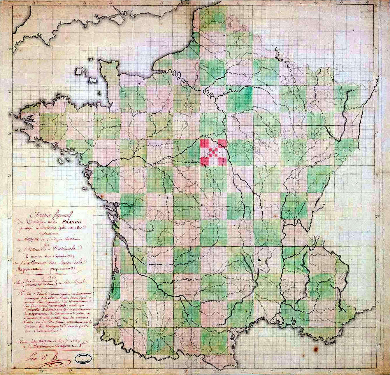
The departments were created in 1790 as a rational replacement of Ancien Régime provinces with a view to strengthen national unity; the title "department" is used to mean a part of a larger whole. Almost all of them were named after physical geographical features (rivers, mountains, or coasts), rather than after historical or cultural territories, which could have their own loyalties, or after their own administrative seats. The division of France into departments was a project particularly identified with the French revolutionary leader the Abbé Sieyès, although it had already been frequently discussed and written about by many politicians and thinkers. The earliest known suggestion of it is from 1665 in the writings of d'Argenson. They have inspired similar divisions in many countries, some of them former French colonies. The 1822 territorial division of Spain (reverted due to the 1823 French intervention ending the trienio liberal) and the 1833 territorial division of Spain, which forms the basis of the present day provinces of Spain with minor modifications, are also based on the French model of departments of roughly equal size.
Most French departments are assigned a two-digit number, the Official Geographical Code, allocated by the Institut national de la statistique et des études économiques (Insée). Overseas departments have a three-digit number. The number is used, for example, in the postal code and was, until the introduction of the SIV scheme in 2009, part of the vehicle registration plate number. Residents commonly use the numbers to refer to their own department or a neighbouring one, for example inhabitants of Loiret may refer to their department as "the 45". More distant departments are generally referred to by their names, as few people know the numbers of all the departments.
In 2014, President François Hollande proposed abolishing departmental councils by 2020, which would have maintained the departments as administrative divisions, and transferring their powers to other levels of governance. This reform project has since been scrapped.
History
Main article: Territorial evolution of France
The first French territorial departments were proposed in 1665 by Marc-René d'Argenson to serve as administrative areas purely for the Ponts et Chaussées (Bridges and Highways) infrastructure administration.
Before the French Revolution, France gained territory gradually through the annexation of a mosaic of independent entities. By the end of the Ancien Régime it was organised into provinces. During the Revolution they were dissolved, partly in order to weaken old loyalties. The National Constituent Assembly decided to create a more uniform division into departments (département) and districts in late 1789. The process began on 4 August 1789 with the elimination of provincial privileges, and a 22 December 1789 decree (with letters patent in January 1790) provided for the termination of the provincial governments.
The modern department system, as all-purpose units of the government, was decreed on 26 February 1790 (with letters patent on 4 March 1790) by the National Constituent Assembly. Their boundaries served two purposes:
- Boundaries were chosen to break up France's historical regions in an attempt to erase cultural differences and build a more homogeneous nation.
- Boundaries were set so that every settlement in the country was within a day's ride of the capital of a department. This was a security measure, intended to keep the entire national territory under close control.
The old nomenclature was carefully avoided in naming the new departments. Most were named after an area's principal river or other physical features. Even Paris was in the department of Seine. Savoy, during its temporary occupation, became the department of Mont-Blanc. The provinces continued to exist administratively until 21 September 1791.
The number of departments, initially 83, had been increased to 130 by 1809 with the territorial gains of the Republic and of the First French Empire. Following the defeats of Napoleon in 1814–1815 the Congress of Vienna returned France to its pre-war size and the number of departments was reduced to 86 (three of the original departments having been split). In 1860 France acquired the County of Nice and Savoy, which led to the creation of three new departments. Two were added from the new Savoyard territory, while the department of Alpes-Maritimes was created from Nice and a portion of the Var department. The 89 departments were given numbers based on the alphabetical order of their names.
The department of Bas-Rhin and parts of Meurthe, Moselle, Vosges and Haut-Rhin were ceded to the German Empire in 1871 following France's defeat in the Franco-Prussian War. A small part of Haut-Rhin, however, remained French and became known as the Territoire de Belfort; the remaining parts of Meurthe and Moselle were merged into a new Meurthe-et-Moselle department. When France regained the ceded departments after World War I, the Territoire de Belfort was not reintegrated into Haut-Rhin. In 1922 it became France's 90th department. Likewise the Lorraine departments were not changed back to their original boundaries, and a new Moselle department was created in the regained territory, with slightly different boundaries from the pre-war department of the same name.
The reorganisation of Île-de-France in 1968 and the division of Corsica in 1975 added six more departments, raising the total in Metropolitan France to 96. By 2011, when the overseas collectivity of Mayotte became a department, joining the earlier overseas departments of the Republic (all created in 1946) – French Guiana, Guadeloupe, Martinique and Réunion – the total number of departments in the French Republic had become 101. In 2015 the Urban Community of Lyon was split from Rhône to form the Métropole de Lyon, a sui generis entity, with the powers of both an intercommunality and those of a department on its territory, formally classified as a "territorial collectivity with particular status" () and as such not belonging to any department. As of 2019 Corse-du-Sud and Haute-Corse are still administrative departments, although they no longer have the status of departmental "territorial collectivities": region and department functions have been managed by a "single territorial collectivity" since 2018.
Despite the intention to avoid the old nomenclature, often the names of pre-1790 provinces remained in use. For example, the name of Berry, though no longer having an official status, remains in widespread use in daily life.
General characteristics
Main article: Administrative divisions of France
Government and administration

The departmental seat of government is known as the prefecture (préfecture) or chef-lieu de département and is generally a town of some importance roughly at the geographical centre of the department. This was determined according to the time taken to travel on horseback from the periphery of the department. The goal was for the prefecture to be accessible on horseback from any town in the department within 24 hours. The prefecture is not necessarily the largest city in the department: for instance, in Saône-et-Loire department the capital is Mâcon, but the largest city is Chalon-sur-Saône. Departments may be divided into arrondissements. The capital of an arrondissement is called a subprefecture (sous-préfecture) or chef-lieu d'arrondissement.
Each department is administered by a departmental council (conseil départemental), an assembly elected for six years by universal suffrage, with the President of the Departmental Council as executive of the department. Before 1982, the chief executive of the department was the prefect (préfet), who represents the Government of France in each department and is appointed by the President of the French Republic. The prefect is assisted by one or more sub-prefects (sous-préfet) based in the subprefectures of the department. Since 1982, the prefect retains only the powers that are not delegated to the department councils. In practice, their role has been largely limited to preventing local policy from conflicting with national policy.
The departments are further divided into communes, governed by municipal councils. As of 2025, there were 34,746 communes in France. In the overseas territories, some communes play a role at departmental level. Paris, the country's capital city, is a commune as well as a department.
In mainland France (metropolitan France, excluding Corsica), the median land area of a department is 5965 km2, which is two-and-a-half times the median land area of the ceremonial counties of England and the preserved counties of Wales and slightly more than three-and-half times the median land area of a county of the United States. At the 2001 census, the median population of a department in continental France was 511,000 inhabitants, which is 21 times the median population of a United States county, but less than two-thirds of the median population of a ceremonial county of England and Wales. Most of the departments have an area of between 4,000 and 8,000 km2 (1500 to 3000 sq. mi), and a population between 320,000 and 1 million. The largest in area is Gironde (10,000 km2), while the smallest is the city of Paris (105 km2). The most populous is Nord (2,550,000) and the least populous is Lozère (74,000).
Numbering
The departments are numbered: their two-digit numbers appear in postal codes, in INSEE codes (including "social security numbers") and on vehicle number plates. Initially the numbers corresponded to the alphabetical order of the names of the departments, but several changed their names and some have been divided, so the correspondence became less exact. Alphanumeric codes 2A and 2B were used for Corsica while it was split but it has since reverted to 20. The two-digit code "98" is used by Monaco. Together with the ISO 3166-1 alpha-2 country code FR, the numbers form the ISO 3166-2 country subdivision codes for the metropolitan departments. The overseas departments have three digits.
Relation to national government
Originally, the relationship between the departments and the central government was left somewhat ambiguous. While citizens in each department elected their own officials, the local governments were subordinated to the central government, becoming instruments of national integration. By 1793, however, the revolutionary government had turned the departments into transmission belts for policies enacted in Paris. With few exceptions, the departments had this role until the early 1960s.
Political party preferences
These maps cannot be used as a useful resource of voter preferences, because Departmental Councils are elected on a two-round system, which drastically limits the chances of fringe parties, if they are not supported on one of the two rounds by a moderate party. After the 1992 election, the left had a majority in only 21 of the 100 departments; after the 2011 election, the left dominated 61 of the 100 departments. (Mayotte only became a department after the election.) File:Cantonales_1998(dom).png|Party affiliation of the General Council Presidents of the various departments in the cantonal elections of 1998 File:Cantonales 2001.svg|Party affiliation of the General Council Presidents of the various departments in the elections of 2001 File:Cantonales 2004.svg|Party affiliation of the General Council Presidents of the various departments in the elections of 2004 File:Conseils généraux 2008.svg|Party affiliation of the General Council Presidents of the various departments in the elections of 2008 File:Conseils généraux 2011.png|Party affiliation of the General Council Presidents of the various departments in the elections of 2011 File:Presidents of French departments current.svg|Party affiliation of the General Council Presidents of the various departments in the elections of 2015 Key to the parties:
- Divers Centre = Independents of the centre or Democratic Movement (Mouvement démocrate)
- Divers Droite (DVD) = Independent conservatives
- Divers Gauche (DVG) = Independent left-wing politicians
- MPF = Movement for France (Mouvement pour la France) (right)
- Nouveau Centre = New Centre (centre or centre-right)
- PCF = French Communist Party (Parti communiste français)
- PRG = Radical Party of the Left (Parti radical de gauche)
- PS = Socialist Party (Parti socialiste)
- UDF = Union for French Democracy (Union pour la démocratie française) succeeded by Democratic Movement
- UMP = Union for a Popular Movement (Union pour un mouvement populaire)
Future
The removal of one or more levels of local government has been discussed for some years; in particular, the option of removing the departmental level. Frédéric Lefebvre, spokesman for the UMP, said in December 2008 that the fusion of the departments with the regions was a matter to be dealt with soon. This was soon refuted by Édouard Balladur and Gérard Longuet, members of the committee for the reform of local authorities, known as the Balladur Committee.
In January 2008, the Attali Commission recommended that the departmental level of government should be eliminated within ten years.
Nevertheless, the Balladur Committee has not retained this proposition and does not advocate the disappearance of the departments, but simply "favors the voluntary grouping of departments", which it suggests also for the regions, with the aim of reducing the number of regions to 15. This committee advocates, on the contrary, the suppression of the cantons.
Maps and tables
Current departments
Each department has a coat of arms and a flag with which it is commonly associated, though not all are officially recognised or used.
| INSEE code | Arms | Date of establishment | Department | Capital | Region | Named after | 01 | 02 | 03 | 04 | 05 | 06 | 07 | 08 | 09 | 10 | 11 | 12 | 13 | 14 | 15 | 16 | 17 | 18 | 19 | 2A | 2B | 21 | 22 | 23 | 24 | 25 | 26 | 27 | 28 | 29 | 30 | 31 | 32 | 33 | 34 | 35 | 36 | 37 | 38 | 39 | 40 | 41 | 42 | 43 | 44 | 45 | 46 | 47 | 48 | 49 | 50 | 51 | 52 | 53 | 54 | 55 | 56 | 57 | 58 | 59 | 60 | 61 | 62 | 63 | 64 | 65 | 66 | 67 | 68 | 69D | 69M | 70 | 71 | 72 | 73 | 74 | 75 | 76 | 77 | 78 | 79 | 80 | 81 | 82 | 83 | 84 | 85 | 86 | 87 | 88 | 89 | 90 | 91 | 92 | 93 | 94 | 95 | 971 | 972 | 973 | 974 | 976 | ||
|---|---|---|---|---|---|---|---|---|---|---|---|---|---|---|---|---|---|---|---|---|---|---|---|---|---|---|---|---|---|---|---|---|---|---|---|---|---|---|---|---|---|---|---|---|---|---|---|---|---|---|---|---|---|---|---|---|---|---|---|---|---|---|---|---|---|---|---|---|---|---|---|---|---|---|---|---|---|---|---|---|---|---|---|---|---|---|---|---|---|---|---|---|---|---|---|---|---|---|---|---|---|---|---|---|---|---|---|---|---|---|
| [[File:Blason département fr Ain.svg | 22x20px | Coat of arms of department 01]] | 26 February 1790 | Ain | Bourg-en-Bresse | Auvergne-Rhône-Alpes | Ain (river) | |||||||||||||||||||||||||||||||||||||||||||||||||||||||||||||||||||||||||||||||||||||||||||||||||||||||
| [[File:Blason département fr Aisne.svg | 22x20px | Coat of arms of department 02]] | Aisne | Laon | Hauts-de-France | Aisne (river) | ||||||||||||||||||||||||||||||||||||||||||||||||||||||||||||||||||||||||||||||||||||||||||||||||||||||||
| [[File:Blason dpt fr Allier.svg | 22x20px | Coat of arms of department 03]] | Allier | Moulins | Auvergne-Rhône-Alpes | Allier (river) | ||||||||||||||||||||||||||||||||||||||||||||||||||||||||||||||||||||||||||||||||||||||||||||||||||||||||
| [[File:Blason departement Alpes-de-Haute-Provence.svg | 22x20px | Coat of arms of department 04]] | Alpes-de-Haute-Provence | Digne-les-Bains | Provence-Alpes-Côte d'Azur | Alps mountains and Provence region | ||||||||||||||||||||||||||||||||||||||||||||||||||||||||||||||||||||||||||||||||||||||||||||||||||||||||
| [[File:Blason dpt fr HautesAlpes.svg | 22x20px | Coat of arms of department 05]] | Hautes-Alpes | Gap | Alps mountains | |||||||||||||||||||||||||||||||||||||||||||||||||||||||||||||||||||||||||||||||||||||||||||||||||||||||||
| [[File:Nice Arms.svg | 22x20px | Coat of arms of department 06]] | Alpes-Maritimes | Nice | ||||||||||||||||||||||||||||||||||||||||||||||||||||||||||||||||||||||||||||||||||||||||||||||||||||||||||
| [[File:Blason dpt fr Ardeche.svg | 22x20px | Coat of arms of department 07]] | Privas | Auvergne-Rhône-Alpes | Ardèche (river) | |||||||||||||||||||||||||||||||||||||||||||||||||||||||||||||||||||||||||||||||||||||||||||||||||||||||||
| [[File:Blason département fr Ardennes.svg | 22x20px | Coat of arms of department 08]] | Ardennes | Grand Est | Ardennes Forest | |||||||||||||||||||||||||||||||||||||||||||||||||||||||||||||||||||||||||||||||||||||||||||||||||||||||||
| [[File:Blason dpt fr Ariège.svg | 22x20px | Coat of arms of department 09]] | Foix | Occitanie | Ariège (river) | |||||||||||||||||||||||||||||||||||||||||||||||||||||||||||||||||||||||||||||||||||||||||||||||||||||||||
| [[File:Blason département fr Aube.svg | 22x20px | Coat of arms of department 10]] | Aube | Troyes | Grand Est | Aube (river) | ||||||||||||||||||||||||||||||||||||||||||||||||||||||||||||||||||||||||||||||||||||||||||||||||||||||||
| [[File:Blason dpt fr Aude.svg | 22x20px | Coat of arms of department 11]] | Aude | Carcassonne | Occitanie | Aude (river) | ||||||||||||||||||||||||||||||||||||||||||||||||||||||||||||||||||||||||||||||||||||||||||||||||||||||||
| [[File:Blason comtes de Rodez.svg | 22x20px | Coat of arms of department 12]] | Aveyron | Rodez | Aveyron (river) | |||||||||||||||||||||||||||||||||||||||||||||||||||||||||||||||||||||||||||||||||||||||||||||||||||||||||
| [[File:Blason département fr Bouches-du-Rhône.svg | 22x20px | Coat of arms of department 13]] | Marseille | Provence-Alpes-Côte d'Azur | Rhône (river) | |||||||||||||||||||||||||||||||||||||||||||||||||||||||||||||||||||||||||||||||||||||||||||||||||||||||||
| [[File:Blason département fr Calvados.svg | 22x20px | Coat of arms of department 14]] | Calvados | Caen | Normandy | Latin calva dorsa ("bare backs"), referring to two offshore rocks | ||||||||||||||||||||||||||||||||||||||||||||||||||||||||||||||||||||||||||||||||||||||||||||||||||||||||
| [[File:Blason dpt fr Cantal.svg | 22x20px | Coat of arms of department 15]] | Cantal | Aurillac | Auvergne-Rhône-Alpes | Mounts of Cantal | ||||||||||||||||||||||||||||||||||||||||||||||||||||||||||||||||||||||||||||||||||||||||||||||||||||||||
| [[File:Blason département fr Charente.svg | 22x20px | Coat of arms of department 16]] | Charente | Nouvelle-Aquitaine | Charente (river) | |||||||||||||||||||||||||||||||||||||||||||||||||||||||||||||||||||||||||||||||||||||||||||||||||||||||||
| [[File:Blason département fr Charente-Maritime.svg | 22x20px | Coat of arms of department 17]] | Charente-Maritime | La Rochelle | ||||||||||||||||||||||||||||||||||||||||||||||||||||||||||||||||||||||||||||||||||||||||||||||||||||||||||
| [[File:Blason dpt fr Cher.svg | 22x20px | Coat of arms of department 18]] | Cher | Bourges | Centre-Val de Loire | Cher (river) | ||||||||||||||||||||||||||||||||||||||||||||||||||||||||||||||||||||||||||||||||||||||||||||||||||||||||
| [[File:Blason département fr Corrèze.svg | 22x20px | Coat of arms of department 19]] | Tulle | Nouvelle-Aquitaine | Corrèze (river) | |||||||||||||||||||||||||||||||||||||||||||||||||||||||||||||||||||||||||||||||||||||||||||||||||||||||||
| [[File:Blason de Corse.svg | 22x20px | Coat of arms of department 2A]] | 1 January 1979 | Corse-du-Sud | Ajaccio | Corsica | Island of Corsica and South cardinal direction | |||||||||||||||||||||||||||||||||||||||||||||||||||||||||||||||||||||||||||||||||||||||||||||||||||||||
| Haute-Corse | Bastia | Island of Corsica | ||||||||||||||||||||||||||||||||||||||||||||||||||||||||||||||||||||||||||||||||||||||||||||||||||||||||||||
| [[File:Blason département fr Côte-d'Or.svg | 22x20px | Coat of arms of department 21]] | 26 February 1790 | Dijon | Bourgogne-Franche-Comté | Côte d'Or (escarpment) | ||||||||||||||||||||||||||||||||||||||||||||||||||||||||||||||||||||||||||||||||||||||||||||||||||||||||
| [[File:Blason département fr Côtes-d'Armor.svg | 22x20px | Coat of arms of department 22]] | Saint-Brieuc | Brittany Brittany | coasts of Armorica | |||||||||||||||||||||||||||||||||||||||||||||||||||||||||||||||||||||||||||||||||||||||||||||||||||||||||
| [[File:Blason Bourbon-La Marche.svg | 22x20px | Coat of arms of department 23]] | Creuse | Nouvelle-Aquitaine | Creuse (river) | |||||||||||||||||||||||||||||||||||||||||||||||||||||||||||||||||||||||||||||||||||||||||||||||||||||||||
| [[File:Blason Dordogne 1.svg | 22x20px | Coat of arms of department 24]] | Dordogne | Dordogne (river) | ||||||||||||||||||||||||||||||||||||||||||||||||||||||||||||||||||||||||||||||||||||||||||||||||||||||||||
| [[File:Blason département fr Doubs.svg | 22x20px | Coat of arms of department 25]] | Doubs | Bourgogne-Franche-Comté | Doubs (river) | |||||||||||||||||||||||||||||||||||||||||||||||||||||||||||||||||||||||||||||||||||||||||||||||||||||||||
| [[File:Blason département fr Drôme.svg | 22x20px | Coat of arms of department 26]] | Valence | Auvergne-Rhône-Alpes | Drôme (river) | |||||||||||||||||||||||||||||||||||||||||||||||||||||||||||||||||||||||||||||||||||||||||||||||||||||||||
| [[File:Blason département fr Eure.svg | 22x20px | Coat of arms of department 27]] | Eure | Normandy | Eure (river) | |||||||||||||||||||||||||||||||||||||||||||||||||||||||||||||||||||||||||||||||||||||||||||||||||||||||||
| [[File:Blason département fr Eure-et-Loir.svg | 22x20px | Coat of arms of department 28]] | Eure-et-Loir | Chartres | Centre-Val de Loire | Eure and Loir rivers | ||||||||||||||||||||||||||||||||||||||||||||||||||||||||||||||||||||||||||||||||||||||||||||||||||||||||
| [[File:Blason département fr Finistère.svg | 22x20px | Coat of arms of department 29]] | Quimper | Brittany Brittany | Latin Finis Terrae ("end of earth") | |||||||||||||||||||||||||||||||||||||||||||||||||||||||||||||||||||||||||||||||||||||||||||||||||||||||||
| [[File:Blason département fr Gard.svg | 22x20px | Coat of arms of department 30]] | Gard | Occitanie | Occitan name for Gardon river | |||||||||||||||||||||||||||||||||||||||||||||||||||||||||||||||||||||||||||||||||||||||||||||||||||||||||
| [[File:Blason département fr Haute-Garonne.svg | 22x20px | Coat of arms of department 31]] | Haute-Garonne | Toulouse | Garonne (river) | |||||||||||||||||||||||||||||||||||||||||||||||||||||||||||||||||||||||||||||||||||||||||||||||||||||||||
| [[File:Blason dpt fr Gers.svg | 22x20px | Coat of arms of department 32]] | Gers | Auch | Gers (river) | |||||||||||||||||||||||||||||||||||||||||||||||||||||||||||||||||||||||||||||||||||||||||||||||||||||||||
| [[File:Blason département fr Gironde.svg | 22x20px | Coat of arms of department 33]] | Gironde | Bordeaux | Nouvelle-Aquitaine | Gironde estuary | ||||||||||||||||||||||||||||||||||||||||||||||||||||||||||||||||||||||||||||||||||||||||||||||||||||||||
| [[File:Blason département fr Hérault.svg | 22x20px | Coat of arms of department 34]] | Montpellier | Occitanie | Hérault (river) | |||||||||||||||||||||||||||||||||||||||||||||||||||||||||||||||||||||||||||||||||||||||||||||||||||||||||
| [[File:Blason département fr Ille-et-Vilaine.svg | 22x20px | Coat of arms of department 35]] | Ille-et-Vilaine | Rennes | Brittany Brittany | Ille and Vilaine rivers | ||||||||||||||||||||||||||||||||||||||||||||||||||||||||||||||||||||||||||||||||||||||||||||||||||||||||
| [[File:Blason département fr Indre.svg | 22x20px | Coat of arms of department 36]] | Indre | Centre-Val de Loire | Indre (river) | |||||||||||||||||||||||||||||||||||||||||||||||||||||||||||||||||||||||||||||||||||||||||||||||||||||||||
| [[File:Blason département fr Indre-et-Loire.svg | 22x20px | Coat of arms of department 37]] | Indre-et-Loire | Tours | Indre and Loire rivers | |||||||||||||||||||||||||||||||||||||||||||||||||||||||||||||||||||||||||||||||||||||||||||||||||||||||||
| [[File:Blason departement Isere.svg | 22x20px | Coat of arms of department 38]] | Grenoble | Auvergne-Rhône-Alpes | Isère (river) | |||||||||||||||||||||||||||||||||||||||||||||||||||||||||||||||||||||||||||||||||||||||||||||||||||||||||
| [[File:Blason département fr Jura.svg | 22x20px | Coat of arms of department 39]] | Jura | Lons-le-Saunier | Bourgogne-Franche-Comté | Jura Mountains | ||||||||||||||||||||||||||||||||||||||||||||||||||||||||||||||||||||||||||||||||||||||||||||||||||||||||
| [[File:Blason dpt fr Landes.svg | 22x20px | Coat of arms of department 40]] | Landes | Mont-de-Marsan | Nouvelle-Aquitaine | Heathlands (*lande*) that dominated the region at the time | ||||||||||||||||||||||||||||||||||||||||||||||||||||||||||||||||||||||||||||||||||||||||||||||||||||||||
| [[File:Blason département fr Loir-et-Cher.svg | 22x20px | Coat of arms of department 41]] | Loir-et-Cher | Blois | Centre-Val de Loire | Loir and Cher rivers | ||||||||||||||||||||||||||||||||||||||||||||||||||||||||||||||||||||||||||||||||||||||||||||||||||||||||
| [[File:Blason departement Loire.svg | 22x20px | Coat of arms of department 42]] | 12 August 1793 | Loire | Auvergne-Rhône-Alpes | Loire (river) | ||||||||||||||||||||||||||||||||||||||||||||||||||||||||||||||||||||||||||||||||||||||||||||||||||||||||
| [[File:Blason dpt fr Haute-Loire.svg | 22x20px | Coat of arms of department 43]] | 26 February 1790 | Haute-Loire | Le Puy-en-Velay | |||||||||||||||||||||||||||||||||||||||||||||||||||||||||||||||||||||||||||||||||||||||||||||||||||||||||
| [[File:Blason dpt fr LoireAtlantique dapres Robert Louis.svg | 22x20px | Coat of arms of department 44]] | Loire-Atlantique | Nantes | Pays de la Loire | Loire (river) and Atlantic Ocean | ||||||||||||||||||||||||||||||||||||||||||||||||||||||||||||||||||||||||||||||||||||||||||||||||||||||||
| [[File:Blason département fr Loiret.svg | 22x20px | Coat of arms of department 45]] | Loiret | Centre-Val de Loire | Loiret (river) | |||||||||||||||||||||||||||||||||||||||||||||||||||||||||||||||||||||||||||||||||||||||||||||||||||||||||
| [[File:Blason département fr Lot.svg | 22x20px | Coat of arms of department 46]] | Lot | Cahors | Occitanie | Lot (river) | ||||||||||||||||||||||||||||||||||||||||||||||||||||||||||||||||||||||||||||||||||||||||||||||||||||||||
| [[File:Blason département fr Lot-et-Garonne.svg | 22x20px | Coat of arms of department 47]] | Lot-et-Garonne | Agen | Nouvelle-Aquitaine | Lot and Garonne rivers | ||||||||||||||||||||||||||||||||||||||||||||||||||||||||||||||||||||||||||||||||||||||||||||||||||||||||
| [[File:Blason département fr Lozère.svg | 22x20px | Coat of arms of department 48]] | Mende | Occitanie | Mont Lozère | |||||||||||||||||||||||||||||||||||||||||||||||||||||||||||||||||||||||||||||||||||||||||||||||||||||||||
| [[File:Blason departement Maine-et-Loire.svg | 22x20px | Coat of arms of department 49]] | Maine-et-Loire | Angers | Pays de la Loire | Maine and Loire rivers | ||||||||||||||||||||||||||||||||||||||||||||||||||||||||||||||||||||||||||||||||||||||||||||||||||||||||
| [[File:Blason département fr Manche.svg | 22x20px | Coat of arms of department 50]] | Manche | Normandy | English Channel | |||||||||||||||||||||||||||||||||||||||||||||||||||||||||||||||||||||||||||||||||||||||||||||||||||||||||
| [[File:Blason departement Marne.svg | 22x20px | Coat of arms of department 51]] | Marne | Grand Est | Marne (river) | |||||||||||||||||||||||||||||||||||||||||||||||||||||||||||||||||||||||||||||||||||||||||||||||||||||||||
| [[File:Blason département fr Haute-Marne.svg | 22x20px | Coat of arms of department 52]] | Haute-Marne | Chaumont | ||||||||||||||||||||||||||||||||||||||||||||||||||||||||||||||||||||||||||||||||||||||||||||||||||||||||||
| [[File:Blason département fr Mayenne.svg | 22x20px | Coat of arms of department 53]] | Mayenne | Laval | Pays de la Loire | Mayenne (river) | ||||||||||||||||||||||||||||||||||||||||||||||||||||||||||||||||||||||||||||||||||||||||||||||||||||||||
| [[File:Blason Meurthe-et-Moselle.svg | 22x20px | Coat of arms of department 54]] | 7 September 1871 | Meurthe-et-Moselle | Nancy | Grand Est | Meurthe and Moselle rivers | |||||||||||||||||||||||||||||||||||||||||||||||||||||||||||||||||||||||||||||||||||||||||||||||||||||||
| [[File:Blason Meuse.svg | 22x20px | Coat of arms of department 55]] | 26 February 1790 | Meuse | Bar-le-Duc | Meuse (river) | ||||||||||||||||||||||||||||||||||||||||||||||||||||||||||||||||||||||||||||||||||||||||||||||||||||||||
| [[File:Blason departement Morbihan.svg | 22x20px | Coat of arms of department 56]] | Morbihan | Vannes | Brittany Brittany | Gulf of Morbihan | ||||||||||||||||||||||||||||||||||||||||||||||||||||||||||||||||||||||||||||||||||||||||||||||||||||||||
| [[File:Blason Moselle.svg | 22x20px | Coat of arms of department 57]] | Moselle | Metz | Grand Est | Moselle (river) | ||||||||||||||||||||||||||||||||||||||||||||||||||||||||||||||||||||||||||||||||||||||||||||||||||||||||
| [[File:Blason dpt fr Nievre.svg | 22x20px | Coat of arms of department 58]] | Nevers | Bourgogne-Franche-Comté | Nièvre (river) | |||||||||||||||||||||||||||||||||||||||||||||||||||||||||||||||||||||||||||||||||||||||||||||||||||||||||
| [[File:Blason Nord-Pas-De-Calais.svg | 22x20px | Coat of arms of department 59]] | Nord | Lille | Hauts-de-France | North cardinal direction | ||||||||||||||||||||||||||||||||||||||||||||||||||||||||||||||||||||||||||||||||||||||||||||||||||||||||
| [[File:Blason département fr Oise.svg | 22x20px | Coat of arms of department 60]] | Oise | Beauvais | Oise (river) | |||||||||||||||||||||||||||||||||||||||||||||||||||||||||||||||||||||||||||||||||||||||||||||||||||||||||
| [[File:Blason département fr Orne.svg | 22x20px | Coat of arms of department 61]] | Orne | Normandy | Orne (river) | |||||||||||||||||||||||||||||||||||||||||||||||||||||||||||||||||||||||||||||||||||||||||||||||||||||||||
| [[File:Pas de Calais Arms.svg | 22x20px | Coat of arms of department 62]] | Pas-de-Calais | Arras | Hauts-de-France | Strait of Dover | ||||||||||||||||||||||||||||||||||||||||||||||||||||||||||||||||||||||||||||||||||||||||||||||||||||||||
| [[File:Blason dpt fr Puy-de-Dome.svg | 22x20px | Coat of arms of department 63]] | Clermont-Ferrand | Auvergne-Rhône-Alpes | Puy de Dôme volcano | |||||||||||||||||||||||||||||||||||||||||||||||||||||||||||||||||||||||||||||||||||||||||||||||||||||||||
| [[File:Blason des Pyrénées-Atlantiques.svg | 22x20px | Coat of arms of department 64]] | Pau | Nouvelle-Aquitaine | Pyrenees mountains and Atlantic Ocean | |||||||||||||||||||||||||||||||||||||||||||||||||||||||||||||||||||||||||||||||||||||||||||||||||||||||||
| [[File:Blason dpt fr HautesPyrenees.svg | 22x20px | Coat of arms of department 65]] | Tarbes | Occitanie | Pyrenees mountains | |||||||||||||||||||||||||||||||||||||||||||||||||||||||||||||||||||||||||||||||||||||||||||||||||||||||||
| [[File:Arms of the Pyrénées-Orientales.svg | 22x20px | Coat of arms of department 66]] | Perpignan | Pyrenees mountains and East cardinal direction | ||||||||||||||||||||||||||||||||||||||||||||||||||||||||||||||||||||||||||||||||||||||||||||||||||||||||||
| [[File:Blason département fr Bas-Rhin.svg | 22x20px | Coat of arms of department 67]] | Bas-Rhin | Strasbourg | Grand Est | Rhine (river) | ||||||||||||||||||||||||||||||||||||||||||||||||||||||||||||||||||||||||||||||||||||||||||||||||||||||||
| [[File:Blason Haut Rhin.svg | 22x20px | Coat of arms of department 68]] | Haut-Rhin | Colmar | ||||||||||||||||||||||||||||||||||||||||||||||||||||||||||||||||||||||||||||||||||||||||||||||||||||||||||
| [[File:Blason dpt fr Rhone.svg | 22x20px | Coat of arms of department 69]] | 12 August 1793 | Lyon (provisional) | Auvergne-Rhône-Alpes | Rhône (river) | ||||||||||||||||||||||||||||||||||||||||||||||||||||||||||||||||||||||||||||||||||||||||||||||||||||||||
| [[File:Blason Ville fr Lyon.svg | 22x20px | Coat of arms of Lyon]] | 1 January 2015 | Lyon | commune of Lyon | |||||||||||||||||||||||||||||||||||||||||||||||||||||||||||||||||||||||||||||||||||||||||||||||||||||||||
| [[File:Blason dpt fr Haute-Saone.svg | 22x20px | Coat of arms of department 70]] | 26 February 1790 | Vesoul | Bourgogne-Franche-Comté | Saône (river) | ||||||||||||||||||||||||||||||||||||||||||||||||||||||||||||||||||||||||||||||||||||||||||||||||||||||||
| [[File:Blason département fr Saône-et-Loire.svg | 22x20px | Coat of arms of department 71]] | Saône and Loire rivers | |||||||||||||||||||||||||||||||||||||||||||||||||||||||||||||||||||||||||||||||||||||||||||||||||||||||||||
| [[File:Blason dpt fr Sarthe.svg | 22x20px | Coat of arms of department 72]] | Sarthe | Le Mans | Pays de la Loire | Sarthe (river) | ||||||||||||||||||||||||||||||||||||||||||||||||||||||||||||||||||||||||||||||||||||||||||||||||||||||||
| [[File:Savoie Blason.svg | 22x20px | Coat of arms of department 73]] | 15 June 1860 | Savoie | Auvergne-Rhône-Alpes | region of Savoy | ||||||||||||||||||||||||||||||||||||||||||||||||||||||||||||||||||||||||||||||||||||||||||||||||||||||||
| [[File:Haute Savoie blason.svg | 22x20px | Coat of arms of department 74]] | Haute-Savoie | Annecy | ||||||||||||||||||||||||||||||||||||||||||||||||||||||||||||||||||||||||||||||||||||||||||||||||||||||||||
| [[File:Blason paris 75.svg | 22x20px | Coat of arms of department 75]] | 1 January 1968 | Paris | Paris | Île-de-France | commune of Paris | |||||||||||||||||||||||||||||||||||||||||||||||||||||||||||||||||||||||||||||||||||||||||||||||||||||||
| [[File:Blason76.svg | 22x20px | Coat of arms of department 76]] | 26 February 1790 | Seine-Maritime | Rouen | Normandy | Seine (river) | |||||||||||||||||||||||||||||||||||||||||||||||||||||||||||||||||||||||||||||||||||||||||||||||||||||||
| [[File:Blason département fr Seine-et-Marne.svg | 22x20px | Coat of arms of department 77]] | Seine-et-Marne | Melun | Île-de-France | Seine and Marne rivers | ||||||||||||||||||||||||||||||||||||||||||||||||||||||||||||||||||||||||||||||||||||||||||||||||||||||||
| [[File:Blason département fr Yvelines.svg | 22x20px | Coat of arms of department 78]] | 1 January 1968 | Yvelines | Versailles | Forest of Yvelines | ||||||||||||||||||||||||||||||||||||||||||||||||||||||||||||||||||||||||||||||||||||||||||||||||||||||||
| [[File:Blason département fr Deux-Sèvres.svg | 22x20px | Coat of arms of department 79]] | 26 February 1790 | Niort | Nouvelle-Aquitaine | Sèvre Nantaise and Sèvre Niortaise rivers | ||||||||||||||||||||||||||||||||||||||||||||||||||||||||||||||||||||||||||||||||||||||||||||||||||||||||
| [[File:Blason département fr Somme.svg | 22x20px | Coat of arms of department 80]] | Somme | Amiens | Hauts-de-France | Somme (river) | ||||||||||||||||||||||||||||||||||||||||||||||||||||||||||||||||||||||||||||||||||||||||||||||||||||||||
| [[File:Blason dpt fr Tarn.svg | 22x20px | Coat of arms of department 81]] | Tarn | Albi | Occitanie | Tarn (river) | ||||||||||||||||||||||||||||||||||||||||||||||||||||||||||||||||||||||||||||||||||||||||||||||||||||||||
| [[File:Blason département fr Tarn-et-Garonne.svg | 22x20px | Coat of arms of department 82]] | 4 November 1808 | Tarn-et-Garonne | Montauban | Tarn and Garonne rivers | ||||||||||||||||||||||||||||||||||||||||||||||||||||||||||||||||||||||||||||||||||||||||||||||||||||||||
| [[File:Blason departement Var.svg | 22x20px | Coat of arms of department 83]] | 26 February 1790 | Var | Toulon | Provence-Alpes-Côte d'Azur | Var (river) | |||||||||||||||||||||||||||||||||||||||||||||||||||||||||||||||||||||||||||||||||||||||||||||||||||||||
| [[File:Blason département fr Vaucluse.svg | 22x20px | Coat of arms of department 84]] | 25 June 1793 | Vaucluse | Avignon | Fontaine de Vaucluse spring | ||||||||||||||||||||||||||||||||||||||||||||||||||||||||||||||||||||||||||||||||||||||||||||||||||||||||
| [[File:Blason dpt fr 85 Vendée.svg | 22x20px | Coat of arms of department 85]] | 26 February 1790 | La Roche-sur-Yon | Pays de la Loire | Vendée (river) | ||||||||||||||||||||||||||||||||||||||||||||||||||||||||||||||||||||||||||||||||||||||||||||||||||||||||
| [[File:Blason département fr Vienne.svg | 22x20px | Coat of arms of department 86]] | Vienne | Poitiers | Nouvelle-Aquitaine | Vienne (river) | ||||||||||||||||||||||||||||||||||||||||||||||||||||||||||||||||||||||||||||||||||||||||||||||||||||||||
| [[File:Blason département fr Haute-Vienne.svg | 22x20px | Coat of arms of department 87]] | Haute-Vienne | Limoges | ||||||||||||||||||||||||||||||||||||||||||||||||||||||||||||||||||||||||||||||||||||||||||||||||||||||||||
| [[File:Blason département fr Vosges.svg | 22x20px | Coat of arms of department 88]] | Vosges | Grand Est | Vosges Mountains | |||||||||||||||||||||||||||||||||||||||||||||||||||||||||||||||||||||||||||||||||||||||||||||||||||||||||
| [[File:Blason département fr Yonne.svg | 22x20px | Coat of arms of department 89]] | Yonne | Auxerre | Bourgogne-Franche-Comté | Yonne (river) | ||||||||||||||||||||||||||||||||||||||||||||||||||||||||||||||||||||||||||||||||||||||||||||||||||||||||
| [[File:Blason département fr Territoire de Belfort.svg | 22x20px | Coat of arms of department 90]] | 11 March 1922 | Territoire de Belfort | Belfort | commune of Belfort | ||||||||||||||||||||||||||||||||||||||||||||||||||||||||||||||||||||||||||||||||||||||||||||||||||||||||
| [[File:Blason département fr Essonne.svg | 22x20px | Coat of arms of department 91]] | 1 January 1968 | Essonne | Évry-Courcouronnes | Île-de-France | Essonne (river) | |||||||||||||||||||||||||||||||||||||||||||||||||||||||||||||||||||||||||||||||||||||||||||||||||||||||
| [[File:Blason département fr Hauts-de-Seine.svg | 22x20px | Coat of arms of department 92]] | Hauts-de-Seine | Nanterre | Seine (river) | |||||||||||||||||||||||||||||||||||||||||||||||||||||||||||||||||||||||||||||||||||||||||||||||||||||||||
| [[File:Blason département fr Seine-Saint-Denis.svg | 22x20px | Coat of arms of department 93]] | Seine-Saint-Denis | Bobigny | Seine (river) and commune of Saint-Denis | |||||||||||||||||||||||||||||||||||||||||||||||||||||||||||||||||||||||||||||||||||||||||||||||||||||||||
| [[File:Blason département fr Val-de-Marne.svg | 22x20px | Coat of arms of department 94]] | Val-de-Marne | Créteil | Marne (river) | |||||||||||||||||||||||||||||||||||||||||||||||||||||||||||||||||||||||||||||||||||||||||||||||||||||||||
| [[File:Blason département fr Val-d'Oise.svg | 22x20px | Coat of arms of department 95]] | Val-d'Oise | Pontoise | Oise (river) | |||||||||||||||||||||||||||||||||||||||||||||||||||||||||||||||||||||||||||||||||||||||||||||||||||||||||
| [[File:Coat of arms of Guadeloupe.svg | 22x20px | Coat of arms of Guadeloupe]] | 19 March 1946 | Guadeloupe | Basse-Terre | Guadeloupe | Island of Guadeloupe | |||||||||||||||||||||||||||||||||||||||||||||||||||||||||||||||||||||||||||||||||||||||||||||||||||||||
| [[File:Coat of arms of Martinique.svg | 22x20px | Coat of arms of Martinique]] | Martinique | Fort-de-France | Martinique | Island of Martinique | ||||||||||||||||||||||||||||||||||||||||||||||||||||||||||||||||||||||||||||||||||||||||||||||||||||||||
| [[File:Blason de la Guyane.svg | 22x20px | Coat of arms of Guyane]] | Guyane | Cayenne | French Guiana | The Guianas | ||||||||||||||||||||||||||||||||||||||||||||||||||||||||||||||||||||||||||||||||||||||||||||||||||||||||
| [[File:Blason Réunion DOM.svg | 22x20px | Coat of arms of Réunion]] | Saint-Denis | Réunion | Island of Réunion | |||||||||||||||||||||||||||||||||||||||||||||||||||||||||||||||||||||||||||||||||||||||||||||||||||||||||
| [[File:BlasonMayotte.svg | 22x20px | Coat of arms of Mayotte]] | 9 August 2009 | |||||||||||||||||||||||||||||||||||||||||||||||||||||||||||||||||||||||||||||||||||||||||||||||||||||||||||
| 31 March 2011 | Mayotte | Mamoudzou | Mayotte | Island of Mayotte |
- Most of the coats of arms are unofficial
- Alpes-de-Haute-Provence was known as Basses-Alpes ('Lower Alps') until 1970
- Charente-Maritime was known as Charente-Inférieure ('Lower Charente') until 1941
- Côtes-d'Armor was known as Côtes-du-Nord ('Coasts of the North') until 1990
- Gironde was known as Bec-d'Ambès ('Beak of Ambès') from 1793 until 1795. The Convention eliminated the name to avoid recalling the outlawed Girondin political faction.
- Loire-Atlantique was known as Loire-Inférieure ('Lower Loire') until 1957
- Maine-et-Loire was known as Mayenne-et-Loire (Mayenne and Loire rivers) until 1791
- Pyrénées-Atlantiques was known as Basses-Pyrénées ('Lower Pyrenees') until 1969
- Number 75 was formerly assigned to Seine
- Seine-Maritime was known as Seine-Inférieure ('Lower Seine') until 1955
- Number 78 was formerly assigned to Seine-et-Oise
- Number 91 was formerly assigned to Alger, in French Algeria
- Number 92 was formerly assigned to Oran, in French Algeria
- Number 93 was formerly assigned to Constantine, in French Algeria
- The prefecture of Val-d'Oise was established in Pontoise when the department was created, but moved de facto to the neighbouring commune of Cergy; currently, both part of the ville nouvelle of Cergy-Pontoise
- The overseas departments each constitute a region and enjoy a status identical to metropolitan France. They are part of France and the European Union, though special EU rules apply to them.
- Mayotte became the 101st department of France on 31 March 2011. The INSEE code of Mayotte is 976 (975 is already assigned to the French overseas collectivity of Saint Pierre and Miquelon)
- Metropoles with territorial collectivity statute.
- Corsica was divided into two departments (Golo and Liamone) from 1793 to 1811, and again into two departments (Corse-du-Sud, number 2A, and Haute-Corse, number 2B) in 1975. As of 2019, Corse-du-Sud and Haute-Corse are still administrative departments, although they no longer have the status of departmental "territorial collectivities": region and department functions have been managed by a "single territorial collectivity" since 2018. |


|}
Former departments
Former departments of the current territory of France
| No. | Department | Prefecture | Dates in existence | Named after | Subsequent history | – | – | – | – | – | – | – | 75 | 78 | 20 | 975 |
|---|---|---|---|---|---|---|---|---|---|---|---|---|---|---|---|---|
| Rhône-et-Loire | Lyon | 1790–1793 | Rhône and Loire rivers | Divided into Rhône and Loire. | ||||||||||||
| Corse | Bastia | Island of Corsica | Divided into Golo and Liamone. | |||||||||||||
| Golo | 1793–1811 | Golo (river) | Reunited with Liamone into Corse. | |||||||||||||
| Liamone | Ajaccio | Liamone (river) | Reunited with Golo into Corse. | |||||||||||||
| Mont-Blanc | Chambéry | 1792–1815 | Mont Blanc mountain | Formed from part of the Duchy of Savoy, a territory of the Kingdom of Piedmont-Sardinia which was restored to its former status at the Treaty of Paris (1815). The territory returned to French rule in 1860 and it corresponds approximately to the present departments of Savoie and Haute-Savoie. | ||||||||||||
| Léman | Geneva | 1798–1814 | Lake Geneva | Formed when the Republic of Geneva was annexed into the French First Republic and added to territory taken from other departments. Corresponds to the present Swiss canton of Geneva and parts of the current departments of Ain and Haute-Savoie. | ||||||||||||
| Meurthe | Nancy | 1790–1871 | Meurthe (river) | Ceased to exist following the annexation of Alsace-Lorraine by the German Empire in 1871 and was not recreated after the province was restored to France by the Treaty of Versailles. | ||||||||||||
| Seine | Paris | 1790–1967 | Seine (river) | Divided into four new departments on 1 January 1968: Paris, Hauts-de-Seine, Seine-Saint-Denis, and Val-de-Marne (the last also incorporating a small amount of territory from Seine-et-Oise). | ||||||||||||
| Seine-et-Oise | Versailles | Seine and Oise rivers | Divided into four new departments on 1 January 1968: Yvelines, Val-d'Oise, Essonne, Val-de-Marne (the last largely comprising territory from Seine). | |||||||||||||
| Corse | Ajaccio | 1811–1975 | Island of Corsica | Divided into Corse-du-Sud and Haute-Corse. | ||||||||||||
| Saint Pierre and Miquelon | Saint-Pierre | 1976–1985 | Islands of Saint Pierre and Miquelon | Converted to an overseas collectivity. |
Departments of Algeria ({{lang|fr|Départements d'Algérie}})


Unlike the rest of the French possessions in Africa, Algeria was divided into departments just like Corsica or Normandy from 1848 until its independence in 1962. These departments were supposed to be "assimilated" or "integrated" to France sometime in the future.
| No. | Department | Prefecture | Dates of existence | 91 | 92 | 93 | – |
|---|---|---|---|---|---|---|---|
| Alger | Algiers | 1848–1957 | |||||
| Oran | Oran | ||||||
| Constantine | Constantine | ||||||
| Bône | Annaba | 1955–1957 |
| |}
| No. | Department | Prefecture | Dates of existence | 8A | 8B | 9A | 9B | 9C | 9D | 9E | 9F | 9G | 9H | 9J | 9K | 9L | 9M | 9N | 9P | 9R |
|---|---|---|---|---|---|---|---|---|---|---|---|---|---|---|---|---|---|---|---|---|
| Oasis | Ouargla | 1957–1962 | ||||||||||||||||||
| Saoura | Béchar | |||||||||||||||||||
| Alger | Algiers | |||||||||||||||||||
| Batna | Batna | |||||||||||||||||||
| Bône | Annaba | 1955–1962 | ||||||||||||||||||
| Constantine | Constantine | 1957–1962 | ||||||||||||||||||
| Médéa | Médéa | |||||||||||||||||||
| Mostaganem | Mostaganem | |||||||||||||||||||
| Oran | Oran | |||||||||||||||||||
| Orléansville | Chlef | |||||||||||||||||||
| Sétif | Sétif | |||||||||||||||||||
| Tiaret | Tiaret | |||||||||||||||||||
| Tizi Ouzou | Tizi Ouzou | |||||||||||||||||||
| Tlemcen | Tlemcen | |||||||||||||||||||
| Aumale | Sour El-Ghozlane | 1958–1959 | ||||||||||||||||||
| Bougie | Béjaïa | 1958–1962 | ||||||||||||||||||
| Saïda | Saïda |
| |}
Departments in former French colonies
| Department | Named after | Current location | Dates in existence | Sainte-Lucie | Île de France | Indes-Orientales |
|---|---|---|---|---|---|---|
| South cardinal direction | Haiti | 1795–1800 | ||||
| Dominican Republic, Haiti | ||||||
| North cardinal direction | Haiti | |||||
| West cardinal direction | ||||||
| Samaná Bay | Dominican Republic | |||||
| Island of St Lucia | Saint Lucia, Tobago | |||||
| Island of Mauritius | Mauritius, Seychelles | |||||
| India and East cardinal direction | India: |
Departments of the Napoleonic Empire in Europe
There are a number of former departments in territories conquered by France during the French Revolution and Napoleonic Empire that are now not part of France:
| Department | Prefecture | ||||||||||||||||||||||||||||||||||||||||||||||||||||||||
|---|---|---|---|---|---|---|---|---|---|---|---|---|---|---|---|---|---|---|---|---|---|---|---|---|---|---|---|---|---|---|---|---|---|---|---|---|---|---|---|---|---|---|---|---|---|---|---|---|---|---|---|---|---|---|---|---|---|
| (French name | |||||||||||||||||||||||||||||||||||||||||||||||||||||||||
| if different) | Named after | Current location | Contemporary location | Dates in existence | Mont-Terrible | Dyle | Escaut | Forêts | Jemmape | Lys | Meuse-Inférieure | Deux-Nèthes | Ourthe | Sambre-et-Meuse | Corcyre | Ithaque | Mer-Égée | Mont-Tonnerre | Rhin-et-Moselle | Roer | Sarre | Doire | Marengo | Pô | Sésia | Stura | Tanaro | Apennins | Gênes | Montenotte | Arno | Méditerranée (department) | Ombrone | Taro | Rome | Trasimène | Bouches-du-Rhin | Bouches-de-l'Escaut | Simplon | Bouches-de-la-Meuse | Bouches-de-l'Yssel | Ems-Occidental | Ems-Oriental | Frise | Yssel-Supérieur | Zuyderzée | Bouches-de-l'Elbe | Bouches-du-Weser | Ems-Supérieur | Lippe | Bouches-de-l'Èbre | Montserrat | Sègre | Ter | Bouches-de-l'Èbre-Montserrat | Sègre-Ter | |
| Porrentruy | Mont Terri mountain | Switzerland | |||||||||||||||||||||||||||||||||||||||||||||||||||||||
| France (Doubs) | Holy Roman Empire: | 1793–1800 | |||||||||||||||||||||||||||||||||||||||||||||||||||||||
| Brussels | |||||||||||||||||||||||||||||||||||||||||||||||||||||||||
| Bruxelles | Dyle (river) | Belgium | Austrian Netherlands: | 1795–1814 | |||||||||||||||||||||||||||||||||||||||||||||||||||||
| Ghent | |||||||||||||||||||||||||||||||||||||||||||||||||||||||||
| Gand | Scheldt river | Belgium | |||||||||||||||||||||||||||||||||||||||||||||||||||||||
| Netherlands | Austrian Netherlands: | ||||||||||||||||||||||||||||||||||||||||||||||||||||||||
| Luxembourg | Ardennes forest | Luxembourg | |||||||||||||||||||||||||||||||||||||||||||||||||||||||
| Belgium | |||||||||||||||||||||||||||||||||||||||||||||||||||||||||
| Germany | Austrian Netherlands: | ||||||||||||||||||||||||||||||||||||||||||||||||||||||||
| Mons | Battle of Jemappes | Belgium | Austrian Netherlands: | ||||||||||||||||||||||||||||||||||||||||||||||||||||||
| Bruges | Lys (river) | Austrian Netherlands: | |||||||||||||||||||||||||||||||||||||||||||||||||||||||
| Maastricht | |||||||||||||||||||||||||||||||||||||||||||||||||||||||||
| Maëstricht | Meuse river | Belgium | |||||||||||||||||||||||||||||||||||||||||||||||||||||||
| Netherlands | Austrian Netherlands: | ||||||||||||||||||||||||||||||||||||||||||||||||||||||||
| Antwerp | |||||||||||||||||||||||||||||||||||||||||||||||||||||||||
| Anvers | Two branches of the Nete (river) | Austrian Netherlands: | |||||||||||||||||||||||||||||||||||||||||||||||||||||||
| Liège | Ourthe river | Belgium | |||||||||||||||||||||||||||||||||||||||||||||||||||||||
| Germany | Austrian Netherlands: | ||||||||||||||||||||||||||||||||||||||||||||||||||||||||
| Namur | Sambre and Meuse rivers | Belgium | Austrian Netherlands: | ||||||||||||||||||||||||||||||||||||||||||||||||||||||
| Corfu | |||||||||||||||||||||||||||||||||||||||||||||||||||||||||
| Corfou | Island of Corfu | ||||||||||||||||||||||||||||||||||||||||||||||||||||||||
| (archaic French form) | Greece | Republic of Venice | 1797–1799 | ||||||||||||||||||||||||||||||||||||||||||||||||||||||
| Argostoli | Island of Ithaca | 1797–1798 | |||||||||||||||||||||||||||||||||||||||||||||||||||||||
| Zakynthos | |||||||||||||||||||||||||||||||||||||||||||||||||||||||||
| Zante | Aegean Sea | ||||||||||||||||||||||||||||||||||||||||||||||||||||||||
| Mainz | |||||||||||||||||||||||||||||||||||||||||||||||||||||||||
| Mayence | Donnersberg mountain | Germany | Holy Roman Empire: | 1801–1814 | |||||||||||||||||||||||||||||||||||||||||||||||||||||
| Koblenz | |||||||||||||||||||||||||||||||||||||||||||||||||||||||||
| Coblence | Rhine and Moselle rivers | Holy Roman Empire: | |||||||||||||||||||||||||||||||||||||||||||||||||||||||
| Aachen | |||||||||||||||||||||||||||||||||||||||||||||||||||||||||
| Aix-la-Chapelle | Roer river | Germany | |||||||||||||||||||||||||||||||||||||||||||||||||||||||
| Netherlands | Holy Roman Empire: | ||||||||||||||||||||||||||||||||||||||||||||||||||||||||
| Trier | |||||||||||||||||||||||||||||||||||||||||||||||||||||||||
| Trèves | Saar (river) | Belgium | |||||||||||||||||||||||||||||||||||||||||||||||||||||||
| Germany | Holy Roman Empire: | ||||||||||||||||||||||||||||||||||||||||||||||||||||||||
| Ivrea | |||||||||||||||||||||||||||||||||||||||||||||||||||||||||
| Ivrée | Dora Baltea river | Italy | Kingdom of Piedmont-Sardinia: | 1802–1814 | |||||||||||||||||||||||||||||||||||||||||||||||||||||
| Alessandria | |||||||||||||||||||||||||||||||||||||||||||||||||||||||||
| Alexandrie | Battle of Marengo | ||||||||||||||||||||||||||||||||||||||||||||||||||||||||
| Turin | Po (river) | ||||||||||||||||||||||||||||||||||||||||||||||||||||||||
| Vercelli | |||||||||||||||||||||||||||||||||||||||||||||||||||||||||
| Verceil | Sesia river | ||||||||||||||||||||||||||||||||||||||||||||||||||||||||
| Cuneo | |||||||||||||||||||||||||||||||||||||||||||||||||||||||||
| Coni | Stura di Demonte river | ||||||||||||||||||||||||||||||||||||||||||||||||||||||||
| Asti | Tanaro (river) | 1802–1805 | |||||||||||||||||||||||||||||||||||||||||||||||||||||||
| Chiavari | Apennine mountains | Republic of Genoa | 1805–1814 | ||||||||||||||||||||||||||||||||||||||||||||||||||||||
| Genoa | |||||||||||||||||||||||||||||||||||||||||||||||||||||||||
| Gênes | City of Genoa | ||||||||||||||||||||||||||||||||||||||||||||||||||||||||
| Savona | |||||||||||||||||||||||||||||||||||||||||||||||||||||||||
| Savone | Battle of Montenotte | ||||||||||||||||||||||||||||||||||||||||||||||||||||||||
| Florence | Arno (river) | Grand Duchy of Tuscany | 1808–1814 | ||||||||||||||||||||||||||||||||||||||||||||||||||||||
| Livorno | |||||||||||||||||||||||||||||||||||||||||||||||||||||||||
| Livourne | Mediterranean Sea | ||||||||||||||||||||||||||||||||||||||||||||||||||||||||
| Siena | |||||||||||||||||||||||||||||||||||||||||||||||||||||||||
| Sienne | Ombrone river | ||||||||||||||||||||||||||||||||||||||||||||||||||||||||
| Parma | |||||||||||||||||||||||||||||||||||||||||||||||||||||||||
| Parme | Taro (river) | Holy Roman Empire: | |||||||||||||||||||||||||||||||||||||||||||||||||||||||
| Rome | City of Rome | Papal States | 1809–1814 | ||||||||||||||||||||||||||||||||||||||||||||||||||||||
| Spoleto | |||||||||||||||||||||||||||||||||||||||||||||||||||||||||
| Spolète | Lake Trasimeno | ||||||||||||||||||||||||||||||||||||||||||||||||||||||||
| 's-Hertogenbosch | |||||||||||||||||||||||||||||||||||||||||||||||||||||||||
| Bois-le-Duc | Rhine river | Netherlands | Dutch Republic: | 1810–1814 | |||||||||||||||||||||||||||||||||||||||||||||||||||||
| Middelburg | |||||||||||||||||||||||||||||||||||||||||||||||||||||||||
| Middelbourg | Scheldt river | Dutch Republic: | |||||||||||||||||||||||||||||||||||||||||||||||||||||||
| Sion | Simplon Pass | Switzerland | République des Sept-Dizains | ||||||||||||||||||||||||||||||||||||||||||||||||||||||
| The Hague | |||||||||||||||||||||||||||||||||||||||||||||||||||||||||
| La Haye | Meuse river | Netherlands | Dutch Republic: | 1811–1814 | |||||||||||||||||||||||||||||||||||||||||||||||||||||
| Zwolle | IJssel river | Dutch Republic: | |||||||||||||||||||||||||||||||||||||||||||||||||||||||
| Groningen | |||||||||||||||||||||||||||||||||||||||||||||||||||||||||
| Groningue | Ems (river) | Netherlands | |||||||||||||||||||||||||||||||||||||||||||||||||||||||
| Germany | Dutch Republic: | ||||||||||||||||||||||||||||||||||||||||||||||||||||||||
| Aurich | Germany | Holy Roman Empire: | |||||||||||||||||||||||||||||||||||||||||||||||||||||||
| Leeuwarden | |||||||||||||||||||||||||||||||||||||||||||||||||||||||||
| Leuwarden | Friesland region | Netherlands | Dutch Republic: | ||||||||||||||||||||||||||||||||||||||||||||||||||||||
| Arnhem | IJssel river | Dutch Republic: | |||||||||||||||||||||||||||||||||||||||||||||||||||||||
| Amsterdam | Zuiderzee inlet | Dutch Republic: | |||||||||||||||||||||||||||||||||||||||||||||||||||||||
| Hamburg | |||||||||||||||||||||||||||||||||||||||||||||||||||||||||
| Hambourg | Elbe river | Germany | Holy Roman Empire: | ||||||||||||||||||||||||||||||||||||||||||||||||||||||
| Bremen | |||||||||||||||||||||||||||||||||||||||||||||||||||||||||
| Brême | Weser river | Holy Roman Empire: | |||||||||||||||||||||||||||||||||||||||||||||||||||||||
| Osnabrück | Ems (river) | Holy Roman Empire: | |||||||||||||||||||||||||||||||||||||||||||||||||||||||
| Münster | |||||||||||||||||||||||||||||||||||||||||||||||||||||||||
| Munster | Lippe (river) | Holy Roman Empire: | |||||||||||||||||||||||||||||||||||||||||||||||||||||||
| Lleida | |||||||||||||||||||||||||||||||||||||||||||||||||||||||||
| Lérida | Ebro river | Spain | Kingdom of Spain: | 1812–1813 | |||||||||||||||||||||||||||||||||||||||||||||||||||||
| Barcelona | |||||||||||||||||||||||||||||||||||||||||||||||||||||||||
| Barcelone | Montserrat (mountain) | ||||||||||||||||||||||||||||||||||||||||||||||||||||||||
| Puigcerdà | |||||||||||||||||||||||||||||||||||||||||||||||||||||||||
| Puigcerda | Segre (river) | ||||||||||||||||||||||||||||||||||||||||||||||||||||||||
| Girona | |||||||||||||||||||||||||||||||||||||||||||||||||||||||||
| Gérone | Ter (river) | ||||||||||||||||||||||||||||||||||||||||||||||||||||||||
| Barcelona | |||||||||||||||||||||||||||||||||||||||||||||||||||||||||
| Barcelone | Ebro river and Montserrat mountain | *Previously the departments of Bouches-de-l'Èbre and Montserrat* | 1813–1814 | ||||||||||||||||||||||||||||||||||||||||||||||||||||||
| Girona | |||||||||||||||||||||||||||||||||||||||||||||||||||||||||
| Gérone | Segre and Ter rivers | *Previously the departments of Sègre and Ter* |
Notes for Table 7:
- Where a Napoleonic department was composed of parts from more than one country, the nation-state containing the prefecture is listed. Please expand this table to list all countries containing significant parts of the department.
- Territories that were a part of Austrian Netherlands were also a part of Holy Roman Empire.
- The Bishopric of Basel was a German Prince-Bishopric, not to be confused with the adjacent Swiss Canton of Basel.
- The Ionian Islands were annexed by France after the Fall of the Republic of Venice. They were lost to France, becoming the Septinsular Republic, a Russo-Ottoman vassal state, from 1800 to 1807, before reverting to France at the Treaty of Tilsit. The second period of French rule lasted until 1810/14, after which these territories became a British protectorate, as the United States of the Ionian Islands
- Maastricht was a condominium of the Dutch Republic and the Prince-Bishopric of Liège.
- On 6 June 1805, as a result of the annexation of the Ligurian Republic (the puppet successor state to the Republic of Genoa), Tanaro was abolished and its territory divided between the departments of Marengo, Montenotte and Stura.
- Before becoming the department of Apennins, the Republic of Genoa was converted to a puppet successor state, the Ligurian Republic.
- Before becoming the department of Arno, the Grand Duchy of Tuscany was converted to a puppet successor state, the Kingdom of Etruria.
- Rome was known as the department du Tibre until 1810.
- Before becoming the departments of Bouches-du-Rhin, Bouches-de-l'Escaut, Bouches-de-la-Meuse, Bouches-de-l'Yssel, Ems-Occidental, Frise, Yssel-Supérieur and Zuyderzée, these territories of the Dutch Republic were converted to a puppet successor state, the Batavian Republic (1795–1806), then those territories that had not already been annexed (all except the first two departments here), along with the Prussian County of East Frisia, were converted to another puppet state, the Kingdom of Holland.
- Before becoming the department of Simplon, the République des Sept Dizains was converted to a revolutionary République du Valais (16 March 1798) which was swiftly incorporated (1 May 1798) into the puppet Helvetic Republic until 1802 when it became the independent Rhodanic Republic.
- In the months before Lippe was formed, the arrondissements of Rees and Münster were part of Yssel-Supérieur, the arrondissement of Steinfurt was part of Bouches-de-l'Yssel and the arrondissement of Neuenhaus was part of Ems-Occidental.
References
References
- "Code officiel géographique au 1er janvier 2021 {{!}} Insee".
- Ministère de l'intérieur. "Les élections départementales : comprendre ce qui change".
- "Quelles sont les compétences des départements ?".
- "83 départements sont créés en France".
- Rey, Alain. (2011-10-25). "Dictionnaire Historique de la langue française". NATHAN.
- "Sous le Sénat de l'Empire – Personnalités – Emmanuel-Joseph Sieyès – Sénat".
- "Création du département". Archives départementales du Puy-de-Dôme.
- "Carte de France à la révolution: création des départements".
- Turchetti, Mario. (2005). "La Suisse de la Médiation dans l'Europe napoléonienne (1803–1814): actes du colloque de Fribourg (journée du 10 octobre 2003)". Saint-Paul.
- "🔎 Code INSEE : définition et explications".
- "François Hollande fixe les régions à 14 et la fin des départements à 2020".
- Masson, Jean-Louis. (1984). "Provinces, départements, régions: L'organisation administrative de la France d'hier à demain". Éditions Fernand Lanore.
- Legay, Marie-Laure. (2003). "La fin du pouvoir provincial (4 août 1789-21 septembre 1791)". Annales historiques de la Révolution française.
- (11 December 1999). "Le nom des départements". Le Monde.
- See [[Provinces of the Netherlands]] for the annexed Dutch departments.
- "24 mars 1860 - La France reçoit Nice et la Savoie - Herodote.net".
- "Départements 1867".
- "La fusion département-région n'est pas à l'ordre du jour".
- [http://www.la-croix.com/illustrations/Multimedia/Actu/2008/1/23/attali.pdf Report of the ''Attali Commission'']{{Dead link. (July 2019). fr
- "Les 20 propositions du Comité (20 propositions of the Committee)". Committee for the reform of local authorities.
- (25 November 2016). "Mayotte - Histoire". Ministère des Outre-mer.
This article was imported from Wikipedia and is available under the Creative Commons Attribution-ShareAlike 4.0 License. Content has been adapted to SurfDoc format. Original contributors can be found on the article history page.
Ask Mako anything about Departments of France — get instant answers, deeper analysis, and related topics.
Research with MakoFree with your Surf account
Create a free account to save articles, ask Mako questions, and organize your research.
Sign up freeThis content may have been generated or modified by AI. CloudSurf Software LLC is not responsible for the accuracy, completeness, or reliability of AI-generated content. Always verify important information from primary sources.
Report