From Surf Wiki (app.surf) — the open knowledge base
Cordillera Occidental (Colombia)
Mountain range in Colombia
Mountain range in Colombia
| Field | Value |
|---|---|
| name | Cordillera Occidental |
| other_name | Western Ranges |
| photo | Cordillera Occidentale de Colombia.jpg |
| highest | Cerro Tatamá |
| elevation_m | 4100 |
| elevation_ref | |
| country | Colombia |
| length_km | 1200 |
| length_orientation | north-south |
| area_km2 | 86239 |
| area_ref | |
| map | Colombia |
| range_coordinates | |
| range_coordinates_ref |
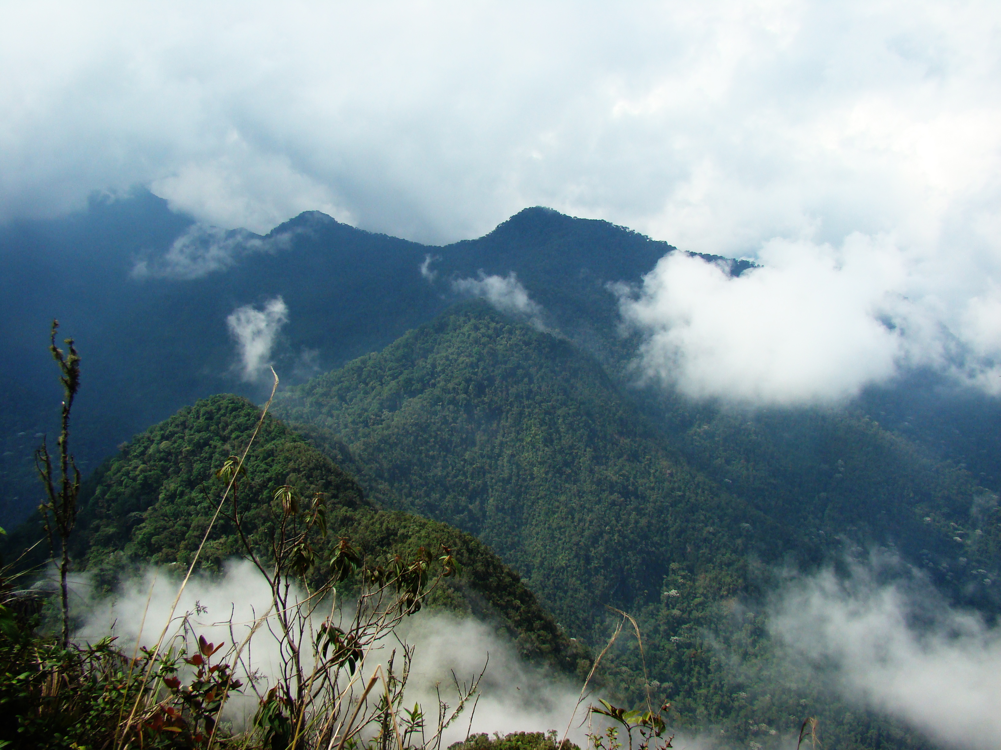
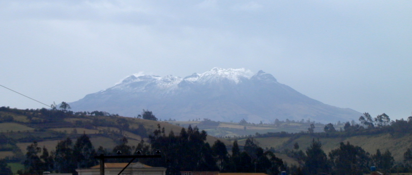
The Cordillera Occidental () is the lowest in elevation of the three branches of the Colombian Andes. The average altitude is 2000 m and the highest peak is Cerro Tatamá at 4100 m. The range extends from south to north dividing from the Colombian Massif in Nariño Department, passes north through Cauca, Valle del Cauca, Risaralda, Chocó, and Caldas Departments to the Paramillo Massif in Antioquia and Córdoba Departments. The cordillera is paralleled on the east by the Cauca river. From this massif the range divides further to form the Serranías de Ayapel, San Jerónimo and Abibe. Only to recede into the Caribbean plain and the Sinú River valley.
It is a direct continuation of Cordillera Occidental of Ecuador.

Geography
The western part of the mountain range belongs to the Pacific region of Colombia, with the San Juan River being the main watershed, while the eastern part belongs to the Cauca River basin. The northern and northwestern parts belong to the Atlantic Slope, with the Atrato and Sinú Rivers being the main watersheds. The Cordillera Occidental is separated from the coastal Baudó Mountains by the Atrato River.
A number of ecoregions cover the cordillera. The Chocó–Darién moist forests cover the western foothills below 1000 meters elevation. The Northwestern Andean montane forests cover the humid western slopes of the range. The Cauca Valley montane forests cover the eastern slopes. Northern Andean páramo covers the highest elevations.
Highest peaks
- Cerro Tatamá – 4100 m – Chocó & Risaralda
- Azufral – 4070 m – Nariño
- Farallones de Cali – 4050 m – Valle del Cauca
- Farallones del Citará – 4050 m – Antioquia
- Páramo de Frontino – 3950 m – Antioquia
- Cerro Caramanta – 3900 m – Antioquia, Caldas & Risaralda
- Cerro Napi – 3860 m – Cauca
- Alto Musinga – 3850 m – Antioquia
- Cerro Calima – 3840 m – Valle del Cauca
- Cerro Paramillo – 3730 m – Antioquia
- Cerro Ventana – 3450 m – Valle del Cauca & Chocó
Protected areas
The West Andes have the following nationally protected areas from south to north:
- PNN Munchique
- PNN Farallones de Cali
- PNN Tatamá
- PNN Las Orquídeas
- PNN Paramillo
Other areas under consideration for national protection include:
- Serranía del Pinche
- Serranía de los Paraguas
Locally protected areas
- Yotoco Forest Reserve
- Bitaco River Forest Reserve
Recreation areas
- Dapa
- Calima Lake
References
References
- "Cordillera Occidental (Colombia)".
- (1957). "HUMAN GEOGRAPHY AND ECOLOGY IN THE SINU COUNTRY OF COLOMBIA". CALIFORNIA UNIV BERKELEY.
- (October 1952). "The structure of Colombia". Eos, Transactions American Geophysical Union.
This article was imported from Wikipedia and is available under the Creative Commons Attribution-ShareAlike 4.0 License. Content has been adapted to SurfDoc format. Original contributors can be found on the article history page.
Ask Mako anything about Cordillera Occidental (Colombia) — get instant answers, deeper analysis, and related topics.
Research with MakoFree with your Surf account
Create a free account to save articles, ask Mako questions, and organize your research.
Sign up freeThis content may have been generated or modified by AI. CloudSurf Software LLC is not responsible for the accuracy, completeness, or reliability of AI-generated content. Always verify important information from primary sources.
Report