From Surf Wiki (app.surf) — the open knowledge base
Central Greece (geographic region)
Central part of Greece

Central part of Greece
| Field | Value |
|---|---|
| name | Continental/Central Greece |
| native_name | Στερεά/Κεντρική Ελλάδα*Stereá/Kentrikí Elláda* |
| native_name_lang | el |
| settlement_type | Geographic region of Greece |
| image_map | Location map of CentralGreece (Greece).svg |
| map_caption | Continental Greece (blue) within Greece |
| mapsize1 | 200px |
| seat_type | Capital |
| seat | Athens (until 1987, then abolished) |
| parts_type | Subdivisions |
| parts_style | list |
| p1 | Aetolia-Acarnania |
| p2 | Attica |
| p3 | Boeotia |
| p4 | Euboea |
| p5 | Evrytania |
| p6 | Phocis |
| p7 | Phthiotis |
| area_total_km2 | 24,818.3 |
| population_total | 4,591,568 ([2001 census](http://www.statistics.gr/)) |
| population_density_km2 | 185 |
| population_demonym | *Stereoelladites*, *Roumeliotes* |
the geographic region of Central Greece
Continental Greece (; formerly Χέρσος Ἑλλάς, grc), colloquially known as Roumeli (Ρούμελη), is a traditional geographic region of Greece. In English, the area is usually called Central Greece, but the equivalent Greek term (Κεντρική Ελλάδα, el) is more rarely used.
It includes the southern part of the Greek mainland (sans the Peloponnese), as well as the offshore island of Euboea. Since 1987, its territory has been divided among the administrative regions of Central Greece and Attica, and the regional unit (former prefecture) of Aetolia-Acarnania in the administrative region of Western Greece.
Etymology
The region has traditionally been known as el (Ρούμελη), a name deriving from the Turkish word Rūm-eli, meaning "the land of the Rūm the Romans, i.e. the [Byzantine Greeks]" and originally encompassing all of the Ottoman Empire's European possessions. The official name el ("Continental" or "Mainland" Greece) derives from the juxtaposition with the Peloponnese peninsula across the Corinthian Gulf, and the fact that these two territories formed the independent First Hellenic Republic after the Greek War of Independence (1821–1829).
Geography
Central Greece is the most populous geographical region of Greece, with a population of 4,591,568 people, and covers an area of 24,818.3 sqkm, making it the second-largest of the country. It is located to the north of the Peloponnese and to the south of Thessaly and Epirus, bordering the Aegean Sea to the east, the Ionian Sea to the west and the Corinthian Gulf to the south. Its climate is temperate along its coastlines, and dry in the interior.
Mountains
The region is one of the most mountainous in Greece, having some of the highest elevations in the country.
| Number | Mountain | Height (m) | Ranking | |
|---|---|---|---|---|
| in Greece | Regional unit | |||
| 1 | Giona | Phocis | ||
| 2 | Vardousia | Phocis | ||
| 3 | Parnassus | Phocis, Boeotia | ||
| 4 | Tymfristos | Evrytania, Phthiotis | ||
| 5 | Oeta | Phthiotis |
Lakes
Central Greece also has some of the largest lakes in Greece; among the most important is Mornos lake in Phocis, which supplies water to Phocis, parts of Phthiotis, Boeotia, and Athens as well.
| Number | Lake | Area (km2) | Ranking | |
|---|---|---|---|---|
| in Greece | Regional unit | |||
| 1 | Trichonida | Aetolia-Acarnania | ||
| 2 | Yliki | Boeotia | ||
| 3 | Amvrakia | Aetolia-Acarnania | ||
| 4 | Lysimachia | Aetolia-Acarnania | ||
| 5 | Ozeros | Aetolia-Acarnania |
Rivers
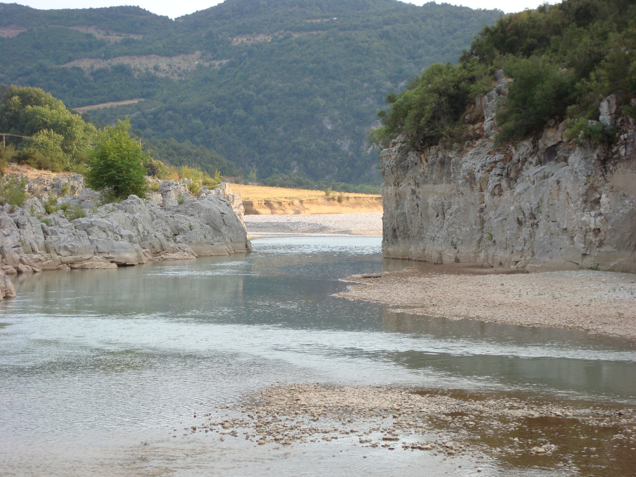
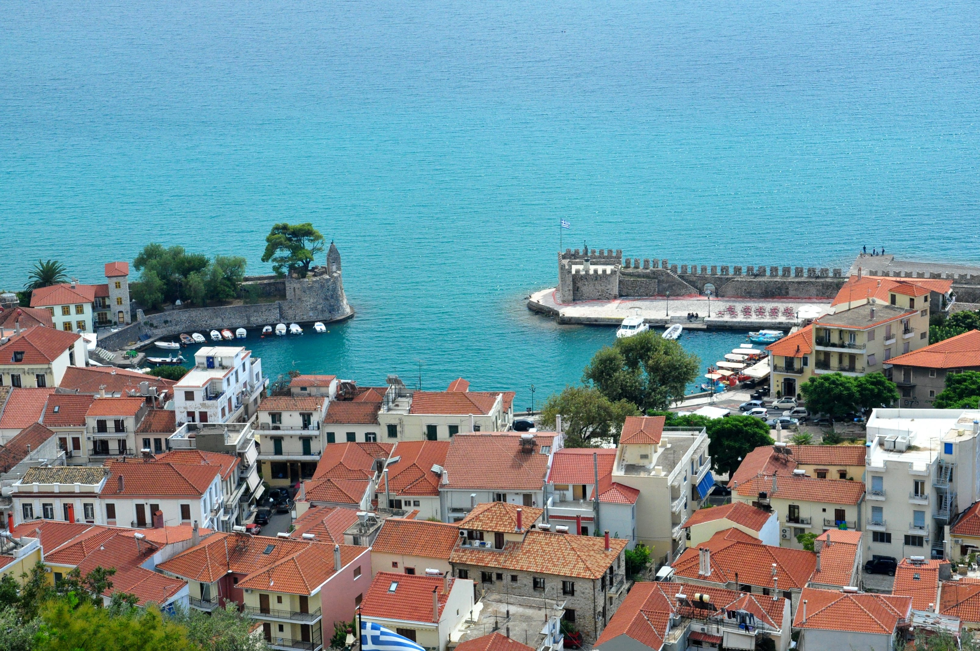
Some important and well-known rivers of Central Greece are the Acheloos in Aetolia-Acarnania, which is the second longest of the country, the Spercheios in Phthiotis, the Evenus in Aetolia-Acarnania, and the Mornos in Phocis.
Cities
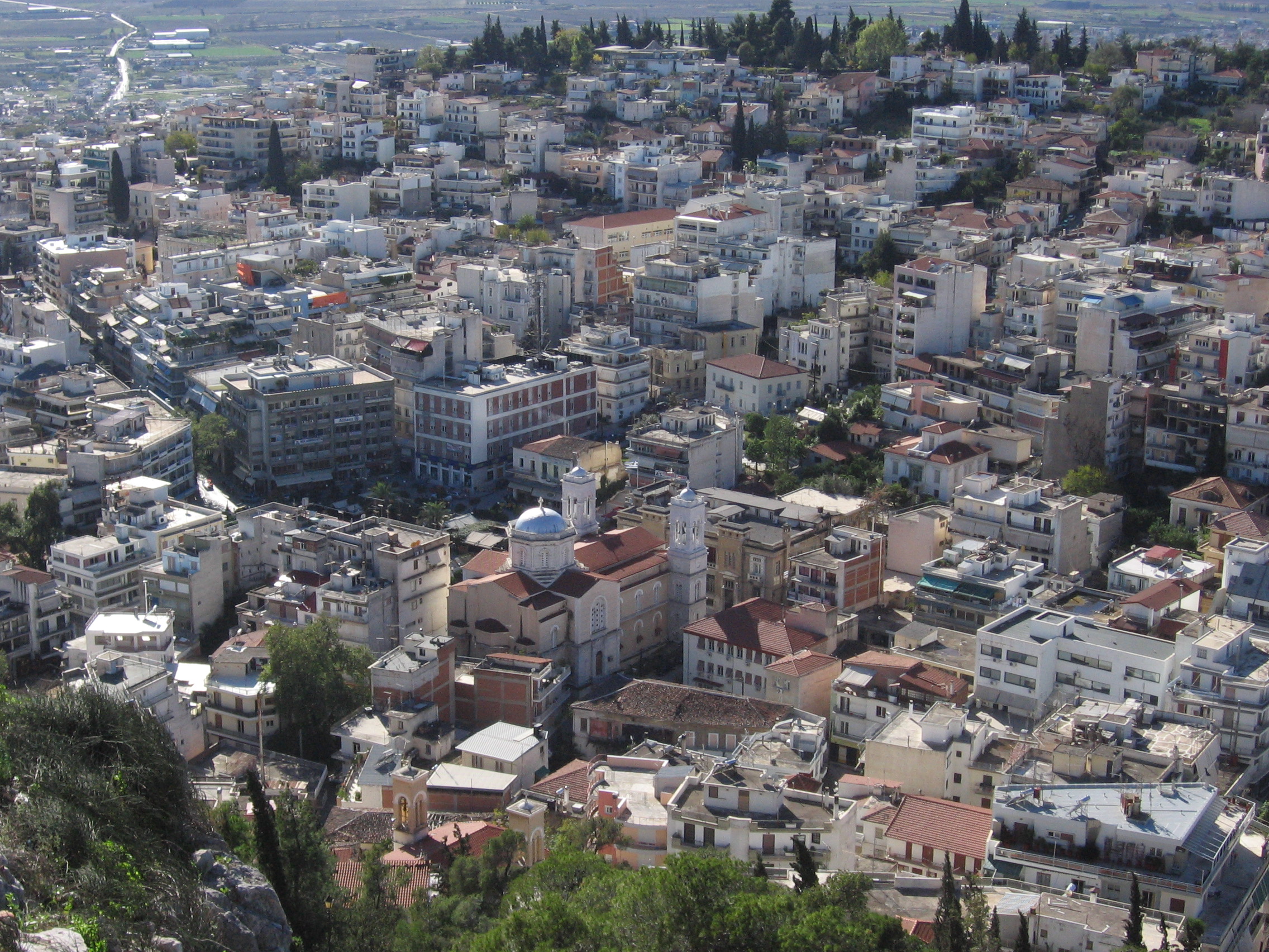
The principal cities of the region of Central Greece according to the census of 2001 are:
- Athens
- :3,130,841 (Athens urban area)
- ::3,761,810 (Athens metropolitan area)
- Lamia :58,601
- Agrinio :57,147
- Chalkida :53,584
- Thebes :21,211
- Livadeia :20,061
Gallery
File:Delphi-2.jpg|The Athenian Treasury in Delphi File:Livadeia general.jpg|Livadeia File:Galaxidi-2.jpg|Galaxidi File:Strandpromenade Chalkida.jpg|Chalkis File:20090803 hosiosloukas36.jpg|Hosios Loukas File:Fustanella Central Greece.JPG|Fustanella from central Greece
References
References
- (1998). "Ρούμελη". Institute of Modern Greek Studies (Manolis Triantafyllidis Foundation).
- "Περιφερειακό Επιχειρησιακό Πρόγραμμα Στερεάς Ελλάδας 2000–2006".
This article was imported from Wikipedia and is available under the Creative Commons Attribution-ShareAlike 4.0 License. Content has been adapted to SurfDoc format. Original contributors can be found on the article history page.
Ask Mako anything about Central Greece (geographic region) — get instant answers, deeper analysis, and related topics.
Research with MakoFree with your Surf account
Create a free account to save articles, ask Mako questions, and organize your research.
Sign up freeThis content may have been generated or modified by AI. CloudSurf Software LLC is not responsible for the accuracy, completeness, or reliability of AI-generated content. Always verify important information from primary sources.
Report