From Surf Wiki (app.surf) — the open knowledge base
Carpathian Mountains
Mountain range in Central and Eastern Europe
Mountain range in Central and Eastern Europe
| Field | Value | |
|---|---|---|
| name | Carpathians | |
| native_name | {{plainlist | |
| photo | Morskie Oko in 2020.jpg | |
| photo_size | 325px | |
| photo_caption | Tatra Mountains – Morskie Oko, Mięguszowiecki Summits, Cubryna, Mnich | |
| country | ||
| borders_on | Alps | |
| orogeny | Alpine orogeny | |
| area_km2 | 190000 | |
| length_km | 1500 | |
| width_km | 500 | |
| highest | Gerlachovský štít, Slovakia | |
| elevation_m | 2655 | |
| range_coordinates | ||
| map_image | Mapcarpat.png | |
| map_caption | The different sections of the Carpathians with the borders of constituent countries in black, and the rivers in blue |
- }}
The Carpathian Mountains or Carpathians () are a range of mountains forming an arc across Central Europe and Southeast Europe. Roughly 1500 km long, it is the third-longest European mountain range after the Urals at 2500 km and the Scandinavian Mountains at 1700 km. The highest peaks in the Carpathians are in the Tatra Mountains, exceeding 2600 m, closely followed by those in the Southern Carpathians in Romania, exceeding 2550 m.
The range stretches from the Western Carpathians in Austria, the Czech Republic, Slovakia and Poland, clockwise through the Eastern Carpathians in Ukraine and Romania, to the Southern Carpathians in Romania and Serbia. The term Outer Carpathians is frequently used to describe the northern rim of the Western and Eastern Carpathians.
The Carpathians provide habitat for the largest European populations of brown bears, wolves, chamois, and lynxes, with the highest concentration in Romania, as well as over one-third of all European plant species. The mountains and their foothills also have many thermal and mineral waters, with Romania having one-third of the European total.
Romania is likewise home to the second-largest area of virgin forests in Europe after Russia, totaling 250,000 hectares (65%), most of them in the Carpathians, with the Southern Carpathians constituting Europe's largest unfragmented forest area. Rates of forest loss due to clearcutting, and deforestation due to illegal logging in the Carpathians are high.
Name
In modern times, the range is called Karpaty in Czech, Polish and Slovak and Карпати in Ukrainian, Карпати / Karpati in Serbo-Croatian, Carpați in Romanian, Карпаты in Rusyn, Karpaten in German and Kárpátok in Hungarian. Although the toponym was recorded by Ptolemy in the second century AD, the modern form of the name is a neologism in most languages.
Historical names
In late Roman documents, the Eastern Carpathian Mountains were referred to as Montes Sarmatici (meaning Sarmatian Mountains). The Western Carpathians were called Carpates, a name that is first recorded in Ptolemy's Geographia (second century AD).
In the Scandinavian Hervarar saga, which relates ancient Germanic legends about battles between Goths and Huns, the name Karpates appears in the predictable Germanic form as Harvaða fjöllum (see Grimm's law). "Inter Alpes Huniae et Oceanum est Polonia" ("Between the Hunic Alps and the ocean lies Poland") by Gervase of Tilbury, was described in his Otia Imperialia ("Recreation for an Emperor") in 1211.
Havasok ("Snowy Mountains") was its medieval Hungarian name. Rus' chronicles referred to it as "Hungarian Mountains". Later sources, such as Dimitrie Cantemir and the Italian chronicler Giovanandrea Gromo, referred to the range as "Transylvania's Mountains", while the 17th-century historian Constantin Cantacuzino translated the name of the mountains in an Italian-Romanian glossary to "Rumanian Mountains".
Etymology
The etymology of the Carpathians is not clearly established, but the name "Carpates" is highly associated with the old Dacian tribes called "Carpes" or "Carpi" who lived in an area to the east of the Carpathians, from the east, northeast of the Black Sea to the Transylvanian Plain in the present day Romania and Moldova.
Potential root words

Karpates is considered a Paleo-Balkan name, with evidence provided by the Albanian kárpë / kárpa, pl. kárpa / kárpat ('rock, stiff'), and the Messapic karpa 'tuff (rock), limestone' (preserved as càrpë 'tuff' in Bitonto dialect and càrparu 'limestone' in Salentino).
The name Carpates may ultimately be from the Proto Indo-European root **sker-/**ker-, which meant mountain, rock, or rugged (cf. Albanian kárpë, Germanic root **skerp-*, Old Norse harfr "harrow", Gothic skarpo, Middle Low German scharf "potsherd", and Modern High German Scherbe "shard", Lithuanian kar~pas "cut, hack, notch", Latvian cìrpt "to shear, clip"). The archaic Polish word karpa meant 'rugged irregularities, underwater obstacles/rocks, rugged roots, or trunks'. The more common word skarpa means a sharp cliff or other vertical terrain, cf. Old English scearp and English sharp.
The name may instead come from Indo-European *ine 'to turn', akin to Old English hweorfan 'to turn, change' (English warp) and Greek καρπός grc 'wrist' (Karpathos island has the same root word), perhaps referring to the way the Carpathian mountain range bends or veers in an L-shape.
Geography

Although commonly referred to as a mountain chain, the Carpathians do not form an uninterrupted chain of mountains, but consist of several orographically and geologically distinctive groups. The northwestern Carpathians begin in Slovakia and southern Poland. They surround Transcarpathia and Transylvania in a large semicircle, sweeping towards the southeast, and end on the Danube near Orșova in Romania. The total length of the Carpathians is over 1500 km.
The mountain chain's width varies between 12 and. The highest altitudes of the Carpathians occur where they are widest, in the Transylvanian plateau and in the southern Tatra Mountains group. The highest range, in which Gerlachovský štít in Slovakia is the highest peak, is 2655 m above sea level.
The Carpathians cover an area of 190000 km2. After the Alps, they form the next-most extensive mountain system in Europe. Percentage of the range by country is: Czech Republic (3%) and Austria (1%) in the northwest through Slovakia (21%), Poland (10%), Ukraine (10%), Romania (50%) to Serbia (5%) in the south.
It was believed that no area of the Carpathian range was covered in snow all year round and there were no glaciers, but recent research by Polish scientists discovered one permafrost and glacial area in the Tatra Mountains.
Comparison with the Alps
The Carpathians, which attain an altitude over 2500 m in only a few places, lack the bold peaks, extensive snowfields, large glaciers, high waterfalls, and numerous large lakes that are common in the Alps. The Carpathians at their highest altitude are only as high as the middle region of the Alps, with which they share a common appearance, climate, and flora.
The Carpathians are separated from the Alps by the Danube, only meeting at the Leitha Mountains at Bratislava. The river also separates the Carpathians from the Balkan Mountains at Orșova in Romania. The valley of the March and Oder separates the Carpathians from the Silesian and Moravian chains, which belong to the middle wing of the great Central Mountain System of Europe.
Unlike the other wings of the system, the Carpathians, which form the watershed between the northern seas and the Black Sea, are surrounded on all sides by plains. The Pannonian plain is to the southwest, the Lower Danubian Plain to the south, with the southern part being in Bulgaria, and the northern – in (Romania), and the Galician plain to the northeast.
Mountain passes
In the Romanian part of the main chain of the Carpathians, mountain passes include Prislop Pass, Tihuța Pass, Bicaz Canyon, Ghimeș Pass, Buzău Pass, Predeal Pass (crossed by the railway from Brașov to Bucharest), Turnu Roșu Pass (1,115 ft., running through the narrow gorge of the Olt River and crossed by the railway from Sibiu to Bucharest), Vulcan Pass, and the Iron Gate (both crossed by the railway from Timișoara to Craiova).
Geology

The area now occupied by the Carpathians was once occupied by smaller ocean basins. The Carpathian mountains were formed during the Alpine orogeny in the Mesozoic and Cenozoic by moving the ALCAPA (Alpine-Carpathian-Pannonian), Tisza and Dacia plates over subducting oceanic crust.
The mountains take the form of a fold and thrust belt with generally north vergence in the western segment, northeast to east vergence in the eastern portion and southeast vergence in the southern portion. Currently, the area is the most seismically active in Central Europe.
The external, generally northern, portion of the orogenic belt is a Tertiary accretionary wedge of a so-called Flysch belt (the Carpathian Flysch Belt) created by rocks scraped off the sea bottom and thrust over the North-European plate. The Carpathian accretionary wedge is made of several thin skinned nappes composed of Cretaceous to Paleogene turbidites. Thrusting of the Flysch nappes over the Carpathian foreland caused the formation of the Carpathian foreland basin. The boundary between the Flysch belt and internal zones of the orogenic belt in the western segment of the mountain range is marked by the Pieniny Klippen Belt, a narrow complicated zone of polyphase compressional deformation, later involved in a supposed strike-slip zone.
Internal zones in western and eastern segments contain older Variscan igneous massifs reworked in Mesozoic thick and thin-skinned nappes. During the Middle Miocene this zone was affected by intensive calc-alkaline arc volcanism that developed over the subduction zone of the flysch basins. At the same time, the internal zones of the orogenic belt were affected by large extensional structure of the back-arc Pannonian Basin. The last volcanic activity occurred at Ciomadul about 30,000 years ago.
The mountains started to gain their current shape from the latest Miocene onward. At some locations solifluction deposits have formed on the slopes of the Carpathians.
Ecology
Main article: Carpathian montane conifer forests

The ecology of the Carpathians varies with altitude, ranging from lowland forests to alpine meadows. Foothill forests are primarily of broadleaf deciduous trees, including oak, hornbeam, and linden. European beech is characteristic of the montane forest zone. Higher-elevation subalpine forests are characterized by Norway spruce (Picea abies). Krummholz and alpine meadows occur above the treeline.
Wildlife in the Carpathians includes Eurasian brown bear (Ursus arctos arctos), Eurasian wolf (Canis lupus lupus), Eurasian lynx (Lynx lynx), European wildcat (Felis silvestris), Tatra chamois (Rupicapra rupicapra tatrica), European bison (Bison bonasus), and golden eagle (Aquila chrysaetos).
Divisions of the Carpathians
Main article: Divisions of the Carpathians

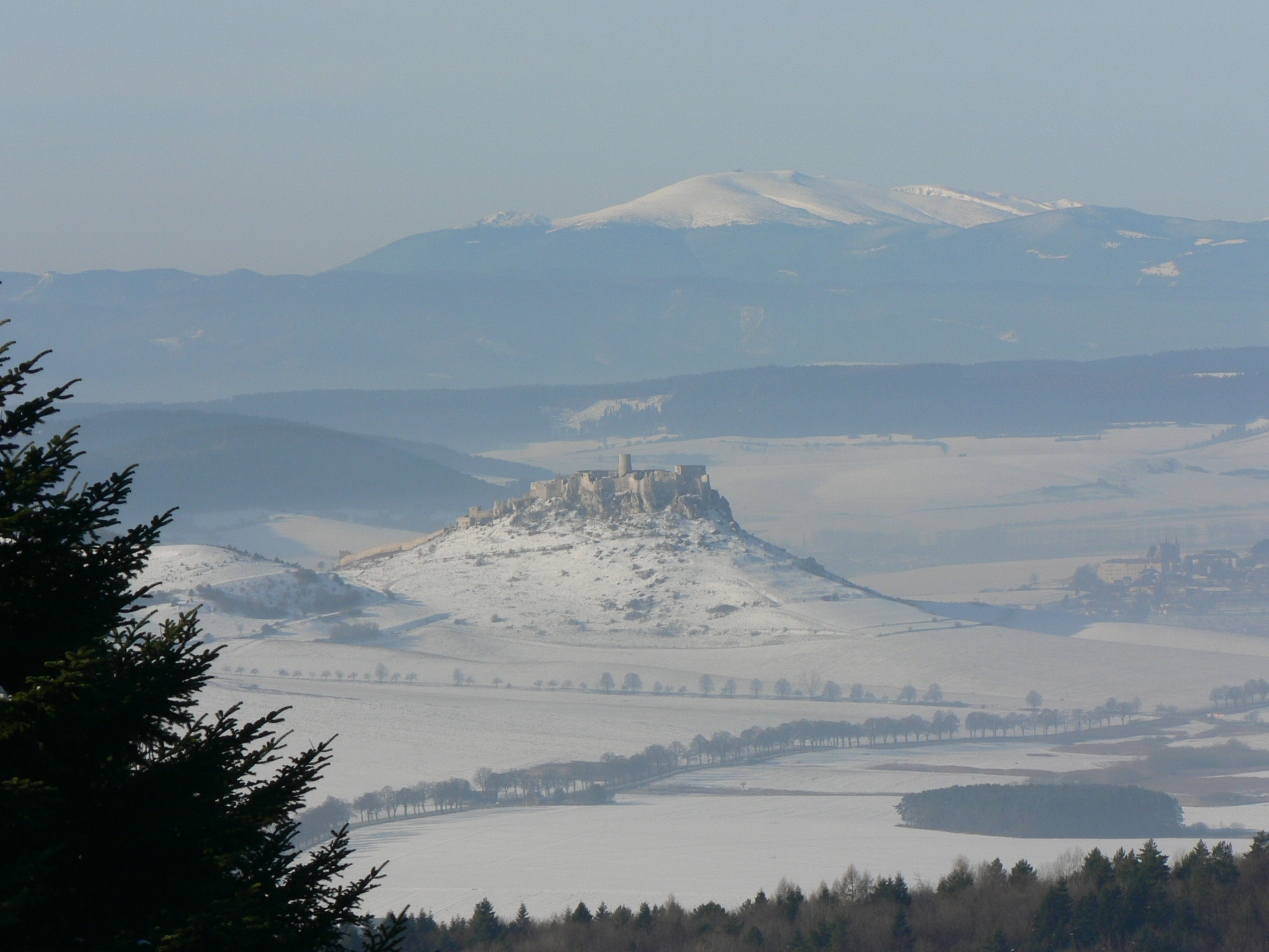
|Outer Western Carpathians |Inner Western Carpathians |Outer Eastern Carpathians |Inner Eastern Carpathians |Southern Carpathians |Western Romanian Carpathians |Transylvanian Plateau |Serbian Carpathians In geopolitical terms, Carpathian Mountains are often grouped and labeled according to national or regional borders, but such division has turned out to be relative, since it was, and still is dependent on frequent historical, political and administrative changes of national or regional borders. According to modern geopolitical division, Carpathians can be grouped as: Serbian, Romanian, Ukrainian, Polish, Slovakian, Czech and Austrian. Within each nation, specific classifications of the Carpathians have been developing, often reflecting local traditions, and thus creating terminological diversity, that produces various challenges in the fields of comparative classification and international systematization.
_06.jpg)
A major part of the western and northeastern Outer Eastern Carpathians in Poland, Ukraine, and Slovakia is traditionally called the Eastern Beskids.The border between the eastern and southern Carpathians is formed by the Predeal Pass, south of Brașov and the Prahova Valley.
The geological border between the Western and Eastern Carpathians runs approximately along the line (south to north) between the towns of Michalovce, Bardejov, Nowy Sącz and Tarnów. In older systems the border runs more in the east, along the line (north to south) along the rivers San and Osława (Poland), the town of Snina (Slovakia) and river Tur'ia (Ukraine). Biologists shift the border even further to the east.
The section of the Carpathians within the borders of Romania is commonly known as the Romanian Carpathians. In local use, Romanians sometimes denote as "Eastern Carpathians" only the Romanian part of the Eastern Carpathians, which lies on their territory (i.e., from the Ukrainian border or from the Prislop Pass to the south), which they subdivide into three simplified geographical groups (northern, central, southern), instead of Outer and Inner Eastern Carpathians. These groups are:
- Maramureș-Bukovinian Carpathians (Romanian: Carpații Maramureșului și ai Bucovinei)
- Moldavian-Transylvanian Carpathians (Romanian: Carpații Moldo-Transilvani)
- Curvature Carpathians (Romanian: Carpații Curburii, Carpații de Curbură)
The section of the Carpathians within the borders of Ukraine is commonly known as the Ukrainian Carpathians. Classification of eastern sections of the Carpathians is particularly complex, since it was influenced by several overlapping traditions. Terms like Wooded Carpathians, Poloniny Mountains or Eastern Beskids are often used in varying scopes by authors belonging to different traditions.
File:Veliki buk02.JPG|Beljanica region waterfall File:Slovakia Vratna 11.jpg|Vrátna dolina, Slovakia File:Marmarosch.jpg|Maramureș. Mountains in the north of Romania and the west of Ukraine File:«Ловачка». Погляд із мукачівського замку P1380061.jpg|Mukachevo, Western Ukraine File:0.2014 Sanok, von Kościuszkistrasse aus gesehen.JPG|View from Sanok in Poland File:Kežmarok z Kamennej bane.jpg|Kežmarok in Slovakia File:Aleksander Kotsis Pogrzeb górala 1860.jpg|Gorals in the Polish Carpathians File:Szczawnica in Poland 1939.jpg|Szczawnica in Poland, Pieniny, 1939 File:"Grojcowianie" folklore group in Żywiec Beskids clothing.jpg|The Feast of the Assumption of Mary in the Polish Carpathians
Highest peaks
This is an (incomplete) list of the peaks of the Carpathians having summits over 2500 m, with their heights, geologic divisions, and locations.
| Peak | Geologic divisions | Nation (Nations) | County (Counties) | Height (m) | Height (ft) |
|---|---|---|---|---|---|
| Gerlachovský štít | High Tatras | Slovakia | Prešov Region | 2655 m | |
| Gerlachovská veža | 2642 m | ||||
| Lomnický štít | 2633 m | ||||
| Ľadový štít | 2627 m | ||||
| Pyšný štít | 2623 m | ||||
| Zadný Gerlach | 2616 m | ||||
| Lavínový štít | 2606 m | ||||
| Malý Ľadový štít | 2602 m | ||||
| Kotlový štít | 2601 m | ||||
| Lavínová veža | 2600 m | ||||
| Malý Pyšný štít | 2591 m | ||||
| Veľká Litvorová veža | 2581 m | ||||
| Strapatá veža | 2565 m | ||||
| Kežmarský štít | 2556 m | ||||
| Vysoká | 2547 m | ||||
| Moldoveanu | Făgăraș Mountains | Romania | Argeș | 2544 m | |
| Negoiu | Sibiu | 2535 m | |||
| Viștea Mare | Brașov | 2527 m | |||
| Parângu Mare | Parâng Mountains | Alba, Gorj, Hunedoara | 2519 m | ||
| Lespezi | Făgăraș Mountains | Sibiu | 2517 m | ||
| Peleaga | Retezat Mountains | Hunedoara | 2509 m | ||
| Păpușa | 2508 m | ||||
| Vânătoarea lui Buteanu | Făgăraș Mountains | Argeș | 2507 m | ||
| Omu (mountain) | Bucegi Mountains | Prahova, Brașov, Dâmbovița | 2514 m | ||
| Cornul Călțunului | Făgăraș Mountains | Sibiu | 2505 m | ||
| Ocolit (Bucura) | Bucegi Mountains | Prahova, Brașov, Dâmbovița | 2503 m | ||
| Rysy | High Tatras | Poland, Slovakia | Lesser Poland Voivodeship, Prešov Region | 2503 m | |
| Dara | Făgăraș Mountains | Romania | Sibiu | 2500 m |
Highest peaks by country
This is a list of the highest national peaks of the Carpathians, their heights, geologic divisions, and locations.
| Peak | Geologic divisions | Nation (Nations) | County (Counties) | Height (m) | Height (ft) |
|---|---|---|---|---|---|
| Gerlachovský štít | High Tatras | Slovakia | Prešov Region | 2655 m | |
| Moldoveanu | Făgăraș Mountains | Romania | Argeș | 2544 m | |
| Rysy | High Tatras | Poland | Tatra County | 2499 m | |
| Hoverla | Eastern Beskids (Chornohora) | Ukraine | Nadvirna Raion, Rakhiv Raion | 2061 m | |
| Rtanj | Serbian Carpathians | Serbia | Zaječar District | 1565 m | |
| Lysá hora | Moravian-Silesian Beskids | Czech Republic | Moravian-Silesian Region | 1323 m | |
| Kékes | Mátra-Slanec Area (Mátra) | Hungary | Heves County | 1014 m | |
| Hundsheimer Berg | Hundsheimer Berge | Austria | Niederösterreich | 481 m |
Cities and towns
The table and the list may contain some localities near the Carpathians, not only in these mountains.
| City | Country | Population | **Highest elevation** **[m]** | Latitude | Longitude |
|---|---|---|---|---|---|
| Kraków | Poland | 804,237 | 383 | 50°03′41″N | 19°56′14″E |
| Banská Bystrica | Slovakia | 74,590 | 368 | 48°44′07″N | 19°08′43″E |
| Bratislava | Slovakia | 475,503 | 514 | 48°08′38″N | 17°06′35″E |
| Cluj-Napoca | Romania | 286,598 | 340 | 46°46′N | 23°35′E |
| Chernivtsi | Ukraine | 264,298 | 248 | 48°18′0″N | 25°56′0″E |
| Brașov | Romania | 237,589 | 538 | 45°40′N | 25°37′E |
| Košice | Slovakia | 225,044 | 206 | 48°43′N | 21°15′E |
| Ivano-Frankivsk | Ukraine | 238,196 | 260 | 48°55′22″N | 24°42′38″E |
| Oradea | Romania | 183,105 | 142 | 47°04′20″N | 21°55′16″E |
| Bielsko-Biała | Poland | 165,127 | 1,117 | 49°49′21″N | 19°2′40″E |
| Miskolc | Hungary | 143,502 | 945 | 48°06′15″N | 20°47′30″E |
| Sibiu | Romania | 134,309 | 415 | 45°47′34″N | 24°09′07″E |
| Târgu Mureș | Romania | 116,033 | 320 | 46°32′44″N | 24°33′45″E |
| Baia Mare | Romania | 108,759 | 228 | 47°39′24″N | 23°34′19″E |
| Uzhhorod | Ukraine | 115,449 | 169 | 48°37′26″N | 22°17′42″E |
| Tarnów | Poland | 105,922 | 384 | 50°00′45″N | 20°59′19″E |
| Râmnicu Vâlcea | Romania | 93,151 | 250 | 45°6′17″N | 24°22′32″E |
| Prešov | Slovakia | 82,927 | 296 | 49°00′06″N | 21°14′22″E |
| Mukachevo | Ukraine | 85,569 | 125 | 48°27′00″N | 22°45′00″E |
| Drohobych | Ukraine | 73,682 | 371 | 49°21′00″N | 23°30′00″E |
Smaller cities and towns:
- Piatra Neamț (Romania)
- Nowy Sącz (Poland)
- Suceava (Romania)
- Vršac (Serbia)
- Târgu Jiu (Romania)
- Drobeta-Turnu Severin (Romania)
- Reșița (Romania)
- Žilina (Slovakia)
- Bistrița (Romania)
- Zvolen (Slovakia)
- Deva (Romania)
- Zlín (Czech Republic)
- Hunedoara (Romania)
- Martin (Slovakia)
- Zalău (Romania)
- Przemyśl (Poland)
- Krosno (Poland)
- Sanok (Poland)
- Alba Iulia (Romania)
- Sfântu Gheorghe (Romania)
- Turda (Romania)
- Mediaș (Romania)
- Poprad (Slovakia)
- Spišská Nová Ves (Slovakia)
- Petroșani (Romania)
- Miercurea Ciuc (Romania)
- Făgăraș (Romania)
- Odorheiu Secuiesc (Romania)
- Boryslav (Ukraine)
- Jasło (Poland)
- Cieszyn (Poland)
- Nowy Targ (Poland)
- Żywiec (Poland)
- Zakopane (Poland)
- Petrila (Romania)
- Cugir (Romania)
- Târgu Neamț (Romania)
- Câmpulung Moldovenesc (Romania)
- Gheorgheni (Romania)
- Rakhiv (Ukraine)
- Vatra Dornei (Romania)
- Rabka-Zdrój (Poland)
- Bor (Serbia)
References
Sources
References
- [http://www.carpathians.pl/carpathians01.html About the Carpathians – Carpathian Heritage Society] {{webarchive. link. (6 April 2010)
- [http://www.visiteurope.com/en/region/carpathians] {{Webarchive. link. (12 October 2017 "The Carpathians" European Travel Commission, in The Official Travel Portal of Europe, Retrieved 15 November 2016)
- [http://www.carpathianconvention.org/tl_files/carpathiancon/Downloads/03%20Meetings%20and%20Events/Working%20Groups/Spatial%20Planning/200805_Strategic%20Workshop%20on%20Spatial%20Planning/15BS.pdf] {{Webarchive. link. (19 November 2016 The Carpathian Project: Carpathian Mountains in Serbia, Institute for Spatial Planning, Faculty of Geography, University of Belgrade (2008), Retrieved: 15 November 2016)
- Paun Es Durlić. (2011). "Sacred Language of the Vlach Bread". Balkankult.
- Peter Christoph Sürth. "Braunbären (Ursus arctos) in Europa".
- Peter Christoph Sürth. "Wolf (Canis lupus) in Europa".
- Peter Christoph Sürth. "Eurasischer Luchs (Lynx lynx) in Europa".
- "Carpathian montane conifer forests – Encyclopedia of Earth".
- [http://www.capital.ro/detalii-articole/stiri/bucuresti-statiune-balneara-o-gluma-buna-115796.html București, stațiune balneară – o glumă bună?] {{Webarchive. link. (14 March 2012 in Capital, 19 January 2009. Retrieved: 26 April 2011)
- [http://www.zf.ro/ziarul-de-duminica/reportajul-saptamanii-ruinele-de-la-baile-herculane-si-borsec-nu-mai-au-nimic-de-oferit-6092451 Ruinele de la Baile Herculane si Borsec nu mai au nimic de oferit] {{Webarchive. link. (13 July 2019 in Ziarul Financiar, 5 May 2010. Retrieved: 26 April 2011)
- [https://jurnalul.ro/stiri/observator/salvati-padurile-virgine-594667.html Salvați pădurile virgine!] in Jurnalul Național, 26 October 2011. Retrieved: 31 October 2011
- [http://www.globalissues.org/news/2011/05/30/9865 Europe: New Move to Protect Virgin Forests] in Global Issues, 30 May 2011. Retrieved 31 October 2011.
- Neslen, Arthur. (31 May 2018). "Romania breaks up alleged €25m illegal logging ring". The Guardian.
- E.g. in work ''Tractatus de duabus Sarmatiis, Asiana et Europiana, et de contentis in eis'' by [[Maciej Miechowita. Mathias de Miechow]], first edition from 1517. [https://www.hs-augsburg.de/~harsch/Chronologia/Lspost16/Miechow/mie_tr21.html Second book, chapter 1].
- Smith, William. (1854). "Dictionary of Greek and Roman Geography". Walton and Maberly.
- Thirteenth- to fifteenth-century Hungarian documents named the mountains ''Thorchal'', ''Tarczal'', or less frequently ''Montes Nivium'' ("Snowy Mountains").{{cite DNB|wstitle=Gervase of Tilbury}}
- Matasović, Ranko. (1995). "Skokove 'ilirske' etimologije". Folia onomastica Croatica.
- Demiraj, Bardhyl. (1997). "Albanische Etymologien: Untersuchungen zum albanischen Erbwortschatz". Rodopi.
- (1998). "I dialetti italiani: dizionario etimologico, Volume 1". UTET.
- Buza. 2011. Beskydy]]'', a series of mountain ranges in the Carpathians, has a meaning in Albanian: ''bjeshkë / bjeshkët'' 'high mountains, mountain pastures' (cf. also the Albanian oronym ''Bjeshkët e Namuna'', the [[Accursed Mountains
- Çabej, Eqrem. (1985). "The Albanians and their Territories". 8 Nëntori.
- Room, Adrian. (1997). "Placenames of the World". MacFarland and Co.
- [http://www.nhmbeo.rs/upload/documents/casopisi/Glasnik/Vol03/Maran%20(2010).pdf] {{Webarchive. link. (1 August 2019 Bulletin of the Natural History Museum, pg. 54, Valuing the geological heritage of Serbia (UDC: 502.171:55(497.11), Aleksandra Maran (2010), Retrieved 15 November 2016)
- "Glacial Ice and Permafrost Distribution in the Medena Kotlina (Slovak Tatras): Mapped with Application of GPR and GST Measurements". Studia Geomorphologica Carpatho-Balcanica.
- Plašienka, D.. (2002). "Origin and growth of the Western Carpathian orogenetic wedge during the mesozoic". Geologica Carpathica.
- (2006). "Postcollisional Tectonics and Magmatism in the Mediterranean Region and Asia". Geological Society of America.
- (1 January 2019). "Unification of data from various seismic catalogues to study seismic activity in the Carpathians Mountain arc". Open Geosciences.
- (2007). "Depositional architecture, sequence stratigraphy and geodynamic development of the Carpathian Foredeep (Czech Republic)". Geologica Carpathica.
- Mišík, M.. (1997). "The Slovak Part of the Pieniny Klippen Belt After the Pioneering Works of D. Andrusov". Geologica Carpathica.
- (2006). "Geochronology of Neogene magmatism in the Carpathian arc and intra-Carpathian area". Geologica Carpathica.
- Dolton, G.L.. (2006). "Pannonian Basin Province, Central Europe (Province 4808)—Petroleum geology, total petroleum systems, and petroleum resource assessment". U.S. Geological Survey Bulletin.
- (1983). "Evolution of the Pannonian basin system. 1. Tectonics". Tectonics.
- Starkel, Leszek. (1969). "L'évolution des versants des Carpates à flysch au quaternaire". [[Biuletyn Peryglacjalny]].
- (September 2022}} in the [[Western Carpathians]]. After the Roman emperor [[Trajan]]'s conquest of Dacia, he brought back to Rome over 165 tons of gold and 330 tons of silver.{{cite web). "Dacia-Province of the Roman Empire". United Nations of Roma Victor.
- {{WWF ecoregion
- "St. Martin’s Parish Church in Zawada".
- "Drohobych topographic map, elevation, terrain".
This article was imported from Wikipedia and is available under the Creative Commons Attribution-ShareAlike 4.0 License. Content has been adapted to SurfDoc format. Original contributors can be found on the article history page.
Ask Mako anything about Carpathian Mountains — get instant answers, deeper analysis, and related topics.
Research with MakoFree with your Surf account
Create a free account to save articles, ask Mako questions, and organize your research.
Sign up freeThis content may have been generated or modified by AI. CloudSurf Software LLC is not responsible for the accuracy, completeness, or reliability of AI-generated content. Always verify important information from primary sources.
Report