From Surf Wiki (app.surf) — the open knowledge base
Burnham Overy
Civil parish in Norfolk, England
Civil parish in Norfolk, England
| Field | Value |
|---|---|
| country | England |
| coordinates | |
| os_grid_reference | TF843435 |
| official_name | Burnham Overy |
| population | 297 |
| population_ref | (2021) |
| area_total_km2 | 17.92 |
| static_image_name | Burnham Overy 2.jpg |
| static_image_caption | The Staithe |
| shire_district | King's Lynn and West Norfolk |
| shire_county | Norfolk |
| region | East of England |
| civil_parish | Burnham Overy |
| constituency_westminster | North West Norfolk |
| postcode_district | PE31 |
| postcode_area | PE |
| post_town | KING'S LYNN |
| dial_code | 01328 |


Burnham Overy is a civil parish on the north coast of Norfolk, England. The parish includes the settlements of Burnham Overy Town, the original village adjacent to the medieval parish church and now reduced to a handful of houses, and Burnham Overy Staithe, a larger settlement about 1/2 mi to the north on the estuary of the River Burn. It is 1 mi north-west of Burnham Market, 20 mi north-east of King's Lynn, and 30 mi north-west of Norwich. The A149 road runs through the parish.
The civil parish has an area of 8.92 km2 and at the 2001 census had a population of 311 in 167 households, reducing to a population of 134 at the 2011 Census. For the purposes of local government, the parish falls within the district of King's Lynn and West Norfolk. At the 2021 census the parish had a population of 297.
History
Burnham Thorpe, the birthplace of Horatio, Admiral Lord Nelson, lies 1 mi to the south-. According to various documents, Nelson learned to row and sail a dinghy at Burnham Overy Staithe, at the age of 10, two years before joining the Navy. The village’s only pub is called The Hero in his honour.
Historically Burnham Overy Staithe was the port for the surrounding villages of the Burnhams. Both settlements lie on the River Burn, and until the end of the Middle Ages trading ships were able to reach Burnham Overy Town. With the silting of the river, commercial traffic switched to Burnham Overy Staithe. With the coming of the railway to the Burnhams in 1866, commercial shipping declined and the last cargo is believed to have been shipped from the Staithe soon after the end of the First World War.
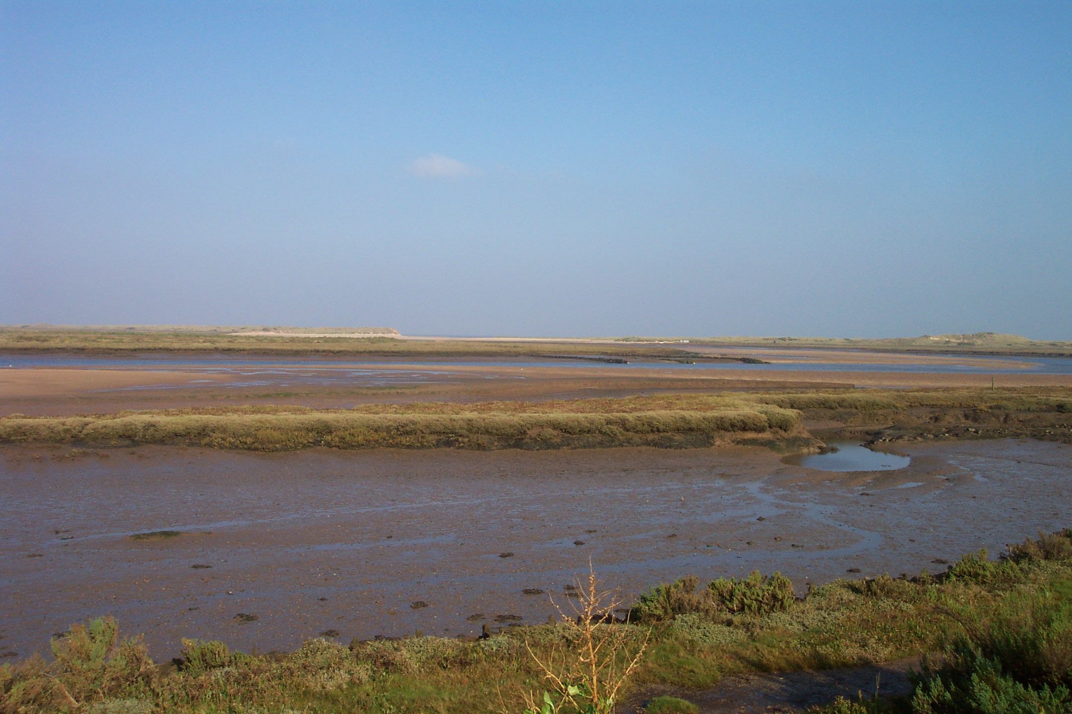
Between Burnham Overy Staithe and the sea, the river spreads out into multiple tidal creeks through the salt marshes that fringe this stretch of coast, and finally reaches the sea by passing through the sand dunes at a gap near Gun Hill known locally as Burnham Harbour. Small boats can reach Burnham Overy Staithe through this gap and creek. Today Burnham Overy Staithe, and the associated harbour, is a recreational sailing centre. It is also the point of departure for seasonal ferries to Scolt Head Island National Nature Reserve.
To the east of Burnham Overy creek, former salt marshes have been reclaimed to form fresh water meadows, part of the Holkham estate. A 1+1/2 mi long footpath links Burnham Overy Staithe to the sand-dunes and beach, running along the crest of an embankment.
St Clement's Church
Burnham Overy's parish church is dedicated to Clement of Rome and dates from the 12th century. It is located at Burnham Overy Town and is Grade I listed. The church retains many of its medieval features in addition to a set of Stuart royal arms which have been re-lettered with the name of George III.
Notable people
- Richard Woodget (1845–1928), captain of the Cutty Sark, born and died in Burnham Overy
- Robert Austin (1895–1973), artist and engraver, died in Burnham Overy
In popular culture
In Joan G. Robinson's 1967 book When Marnie Was There, the villages of Little Overton and Barnham are based upon Burnham Overy, especially the key locations of the staithe and the windmill.
Leith House Orchards, a family-run orchard, was featured in BBC Two's The Hairy Bikers Go Local in January 2023.
References
References
- "Civil parish population 2011".
- (2001). "Census population and household counts for unparished urban areas and all parishes". Office for National Statistics & Norfolk County Council.
- "Burnham Overy (Parish, United Kingdom) - Population Statistics, Charts, Map and Location".
- "Burnham Overy, Norfolk". britainexpress.com.
- (2002). "OS Explorer Map 251 - Norfolk Coast Central". Ordnance Survey.
- "Coasthopper bus service - Burnham Overy Staithe".
- {{NHLE
- "Norfolk Churches".
- "Leith House Orchards".
- "BBC Two - the Hairy Bikers Go Local".
This article was imported from Wikipedia and is available under the Creative Commons Attribution-ShareAlike 4.0 License. Content has been adapted to SurfDoc format. Original contributors can be found on the article history page.
Ask Mako anything about Burnham Overy — get instant answers, deeper analysis, and related topics.
Research with MakoFree with your Surf account
Create a free account to save articles, ask Mako questions, and organize your research.
Sign up freeThis content may have been generated or modified by AI. CloudSurf Software LLC is not responsible for the accuracy, completeness, or reliability of AI-generated content. Always verify important information from primary sources.
Report