From Surf Wiki (app.surf) — the open knowledge base
Bukit Timah Hill
Tallest hill in Singapore
Tallest hill in Singapore
| Field | Value |
|---|---|
| name | Bukit Timah Hill |
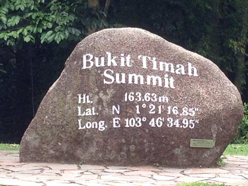
| photo | Bukit Timah Hill.jpg |
| elevation_m | 164 |
| prominence_m | 164 |
| listing | Country highest point |
| translation | "Tin-bearing hill" |
| language | Malay |
| Singapore English | |
| location | Singapore |
| map | Singapore |
| coordinates | |
| type | Hill |
Singapore English
Bukit Timah Hill is the highest natural peak in Singapore. It is located in Bukit Panjang rather than its namesake district and its altitude is 164 m above sea level.
Altitude
The hill's 164 m altitude makes it the highest natural peak in Singapore. The highest point in Singapore, however, is the 284 m Guoco Tower, one of scores of buildings taller than the hill.
Location and accessibility
The hill is located in the Nature Reserve subzone of Bukit Panjang rather than its namesake district of Bukit Timah, near the geographical centre of Singapore. It is accessible via Hillview MRT station on the Downtown MRT line. The hill is now protected as part of the Bukit Timah Nature Reserve, which has been classified as an ASEAN Heritage Park. The hill's paved maintenance road (leading to the hill's pair of 60 m VHF steel lattice radio masts built in the 1960s), is not open to the public. Public access is provided by several walking trails.
Climate
Bukit Timah Hill features a tropical rainforest climate (Köppen Af) and has a mix of both wet and dry seasons.
Due to its low to moderate elevation, the weather is slightly cooler than the rest of Singapore and strong winds sometimes occur at the peak. The daily temperature range is between 21 –.
The dry season runs from April to August, during which, there is generally less rainfall and warmer temperatures. The wet season runs from September to March, during which, there is more frequent rainfall and cooler temperatures.
The average annual rainfall is 2810 mm. The average annual daily mean temperature is 26.4 °C. The coolest month is January, where the average daily mean temperature is 25.6 °C. The minimum temperature may dip below 20.8 °C during rainy days in January. The warmest month is July, with an average daily mean temperature of 28.3 °C.
References
References
- [http://www.singaporesights.com/sight/bukit-timah-nature-reserve-%E2%80%93-host-highest-hill-singapore Bukit Timah Nature Reserve – Host The Highest Mountain in The Singapore], SingaporeSights.com, accessed October 2009. {{webarchive. link. (March 29, 2009)
- Lye Lin Heng. (1991). "Wildlife Protection Laws in Singapore". Singapore Journal of Legal Studies.
- "Provision of Radio Masts and Towers - VHF Station, Bukit …".
This article was imported from Wikipedia and is available under the Creative Commons Attribution-ShareAlike 4.0 License. Content has been adapted to SurfDoc format. Original contributors can be found on the article history page.
Ask Mako anything about Bukit Timah Hill — get instant answers, deeper analysis, and related topics.
Research with MakoFree with your Surf account
Create a free account to save articles, ask Mako questions, and organize your research.
Sign up freeThis content may have been generated or modified by AI. CloudSurf Software LLC is not responsible for the accuracy, completeness, or reliability of AI-generated content. Always verify important information from primary sources.
Report