From Surf Wiki (app.surf) — the open knowledge base
Brush Creek (Blue River tributary)
| Field | Value |
|---|---|
| name | Brush Creek |
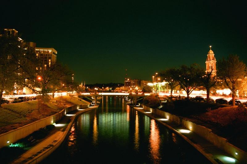
| image | USACE Brush Creek Kansas City.jpg |
| image_caption | Brush Creek flowing through Kansas City, Missouri |
| map | Kc-rivers.png |
| map_caption | Kansas City metropolitan rivers with Brush Creek in the middle |
| subdivision_type1 | Country |
| subdivision_name1 | United States |
| subdivision_type2 | State |
| subdivision_name2 | Kansas, Missouri |
| subdivision_type5 | City |
| subdivision_name5 | Kansas City |
| length | 10.5 mi, East |
| source1_location | East Johnson County, Kansas, United States |
| source1_coordinates | |
| source1_elevation | 741 ft |
| mouth | Blue River |
| mouth_location | Kansas City, Missouri, United States |
| mouth_coordinates | |
| mouth_elevation | 222 ft |
| river_system | Blue River |
Brush Creek is a 10.5 mi stream that runs from Johnson County, Kansas, through Jackson County, Missouri. It is a tributary of the Blue River.
Brush Creek begins near West 80th Street and Lamar Avenue in Overland Park, Kansas, and drains to the Blue River at Blue Banks Avenue and Hardesty Avenue in Kansas City.
History
Brush Creek was named for the brush once lining its course.
The Battle of Westport, the biggest battle in the American Civil War west of the Mississippi River, was fought on either side of it.
The Country Club Plaza is built on the banks of the creek. The expansive lawn of Nelson-Atkins Museum of Art runs from the steps of the museum down to the creek.
Attempts to control flooding on the creek by paving it with concrete produced by companies owned by Political Boss Thomas Pendergast was a scandal in the 1930s.
Heavy rainfall in September 1977 resulted in Brush Creek flooding the Plaza with 5 to of water. The next stream westward, Turkey Creek on the Kansas side, also flooded at the same time. Twenty-five people died in the flood, and damage exceeded $66 million.
Today
Kansas City, Missouri, has a combined storm water and sanitary sewer system. During heavy rains, sewage from the sanitary sewer can overflow into the storm sewer and appear in local waterways. Several waterways, including Brush Creek, are posted with signs discouraging contact with the water after rain. Because of this, one local nickname for this stream is "Flush Creek". In 2010, as part of a settlement with the EPA, Kansas City started a 25-year, $2.5 billion project to address this issue and to improve the city's sanitary and storm sewers.
References
References
- {{cite gnis
- U.S. Geological Survey. National Hydrography Dataset high-resolution flowline data. [http://viewer.nationalmap.gov/viewer/ The National Map] {{webarchive. link. (2012-03-29 , accessed May 31, 2011)
- "Jackson County Place Names, 1928–1945 (archived)". The State Historical Society of Missouri.
- (April 23, 2012). "50 things every Kansas Citian should know". [[The Kansas City Star]].
- Rex C. Buchanan & James R. McCauley, ''Roadside Kansas: A Traveler's Guide to Its Geology and Landmarks,'' 1987, University Press of Kansas.
- "Flush Creek Watershed Moment!!!".
- "Joco dumps sewage in Flush Creek : BlogKC".
- (18 May 2010). "Kansas City, Missouri, to Spend $2.5 Billion to Eliminate Sewer Overflows".
This article was imported from Wikipedia and is available under the Creative Commons Attribution-ShareAlike 4.0 License. Content has been adapted to SurfDoc format. Original contributors can be found on the article history page.
Ask Mako anything about Brush Creek (Blue River tributary) — get instant answers, deeper analysis, and related topics.
Research with MakoFree with your Surf account
Create a free account to save articles, ask Mako questions, and organize your research.
Sign up freeThis content may have been generated or modified by AI. CloudSurf Software LLC is not responsible for the accuracy, completeness, or reliability of AI-generated content. Always verify important information from primary sources.
Report