From Surf Wiki (app.surf) — the open knowledge base
Bell Hill, Dorset
Hill in Dorset, England
Hill in Dorset, England
| Field | Value |
|---|---|
| name | Bell Hill |
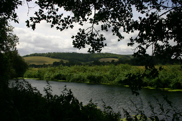
| photo | Bell Hill - geograph.org.uk - 373443.jpg |
| photo_caption | View from Bell Hill looking down Bell Hill Rd towards the Blackmore Vale |
| elevation_m | 258 |
| elevation_ref | |
| prominence_m | 50 |
| prominence_ref | |
| parent_peak | Lewesdon Hill |
| range | Dorset Downs |
| listing | Hills of Dorset |
| location | Dorset, England |
| map | England |
| coordinates | |
| grid_ref_UK | ST800082 |
| topo | OS Landranger 194 |
| fetchwikidata | ALL |
At 258 metres, Bell Hill is one of the highest hills in the county of Dorset, England and a high point on the Wessex Ridgeway.
Location
Bell Hill lies about 5 miles west of Blandford Forum. The village of Ibberton nestles against its southwestern foot, whilst a little further to the northeast, below Okeford Hill on the same ridgeline, is the village of Okeford Fitzpaine.
The summit itself lies on a ridge running from northeast to southwest. To the northwest its escarpment drops steeply in to the Blackmore Vale and Stour Valley, whilst to the southeast the woods of Turnworth Clump and Ringmoor are bracketed by two more ridges, Ibberton Long Down and Turnworth Down, forming a horseshoe with Bell Hill. Another spur runs east from Turnworth Down to Shillingstone Hill, site of a quarry and a popular cross-country race. A trig point on the Wessex Ridgeway marks this subsidiary summit.
History
There is evidence of prehistoric settlement, with a tumulus (a bowl barrow) 500 metres southwest of the summit, a cross dyke beyond it and a settlement and field system in the area of the Ringmoor plantation. Ringmoor is a National Trust property. A disused pit at the foot of the escarpment indicates earlier quarrying activity.
The villages of Belchalwell in the vale a mile to the northwest, and Belchalwell Street at the foot of the scarp, took their names from the original names of the two settlements, Bell and Chaldwell. Bell, now Belchalwell, was named after Bell Hill, and Chaldwell became Belchalwell Street.
Sport
Bell Hill is a designated paragliding site.
References
References
- "Summit Listings by Relative Height".
- [[Ordnance Survey]] 1:50,000 Landranger series, no. 194
- {{NHLE
- [http://www.dorsetlife.co.uk/2011/11/the-dorset-walk-woolland-belchalwell-and-ibberton/ ''The Dorset Walk – Woolland, Belchalwell and Ibberton''] at www.dorsetlife.co.uk. Accessed on 27 March 2013.
- "Bell Hill".
This article was imported from Wikipedia and is available under the Creative Commons Attribution-ShareAlike 4.0 License. Content has been adapted to SurfDoc format. Original contributors can be found on the article history page.
Ask Mako anything about Bell Hill, Dorset — get instant answers, deeper analysis, and related topics.
Research with MakoFree with your Surf account
Create a free account to save articles, ask Mako questions, and organize your research.
Sign up freeThis content may have been generated or modified by AI. CloudSurf Software LLC is not responsible for the accuracy, completeness, or reliability of AI-generated content. Always verify important information from primary sources.
Report