From Surf Wiki (app.surf) — the open knowledge base
Arkansas Highway 980
Highway designation in Arkansas
Highway designation in Arkansas
| Field | Value |
|---|---|
| state | AR |
| type | AR |
| route | 980 |
| maint | AHTD |
| previous_type | AR |
| previous_route | 959 |
| next_type | AR |
| next_route | 1 |
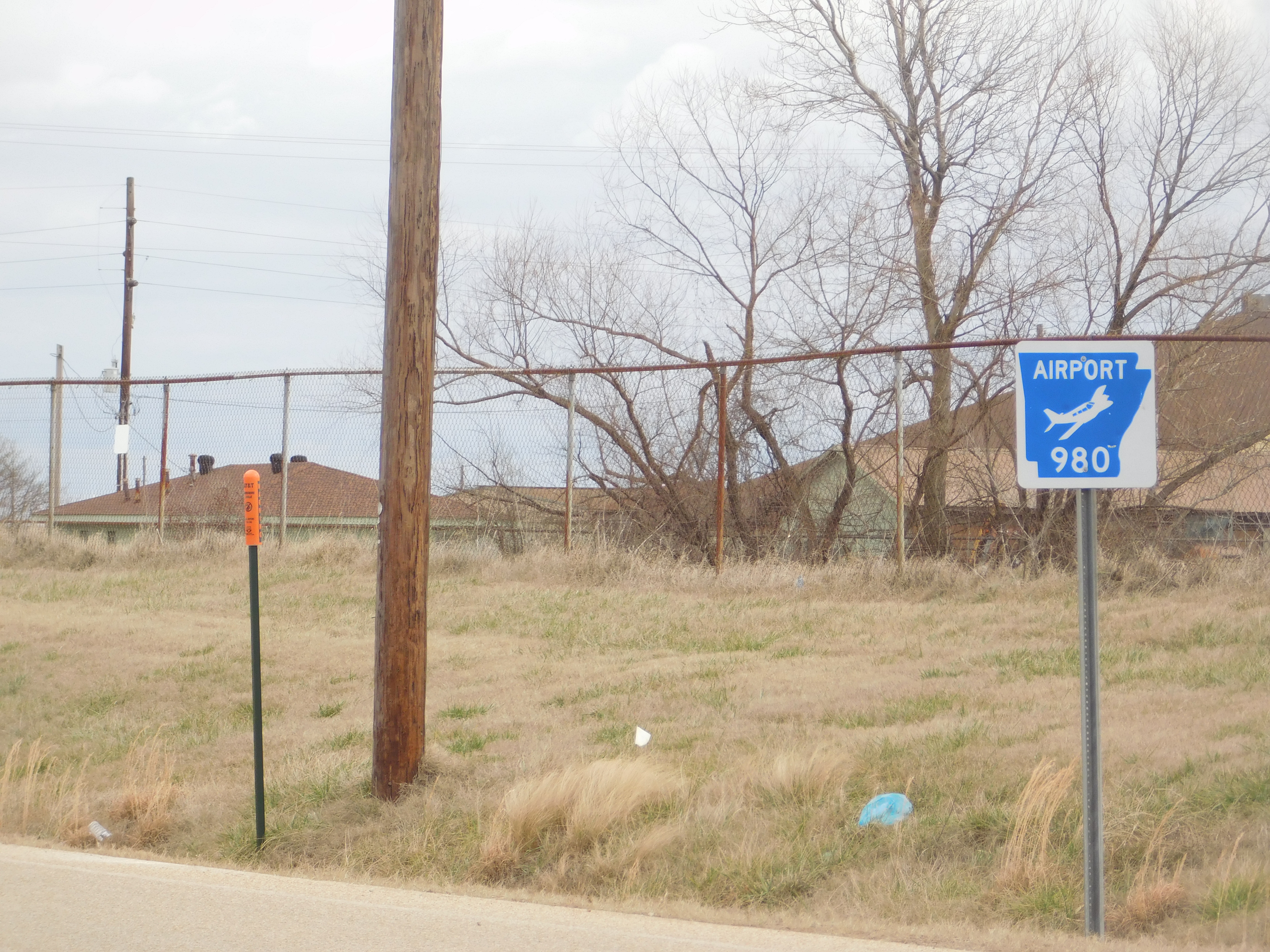
Highway 980 (AR 980, Ark. 980, and Hwy. 980) is a state highway designation for all state maintained airport roads in Arkansas.
TOC
List of routes
Arkansas County
Almyra
Arkansas Highway 980 is a state highway of 2.78 mi in Arkansas County. It connects Arkansas Highway 130 with Almyra Municipal Airport in Almyra.
Section 2
Arkansas Highway 980 is a state highway of 1.93 mi in Arkansas County. It connects U.S. Route 165 with De Witt Municipal Airport in south De Witt.
Benton County

Arkansas Highway 980 is a state highway of 0.20 mi in Benton County. It connects AR 59 with Smith Field in Siloam Springs.
Boone County
Highway 980 is a state highway of 0.45 mi in Boone County. It connects US 62/US 65/US 412 with the Boone County Airport in Harrison.
;History The highway was designated by the Arkansas State Highway Commission on March 26, 1975.
;Major intersections
Bradley County
Arkansas Highway 980 is a state highway of 0.52 mi in Bradley County. It connects US 63/AR 8 with the Warren Municipal Airport south of Warren.
Carroll County
Arkansas Highway 980 is a state highway of 0.60 mi in Carroll County. It connects US 62 with the Carroll County Airport near Berryville.
Chicot County
Section 1
Arkansas Highway 980 is a state highway of 0.22 mi in Chicot County. It connects US 165 with the Dermott Municipal Airport near Dermott.
Section 2
Arkansas Highway 980 is a state highway of 1.70 mi in Chicot County. It connects US 65 with the Lake Village Municipal Airpott Municipal Airport near Lake Village.
Clay County
Section 1
Arkansas Highway 980 is a state highway of 0.41 mi in Clay County. It connects US 62/US 67 (Future I-57) with the Corning Municipal Airport near Corning.
Section 2
Arkansas Highway 980 is a state highway of 0.31 mi in Clay County. It connects US 49/AR 1 with the Rector Airport near Rector.
Cleburne County

Highway 980 is a state highway of 0.36 mi in Cleburne County. It connects Highway 25 Business (AR 25B) with the Heber Springs Municipal Airport in Heber Springs.
;History The highway was designated by the Arkansas State Highway Commission on March 22, 1972.
;Major intersections
Columbia County
Arkansas Highway 980 is a state highway of 0.66 mi in Columbia County. The route connects U.S. Route 79 with Magnolia Municipal Airport south of Magnolia.
Conway County
Arkansas Highway 980 is a state highway of 0.73 mi in Conway County. It connects AR 9 with the Morrilton Airport in Morrilton.
Cross County
Arkansas Highway 980 is a state highway of 1.33 mi in Cross County. The route connects Arkansas Highway 1 with Wynne Municipal Airport in Wynne.
Desha County
Section 1
Arkansas Highway 980 is a state highway of 0.82 mi in Desha County. The route connects Arkansas Highway 4 with McGehee Municipal Airport in McGehee. The route was shortened on January 7, 2009.
Section 2
Arkansas Highway 980 is a state highway of 0.49 mi in Desha County. The route connects Arkansas Highway 54 with Billy Free Municipal Airport near Dumas.
Drew County
Arkansas Highway 980 is a state highway of 0.50 mi in Drew County. The route connects U.S. Route 278 with Ellis Field in east Monticello.
Fulton County
Arkansas Highway 980 is a state highway of 0.40 mi in Fulton County. It connects AR 9 with the Salem Airport in Salem.
Howard County

Arkansas Highway 980 is a state highway of 3.58 mi in Howard County. The route connects U.S. Route 371 with Howard County Airport north of Nashville.
Lawrence County
Arkansas Highway 980 is a state highway of 1.89 mi in Lawrence County. It connects US 67 with the Walnut Ridge Regional Airport in College City.
Madison County
Arkansas Highway 980 is a state highway of 1.13 mi in Madison County. It connects AR 74 with the Huntsville - Madison County Municipal Airport in Huntsville.
Marion County
Arkansas Highway 980 is a state highway of 1.17 mi in Marion County. It connects AR 178 with the Marion County Regional Airport in Flippin.
Polk County
Arkansas Highway 980 is a state highway of 0.4 mi in Polk County. It connects Arkansas Highway 8 with the Mena Intermountain Municipal Airport in Mena.
Van Buren County
Arkansas Highway 980 is a state highway of 1.0 mi in Van Buren County. It connects AR 16 with the Clinton Municipal Airport in Clinton.
Former routing
Arkansas Highway 980 was a state highway of 0.2 mi in Baxter County. It connected AR 126 with Ozark Regional Airport in Midway. It was removed from the State Highway system on April 27, 2007.
References
References
- Planning and Research Division. (April 2010). "[Arkansas] State Highways 2009". Arkansas State Highway and Transportation Department.
- ((Planning and Research Division)). (January 11, 2011). "General Highway Map: Arkansas County, Arkansas". Arkansas State Highway and Transportation Department.
- ((Planning and Research Division)). (August 24, 2010). "General Highway Map: Benton County, Arkansas". Arkansas State Highway and Transportation Department.
- ((Transportation Planning and Policy Division)). (November 19, 2013). "General Highway Map: Boone County, Arkansas". Arkansas Department of Transportation.
- (1970–1979). "Minutes of the Meeting of the Arkansas State Highway Commission". Arkansas State Highway Commission.
- ((Planning and Research Division)). (October 29, 2008). "General Highway Map: Bradley County, Arkansas". Arkansas State Highway and Transportation Department.
- ((Transportation Planning and Policy Division)). (September 7, 2017). "General Highway Map: Carroll County, Arkansas". Arkansas State Highway and Transportation Department.
- ((Planning and Research Division)). (May 25, 2010). "General Highway Map: Chicot County, Arkansas". Arkansas State Highway and Transportation Department.
- ((Planning and Research Division)). (February 11, 2010). "General Highway Map: Clay County, Arkansas". Arkansas State Highway and Transportation Department.
- {{harvp. "Minutes". 1970–1979
- ((Transportation Planning and Policy Division)). (November 19, 2014). "General Highway Map: Cleburne County, Arkansas". Arkansas State Highway and Transportation Department.
- ((Planning and Research Division)). (October 7, 2009). "General Highway Map: Columbia County, Arkansas". Arkansas State Highway and Transportation Department.
- ((Planning and Research Division)). (May 30, 2007). "General Highway Map: Cross County, Arkansas". Arkansas State Highway and Transportation Department.
- ((Planning and Research Division)). (August 24, 2010). "General Highway Map: Desha County, Arkansas". Arkansas State Highway and Transportation Department.
- ((Planning and Research Division)). (August 4, 2009). "General Highway Map: Drew County, Arkansas". Arkansas State Highway and Transportation Department.
- ((Planning and Research Division)). (April 11, 2003). "General Highway Map: Fulton County, Arkansas". Arkansas State Highway and Transportation Department.
- ((Planning and Research Division)). (May 12, 2009). "General Highway Map: Howard County, Arkansas". Arkansas State Highway and Transportation Department.
- ((Planning and Research Division)). (August 28, 2007). "General Highway Map: Lawrence County, Arkansas". Arkansas State Highway and Transportation Department.
- ((Planning and Research Division)). (Jun 19, 2014). "General Highway Map: Madison County, Arkansas". Arkansas State Highway and Transportation Department.
- ((Planning and Research Division)). (April 15, 2008). "General Highway Map: Marion County, Arkansas". Arkansas State Highway and Transportation Department.
- ((Planning and Research Division)). (October 18, 2000). "General Highway Map: Polk County, Arkansas". Arkansas State Highway and Transportation Department.
- ((Planning and Research Division)). (2002). "General Highway Map: Baxter County, Arkansas".
- ((Planning and Research Division)). (April 11, 2007). "Baxter County, Arkansas". Arkansas State Highway and Transportation Department.
This article was imported from Wikipedia and is available under the Creative Commons Attribution-ShareAlike 4.0 License. Content has been adapted to SurfDoc format. Original contributors can be found on the article history page.
Ask Mako anything about Arkansas Highway 980 — get instant answers, deeper analysis, and related topics.
Research with MakoFree with your Surf account
Create a free account to save articles, ask Mako questions, and organize your research.
Sign up freeThis content may have been generated or modified by AI. CloudSurf Software LLC is not responsible for the accuracy, completeness, or reliability of AI-generated content. Always verify important information from primary sources.
Report