From Surf Wiki (app.surf) — the open knowledge base
2010 Eureka earthquake
January 2010 earthquake in California
January 2010 earthquake in California
| Field | Value | |||||||
|---|---|---|---|---|---|---|---|---|
| title | 2010 Eureka earthquake | |||||||
| map | January 2010 Eureka earthquake intensity USGS.jpg | |||||||
| map2 | {{Location map+ | USA California | ||||||
| {{Location map~ | California | lat | 36.97 | long=-122.02 | label=Santa Cruz | label_size=100 | position=left | mark=Green pog.svg}} |
| {{Location map~ | California | lat | 39.53 | long=-119.82 | label=Reno | label_size=100 | position=right | mark=Green pog.svg}} |
| {{Location map~ | California | lat | 40.80 | long=-124.16 | label=Eureka | label_size=100 | position=right | mark=Green pog.svg}} |
| {{Location map~ | California | lat | 40.65 | long=-124.76 | mark=Bullseye1.png | marksize=40 | outside=1}} | |
| relief | yes | |||||||
| width | 260 | |||||||
| float | right | |||||||
| timestamp | 2010-01-10 00:27:41 | |||||||
| isc-event | 14223208 | |||||||
| anss-url | nc71338066 | |||||||
| local-date | ||||||||
| local-time | 16:27:38 PST | |||||||
| duration | ~10 seconds at King Salmon, California | |||||||
| magnitude | 6.5 | |||||||
| depth | 13.5 mi | |||||||
| location | ||||||||
| type | Strike-slip | |||||||
| aftershocks | ~24 | |||||||
| countries affected | North Coast (California), | |||||||
| United States | ||||||||
| damage | $21.8–43 million | |||||||
| intensity | ||||||||
| casualties | 35 injuries | |||||||
| map_size | 300 |
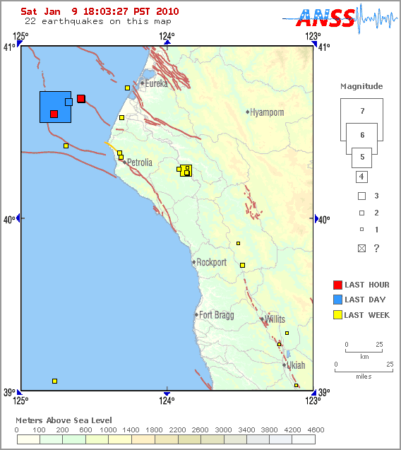
| isc-event = 14223208 | anss-url = nc71338066 | local-date = | local-time = 16:27:38 PST United States The 2010 Eureka earthquake occurred on January 9 at 4:27:38 pm PST offshore of Humboldt County, California, United States. The magnitude was measured 6.5 on the scale, and its epicenter was located offshore in the Pacific Ocean 33 mi west of the nearest major city, Eureka, California. Additionally, there was a separate earthquake further offshore of Eureka on February 4 with a slightly lower magnitude of 5.9. It was also the most significant earthquake in the Eureka area in terms of magnitude since the 1992 Cape Mendocino earthquakes. It was felt from Santa Cruz County, California in the south, to Eugene, Oregon in the north and to the east as far as Reno, Nevada.
Tectonic setting
Near Cape Mendocino, the Mendocino triple junction is an area of active seismicity where three tectonic plates come together. The Mendocino fracture zone (also known as the Mendocino Fault east of the Gorda Ridge) is a transform fault that separates the Pacific and Gorda plates. To the south, the relative motion between the Pacific plate and North American plate is accommodated by the San Andreas Fault, and to the north, the Gorda plate is converging with the North American plate at the Cascadia subduction zone.
Impact
Structural damage was inflicted among older Victorian houses, power was severed for several hours, and windows were shattered. In addition, 28,000 customers of Pacific Gas and Electric Company, mostly those from Humboldt County, were temporarily left without electricity and phone services as a result.
In Eureka, the Old Town Bar and Grill building was previously believed to be severely damaged beyond repair and ordered demolished by the city, until a developer purchased and renovated it in 2011. The town's high school, known as Eureka High School, and the Bayshore Mall were damaged and briefly closed, though both were later reopened with close to full services. An auditorium at Eureka High remained closed over concerns regarding its structural safety as of June 15, 2010. A total of 463 buildings sustained damage as a result of the earthquake, leaving $21.8–43 million in losses.
References
References
- {{Cite isc. EHB. 14223208
- (January 9, 2010). "Magnitude 6.5 earthquake rattles Eureka in Northern California". Los Angeles Times.
- (January 9, 2010). "Magnitude 6.5–Offshore Northern California". United States Geological Survey.
- Garofoli, Joe. (January 9, 2010). "6.5 quake rocks Humboldt County". San Francisco Chronicle.
- Valencia, Nick. (January 9, 2010). "6.5 earthquake strikes off California coast". CNN.
- (February 4, 2010). "2nd Strong Quake in Month Hits Off N. Calif. Coast". [[KEPR-TV]].
- "Cape Mendocino, California Earthquakes". United States Geological Survey.
- Bakun, W. H.. (2000). "Seismicity of California's North Coast". Bulletin of the Seismological Society of America.
- Tam, Donna. (January 9, 2011). "Saving a piece of history: Eureka's Old Town Bar and Grill building expected to be completed by end of the year". The Times-Standard.
- John Driscoll. (January 13, 2010). "Gov. declares state of emergency for North Coast quake". [[Times-Standard]].
- Impact Forecasting. (January 2010). "January 2010 Monthly Cat Recap". Aon Benfield.
- EERI. (2010). "The Mw6.5 Offshore Northern California Earthquake of January 9, 2010". [[Earthquake Engineering Research Institute]].
- National Geophysical Data Center / World Data Service (NGDC/WDS). (1972). "Significant Earthquake Database". [[National Geophysical Data Center]], [[National Oceanic and Atmospheric Administration.
This article was imported from Wikipedia and is available under the Creative Commons Attribution-ShareAlike 4.0 License. Content has been adapted to SurfDoc format. Original contributors can be found on the article history page.
Ask Mako anything about 2010 Eureka earthquake — get instant answers, deeper analysis, and related topics.
Research with MakoFree with your Surf account
Create a free account to save articles, ask Mako questions, and organize your research.
Sign up freeThis content may have been generated or modified by AI. CloudSurf Software LLC is not responsible for the accuracy, completeness, or reliability of AI-generated content. Always verify important information from primary sources.
Report