From Surf Wiki (app.surf) — the open knowledge base
Lào Cai province
Province of Vietnam

Province of Vietnam
| Field | Value | |||||
|---|---|---|---|---|---|---|
| name | Lào Cai | |||||
| type | Province | |||||
| image_skyline | {{Photomontage | |||||
| spacing | 1 | |||||
| color_border | white | |||||
| color | white | |||||
| size | 310 | |||||
| photo1a | Cáp-treo-fan-12.jpg | |||||
| photo1b | Cáp-treo-fansipan-17.jpg | |||||
| photo2a | Bao An Pagoda.jpg | |||||
| photo2b | Sa Pa center.JPG | |||||
| photo3a | Sapa lake.jpg | |||||
| photo3b | Vua Mèo House.jpg | |||||
| photo4a | Thacbac.jpg | |||||
| photo4b | Stone church in Sapa.jpg | |||||
| photo5a | Terraced fields Sa Pa 3.jpg | |||||
| photo5b | Rice fields near Sapa, Viêt Nam.jpg | |||||
| photo6a | Terraced fields Sa Pa 2.jpg | |||||
| photo6b | Sa Pa ngày tuyết 1.jpg | |||||
| image_caption | Fansipan aerial tramway Phan Xi Păng Topas tourist area Bảo An Temple Lào Cai Mountain Lào Cai City Hoàng A Tưởng House Sa Pa Terrace Sa Pa Mountain Stone church in Sa Pa Bạc Waterfall snowfall at Sa Pa | |||||
| image_map | Lao Cai in Viet Nam.svg | |||||
| mapframe | yes | |||||
| mapframe-zoom | 8 | |||||
| coordinates | ||||||
| subdivision_type | Country | |||||
| subdivision_name | Vietnam | |||||
| subdivision_type1 | Region | |||||
| subdivision_name1 | Northwest | |||||
| image_flag | Flag of laocai province.jpg | |||||
| image_seal | Logo_tỉnh_Lào_Cai.svg | |||||
| seat_type | Capital | |||||
| seat | Yên Bái ward | |||||
| government_type | Province | |||||
| governing_body | Lào Cai Provincial People's Council | |||||
| parts_type | Subdivision | |||||
| parts | 99 second-level subdivisions | |||||
| (10 wards, 89 communes) | ||||||
| leader_title1 | Chairman of People's Council | |||||
| leader_name1 | Nguyễn Văn Vịnh | |||||
| leader_title2 | Chairman of People's Committee | |||||
| leader_name2 | Trịnh Xuân Trường | |||||
| area_footnotes | ||||||
| area_total_km2 | 13256.92 | |||||
| population_footnotes | ||||||
| population_total | 1,778,785 | |||||
| population_as_of | 2025 | |||||
| population_density_km2 | auto | |||||
| demographics_type1 | Ethnic groups | |||||
| demographics1_footnotes | {{cite book | |||||
| author | General Statistics Office of Vietnam | year = 2019 | url = https://www.gso.gov.vn/wp-content/uploads/2019/12/Ket-qua-toan-bo-Tong-dieu-tra-dan-so-va-nha-o-2019.pdf | title = "Completed Results of the 2019 Viet Nam Population and Housing Census" | publisher = Statistical Publishing House (Vietnam) | isbn= 978-604-75-1532-5 }} |
| demographics1_title1 | Vietnamese | |||||
| demographics1_info1 | 33.78% | |||||
| demographics1_title2 | Mông | |||||
| demographics1_info2 | 25.08% | |||||
| demographics1_title3 | Tày | |||||
| demographics1_info3 | 14.83% | |||||
| demographics1_title4 | Dao | |||||
| demographics1_info4 | 14.24% | |||||
| demographics1_title5 | Giáy | |||||
| demographics1_info5 | 4.53% | |||||
| demographics1_title6 | Others | |||||
| demographics1_info6 | 7.54% | |||||
| demographics_type2 | GDP | |||||
| demographics2_title1 | Province | |||||
| demographics2_info1 | VND 43.634 trillion | |||||
| US$ 1.895 billion | ||||||
| blank1_name | HDI (2020) | |||||
| blank1_info | 0.687 | |||||
| (47th) | ||||||
| timezone | ICT | |||||
| utc_offset | +7 | |||||
| area_code_type | Area codes | |||||
| area_code | 214 | |||||
| iso_code | VN-02 | |||||
| website | ||||||
| postal_code_type | Postal code | |||||
| postal_code | 31xxx |
| mapframe-zoom = 8 (10 wards, 89 communes) US$ 1.895 billion (47th)
Lào Cai is a province of the mountainous Northwest region of Vietnam bordering the province of Yunnan in China. The province covers an area of about 13,256.92 km2 and as of 2025 it had a population of 1,778,785 people.
Lào Cai and Sa Pa are two important cities within the province at the border with China; the former is well known as key trading post and the latter is hill station famous for tourism, in the Northwest region of Vietnam. Lào Cai is also the capital of Lào Cai province and shares border with the city of Hekou, in the Yunnan province of Southwest China. This border town was closed after the 1979 war with China, since reopened in 1993, has become a major tourist centre between Hanoi, Sa Pa and Kunming (China). Sa Pa is notable as a hill resort and market centre for the local ethnic Hmong, including the Red, Black, Green and Flower Hmong. Located across the Muong Hoa Valley from Vietnam's highest mountain, Fansipan, the city is sometimes referred to as the "queen of mountains".
Lào Cai has many historical sites, natural caves and produces agricultural specialties such as Bắc Hà plums.
In a 1929 survey conducted in the area, the vegetation (flora) and fauna (mammals) recorded by the French biologist Delacour who accompanied Theodore Roosevelt were unique to the region in northern Vietnam.
Etymology
The name "Lao-Kay" has been used by the French since the colonial era in their writing, pronounced as "Lào Cai" by the Vietnamese. The latter became official usage and spelling after November 1950.
The origin of the province's name is unclear and there are several explanations. The area in the ward of Cốc Lếu was the site of an old commercial district that developed into a market town. Because of this it was called Lão Nhai (老街, literally Phố Cũ, Old Town), in Hmong language it is pronounced as "Lao Cai". After this a new market town was developed and named Tân Nhai (新街, today Phố Mới, New Town). The word Lào Cai is sourced to "Lao Kai" which appeared as Jean Dupuis led a naval expedition up the Red River and in 1879 published the Map of Tonkin, in which the location was marked as "Lao-kai, residence du Chef des Pavillone noirs" (residence of the Head of Black Flag Army). According to Professor Đào Duy Anh, it derives from the word "Lão Nhai". While making maps, the French wrote it as "Lao-Kay" and this word was used by them in documents. When reading, the Vietnamese pronounced it Lào Cai and this has persisted since.
Geography and climate
Lào Cai province is located in the north of the country and has an area of 13,256.92 km2. It borders the provinces of Tuyên Quang, Sơn La, Lai Châu and Phú Thọ, as well as the province of Yunnan in the People's Republic of China.
There are ten major soil groups under 30 categories in the province, under ten land groups. The land groups are: The Alluvial group (1.47% of the land area) along the Red River is good for growing food crops and trees; the Oxisol type which occupies 40% of land area has generally reddish brown soil, below altitude of 900 m, is a fertile land suitable for the annual and commercial crops; Team Red Yellow soil humus covers 30% land area in the Sa Pa, Mường Khương, Bắc Hà, Bát Xát districts of the province suitable for medicinal plants, fruit trees and vegetables; humus soil on the mountain occupies 11.42% of the land area mostly in Sa Pa district which has rich canopy of mixed forest; and the Oxisol color altered by rice in 2% of land area are formed into a landscape of terraced fields, as seen in Bắc Hà and Sa Pa districts.
;Climate As the province is mostly mountainous, it experiences a dry cold climate from October to March, while the tropical monsoon is rainy season, which lasts from April to September. The annual average temperature is 23 C. The temperature generally ranges between 18 C and 28 C in the lowland areas and between 20 C and 22 C in the highland areas. In Sa Pa town, however, the temperature can drop to less than 0 C with snowy conditions. Fog and frost are a common phenomenon in the province.
|Jan record high C = 31.4 |Jan record low C = 1.4 |Feb record high C = 34.6 |Feb record low C = 5.6 |Mar record high C = 38.0 |Mar record low C = 6.8 |Apr record high C = 39.0 |Apr record low C = 10.0 |May record high C = 42.8 |May record low C = 14.8 |Jun record high C = 40.1 |Jun record low C = 18.7 |Jul record high C = 39.7 |Jul record low C = 20.0 |Aug record high C = 40.0 |Aug record low C = 17.3 |Sep record high C = 36.8 |Sep record low C = 15.8 |Oct record high C = 37.2 |Oct record low C = 8.8 |Nov record high C = 33.2 |Nov record low C = 5.8 |Dec record high C = 32.8 |Dec record low C = 2.8 |year record high C = 42.8 |year record low C = 1.4 | archive-url = https://web.archive.org/web/20180722172120/http://ibst.vn/DATA/nhyen/QCVN%2002-2009%20BXD%20So%20lieu%20tu%20nhien.pdf | archive-date = 22 July 2018 | access-date = 3 August 2018}}
|Jan record high C = 23.2 |Feb record high C = 25.8 |Mar record high C = 28.1 |Apr record high C = 29.8 |May record high C = 30.0 |Jun record high C = 29.4 |Jul record high C = 29.1 |Aug record high C = 29.6 |Sep record high C = 28.2 |Oct record high C = 26.4 |Nov record high C = 24.5 |Dec record high C = 24.0 |year record high C = 30.0 |Jan record low C = -6.1 |Feb record low C = -1.3 |Mar record low C = -3.5 |Apr record low C = 3.4 |May record low C = 8.3 |Jun record low C = 10.8 |Jul record low C = 7.0 |Aug record low C = 10.4 |Sep record low C = 8.7 |Oct record low C = 5.6 |Nov record low C = 1.0 |Dec record low C = -3.2 |year record low C = -6.1
;Water resources Lào Cai is a mountainous region. In the northwest of the province is Phan Xi Păng (also called Fansipan; elevation 3143 m, snow covered during winter season), Vietnam's highest mountain. It is located in the Hoàng Liên Sơn and the Hoàng Liên National Park. The Sa Pa Mountains form the western part of the province. While the province is drained by over 100 rivers, the main river that bisects the province is the Red River, (), the most significant river of northern Vietnam, which flows out of China towards the capital Hanoi. It flows through the province over a length of 130 km. Other rivers of significance are the Chay and Nam Ti Rivers. Much of the province is heavily forested.
Ground water resources have been estimated reserves as 4,448 million cubic metres out of which good quality water is estimated as 30 million cubic metres. In addition, there are four mineral water sources.
;Mineral resources The province has rich mineral resources, 30 types have been identified with good reserves. The major valuable mineral reserves are: Copper (53 million tons), molybdenum (15 million tons), apatite and iron (2.5 billion tons). There are 150 mines in the province exploiting various minerals.
Flora and fauna
Forests account for 2789.07 km, accounting for 43.87% of the province's area, of which 2292.97 km is natural while the remainder is plantation forestry. The forests feature 442 species, including various types of birds, insects and frogs. The province has a rich forest reserve known for its many species of rare timber plants; some of the well known species are: po mu (fukiena), lat hoa (chukrasia tabularis), and cho chi, apart from many species of medicinal herbs.
In the Fansipan mountain ranges, vegetation varies with altitude, with elevation above 1500 m retaining the forests. In the elevation range of 2500 -, which is the mist area, "elfin forest" is the dominant forest vegetation of "gnarled trees (Tsuga yunanaris)" of less than 8 m height covered with moss. Above 2800 m elevation, the mountain range has undersized vegetation with many bamboos and rhododendrons.
The Hoang Lien National Park has only 12 km2 of forest left as a result of anthropogenic pressure over centuries. Grass, bushes and small trees are seen on the land which are devoid of forests, and large areas are used for cultivation; ginger plantation, as a cash crop is widespread.
According to a 1929 survey conducted in the area, the fauna (mammals) recorded by the French biologist Delacour who accompanied Theodore Roosevelt were: the clouded leopard (Neofelis nebuiosa), leopard (Panthera pardus), tiger (panthera tigris), binturong (Arctictus binturong) and black gibbon (Hylobates concolor), the stump-tailed macaque (Macaca arctoides), and Asiatic black bear (Selenarctos thibetanus). In Sa Pa forests, 150 species of birds were recorded such as the red-vented barbet ( Megalaima lagrandieri), collared finchbill (Spizixo semitoroues), white-throated laughingthrush (Garrulax albogularis) and the chestnut bulbul (Hypsipetes castanotus); all species are considered exclusive to North Vietnam.
History
.jpg)
Lào Cai has been known since ancient times as a historic trading post. Here, the Chinese, the Vietnamese and the ethnic minorities of the region fought to gain control of the region. In 1463, the Viet Kings established Lào Cai as the capital of their northernmost region, then named as Hưng Hóa. It came under French colonial rule in 1889 and was their administrative town, and also served as a military garrison. In the early 19th century the first railway line was built from Hanoi to this region. It took seven years to complete but at the cost of 25,000 lives of Vietnamese people who were conscripted labourers.
In late 1978, the Vietnamese invaded Cambodia due to constant attacks resulting in massacres from the genocidal Khmer Rouge on Vietnamese soil. The Chinese, as allies of the Khmer Rouge invaded North Vietnam with the aim of "teaching the Vietnamese a lesson" to withdraw from Cambodia. The attack was launched by 200,000-600,000 People's Liberation Army personnel. They occupied territory from Paso (previously known as Phon Tho) in the Northwest to Cao Bằng and Lạng Sơn in the Northwest. The Chinese suffered heavy casualties, but managed to take these cities due to fighting being done against primarily Vietnamese militia units and local border troops, with the core fighting element of Vietnamese army all being stationed in Cambodia. China decided to withdraw completely after less than a month and claimed that ‘the gate to Hanoi was open’ and that ‘their punitive mission had been achieved’. On the way back to the Chinese border, the PLA destroyed local infrastructure and homes, looted equipment and resources including livestock, weakening the already destabilised post-Vietnam War economy of Vietnam's northernmost provinces. The PLA completely pulled out on March 16. Both sides declared victory with China claiming their ‘mission was successful’ and Vietnam successfully repelling a Chinese Invasion. Following the invasion, the border with China was closed for several years. The city of Lào Cai was devastated by the Chinese. The war also resulted in the planting of land mines that continue to inflict casualties along the border with China.
The border town of Lào Cai, which lies along the Red River and is the provincial capital has now prospered due to trade with China and is a booming city with a community of millionaires. Since 2006, Lào Cai has had city status and is the largest town in the region. An airport is planned to be built by 2020.
On June 12, 2025, the National Assembly passed Resolution No. 202/2025/QH15, which took effect the same day, merging Yên Bái Province into Lào Cai Province.
Administrative divisions
Administrative reforms before 1/7/2025
Lào Cai was subdivided into 9 district-level subdivisions:
| Second-tier | |||||
|---|---|---|---|---|---|
| subdivisions (before 2025) | Area | ||||
| (km2) | Third-tier subdivisions | Ward | Township | Commune | |
| Lào Cai city | 229.67 | 12 | 5 | ||
| Bắc Hà District | 686.78 | 1 | 20 | ||
| Bảo Thắng District | 691.55 | 3 | 12 | ||
| Bảo Yên District | 820.00 | 1 | 17 | ||
| Bát Xát District | 1050.00 | 1 | 22 | ||
| Mường Khương District | 556.15 | 1 | 15 | ||
| Sa Pa town | 683.29 | 6 | 10 | ||
| Si Ma Cai District | 234.54 | 13 | |||
| Văn Bàn District | 1422.00 | 1 | 22 |
They were further subdivided into 8 commune-level towns (or townlets), 144 communes, and 12 wards.{{Cite web |access-date=2010-06-23 |url-status=dead |archive-url=https://web.archive.org/web/20101113145738/http://www.gso.gov.vn/default_en.aspx?tabid=466&idmid=3&ItemID=8601 |archive-date=13 November 2010
Economy
Traditional economic activities such as agriculture and forestry remain important, but the province has also been attempting to develop foreign investment in the area. Cross-border trade with China is also a growing source of income, as is tourism centred on trekking up the peak of Fansipan, Vietnam's highest mountain. Ecotourism is gaining ground. Agriculture and forestry constitute 78.07% of economic activity; fishing and aquaculture 0.04%, mining 1.62%; manufacturing 2.37%, power and water 0.22%, construction 3.29%, repairmen 3.48%; hospitality 0.90%, communications 1.31%; finance 0.21%, science and technology 0.05%;, education and research 3.57%; health and social work 0.69%; cultural activities 0.24% and several other small sectors.
As against the national figure of 7,592 cooperatives, there are 19 cooperatives in the province, out of which 17 are agricultural cooperatives and one is a fisheries cooperative.{{Cite web |access-date=2010-06-23 |url-status=dead |archive-url=https://web.archive.org/web/20091113143803/http://www.gso.gov.vn/default_en.aspx?tabid=469&idmid=3&ItemID=8895 |archive-date=2009-11-13 |access-date=2010-06-23 |url-status=dead |archive-url=https://web.archive.org/web/20091113143547/http://www.gso.gov.vn/default_en.aspx?tabid=469&idmid=3&ItemID=8893 |archive-date=2009-11-13 |access-date=2010-06-23 |url-status=dead |archive-url=https://web.archive.org/web/20091113143648/http://www.gso.gov.vn/default_en.aspx?tabid=469&idmid=3&ItemID=8889 |archive-date=2009-11-13
In 2008, the province produced 199,800 tonnes of cereals compared to the national production of 43.68 million tonnes.{{Cite web |access-date=2010-06-23 |url-status=dead |archive-url=https://web.archive.org/web/20091113143531/http://www.gso.gov.vn/default_en.aspx?tabid=469&idmid=3&ItemID=8883 |archive-date=2009-11-13
In 2007, the industrial output of the province was a meagre 1,916.2 bill. đồngs against the national output of 1.47 million billion đồngs.
Lào Cai has 150 mines or mining locations of 30 different categories, some of which are the largest of their kind in the country. These include the apatite mine at Cam Đường with 2.5 billion tonnes, the iron mine at Quý Xa with 124 million tons, the copper mine at Sin Quyền with 53 million tons, the molybdenum mine at Ô Quy Hồ with 15,400 tons, the rare earth mine Mau Xe and the lead and zinc mine of Na Tum.
In recent years the government of Vietnam has encouraged reforestation in the province, because of the importance of wood for fuel and development and for environmental reasons. Tree planting has been ordered particularly in Sa Pa.
Demographics
With more than 20 ethnic groups, Lào Cai is a melting pot of cultures and history. Ethnic Vietnamese are the majority, especially since 1960 when the North Vietnamese government followed a policy of settling communist party cadres from lowland areas in upland areas, then predominantly occupied by tribes. According to the General Statistics Office of the Government of Vietnam, the population of Lào Cai province, as of 2008, was 602,300 with a density of 94 persons per square kilometre over a total land area of 6383.9 km2 of the province. The male population during this period was 303,300{{Cite web |access-date=2010-06-23 |url-status=dead |archive-url=https://web.archive.org/web/20091113144832/http://www.gso.gov.vn/default_en.aspx?tabid=467&idmid=3&ItemID=8650 |archive-date=2009-11-13 |access-date=2010-06-23 |url-status=dead |archive-url=https://web.archive.org/web/20141012135552/http://www.gso.gov.vn/default_en.aspx?tabid=467 |archive-date=2014-10-12
The province has 25 of Vietnam's ethnic minority groups accounting for 64.09% of its population. The largest ethnic groups are: Vietnamese - 35.9%, Hmong - 22.21%, Tay - 15.84%, Dao -14.05%, Giay - 4.7%, Nùng 4.4% and the others belong to Phu La, San Chay, Ha Nhi, and the La Chi groups.
Languages, other than Vietnamese, spoken in Lào Cai province include the following.
- Hmong–Mien languages
- Hmong
- Kim Mun
- Tai languages
- Nùng
- Tày (Tày Sa Pa, etc.)
- Giáy (Bouyei) - Bát Xát District, Mường Khương District, Bảo Yên District
- Tibeto-Burman languages
- Phula - Bát Xát District, Mường Khương District, Bắc Hà District
- Laghuu - Bát Xát District, Sa Pa, Văn Bàn District, Bảo Thắng District
Hoàng Liên National Park
The Hoàng Liên National Park is located within the province and was upgraded from a nature reserve in 2006. It covers an area of 24.66 square kilometres (30 km2 is also mentioned in some references) and contains the peak of Fan Si Pan, which, at 3143 m, is the highest peak in Vietnam. The park contains heavy forests and a rich biodiversity, although because of agricultural production of ginger and other land uses, today only about 12 km of the park is forested. 1884 migrating raptors have been recorded in the national park, which is stated to be a rarity in terms of numbers and the species varieties. The area was surveyed by French biologist Delacour in 1929 who had accompanied Theodore Roosevelt to an expedition in southeast Asia. He collected 48 mammal species for the Chicago Natural History Museum although most were shot. Sediments in the park date back to the Mesozoic era, whilst the granite is a Palaeocene intrusion. The northwestern boundary of the national park is made with a rugged boundary of marble and metamorphosed calcium carbonate.
Transport
Lào Cai is one of the few mountainous provinces with well-developed transport networks consisting of roads, rail and waterways. An airport is planned in Bao Yen District. The provincial city is connected by road, rail and river transport links with Hanoi on its northwest (340 km) and to Yunnan province in China. Within the province, road links exist to Sa Pa and Bắc Hà. The Haiphong railway to Yunnan is of strategic importance. There are four national highways totaling to a length of 400 km, provincial roads of about 300 km length and 1,000 km of village roads.
The Hanoi–Lào Cai railway is 296 km, of which 62 km is in the province, and links to Chinese railways at the border. It can carry 1 billion tonnes of freight per year and thousands per day. Plans for a high-speed rail link between Hanoi and Lào Cai has been investigated by the Ministry of Transport and the Asian Development Bank. This is expected to create a high-speed rail corridor from Kunming – Lào Cai – Hanoi – Haiphong.
Red River flowing through the province provides water transport facilities though its transportation capacity is limited. The planned Sapa Airport Project was approved by the government of Vietnam and will be built in this province in the Q4/2021.
Visitor attractions
As Lào Cai province is mountainous and still developing, its natural environment is relatively environmentally unspoilt. This means that its potential as an ecotourism destination among Vietnamese and foreigners is still intact. It has now become popular and a novel experience among both Chinese and Vietnamese as a tourist destination, particularly a "sexualized and sensualised" border town of Lào Cai. Special border travel packages for tourists, arranged between China and Vietnam under the present political set up in Vietnam, has relaxed regulations permitting tourists to visit selected locations under conducted tours to places in Northern Vietnam and particularly to the provincial headquarter of Lào Cai; Lào Cai is the last stop before crossing into China on way to Kunming across the border, which lies at the end of the train line to China. Since then the Chinese tourists visiting Lào Cai on a one-day trip or two days trip including the hill station town of Sa Pa in the province (a popular five trip is also organized covering Lào Cai, Hanoi, Hạ Long and Hai Phong) recorded a quantum jump, from 4200 in 1995 to 176,310 in 2002. Lào Cai is popular among Chinese travellers (males, in particular) who are said to be "obsessed with Zhao Xiaojie ("looking for misses") for its sex market. A male tourist from China made a mention: "There is a common saying in China: Vietnam sacrifices one generation of young women for the well-being of the next three generations."{{Cite book|last=Hitchcock|first=Michael|title= Tourism in Southeast Asia: challenges and new directions A popular motorbiking route among tourists that covers the mountainous region of the province known as the "Tonkinese Alps", is to start from the White Thai villages, Sơn La, historic site of Dien Bien Phu and terminating at Sa Pa.
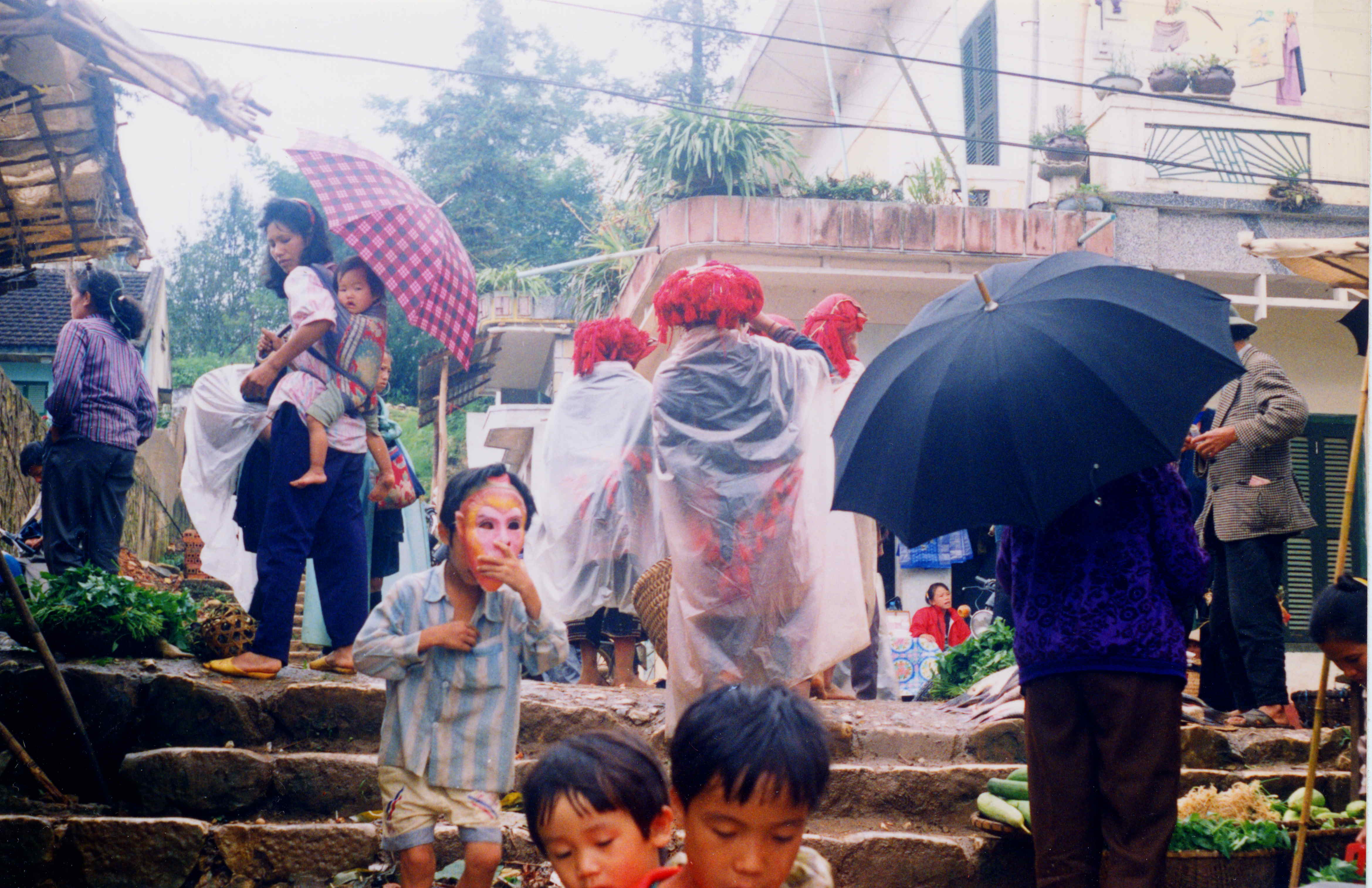
Sa Pa is one of 21 national tourism areas in Vietnam. Sa Pa is at an altitude of 1200 -, has a mild climate throughout the year, lush, forested and mountainous scenery, waterfalls and is a hub of cultural activities of various ethnic minorities in the region, such as the Hmong and Dao people used to gather during the weekly market to "attend an ephemeral "Love Market" where young men and women chose partners to marry. It is 38 km away from the border town of Lào Cai. Visit to Sapa town is said to be more popular among visitors from Western countries in view of its attraction of ethnic tribals. In fact, the French had established a Travel Bureau, as early as 1917, and the town was popular among the "French colonist" all through their rule as a hill resort. However, Sa Pa has gone through several rounds of destruction between 1947 and 1953, and again in 1979 due to war with French and Chinese. It has been partly restored and has gradually become a tourist hub since the region was opened to tourism in 1993. A good time to visit Sa Pa would be when rice fields in different green shades are being harvested in the fall season (September to November). The colours of the rice fields indicate the time for harvesting various plots. The women of the ethnic minority tribes who harvest the crops on the fields further accentuate the different green shades of the fields with their eye-catching red and indigo-coloured dresses.
Lào Cai has many historic sites, natural caves and produces agricultural specialties such as Bắc Hà plums.
References
References
- "Giới thiệu tổng quan về tỉnh Lào Cai mới". ĐÀI PHÁT THANH - TRUYỀN HÌNH LÀO CAI.
- "Tình hình kinh tế, xã hội Lào Cai năm 2018".
- "Human Development Index by province(*) by Cities, provincies and Year".
- "Lao Cai". Vietnam.Sawadee.
- "Lao Cai".
- "Fauna and Flora". Tpoas Ecolodge.
- "History of Lao Cai". Lao Cai Provincial Government.
- Tonkin Map 1879, in [http://www.forez-info.com/encyclopedie/histoire/18243-il-etait-un-tonkin-jean-dupuis.html Il était un Tonkin: Jean Dupuis] {{Webarchive. link. (2015-12-22 . forez-info, 2012. Retrieved 22/12/2015.)
- "Natural resources". Lào Cai: Government of Vietnam.
- "Natural resources". Lào Cai: Government of Vietnam.
- [https://seadelt.net/Asset/Source/Document_ID-254_No-01.pdf Archived copy] {{Webarchive. link. (10 May 2021)
- "QCVN 02:2022/BXD Quy chuẩn kỹ thuật quốc gia về Số liệu điều kiện tự nhiên dùng trong xây dựng".
- [https://seadelt.net/Asset/Source/Document_ID-254_No-01.pdf Archived copy] {{Webarchive. link. (10 May 2021)
- Boobbyer, Claire. (2008). "Footprint Vietnam". Footprint Travel Guides.
- "Lao-Cai Lao Cai". Britannica Online Encyclopedia.
- "Provinces of North East Region: Lao Cai Province". Wompom.
- (1997). "Merriam-Webster's geographical dictionary". Merriam-Webster.
- "Nghị quyết số 202/2025/QH15 về việc sắp xếp đơn vị hành chính cấp tỉnh".
- "Number of cooperatives in 2008 by kind of activity and by province: Agriculture, Forestry and Fishery". Population and Employment :General Statistics Office of the Government of Vietnam.
- "Agriculture, Forestry and Fishery:Production of cereals per capita by province". Population and Employment: General Statistics Office of the Government of Vietnam.
- "Industry: Industrial output value at current prices by province". Population and Employment: General Statistics Office of the Government of Vietnam.
- "Population and population density in 2008 by province". General Statistics Office of the Government of Vietnam.
- "Average female population by province". General Statistics Office of the Government of Vietnam.
- "Average rural population by province". Population and Employment: General Statistics Office of the Government of Vietnam.
- "Population, ethnic administrative institutions". Lao cai: Government of Vietnam.
- "Raptor migration at Hoang Lien Nature Reserve, northern Vietnam". Oriental Bird Club.
- "fauna and flora". Tripadviser.
- "Sa Pa Airport to be smaller, cost estimate almost halved".
- Ray, Nick. (2009). "Cambodia Laos & the Greater Mekong". Lonely Planet.
- Michaud, Jean, Turner, Sarah. (2006). "Contending of a hill station". Annals of Tourism Research.
- Pham, Sherisse. (2008). "Frommer's Vietnam". Frommer's.
This article was imported from Wikipedia and is available under the Creative Commons Attribution-ShareAlike 4.0 License. Content has been adapted to SurfDoc format. Original contributors can be found on the article history page.
Ask Mako anything about Lào Cai province — get instant answers, deeper analysis, and related topics.
Research with MakoFree with your Surf account
Create a free account to save articles, ask Mako questions, and organize your research.
Sign up freeThis content may have been generated or modified by AI. CloudSurf Software LLC is not responsible for the accuracy, completeness, or reliability of AI-generated content. Always verify important information from primary sources.
Report