From Surf Wiki (app.surf) — the open knowledge base
34th Street station (Hudson–Bergen Light Rail)
New Jersey Transit Hudson–Bergen Light Rail station
New Jersey Transit Hudson–Bergen Light Rail station
| Field | Value | |||||||||
|---|---|---|---|---|---|---|---|---|---|---|
| name | 34th Street | |||||||||
| style | NJ Transit | |||||||||
| image | 34th St HBLR Sta jeh.JPG | |||||||||
| image_caption | 34th Street station as seen from the East 32nd Street overpass | |||||||||
| address | Avenue E at East 34th Street | |||||||||
| borough | Bayonne, New Jersey | |||||||||
| coordinates | ||||||||||
| owned | New Jersey Transit | |||||||||
| platform | 1 island platform | |||||||||
| tracks | 2 | |||||||||
| connections | NYCT Bus: | |||||||||
| structure | Below-grade | |||||||||
| parking | 417 spaces, 9 accessible spaces | |||||||||
| bicycle | Yes | |||||||||
| accessible | Yes | |||||||||
| zone | 1 | |||||||||
| opened | ||||||||||
| services | {{Adjacent stations | system=NJ Transit | ||||||||
| line1 | 8th Street-Hoboken | left1=22nd Street | right1=45th Street | |||||||
| line2 | Bayonne Flyer | left2=22nd Street | right2=45th Street | |||||||
| other_services_header | Former services | |||||||||
| other_services_collapsible | yes | |||||||||
| other_services | {{Adjacent stations | system1=Conrail | line1=Bayonne Scoot | left1=East 22nd Street | right1= | system2=Central Railroad of New Jersey | line2=Somerville-Jersey City | left2=East 22nd Street | right2=East 45th Street | note-mid2=LocalEast 33rd Street |
| line3 | Suburban service | left3=East 22nd Street | right3=East 45th Street}} | |||||||
| mapframe | yes | |||||||||
| mapframe-zoom | 14 | |||||||||
| mapframe-marker-color | ||||||||||
| mapframe-marker | rail-light |
| mapframe-zoom = 14 | mapframe-marker-color = | mapframe-marker = rail-light
34th Street station is a station on the Hudson–Bergen Light Rail (HBLR) in Bayonne, New Jersey. The third of four stations in the city of Bayonne, 34th Street is located at the intersection of Avenue E and East 34th Street, the station doubles as a park and ride with access to Route 440 southbound.
History
Jersey Central station
34th Street station was built just north of a former Central Railroad of New Jersey station, located at Avenue E and East 33rd Street. This station was known as East 33rd Street and, before that, it was known as Bayonne. The station opened on August 1, 1864 as part of a railroad connection between what would become Communipaw Terminal and the Bergen Point neighborhood. This was before the bridge across Newark Bay had been built which connected the railroad to the main line at Elizabethport. The depot was built on the westbound platform at the time and a new eastbound station was completed in 1901. The westbound depot was razed in 1962. East 33rd Street's eastbound depot became the main ticket agency, which was removed on April 30, 1967 as part of the Aldene Plan, which moved passenger service to the Lehigh Valley Railroad into Newark Penn Station. Passenger service through Bayonne and Jersey City was truncated to East 33rd Street as part of the Aldene Plan. The station depot was razed in 1969. Passenger service at East 33rd Street ended on August 6, 1978 when Conrail ended the shuttle between Cranford and East 33rd Street.
HBLR station
The modern station opened on April 15, 2000 as the terminus of the original minimum operating segment (MOS) of the Hudson–Bergen Light Rail.
Station layout
The station has two tracks and a single island platform, along with an overhead pedestrian bridge to the parking lot on Route 440. 34th Street station is accessible for handicapped people as part of the Americans with Disabilities Act of 1990. As a result, there are elevators for the pedestrian bridge, along with grade-level train access on the platforms. The station serves local service between 8th Street station in Bayonne and Hoboken Terminal, along with the Bayonne Flyer, an express service between Bayonne and Hoboken.
Connections
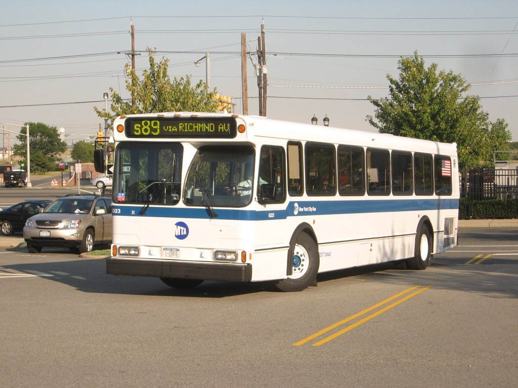
Since September 2007, the S89 bus route of the Metropolitan Transit Authority of the New York City metro area provides a link from 34th Street station to Staten Island. A 397-space park and ride lot has also been built at the station.
In 2005, eight PCC streetcars from the Newark City Subway were given to the Bayonne to be rehabilitated and operated along a proposed 2.5 mi loop to connect the station to MOTBY, the former naval base being redeveloped as cruise port, residential and recreation area. As of 2015, plans call for a pedestrian bridge over Route 440 connecting the station to the new developments. In 2017, the North Jersey Transportation Planning Authority allocated funds for the study of bridge plans for which the City of Bayonne has $4 million to build. A concept development report for this bridge was completed in 2024, which gave a cost estimate of $10 million for constructing the preferred option of a fully enclosed overhead bridge.
References
References
- "34th Street Station (Bayonne)".
- (1908). "Papers Read Before the Historical Society of Hudson County". Historical Society of Hudson County.
- Bernhart, Benjamin L.. (2004). "Historic Journeys By Rail: Central Railroad of New Jersey Stations, Structures & Marine Equipment". Outer Station Project.
- (March 1, 1967). "18 Stations on Railroad Cutback List". [[The Asbury Park Press]].
- (May 1, 1967). "Shore Commuters Gripe About Standing". The Daily Home News.
- (August 7, 1978). "DOT Gives Farewell Toots to Underused 'Bayonne Scoots'". The Home News.
- (April 16, 2000). "Leaders Cheer Light Rail Opening as Hudson Steps Into 21st Century". The Jersey Journal.
- (February 4, 2018). "S89 Bus Timetable".
- Lin, Jonathan. (October 19, 2015). "What's planned for Bayonne's MOT? City officials, developers give an overview". The Jersey Journal.
- Zeitlinger, Ron. (27 January 2017). "What one city is doing to avoid repeat of roadway tragedy". The Jersey Journal.
- (April 15, 2024). "Pedestrian Bridge over Route 440 Concept Development Study".
- "Concept Report for Pedestrian Bridge Over Route 440 Complete".
This article was imported from Wikipedia and is available under the Creative Commons Attribution-ShareAlike 4.0 License. Content has been adapted to SurfDoc format. Original contributors can be found on the article history page.
Ask Mako anything about 34th Street station (Hudson–Bergen Light Rail) — get instant answers, deeper analysis, and related topics.
Research with MakoFree with your Surf account
Create a free account to save articles, ask Mako questions, and organize your research.
Sign up freeThis content may have been generated or modified by AI. CloudSurf Software LLC is not responsible for the accuracy, completeness, or reliability of AI-generated content. Always verify important information from primary sources.
Report