Whyte Avenue
Avenue in Edmonton, Alberta, Canada
title: "Whyte Avenue" type: doc version: 1 created: 2026-02-28 author: "Wikipedia contributors" status: active scope: public tags: ["shopping-districts-and-streets-in-canada", "roads-in-edmonton"] description: "Avenue in Edmonton, Alberta, Canada" topic_path: "geography/canada" source: "https://en.wikipedia.org/wiki/Whyte_Avenue" license: "CC BY-SA 4.0" wikipedia_page_id: 0 wikipedia_revision_id: 0
::summary Avenue in Edmonton, Alberta, Canada ::
::data[format=table title="Infobox street"]
| Field | Value |
|---|---|
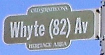
| marker_image | [[File:Whyte (82) Av.jpg]] |
| name | Whyte Avenue |
| alternate_name | 82 Avenue |
| maint | the City of Edmonton |
| namesake | Sir William Whyte |
| length_km | 7.2 |
| length_ref | |
| image_map | {{Location map+ |
| caption | Start/End points of Whyte (82) Avenue |
| width | 230 |
| {{Location map~ | Edmonton |
| {{Location map~ | Edmonton |
| inauguration_date | 1890s |
| direction_a | West |
| terminus_a | 114 Street / University Avenue |
| junction | 109 Street, 104 Street, Gateway Boulevard, 75 Street |
| direction_b | East |
| terminus_b | Sherwood Park Freeway |
| location | Edmonton |
| :: |
|marker_image=[[File:Whyte (82) Av.jpg]] |name=Whyte Avenue |alternate_name=82 Avenue |maint= the City of Edmonton |namesake=Sir William Whyte |length_km=7.2 |length_ref= |length_notes= |image_map = {{Location map+ |Edmonton |caption=Start/End points of Whyte (82) Avenue |width=230 |places= |inauguration_date=1890s |decommissioned= |direction_a=West |terminus_a=114 Street / University Avenue |junction=109 Street, 104 Street, Gateway Boulevard, 75 Street |direction_b=East |terminus_b=Sherwood Park Freeway |location=Edmonton
::figure[src="https://upload.wikimedia.org/wikipedia/commons/d/d0/Old_Strathcona_(looking_east_from_104th_Street).JPG" caption="Whyte (82) Avenue, looking east from 104 Street."] ::
Whyte (82) Avenue is an arterial road in south-central Edmonton, Alberta, Canada. It became the main street of the City of Strathcona as it formed, and now runs through Old Strathcona. It was named in 1891 after Sir William Whyte, the superintendent of the CPR's western division from 1886 to 1897, knighted by King George V in 1911. Whyte (82) Avenue is part of a 40 km continuous roadway that runs through Sherwood Park, Edmonton, and St. Albert that includes Wye Road, Sherwood Park Freeway, portions of University Avenue and Saskatchewan Drive, Groat Road, and St. Albert Trail.
The roadway was originally the core of the city of Strathcona and was the division between the north and south quadrants, and Main Street, now 104 Street (Calgary Trail) was the division between the west and east quadrants. In 1912, Edmonton and Strathcona amalgamated, and Edmonton adopted its present numbering system. Whyte Avenue was co-designated 82 Avenue, which allowed it to keep both names. As Alberta's highway system developed, Whyte Avenue became part of Highway 2 (previously Highway 1 prior to 1941) between 104 Street and 109 Street, and it was part of Highway 14 east of 104 Street. The highway designations were moved to Whitemud Drive in the 1980s.
A small section of 82 Avenue exists as a collector road between 71 Street and 50 Street, where the main roadway transitions to the Sherwood Park Freeway.
Neighbourhoods
List of neighbourhoods Whyte (82) Avenue runs through, in order from west to east:
Major intersections
Starting at the west end of University Avenue. |km=-0.8 |road=Saskatchewan Drive |notes=As University Avenue; roadway continues as Saskatchewan Drive to Groat Road |type=trans |km=0.0 |mspan=2 |road= 114 Street |notes=Adjacent to at-grade LRT crossing; becomes Whyte (82) Avenue; access to University of Alberta and University of Alberta Hospital |type=incomplete |km=0.5 |road=112 Street |notes=No southbound exit; alternate access to University of Alberta |km=1.0 |road=109 Street |notes=Former |km=2.0 |road= |notes=One-way (southbound); former Hwy 2 south |km=2.2 |road=Gateway Boulevard (103 Street) |notes=One-way (northbound); access to City Centre; former |km=2.7 |road=99 Street |notes= |km=3.6 |place=Crosses the Mill Creek Ravine |km=4.0 |road=Rue Marie-Anne Gaboury / 91 Street |notes=Access to Campus Saint-Jean |km=4.8 |road=83 Street |notes=Access to Bonnie Doon Shopping Centre and City Centre |km=5.6 |road=75 Street |notes= |type=trans |km=6.0 |mspan=2 |road=71 Street / 82 AvenueSherwood Park Freeway |notes=Roadway continues east as Sherwood Park Freeway; 82 Avenue continues as minor street to 50 Street; former
References
References
- "Whyte (82) Avenue in Edmonton, AB".
- Monto, Tom. Old Strathcona - Edmonton's Southside Roots (Edmonton: Crang Publishing/Alhambra Books, 2011).
- (1911). "Mundy’s Map of The Twin Cities Edmonton & Strathcona". The Mundy Blueprint Co..
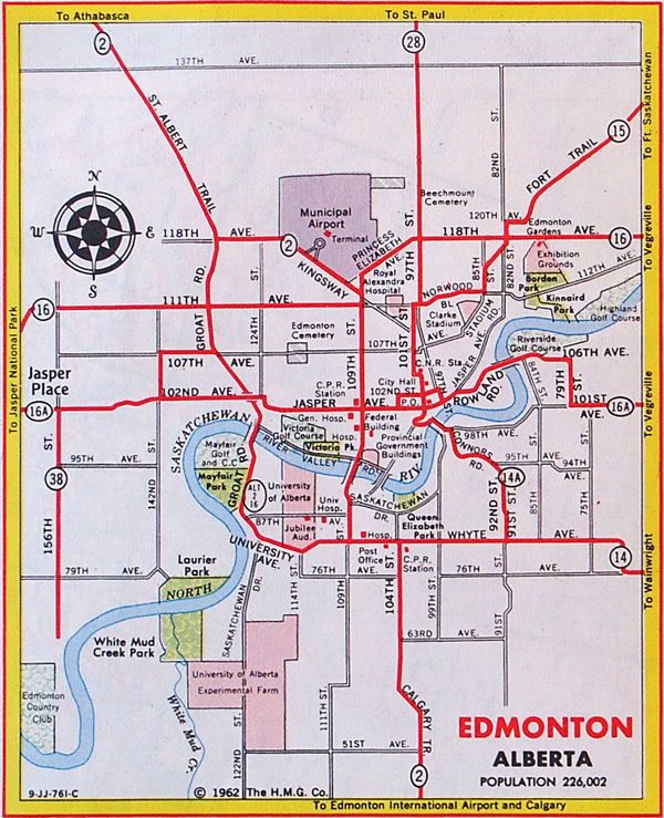
- (1962). "Alberta Official Road Map". Government of the Province of Alberta.
::callout[type=info title="Wikipedia Source"] This article was imported from Wikipedia and is available under the Creative Commons Attribution-ShareAlike 4.0 License. Content has been adapted to SurfDoc format. Original contributors can be found on the article history page. ::