Sunriver, Oregon

Unincorporated community in the state of Oregon, United States
title: "Sunriver, Oregon" type: doc version: 1 created: 2026-02-28 author: "Wikipedia contributors" status: active scope: public tags: ["planned-communities-in-the-united-states", "unincorporated-communities-in-deschutes-county,-oregon", "census-designated-places-in-oregon", "1968-establishments-in-oregon", "unincorporated-communities-in-oregon"] description: "Unincorporated community in the state of Oregon, United States" topic_path: "geography/united-states" source: "https://en.wikipedia.org/wiki/Sunriver,_Oregon" license: "CC BY-SA 4.0" wikipedia_page_id: 0 wikipedia_revision_id: 0
::summary Unincorporated community in the state of Oregon, United States ::
::data[format=table title="Infobox settlement"]
| Field | Value |
|---|---|
| name | Sunriver, Oregon |
| settlement_type | Census-designated place |
| image_skyline | 2017-07-12 Sunriver 01.jpg |
| imagesize | 240 |
| image_caption | Entrance to Sunriver in 2017 |
| pushpin_map | USA#Oregon |
| pushpin_label | Sunriver |
| pushpin_relief | 1 |
| subdivision_type | Country |
| subdivision_name | United States |
| subdivision_type1 | State |
| subdivision_name1 | Oregon |
| subdivision_type2 | County |
| subdivision_name2 | Deschutes |
| unit_pref | Imperial |
| area_footnotes | |
| area_total_sq_mi | 8.99 |
| area_total_km2 | 23.27 |
| area_land_sq_mi | 8.85 |
| area_land_km2 | 22.92 |
| area_water_sq_mi | 0.14 |
| area_water_km2 | 0.36 |
| population_as_of | 2020 |
| population_total | 2023 |
| population_footnotes | |
| population_density_km2 | 88.27 |
| population_density_sq_mi | 228.61 |
| timezone | PST |
| utc_offset | −08:00 |
| timezone_DST | PDT |
| utc_offset_DST | −07:00 |
| coordinates | |
| elevation_footnotes | |
| elevation_ft | 4170 |
| postal_code_type | ZIP Code |
| postal_code | 97707 |
| area_codes | 458 and 541 |
| blank_name | FIPS code |
| blank_info | 41-71250 |
| blank1_name | GNIS feature ID |
| blank1_info | 2584426 |
| :: |
|name = Sunriver, Oregon |settlement_type = Census-designated place |image_skyline = 2017-07-12 Sunriver 01.jpg |imagesize = 240 |image_caption = Entrance to Sunriver in 2017 |pushpin_map = USA#Oregon |pushpin_label = Sunriver |pushpin_relief = 1 |subdivision_type = Country |subdivision_name = United States |subdivision_type1 = State |subdivision_name1 = Oregon |subdivision_type2 = County |subdivision_name2 = Deschutes |government_footnotes = |government_type = |established_title = |established_date = |unit_pref = Imperial |area_footnotes = |area_total_sq_mi = 8.99 |area_total_km2 = 23.27 |area_land_sq_mi = 8.85 |area_land_km2 = 22.92 |area_water_sq_mi = 0.14 |area_water_km2 = 0.36 |population_as_of = 2020 |population_total = 2023 |population_footnotes = |population_density_km2 = 88.27 |population_density_sq_mi = 228.61 |timezone = PST |utc_offset = −08:00 |timezone_DST = PDT |utc_offset_DST = −07:00 |coordinates = |elevation_footnotes = |elevation_ft = 4170 |postal_code_type = ZIP Code |postal_code = 97707 |area_codes = 458 and 541 |blank_name = FIPS code |blank_info = 41-71250 |blank1_name = GNIS feature ID |blank1_info = 2584426
Sunriver is a census-designated place and 3300 acre planned residential and resort community in Deschutes County, Oregon, United States. As of the 2020 census it had a population of 2,023, an increase from 1,393 in 2010. It is part of the Bend Metropolitan Statistical Area, located on the eastern side of the Deschutes River, about 15 mi south of Bend at the base of the Cascade Range.
Sunriver consists of residential homesites and common areas, recreational facilities, the Sunriver Resort and a commercial development known as The Village at Sunriver.
History
Sunriver is located on the grounds of the former Camp Abbot, a World War II training facility designed to train combat engineers in a simulated combat environment. The U.S. Army camp opened in 1942, but by June 1944 the camp was abandoned and most of the settlement was razed.{{cite web | url = https://www.nwp.usace.army.mil/pa/fuds/abbott/home.asp | title = Formerly Used Defense Sites - Portland District - US Army Corps of Engineers | publisher = US Army Corps of Engineers | accessdate = 2007-09-27
The Officers' Club was spared; it has been preserved and renovated and is now known as the "Great Hall," under management of Sunriver Resort. The name "Sunriver" was selected by developers John Gray and Donald V. McCallum. The initial condominiums were built in 1968 in conjunction with the completion of Sunriver Lodge, and in 1969 the master plan was completed and developers began selling lots.{{cite web |url = http://www.co.deschutes.or.us/go/visiting/history/city-history/sunriver |title = Sunriver History |work = Deschutes County Government, Oregon |access-date = 2007-09-27 |url-status = dead |archive-url = https://web.archive.org/web/20090613064030/http://www.co.deschutes.or.us/go/visiting/history/city-history/sunriver |archive-date = 2009-06-13 |df = | url = http://sunriver-resort.com/resort-history.php | title = Resort History – Sunriver Oregon Lodging | publisher = Sunriver Resort | accessdate = 2007-09-27 |archiveurl = https://web.archive.org/web/20070730121142/http://www.sunriver-resort.com/resort-history.php |archivedate = 2007-07-30}}
Sunriver was also the site of the pioneer Shonquest Ranch. Sunriver post office was established on July 18, 1969, at the same time as the public facilities were opened.
Geography
Climate
This region experiences warm (but not hot) and dry summers, with no average monthly temperatures above 71.6 F. According to the Köppen Climate Classification system, Sunriver has a warm-summer Mediterranean climate, abbreviated "Csb" on climate maps.
|location = Sunriver, Oregon, 1991–2020 normals, 1998–2021 extremes: 4180ft (1274m) |single line = Yes |collapsed = Y |Jan record high F = 62 |Feb record high F = 66 |Mar record high F = 78 |Apr record high F = 84 |May record high F = 93 |Jun record high F = 101 |Jul record high F = 102 |Aug record high F = 101 |Sep record high F = 102 |Oct record high F = 89 |Nov record high F = 72 |Dec record high F = 64
|Jan avg record high F = 52.4 |Feb avg record high F = 56.6 |Mar avg record high F = 66.5 |Apr avg record high F = 76.7 |May avg record high F = 83.8 |Jun avg record high F = 89.5 |Jul avg record high F = 96.2 |Aug avg record high F = 96.7 |Sep avg record high F = 92.0 |Oct avg record high F = 80.5 |Nov avg record high F = 63.6 |Dec avg record high F = 51.5 |year avg record high F = 97.9
|Jan high F = 39.8 |Feb high F = 43.1 |Mar high F = 49.7 |Apr high F = 56.6 |May high F = 64.7 |Jun high F = 72.0 |Jul high F = 84.1 |Aug high F = 83.1 |Sep high F = 75.8 |Oct high F = 61.9 |Nov high F = 46.3 |Dec high F = 37.5 |year high F =
|Jan mean F = 29.7 |Feb mean F = 32.1 |Mar mean F = 37.0 |Apr mean F = 40.6 |May mean F = 48.8 |Jun mean F = 54.6 |Jul mean F = 62.5 |Aug mean F = 61.6 |Sep mean F = 54.9 |Oct mean F = 44.9 |Nov mean F = 35.1 |Dec mean F = 28.3 |year mean F =
|Jan low F = 19.6 |Feb low F = 21.1 |Mar low F = 24.2 |Apr low F = 24.6 |May low F = 32.9 |Jun low F = 37.2 |Jul low F = 41.0 |Aug low F = 40.1 |Sep low F = 34.0 |Oct low F = 27.8 |Nov low F = 24.0 |Dec low F = 19.0 |year low F =
|Jan avg record low F = 2.0 |Feb avg record low F = 4.5 |Mar avg record low F = 10.5 |Apr avg record low F = 15.5 |May avg record low F = 20.2 |Jun avg record low F = 26.6 |Jul avg record low F = 31.5 |Aug avg record low F = 30.3 |Sep avg record low F = 23.0 |Oct avg record low F = 14.3 |Nov avg record low F = 6.0 |Dec avg record low F = -2.8 |year avg record low F = -7.4
|Jan record low F = -15 |Feb record low F = -16 |Mar record low F = -3 |Apr record low F = 10 |May record low F = 11 |Jun record low F = 16 |Jul record low F = 19 |Aug record low F = 24 |Sep record low F = 12 |Oct record low F = -8 |Nov record low F = -8 |Dec record low F = -27 |year record low F =
|precipitation colour = green |Jan precipitation inch = 2.86 |Feb precipitation inch = 1.91 |Mar precipitation inch = 1.54 |Apr precipitation inch = 1.16 |May precipitation inch = 1.71 |Jun precipitation inch = 1.09 |Jul precipitation inch = 0.52 |Aug precipitation inch = 0.55 |Sep precipitation inch = 0.75 |Oct precipitation inch = 1.44 |Nov precipitation inch = 2.43 |Dec precipitation inch = 3.16 |year precipitation inch =
|Jan snow inch = 12.2 |Feb snow inch = 11.5 |Mar snow inch = 5.0 |Apr snow inch = 2.1 |May snow inch = 0.3 |Jun snow inch = 0.0 |Jul snow inch = 0.0 |Aug snow inch = 0.0 |Sep snow inch = 0.0 |Oct snow inch = 0.6 |Nov snow inch = 6.3 |Dec snow inch = 15.7 |year snow inch =
|source 1 = NOAA |url = https://www.ncei.noaa.gov/access/services/data/v1?dataset=normals-monthly-1991-2020&startDate=0001-01-01&endDate=9996-12-31&stations=USC00358246&format=pdf |title = Sunriver, Oregon 1991-2020 Monthly Normals |access-date = March 13, 2024 |source 2 = XMACIS2 (records, monthly max/mins & 1999-2021 snow) |url = https://xmacis.rcc-acis.org/ |publisher = National Oceanic and Atmospheric Administration |title = xmACIS |access-date = March 13, 2024
::figure[src="https://upload.wikimedia.org/wikipedia/commons/c/c8/2017-08-15_Sunriver_35.jpg" caption="Three Rivers School in Sunriver"] ::
Demographics
|align=left |1990= 744 |2000= 1393 |2010= 1393 |2020= 2023 |footnote=U.S. Decennial Census
Education
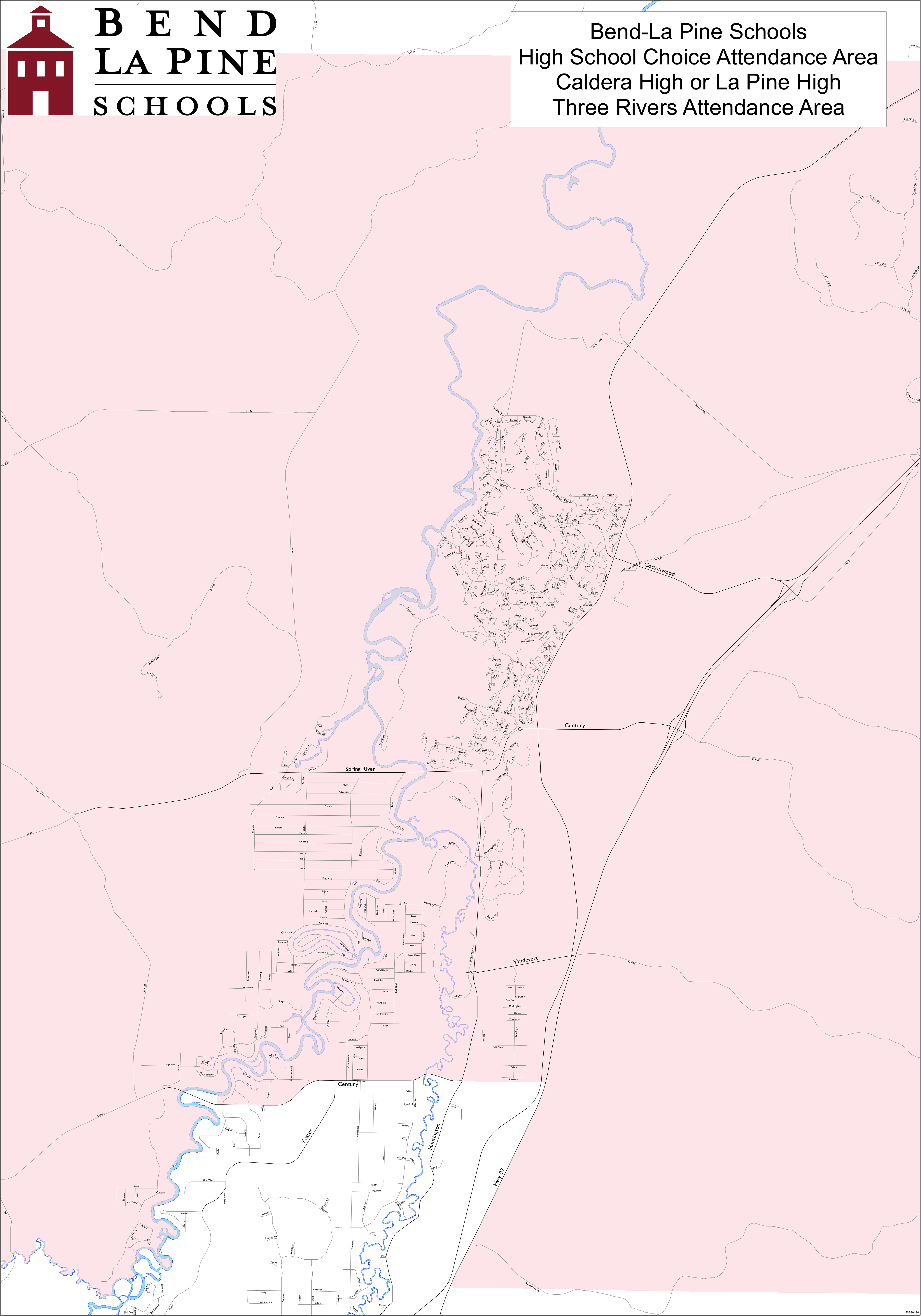
It is in the Bend-La Pine School District. Zoned schools are:
- Three Rivers School
- Residents may choose between Caldera High School or La Pine High School.
Deschutes County is in the boundary of Central Oregon Community College.
Deschutes Public Library operates the Sunriver Library.
References
References
- "ArcGIS REST Services Directory". United States Census Bureau.
- {{GNIS. 2584426
- "Geographic Identifiers: 2010 Demographic Profile Data (G001): Sunriver CDP, Oregon". U.S. Census Bureau, American Factfinder.
- "Census Population API". United States Census Bureau.
- (July 29, 1973). "Come stake a claim on your cabin in the fun!". Eugene Register-Guard.
- {{Cite OGN. 7th
- "Sunriver, Oregon". Canty Media.
- "Census of Population and Housing". Census.gov.
- Geography Division. (December 18, 2020). "2020 CENSUS - SCHOOL DISTRICT REFERENCE MAP: Deschutes County, OR". [[U.S. Census Bureau]].
- Geography Division. (April 9, 2021). "2020 CENSUS - CENSUS BLOCK MAP: Sunriver CDP, OR". [[U.S. Census Bureau]].
- "La Pine and Sunriver Area Map". [[Bend-La Pine School District]].
- "High School Choice Attendance Area". [[Bend-La Pine School District]].
- "Oregon Community Colleges and Community College Districts". [[Oregon Department of Community Colleges & Workforce Development]].
- "Libraries". [[Deschutes Public Library]].
::callout[type=info title="Wikipedia Source"] This article was imported from Wikipedia and is available under the Creative Commons Attribution-ShareAlike 4.0 License. Content has been adapted to SurfDoc format. Original contributors can be found on the article history page. ::