Ōtāne
Town in Hawke's Bay, New Zealand
title: "Ōtāne" type: doc version: 1 created: 2026-02-28 author: "Wikipedia contributors" status: active scope: public tags: ["central-hawke's-bay-district", "populated-places-in-hawke's-bay"] description: "Town in Hawke's Bay, New Zealand" topic_path: "general/central-hawke-s-bay-district" source: "https://en.wikipedia.org/wiki/Ōtāne" license: "CC BY-SA 4.0" wikipedia_page_id: 0 wikipedia_revision_id: 0
::summary Town in Hawke's Bay, New Zealand ::
::data[format=table title="Infobox settlement"]
| Field | Value |
|---|---|
| name | Ōtāne |
| coordinates | |
| mapframe | yes |
| mapframe-zoom | 9 |
| area_footnotes | |
| area_total_km2 | 0.94 |
| population_footnotes | |
| population_as_of | |
| population_total | |
| population_density_km2 | auto |
| subdivision_type | Country |
| subdivision_name | New Zealand |
| subdivision_type1 | Region |
| subdivision_name1 | Hawke's Bay |
| subdivision_type2 | Territorial authority |
| subdivision_name2 | Central Hawke's Bay District |
| subdivision_type3 | Ward |
| subdivision_name3 | Aramoana-Ruahine |
| seat_type | Electorates |
| seat | |
| leader_title | Territorial Authority |
| leader_name | Central Hawke's Bay District Council |
| leader_title1 | Regional council |
| leader_name1 | Hawke's Bay Regional Council |
| leader_title2 | Mayor of Central Hawke's Bay |
| leader_name2 | |
| leader_title3 | Tukituki MP |
| leader_name3 | |
| leader_title4 | Ikaroa-Rāwhiti MP |
| leader_name4 | |
| elevation_m | 95 |
| :: |
| name = Ōtāne | settlement_type = | image_skyline = | image_alt = | image_caption = | etymology = | nickname = | coordinates = | mapframe = yes | mapframe-zoom = 9 | area_footnotes = | area_total_km2 = 0.94 | population_footnotes = | population_as_of = | population_total = | population_density_km2 = auto | subdivision_type = Country | subdivision_name = New Zealand | subdivision_type1 = Region | subdivision_name1 = Hawke's Bay | subdivision_type2 = Territorial authority | subdivision_name2 = Central Hawke's Bay District | subdivision_type3 = Ward | subdivision_name3 = Aramoana-Ruahine | seat_type = Electorates | seat = | leader_title = Territorial Authority | leader_name = Central Hawke's Bay District Council | leader_title1 = Regional council | leader_name1 = Hawke's Bay Regional Council | leader_title2 = Mayor of Central Hawke's Bay | leader_name2 = | leader_title3 = Tukituki MP | leader_name3 = | leader_title4 = Ikaroa-Rāwhiti MP | leader_name4 = | elevation_m = 95
Ōtāne is a town in the Central Hawke's Bay District and the Hawke's Bay region, on the east coast of New Zealand's North Island. The small village has a school, general store, cafe and pub, and is located just off State Highway 2.
History
The town was founded in 1874, during a subdivision of Henry Tiffen's 5140-hectare Homewood farming estate. The first sales of Kaikora township sections were on 26 March 1874. It became the centre of the Patangata County from 1885 to 1977. The county took its name from a nearby Māori pā.
Name
On 1 April 1910 the Post Department changed the name from Kaikora North to Otane, to avoid confusion with Kaikōura. The name of the railway station was changed a month later. An 1869 advert mentioned Otane bush, Kaikora.
In July 2020, the name of the locality was officially gazetted as Ōtāne by the New Zealand Geographic Board, having previously often been written as Otane. The New Zealand Ministry for Culture and Heritage gives a translation of "place of a man" for Ōtāne. ::figure[src="https://upload.wikimedia.org/wikipedia/commons/b/b5/Ōtāne_in_1958.png" caption="Ōtāne railway station in 1958"] ::
Library
Tenders for a new public library were invited in 1883 and it was open by 1884. It was replaced in 1929 by a building which also contained council and medical offices. It is now occupied by Henry's Family Pies, cafe and store. A war memorial is next to the former library.
Railway station
Initially the township was served by mail coaches running between Napier and Waipukurau. Ōtāne (at that time Kaikora) railway station opened on Monday 28 August 1876, when the railway was extended from Te Aute to Waipawa. as part of the Palmerston North–Gisborne Line. It was part of the Paki Paki to Waipukurau contract, tendered on 9 July 1874 for £19,532 by Charles McKirdy, of Wellington, who built the Rimutaka Incline and several other lines. A local contractor tendered £29,173. There were allegations of mismanagement and disputes about the contracts. However, in 1876, the Minister for Public Works, Edward Richardson, attributed delays only to unexpectedly heavy land claims and floods. S Tracey and Allen, of Napier, tendered £7,989 for track for the Paki Paki-Waipawa length in September 1875. Ōtāne started with 2 trains a day in each direction, increased to 3 in 1883 and 4 in 1896.
By March 1876 Justin McSweeney had built a platform and station, McLeod & Co a 5th class stationmaster's house and Joseph Sowry a goods shed and water tank. In 1884 the station was enlarged and a loading ramp, cattle and sheep yards added. That station burnt down on 1 February 1894. By 1896 Kaikora had a 5th class station, platform (154 ft long in 1926), cart approach, 40 ft x 30 ft goods shed, loading bank, cattle yards, stationmaster's house, urinals and a passing loop for 26 wagons. In 1940 the loop was extended for 80 wagons. There was a Post Office at the station from 1883 to 1912. In 1912 an automatic tablet exchanger was added. Railway houses were built in 1927, 1945 and 1953. In 1966 a new 500 ft2 station was built of concrete blocks, with an aluminium roof on the same site. On 9 October 1967 Ōtāne closed as an officered station and on 8 June 1985 it closed to all traffic. Only a short platform remains.
Demographics
Statistics New Zealand describes Ōtāne as a rural settlement, which covers 0.94 km2. and had an estimated population of as of with a population density of people per km2. Ōtāne is part of the larger Mangarara statistical area.
Ōtāne had a population of 762 in the 2023 New Zealand census, an increase of 99 people (14.9%) since the 2018 census, and an increase of 219 people (40.3%) since the 2013 census. There were 348 males and 408 females in 282 dwellings. 2.8% of people identified as LGBTIQ+. The median age was 38.9 years (compared with 38.1 years nationally). There were 165 people (21.7%) aged under 15 years, 96 (12.6%) aged 15 to 29, 357 (46.9%) aged 30 to 64, and 141 (18.5%) aged 65 or older.
People could identify as more than one ethnicity. The results were 76.4% European (Pākehā), 33.5% Māori, 3.5% Pasifika, 3.9% Asian, and 3.1% other, which includes people giving their ethnicity as "New Zealander". English was spoken by 96.5%, Māori by 9.8%, Samoan by 1.2%, and other languages by 5.5%. No language could be spoken by 3.1% (e.g. too young to talk). New Zealand Sign Language was known by 0.4%. The percentage of people born overseas was 14.6, compared with 28.8% nationally.
Religious affiliations were 29.1% Christian, 0.4% Hindu, 0.4% Islam, 2.8% Māori religious beliefs, 0.8% New Age, and 0.4% other religions. People who answered that they had no religion were 56.7%, and 9.1% of people did not answer the census question.
Of those at least 15 years old, 84 (14.1%) people had a bachelor's or higher degree, 354 (59.3%) had a post-high school certificate or diploma, and 159 (26.6%) people exclusively held high school qualifications. The median income was $38,400, compared with $41,500 nationally. 42 people (7.0%) earned over $100,000 compared to 12.1% nationally. The employment status of those at least 15 was 303 (50.8%) full-time, 75 (12.6%) part-time, and 18 (3.0%) unemployed.
Education
Ōtāne School is a Year 1–8 co-educational state primary school. It is a decile 3 school with a roll of as of The first Otane School was built in 1868, but burned in 1899 and was rebuilt on the present site.
Argyll East School is a Year 1–8 co-educational state primary school. It is a decile 4 school with a roll of as of The school opened in 1903.
References
References
- "Otane, Hawke's Bay". NZ Topo Map.
- "Otane official website". Central Hawke's Bay District Council.
- (28 Mar 1874). "TELEGRAMS. NEW ZEALAND MAIL".
- "Otane". [[Ministry for Culture and Heritage]].
- (18 Mar 1910). "Local and General. HASTINGS STANDARD".
- (11 Dec 1909). "Re-naming Kaikora North. WAIPAWA MAIL".
- "Station Archive".
- (21 May 1869). "HAWKE'S BAY HERALD".
- (16 July 2020). "Notice of approved official geographic names". New Zealand Gazette.
- (6 August 2019). "1000 Māori place names". New Zealand Ministry for Culture and Heritage.
- (26 Oct 1883). "WAIPAWA MAIL".
- (9 May 1884). "WAIPAWA MAIL".
- (20 May 1929). "Otane's Day. WAIPAWA MAIL".
- (6 Feb 2021). "Otane Country Fair".
- "Otane war memorial".
- (23 Jan 1874). "HAWKE'S BAY TIMES".
- "Station Archive".
- (9 July 1874). "Untitled". The Evening Post.
- (9 January 1883). "DAILY TELEGRAPH".
- (28 April 1896). "RAILWAY TIME-TABLE. HASTINGS STANDARD".
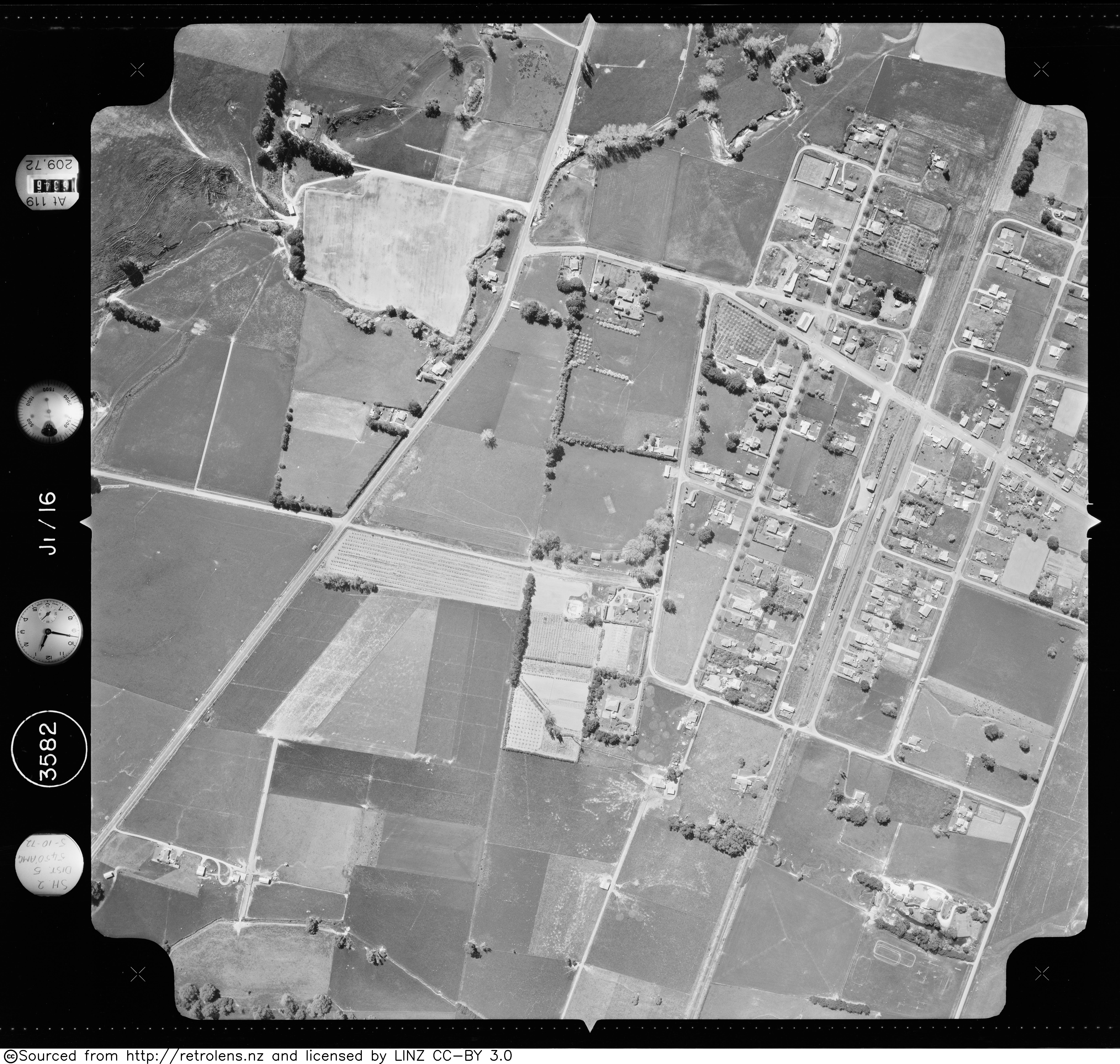
- (5 October 1972). "Survey: SN3582 Run: J1 Photo: 16".
- (Aug 2013). "Carruthers St".
- (1993). "New Zealand Railway and Tramway Atlas". Quail Map Company.
- "Stats NZ Geographic Data Service".
- "Geographic Boundary Viewer". Stats NZ.
- {{NZ census 2018. 7016719–7016722
- "Totals by topic for dwellings, (RC, TALB, UR, SA3, SA2, Ward, Health), 2013, 2018, and 2023 Censuses". Stats NZ – Tatauranga Aotearoa – Aotearoa Data Explorer.
- "Totals by topic for individuals, (RC, TALB, UR, SA3, SA2, Ward, Health), 2013, 2018, and 2023 Censuses". Stats NZ – Tatauranga Aotearoa – Aotearoa Data Explorer.
- "Ministry of Education School Profile". [[Ministry of Education (New Zealand).
- "Education Review Office Report". [[Education Review Office]].
- "William Watts".
- "Otane Primary School 125th jubilee : October 22nd, 23rd, 24th, 1993". National Library of New Zealand.
- "Ministry of Education School Profile". [[Ministry of Education (New Zealand).
- "Education Review Office Report". [[Education Review Office]].
- "Argyll golden jubilee : settlement 1903-55, school 1905-55". National Library of New Zealand.
::callout[type=info title="Wikipedia Source"] This article was imported from Wikipedia and is available under the Creative Commons Attribution-ShareAlike 4.0 License. Content has been adapted to SurfDoc format. Original contributors can be found on the article history page. ::