Gowen County
title: "Gowen County" type: doc version: 1 created: 2026-02-28 author: "Wikipedia contributors" status: active scope: public tags: ["counties-of-new-south-wales"] topic_path: "geography/united-kingdom" source: "https://en.wikipedia.org/wiki/Gowen_County" license: "CC BY-SA 4.0" wikipedia_page_id: 0 wikipedia_revision_id: 0
::data[format=table title="Infobox Australian place"]
| Field | Value |
|---|---|
| type | cadastral |
| name | Gowen |
| state | nsw |
| image | Gowen NSW.PNG |
| caption | Location in New South Wales |
| near-nw | Leichhardt |
| near-n | Baradine |
| near-ne | White |
| near-e | Napier |
| near-se | Napier |
| near-s | Lincoln |
| near-sw | Ewenmar |
| near-w | Ewenmar |
| :: |
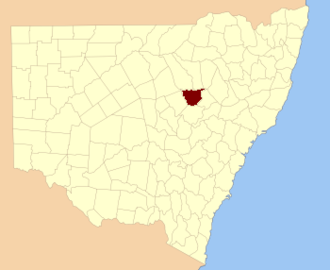
| type = cadastral | name = Gowen | state = nsw | image = Gowen NSW.PNG | caption = Location in New South Wales | near-nw = Leichhardt | near-n = Baradine | near-ne = White | near-e = Napier | near-se = Napier | near-s = Lincoln | near-sw = Ewenmar | near-w = Ewenmar Gowen County is one of the 141 cadastral divisions of New South Wales. It is located to the east of the Castlereagh River in the area to the east of Gilgandra, to Coonabarabran in the north-east. This includes land on both sides of the Newell Highway.
The origin of the name Gowen County is unknown.
Parishes within this county
A full list of parishes found within this county; their current LGA and mapping coordinates to the approximate centre of each location is as follows:
::data[format=table]
References
References
- "Gowen".
::callout[type=info title="Wikipedia Source"] This article was imported from Wikipedia and is available under the Creative Commons Attribution-ShareAlike 4.0 License. Content has been adapted to SurfDoc format. Original contributors can be found on the article history page. ::