Farson, Wyoming
Census-designated place in Sweetwater County, Wyoming, United States
title: "Farson, Wyoming" type: doc version: 1 created: 2026-02-28 author: "Wikipedia contributors" status: active scope: public tags: ["census-designated-places-in-sweetwater-county,-wyoming", "census-designated-places-in-wyoming", "sweetwater-county,-wyoming"] description: "Census-designated place in Sweetwater County, Wyoming, United States" topic_path: "general/census-designated-places-in-sweetwater-county-wyoming" source: "https://en.wikipedia.org/wiki/Farson,_Wyoming" license: "CC BY-SA 4.0" wikipedia_page_id: 0 wikipedia_revision_id: 0
::summary Census-designated place in Sweetwater County, Wyoming, United States ::
::data[format=table title="Infobox settlement"]
| Field | Value |
|---|---|
| official_name | Farson, Wyoming |
| settlement_type | Census-designated place |
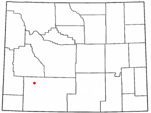
| image_map | WYMap-doton-Farson.PNG |
| mapsize | 250x200px |
| map_caption | Location of Farson, Wyoming |
| subdivision_type | Country |
| subdivision_name | United States |
| subdivision_type1 | State |
| subdivision_name1 | Wyoming |
| subdivision_type2 | County |
| subdivision_name2 | Sweetwater |
| unit_pref | Imperial |
| area_total_km2 | 201.4 |
| area_land_km2 | 195.4 |
| area_water_km2 | 6.1 |
| area_total_sq_mi | 77.8 |
| area_land_sq_mi | 75.4 |
| area_water_sq_mi | 2.4 |
| population_as_of | 2010 |
| population_total | 313 |
| population_density_km2 | 1.6 |
| population_density_sq_mi | 4.2 |
| timezone | Mountain (MST) |
| utc_offset | −7 |
| timezone_DST | MDT |
| utc_offset_DST | −6 |
| elevation_footnotes | |
| elevation_ft | 6595 |
| coordinates | |
| postal_code_type | ZIP code |
| postal_code | 82932 |
| area_code | 307 |
| blank_name | FIPS code |
| blank_info | 56-26055 |
| blank1_name | GNIS feature ID |
| blank1_info | 1588389 |
| :: |
|official_name = Farson, Wyoming |settlement_type = Census-designated place |nickname = |motto =
|image_skyline = |imagesize = |image_caption = |image_flag = |image_seal =
|image_map = WYMap-doton-Farson.PNG |mapsize = 250x200px |map_caption = Location of Farson, Wyoming |image_map1 = |mapsize1 = |map_caption1 =
|subdivision_type = Country |subdivision_name = United States |subdivision_type1 = State |subdivision_name1 = Wyoming |subdivision_type2 = County |subdivision_name2 = Sweetwater
|government_footnotes = |government_type = |leader_title = |leader_name = |leader_title1 = |leader_name1 = |established_title = |established_date =
|unit_pref = Imperial |area_footnotes = |area_magnitude = |area_total_km2 = 201.4 |area_land_km2 = 195.4 |area_water_km2 = 6.1 |area_total_sq_mi = 77.8 |area_land_sq_mi = 75.4 |area_water_sq_mi = 2.4
|population_as_of = 2010 |population_footnotes = |population_total = 313 |population_density_km2 = 1.6 |population_density_sq_mi = 4.2
|timezone = Mountain (MST) |utc_offset = −7 |timezone_DST = MDT |utc_offset_DST = −6 |elevation_footnotes = |elevation_m = |elevation_ft = 6595 |coordinates = |postal_code_type = ZIP code |postal_code = 82932 |area_code = 307 |blank_name = FIPS code |blank_info = 56-26055 |blank1_name = GNIS feature ID |blank1_info = 1588389 |website = |footnotes =
Farson is a census-designated place (CDP) in Sweetwater County, Wyoming, United States. The population was 313 at the 2010 census.
History
Farson and nearby Eden are located near an archaeological site dating to the Protohistoric period. It contains the remains of at least 12 lodges and a massive bone bed of over 200 pronghorn, indicating it was a site for communal hunting and processing. Farson served as a relay station for the Pony Express and stagecoaches was located at the crossing of the Big Sandy River. It served as a vital stop for mail and travelers until 1862. Farson is near Simpsons Hollow, located approximately 10 miles southwest. This site was the location of a famous 1857 raid during the "Utah War." Mormon militia burned 26 U.S. Army supply wagons to prevent federal troops from reaching Salt Lake City. Farson owes its name to John Farson, a Chicago broker and financier. In 1907, under the Carey Act, he backed the Eden Irrigation and Land Company to bring water to the valley.
Demographics
As of the census of 2000, there were 242 people, 96 households, and 69 families residing in the CDP. The population density was 3.2 people per square mile (1.2/km2). There were 118 housing units at an average density of 1.6/sq mi (0.6/km2). The racial makeup of the CDP was 96.28% White, 0.83% African American, 1.65% from other races, and 1.24% from two or more races. Hispanic or Latino of any race were 5.37% of the population.
There were 96 households, out of which 30.2% had children under the age of 18 living with them, 64.6% were married couples living together, 5.2% had a female householder with no husband present, and 28.1% were non-families. 26.0% of all households were made up of individuals, and 9.4% had someone living alone who was 65 years of age or older. The average household size was 2.52 and the average family size was 3.01.
In the CDP, the population was spread out, with 23.6% under the age of 18, 8.7% from 18 to 24, 25.2% from 25 to 44, 31.8% from 45 to 64, and 10.7% who were 65 years of age or older. The median age was 40 years. For every 100 females, there were 103.4 males. For every 100 females age 18 and over, there were 110.2 males.
The median income for a household in the CDP was $44,545, and the median income for a family was $56,806. Males had a median income of $41,364 versus $21,250 for females. The per capita income for the CDP was $16,140. None of the population or families were below the poverty line.
Geography
Farson is located at (42.171927, -109.420096).
According to the United States Census Bureau, the CDP has a total area of 77.8 square miles (201.4 km2), of which 75.4 square miles (195.4 km2) of land and 2.3 square miles (6.1 km2) (3.02%) is water.
Farson lies at the intersection of U.S. 191 and Wyoming Highway 28 (the South Pass Highway). It is 40 miles north of Rock Springs and approximately 45 miles southwest of South Pass.
Climate
According to the Köppen Climate Classification system, Farson has a cold semi-arid climate, abbreviated "BSk" on climate maps. The hottest temperature recorded in Farson was 102 °F on July 9, 2018, while the coldest temperature recorded was -52 °F on December 31, 1978.
|location = Farson, Wyoming, 1991-2020 normals, extremes 1915-present |single line = Yes
|Jan record high F = 55 |Feb record high F = 58 |Mar record high F = 70 |Apr record high F = 81 |May record high F = 89 |Jun record high F = 97 |Jul record high F = 102 |Aug record high F = 109 |Sep record high F = 93 |Oct record high F = 81 |Nov record high F = 71 |Dec record high F = 70
|Jan avg record high F = 39.7 |Feb avg record high F = 43.3 |Mar avg record high F = 58.1 |Apr avg record high F = 70.7 |May avg record high F = 79.0 |Jun avg record high F = 85.3 |Jul avg record high F = 90.0 |Aug avg record high F = 88.0 |Sep avg record high F = 82.1 |Oct avg record high F = 72.3 |Nov avg record high F = 56.3 |Dec avg record high F = 42.7 |year avg record high F = 88.2
|Jan high F = 27.5 |Feb high F = 30.1 |Mar high F = 42.5 |Apr high F = 53.8 |May high F = 64.1 |Jun high F = 74.1 |Jul high F = 82.9 |Aug high F = 80.6 |Sep high F = 71.0 |Oct high F = 57.2 |Nov high F = 41.2 |Dec high F = 29.8 |year high F =
|Jan mean F = 11.5 |Feb mean F = 14.3 |Mar mean F = 28.1 |Apr mean F = 38.0 |May mean F = 47.8 |Jun mean F = 57.0 |Jul mean F = 64.0 |Aug mean F = 62.1 |Sep mean F = 52.1 |Oct mean F = 39.6 |Nov mean F = 25.6 |Dec mean F = 13.7 |year mean F =
|Jan low F = -4.4 |Feb low F = -1.6 |Mar low F = 13.6 |Apr low F = 22.2 |May low F = 31.6 |Jun low F = 39.8 |Jul low F = 45.1 |Aug low F = 43.7 |Sep low F = 33.2 |Oct low F = 22.0 |Nov low F = 9.9 |Dec low F = -2.4 |year low F =
|Jan avg record low F = -24.5 |Feb avg record low F = -21.8 |Mar avg record low F = -4.9 |Apr avg record low F = 11.6 |May avg record low F = 18.7 |Jun avg record low F = 29.0 |Jul avg record low F = 37.1 |Aug avg record low F = 34.3 |Sep avg record low F = 22.6 |Oct avg record low F = 9.4 |Nov avg record low F = -9.2 |Dec avg record low F = -20.2 |year avg record low F = -28.5
|Jan record low F = -49 |Feb record low F = -47 |Mar record low F = -31 |Apr record low F = -24 |May record low F = 5 |Jun record low F = 19 |Jul record low F = 25 |Aug record low F = 21 |Sep record low F = 7 |Oct record low F = -15 |Nov record low F = -34 |Dec record low F = -52
|precipitation colour = green |Jan precipitation inch = 0.34 |Feb precipitation inch = 0.29 |Mar precipitation inch = 0.47 |Apr precipitation inch = 0.79 |May precipitation inch = 1.47 |Jun precipitation inch = 1.05 |Jul precipitation inch = 0.54 |Aug precipitation inch = 0.73 |Sep precipitation inch = 0.85 |Oct precipitation inch = 0.61 |Nov precipitation inch = 0.32 |Dec precipitation inch = 0.37 |year precipitation inch =
|Jan snow inch = 4.8 |Feb snow inch = 5.1 |Mar snow inch = 4.9 |Apr snow inch = 4.1 |May snow inch = 0.4 |Jun snow inch = 0.0 |Jul snow inch = 0.0 |Aug snow inch = 0.0 |Sep snow inch = 0.1 |Oct snow inch = 1.1 |Nov snow inch = 3.3 |Dec snow inch = 4.6 |year snow inch =
|unit precipitation days = 0.01 in |Jan precipitation days = 3.1 |Feb precipitation days = 3.3 |Mar precipitation days = 3.5 |Apr precipitation days = 4.7 |May precipitation days = 6.0 |Jun precipitation days = 4.1 |Jul precipitation days = 3.1 |Aug precipitation days = 3.7 |Sep precipitation days = 4.1 |Oct precipitation days = 3.2 |Nov precipitation days = 2.5 |Dec precipitation days = 3.2
|unit snow days = 0.1 in |Jan snow days = 3.2 |Feb snow days = 3.0 |Mar snow days = 2.6 |Apr snow days = 2.1 |May snow days = 0.3 |Jun snow days = 0.0 |Jul snow days = 0.0 |Aug snow days = 0.0 |Sep snow days = 0.0 |Oct snow days = 0.9 |Nov snow days = 1.9 |Dec snow days = 2.9
|source 1 = NOAA |url = https://www.ncei.noaa.gov/access/services/data/v1?dataset=normals-monthly-1991-2020&stations=USC00483170&format=pdf&dataTypes=MLY-TMAX-NORMAL,MLY-TMIN-NORMAL,MLY-TAVG-NORMAL,MLY-PRCP-NORMAL,MLY-SNOW-NORMAL |publisher = National Oceanic and Atmospheric Administration |title = U.S. Climate Normals Quick Access |access-date = August 17, 2022 |source 2 = National Weather Service |url = https://www.weather.gov/wrh/climate?wfo=riw |publisher = National Weather Service |title = NOAA Online Weather Data |access-date = August 17, 2022
Education
Public education in the community of Farson is provided by Sweetwater County School District #1. Farson-Eden School, a K-12 campus, serves the community. The majority of the students enrolled reside in either Farson or Eden; however, there is a bus that transports students from nearby Rock Springs.
Farson has a public library, a branch of the Sweetwater County Library System.
References
References
- "U.S. Census website". [[United States Census Bureau]].
- {{GNIS. 1588389
- "Eden-Farson Site".
- "Big Sandy Station". National Park Service.
- (July 31, 2017). "Simpson's Hollow, flash point in the Utah War".
- (July 28, 2014). "What's In A Wyoming Name? – Farson".
- (2011-02-12). "US Gazetteer files: 2010, 2000, and 1990". [[United States Census Bureau]].
- "2020 CENSUS - SCHOOL DISTRICT REFERENCE MAP: Sweetwater County, WY". [[U.S. Census Bureau]].
- "Wyoming Public Libraries". PublicLibraries.com.
::callout[type=info title="Wikipedia Source"] This article was imported from Wikipedia and is available under the Creative Commons Attribution-ShareAlike 4.0 License. Content has been adapted to SurfDoc format. Original contributors can be found on the article history page. ::