Dzhugdzhur

Mountain range in eastern Siberia, Russia
title: "Dzhugdzhur" type: doc version: 1 created: 2026-02-28 author: "Wikipedia contributors" status: active scope: public tags: ["landforms-of-the-russian-far-east", "mountain-ranges-of-khabarovsk-krai", "east-siberian-mountains"] description: "Mountain range in eastern Siberia, Russia" topic_path: "geography/russia" source: "https://en.wikipedia.org/wiki/Dzhugdzhur" license: "CC BY-SA 4.0" wikipedia_page_id: 0 wikipedia_revision_id: 0
::summary Mountain range in eastern Siberia, Russia ::
::data[format=table title="Infobox mountain"]
| Field | Value |
|---|---|
| name | Dzhugdzhur |
| native_name | evn |
| other_name | Джугджу́р |
| photo | Liverwort flora of Ayan (10.3897-BDJ.9.e65199) Figure 4.jpg |
| highest | Topko |
| elevation_m | 1906 |
| country | Russia |
| state | Khabarovsk Krai |
| parent | East Siberian Mountains |
| length_km | 700 |
| width_km | 175-200 |
| map_image | Location Dzhugdzhur Mountains.PNG |
| map_caption | Location of the Dzhugdzhur mountain range |
| :: |
|name = Dzhugdzhur |native_name =evn |other_name = Джугджу́р |photo = Liverwort flora of Ayan (10.3897-BDJ.9.e65199) Figure 4.jpg |photo_caption = |highest = Topko |elevation_m = 1906 |elevation_ref = |country = Russia |state = Khabarovsk Krai |region = |district = |border = |geology = |period = |parent = East Siberian Mountains |orogeny = |area_km2 = |length_km = 700 |length_orientation = |width_km = 175-200 |width_orientation = |map_image= Location Dzhugdzhur Mountains.PNG |map_caption = Location of the Dzhugdzhur mountain range |range_coordinates= |range_coordinates_ref=
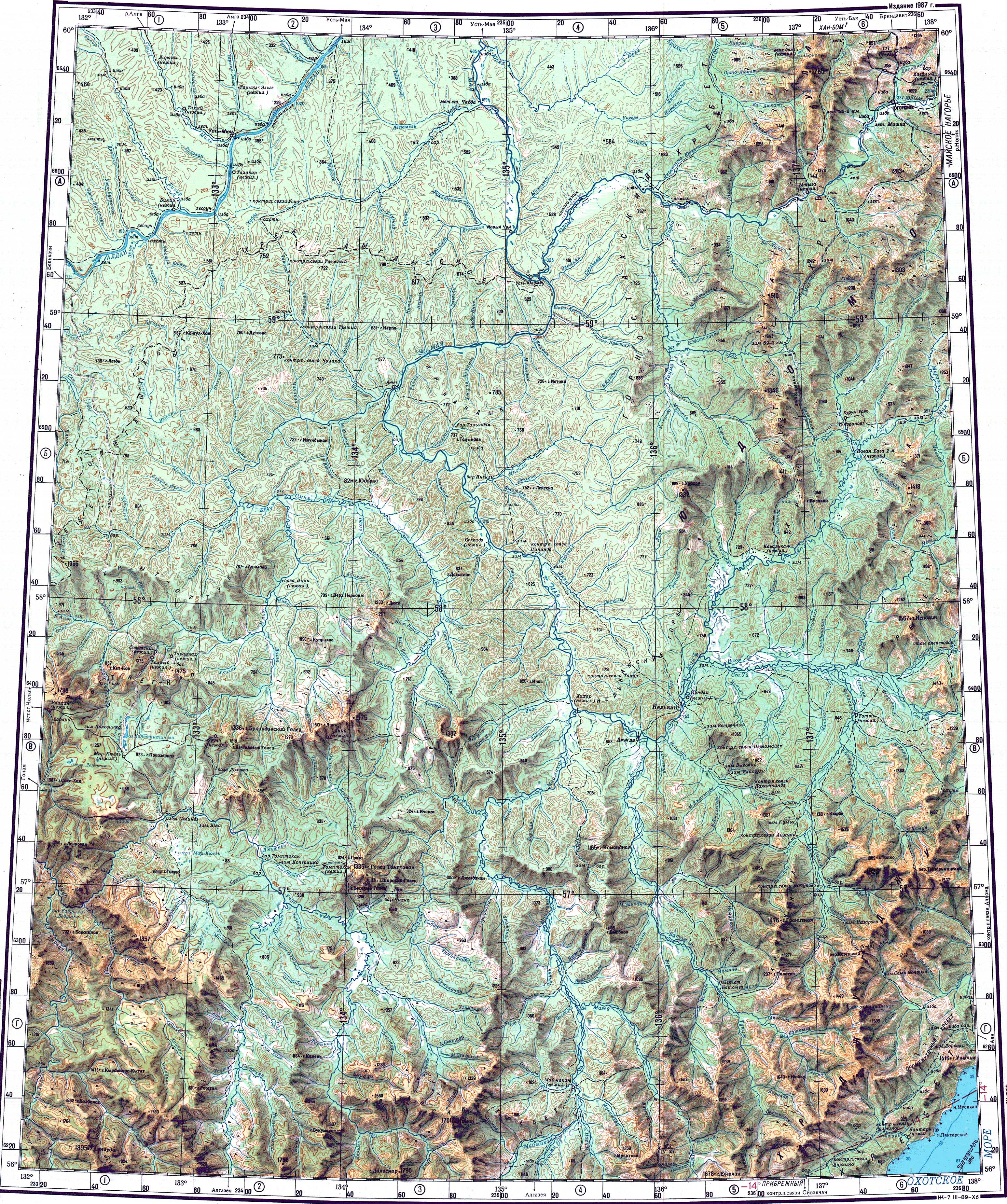
The Dzhugdzhur () or Jugjur, meaning "big bulge" in Evenki, are a mountain range along the western shores of the Sea of Okhotsk, located in Khabarovsk Krai in the far east of Siberia.
The mountains are quite deserted, the one exception being the gold mines that have operated in the range since the 1920s.
Geography
The east range is bound by the northwest coast of the Sea of Okhotsk. To the northwest the range limits with the Yudoma-Maya Highlands, to the southwest with the Stanovoy Range, to the south with the Dzhagdy Range, and to the northeast with the Kolyma Mountains. The Maya, the Maymakan, and the Mati are among the rivers having their source in the range.
Geology
The range was formed by an asymmetrical fold. The southwestern half of the mountains is composed of gneiss and granite from the Precambrian, while the northeast contains Mesozoic shale and limestone as well as Cretaceous and Paleocene igneous rock.
Ecology and climate
The coastal stretch of the range is populated by Japanese stone pine and Dahurian larch. Parts of the range occupied by the Okhotsk-Manchurian taiga ecoregion contain swathes of Jezo spruce up to elevations of 1,300 m.
The climate is wet and cold, with wet rainy summers and severe winters.
References
References
- [[Google Earth]]
- "O-53 Topographic Chart (in Russian)".
- (1970). "The Great Soviet Encyclopedia". Советская Энциклопедия.
::callout[type=info title="Wikipedia Source"] This article was imported from Wikipedia and is available under the Creative Commons Attribution-ShareAlike 4.0 License. Content has been adapted to SurfDoc format. Original contributors can be found on the article history page. ::