Central Mount Stuart
Mountain peak in the Northern Territory, Australia
title: "Central Mount Stuart" type: doc version: 1 created: 2026-02-28 author: "Wikipedia contributors" status: active scope: public tags: ["mountains-of-the-northern-territory"] description: "Mountain peak in the Northern Territory, Australia" topic_path: "general/mountains-of-the-northern-territory" source: "https://en.wikipedia.org/wiki/Central_Mount_Stuart" license: "CC BY-SA 4.0" wikipedia_page_id: 0 wikipedia_revision_id: 0
::summary Mountain peak in the Northern Territory, Australia ::
::data[format=table title="Infobox mountain"]
| Field | Value |
|---|---|
| name | Central Mount Stuart |
| photo | Central_Mt_Stuart.jpg |
| photo_caption | Central Mount Stuart after rain |
| elevation_m | 846 |
| elevation_ref | |
| location | Anmatjere, Northern Territory, Australia |
| coordinates | |
| map | Australia Northern Territory |
| map_caption | Location in the Northern Territory |
| etymology | John McDouall Stuart |
| :: |
| name = Central Mount Stuart | photo = Central_Mt_Stuart.jpg | photo_caption = Central Mount Stuart after rain | elevation_m = 846 | elevation_ref = | prominence = | listing = | location = Anmatjere, Northern Territory, Australia | range = | coordinates = | type = | age = | first_ascent = | easiest_route = | map = Australia Northern Territory | map_caption = Location in the Northern Territory | etymology = John McDouall Stuart
Central Mount Stuart is a mountain peak situated in the southern Northern Territory of Australia. It is easily visible from the nearby Stuart Highway. Around it is the Central Mount Stuart Historical Reserve.
History
The mountain peak lies within the traditional lands of the Anmatyerre people.
It is named in honour of Scottish explorer John McDouall Stuart. Stuart reached the area on 22 April 1860 and determined a point approximately 4 km south-southwest of the peak to be the centre of Australia, (This assessment is not supported by modern geographers—see centre points of Australia.) He climbed to the top the next day, writing in his journal: ::quote Took Kekwick and the flag, and went to the top of the mount, but found it to be much higher and more difficult of ascent than I anticipated. After a deal of labour, slips, and knocks, we at last arrived on the top. It is quite as high as Mount Serle, if not higher. The view to the north is over a large plain of gums, mulga, and spinifex, with watercourses running through it. The large gum creek that we crossed winds round this hill in a north-east direction; at about ten miles it is joined by another. After joining they take a course more north, and I lost sight of them in the far-distant plain. To the north-north-east is the termination of the hills; to the north-east, east and south-east are broken ranges, and to the north-north-west the ranges on the west side of the plain terminate. To the north-west are broken ranges; and to the west is a very high peak, between which and this place to the south-west are a number of isolated hills. Built a large cone of stones, in the centre of which I placed a pole with the British flag nailed to it. Near the top of the cone I placed a small bottle, in which there is a slip of paper, with our signatures to it, stating by whom it was raised. We then gave three hearty cheers for the flag, the emblem of civil and religious liberty, and may it be a sign to the natives that the dawn of liberty, civilization, and Christianity is about to break upon them. We can see no water from the top. Descended, but did not reach the camp till after dark. ::
Stuart originally named the peak Central Mount Sturt, after his former expedition leader Charles Sturt. The name was changed (possibly at the instigation of James Chambers) soon after Stuart's return at Adelaide at the end of the expedition, such that Central Mount Stuart is the name that appeared in the published expedition journal.
Stuart's route was followed by the Adelaide-to-Darwin cross-continental Overland Telegraph Line, completed in 1872, and the Central Australia Railway, built between 1878 and 1929. After the telegraph line had been completed and the first messages sent, Sir Charles Todd and surveyor Richard Randall Knuckey returned to Adelaide from Central Mount Stuart.
Description
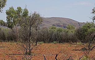
::figure[src="https://upload.wikimedia.org/wikipedia/commons/2/2f/Top_Central_Mt_Stuart.jpg" caption="View looking north from the summit of Central Mount Stuart"] ::
Central Mount Stuart is a prominent landmark, easily visible from the nearby Stuart Highway, which at closest approach lies about 6 km to the southeast. The dark red sandstone that comprise the peak, referred to by geologists as Central Mount Stuart Formation, form part of the Georgina Basin.
Around it is the Central Mount Stuart Historical Reserve.
References
Other external resources
References
- {{Gazetteer of Australia. (August 2019)
- "Place Names Register Extract for "Central Mount Stuart"". Northern Territory Government.
- [https://www.gutenberg.org/ebooks/8911 Journals of John McDouall Stuart at Project Gutenberg]. Retrieved 4 January 2007
- [http://www.ntlis.nt.gov.au/placenames/view.jsp?id=11668 Northern Territory Place Names Register]. Retrieved 1 October 2007
- "John McDouall Stuart".
- (16 June 1914). "Death of Mr. R. R. Knuckey.". [[The Advertiser (Adelaide).
- "Central Mount Stuart Historical Reserve".
::callout[type=info title="Wikipedia Source"] This article was imported from Wikipedia and is available under the Creative Commons Attribution-ShareAlike 4.0 License. Content has been adapted to SurfDoc format. Original contributors can be found on the article history page. ::