Ceilometer
Ground-based lidar for cloud height measurement
title: "Ceilometer" type: doc version: 1 created: 2026-02-28 author: "Wikipedia contributors" status: active scope: public tags: ["meteorological-instrumentation-and-equipment", "aerosol-measurement", "aviation-meteorology"] description: "Ground-based lidar for cloud height measurement" topic_path: "philosophy" source: "https://en.wikipedia.org/wiki/Ceilometer" license: "CC BY-SA 4.0" wikipedia_page_id: 0 wikipedia_revision_id: 0
::summary Ground-based lidar for cloud height measurement ::
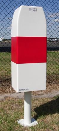
::figure[src="https://upload.wikimedia.org/wikipedia/commons/e/e9/Single_Lens_Ceilometer.JPG" caption="Laser ceilometer"] ::
A ceilometer is a device that uses a laser or other light source to determine the height of a cloud ceiling or cloud base. Ceilometers can also be used to measure the aerosol concentration within the atmosphere. A ceilometer that uses laser light is a type of atmospheric lidar (light detection and ranging) instrument.
Optical drum ceilometer
An optical drum ceilometer uses triangulation to determine the height of a spot of light projected onto the base of the cloud. It consists essentially of a rotating projector, a detector, and a recorder. The projector emits an intense beam of light above into the sky at an angle that varies with the rotation. The detector, which is located at a fixed distance from the projector, uses a photodetector pointing vertically. When it detects the projected light return from the cloud base, the instrument notes the angle and the calculation gives the height of clouds.
Laser ceilometer
A laser ceilometer consists of a vertically pointing laser and a receiver in the same location. A laser pulse with a duration on the order of nanoseconds is sent through the atmosphere. As the beam travels through the atmosphere, tiny fractions of the light are scattered by aerosols. Generally, the size of the particles in question are similar in size to the wavelength of the laser. This situation leads to Mie scattering. A small component of this scattered light is directed back to the lidar receiver. The timing of the received signal can be transformed into a spatial range, z, by using the speed of light. That is,
:\text{distance} = \frac {c \delta t}{2}
where c is the light speed in the air.
In this way, each pulse of laser light results in a vertical profile of aerosol concentration within the atmosphere. Generally, many individual profiles will be averaged together in order to increase the signal-to-noise ratio and average profiles are reported on a time scale of seconds. The presence of clouds or water droplets leads to a very strong return signal compared to background levels, which allows for cloud heights to be easily identified.
Since the instrument will note any returns, it is possible to locate any faint layer where it occurs, additionally to the cloud's base, by looking at the whole pattern of returned energy. Furthermore, the rate at which diffusion happens can be noted by the diminishing part returned to the ceilometer in clear air, giving the coefficient of extinction of the light signal. Using these data could give the vertical visibility and the possible concentration of air pollutants. This has been developed in research and could be applied for operational purpose.
In New Zealand, MetService operates a network of laser ceilometers for cloud base measurements at commercial airports. These sensors are also used to map volcanic ash clouds to allow commercial air traffic to avoid damage caused by ash. The movement of volcanic ash has also been tracked from areas such as Iceland.
Examination of the behavior of ceilometers under various cloud-cover conditions has led to the improvement of algorithms to avoid false readings. Accuracy of measurement can be impacted by the limited vertical range and areal extent of a ceilometer's area of observation.
A common use of ceilometers is to monitor the cloud ceiling for airports. A study group from Montreal, Canada in 2013 recommended that ceilometers should be installed "close to the landing threshold" for aerodromes with precision approach runways, but also considered their location "at the middle marker or at an equivalent distance" to be acceptable.
Hazards
Ceilometers that use visible light can sometimes be fatal to birds, as the animals become disoriented by the light beams and suffer exhaustion and collisions with other birds and structures. In the worst recorded ceilometer non-laser light beam incident, approximately 50,000 birds from 53 different species died at Warner Robins Air Force Base in the United States during one night in 1954.{{cite journal | last=Johnston | first=D |author2=Haines | title=Analysis of Mass Bird Mortality in October, 1954 | journal=The Auk | year=1957 | doi=10.2307/4081744 | volume=74 | issue=4 | pages=447| jstor=4081744 | doi-access=free
Laser ceilometers use invisible lasers to observe the cloud base. Using optical instruments such as binoculars near ceilometers is not recommended, because lenses in instruments could concentrate the beam and damage one's eyes.
References
References
- (16 November 2012). "National Weather Service Glossary". The National Oceanic and Atmospheric Administration.
- (20 August 2021). "Understanding Present and Past Arctic Environments: An Integrated Approach from Climate Change Perspectives". Elsevier.
- (8 September 2010). "Surface-Based Remote Sensing of the Atmospheric Boundary Layer". Springer Science & Business Media.
- (1998). "Automated Surface Observing System (ASOS) User's Guide". Automated Surface Observing System (ASOS) User’s Guide National Oceanic and Atmospheric Administration, United States Navy.
- (25 November 2016). "Measurement and Safety: Volume I". CRC Press.
- (23 March 2020). "15+ Weather Forecast Instruments And Inventions That Helped Define How We Predict the Weather".
- (29 December 2020). "Automated Cloud Base and Visibility Measurement".
- "Cloudbase sensors".
- (2010). "Design and Test of Mie Scattering Laser Ceilometer Transmitter". Applied Laser.
- (2007). "BASELINE ATMOSPHERIC PROGRAM (AUSTRALIA) 2005-2006". Australian Bureau of Meteorology and CSIRO Marine and Atmospheric Research.
- (29 May 2015). "Ceilometer aerosol profiling versus Raman lidar in the frame of the INTERACT campaign of ACTRIS". Atmospheric Measurement Techniques.
- (20 July 1998). "Turn-key Raman lidar for profiling atmospheric water vapor, clouds, and aerosols". Applied Optics.
- (20 December 2010). "Ceilometer lidar comparison: backscatter coefficient retrieval and signal-to-noise ratio determination". Atmospheric Measurement Techniques.
- (11 September 2021). "Capabilities of an Automatic Lidar Ceilometer to Retrieve Aerosol Characteristics within the Planetary Boundary Layer". Remote Sensing.
- (1 September 2019). "Ceilometer Monitoring of Boundary-Layer Height and Its Application in Evaluating the Dilution Effect on Air Pollution". Boundary-Layer Meteorology.
- (2014). "(5 pages) IAVWOPSG.8.WP.024.5.en.docx INTERNATIONAL AIRWAYS VOLCANO WATCH OPERATIONS GROUP (IAVWOPSG) EIGHTH MEETING Melbourne, Australia, 17 to 20 February 2014". International Civil Aviation Organization.
- (26 October 2010). "The Eyjafjallajökull eruption in April 2010 – detection of volcanic plume using in-situ measurements, ozone sondes and lidar-ceilometer profiles". Atmospheric Chemistry and Physics.
- (11 March 2011). "Volcanic ash from Iceland over Munich: mass concentration retrieved from ground-based remote sensing measurements". Atmospheric Chemistry and Physics.
- (1 February 2010). "Detection of Cloud-Base Height Using Jenoptik CHM15K and Vaisala CL31 Ceilometers". Journal of Atmospheric and Oceanic Technology.
- (1 July 2016). "Error Characteristics of Ceilometer-Based Observations of Cloud Amount". Journal of Atmospheric and Oceanic Technology.
- (15 August 2018). "Twenty-five years of cloud base height measurements by ceilometer in Ny-Ålesund, Svalbard". Earth System Science Data.
- "How Cloud Ceilings Are Reported".
- (15 November 2007). "AWI Model 8339 Laser Ceilometer Certified by FAA - All Weather Inc".
- (2013). "(3 pages) AMOFSG.10.SN.012.5.en.docx AERODROME METEOROLOGICAL OBSERVATION AND FORECAST STUDY GROUP (AMOFSG) TENTH MEETING Montréal, 17 to 19 June 2013". AMOFSG.
- (September 15, 2010). "10,000 birds trapped in Twin Towers memorial light". The Telegraph.
- "Vaisala Ceilometer CL31 User'S Guide".
- (1 February 1998). "Cloud-Base Height Measurements with a Single-Pulse Erbium-Glass Laser Ceilometer". Journal of Atmospheric and Oceanic Technology.
::callout[type=info title="Wikipedia Source"] This article was imported from Wikipedia and is available under the Creative Commons Attribution-ShareAlike 4.0 License. Content has been adapted to SurfDoc format. Original contributors can be found on the article history page. ::