Brinnon, Washington

title: "Brinnon, Washington" type: doc version: 1 created: 2026-02-28 author: "Wikipedia contributors" status: active scope: public tags: ["census-designated-places-in-jefferson-county,-washington", "census-designated-places-in-washington-(state)", "1891-establishments-in-washington-(state)", "populated-places-established-in-1891"] topic_path: "general/census-designated-places-in-jefferson-county-washington" source: "https://en.wikipedia.org/wiki/Brinnon,_Washington" license: "CC BY-SA 4.0" wikipedia_page_id: 0 wikipedia_revision_id: 0
::data[format=table title="Infobox settlement"]
| Field | Value |
|---|---|
| official_name | Brinnon, Washington |
| settlement_type | Census-designated place |
| image_skyline | File:Brinnon and the Olympic Mountains beyond.jpg |
| image_caption | Brinnon as seen from the shore of the Hood Canal with the Olympic Mountains in the background |
| image_map | Jefferson_County_Washington_Incorporated_and_Unincorporated_areas_Brinnon_Highlighted.svg |
| map_caption | Location of Brinnon, Washington |
| subdivision_type | Country |
| subdivision_name | United States |
| subdivision_type1 | State |
| subdivision_name1 | Washington |
| subdivision_type2 | County |
| subdivision_name2 | Jefferson |
| established_title | Established |
| established_date | 1891 |
| unit_pref | Imperial |
| area_total_km2 | 25.54 |
| area_land_km2 | 24.89 |
| area_water_km2 | 0.66 |
| population_as_of | 2020 |
| population_total | 907 |
| population_density_km2 | auto |
| timezone | Pacific (PST) |
| utc_offset | -8 |
| timezone_DST | PDT |
| utc_offset_DST | -7 |
| elevation_footnotes | c |
| elevation_ft | 722 |
| coordinates | |
| postal_code_type | ZIP code |
| postal_code | 98320 |
| area_code | 360 |
| blank_name | FIPS code |
| blank_info | 53-08080 |
| blank1_name | GNIS feature ID |
| blank1_info | 2407906 |
| :: |
| official_name = Brinnon, Washington | settlement_type = Census-designated place | image_skyline = File:Brinnon and the Olympic Mountains beyond.jpg | imagesize = | image_caption = Brinnon as seen from the shore of the Hood Canal with the Olympic Mountains in the background | image_map = Jefferson_County_Washington_Incorporated_and_Unincorporated_areas_Brinnon_Highlighted.svg | mapsize = | map_caption = Location of Brinnon, Washington | subdivision_type = Country | subdivision_name = United States | subdivision_type1 = State | subdivision_name1 = Washington | subdivision_type2 = County | subdivision_name2 = Jefferson | government_footnotes = | government_type = | established_title = Established | established_date = 1891 | unit_pref = Imperial | area_footnotes = | area_total_km2 = 25.54 | area_land_km2 = 24.89 | area_water_km2 = 0.66 | area_total_sq_mi = | area_land_sq_mi = | area_water_sq_mi = | population_as_of = 2020 | population_footnotes = | population_total = 907 | population_density_km2 = auto | population_density_sq_mi = | timezone = Pacific (PST) | utc_offset = -8 | timezone_DST = PDT | utc_offset_DST = -7 | elevation_footnotes = c | elevation_ft = 722 | coordinates = | postal_code_type = ZIP code | postal_code = 98320 | area_code = 360 | blank_name = FIPS code | blank_info = 53-08080 | blank1_name = GNIS feature ID | blank1_info = 2407906 | website = | footnotes = Brinnon is a census-designated place (CDP) in Jefferson County, Washington, United States. The population was 907 at the 2020 census. The community is named for Ewell P. Brinnon, who in the late 1850s took a donation land claim at the mouth of the Duckabush River. Its known landmarks include Dosewallips State Park, Triton Cove State Park, Murhutt Falls, and Black Point Marina. Brinnon is also adjacent to Camp Parsons, the oldest Boy Scout camp west of the Mississippi River.
History
::figure[src="https://upload.wikimedia.org/wikipedia/commons/2/2a/BSA_Camp_Parsons_(WA)_entrance.jpg" caption="BSA Camp Parsons"] ::
White settlers began arriving in the area that would become Brinnon, then referred to as both Quogaboos and Ducaboos, in the 1850s. Ewell P. Brinnon, a settler who later became the namesake of the settlement, took a donation land claim in the late 1850s at the mouth of the Duckabush River. In 1891 Brinnon was established when the post office began operations in the settlement.
Camp Parsons was founded in 1919 just outside the north end of Brinnon. The camp is the oldest Boy Scout camp west of the Mississippi River.
Geography
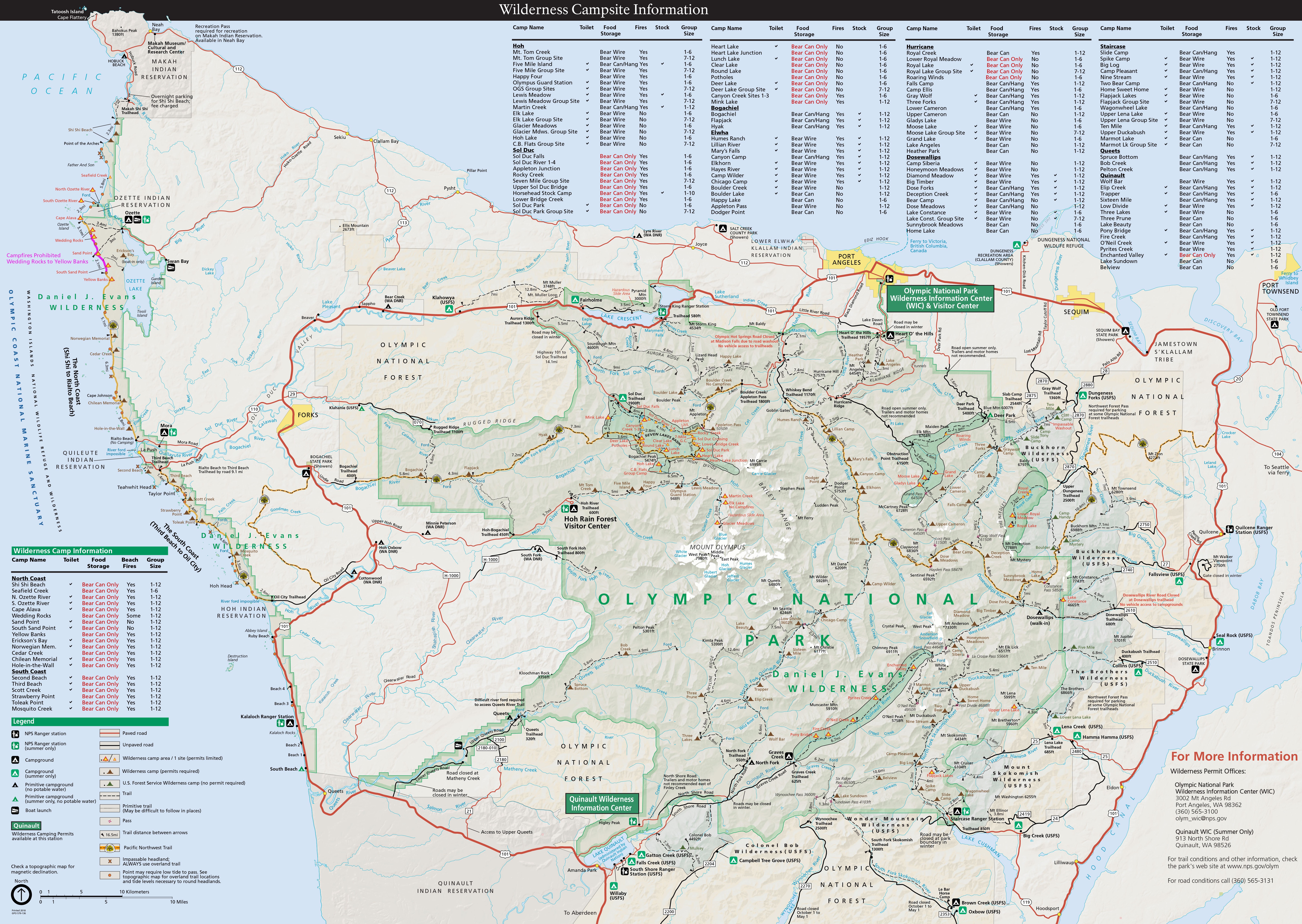
Brinnon is located approximately 61 mi north of Olympia, on the Olympic Peninsula's east side. It sits on the west side of Hood Canal on the eastern edge of the Olympic National Forest.
According to the United States Census Bureau, the CDP has a total area of 25.5 sqkm, of which 24.9 sqkm are land and 0.7 sqkm, or 2.57%, are water. The CDP extends from Wawa Point in the north, just south of Jackson Cove, to the Mason County line in the south at Triton Cove, and includes the unincorporated communities (from north to south) of Seal Rock, Brinnon, and Duckabush. The Dosewallips River crosses the north-central part of the CDP and enters Hood Canal at Brinnon Flats just north of the settlement of Brinnon, while the Duckabush River crosses the south-central part of the CDP, entering Hood Canal at Duckabush village, just south of Black Point.
Climate
Brinnon experiences an oceanic climate (Köppen climate classification Cfb) and is almost categorised as part of the Csb climate category, receiving slightly more than 30 mm, the threshold for Cfb inclusion.
|location = Brinnon |single line = Yes |collapsed = Y |Jan high F = 45 |Feb high F = 50 |Mar high F = 56 |Apr high F = 61 |May high F = 67 |Jun high F = 72 |Jul high F = 77 |Aug high F = 79 |Sep high F = 73 |Oct high F = 62 |Nov high F = 51 |Dec high F = 44 |year high F = 61 |Jan low F = 31 |Feb low F = 33 |Mar low F = 35 |Apr low F = 38 |May low F = 43 |Jun low F = 48 |Jul low F = 51 |Aug low F = 50 |Sep low F = 46 |Oct low F = 40 |Nov low F = 35 |Dec low F = 31 |year low F = 40 |Jan precipitation inch = 7.39 |Feb precipitation inch = 7.38 |Mar precipitation inch = 5.93 |Apr precipitation inch = 3.81 |May precipitation inch = 2.82 |Jun precipitation inch = 2.13 |Jul precipitation inch = 1.29 |Aug precipitation inch = 1.24 |Sep precipitation inch = 1.60 |Oct precipitation inch = 4.13 |Nov precipitation inch = 7.99 |Dec precipitation inch = 8.65 |year precipitation inch = 54.36 |source 1 = {{cite web |url=http://www.weather.com/outlook/health/achesandpains/wxclimatology/monthly/graph/USWA0044?from=36hr_bottomnav_aches |title=Average Weather for Brinnon |accessdate=13 May 2008 |publisher=Weather.com }} |date=August 2010
Demographics
| footnote = US Decennial Census 2020 Census | 2000 = 803 | 2010 = 797 | 2020 = 907 As of the census of 2000, there were 803 people, 413 households, and 258 families residing in the CDP. The population density was 81.3 people per square mile (31.4/km2). There were 912 housing units at an average density of 92.4/sq mi (35.7/km2). The racial makeup of the CDP was 92.65% White, 0.25% African American, 1.49% Native American, 0.62% Asian, 0.25% Pacific Islander, 1.00% from other races, and 3.74% from two or more races. Hispanic or Latino of any race were 1.99% of the population.
There were 413 households, out of which 10.7% had children under the age of 18 living with them, 55.2% were married couples living together, 5.1% had a female householder with no husband present, and 37.5% were non-families. 32.0% of all households were made up of individuals, and 14.5% had someone living alone who was 65 years of age or older. The average household size was 1.94 and the average family size was 2.36.
In the CDP, the population was spread out, with 10.7% under the age of 18, 3.1% from 18 to 24, 15.6% from 25 to 44, 34.9% from 45 to 64, and 35.7% who were 65 years of age or older. The median age was 58 years. For every 100 females, there were 110.2 males. For every 100 females age 18 and over, there were 110.9 males.
The median income for a household in the CDP was $27,885, and the median income for a family was $34,375. Males had a median income of $31,250 versus $16,500 for females. The per capita income for the CDP was $19,820. About 9.9% of families and 13.8% of the population were below the poverty line, including 23.3% of those under age 18 and 6.7% of those age 65 or over.
Economy
Brinnon's economy has been focused on forestry from the time white settlers began living in the area. The CDP's location along the Hood Canal has also provided the area with seafood resources, namely clams, oysters, and mussels.
Except for slowdowns during the Great Depression and during an oversupply of timber in the mid-1950s the timber industry grew along with the need for commercial services. The area's productivity was supported by the Puget Sound mosquito fleet that served the area by bringing in mail, supplies, and job seekers. The boats also brought visitors and as a result, the tourist industry began to grow. As the tourist industry grew, so did the number of lodging establishments. The Olympic Inn operated for much of the 20th century as a destination resort near Seal Rock, but ultimately closed in the early 1970s. Brinnon's tourist industry reached its peak in the area during the 1950s and 1960s, but thanks to its proximity to Olympic National Park and its state parks, the settlement continues to receive campers and tourists.
Infrastructure
Transportation
::figure[src="https://upload.wikimedia.org/wikipedia/commons/4/41/Brinnon_5085.jpg" caption="U.S. 101 through Brinnon, Washington"] ::
U.S. Route 101 runs the length of Brinnon, leading south to Olympia and north to Port Angeles. What would become known as Brinnon had been connected by rudimentary roads to Quilcene to the north as early as 1894. It was not until the mid-1920s that the settlement would be easily accessible by road with the completion of bridges over the Dosewallips and Duckabush Rivers along what would become U.S. Route 101. U.S. Route 101 is the only public road leading in or out of Brinnon. This can isolate the community's residents if the road is washed out or blocked by a landslide, an occurrence that is not uncommon.
Route 1 of Jefferson Transit provides public transit to Brinnon with four weekday round-trip bus services and two Saturday round-trip services from Port Townsend. Jefferson County Route 1 terminates at Triton Cove State Park where it provides access to Route 8 of Mason Transit Authority's bus network with two daily services from Monday to Saturday to Shelton where riders can transfer to other Mason Transit routes including access to Olympia and Bremerton.
During the late 19th and 20th centuries Brinnon was served sporadically by ferry, connecting it to other Hood Canal communities and Seattle. A ferry between Brinnon and Seabeck on the Kitsap Peninsula was established in 1921, but has since ceased operation making travel by road the primary way to access the community. The ferry route last appeared on Washington State Department of Highways maps in 1949, though some sources suggest that ferry ended operations earlier in 1941. The Hood Canal Bridge now serves to connect the communities of eastern Jefferson County to Kitsap County and points east. Brinnon's Pleasant Harbor is served by Kenmore Air with seaplane charter flights.
References
References
- "U.S. Census website". [[United States Census Bureau]].
- {{GNIS. 2407906
- Ruth Kirk and Carmela Alexander. ''Exploiting Washington's Past: A Rude Guide to History''. University of Washington Press, 1995.
- Patrick, Linnea. (March 19, 2017). "BACK WHEN: Brinnon becomes a community". [[Peninsula Daily News]].
- "Camp Parsons".
- (2018). "Olympic Wilderness Map". [[National Park Service]].
- (April 2020}}{{cbignore). "Geographic Identifiers: 2010 Demographic Profile Data (G001): Brinnon CDP, Washington". U.S. Census Bureau, American Factfinder}}{{dead link.
- (2011-02-12). "US Gazetteer files: 2010, 2000, and 1990". [[United States Census Bureau]].
- (May 2023). "Census Bureau profile: [Community], [State]". [[United States Census Bureau]].
- (July 18, 2025). "Dosewallips State Park". [[Washington Department of Fish and Wildlife]].
- (May 1, 2002). "Board of County Commissioners Preferred Alternative Draft- Brinnon Subarea Plan". Brinnon Subarea Planning Group.
- Long, Priscilla. (August 29, 2003). "Dosewallips River Bridge opens in August 1923".
- (n.d.). "1 Brinnon". [[Jefferson Transit (Washington).
- (February 10, 2025). "Route 8". [[Mason Transit Authority]].
- [[United States Forest Service]]. (1924). "Map of automobile roads State of Washington".
- Williams, Mary. (April 29, 2025). "The tiny Kitsap communities of Keyport and Seabeck". Gig Harbor Now.
- {{Cite WSDOT map. (1949)
- (February 14, 1979). "Bridge loss hits wide state area". Spokane Daily Chronicle.
- (2023). "Kenmore Air Route Map: South Zone - Olympia to Nanaimo". [[Kenmore Air]].
::callout[type=info title="Wikipedia Source"] This article was imported from Wikipedia and is available under the Creative Commons Attribution-ShareAlike 4.0 License. Content has been adapted to SurfDoc format. Original contributors can be found on the article history page. ::